Ready to learn about the BEST Dog Friendly Waterfall Hikes in Utah?
I've complied all of them into one post - no more researching, asking around, or spending hours looking at AllTrails. All of these listed are dog-friendly (off leash) of course, and are separated by location. There are not ranked in any order. Click the link for each hike to learn more, to see all the trail stats (distance, elevation gain, etc), and to view a trail map. Directions are also provided for each hike.
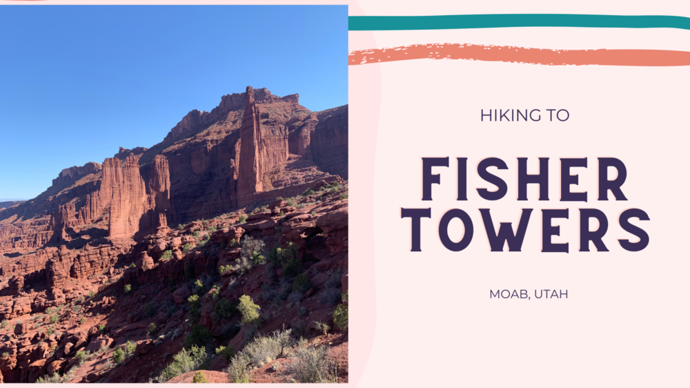
The Fisher Towers Trail, located just 16 miles northeast of Moab, Utah, is a stunning 4-mile round-trip hike that winds through towering, fin-like rock formations. These dramatic spires are made of Moenkopi and Cutler sandstone, sculpted by erosion into unique shapes and sizes over time. As one of the most iconic scenic spots along Utah’s Colorado Riverway, the Fisher Towers rise high above a vibrant landscape of red and pink canyons. From the trail, hikers can enjoy breathtaking views of the Colorado River, Onion Creek, and the well-known rock formation known as “Priest and Nuns” to the south.
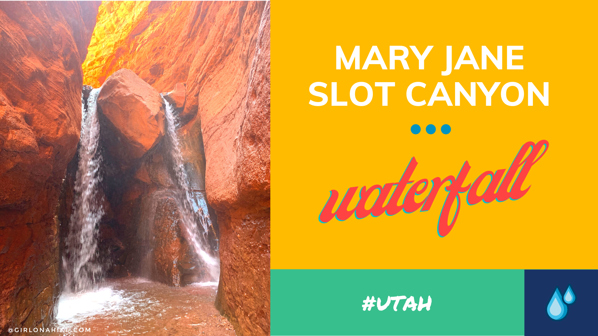
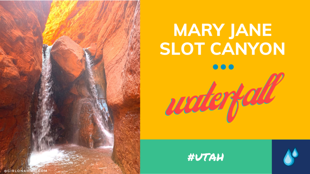
Mary Jane Slot Canyon is one of Moab's hidden gems - the "trail" is a creek the entire way, which leads to a 30 ft waterfall. This is a great trail to do when Moab is too hot, and you, the dogs, or kids need to cool off. The canyon walls get higher as you hike further into the canyon, and eventually will reach upwards of 100 ft! There are several side canyons that allow for exploring tighter slot canyons.
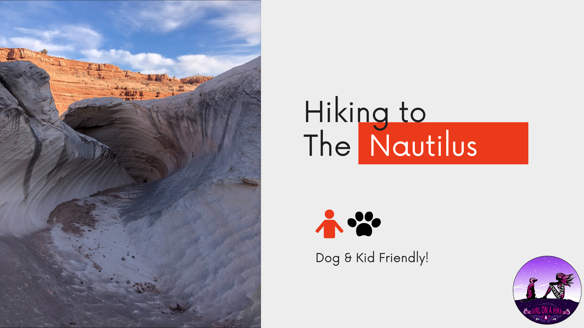

The Nautilus is a delicate and beautiful rock formation made of wind and water eroded sandstone, at the edge of a small ravine near the Paria River, a mere 9 miles Northeast of The Wave. The Nautilus is an outcrop of a soft, thin-layered rock with a rippled surface texture, with the formation of a corkscrew-like gully. It's reminiscent of a conch shell, hence the term nautilus.

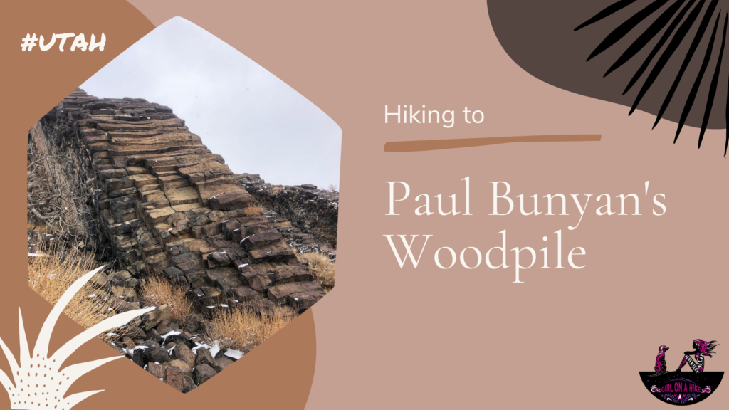
Paul Bunyan's Woodpile is an interesting geological feature in Central Utah, that looks like a "woodpile" of logs left behind by the giant lumberjack of American & Canadian Folklore. Really the woodpile is a cluster of lava rocks formed about 30 million years ago; the logs were then formed into orderly columns.

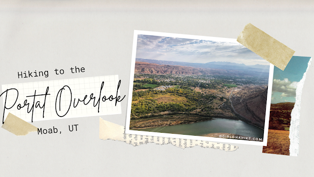
The Portal Overlook is a great overview looking down to Moab, UT as well as the LaSal Mountains and Colorado River. It's a perfect sunrise hike or good trail when you need something short with a great reward! This isn't a trail you want to do middle of summer - zero shade and water, plus lots of bikers, along with the desert heat will make this miserable and can potentially burn dogs paws. The best time to hike this is in Spring or late Fall when the temps have cooled off. Winter would be okay too, just bring microspikes. While this trail is short, I still carried 2 liters of water for just me and Charlie and we both drank it all. You'll definitely get a workout in as this climbs 800 ft to the overlook.
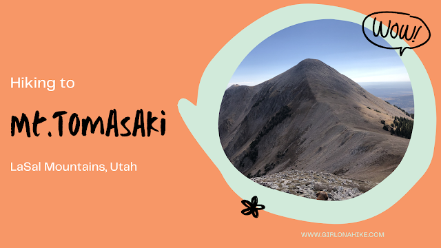
Mt. Tomasaki Hike – La Sal Mountains, Utah
Hiking Mt. Tomasaki in the La Sal Mountains offers an unforgettable alpine experience. As one of Utah’s seven ‘12ers,’ Mt. Tomasaki (12,239 ft) features rugged trails, panoramic views, and high-elevation challenges.”