

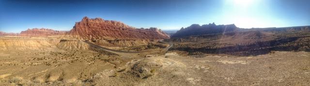
Spotted Wolf Canyon is located off I-70 at the Northern end of the San Rafael Swell, which makes up about 1/4 of Utah. "The Swell" as us Utahns call it, is what most people think of when they think of Utah. The arid area, with little vegetation is often very scenic, with mesas, cliffs, buttes, springs, and many canyons; these are sometimes wide or can be very narrow such as Little Wild Horse Canyon. Most of the swell is owned by the BLM and encompasses 2,000 square miles! This is great for 3 main reasons in my opinion: 1) the land is protected and will not be built on 2) dogs are allowed off leash 3) you can camp almost anywhere, for free!
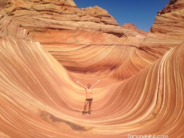
The Wave is a hiker & photographers dream destination! The smooth, unique rock formations make for an unforgettable experience. The Wave has become so popular in the last few years due to social media, photographers, and many articles naming it one of the "coolest", "most unique", "most isolated", most blah blah places on earth! And it really is. However, people don't do their research before hiking here and many have needed to be rescued or have even died while gone missing. Why? The reason is because they go unprepared. There is no trail, the temperatures can be up to 115 degrees in summer, and people don't bring enough water and food.
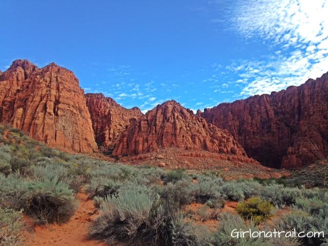
Kayenta Canyon Trail is known by two names: Kayenta Canyon, and to the locals, Hellhole Canyon. This trail starts in the town of Ivins, UT, about 15 minutes west of St. George, UT. If you don't like walking in sand washes, this is not the trail for you. 90% of this trail is walking in the wash, and on a sunny day (most days in Southern Utah), it can get very hot. There is no water, no shade, and no restrooms.