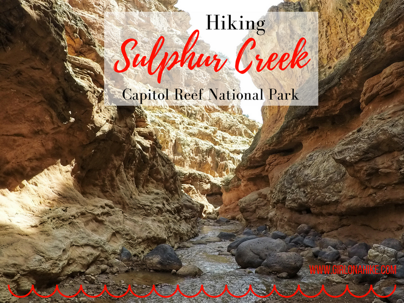
Hiking Sulphur Creek – Capitol Reef’s Hidden Water Canyon Adventure
Sulphur Creek is one of Capitol Reef National Park’s best-kept secrets—a stunning 6-mile water hike that winds through a narrow canyon filled with subway-like channels, layered red and orange sandstone, and three scenic waterfalls. Often compared to Zion's Subway or The Narrows, Sulphur Creek holds its own as a unique and thrilling adventure.
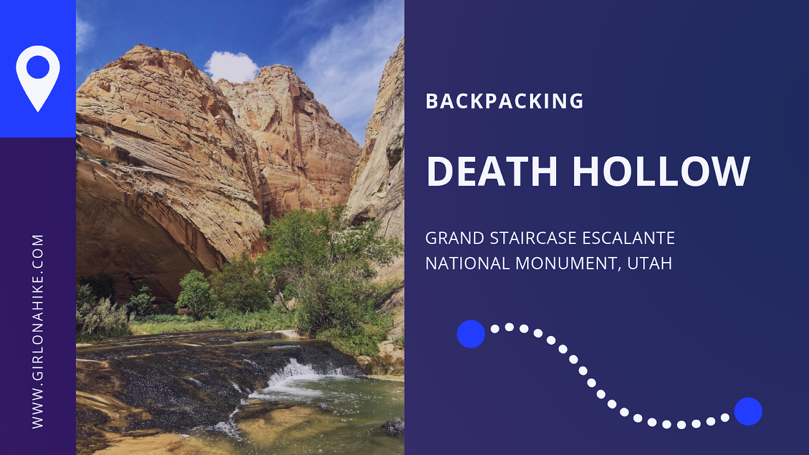
Death Hollow is located in Grand Staircase Escalante National Monument, just outside of Escalante, Utah. The first 6 miles of the trail follows the Boulder Mail Trail - the old route, that even up until 1924, the mules would carry mail on from the residents of Boulder, UT to Escalante, UT. Boulder, UT is right along Highway 12, which wasn't even paved until the 1970's, was the last area in the US to gain automobile access! No matter how much this area has changed due to technology, you'll immediately find yourself in the backcountry and won't see people for days. Over our 3 day adventure, my friend and I only saw two other people the entire time.
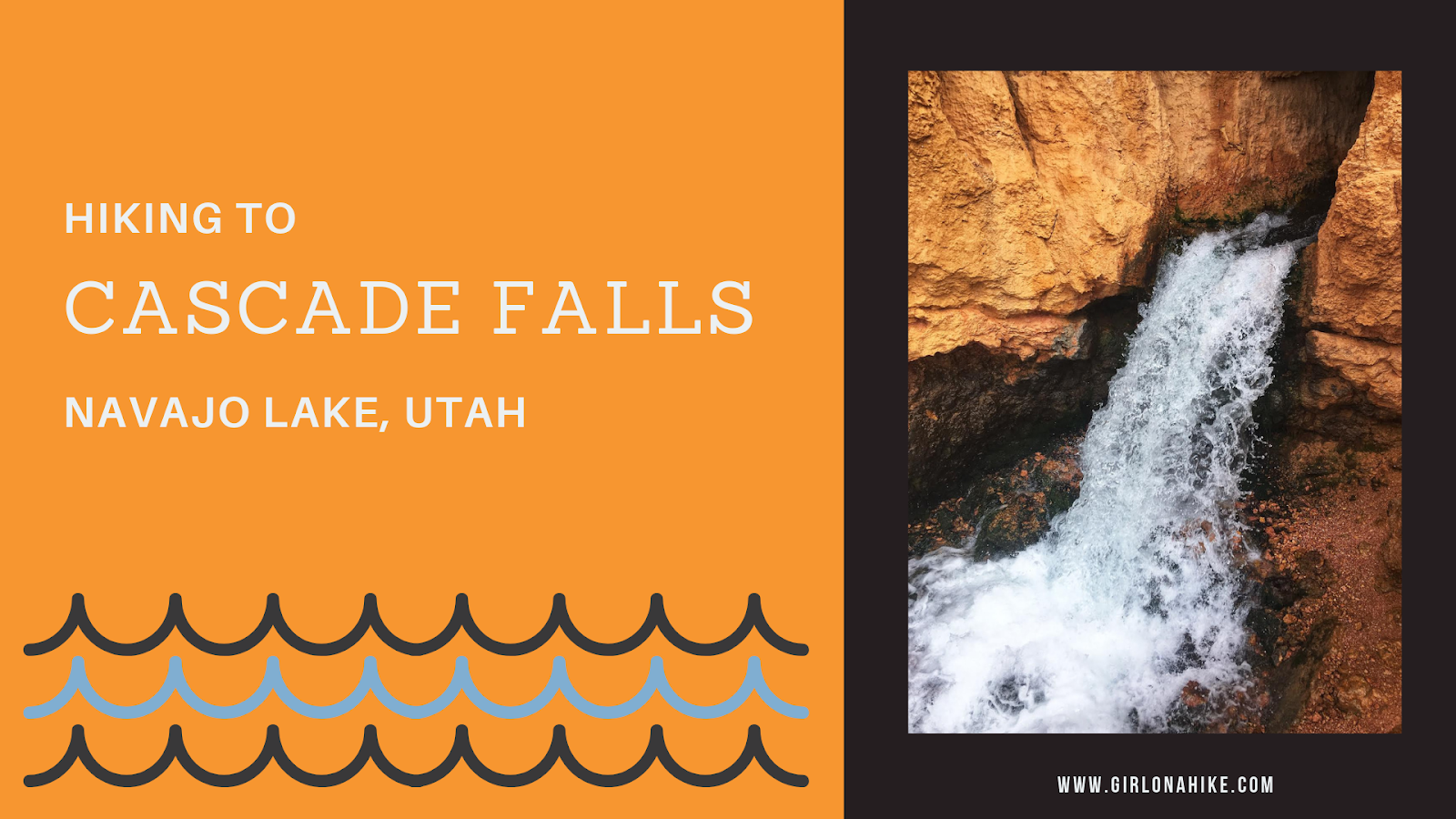
Cascade Falls is located near Navajo Lake, and is in fact, a major drainage port for the lake. The trail offers amazing view of Zion National Park on a clear day, and all ages and all types of hikers plus dogs will enjoy this area. The water from the falls is supplied by the lake through an underground lava tube (sink hole). The water flows through this for a few miles underground before exiting at the Virgin River Rim.
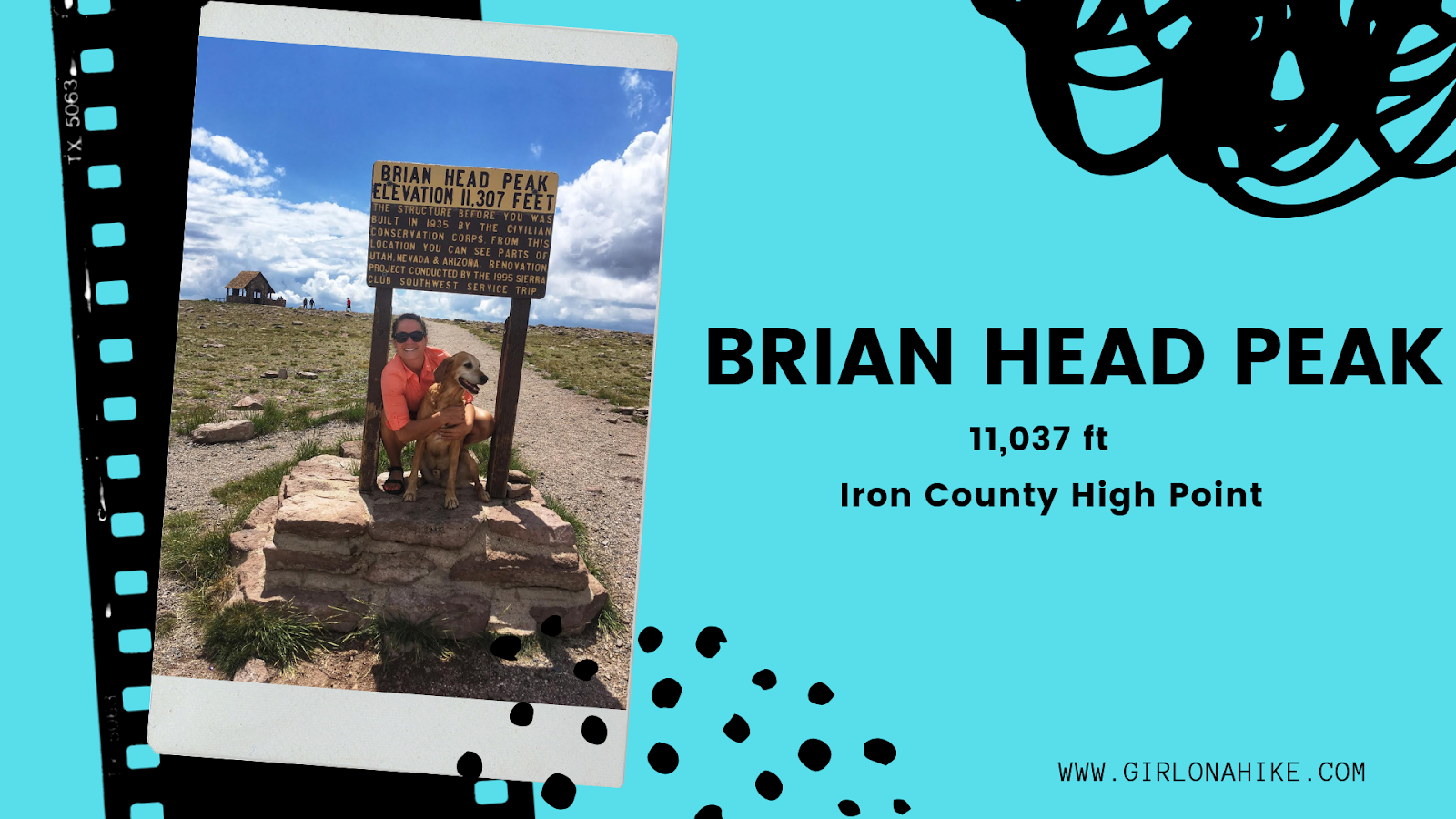

The Kane County High Point (10,080 ft) is located on a small ridge similar to the Wasatch County High point, rather than on an actual peak. The highest actual peak, Andy Nelson Peak (10,027 ft) is nearby so it is worth to do both on the same day. In one day, we actually did the Kane CoHP, Andy Nelson Peak, hiked Cascade Falls, drove through the lava fields, and then drove to the Iron County HP (Brian Head Peak).
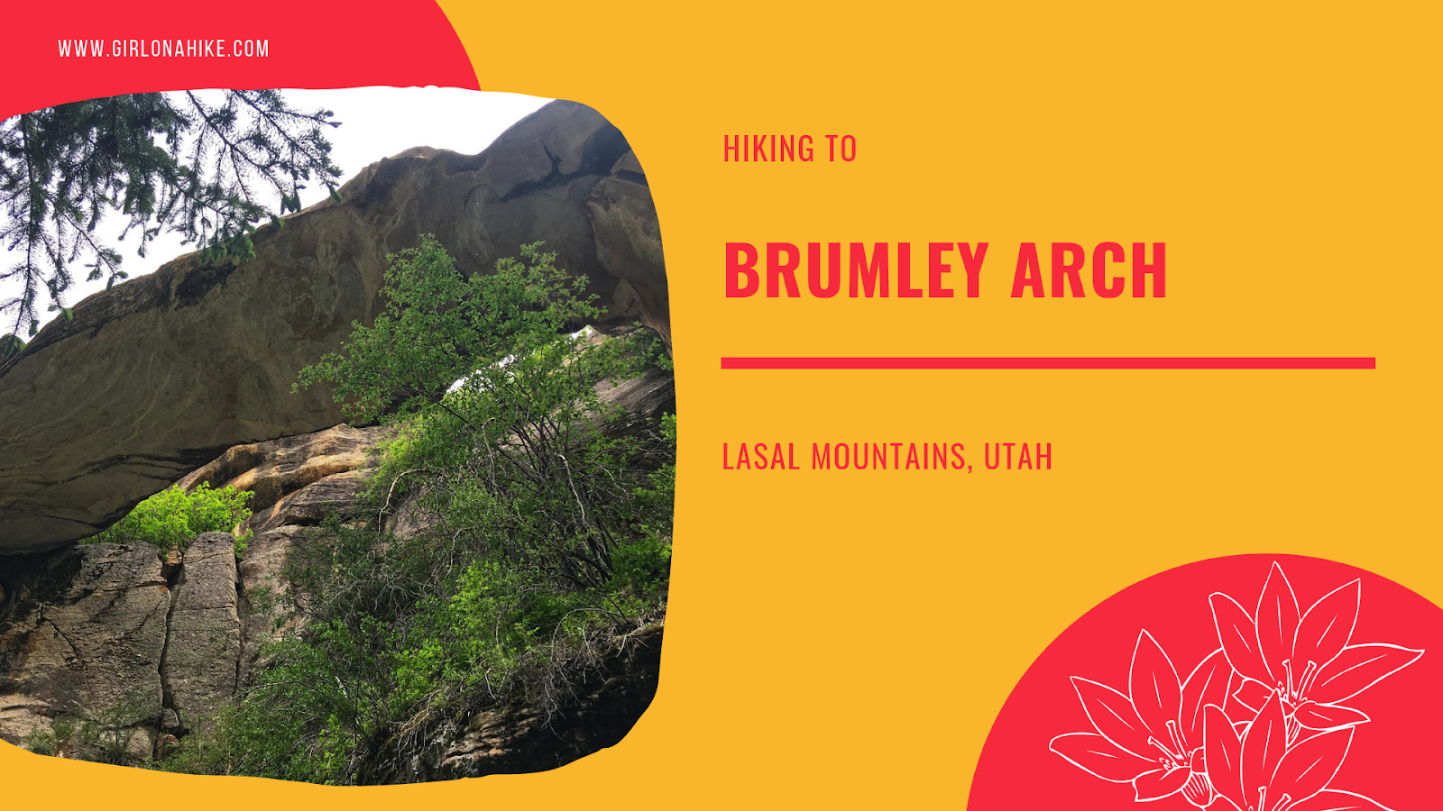
Brumley Arch is located in the LaSal Mountains, just outside Moab, Utah. It is only 2 miles round trip, making this a great family-friendly hike that even dogs are allowed to hike to. The trail is very shaded, but has some steep spots, especially to get to the bottom of the creek and to see the arch so it's best for kids over age 6. Brumley Creek runs year round, though water levels may be quite low in late Summer to Fall.
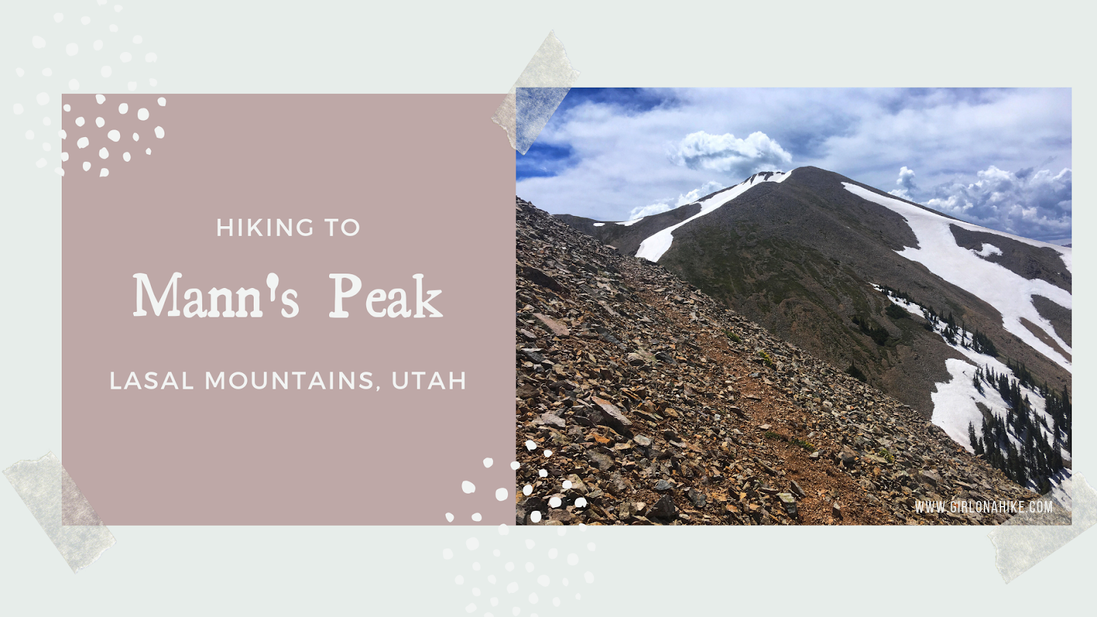
Mann's Peak (12,272 ft) 5th highest peak in the LaSal Mountains, and one of seven "12ers" in the range. The LaSal Mountains are the 2nd highest mountain range in Utah, behind the Uinta Mountains. Mann's Peak is easily accessible by a trail the entire way from the West at Warner Lake Campground, or coming from the East in Beaver Basin. The trail itself is mostly well-shaded, with plenty of water from the Dry Fork Mill Creek. As you reach the saddle, you'll hike above tree line and will be fully exposed. Start hiking early in the morning to beat the afternoon thunderstorms that occur almost daily in this mountain range. The best time to summit is Summer and Fall (typically late June to the first snowfall in October).
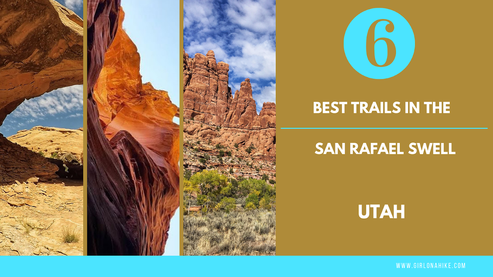
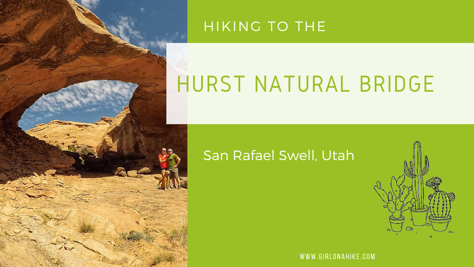
The San Rafael Swell is a mecca of hiking and camping, all free thanks to BLM Land. It's a great area to explore off trail, find rock art, hike through slot canyons, and traverse over red and white slick rock. The Swell offers something for everyone, so it's great for the whole family, kids, and dogs included. The best times of year to hike here are early Spring and late Fall when the temperatures are cooler. From arches to the best views, here are the 6 Best Trails in the San Rafael Swell!
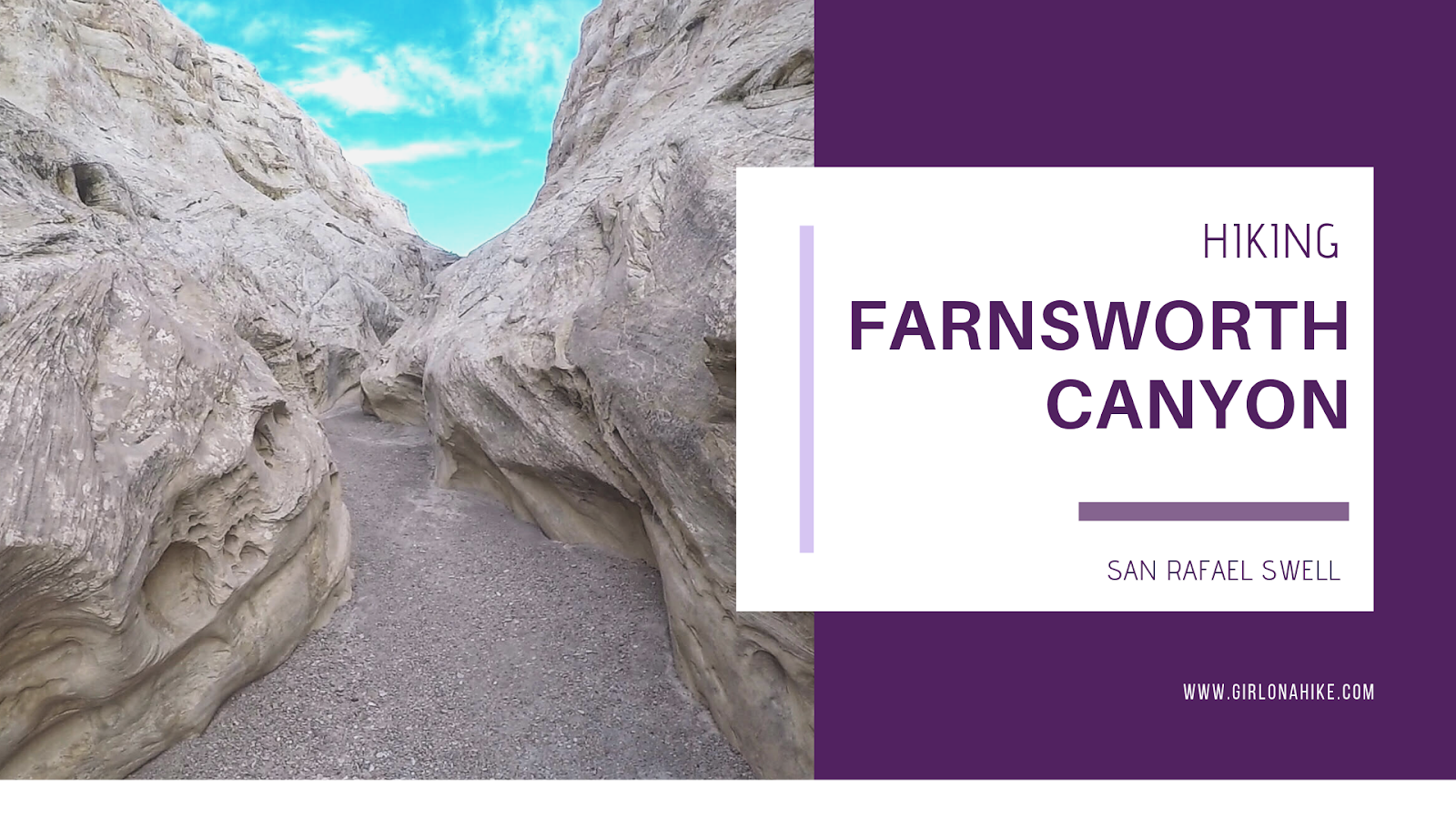
Farnsworth Canyon is located in the San Rafael Swell, and offers a little something for everyone. A short slot canyon, pictographs, exploring off trail, and desert flowers in the Spring all abound. Hiking to the pictographs is only 1.5 miles one way, so even kids can enjoy this hike and "hunt" for the pictograph. Farnsworth Canyon does extend much further, to the other side of the reef, but most people turn around at 1.5 miles. There is zero shade or water, so start early to beat the heat. The slot canyon is very easy to walk through, and nothing technical is required so it's great for beginners.