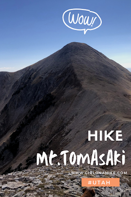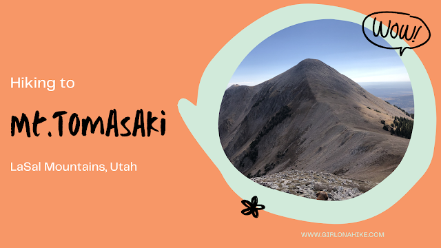
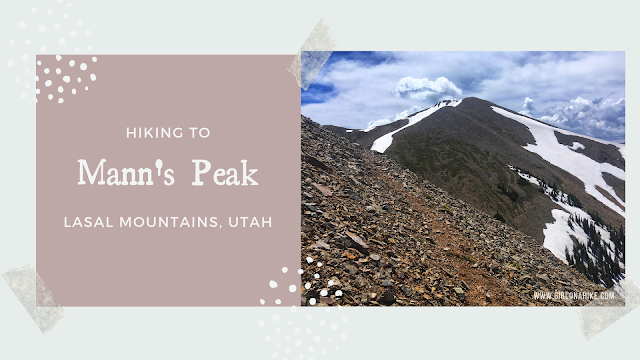
Mt. Tomasaki Hike – La Sal Mountains, Utah
Hiking Mt. Tomasaki in the La Sal Mountains offers an unforgettable alpine experience. As one of Utah’s seven ‘12ers,’ Mt. Tomasaki (12,239 ft) features rugged trails, panoramic views, and high-elevation challenges.”
Hiking Mt. Tomasaki Trail Overview
The Mt. Tomasaki hike begins at the Burro Pass Trailhead. The first half follows a well-defined trail, while the second half transitions to an off-trail route across open alpine terrain. Although there’s no marked path to the summit, the terrain is manageable and straightforward to navigate.
Expect a fully exposed hike with no water sources, so bring plenty of water and sun protection. The best time to summit Mt. Tomasaki is in the summer or fall, typically from late June until the first snowfall in October. Afternoon thunderstorms are common, so it’s best to start early. Before heading out, check with the La Sal Ranger District to confirm that Geyser Pass is open and accessible.
Why This Route?
While shorter routes to Mt. Tomasaki exist, I chose this scenic approach specifically to experience Burro Pass and the surrounding basin. Keep in mind that the first mile of the trail overlaps with the popular Whole Enchilada mountain bike route. If you’re hiking with a dog, like I was with Charlie, it’s wise to keep them leashed in this section to avoid bikers. Starting your hike early—around 6–7 AM—will help you avoid the heaviest bike traffic.
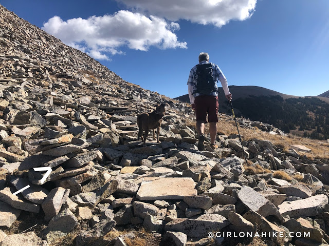
The most challenging part of the hike is the final 0.25 miles to the summit. It’s steep and rocky but mostly stable. Watch your footing carefully. If your dog isn’t used to hiking over boulders, consider bringing booties to protect their paws.
Directions to Burro Pass Trailhead
From Moab, drive south on HWY 191 and turn right onto Old Airport Road. At the “T,” turn left and follow signs for the La Sal Mountain Scenic Loop. Turn right onto Geyser Pass Road and drive 8 miles. At the brown sign for Burro Pass Trailhead, turn left. Continue straight at the next junction, following signs for the trailhead.
Just before a steep, rutted incline, park in the pull-out on the left. A 4WD vehicle is strongly recommended, especially for the last 1.5 miles of road. Here’s a driving map.
Trail Info
Distance: 5.5 miles RT
Elevation gain: 2,000 ft
Time: 3-5 hours
Dog friendly? Yes, off leash
Kid friendly? Ages 10+
Fees/Permits? None
Hiking Mt. Tomasaki: What to Expect
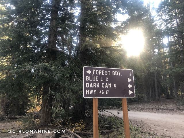
Turn left at Geyser Pass for Forest Boundary.
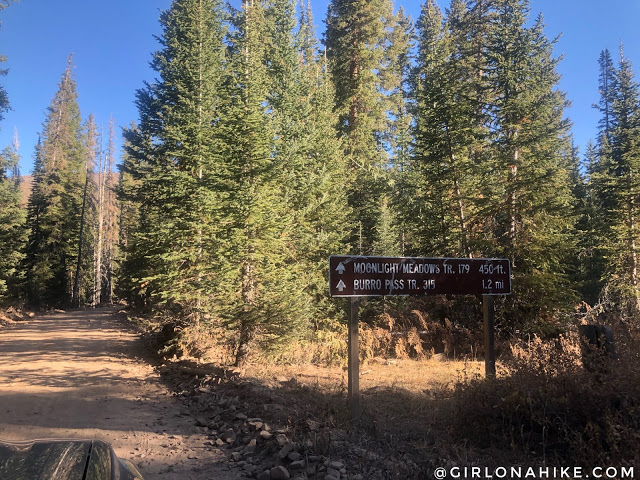
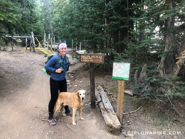
Follow the signs for Burro Pass TH.
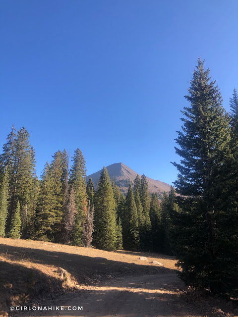
Our destination is in sight!
One more left turn, then drive up as far as you can. There is a pull out on the left side after these trees that is a good spot to park, as there is no parking right at the TH.
Ready to Hike!
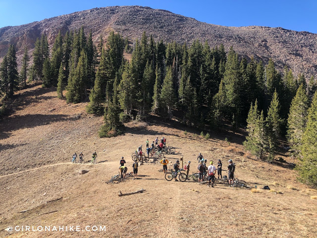
Ready to go! I didn’t realize we would be on the Whole Enchilada bike trail for the first mile.
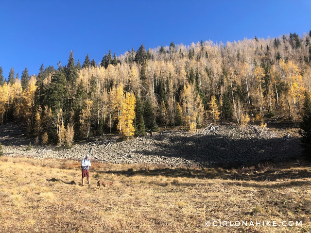
Look at those Fall colors – beautiful!
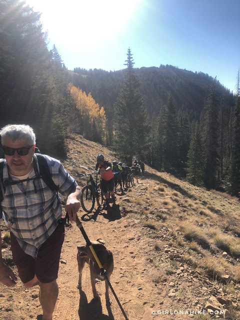
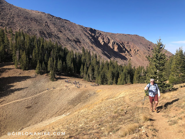
And then it was bike, after bike, after bike…we probably saw 80 bikes in the first mile up until Burro Pass.
Burro Pass
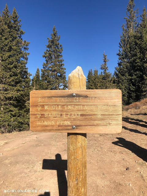
Made it to the pass. Once here, turn right and follow the trail sign for Mann’s Peak.
Leaving the bikes behind, finally! This was only a small handful of them too.
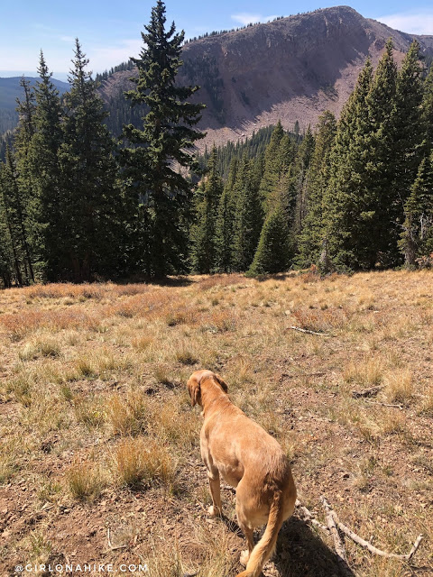
Making our way uphill again and through a short forested section.
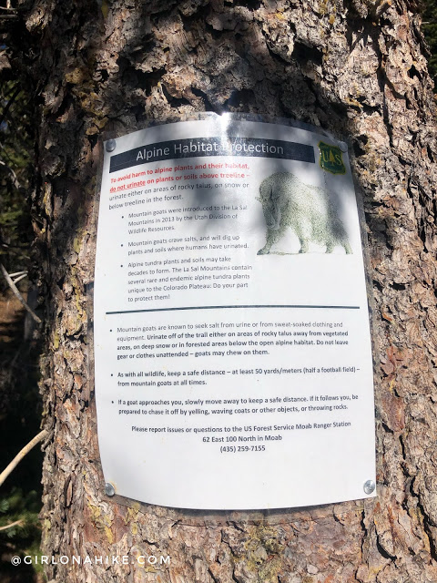
Don’t pee on anything except rocks.
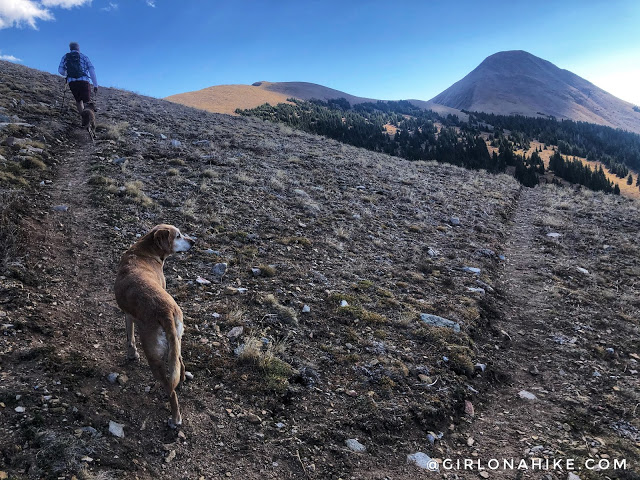
There were a few switchbacks as we kept following the trail. Tomasaki was in good sight again!
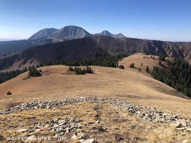
Looking back down towards Burro Pass (tucked in below the meadow).
Once you reach this cairn, if you want to skip Mann’s Peak like we did (since we already did it 2 years ago), just aim straight across to the saddle and leave the trail. If you also want to add in Mann’s Peak, I would recommend following the trail up to bag that, then follow the ridge down to meet the saddle.
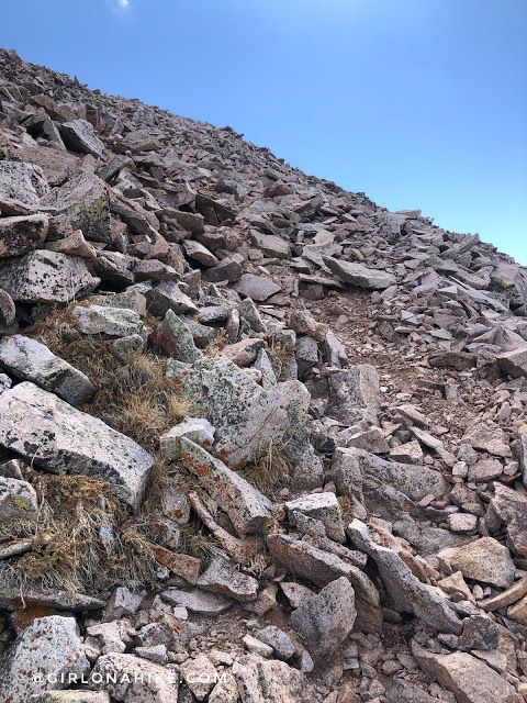
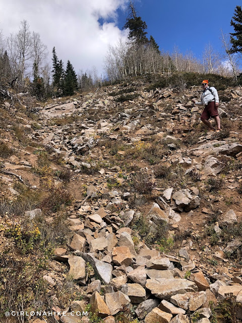
Cutting across the boulder field. All of these rocks were very unstable.
Ahh, made it to the saddle and back on dirt. It was pretty windy here so we layered up.
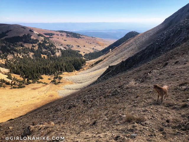
One more look into the basin before heading up.
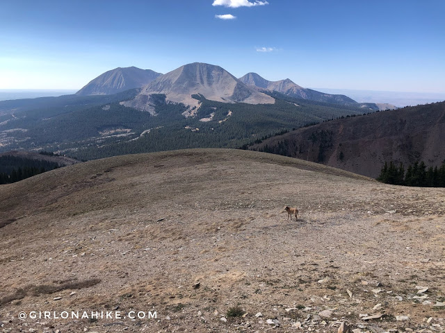
Next we made our way over to the unnamed peak, 11,947 ft. Such a cool view of Mt. Peale & Mt.Tuk from this side! Still on my list is the big rounded one in front, Mt.Mellenthin.
Almost There
Dropping down from the unnamed peak almost to the Tomasaki saddle.
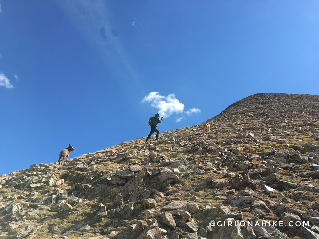
And now for the last climb – the steepest section.
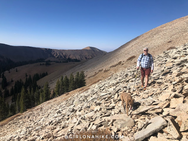
I actually picked up a faint trail to the summit. A little hard to see, but it’s there.
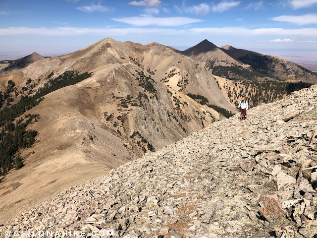
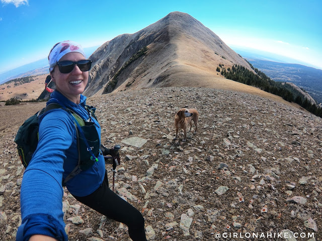
Looking back – what a view! I love the LaSal’s so much! You can see Mann’s Peak and Mt.Waas from here.
On The Summit
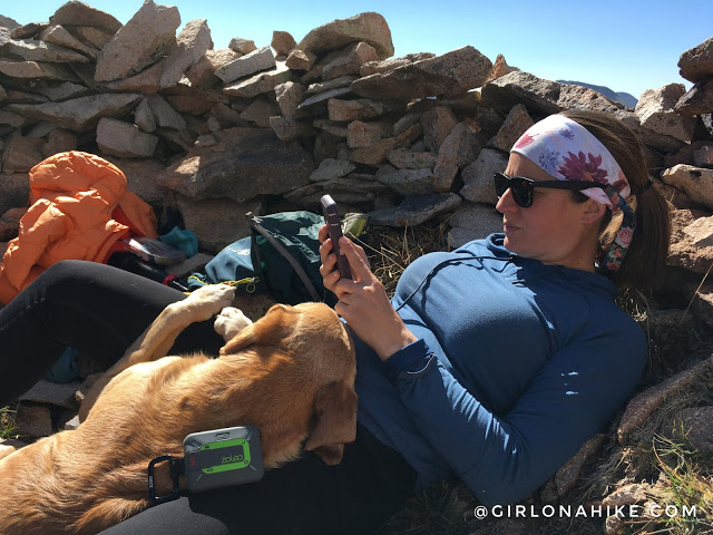
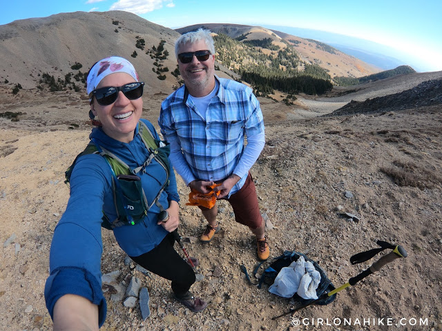
Made it to the summit and first things first – serious face as I check in with my ZOLEO to let my partner know we made it safely. Charlie already snuggles in for his usual summit nap.
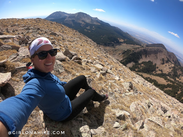
Time to explore around the summit!
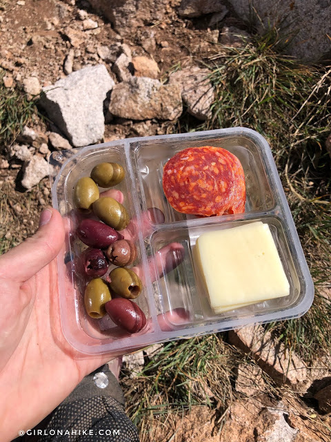
Can’t forget about lunch! I love these “adult” lunchables.
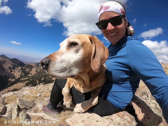
Charlie climbs on my lap for more summit snuggles.
Short Cut for the Descent
On the way down we decided to take the short-cut and just aim straight down back to the car. It was pretty steep but we found an okay gulley to follow down most of the way.
Just before we reached the trail again, there was one super steep section with really loose dirt and rock. I was really glad we didn’t go UP that way. I really liked the semi-loop we created.
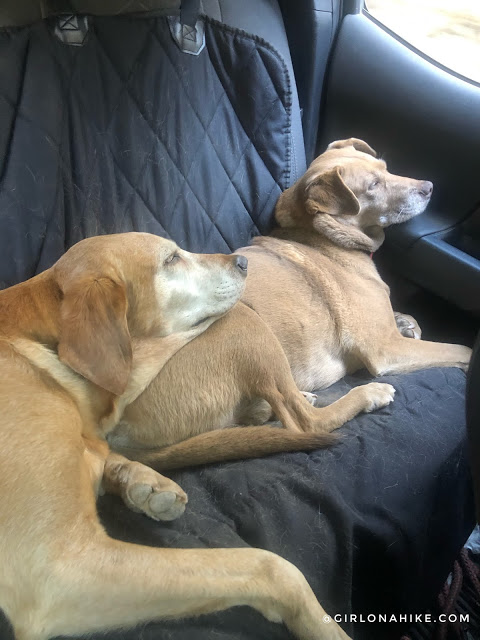
Back to the car and the doggos were out! The sign of a good day!
Check out my video & Subscribe!
Trail Map
My track via Gaia GPS – the best tracking app! Get your app here for a discount.
Nearby Hike

Save me on Pinterest!