

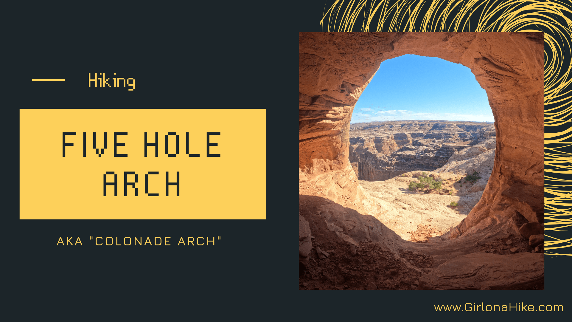
Five Hole Arch (aka Colonnade Arch) is located south of Green River, UT off a rough 4x4 dirt road. The arch is so special it has two names - Five Hole Arch for the obvious five holes nature has created, and Colonnade Arch for the resemblance to Colonnade architecture (a row of columns supporting a roof). Some maps only show one or the other name, and some only label it as "Natural Arch". Whatever you prefer to call it, this arch is quite stunning once you find it.

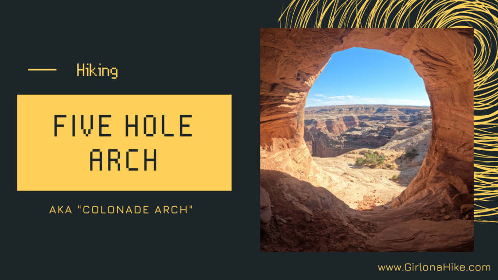
Rainbow Bridge National Monument sits within Lake Powell on the Utah side, and although is one of the largest natural bridges in the world, this national monument is one of the smallest managed by the National Park Service. Rainbow Bridge itself stands 290 ft tall from the base to the top of the arch, and is 275 ft across, making it nearly as tall as the Statue of Liberty.

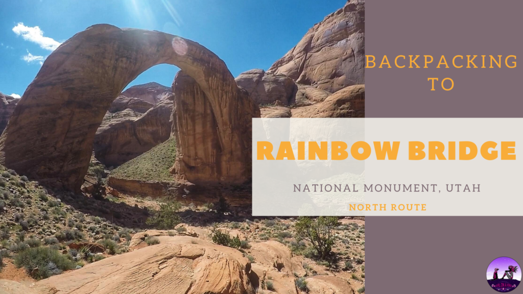
Hiking the North Fork of Mill Creek Canyon is perfect for kids, since it is only 1 mile to the first natural waterfall, and is considered the "locals swimming hole".
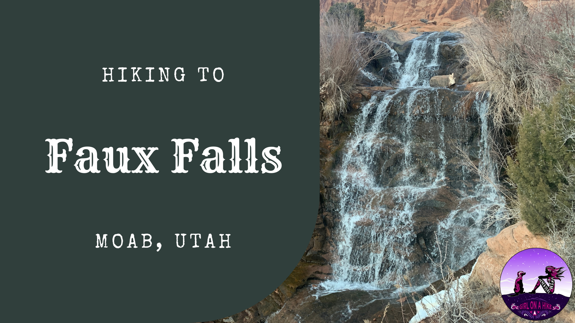

Faux Falls in Moab is a very short walk, that the whole family will enjoy. "Faux" is French for "false" or "fake", hence the name. Faux Falls was built in 1981 along with Ken's Lake, when a drought in the early 1970s pressed for the need of more water for Moab and surrounding areas. Ken's Lake is named for the then District Chairman, Ken McDonald, and the lake was dedicated for irrigation purposes in the upper Spanish Valley - long known as "Poverty Flats" because of its lack of water. It cost $4 million dollars to build the 96 ft high dam to hold an estimated 2,750 acres of water that allows for the cultivation of roughly 900 acres of land.
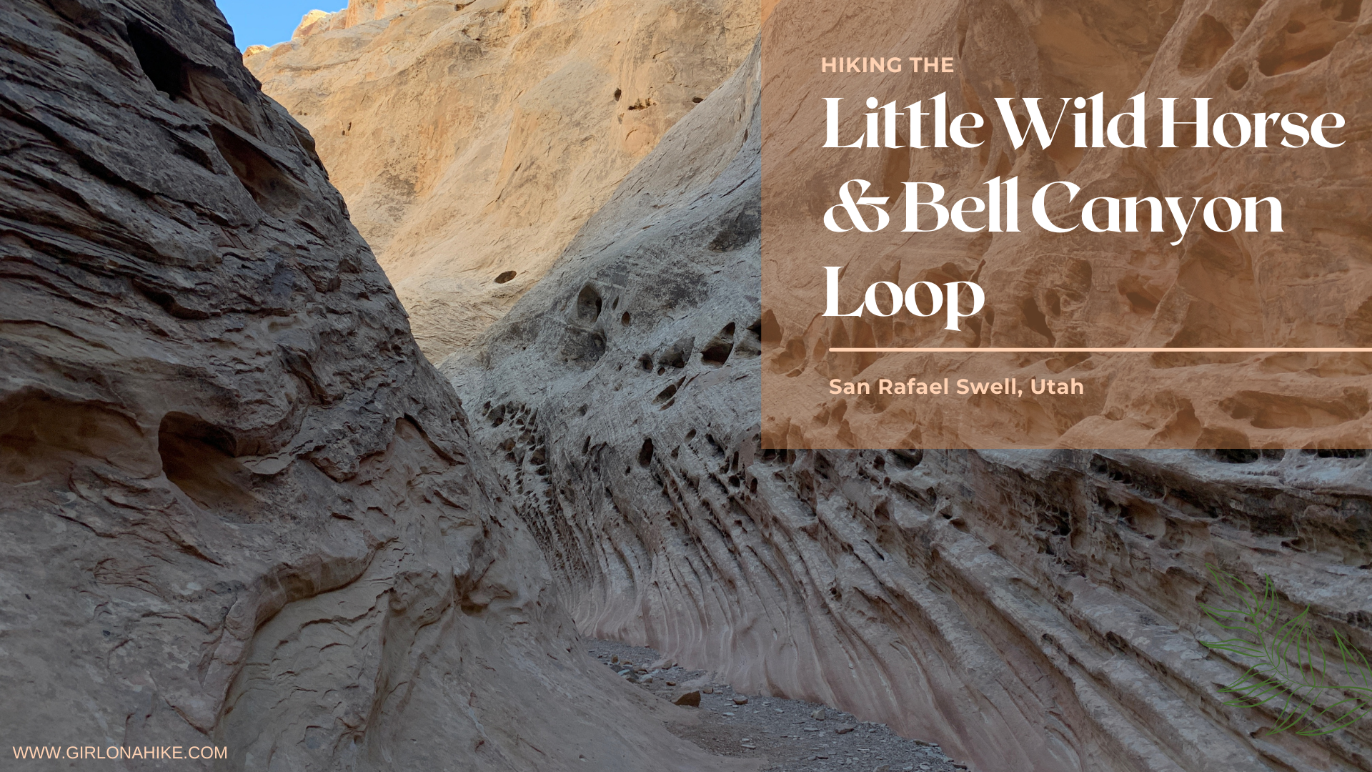

Hiking the Little Wild Horse & Bell Canyon Loop is easy to navigate, the trail is well marked, it's usually free of standing water, the canyon walls are just wide enough for you to fit through, you can drive to the trail head in a small, compact car (most slot canyon entrances require a 4X4 car to get to the TH), you can hike this within a few hours, and it's like a fun maze for kids and dogs.
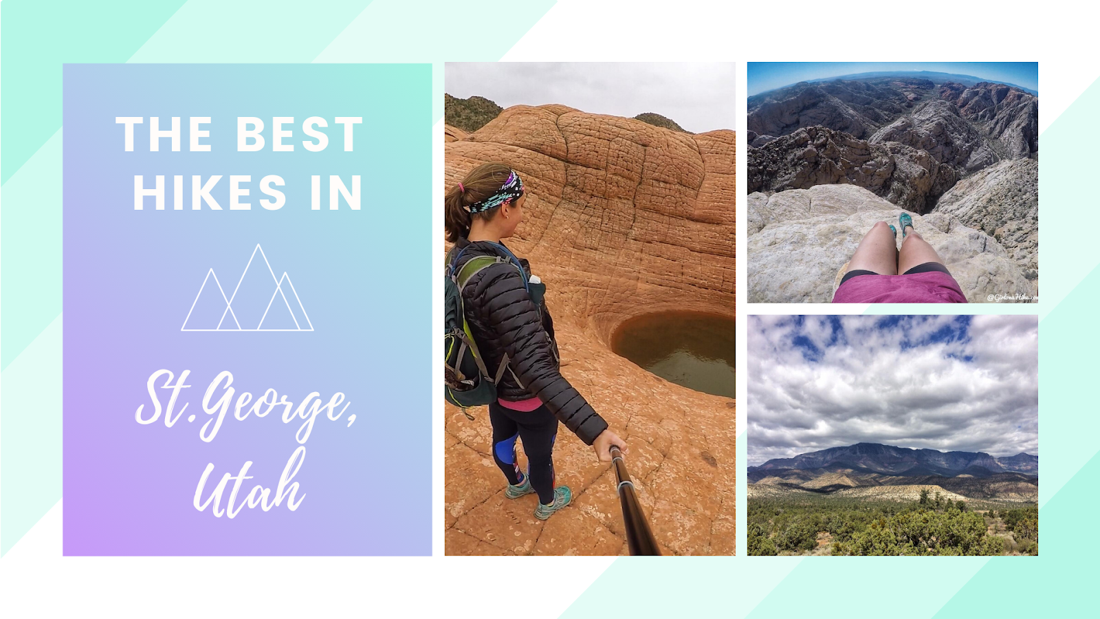
The BEST Hikes in St.George, Utah are located in Southern Utah, near the Utah/Nevada border. This area offers a mecca of outdoor activities! Hiking, biking, climbing, waterfalls, rock art, petroglyphs, cool rock features, you name it, St.George has it!
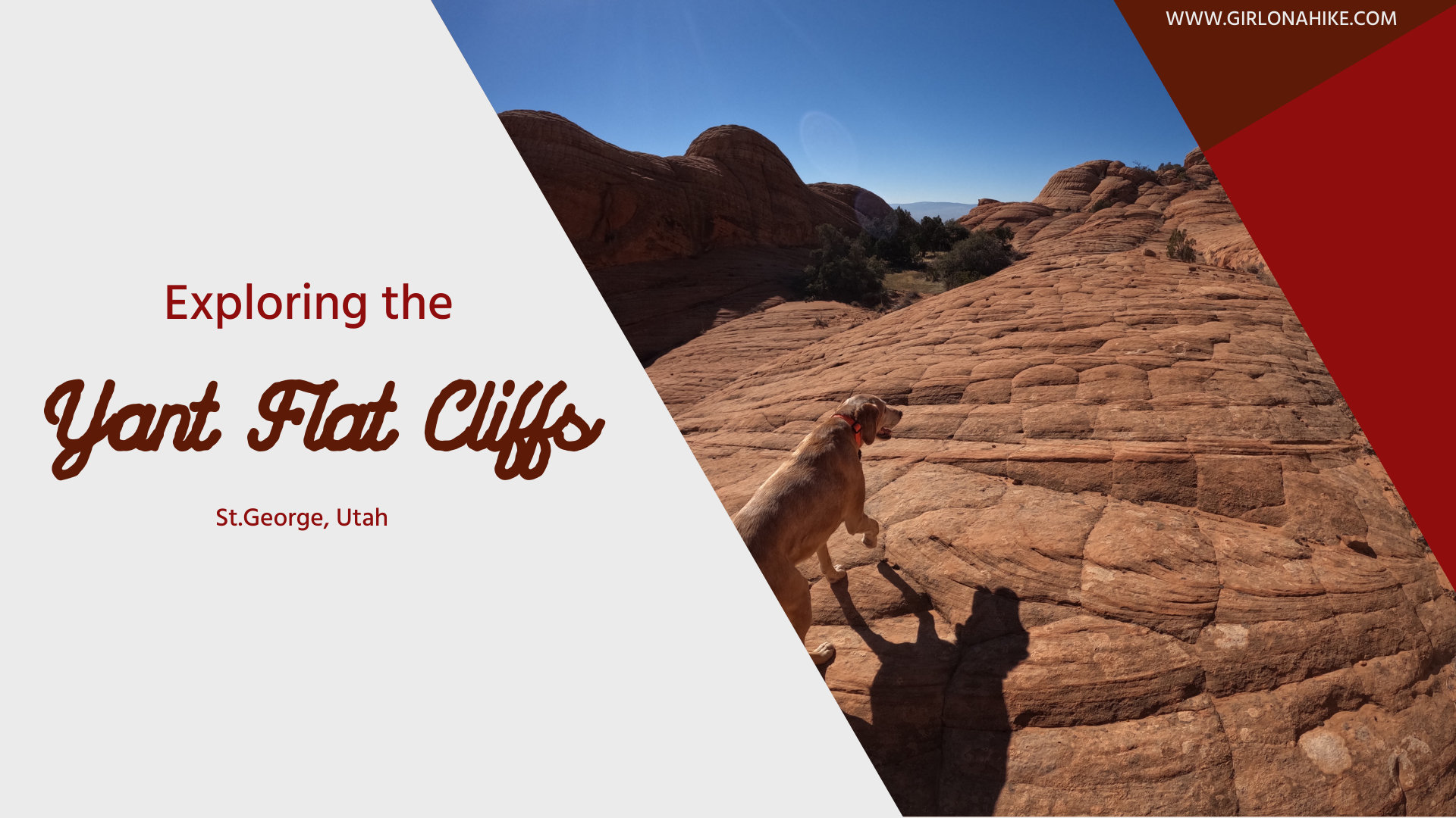
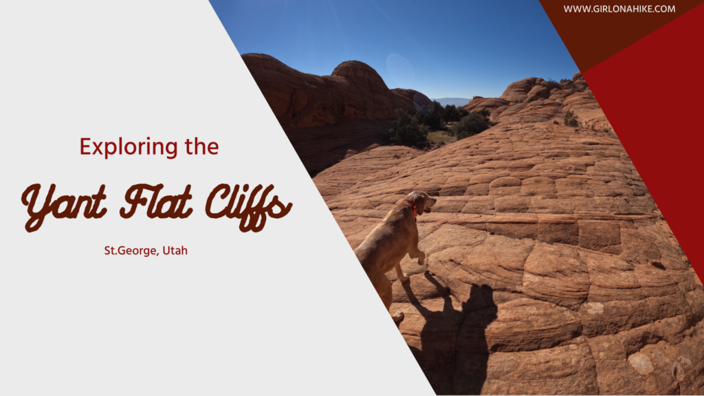
Exploring Yant Flat Cliffs (Candy Cliffs), Utah: A Hidden Gem Near St. George
Yant Flat Cliffs, also known as Candy Cliffs, are a stunning stretch of colorful sandstone formations located northwest of St. George, Utah. Accessible by a rough dirt road, this remote destination rewards visitors with vibrant red, orange, pink, yellow, and white striped slickrock formations spread across steep cliffs and buttes. The unique, wavy patterns resemble swirling candy, giving the area its nickname.
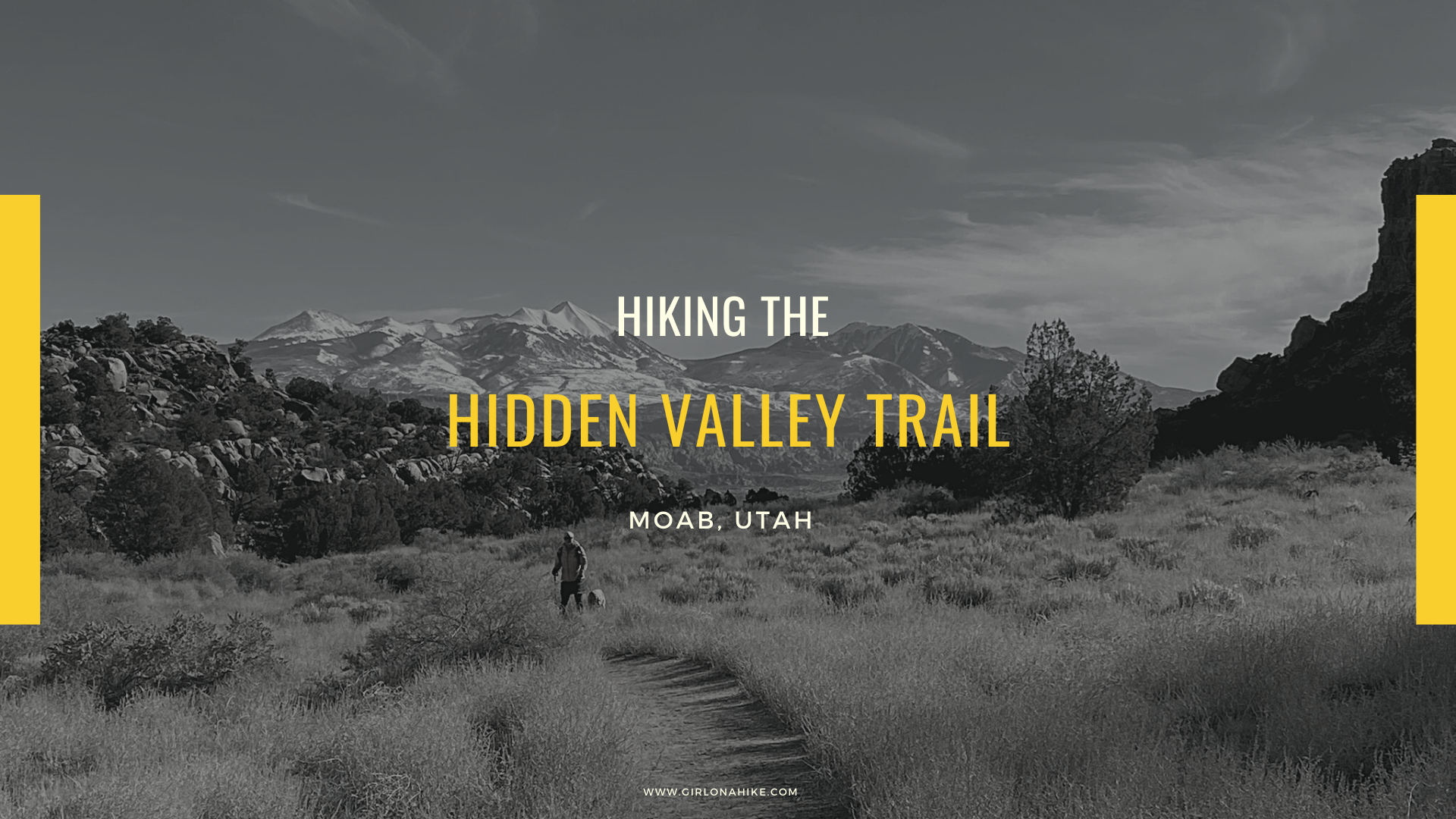
Hiking the Hidden Valley Trail in Moab, Utah: Stunning Views & Ancient Petroglyphs Hidden Valley Trail, located just minutes from downtown Moab, Utah, offers a unique and peaceful escape into a landscape unlike the typical red rock views most associate with

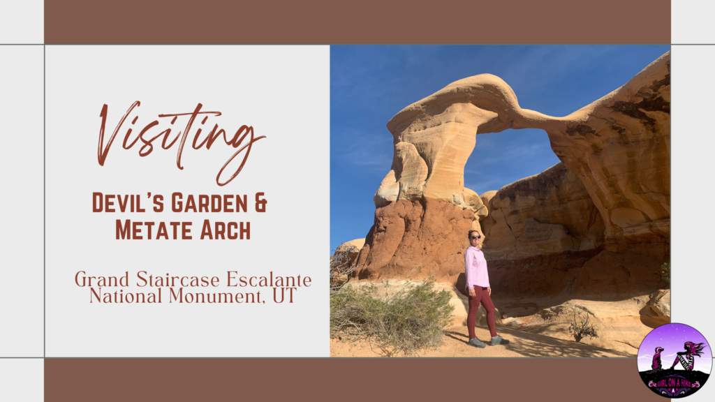
Devil's Garden is apart of Grand Staircase-Escalante National Monument, and is home to Metate Arch as well as hoodoos. Not to be confused with The Devils Garden Loop Trail in Moab, this area is only 640 acres and is part of a Wilderness Study Area, for the purpose of possible wilderness designation; however, wilderness status was not recommended by the BLM back in 1991. One of the reasons state was that the existing roads, parking lot, picnic tables, and port-a-potty are all in close proximity to a natural area. The second reason was the likelihood of several groups of people coming to this area at the same time to the same formations (all of which are within a 2 minute walk from the trailhead). Both of those reasons diminish the wilderness experience of solitude.