

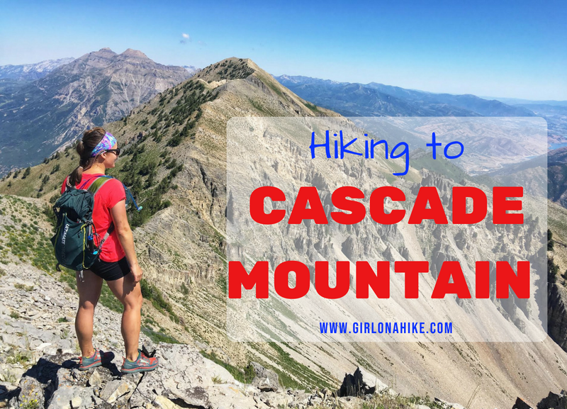
Cascade Mountain (10,908 ft) towers above Orem, Utah and is one of the iconic "Wasatch 7" Peaks. Unlike its well-known neighbor to the north, Mount Timpanogos, Cascade sees far fewer hikers due to its difficulty and rugged terrain. But for experienced hikers and peak baggers, Cascade Mountain is a rewarding summit worth the effort.
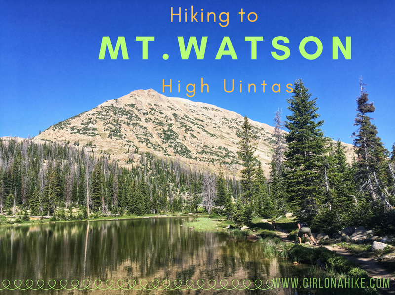
Mt. Watson (11,521 ft) is located on the West end of the High Uintas Wilderness, and though it is surrounded by several popular trails and lakes, most people do not summit this peak. There is a trail for the first 2 miles, but you're on your own after that to reach the top. That's what makes part of this peak fun - it's a "choose your own path" adventure!
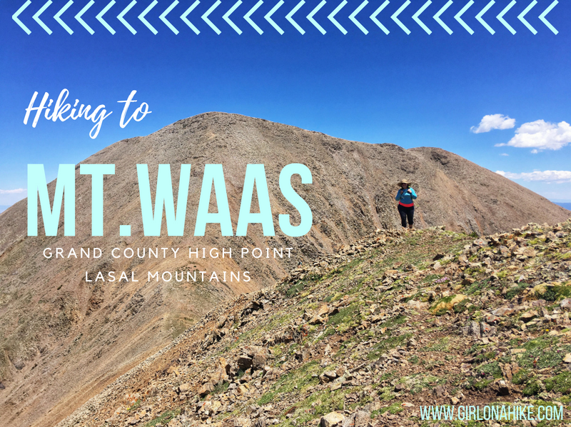
Mt. Waas (12,331 ft) is the Grand County High Point, and highest peak on the north end of the La Sal Mountains near Moab, Utah. The La Sals can be seen as far away from Green River and parts of Colorado, yet hardly anyone makes the trek to the several summits available, making a great place to seek solitude. The Moab valley can be in the 100s for daily high temperatures in the Summer, yet in the LaSals, it can be at least 20-30F cooler depending on how high you reach. The La Sals area only accessible during summer months when the gates are open, and the roads are dry and clear of snow, typically July - October. Winter of 2017 was extremely dry so we were able to summit late June 2018 with only one patch of snow.
The trails I gravitate to most are the ones right out the door - no more than an hour's drive from Salt Lake City. These are the trails I do right before or after work, with friends, solo, or save the bigger hikers for the weekend. Whether you want to see new trails, improve your fitness, or lose weight, use this book as a tool for motivation.
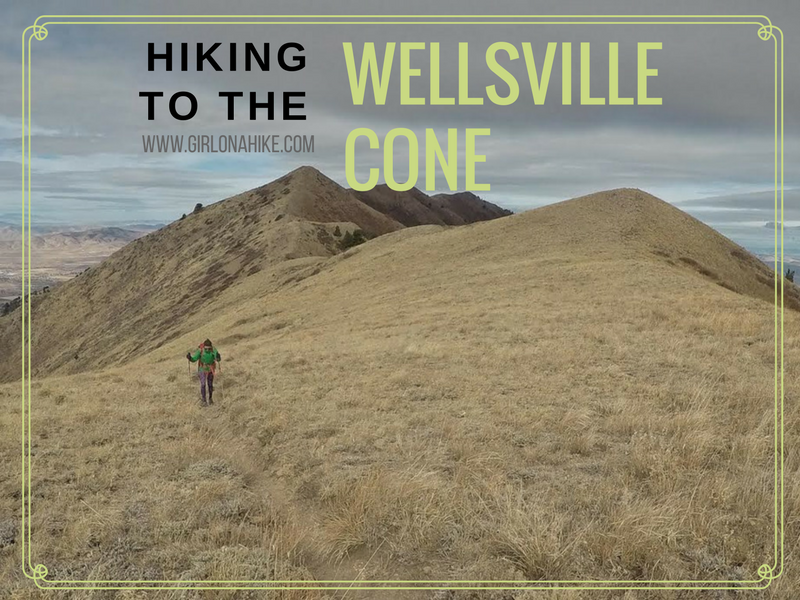
The Wellsville Cone (9,356 ft) is the 2nd highest point in the Wellsville Mountains, the highest being Box Elder Peak. Wellsville Cone is only 16 feet lower, and if you must bag the tallest peak of the mountains go for it, but the views will be the same. There are several routes to reach either summit and all require bushwhacking, and are long, steep hikes.
at
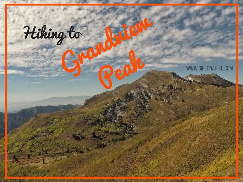
Grandview Peak (9,410 ft) sits at the Salt Lake/Davis County line and is one of the seldom visited peaks along the Wasatch Front. It's a long hike in from all directions, there's no water source, very little shade, and a little bushwhacking required. No matter which route you choose (described below), be prepared for a full 10-12 hour day. However, I've been staring at this peak for 4 years now, and I just HAD to knock it off my peak list. Wednesday night I was looking at the weather for the week, and it was supposed to have perfect blue skies, comfortable temperatures, and the Fall colors were also almost at their peak.
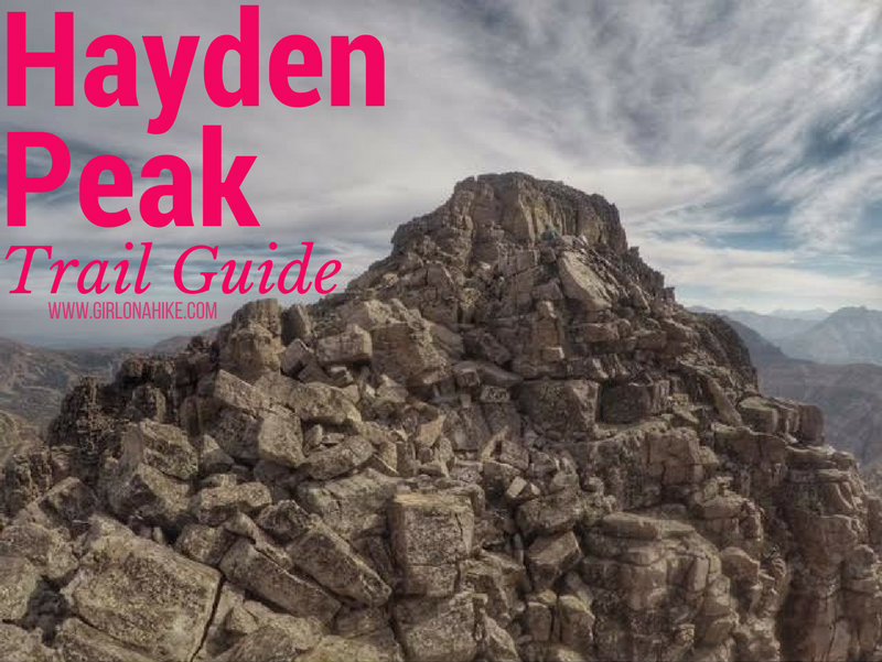
Hayden Peak (12,479 ft) stands out for anyone who's driven along the Mirror Lake Highway in the Uintas. This rugged peak is quite intimidating from the road, but for Peak Baggers that's nothing to prevent us from climbing it. Hiking to the summit of Hayden Peak is NOT for the beginner hiker nor the beginner peak bagger. You should be comfortable hiking across narrow ridges, class 3 scrambles, and route finding. There is either a very faint, or non-existent trail. Though this route is only 2 miles one way, you'll gain a total of just over 2,000 ft.
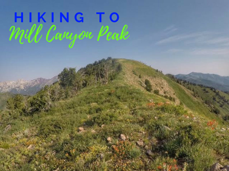
Mill Canyon Peak (10,349 ft) sits on the backside of the Wasatch Mountains and offers amazing 360 degree views. For a 10,000 ft peak this is a relatively easy summit - there's a trail most of the way and no scrambling.
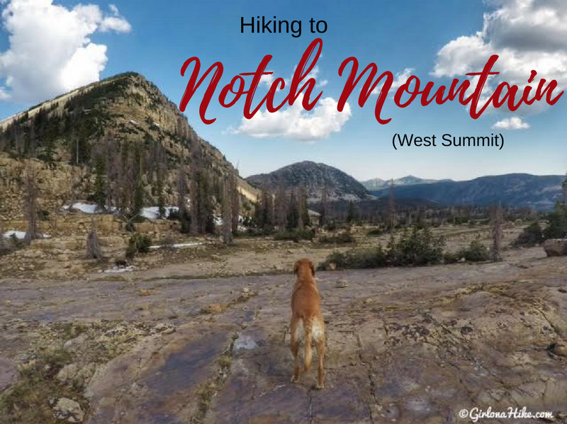
The West Summit of Notch Mountain (11,206 ft) is near "The Notch", an opening in between the West and East summits. The Notch is the high, open area on the Notch Mountain Trail by Lovenia Lake and Twin Lakes. Hiking to the West summit is fairly easy for seasoned peak baggers, and offers a good intro to peak bagging for newbies. There is a trail all the way to The Notch, after that you need to find your own route. It's not hard though, just steep hiking over medium sized boulders. Be careful where you step as some boulders are uneven - always test it out before putting all of your weight on the boulder.