

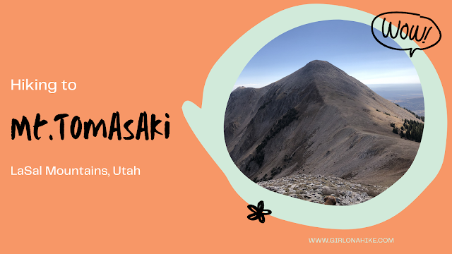
Mt. Tomasaki Hike – La Sal Mountains, Utah
Hiking Mt. Tomasaki in the La Sal Mountains offers an unforgettable alpine experience. As one of Utah’s seven ‘12ers,’ Mt. Tomasaki (12,239 ft) features rugged trails, panoramic views, and high-elevation challenges.”

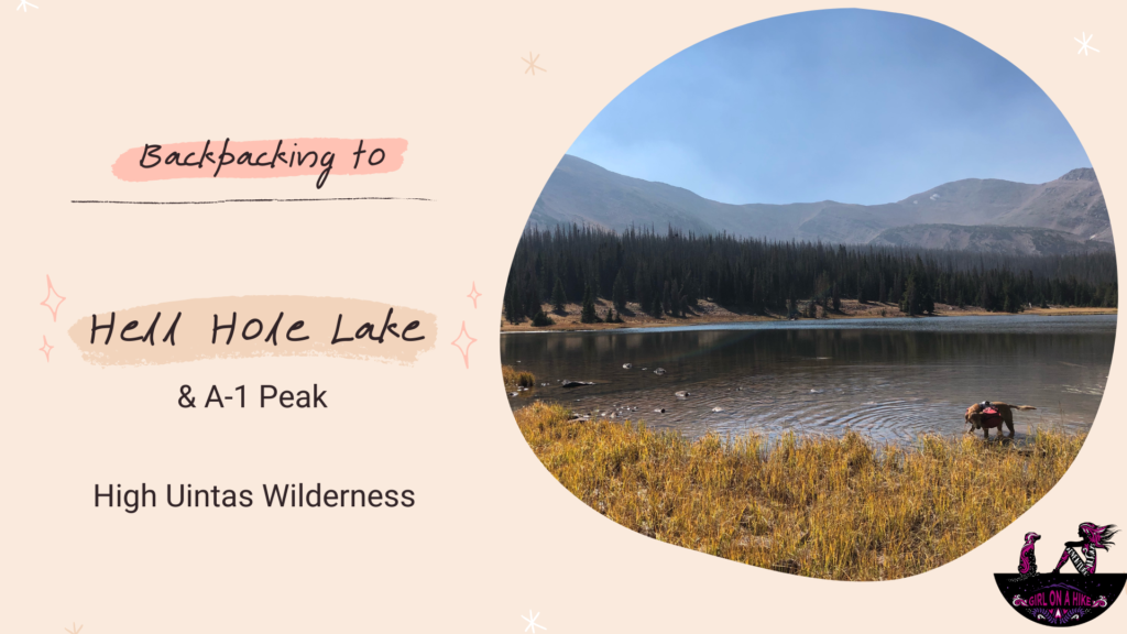
Hiking to Hell Hole Lake in the High Uintas Wilderness
Hell Hole Lake is a scenic alpine lake tucked deep in the High Uintas Wilderness of Utah. Surrounded by rugged peaks like A-1 Peak and Kletting Peak, this secluded lake offers a peaceful backcountry experience away from crowds. Reaching the lake involves a moderately challenging hike that totals 6.7 miles one way, with an elevation gain of around 1,700 feet—a gradual incline that’s manageable for most hikers and backpackers.
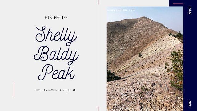

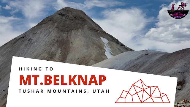
Shelly Baldy Peak (11, 321 ft) is one of the many prominent peaks located in the Tushar Mountains within Fishlake National Forest.
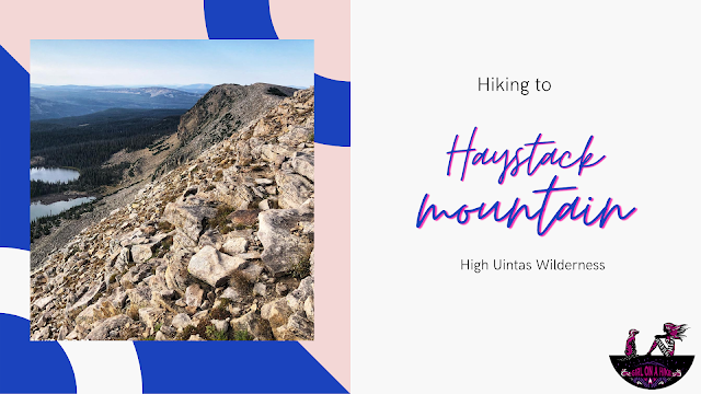
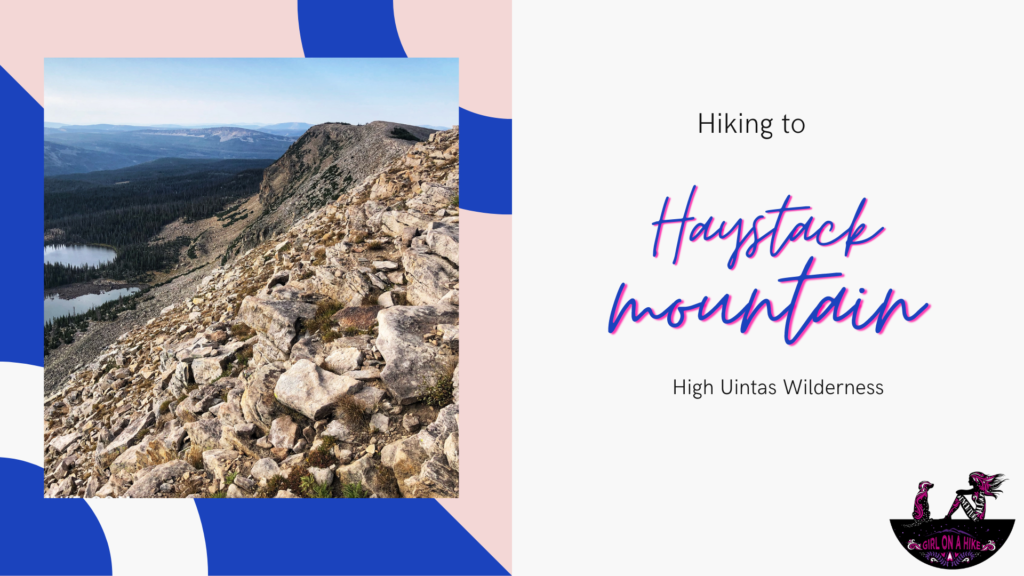
Hiking Haystack Mountain in the Uintas (10,985 ft)
Haystack Mountain (10,985 ft) is a prominent, 3-mile-long ridge located in the High Uintas Wilderness of Utah. Easily accessed from the Crystal Lake Trailhead, this hike offers a scenic and relatively easy summit adventure—perfect for those looking to bag a peak without an intense climb.
🏔 Note: Don’t confuse this Haystack Mountain with the one in the La Sal Mountains near Moab. This Uintas version is shorter, easier, and far more beginner-friendly!
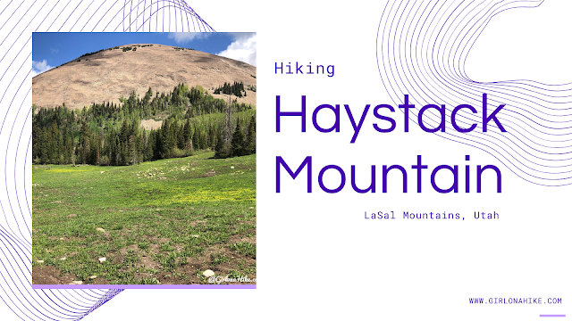
Hiking Haystack Mountain (11,641 ft) in the La Sal Mountains, Utah
Haystack Mountain (11,641 ft) is a striking summit located in the La Sal Mountains, just outside Moab, Utah. As the second-highest mountain range in Utah—after the Uinta Mountains—the La Sals offer a scenic, high-alpine escape from the desert heat below.
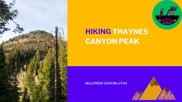
Thaynes Canyon Peak (8,656 ft) is a high point in Millcreek Canyon - not many people summit this peak, as it is not well known and fairly steep.
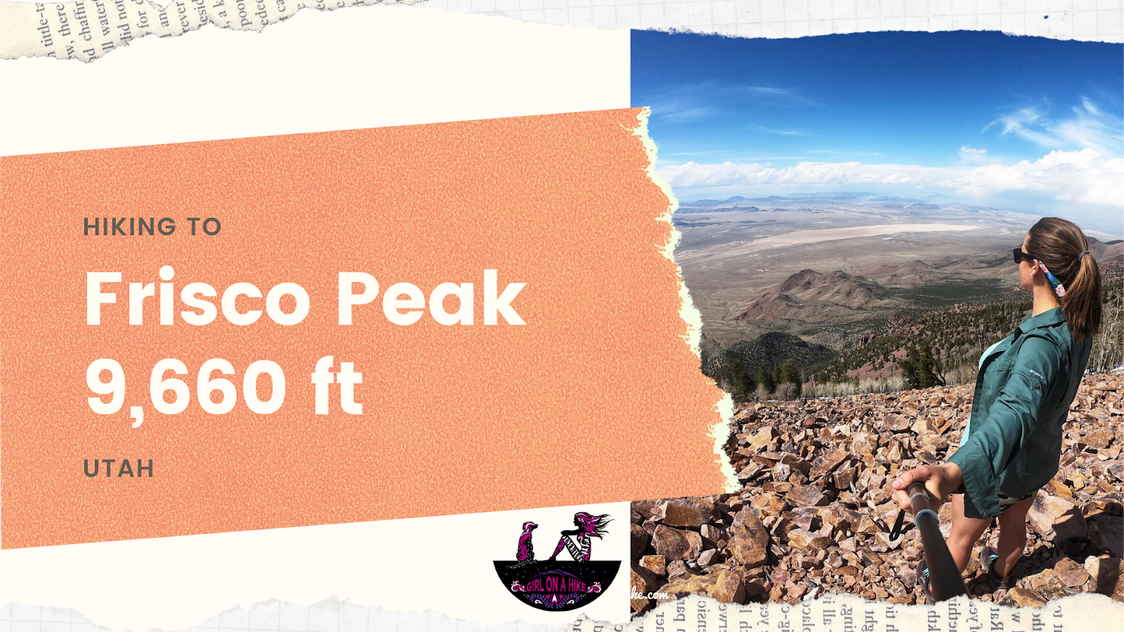

Frisco Peak (9,660 ft) is the peak above Frisco, UT and can be seen from Milford, UT. It's on the list of Utah Peaks with 25 miles of Isolation, so not many people seek out this area for hiking. m.
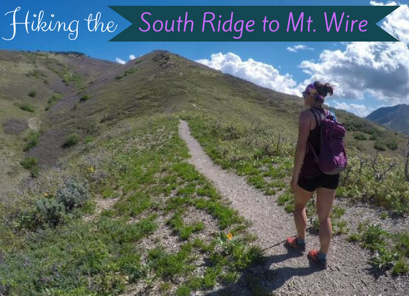
The South Ridge to Mt.Wire can be hiked year round, and overlooks the University of Utah, Emigration Canyon, and Red Butte Canyon. Unfortunately, Mt.Wire isn't much to look at. But what this little hill lacks in prestige, it more than makes up for with steep trails, nice views of the valley, and a spacious top to stretch out and enjoy the scenery. Plus, if you are brave enough, you can climb up the old radio tower! There are two main routes to get to the summit - this way up past The Living Room, or up the South Ridge, the route I will be describing.
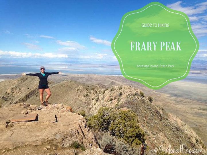
Hiking Frary Peak – The Highest Point on Antelope Island
Frary Peak (6,596 ft) is the highest point on Antelope Island State Park, located in the Great Salt Lake of northern Utah. This stunning hike offers panoramic 360° views of the lake, the Wasatch Mountains, and surrounding valley cities. It’s one of the most rewarding summit hikes close to Salt Lake City and a must-do for outdoor enthusiasts visiting the island.