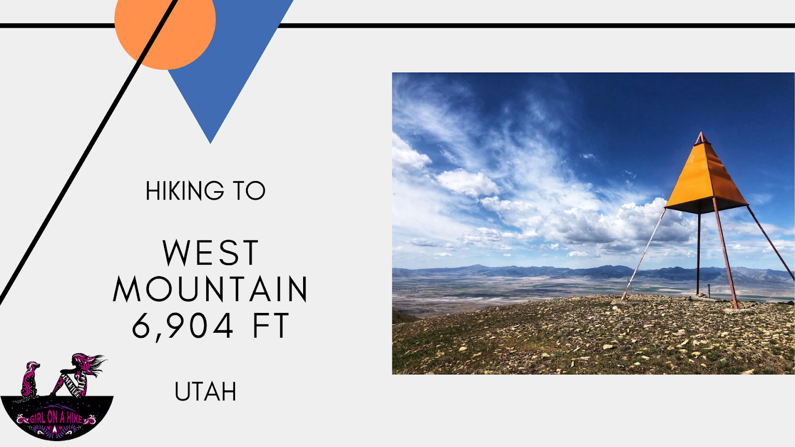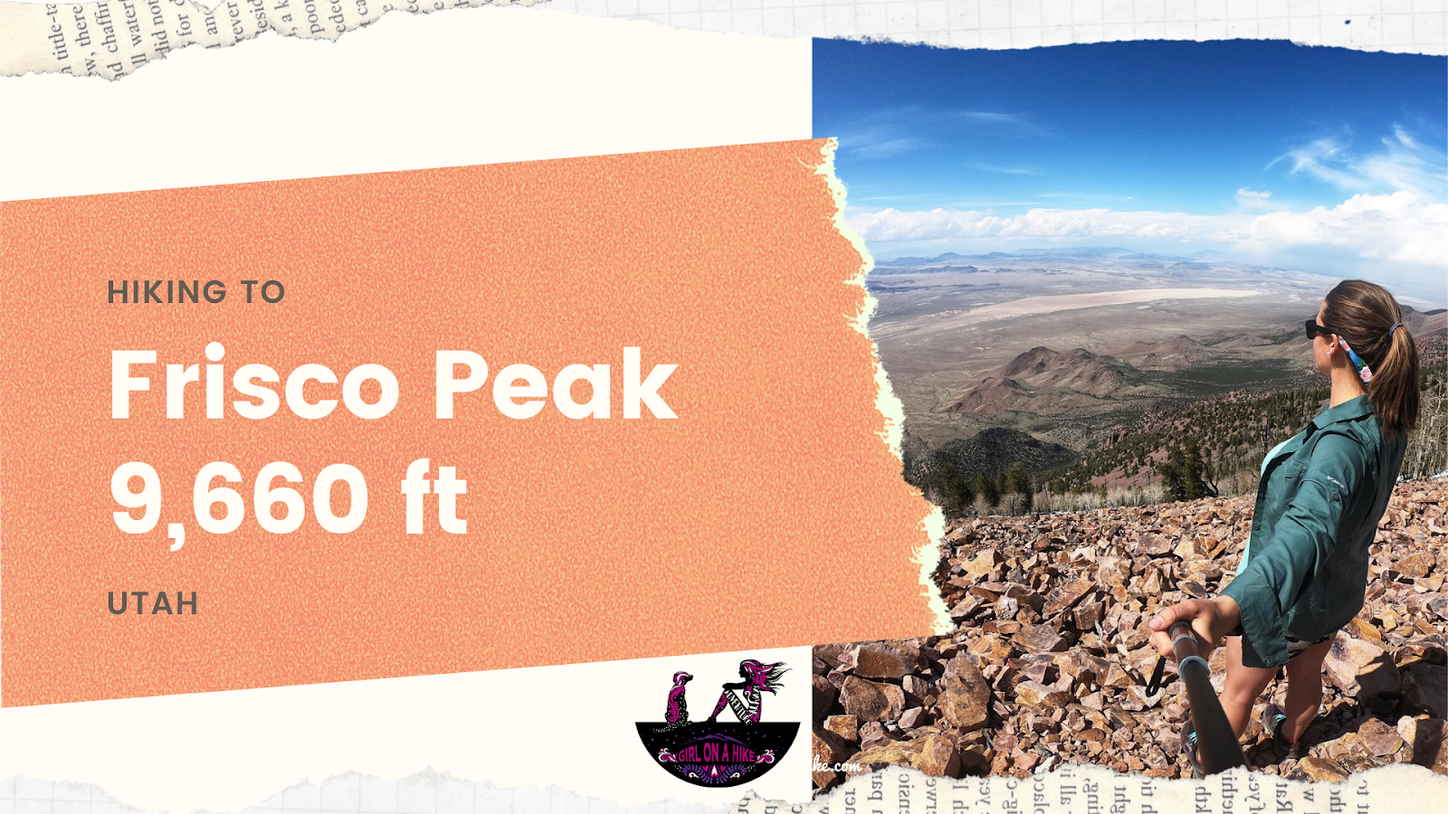

Frisco Peak (9,660 ft) is the peak above Frisco, UT and can be seen from Milford, UT. It’s on the list of Utah Peaks with 25 miles of Isolation, so not many people seek out this area for hiking. m.
About
In fact, it’s more popular for ATVs & dirt bikes. However, if you are a peak bagger, then this one is a great hike in Spring to knock off the list. While the “hike” is along an old mining road, the views on the top are amazing! There is also a launch pad for hang gliders that is really neat to see. This trail is dog friendly, but definitely not for kids. There is nothing technically about this hike, but there is very little shade and only a spring for the first 1/2 mile for dogs to drink fro
Directions
From Beaver, UT head East on HWY 21 all the way to Milford, UT. In Milford, turn left to continue on HWY 21 (Center St.). Drive 8.3 miles and turn right (you’ll dip down to a dry wash, and the turn is at the low of the dip). Reset the odometer. At 0.4 miles stay left, and at 9.2 miles reach the Golden Reef Mine and park here in a safe pull-out. 4×4 is not needed to this point. Here’s a driving map.
Trail Info
Distance: 6 miles RT
Elevation gain: 2,100 ft
Time: 3-5 hours
Dog friendly? Yes, off leash
Kid friendly? No
Fees/Permits? None
 The first 9.2 miles of the road can be used by any type of car, 4×4 is not needed. It was very well graded in May 2020.
 At 9.2 miles you’ll see the Golden Reef Mine on the left (West) side of the road. You’ll want to park right by this, then start hiking (don’t block parts of the road – be sure to pull off in a safe spot). Beyond this point you will need at ATV to reach the peak. Older trip reports on PeakBagger.com say that a Land Rover and 4Runner have made it to the top, but the road was in pretty awful condition when we went.
 Time for a road hike! By the time we left SLC, made the drive, gas stops, etc we didn’t start hiking until 2pm so it was pretty hot. Ideally you’d want to be starting no later than 9am, but that’s what we could do. I carried 2 liters and David carried 3 liters of water.
 The hike up the road is pretty steep, but you do get some great views!
  Road hikes can get a little boring, so bring a friend that makes time go by fast & fun!
 We were getting nervous that these dark clouds were rolling in, but we could finally see the towers on the peak! Also in this area about 10 ATVs passed us for a family of 20! Make sure you have a leash handy for wildlife and people flying by.
 Wow, we were lucky this storm stayed to the North of us. We only got a few sprinkles on us.
  Look at that – blue skies again! And now so close to the actual summit!
 We found the Frisco Peak summit marker! Charlie wasn’t too thrilled haha but he was also pretty hot! He was ready for some shade and a nap.
 Official marker.
 Exploring around the summit. This is looking NW to Wah Wah Valley. The storm off to the right finally pushes through. If you carried binoculars you would be able to see Notch Peak from here.
I’m loving my new sunglasses strap!
 Feelin’ like Michael Jackson here on the launch pad for hang gliders! This is looking South, and the coolest part of the summit.
 Looking back at the towers and launch pad.
 Sure hope they know their dish fell down!
Trail Map
My track via Gaia GPS – the best tracking app! Get your app here for a discount.
Nearby Hike
If you zoom in on my map above, you’ll see “The Beehive Kilns at Frisco, UT”. You can drive right up to the kilns, but small cars may have trouble with ruts. You can also park along the main road, then walk over. This isn’t a hike, its more of a “drive & see” place.

From 1875 to 1885 Frisco was a booming mining town, but an earthquake collapsed the richest parts of the mines and it became a ghost town by 1912. These beehive-shaped charcoal kilns were used for mining. You can still smell the soot inside them. Walking around the backside of the kilns. I’m in flip flops but be careful as I did see quite a bit of glass and other trash. I should have left my Altra’s on.