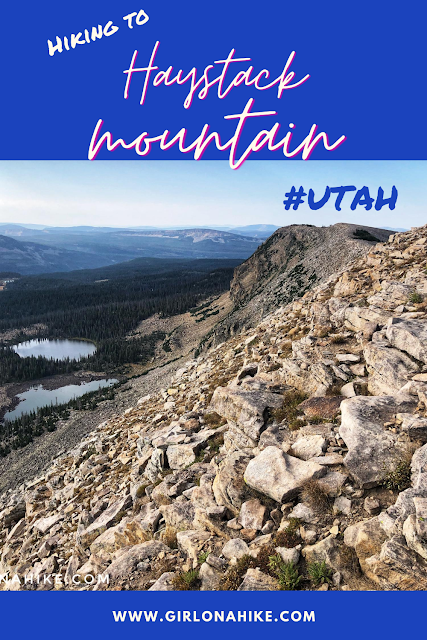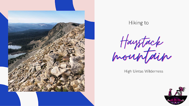
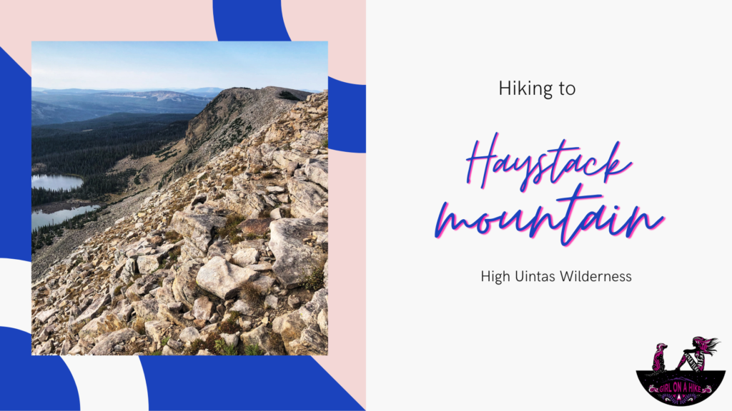
Hiking Haystack Mountain in the Uintas (10,985 ft)
Haystack Mountain (10,985 ft) is a prominent, 3-mile-long ridge located in the High Uintas Wilderness of Utah. Easily accessed from the Crystal Lake Trailhead, this hike offers a scenic and relatively easy summit adventure—perfect for those looking to bag a peak without an intense climb.
🏔 Note: Don’t confuse this Haystack Mountain with the one in the La Sal Mountains near Moab. This Uintas version is shorter, easier, and far more beginner-friendly!
About Haystack Mountain
The Haystack Mountain ridge stretches for about 3 miles and offers some of the easiest peak hiking in the Uintas. From the Crystal Lake Trailhead, follow the established trail for the first 2 miles. You’ll then leave the trail and hike cross-country for about 1.75 miles to reach the summit.
This section of off-trail hiking involves minimal route-finding and gentle boulder hopping, making it an excellent introductory hike for those new to Uinta summits. Along the way, enjoy sweeping views of the Washington Lake and Trial Lake areas to the north, plus 360-degree views of surrounding ridgelines and basins.
Tips for Hiking Haystack Mountain
Bring a map or GPS device, as the last section is off-trail.
Start early to avoid afternoon thunderstorms, which are common in the Uintas.
Pack layers—even in summer, temps can be chilly at high elevation.
Don’t forget the sun protection and plenty of water!
How to Get to the Crystal Lake Trailhead
Driving Directions from Salt Lake City
From Salt Lake City, head east on I-80 toward Park City.
Take Exit 146 for US-40 South toward Heber City.
Take Exit 4 toward Kamas, UT.
At the first stoplight in Kamas, turn left.
At the next light, turn right onto the Mirror Lake Highway (UT-150).
Follow signs for Crystal Lake Trailhead.
🅿️ Parking: The official trailhead lot often fills up quickly, especially on weekends. Be prepared to park in the overflow lot. This is where mileage tracking typically begins.
🚻 Facilities: Restrooms are available at the trailhead.
💰 Fees: Mirror Lake Highway requires a recreation pass:
-
$6 for 1–3 days
-
$12 for 7 days
-
$45 for an annual pass
🛂 Tip: If you have an America the Beautiful Annual Parks Pass, you can park for free. Be sure to display your pass on your dashboard.
🕒 Drive Time from SLC: Approximately 1 hour 15 minutes to 1 hour 30 minutes.
Here is a driving map.
Trail Info
Distance: 7.4 miles RT
Elevation gain: 1,074 ft
Time: 3-4 hours
Dog friendly? Yes, off leash
Kid friendly? Ages 12+
Fees/Permits? The Mirror Lake Highway charges a $6 fee for a 3 day pass. It’s free if you have an annual Mirror Lake Hwy, American Fork Canyon, or National Park annual pass. No permit is required.
Ready to Hike to Haystack Mountain?
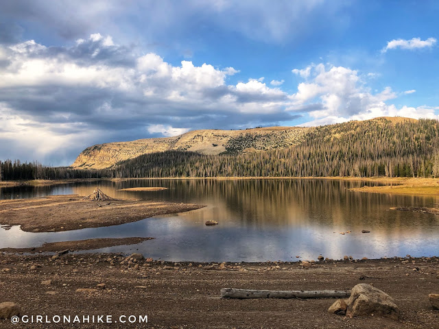
Viewing Haystack Mountain from Washington Lake.
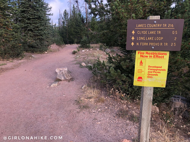
At the official Crystal Lake TH. Follow the main trail for about 2 miles, towards Long Lake.
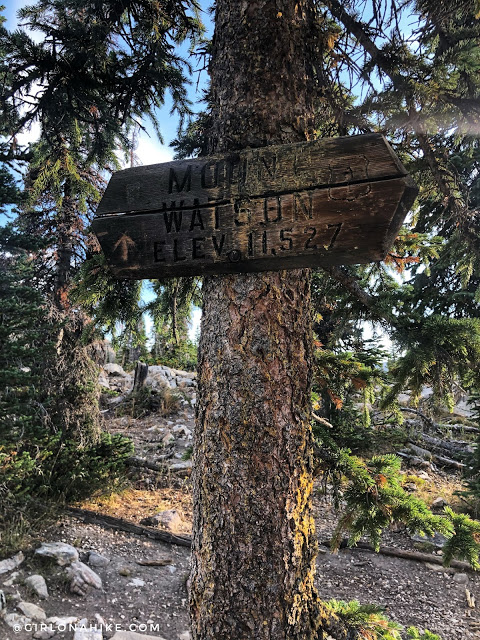
At 1.9 miles (from the overflow parking area), you will see the Mt.Watson sign on your right (North) side of the trail up in a tree. It’s right where there is a small saddle, before the trail starts to drop down to Long Lake. From here, turn left and leave the trail.
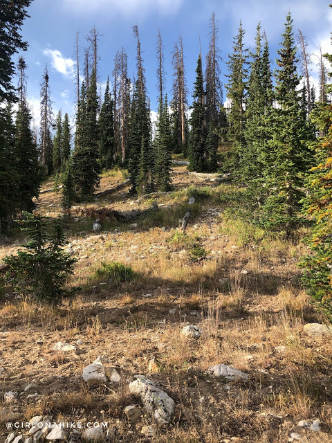
You will now be hiking off trail. Just follow the ridge.
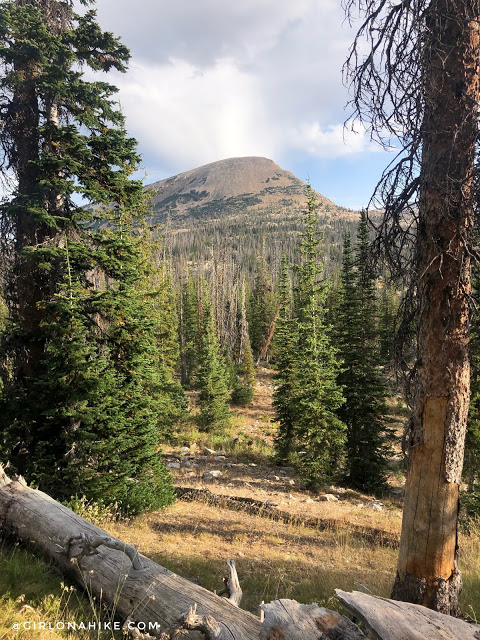
Don’t forget to look back at Mt.Watson!
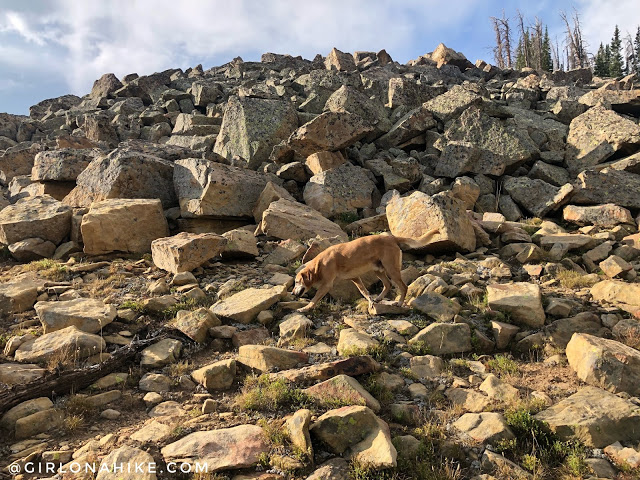
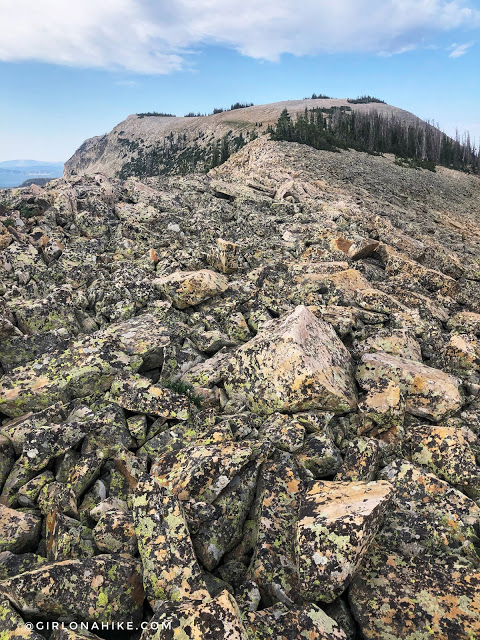
Reach the start of the boulder field. From here, it’s 1.5 miles along the ridge to the summit.
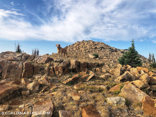
Charlie leads the way as usual!
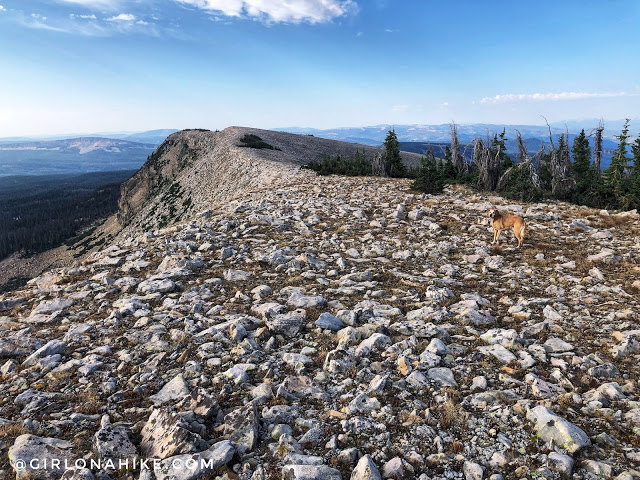
Ahh now that’s what I’m talking about – a ridge for days!!! My favorite. The peak is beyond the highest point you can see here on the far left.
We love hiking over the Uinta boulders.
Generally you want to stay right on the ridge in order to avoid dropping in elevation, only to re-gain it. But, I started to see the lakes and I couldn’t resist a photo op.
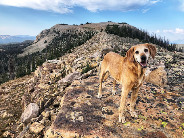
Along the ridge you will first cross 10,983 ft. This is not the true summit – the true summit is just ahead past the next tree patch.
Scenic Views on the Summit
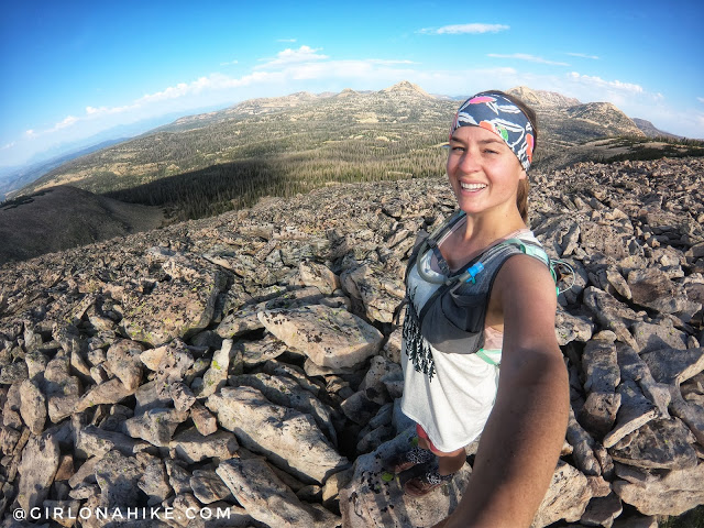
Yay, made it to the official summit – 10,985ft!
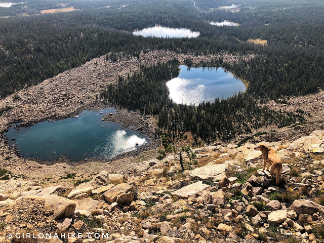
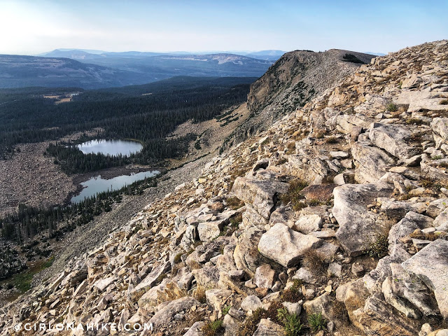
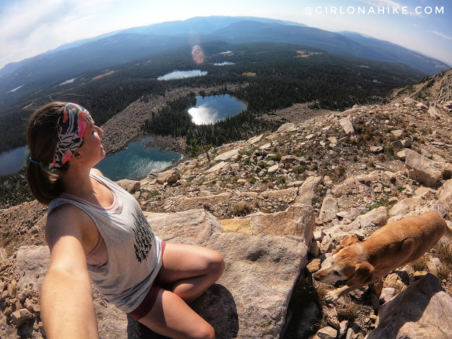
I really liked the views to the East best, down to Azure, Rock, & Haystack Lakes. We could actually hear campers talking all the way down there!
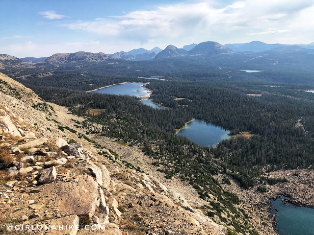
Same spot, looking more North towards Reids Peak and Bald Mountain – also great peaks to hike!
What a great day – we loved this easy Uintas peak!
Check out my video!
Trail Map
My track via Gaia GPS – the best tracking app! Get your app here for a discount.
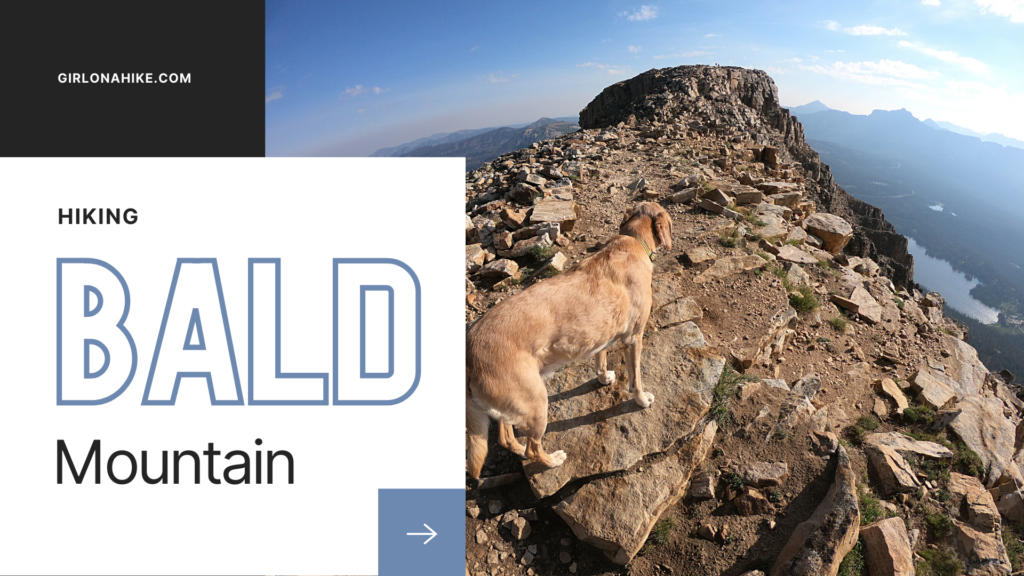
Nearby Hike

Save me on Pinterest!