

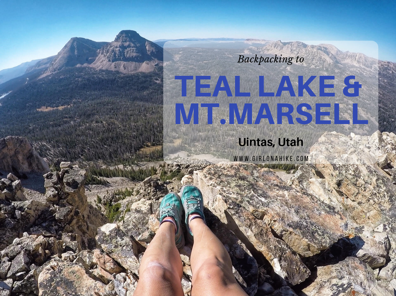
Teal Lake sits at an elevation of 10,400 ft, and is accessed via the popular Ruth Lake Trailhead. You will follow this trail for the first mile, and then after that there is no trail. You should be comfortable with a little route finding, and hiking off trail. The nice thing is that Teal Lake is a mere 2.2 miles, so you really only have to hike off trail for 1.2 miles. You'll pass a few unnamed ponds, Jewel & Naomi Lakes, then reach Teal Lake. There are several nice campsites at Teal Lake, and fishing is plentiful.
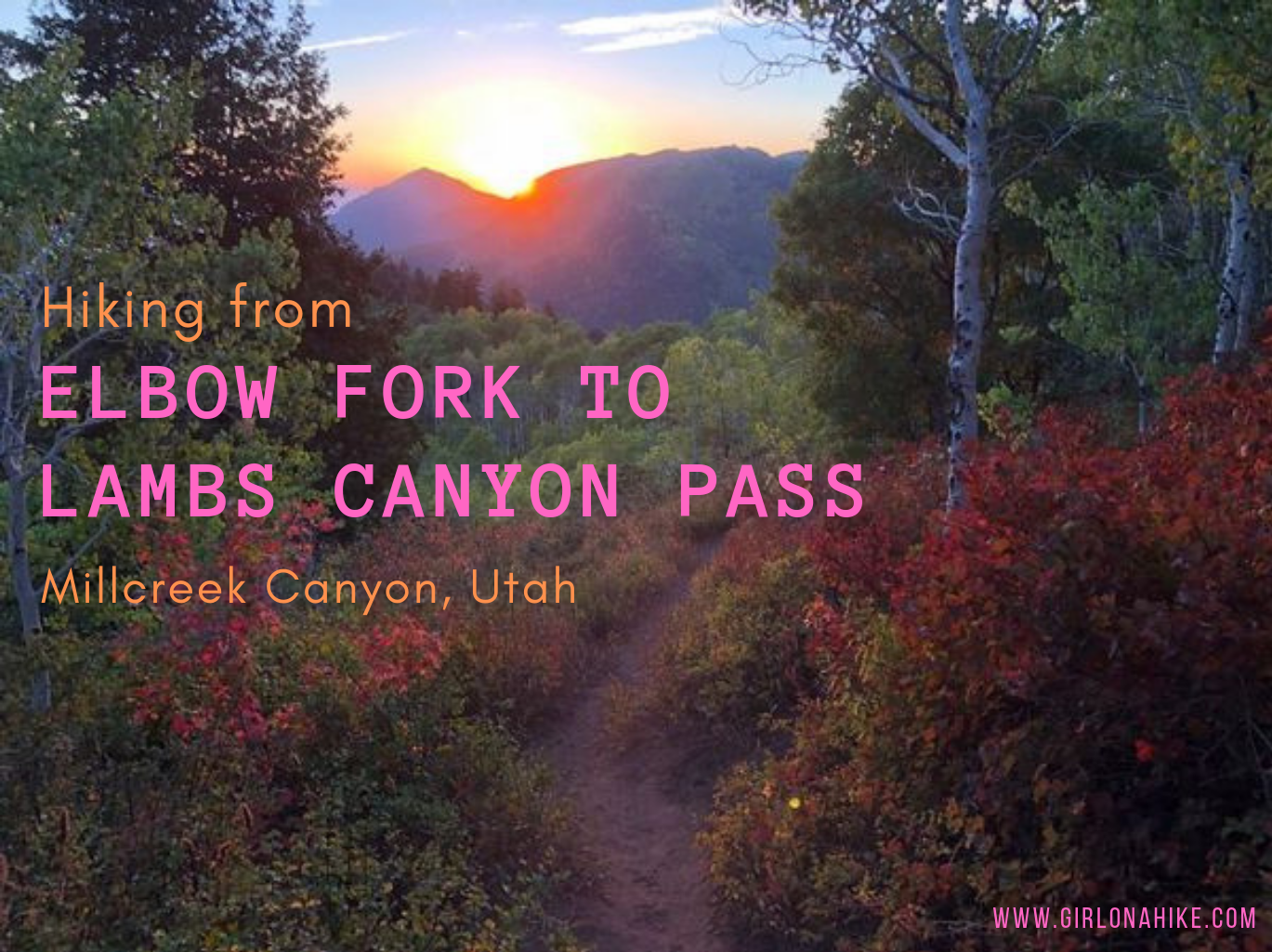
Elbow Fork in Millcreek Canyon is a popular trailhead for Mt. Aire, the Pipeline, and for accessing Lambs Canyon Pass, the dog-friendly way. Many people chose to hike up to Lamb's Canyon Pass via Lamb's Canyon, however that section of trail is part of the SLC Watershed, and dogs are not allowed.

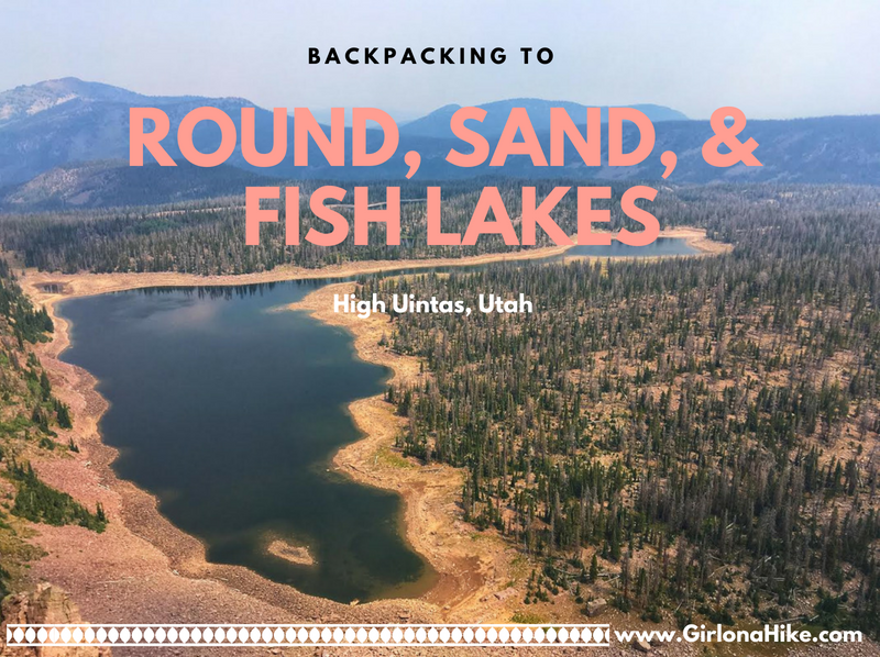
Backpacking to Round, Sand, and Fish Lakes are part of the upper Weber River drainage on the Western end of the Uinta Mountains. The trail steeply follows the Dry Fork stream and canyon, as it makes it way to the three lakes. Camping and fishing are plentiful here. Round Lake is actually home to three species of fish (somewhat unheard of in the Uintas, as there are typically only two species in the lakes). There are Grayling, Brook, and Cutthroat Trout. Further ahead is Fish Lake, which can vary in depth by 19 feet, depending on the snow year and dam levels. Plenty of day hiking options are available too, as most day hikers try to reach the ridge for better views. This route is kid and dog friendly!
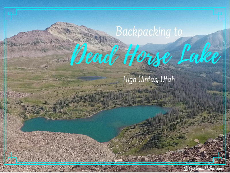
Dead Horse Lake is in the High Uintas Wilderness, and offers an 11 mile hike through large, open meadows, stunning vistas, and of course, leads you to a turquoise lake. This lake offers a great spot for fishing and day hiking. People hiking the Uinta Highline Trail also pass right by Dead Horse Lake. It's a dog friendly trail, though you'll want to give the sheep herds passing by in the meadows plenty of space. Bring your hammock or tent - there are several nice campsites around the lake and plenty of trees for shade. Be sure to check fire restrictions before heading out.
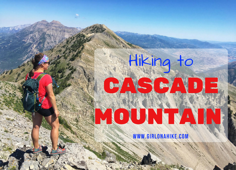
Cascade Mountain (10,908 ft) towers above Orem, Utah and is one of the iconic "Wasatch 7" Peaks. Unlike its well-known neighbor to the north, Mount Timpanogos, Cascade sees far fewer hikers due to its difficulty and rugged terrain. But for experienced hikers and peak baggers, Cascade Mountain is a rewarding summit worth the effort.
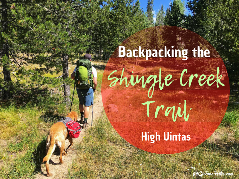
The Shingle Creek Trail in the High Uintas is a popular trail for an "early season" trail for hikers and backpackers to follow when the higher elevations haven't thawed out from winter. I have driven past this trail so many times, yet had never done it - until now! I decided to head up for one night with two friends and our destination was South Erickson Lake. East Shingle Creek Lake is more popular, but a little lower in elevation, and seemed to have more mosquitos so we wanted to keep going.
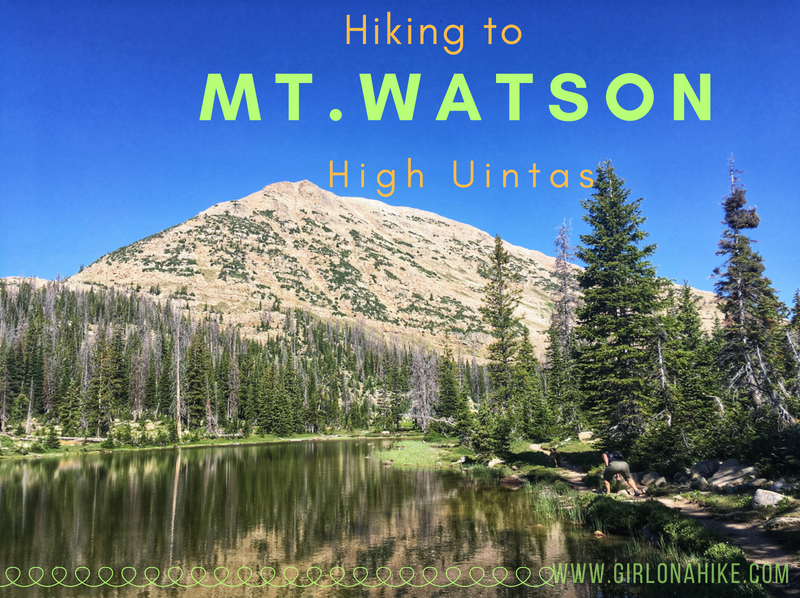
Mt. Watson (11,521 ft) is located on the West end of the High Uintas Wilderness, and though it is surrounded by several popular trails and lakes, most people do not summit this peak. There is a trail for the first 2 miles, but you're on your own after that to reach the top. That's what makes part of this peak fun - it's a "choose your own path" adventure!