

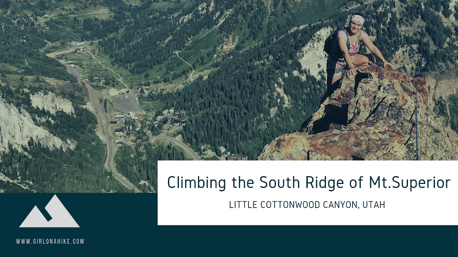
The South Ridge of Mount Superior is a well-known Class 5 scramble and a true gem for adventurous hikers in the Wasatch Mountains. While you can reach the summit via a more traditional hiking trail, this technical ridge route offers a more exhilarating and challenging ascent for experienced climbers.
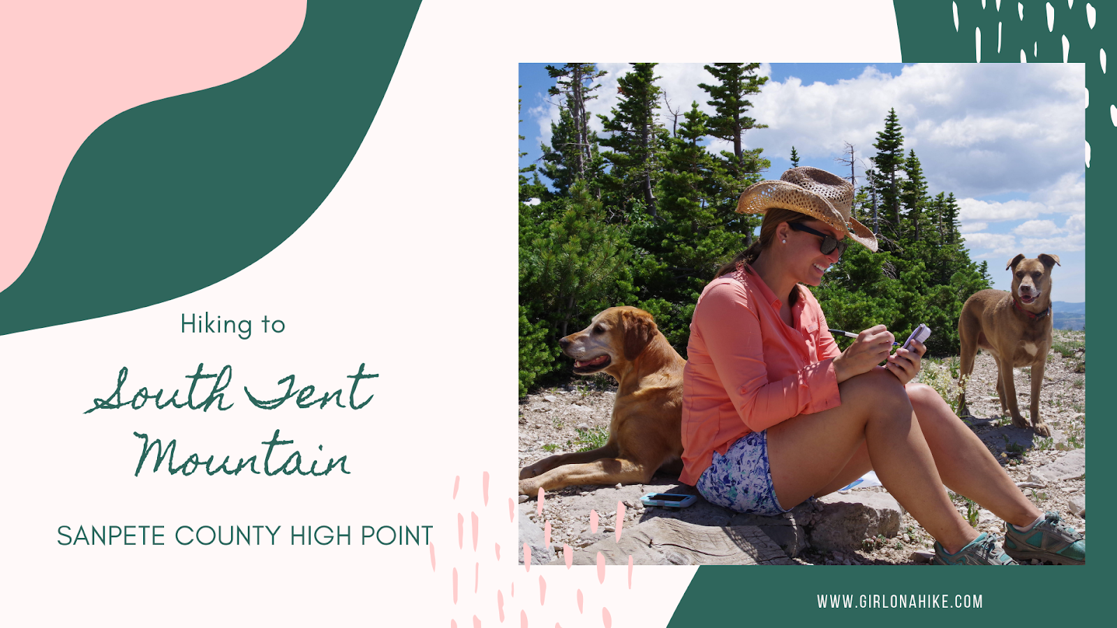
South Tent Mountain (11,285 ft) is the highest point in Sanpete County, Utah, and offers a scenic, rewarding ridge hike with panoramic views. While most hikers opt for the traditional route to the South Tent saddle, we chose to hike the entire ridge—summiting both South Tent Mountain and North Tent Mountain (11,230 ft). This moderate, dog-friendly trail requires no technical gear and covers just 5 miles round-trip, giving you double the peaks with minimal extra effort.
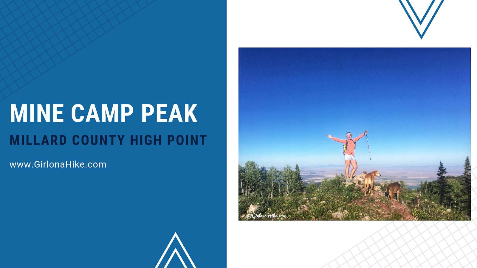
Mine Camp Peak (10, 222ft) is the Millard County High Point (CoHP), and one of the easiest to summit out of all the CoHPs at only 1 mile round trip. The drive will take much longer than the actual hike, so be prepared to spend close to half a day at least to summit this peak, and make the drive in and out. Mine Camp Peak should be combined with other peaks in the area since it's so short. In one weekend, we knocked out Brian Head Peak (Iron County High Point), Andy Nelson Peak & the Kane County High Point, Cascade Falls, and South Tent Mountain (Sanpete County High Point). Camping is available right at the trailhead, but only 2-3 tents can fit and one car can park there. This trail is both dog and kid-friendly!
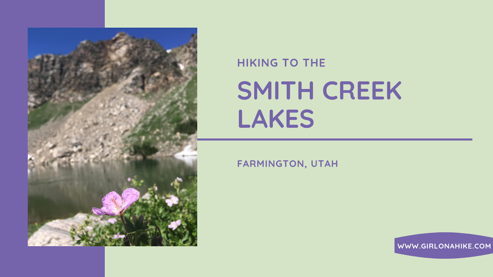
Smith Creek Lakes is located along the Skyline Drive, near Farmington, Utah. The hike starts from Francis Peak, then follows a jeep/ATV road as it drops into the basin where a chain of three lakes sits. All three lakes are fairly big for a high alpine lake, and each lake had at least one campsite. The hike itself is really easy, and you can't get lost. Plan on taking a half day to explore all three lakes, and to let the dogs swim and cool off. Smith Creek Lakes is only available when the Farmington Canyon Road is open, typically June through October. There is only a little shade, so plan to start hiking early to beat the heat on the hike back up to the car.
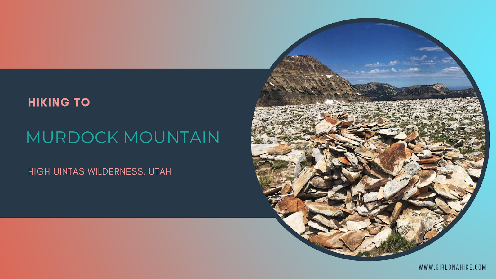
Murdock Mountain is a hidden gem in the High Uintas Wilderness, located just off the Mirror Lake Highway in Utah. Unlike the popular nearby Bald Mountain, which sees hundreds of hikers each summer, Murdock sees fewer than 75 people reach its summit annually. This makes it a perfect destination for solitude and stunning views. The route is off-trail but manageable—only 1 mile of easy boulder-hopping leads to breathtaking 360-degree vistas.
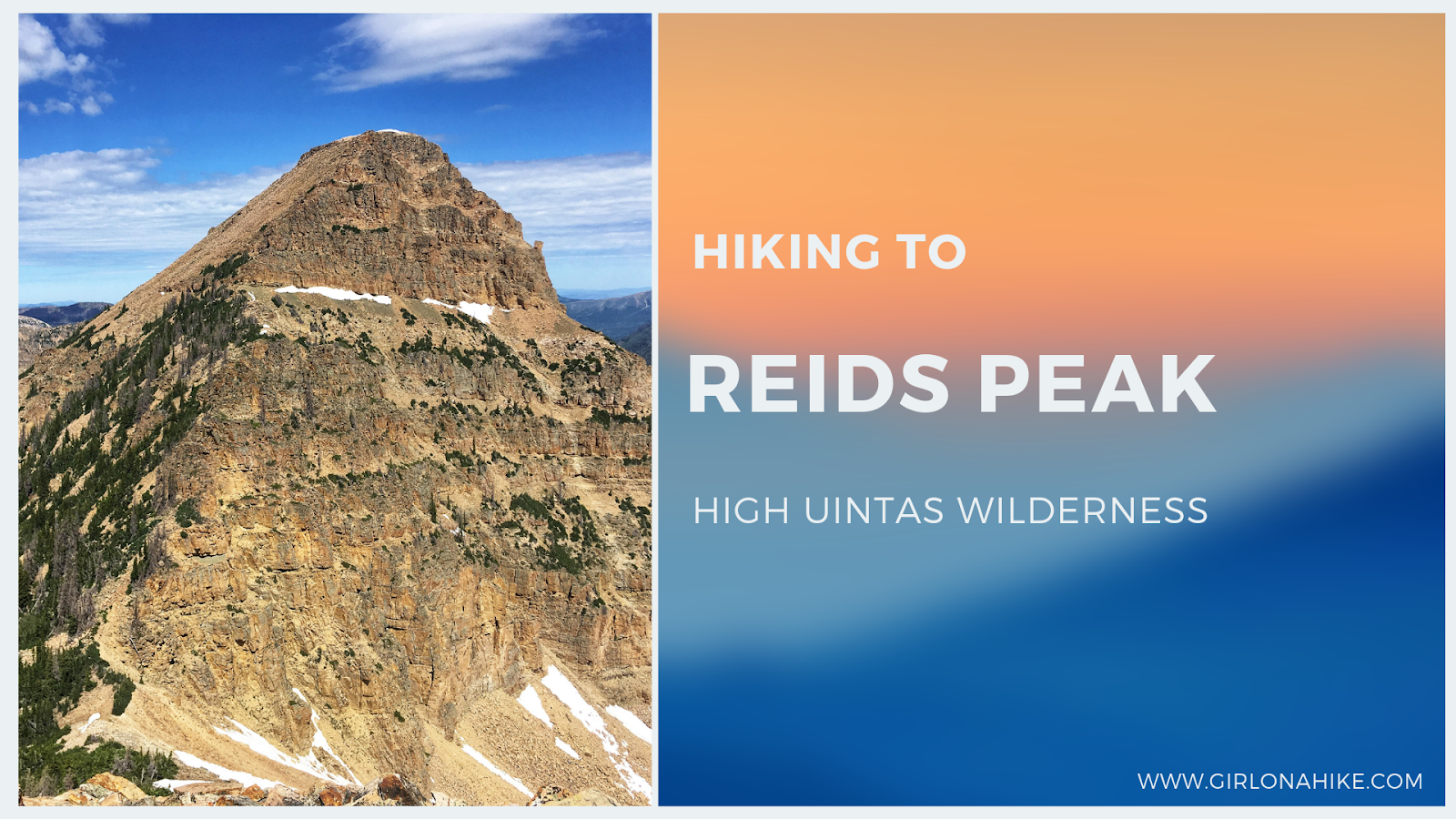
Reids Peak (11,708 ft) is located in the High Uintas Wilderness, just off the Mirror Lake Highway. While its neighbor peak, Bald Mountain, see hundreds of hikers each summer, less than 50 people will make the Reids Peak summit each year, and for good reason. There is no trail to the summit and requires light scrambling, so it's not a good peak for the average/newbie hiker. Typically, only experienced peak baggers are the ones looking to make the summit, and knowledge of route finding will make this hike successful.
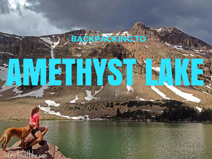
Backpacking to Amethyst Lake in the High Uinta Wilderness is a backpackers dream - a high alpine lake, lots of hiking and fishing, great campsites, not too many people, and cooler temperatures. Although the hike in is somewhat tough (especially if you are carrying a 30-40 lb pack), the reward and view is well worth the hard effort.
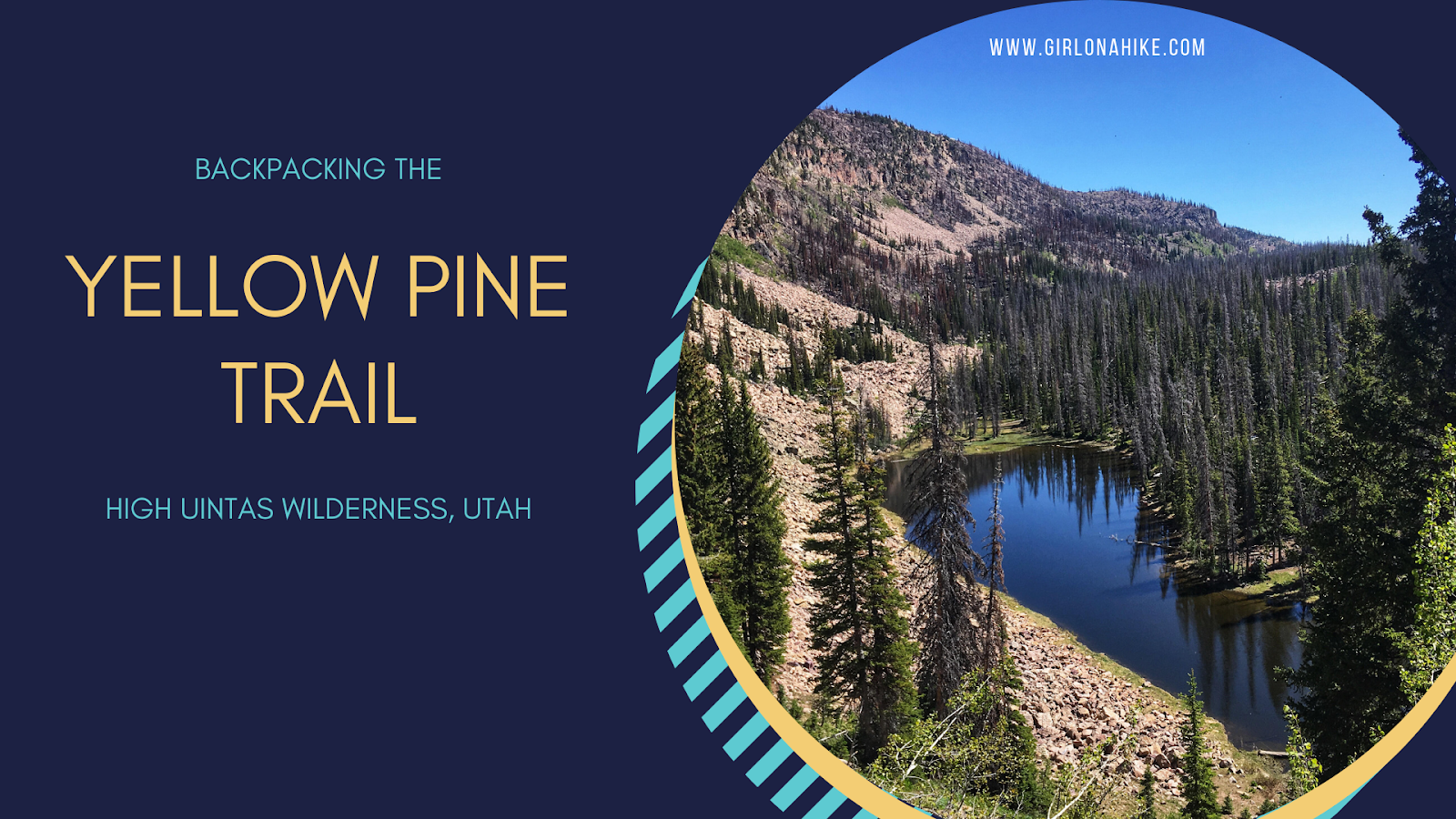
The Yellow Pine Trail is one of the first trailheads you will pass after entering the Mirror Lake Highway, coming from Kamas, UT. The trail leads to three lakes - lower & upper Yellow Pine Lakes, as well as Castle Lake. You can also day hike to Duke & Castle Peak, both over 10,000 ft. This is a great early-season backpacking route when the higher Uintas is covered in snow. The trail is mostly well shaded and offers plenty of water along the way for your pup to drink from or to filter from. It is slightly steep and rocky in sections, so this trail took longer to reach the lakes than anticipated. The best time to hike here is late June though October, or when the first snow flies.