logo dark logo
  • Dog Friendly Lists
  • Find a Hike
  • Discount Codes
  • Fav Gear
  • About
    • Testimonials
    • Awards & Features
Mobile Logo
  • Dog Friendly Lists
  • Find a Hike
  • Discount Codes
  • Fav Gear
  • About
    • Testimonials
    • Awards & Features
Top
Home  >  Hiking   >  Visiting Toquerville Falls
Southern Utah

Visiting Toquerville Falls

Hiking
Share the love!
Shares

Visiting Toquerville Falls, Utah Waterfalls

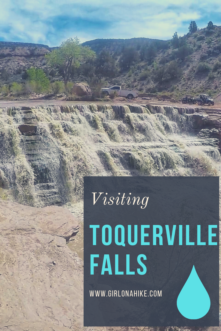
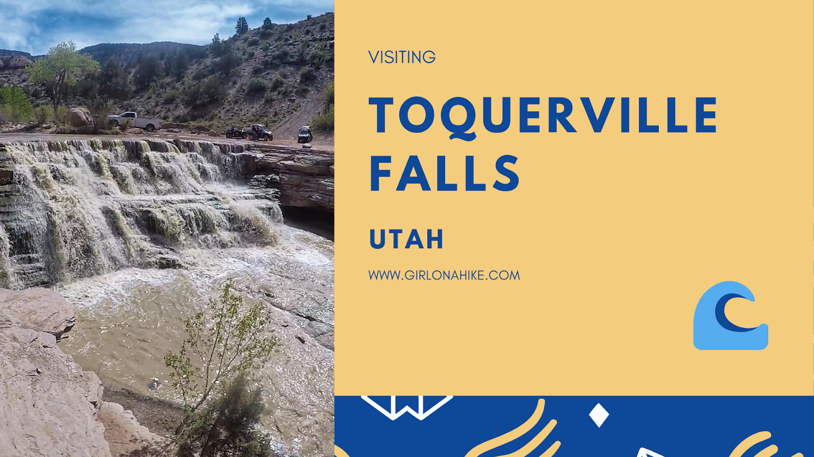
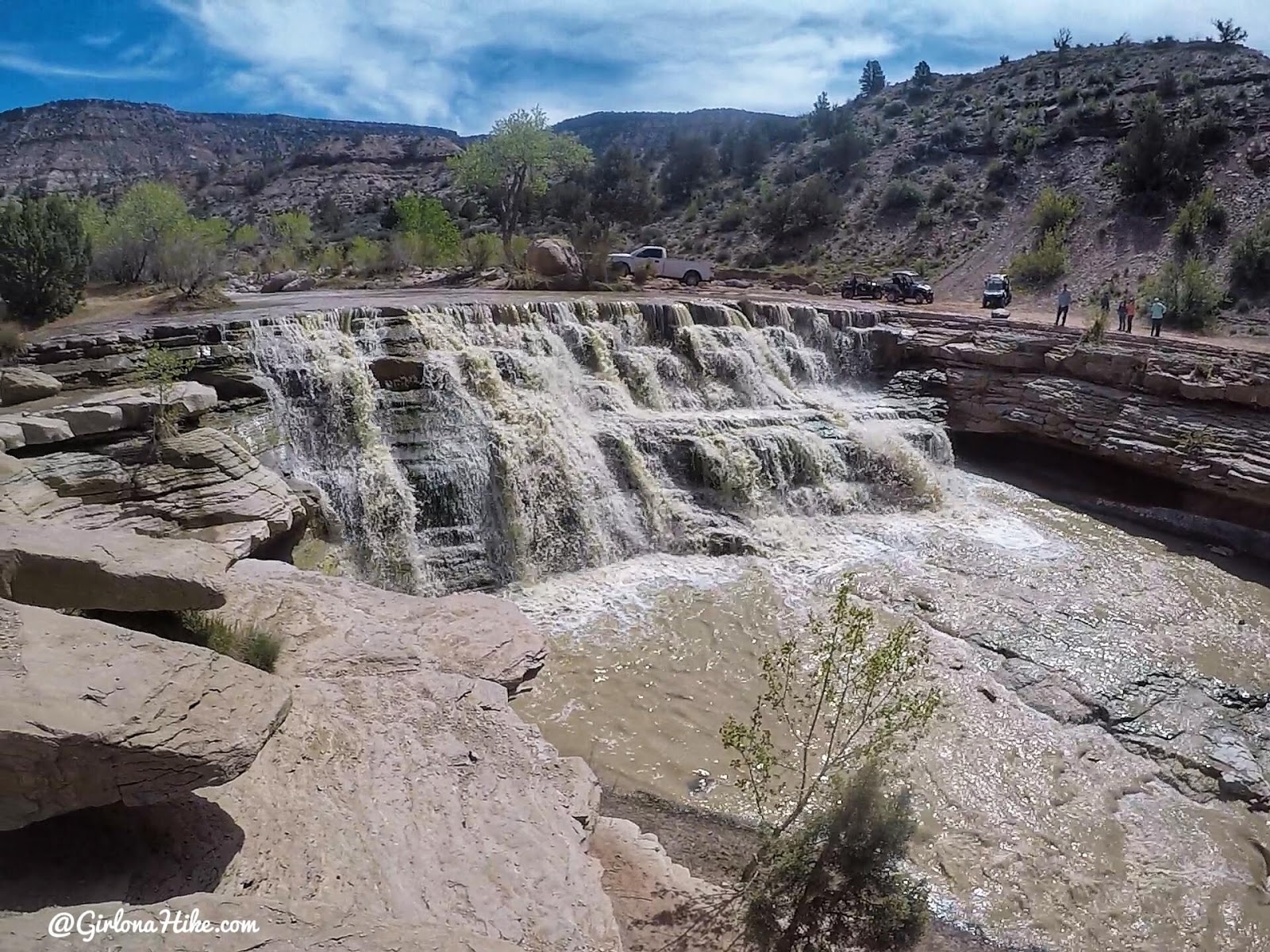
Toquerville Falls is located near St.George in Toquerville, UT. The falls flow from La Verkin Creek over two pour offs – the first a cascade of falls, and the second a complete drop off to about 20 feet to the bottom of the creek.

Contents hide
1 Share the love!
2 About
3 Directions
4 Trail Info
4.1 Check out my Youtube video on my 3 day trip to St. George!
5 Trail Map
6 Recommended Hike
7 Save me on Pinterest!
7.1 Share the love!

About

No hiking is required, but you better have a 4×4 car. The sign along the road says “4×4 recommended”, but there’s no way anything less will make it. The dirt road is only 5.3 miles, but driving it will take you around 45 minutes. We drove a Tacoma and put it in 4-wheel drive several times, all while driving very slow.

The drive is worth it though, as you follow the Hurricane Cliffs to the West, and Smith Plateau to the East. Coming here during Winter or after a rain would not be an ideal time to visit, as the road could be very wet and muddy. All other seasons area great, with high run-off in Spring (what we experienced). In summer, expect hundreds of people cooling off in Toquerville Falls! This area is great for the whole family, especially if you like to ride ATVs or dirt bikes.
 

Directions

From I-15 take exit 27 towards Toquerville, UT, driving East on UT-17. Turn left on Spring Drive. Reset your odometer to 0, and drive 5.8 miles along this road. Once you reach the green sign, the dirt road begins and you will now need 4×4 drive. This drive will take about 45 minutes to reach the falls from the sign.

You can use this driving map, however Google doesn’t understand where the falls are. Use my map provided below for an accurate drive.


Trail Info

Distance: There is no hiking required

Dog friendly? Yes, off leash but be careful of strong currents

Kid friendly? Yes

Fees/Permits? None

Visiting Toquerville Falls, Utah Waterfalls

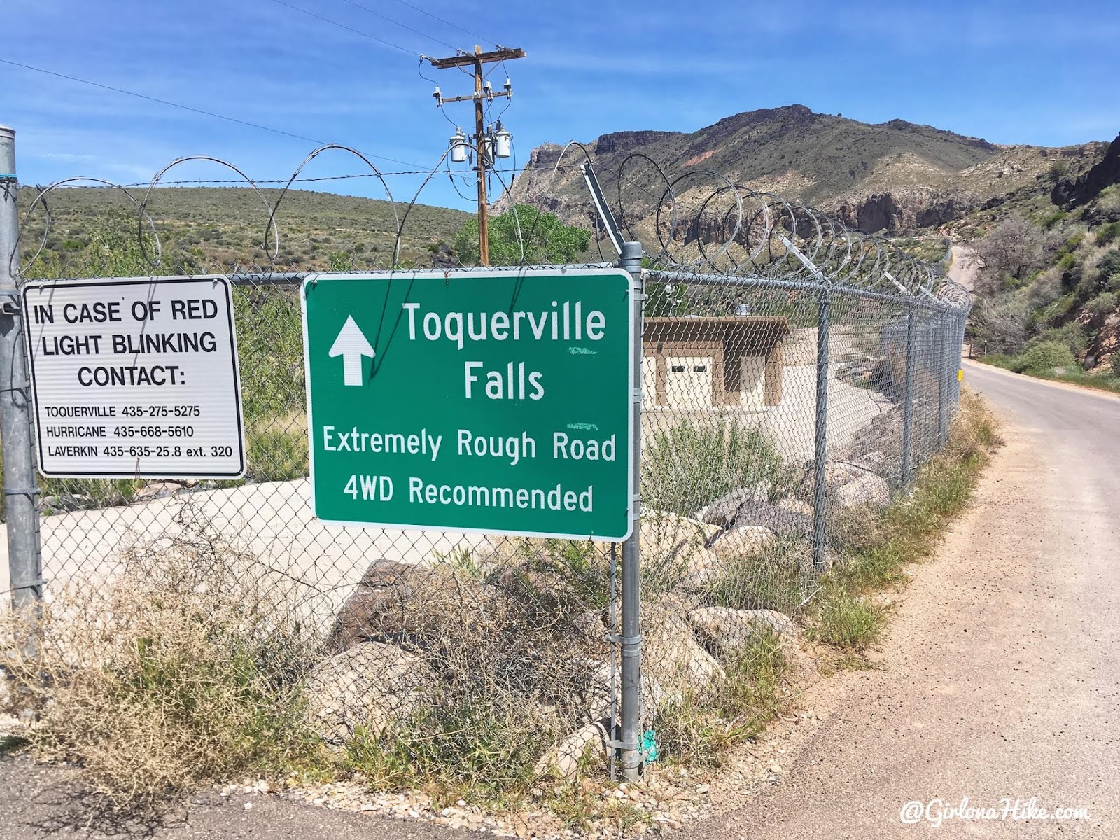
Ready for some off roading! Toquerville Falls are 5.3 miles from this sign.

Visiting Toquerville Falls, Utah Waterfalls

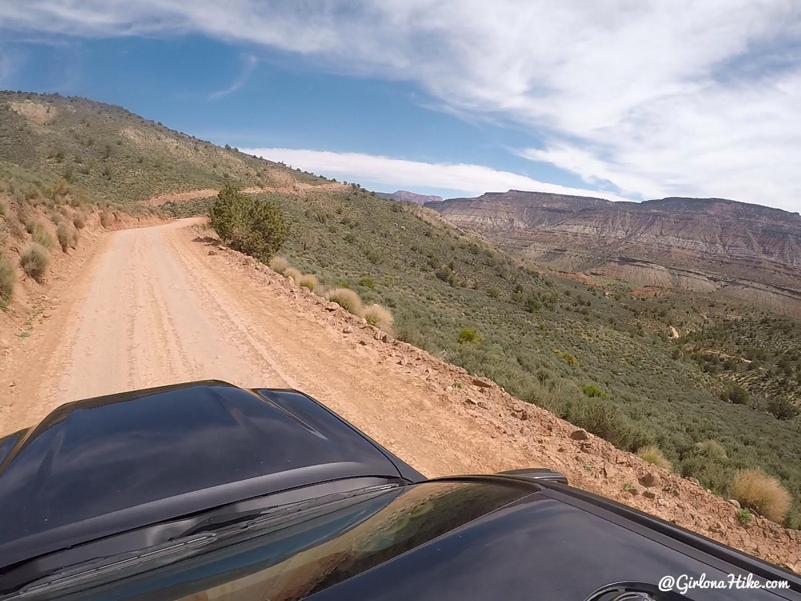
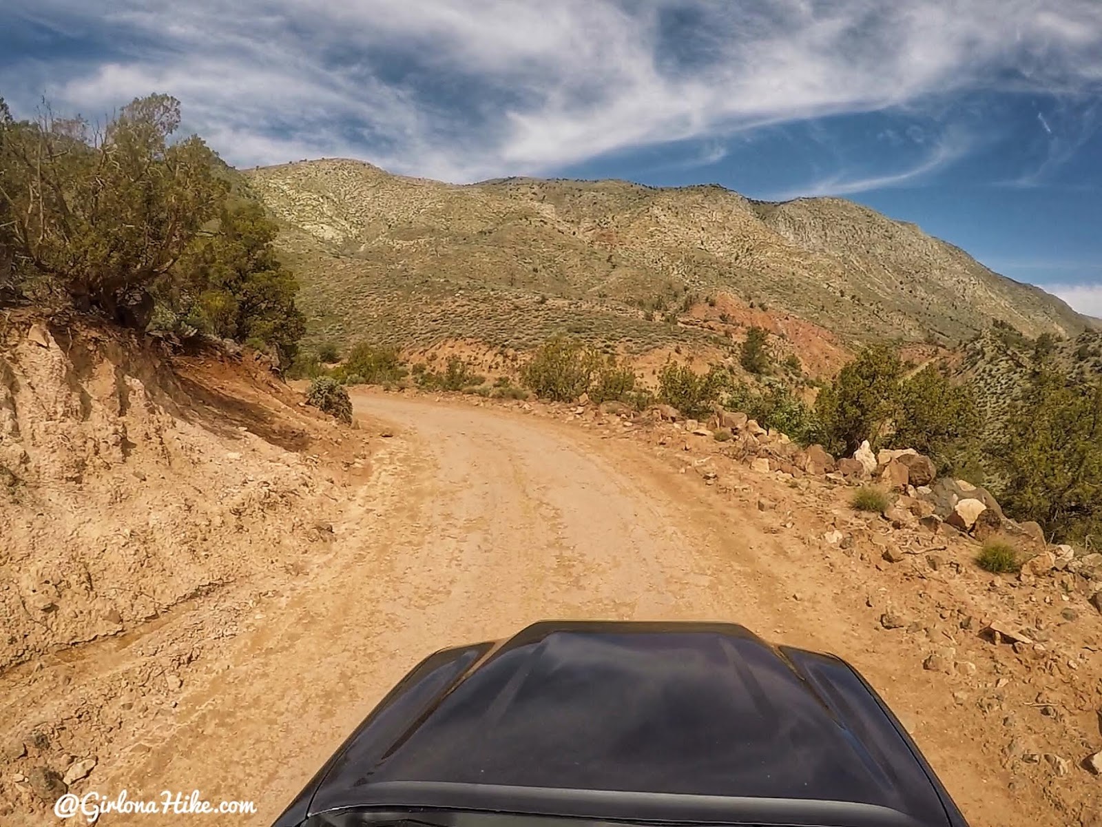
Wow, what a pretty drive! The brown mountain to the right is the Smith Plateau. Some sections of road were completely flat and easy to drive. The road is a single lane, so you still have to go slow in case you need to share the road.

Visiting Toquerville Falls, Utah Waterfalls

The Hurricane Cliffs ahead. If you have an ATV you can explore much more of this area.

Visiting Toquerville Falls, Utah Waterfalls

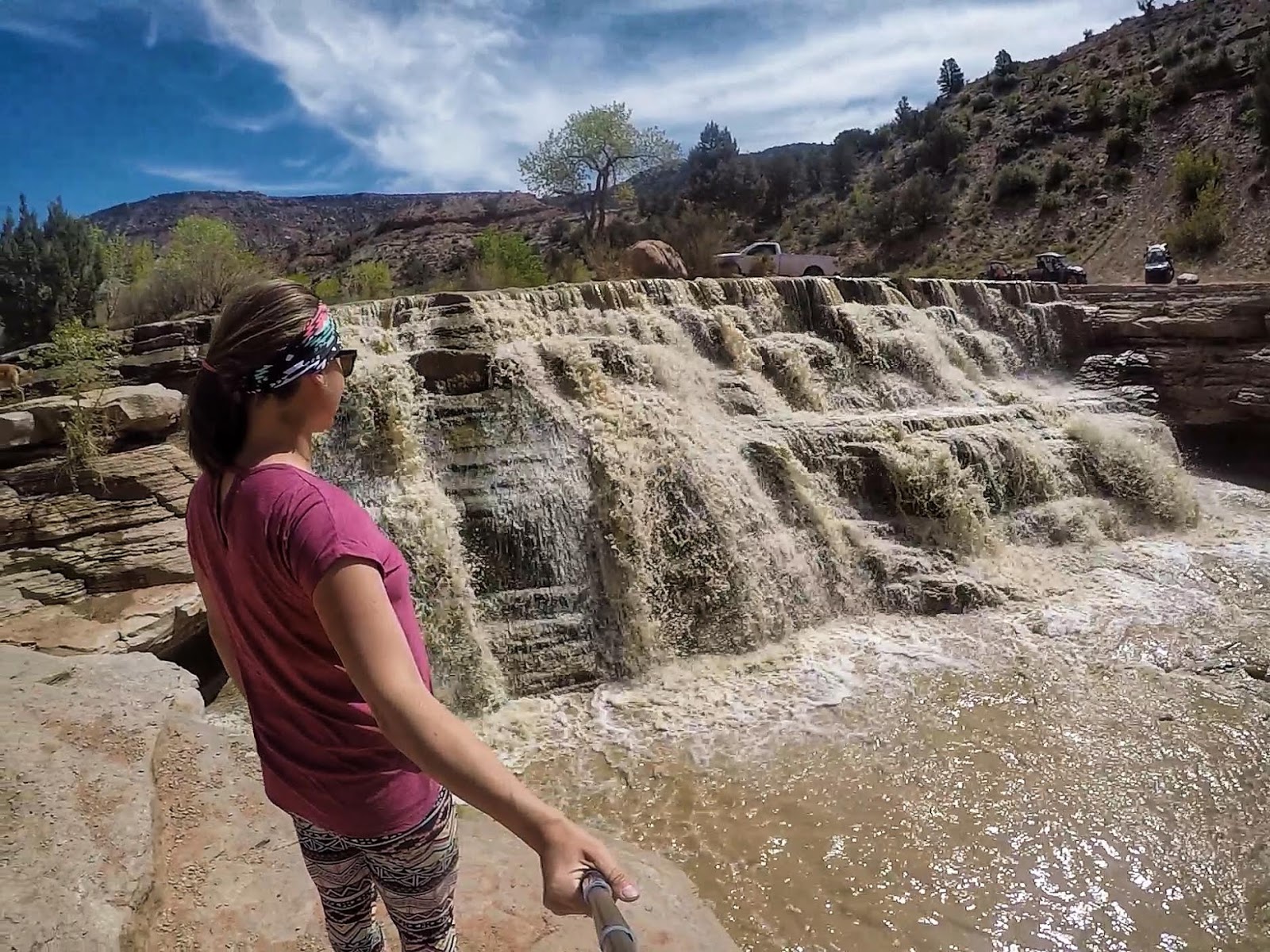
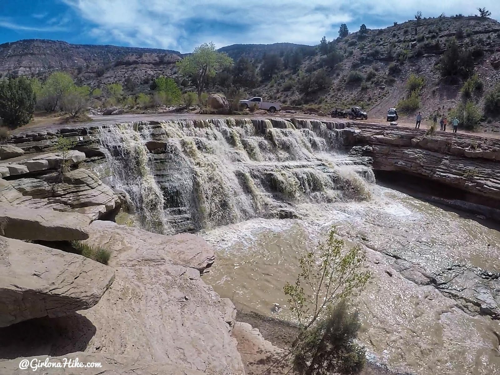
After a beautiful drive we reached the falls! We were surprised to see ATVs and people on the other side of the creek. I wasn’t aware of another route to get here, but if you do some research and want to take an ATV this way, I’m sure it would be really fun.

Visiting Toquerville Falls, Utah Waterfalls

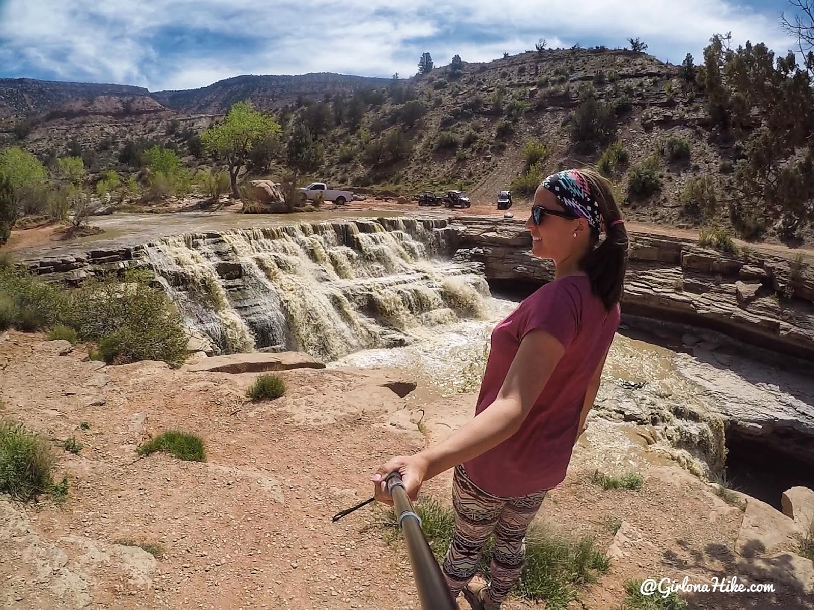
You can see the falls were brown from the recent rain and snow melt from up high. There was no way we were going to get wet today or try and cross it.

Visiting Toquerville Falls, Utah Waterfalls

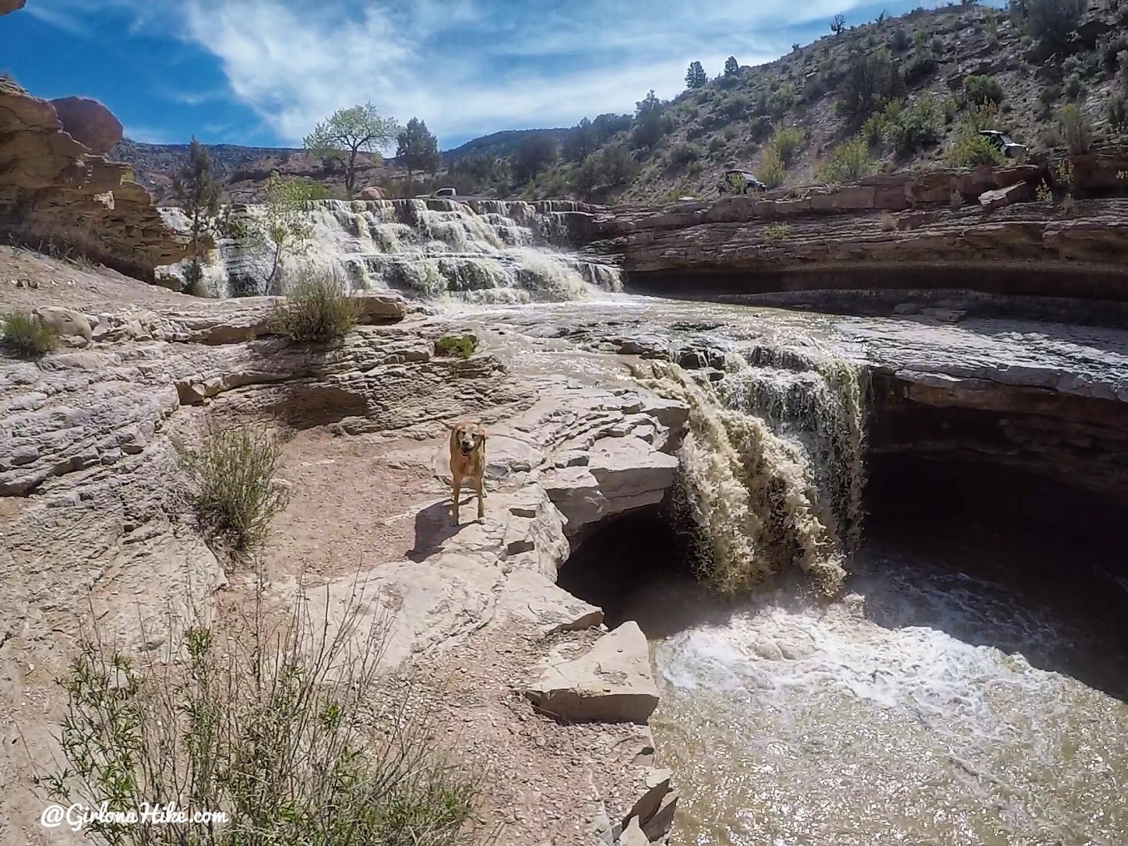
The large pour off that is roughly 20 ft high. Can’t believe how fast the water was raging!

Visiting Toquerville Falls, Utah Waterfalls

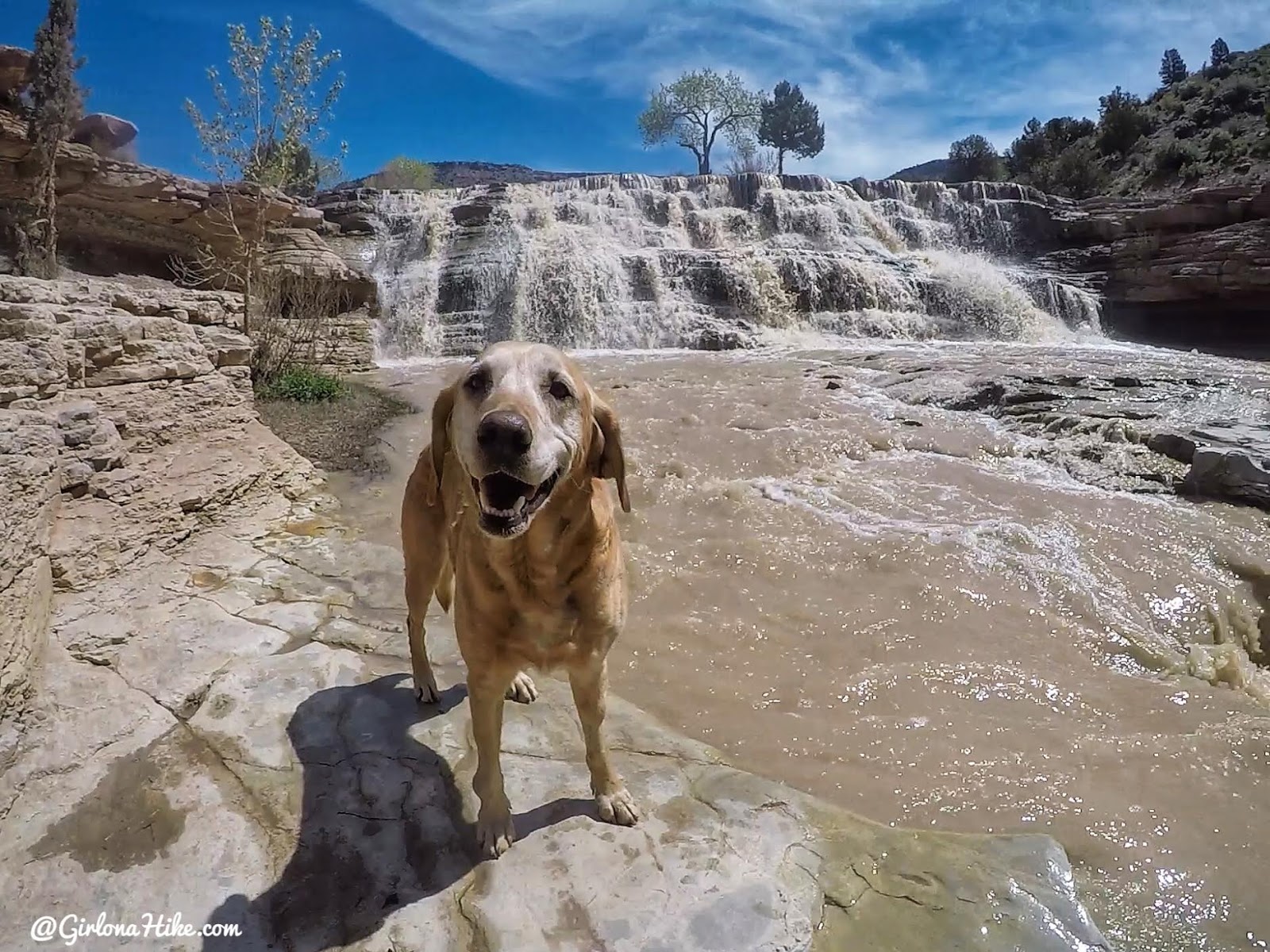
Charlie dipped his toes in the water, but I kept him back from going out too far. I was concerned about the strength of the current and didn’t want him falling over the lower falls. I think he still had a good time!

Visiting Toquerville Falls, Utah Waterfalls

So glad I finally got to see this place – it’s been on my list forever!

Visiting Toquerville Falls, Utah Waterfalls

I would love to come back in the Fall when the leaves have turned red and yellow yet would still be warm enough to play in the water. Until next time!


Check out my Youtube video on my 3 day trip to St. George!


Trail Map

My track via Gaia GPS – the best tracking app! Get your app here for a discount.


Recommended Hike

Hiking the Red Mountain Trail, St. George, Utah

Hiking the Red Mountain Trail, St. George, Utah

Save me on Pinterest!

Share the love!
Shares
Southern Utah The Best Dog Friendly Waterfalls Hikes in Utah
0
Girl On A Hike
April 25, 2019
previous post
next post

Related Posts

Hiking the Three Falls Trail – Alpine, Utah

April 14, 2025
Girl On A Hike
Kanarra Falls trail guide

Hiking to Kanarra Falls, Utah

March 14, 2025
Girl On A Hike

7 Reasons Why Winter is the Best Season to Go Hiking in Utah!

December 30, 2024
Girl On A Hike
Search Trail Guides
About Us
Let’s Connect!
Social Icons
Trending Posts
  • Hiking
    Hiking the Indian Trail in Ogden

  • Hike to the Bear Canyon Suspension Bridge, Draper, UT
    Hiking
    Hike to the Bear Canyon Suspension Bridge, Draper, UT

  • Hiking
    Hiking Mt. Olympus

  • Hiking
    Hiking the Three Falls Trail – Alpine, Utah

error: Content is protected

Share

Blogger
Bluesky
Delicious
Digg
Email
Facebook
Facebook messenger
Flipboard
Google
Hacker News
Line
LinkedIn
Mastodon
Mix
Odnoklassniki
PDF
Pinterest
Pocket
Print
Reddit
Renren
Short link
SMS
Skype
Telegram
Tumblr
Twitter
VKontakte
wechat
Weibo
WhatsApp
X
Xing
Yahoo! Mail

Copy short link

Copy link
Skip to content
Open toolbar Accessibility Tools

Accessibility Tools

  • Increase TextIncrease Text
  • Decrease TextDecrease Text
  • GrayscaleGrayscale
  • High ContrastHigh Contrast
  • Negative ContrastNegative Contrast
  • Light BackgroundLight Background
  • Links UnderlineLinks Underline
  • Readable FontReadable Font
  • Reset Reset