

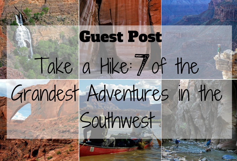
Today's Guest Post is brought to you by Mitch Stevens, the founder and lead guide of Southwest Discoveries.
These trips of a lifetime will challenge you physically and engross you spiritually, leaving an unforgettable and enduring impression of the richest wild places on the planet. The southwest contains literally thousands of amazing hikes. Therefore, we decided to separate the wheat from the chaff and give you the absolute cream of the crop. We rounded up 7 of the grandest adventures in the southwest, treks we have experienced firsthand.

Coyote Gulch, located in Southern Utah, is one of the most iconic and scenic canyons within the Escalante River drainage. Known for its towering red rock walls, natural arches, natural bridges, petroglyphs, cascading waterfalls, and stunning desert beauty, Coyote Gulch is a must-see for any Utah hiker or backpacker.
While some adventurous hikers complete the loop in a day, I highly recommend planning at least one night of backpacking—ideally two—to fully appreciate the canyon’s breathtaking features, cool stream crossings, and dramatic rock formations.
GUEST POST by Katie Wanders Katie Wanders follows New England native, Katie, around the globe. Katie swapped her oceans for mountains and moved to Utah for two years to see what "Life Elevated" was all about. Katie Wanders follows trips around the American West, adventures along the coasts, trips abroad, and showcases her love of New England. Currently, you can find her in a 2016 Penske truck with her dog and cat, wandering around National Parks and making her way back to the Atlantic. You can follow all of her adventures on Facebook, Instagram, and Pinterest!
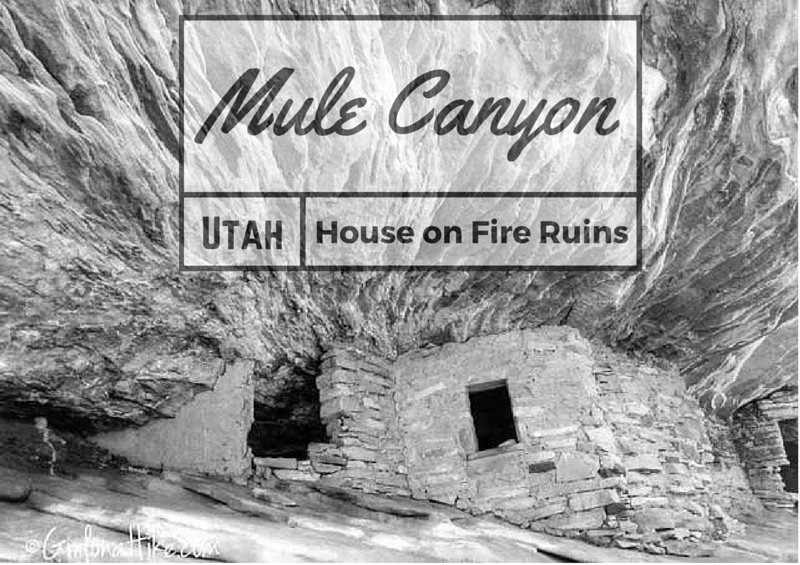
The famous "House on Fire" ruins lie Mule Canyon, in between Natural Bridges National Monument and Blanding, Utah. Southeast Utah is home to the most numerous and varied collection of ruins, spread over a remote area of about 30 by 25 miles. Besides hundreds of ruins, mostly cliff dwellings, the Cedar Mesa area contains many petroglyphs and pictographs, all between 800 - 2000 years old from the Anasazi and Pueblo Indians. Most are found in canyons, where water was easily accessible and conditions were cooler in summer months. All land is public, managed by the BLM, and as of 2016 is protected under the Bears Ears National Monument.
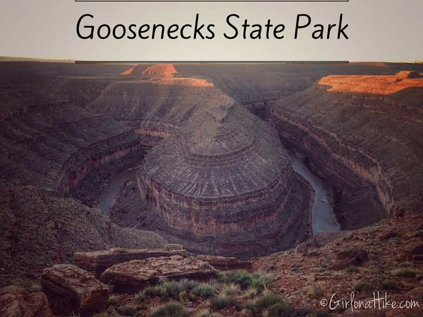
High above the meandering San Juan River, lies Goosenecks State Park. This largely undeveloped park is home to a rare geological featured known as the Entrenched Meander. This refers to a river that is confined to a canyon or gorge, and in most cases is narrow with very little or no flood plain. The headwaters of the San Juan River are in the San Juan Mountains of Southwestern Colorado, which is the origin for 90% of the rivers' flow. The river flows 360 miles from its source, starting at an elevation of 14,000 ft and dropping to just 3,600 ft at Lake Powell.
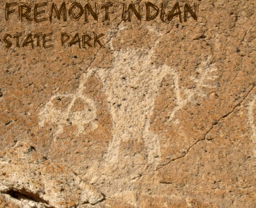
Exploring Fremont Indian State Park After Mystic Hot Springs
After a relaxing soak at Mystic Hot Springs, we continued west on I-70 for about 20 minutes until we arrived at Fremont Indian State Park. This underrated gem is packed with fascinating history, scenic trails, and cultural insights into one of Utah’s oldest Indigenous communities.
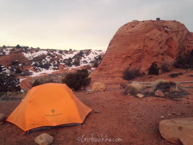
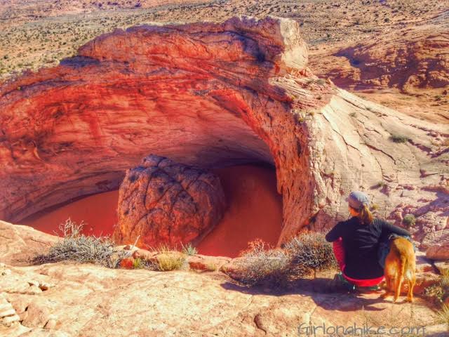
The Sand Flats Recreation Area is located just outside of Moab, UT, about 5-10 minutes to the East. Sand Flats is a nationally significant public land area at the heart of the Colorado Plateau. With high slickrock domes, bowls, and fins, it meets the colorful mesas with views of the La Sal Mountains to the East. Just to the North lies Arches National Park, and to the West, Canyonlands National Park. Sand Flats is home to one of the most famous mountain biking and hiking trails, Slickrock Trail and the nearby Grandstaff Canyon. Sand Flats is managed through Grand County and the BLM.
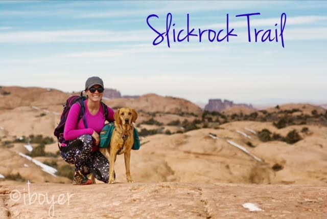
Slickrock Trail, the world famous mountain biking trail, is located in Moab, Utah. Most people bike this 10.5 mile loop, but we hiked it! Slickrock Trail is located at the Sand Flats Recreation Area, about 10 minutes outside of Moab, where we also camped for two nights. This trail is popular for its scenic, rugged expanse of Navajo Sandstone, the remnant of wind blown sand dunes. Slickrock Trail was established in 1969 for motorcycles, but the trail is now popular for both mountain bikes and motorcycles - it is closed to all four-wheeled vehicles.
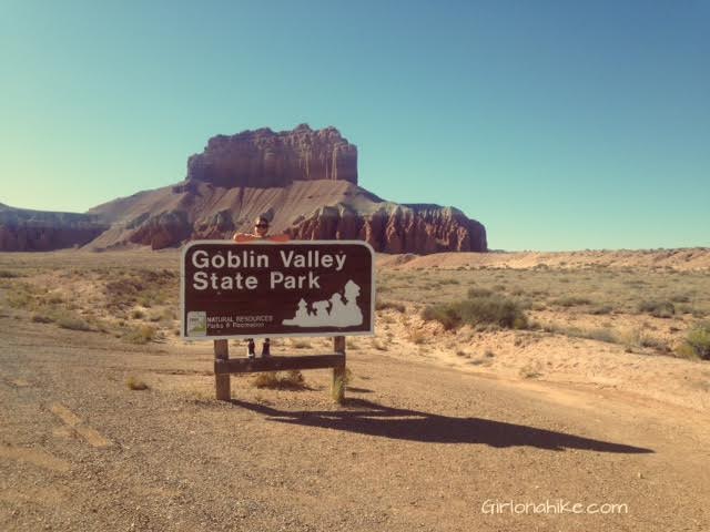
Goblin Valley State Park feels like another world - most say it resembles what would be Mars, however the park sits at the northern end of the San Rafael Swell. The hoodoos ("goblins") are mushroom-shaped pinnacles that are only a few feet high. The formations have large orange/red boulders of hard rock on top, with weaker sand layers below that have eroded more quickly over millions of years from the combined effects of rain and wind.