logo dark logo
  • Dog Friendly Lists
  • Find a Hike
  • Discount Codes
  • Fav Gear
  • About
    • Testimonials
    • Awards & Features
Mobile Logo
  • Dog Friendly Lists
  • Find a Hike
  • Discount Codes
  • Fav Gear
  • About
    • Testimonials
    • Awards & Features
Top
Home  >  Hiking   >  Hiking the Slickrock Trail, Moab
Moab

Hiking the Slickrock Trail, Moab

Hiking
Share the love!
Shares

Slickrock Trail Guide, Slickrock Trail Maps, Slickrock Moab, Sand Flats Recreation Area, Hiking in Utah with Dogs

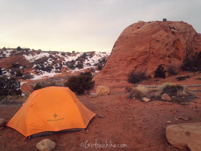
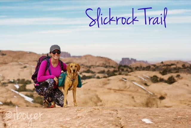
Slickrock Trail, the world famous mountain biking trail, is located in Moab, Utah. Most people bike this 10.5 mile loop, but we hiked it! Slickrock Trail is located at the Sand Flats Recreation Area, about 10 minutes outside of Moab, where we also camped for two nights. This trail is popular for its scenic, rugged expanse of Navajo Sandstone, the remnant of wind blown sand dunes. Slickrock Trail was established in 1969 for motorcycles, but the trail is now popular for both mountain bikes and motorcycles – it is closed to all four-wheeled vehicles.

Contents hide
1 Share the love!
2 About
3 Directions
4 Trail Info
5 Trail Map
5.1 Share the love!

About

The best times to ride or hike here are Spring and Fall, when daytime temperatures aren’t as hot. We hiked here in February, and found several patches of snow and ice, especially on the north facing slopes. This weekend the weather was perfect in Moab, with daytime highs around 50-55F degrees, and the trail wasn’t super popular as it normally is a month from now in March/April.

The inversion in SLC has been so bad the past few weeks, we just had to get out of the nasty air. The state had even declared the air quality as extremely poor. It just also happened to be Valentine’s Day weekend, so Charlie, my boyfriend, and I make a quick trip down to Moab in search of clean air and warm sun.

Directions

 From SLC head south on I-15, and take exit 257 for Spanish Fork Canyon. Drive past Price, UT, then take I-70 East towards Green River. Take exit 182 for Moab. Drive south on HWY 191 for 31 miles. Once you are in Moab, turn left onto 100 North, then right at the stop sign for 400 East. Turn left on Mill Creek Drive, where Dave’s Corner Market is. Drive straight past the first stop sign, and weave your way to the entrance of Sand Flats Rec Area. Drive 2.3 miles and look for the Slickrock Trail on the left. The parking lot is huge, has several restrooms, and two picnic tables.

Trail Info

Distance: 10.5 miles (loop)

Elevation gain: roughly 750 ft

Time: 2-4 hours for bikers, 4-8 hours for hikers

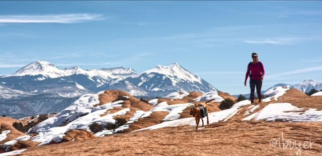
Dog friendly? Yes, off leash. Be courteous and always lets bikers have the right of way.

Kid friendly? Yes

Slickrock Trail Guide, Slickrock Trail Maps, Slickrock Moab, Sand Flats Recreation Area, Hiking in Utah with Dogs

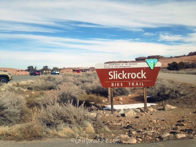
 Entrance to the parking area.
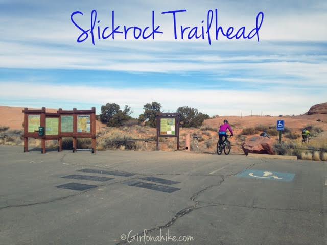
Slickrock Trail Guide, Slickrock Trail Maps, Slickrock Moab, Sand Flats Recreation Area, Hiking in Utah with Dogs

 Official trailhead!

Slickrock Trail Guide, Slickrock Trail Maps, Slickrock Moab, Sand Flats Recreation Area, Hiking in Utah with Dogs

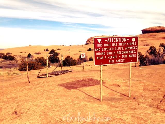
 Start by walking about 5 minutes, then cross over the small cattle guard.

Slickrock Trail Guide, Slickrock Trail Maps, Slickrock Moab, Sand Flats Recreation Area, Hiking in Utah with Dogs

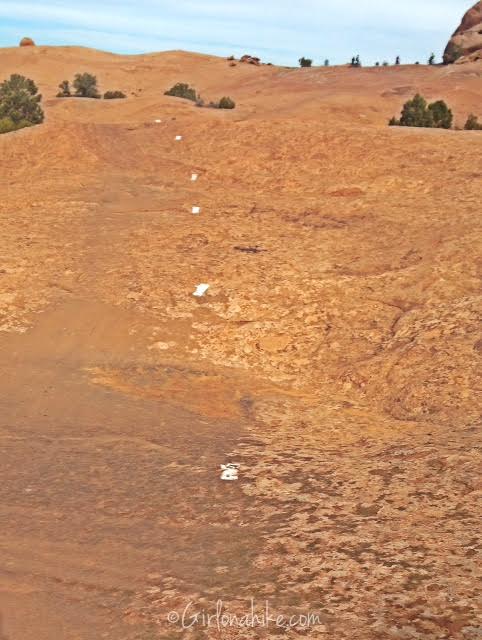
 The entire trail is well marked with white rectangles.

Slickrock Trail Guide, Slickrock Trail Maps, Slickrock Moab, Sand Flats Recreation Area, Hiking in Utah with Dogs

(Photo by @iboyer)

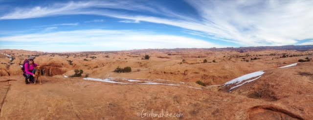
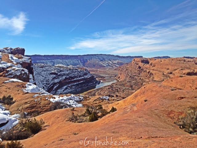
 Abyss Point – a nice overlook of all the slickrock.

Slickrock Trail Guide, Slickrock Trail Maps, Slickrock Moab, Sand Flats Recreation Area, Hiking in Utah with Dogs

 If you hike this trail, always let bikers have right of way.

Slickrock Trail Guide, Slickrock Trail Maps, Slickrock Moab, Sand Flats Recreation Area, Hiking in Utah with Dogs

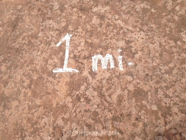
 The trail also marks mileage! How nice of them 🙂

Slickrock Trail Guide, Slickrock Trail Maps, Slickrock Moab, Sand Flats Recreation Area, Hiking in Utah with Dogs

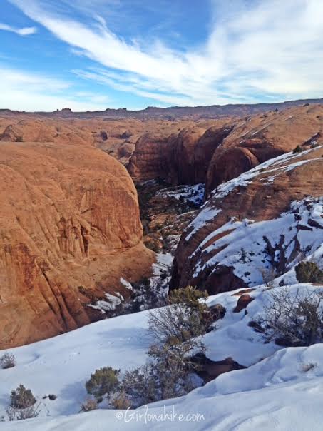
 Looking into one of the small canyons.

Slickrock Trail Guide, Slickrock Trail Maps, Slickrock Moab, Sand Flats Recreation Area, Hiking in Utah with Dogs

(Photo by @iboyer)

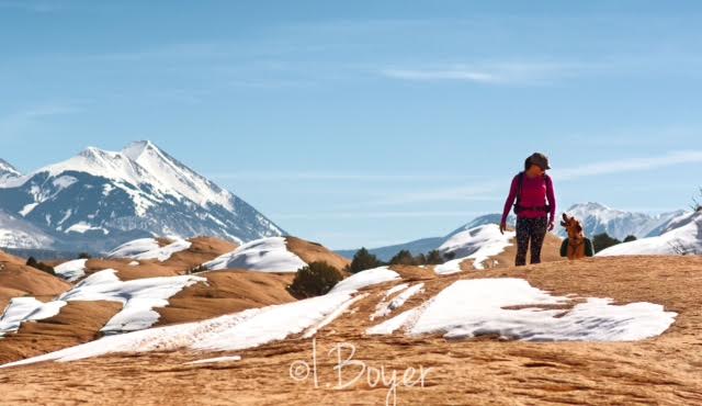
The LaSal Mountains looked amazing with snow and the red rock below. The contrast was very beautiful!

The peaks in the distance to the left are Mt. Tukuhnikivatz & Mt. Peale.

Slickrock Trail Guide, Slickrock Trail Maps, Slickrock Moab, Sand Flats Recreation Area, Hiking in Utah with Dogs

 When we got to the main loop split, we accidentally went right, instead of the recommended left. It doesn’t matter which way you go if you go, it still makes a loop, but for bikers it’s recommended to travel in a clockwise way. We ended up reaching Shrimp Rock and the Colorado Overlook much quicker than we expected due to our quick turn.

Slickrock Trail Guide, Slickrock Trail Maps, Slickrock Moab, Sand Flats Recreation Area, Hiking in Utah with Dogs

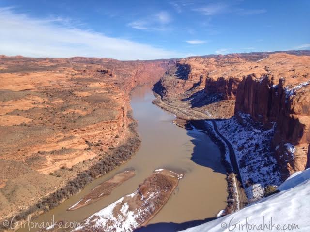
 We took our only real break after hiking about 5 miles. For lunch we had bagels with apples and cheese. The bridge you see is the bridge that crosses into Moab on HWY 191. Hard to believe we were so close to town!

Slickrock Trail Guide, Slickrock Trail Maps, Slickrock Moab, Sand Flats Recreation Area, Hiking in Utah with Dogs

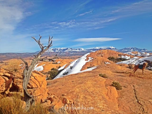
 Beautiful old tree with the LaSals in the distance.

Slickrock Trail Guide, Slickrock Trail Maps, Slickrock Moab, Sand Flats Recreation Area, Hiking in Utah with Dogs

(Photo by @iboyer)

Charlie leads the way.

Slickrock Trail Guide, Slickrock Trail Maps, Slickrock Moab, Sand Flats Recreation Area, Hiking in Utah with Dogs

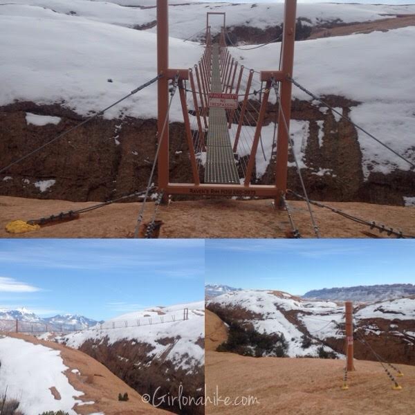
As we worked our way back, we came across the zipline obstacle course by Raven’s Rim Zipline Tours. They are closed during Winter, so we didn’t see anyone flying by.

Slickrock Trail Guide, Slickrock Trail Maps, Slickrock Moab, Sand Flats Recreation Area, Hiking in Utah with Dogs

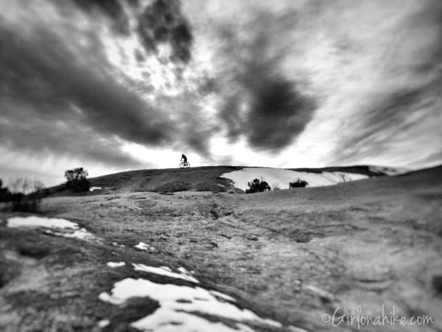
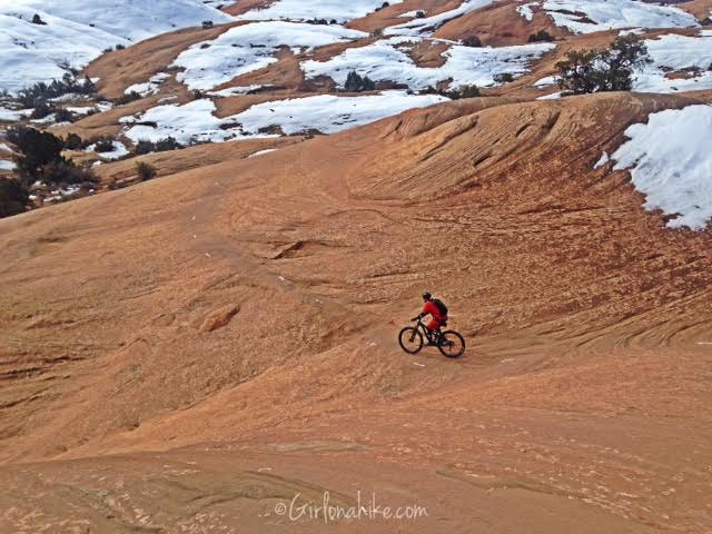
 Lone rider in the clouds.

Slickrock Trail Guide, Slickrock Trail Maps, Slickrock Moab, Sand Flats Recreation Area, La Sal Mountains

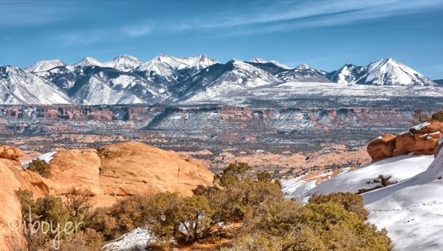
The beautiful LaSal Mountains. Mt. Waas is the peak to the far left.


Trail Map

Slickrock Trail Map, Slickrock Moab

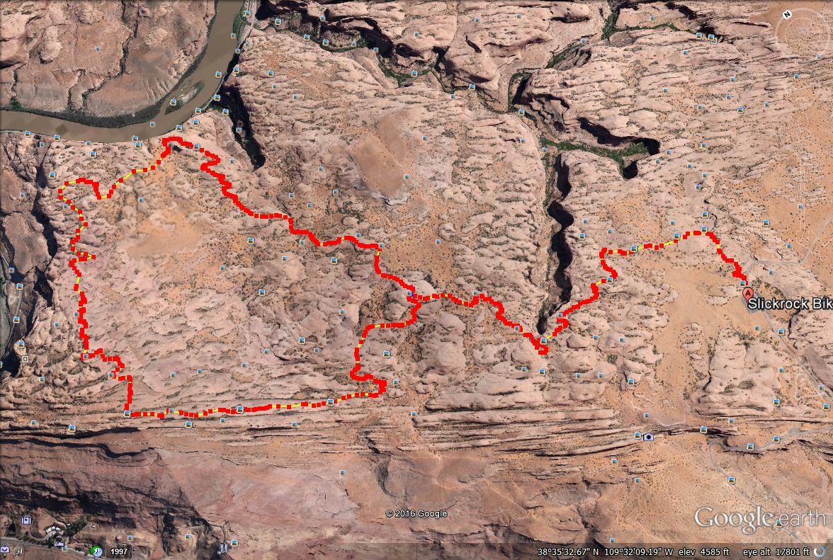
 Route looking Northeast.

Slickrock Trail Map, Slickrock Moab

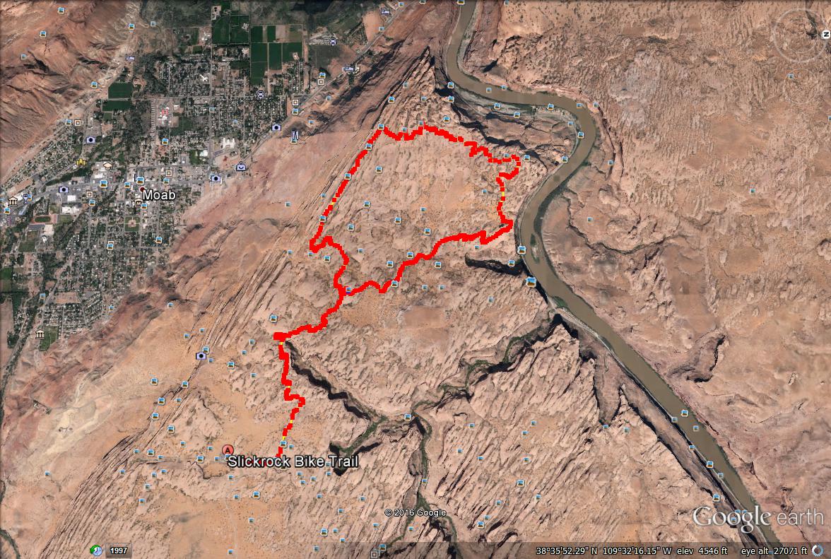
Route looking Northwest.

Hiking Grandstaff Canyon, Moab

Share the love!
Shares
Southern Utah
0
February 15, 2016
previous post
next post

Related Posts

Kanarra Falls trail guide

Hiking to Kanarra Falls, Utah

March 14, 2025
Girl On A Hike

7 Reasons Why Winter is the Best Season to Go Hiking in Utah!

December 30, 2024
Girl On A Hike

Hiking The Subway, Zion National Park

July 8, 2024
Girl On A Hike
Search Trail Guides
About Us
Let’s Connect!
Social Icons
Trending Posts
  • Hiking
    Hiking the Indian Trail in Ogden

  • Hike to the Bear Canyon Suspension Bridge, Draper, UT
    Hiking
    Hike to the Bear Canyon Suspension Bridge, Draper, UT

  • Hiking
    Hiking Mt. Olympus

  • Hiking
    Hiking the Three Falls Trail – Alpine, Utah

error: Content is protected

Share

Blogger
Bluesky
Delicious
Digg
Email
Facebook
Facebook messenger
Flipboard
Google
Hacker News
Line
LinkedIn
Mastodon
Mix
Odnoklassniki
PDF
Pinterest
Pocket
Print
Reddit
Renren
Short link
SMS
Skype
Telegram
Tumblr
Twitter
VKontakte
wechat
Weibo
WhatsApp
X
Xing
Yahoo! Mail

Copy short link

Copy link
Skip to content
Open toolbar Accessibility Tools

Accessibility Tools

  • Increase TextIncrease Text
  • Decrease TextDecrease Text
  • GrayscaleGrayscale
  • High ContrastHigh Contrast
  • Negative ContrastNegative Contrast
  • Light BackgroundLight Background
  • Links UnderlineLinks Underline
  • Readable FontReadable Font
  • Reset Reset