

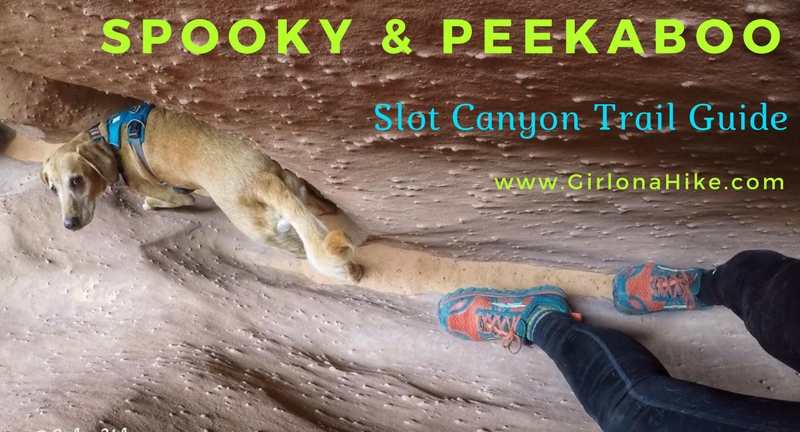
Spooky & Peekaboo are the most popular slot canyons in the Escalante area. The access is easy, you can easily do both as a loop in a few hours, and hikers without technical canyoneering equipment or skills can enjoy both. Spooky slot canyon is one of the narrowest canyons in the world that hikers can safely navigate. It's much longer and slimmer than Peekaboo, forcing hikers to carry daypacks to the side as you shuffle through. Add in a few short obstacles and one 5 ft scramble to make it that much more fun. Claustrophobic people will have a hard time with this Spooky.
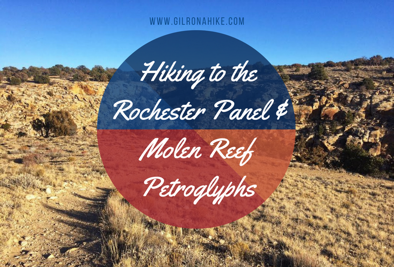
The Rochester Panel and Molen Reef Petroglyphs are near Emery, Utah, and consists of one very large panel of hundreds of images likely carved by the Fremont Native Americans. The vast majority of the petroglyphs have a strong Barrier Canyon influence, including animals, female/male figures, and one large rainbow-like image. Molen Reef Petroglyphs are much smaller, but still expose what the native people were contemplating. You can easily combine both in one afternoon, as the hike to the Rochester Panel is only 1/2 mile, and you can drive right up to the Molen Reef area. Kids, dogs, and casual hikers will enjoy these areas, but please respect the rules and DO NOT touch any of the petroglyphs.
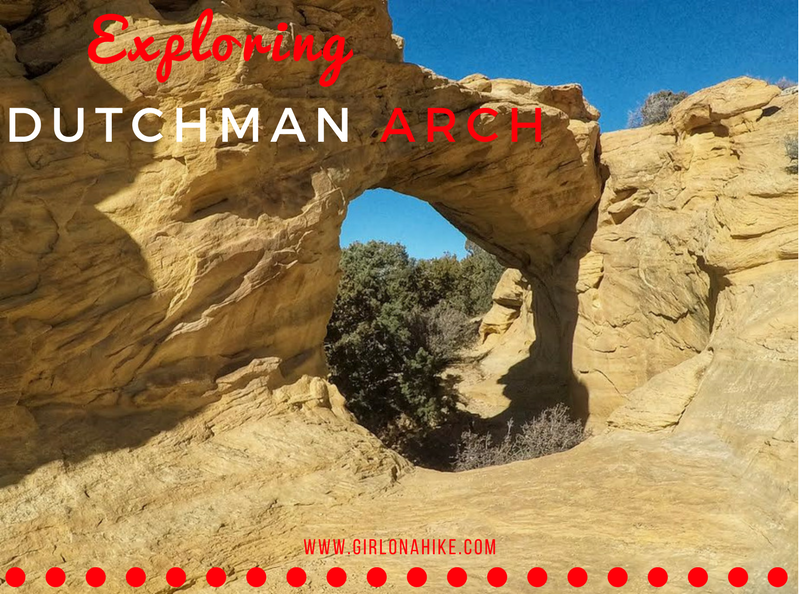
Exploring Dutchman Arch & Head of Sinbad Pictographs – San Rafael Swell, Utah
Located in the heart of the San Rafael Swell, the Dutchman Arch and Head of Sinbad Pictographs are two fascinating sites rich in natural beauty and cultural history. While both are surprisingly close to I-70—just about 1/4 to 1/2 mile north—the drive requires a high-clearance 4x4 vehicle due to sandy and rough road conditions.
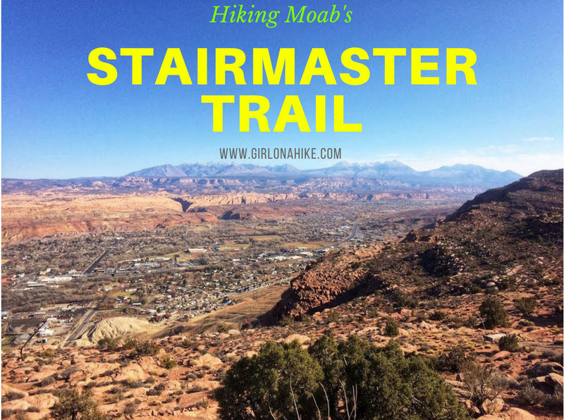
The Stair Master Trail in Moab, Utah is another short yet very rewarding hike that leads to an amazing overlook of the Moab valley and LaSal Mountains. This hike is only 1 mile to the overlook, yet it gains 820 ft. The Stair Master Trail parallels the Moab Rim Safari Jeep Route, so you are likely to see many Jeeps or Razors tackling the rock obstacles. This trail can get really hot in summer, so I recommend avoiding it in Summer months if you are hiking with your dogs (the slickrock gets too hot for their paws) OR start really early in the morning to beat the heat.
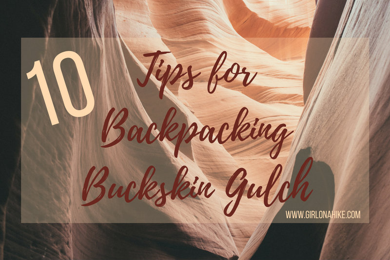
Here are 10 tips for backpacking Buckskin Gulch! Backpacking Buckskin Gulch is a one of a kind adventure - not only do you get to travel through the world's longest and deepest slot canyon, but you have some of the most amazing views of long hallways with rocks towering 200-300 ft above you, hiking through dark sections of molded rock, climbing over obstacles, but also get to experience camping overnight in this amazing area. While this canyon has been nicknamed the "worlds most dangerous hike" it also often appears as one of the top "must-do hikes" in the world! As long as you go prepared, it's a trip of a lifetime!
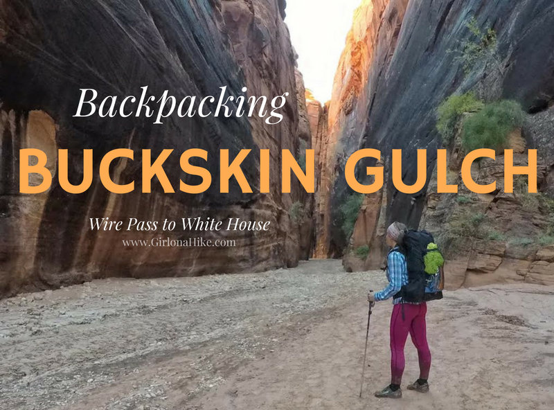
Buckskin Gulch: The World’s Longest and Narrowest Slot Canyon
Buckskin Gulch holds the title as the longest and narrowest slot canyon in the world. This serpentine wonder stretches for 45 miles, with towering rock walls reaching heights of 100 to 300 feet. At its tightest point, the canyon narrows to just 2 feet wide, creating a stunning yet intimidating path where the sky is barely visible.
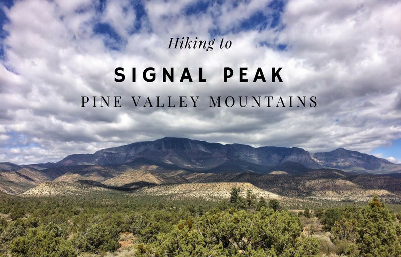
Signal Peak (10,365 ft) is the high point for both the Pine Valley Mountains and Washington County. It you are a peak bagger looking to summit all of Utah's County High Points, you'll be hiking this one. The main route starts from the Oak Grove Campground, and follows the trail up the South ridge very steeply, before dropping into forested areas, and then hiking off trail to reach the summit.
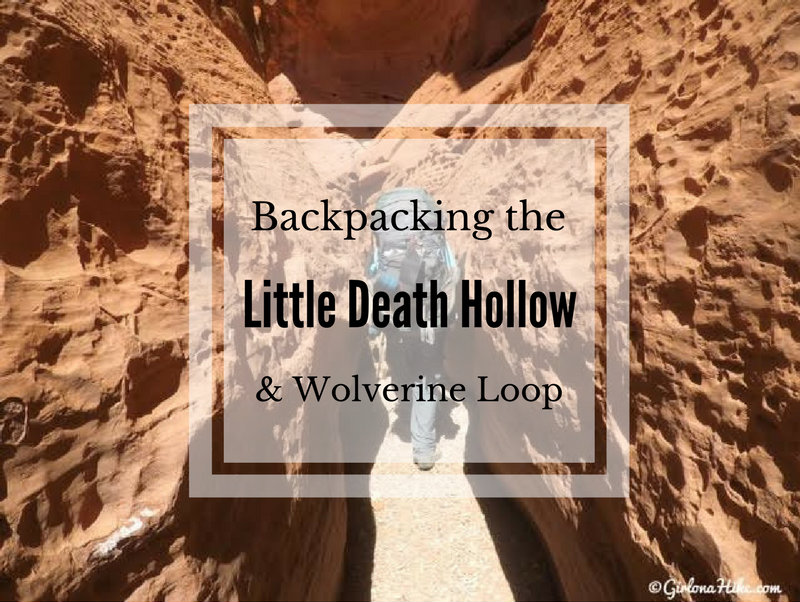
Little Death Hollow is a slot canyon in the northeast corner of Grand Staircase-Escalante National Monument in an area called the Circle Cliffs. Not to be confused with "Death Hollow" near Boulder, UT, Little Death Hollow offers a 4 mile slot canyon that, when dry, offers few obstacles, and beautiful high red sandstone cliffs which deepens and narrows as you continue down canyon.
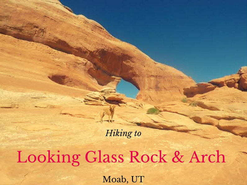
Looking Glass Rock & Arch is off HWY 191, about 25 miles south of Moab, UT yet hardly anyone makes the stop to check out this cool spot. This isn't really a "hike" but more of a "walk", since you basically drive right up to it, then walk about 200 yards up to the arch. Yet what this small walk offers is one of the best arches and viewpoints in the area. There are so many cool arches outside of Arches National Park, yet nobody cares to explore them. Best part? Dogs are allowed!