


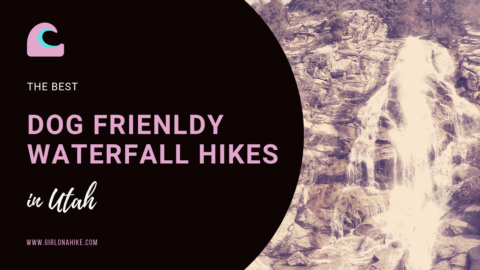
Ready to learn about the BEST Dog Friendly Waterfall Hikes in Utah?
I've complied all of them into one post - no more researching, asking around, or spending hours looking at AllTrails. All of these listed are dog-friendly (off leash) of course, and are separated by location. There are not ranked in any order. Click the link for each hike to learn more, to see all the trail stats (distance, elevation gain, etc), and to view a trail map. Directions are also provided for each hike.
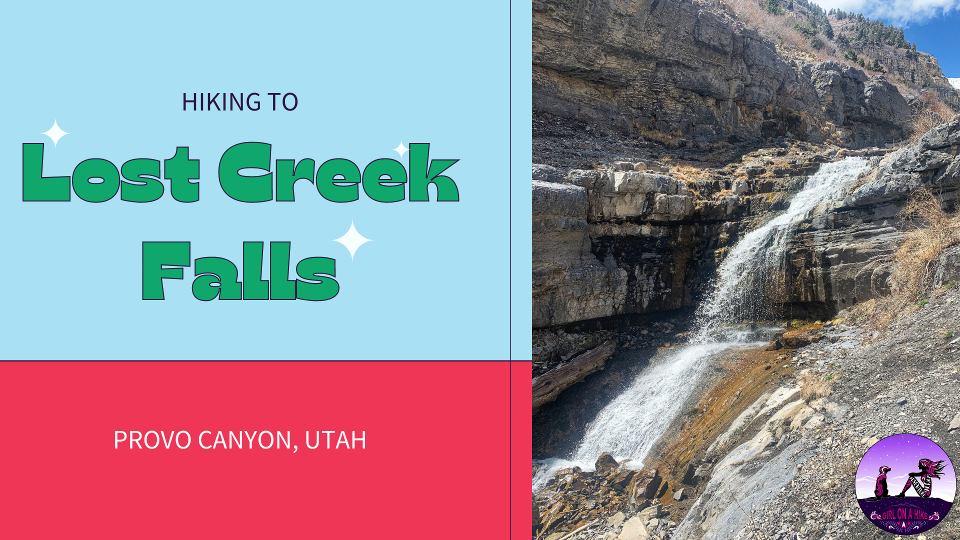
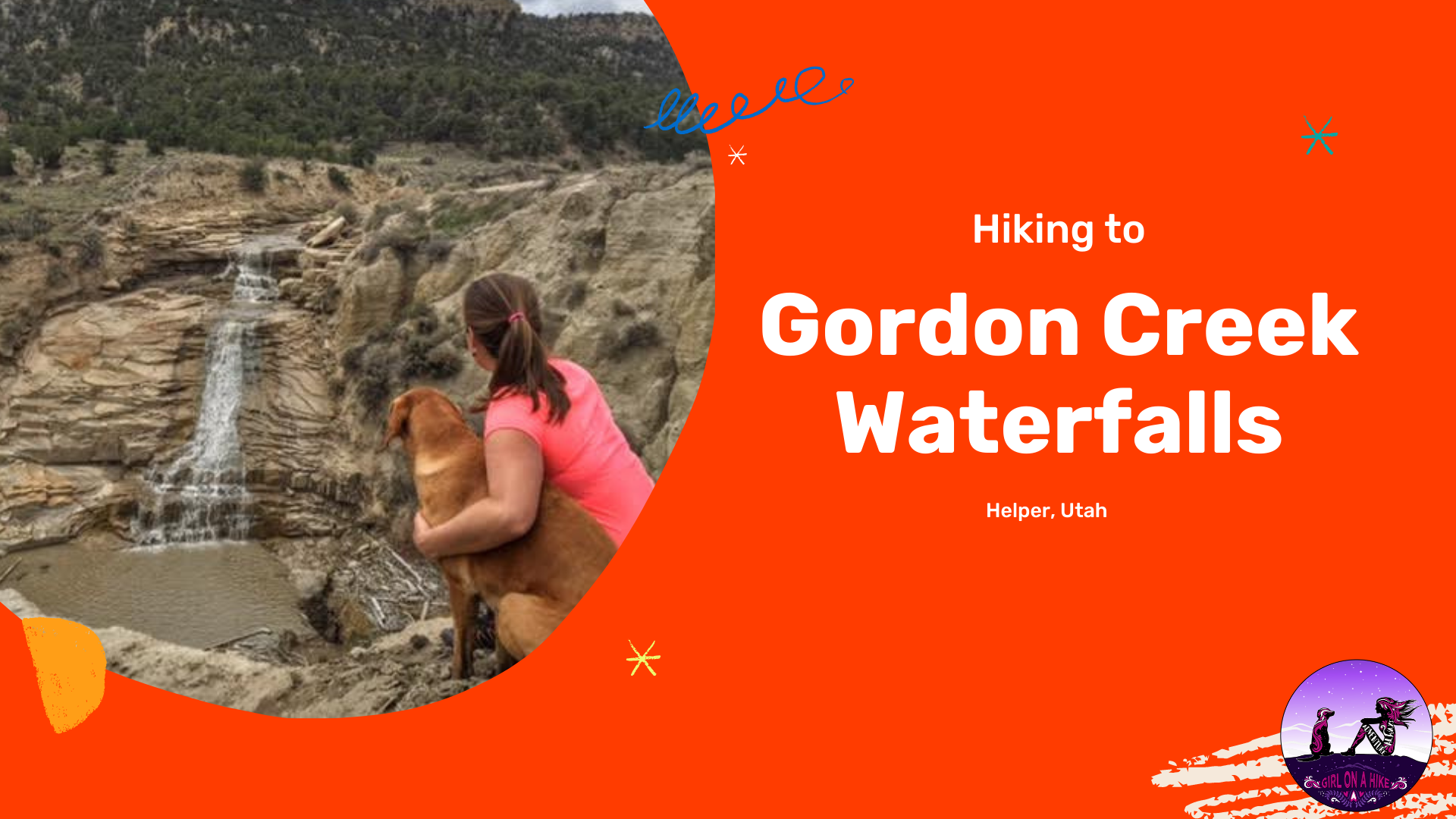
 Lost Creek Falls is located in Provo Canyon, Utah, and is a perfect Spring hike to check out this fun waterfall. It's great for dogs off leash to explore and cool off in the creek, plus great for kids of all ages. The "trail" starts out by following an old, narrow dirt road, and eventually you are left to hike steeply along Lost Creek.
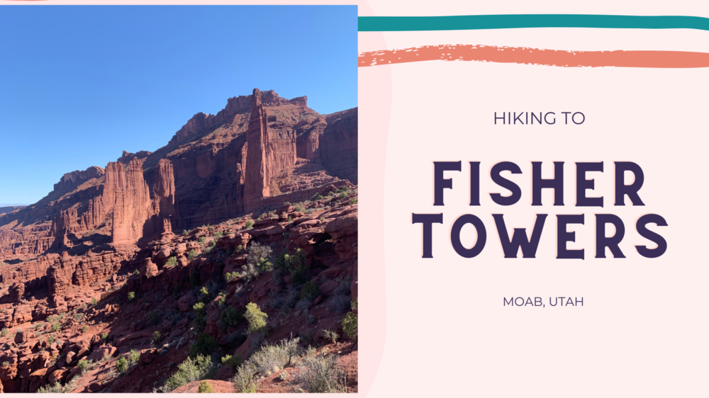
The Fisher Towers Trail, located just 16 miles northeast of Moab, Utah, is a stunning 4-mile round-trip hike that winds through towering, fin-like rock formations. These dramatic spires are made of Moenkopi and Cutler sandstone, sculpted by erosion into unique shapes and sizes over time. As one of the most iconic scenic spots along Utah’s Colorado Riverway, the Fisher Towers rise high above a vibrant landscape of red and pink canyons. From the trail, hikers can enjoy breathtaking views of the Colorado River, Onion Creek, and the well-known rock formation known as “Priest and Nuns” to the south.
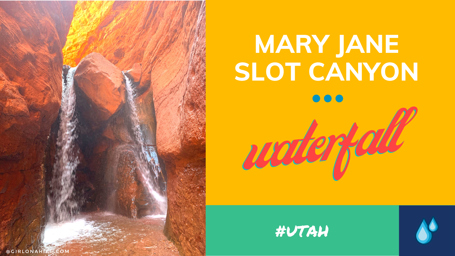
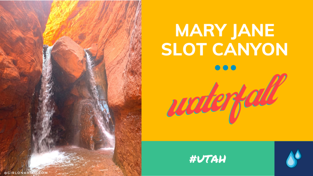
Mary Jane Slot Canyon is one of Moab's hidden gems - the "trail" is a creek the entire way, which leads to a 30 ft waterfall. This is a great trail to do when Moab is too hot, and you, the dogs, or kids need to cool off. The canyon walls get higher as you hike further into the canyon, and eventually will reach upwards of 100 ft! There are several side canyons that allow for exploring tighter slot canyons.
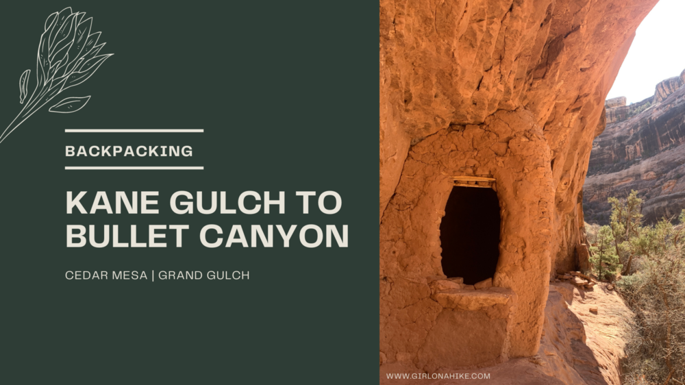
Backpacking Kane Gulch and Bullet Canyons are two popular routes in Bears Ears National Monument within Cedar Mesa, that require at least one night camping. This area is a mecca of ancient ruins and petroglyphs, deep within the canyon walls. Back in the day you wouldn't see people for days, however, with the increase of outdoor activities due to COVID you now can't go more than 2 miles without seeing other groups. This is not the area for solitude. Oh yeah, and there's another big issue...water.
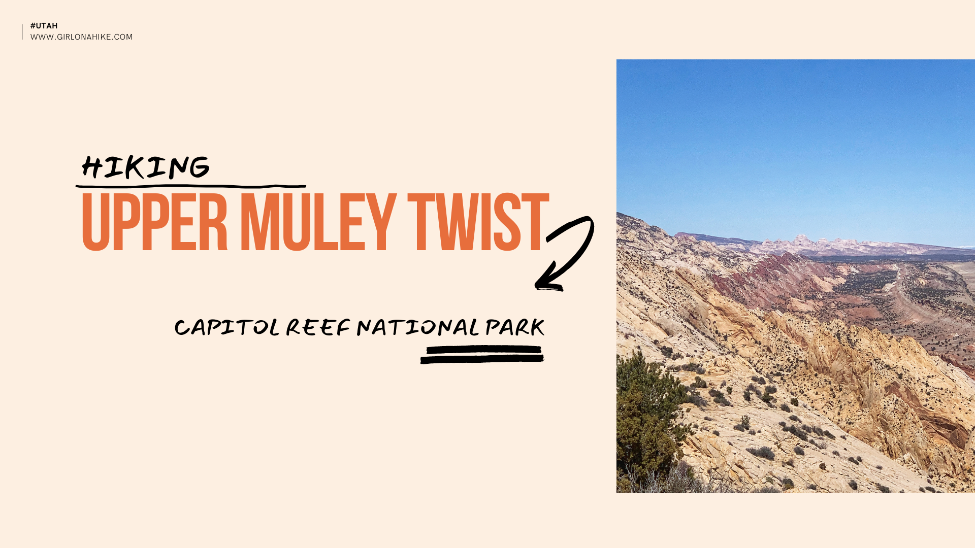

Hiking Upper Muley Twist is located in Capitol Reef National Park (CRNP), and this route covers extremely varied terrain - from deep and narrow, to high and exposed, all within a relatively short distance. It begins in a canyon paralleling the spine of the Waterpocket Fold, a 100 mile long ridge that juts out from the upper crust of the landscape. This long "monocline" is one of the longest in the world! The bizarre landscape is made of brilliantly colored rocks, including at least 7 visible arches, natural bridges, slot canyons, fins, domes, and more. Hiking Upper Muley Twist gives you the grand tour of this area, so it's a must-do!
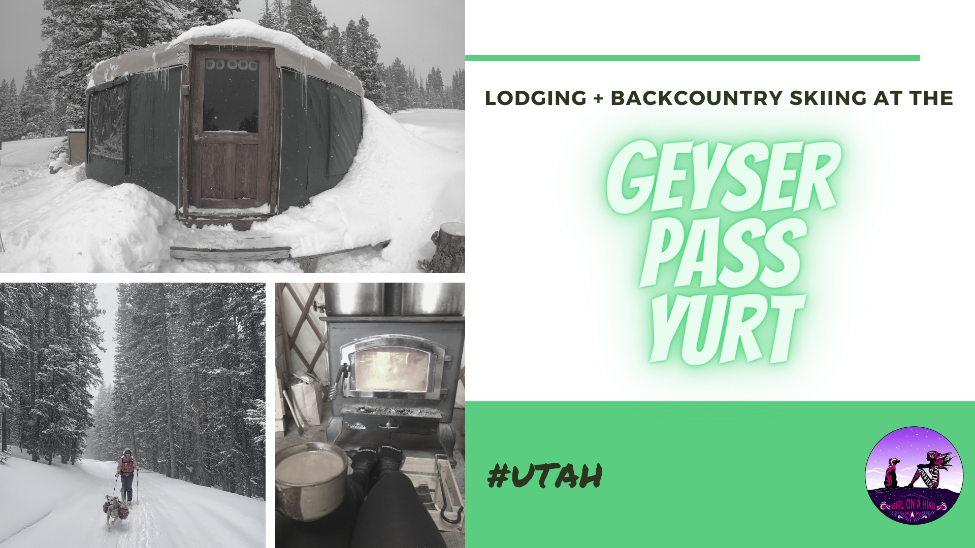
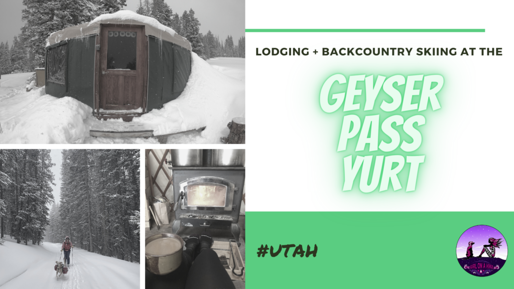
The Geyser Pass Yurt is located in the LaSal Mountains, just outside of Moab, Utah. To reach this yurt requires a 4 mile ski or snowshoe in, following the forest road that is usually drive-able in summer months. It's located right in the pass, just to the SE of Haystack Mountain and to the south of Mt.Tomasaki at 10,500 ft! While on the Manti-LaSal National Forest land, this is a privately owned yurt by Talking Mountain Yurts (TMY). They have a special permit for their yurt to be on National Forest land.

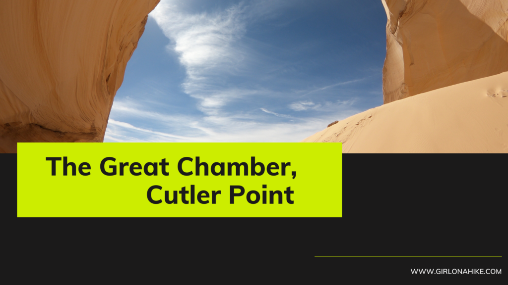
The Great Chamber at Cutler Point is a large open dome with a tall sand hill - perfect for photography. This is less of a hike and more of a scenic viewing area, as long as you can drive all the way! The roads are extremely sandy - high clearance and 4x4 is a MUST.