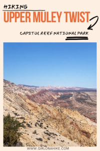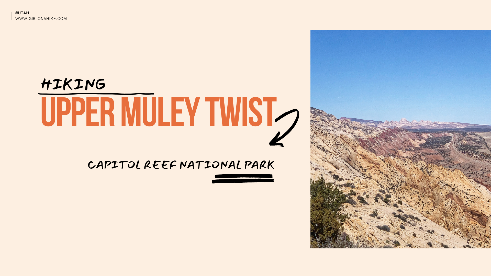

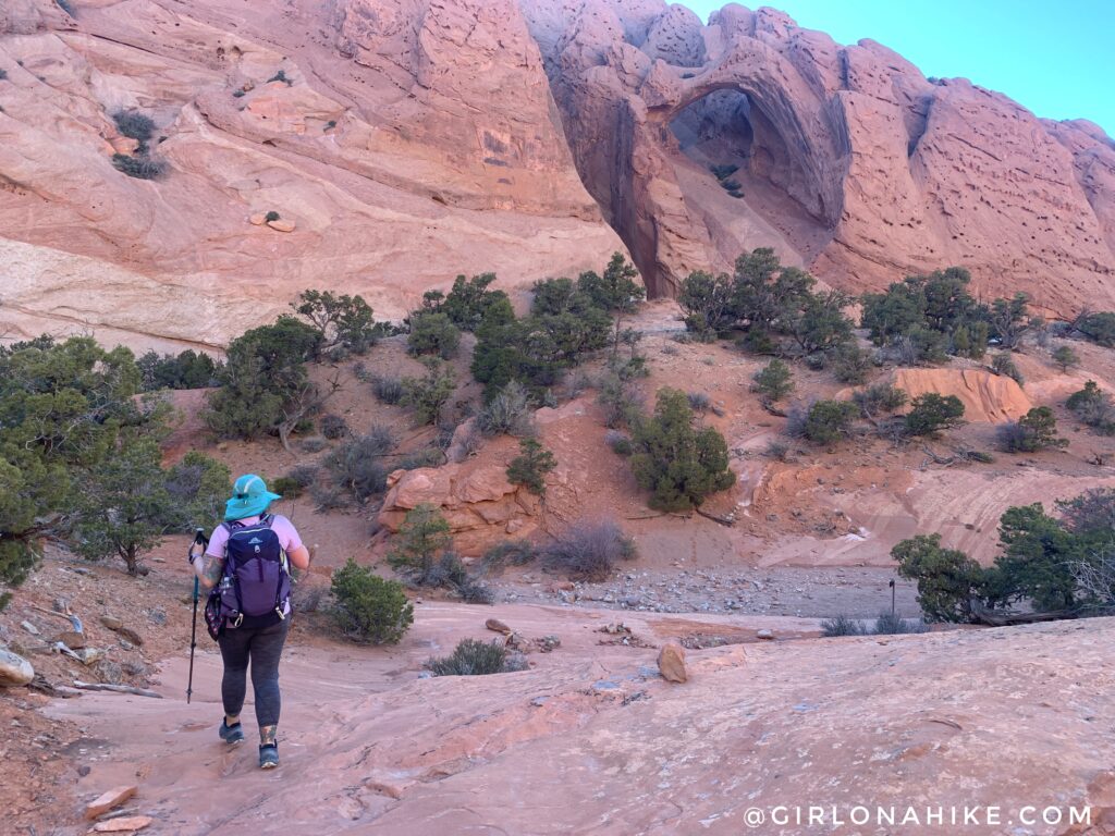
Hiking Upper Muley Twist is located in Capitol Reef National Park (CRNP), and this route covers extremely varied terrain – from deep and narrow, to high and exposed, all within a relatively short distance. It begins in a canyon paralleling the spine of the Waterpocket Fold, a 100 mile long ridge that juts out from the upper crust of the landscape. This long “monocline” is one of the longest in the world! The bizarre landscape is made of brilliantly colored rocks, including at least 7 visible arches, natural bridges, slot canyons, fins, domes, and more. Hiking Upper Muley Twist gives you the grand tour of this area, so it’s a must-do!
About
Depending on where you park and how far your car can make it, this trail can either be 16 miles RT (like it was for us), or if you’re lucky only about 11 miles RT otherwise. The best time of year to hike Upper Muley Twist or anything else in the general area is Spring and late Fall. The day we hiked this the high temp for the day was 50F, and we wore everything from three layers of clothing, to getting sunburned, and sweating. Whether you have to hike the 16 or 11 miles, be prepared for a long day with plenty of water (3 liters minimum), food, dressing in layers, and putting on sunblock.
The initial leg of this hike is pretty easy – there’s no official or maintained trail by CRNP, however, you simply follow the road and then the wash. It’s worth a stop to check out Strike Valley Overlook. In fact, that was my favorite part about the whole day! Once you reach the halfway point is when you start to gain elevation and climb up in areas that may require hand holds. I would consider it a light class-2 scramble in sections. If you are an intermediate hiker with some experience in navigating cross country and scrambling, you will probably find this route challenging yet totally within your abilities to complete it. For beginners, I would plan on a full day (10-12 hours).
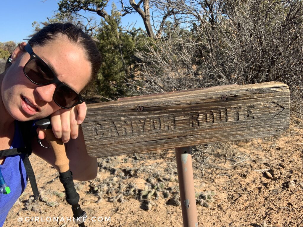
The entire route is marked by cairns and a handful of “Rim Route” signs, as the trail does make a semi-loop on the North end of the waterpocket fold area. I would recommend hiking this loop in a clockwise direction, so that on the way back you can look down and see the arches you initially passed from the top-down, and also see the entire wash that you hiked. The Rim Route is also one of the best sections of the Upper Muley Twist canyon!
Directions
From the CRNP visitor center, drive East on HWY 24 for about 9 miles. Turn right at the sign for Notom Bottom Rd/Lake Powell. Drive down the paved road which turns into a dirt road for 36 miles, and turn right again for Burr Trail Road. Work your way up the 3 miles of steep switchbacks, and at the top of the mesa, you will see the dirt road turn off for Upper Muley Twist TH. Most cars should be able to drive the entire dirt road, 4WD is not needed. Do not attempt to drive this after a recent rain or in winter, as the road will be extremely muddy. Always call the ranger ahead of time to check on the road status at (435) 425-3791.
Here’s a driving map.
Trail Info
Distance:
16 miles RT if you start and park from the 2WD area right off the main road.
11 miles RT if you start from the official TH
Elevation gain: 1,400 ft
Time: 5-9 hours, depending on how far you can drive up the road
Dog friendly? No, dogs are not allowed in CRNP
Kid friendly? No
Fees/Permits? None
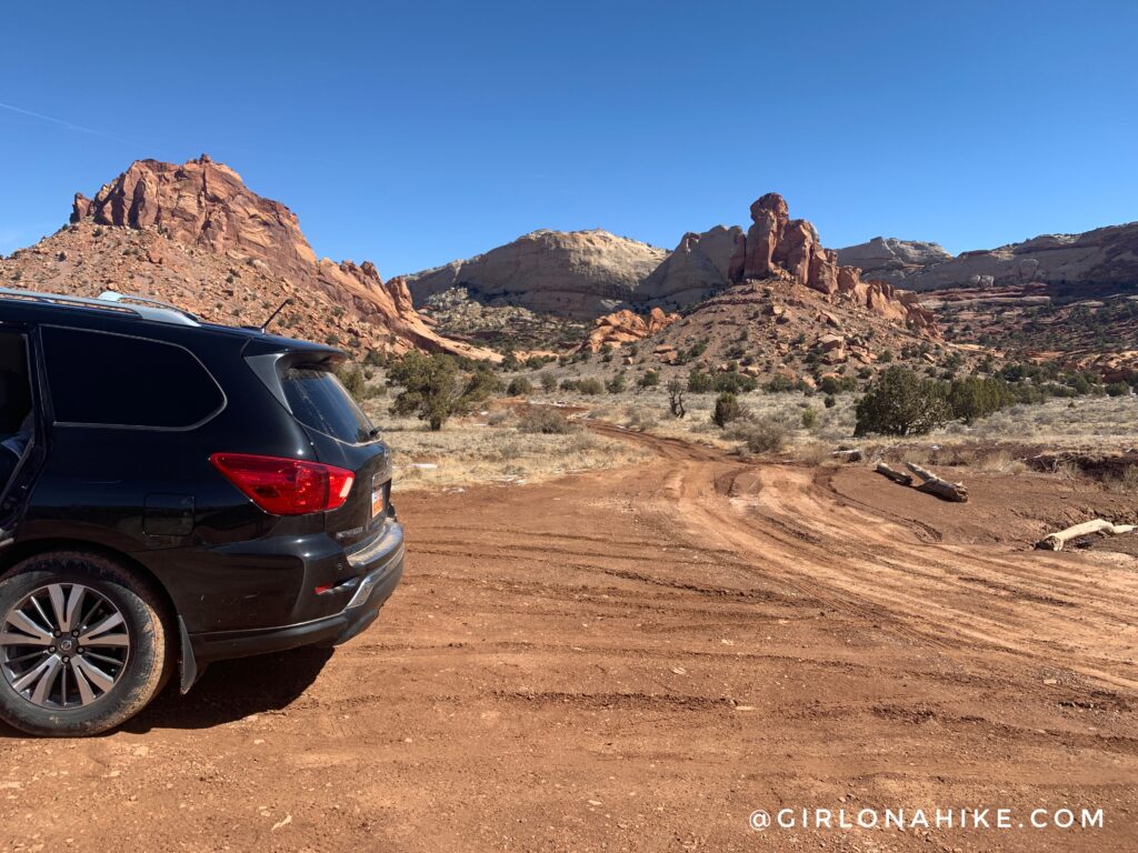
Depending on how muddy the road is, you may have to park right off the Burr Trail Road. The 2WD parking is about 2 minutes past this, and the 4WD TH is 2.5 miles down this road.
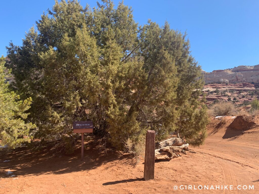
The official 2WD TH register.
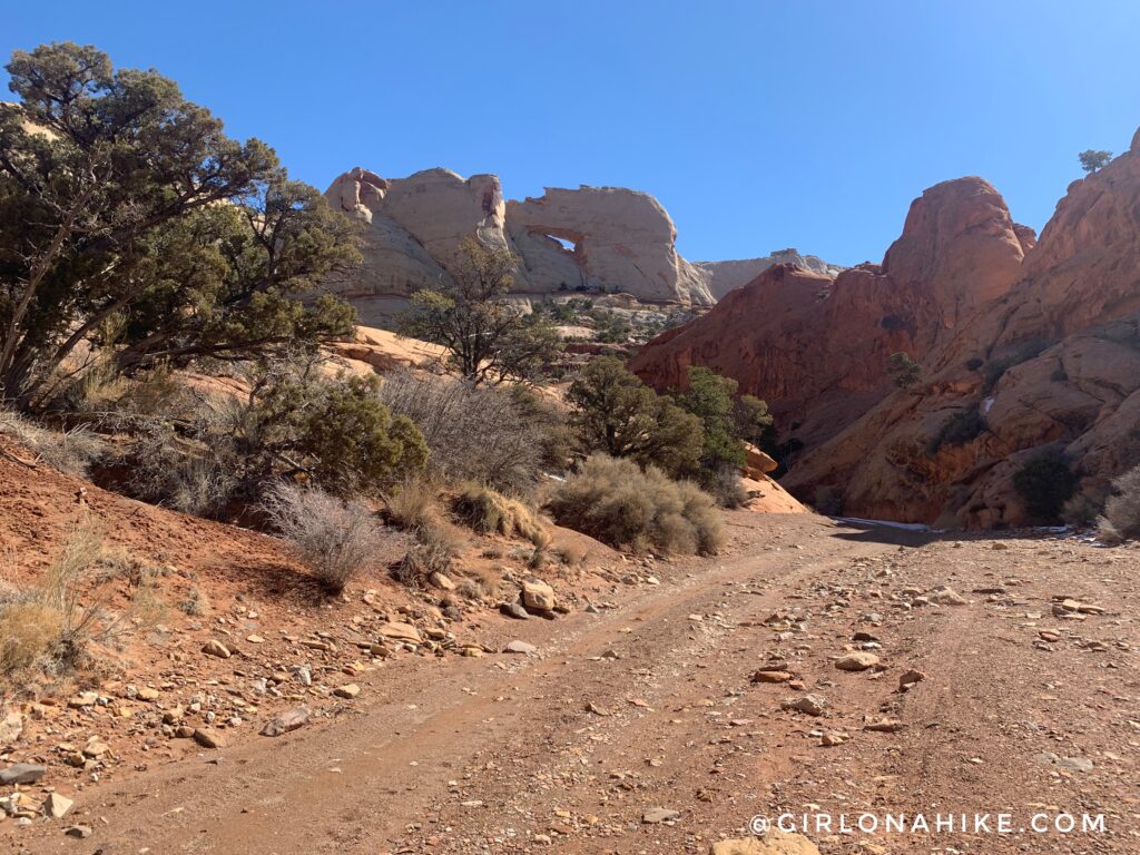
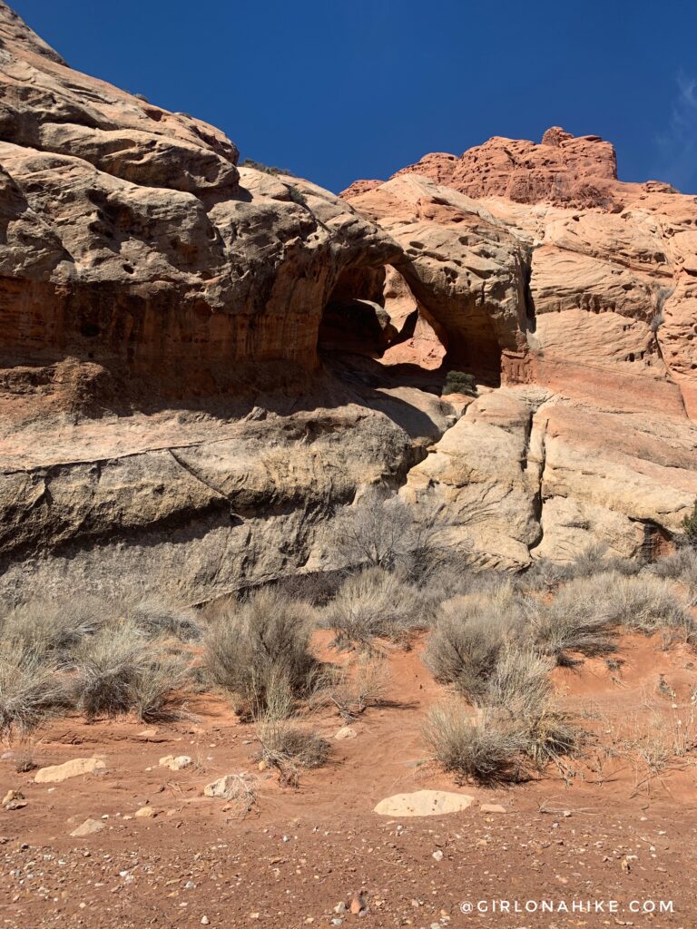
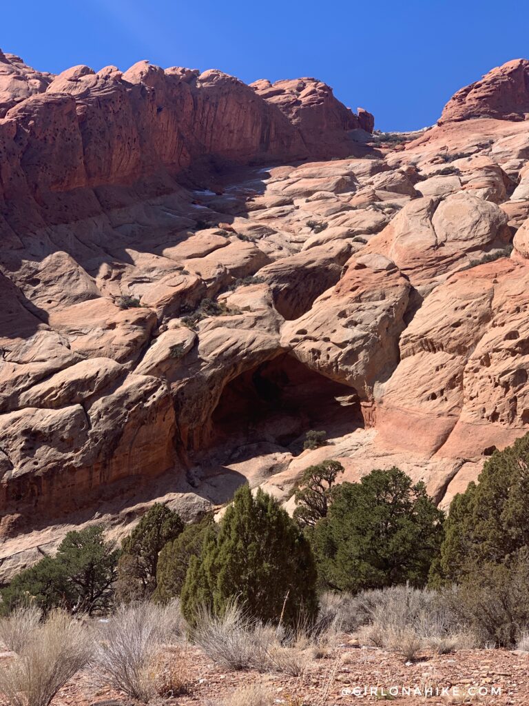
Within 5 minutes of walking from right off the Burr Trail Road, you will see the first arch – Peekaboo Arch.
Arch #2 (unnamed) along the 4WD road.
Arch #3 (unnamed) along the 4WD road.
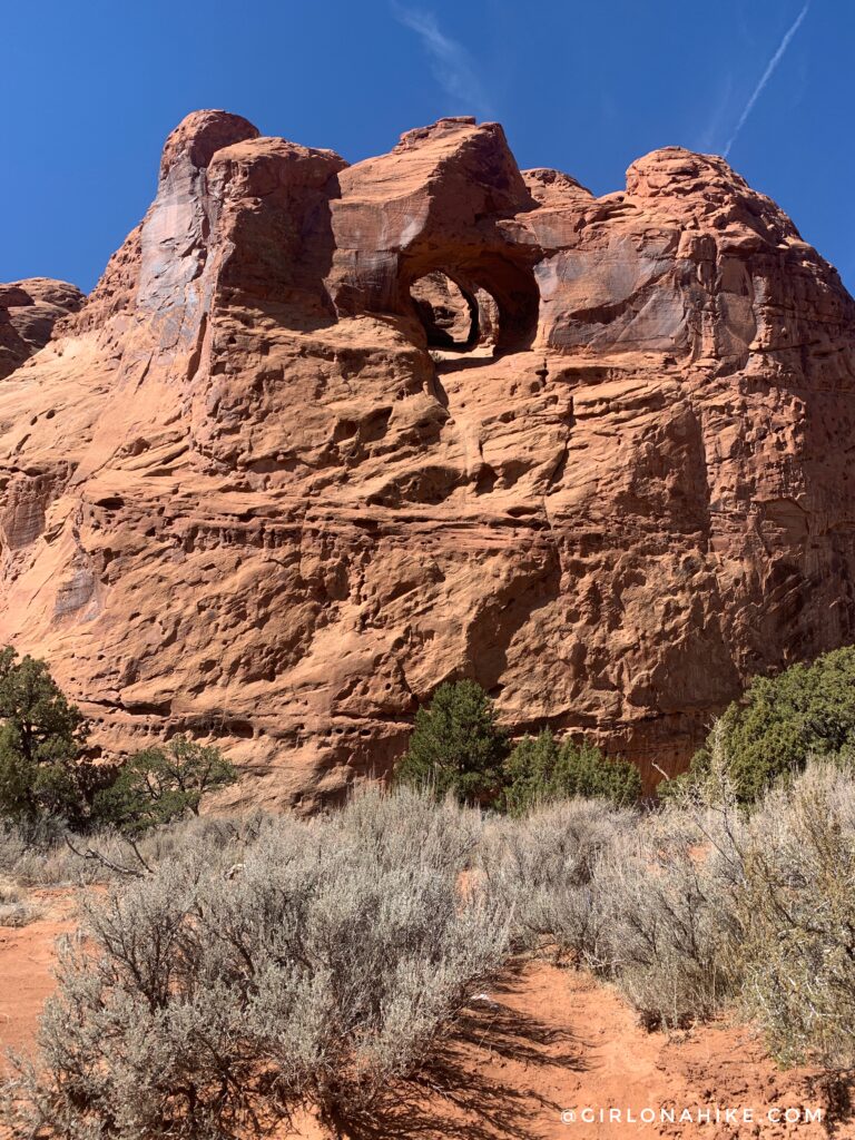
At 2.3 miles, you’ll see Arch #4 (Double Arch) along the 4WD road.
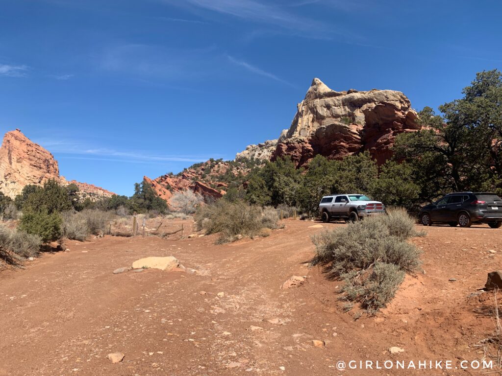
At 2.5 miles reach the 4WD TH. Both a truck and a Rogue made, and at this point we were kicking ourselves in the butt that we didn’t at least try to get through the muddy patch at the start of the dirt road in the Nissan Pathfinder. We totally could have made it (slowly)!
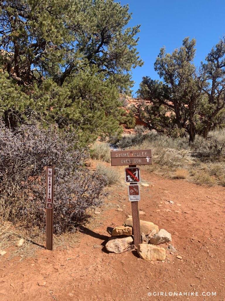
First, we wanted to stop by the Strike Valley Overlook, so we followed that trail. It’s only 1 mile RT, and totally worth your time.
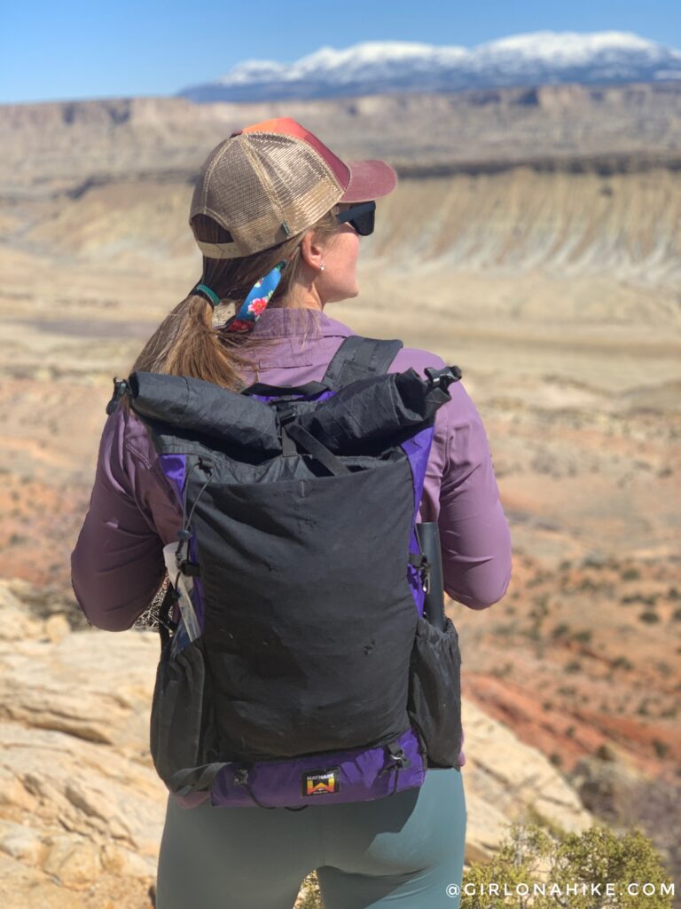
For this hike, I used my Waymark Gear 30 liter pack and it worked out perfect since I had several layers, food, and 3 liters of water.
Get 10% off your entire backpack order, use the code “GIRLONAHIKE” at checkout here!
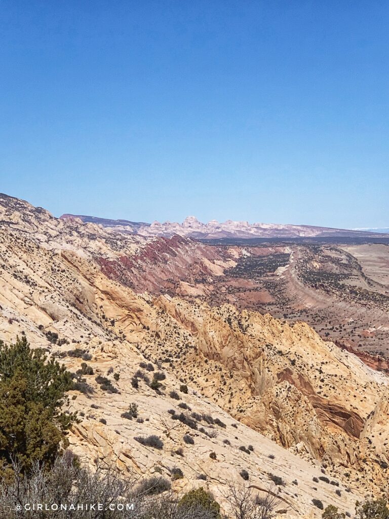
WOW! This is definitely one of the coolest overlooks in Utah. Seeing the terrain jut out from the landscape was amazing. This is Strike Valley Overlook looking North.
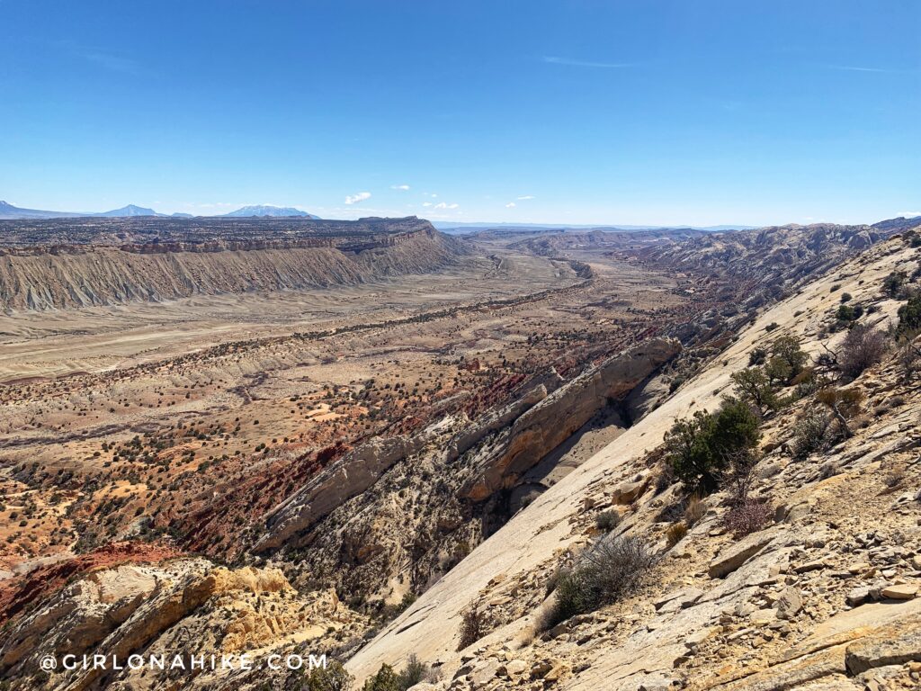
Strike Valley Overlook looking South.
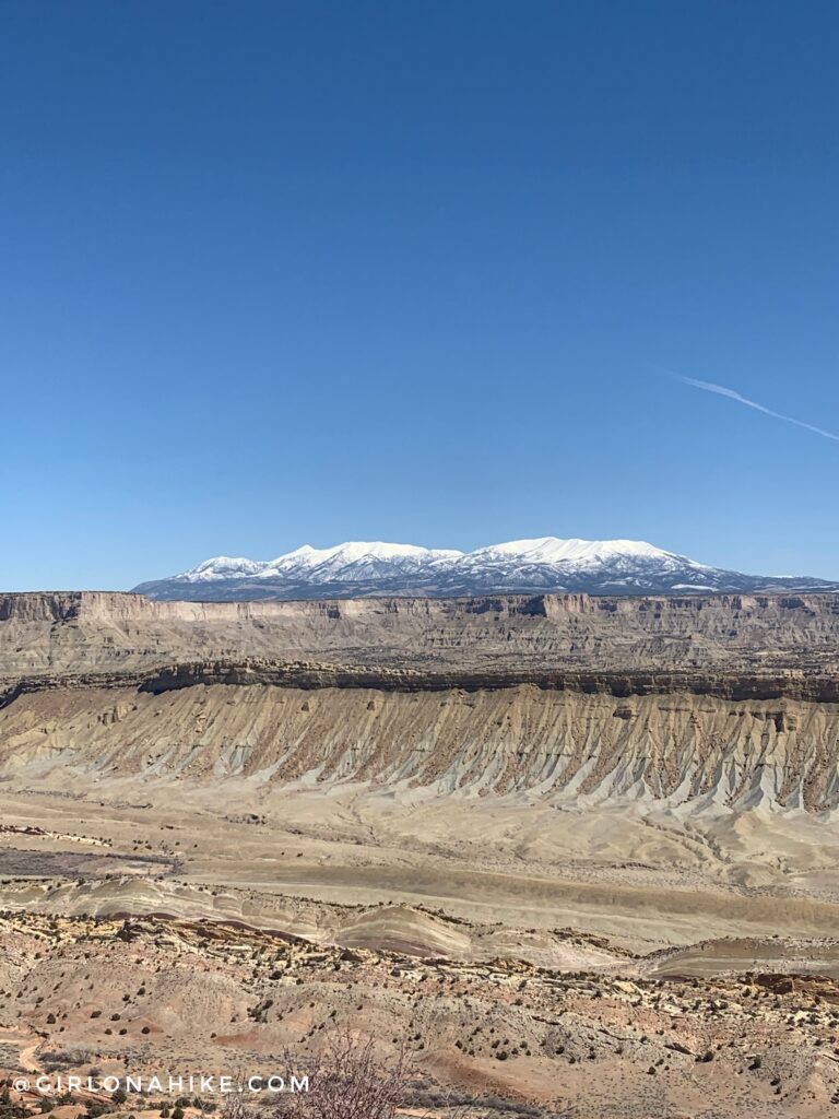
And one of the best views of the Henry Mountains.
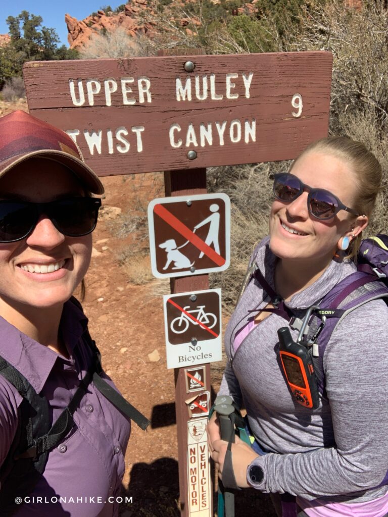
We went back to the main Upper Muley Twist TH to start our “real” hike. The sign says 9 miles (RT), but we both tracked 11 miles RT.
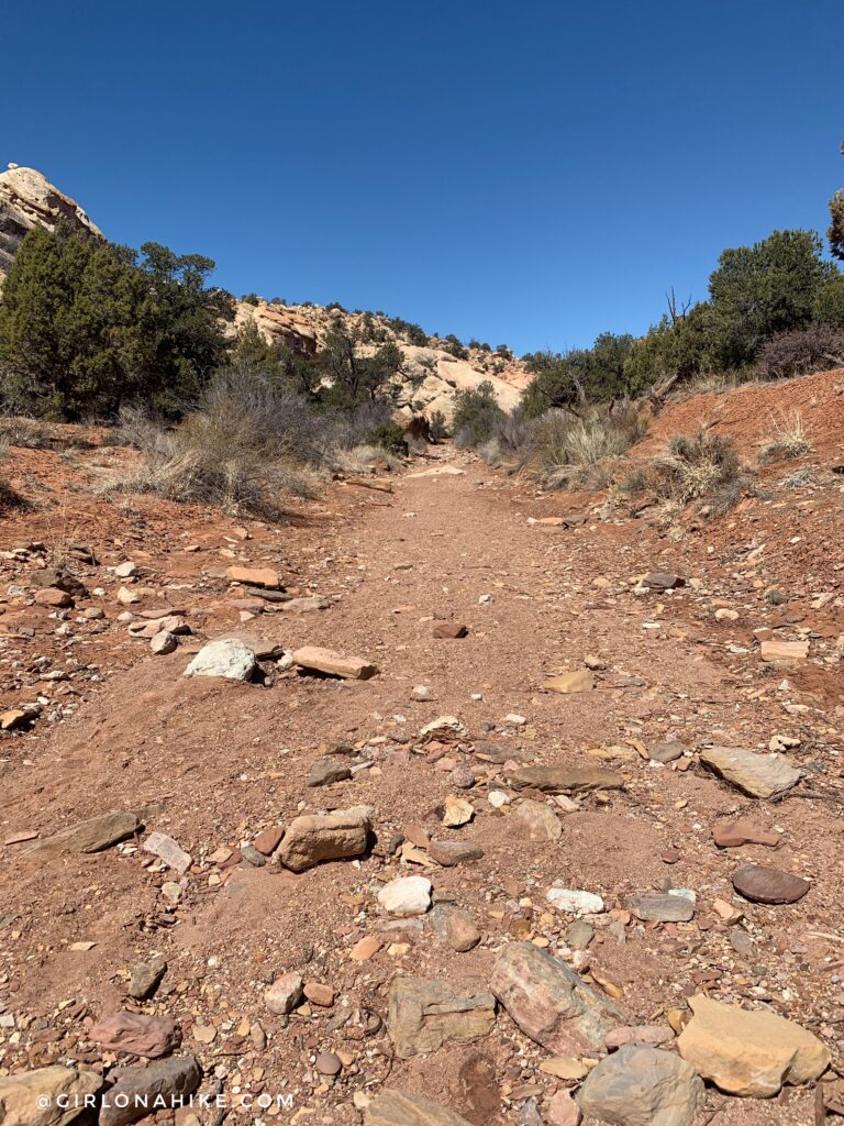
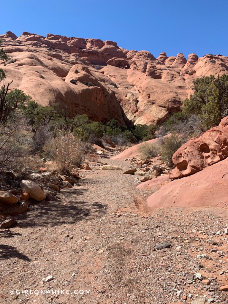
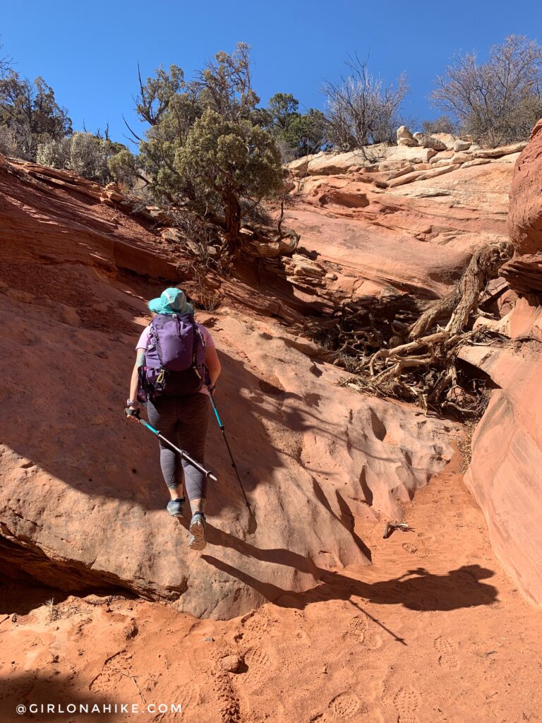
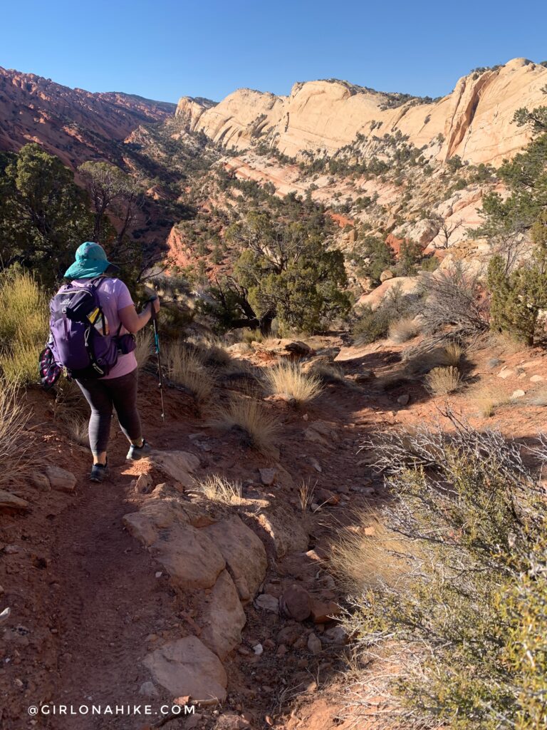
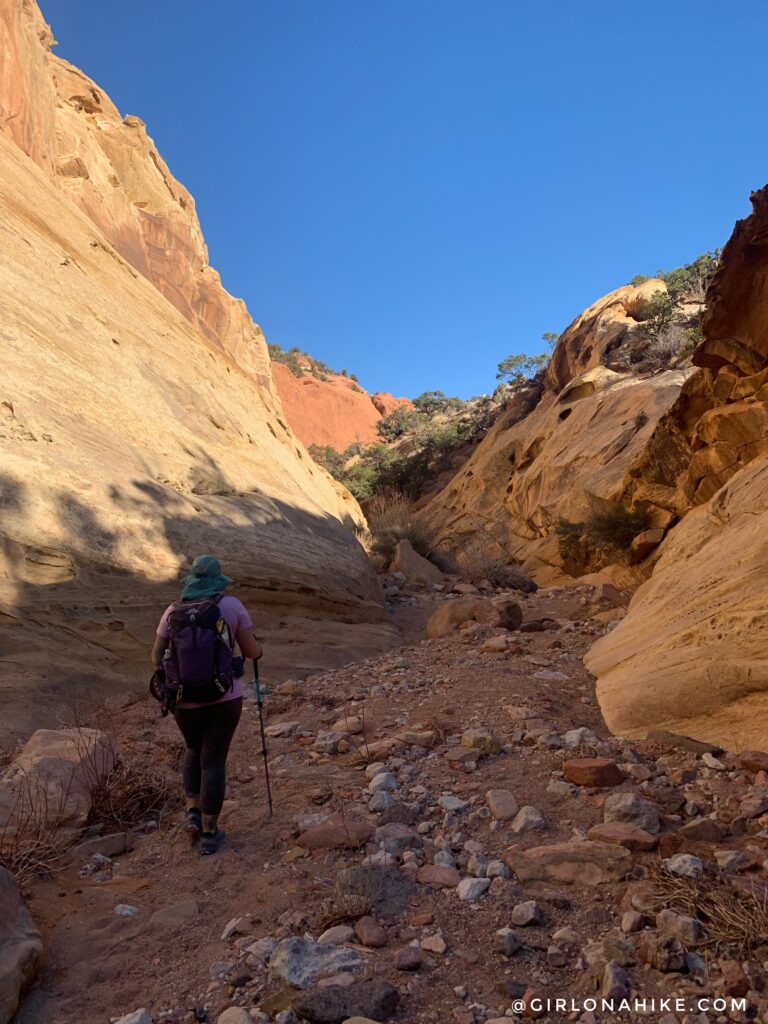
You will be following a wash for the next 3-4 miles.
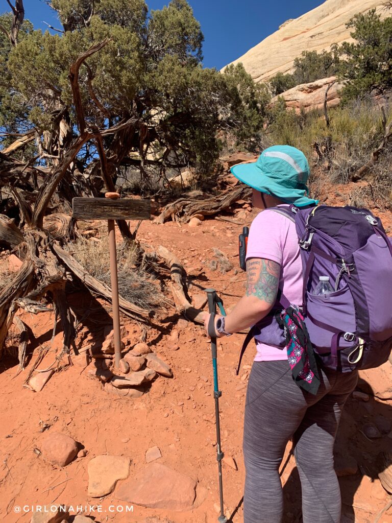
Eventually at mile 5.5 (from where we parked), you will reach the trail split for the Rim Route, and Saddle Arch is on the left (West).
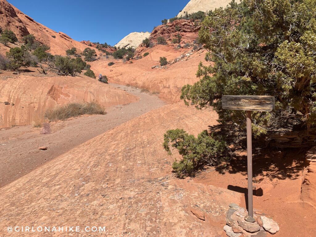
I highly recommend doing the Rim Route loop clockwise, so continue straight past this. You will come back down from the right of this sign, after completing the Rim Route.
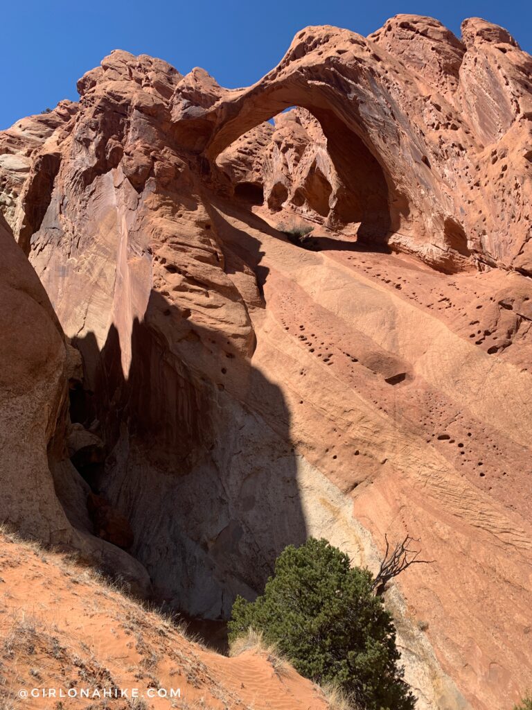
At mile 6.5 you will see another unnamed arch high up ahead.
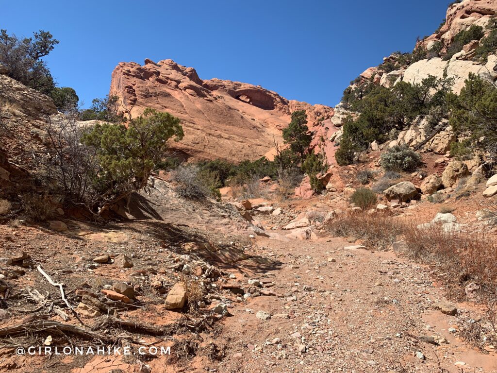
At mile 6.8 you will see another unnamed arch.
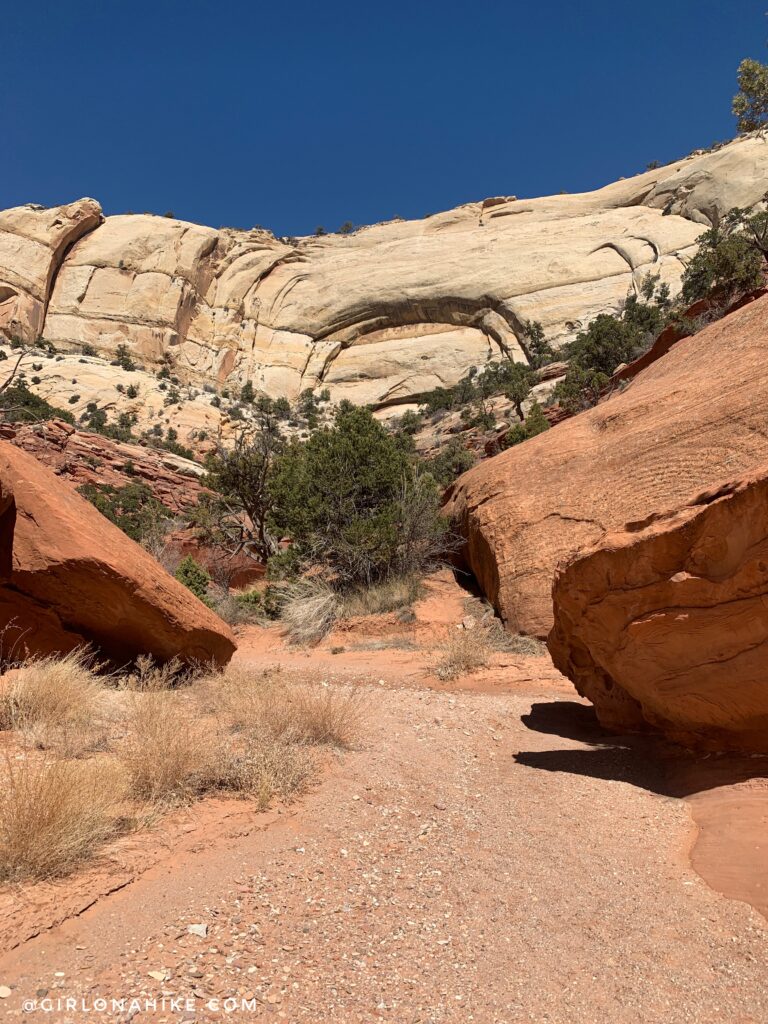
Continue following the wash, and you will see this cut-out looking rainbow/arch imprint ahead.
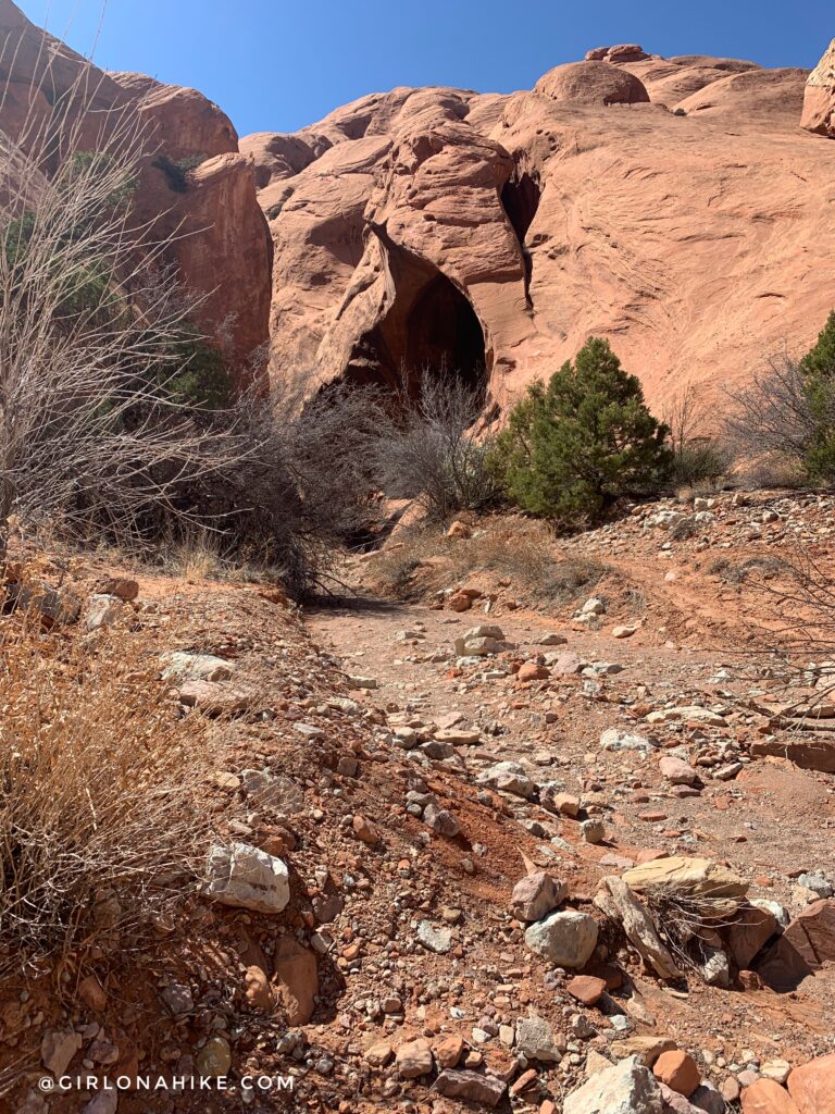
Just around the corner from that is the last arch on the left, at 7.5 miles (also unnamed). This was where we took our lunch break for about 20 minutes, and is also the last area before you start climbing uphill for the Rim Route, so it worked out well.
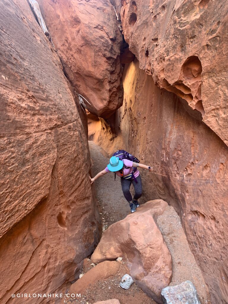
Towards the end of the wash, you will enter a slot canyon. This is NOT the official trail that leads up to the Rim Route – to continue following the trail you will see a bunch of cairns leading a way steeply uphill. For now, check out the slot canyon area.
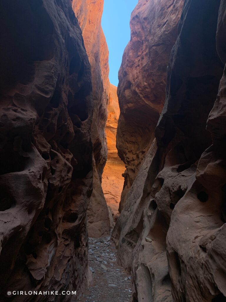
Exploring the slot canyon – we only hiked up maybe 10 minutes until we couldn’t get past a water hole.
Again, backtrack, and then continue following the trail where you will see a bunch of cairns leading a way steeply uphill.
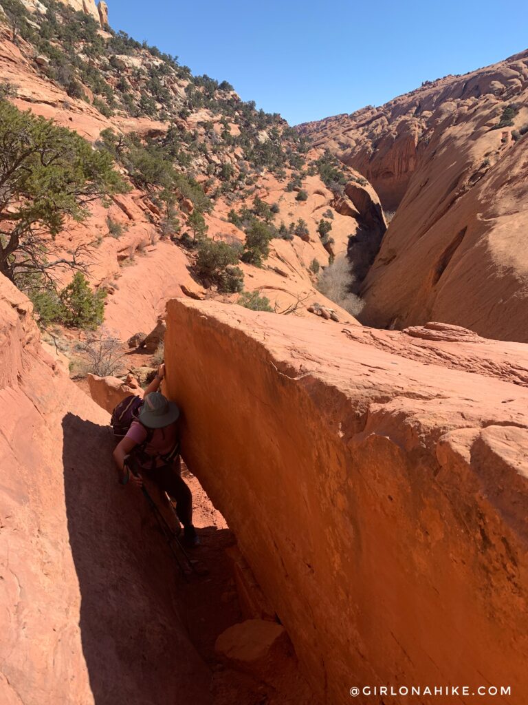
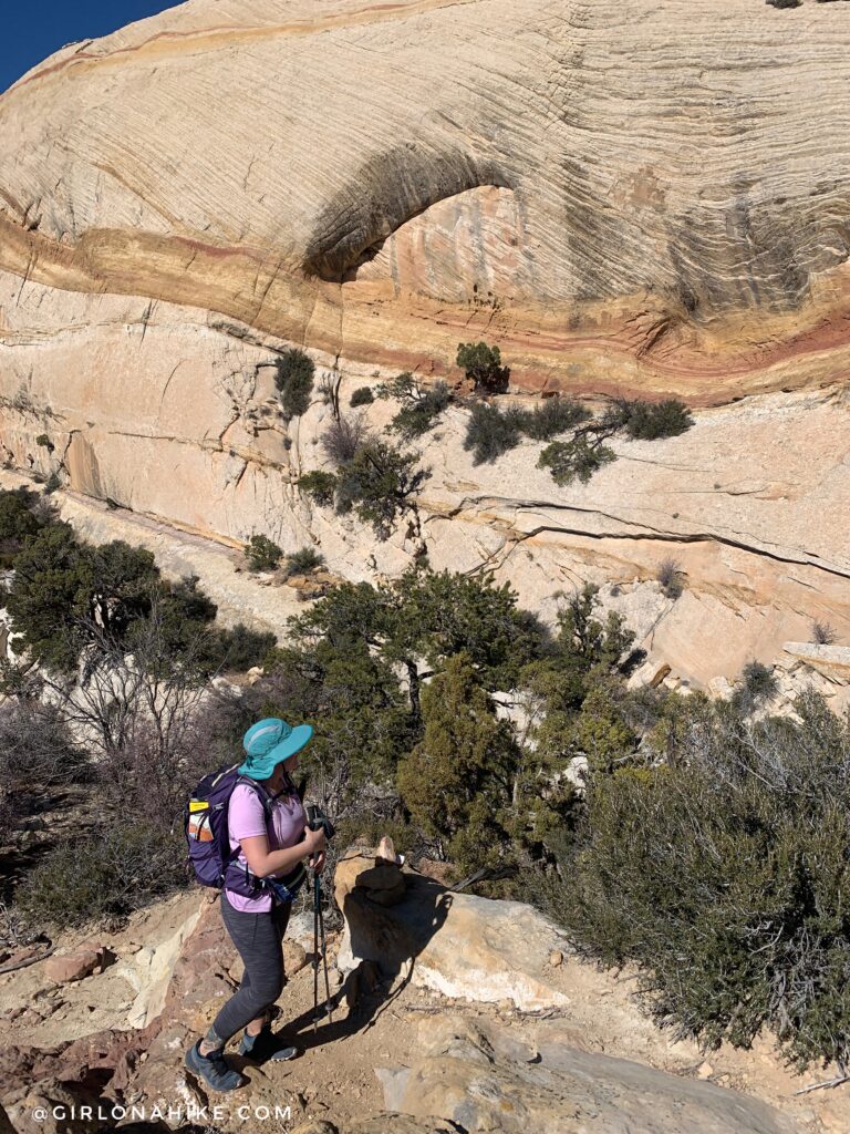
You will follow the rim for awhile, hiking right on a ledge and squeezing through big boulders. Cairns lead the way.
It will feel as if you missed the Rim Route trail split, but keep going and you will come to a small pour off area with this tree stuck in it. Follow the cairns up to the left.
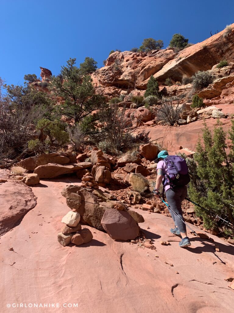
Finally! The last Rim Route sign at 9 miles. Time to start hiking up a steeper area and curving south.
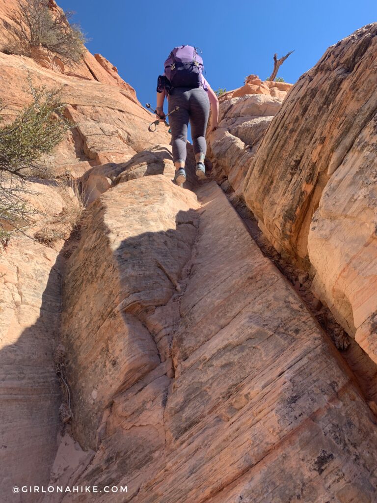
Some sections you will need to use all fours.
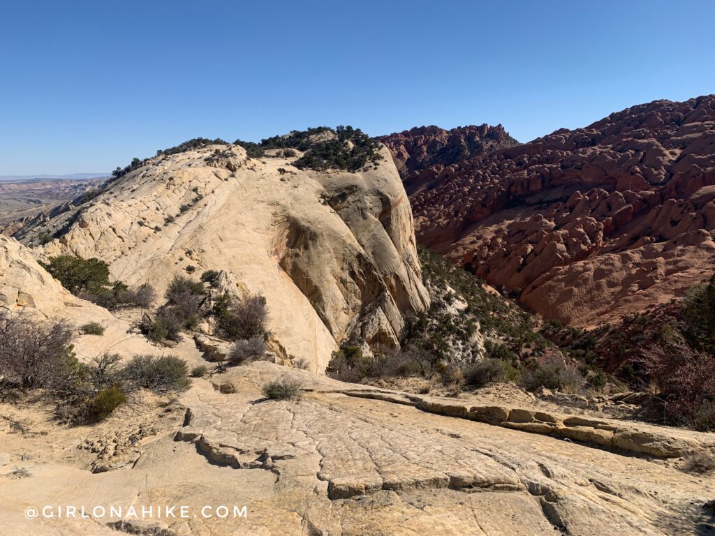
Loving the views of the rainbow colored rock, hiking up towards the Rim Route.
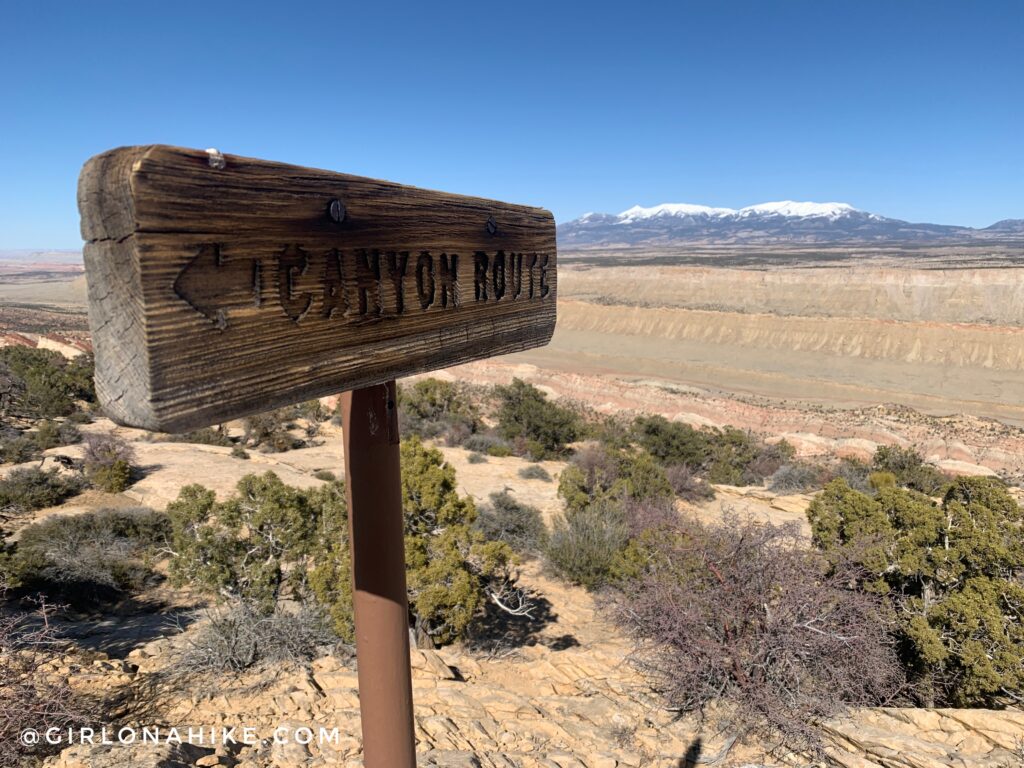
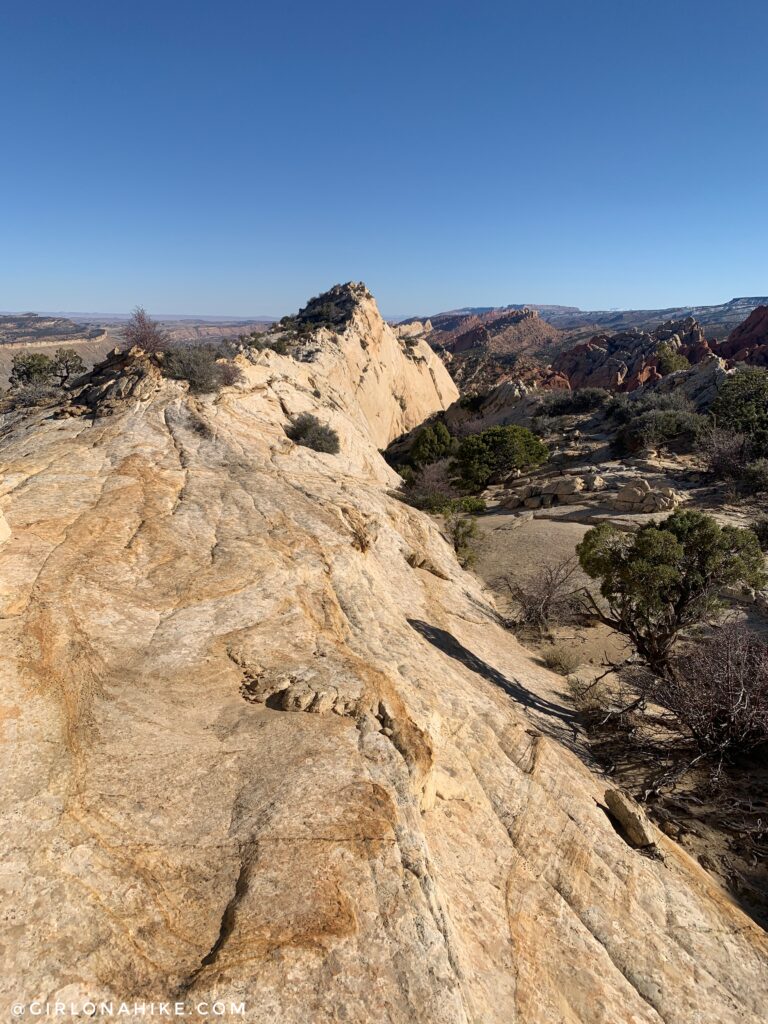
Now we were on top of the Rim, and another sign let us know we were in the right place. We took another quick break here, since we got pretty sweaty hiking uphill. And it was only 50F!
Next, you will follow the rim route for close to 2 miles, as you weave your way up and down over the waterpocket folds.
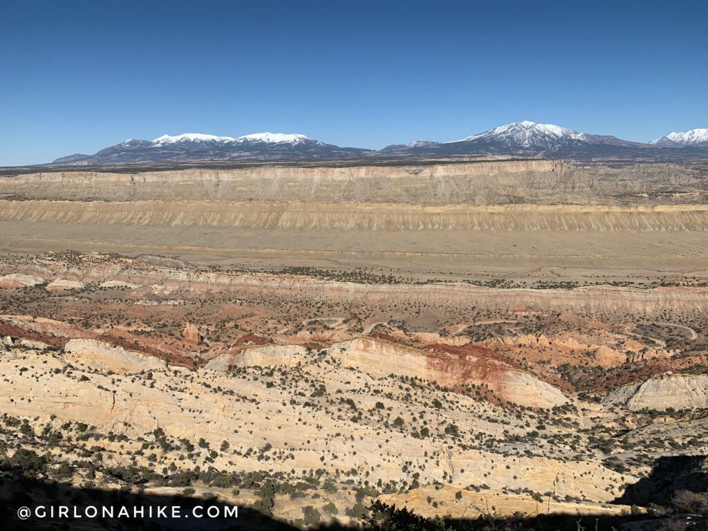
Just can’t get over this view of the Henry’s!
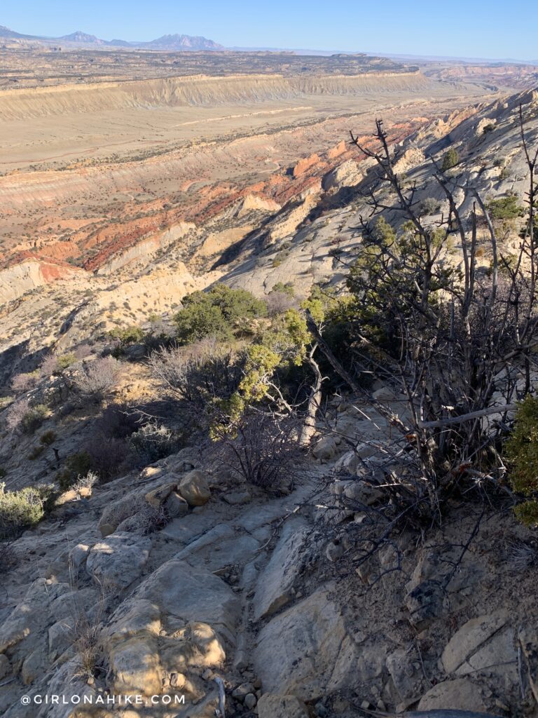
While most of the Rim Route is pretty flat, there are a few sections of very steep but short (like 20 ft) areas. Be careful of the sand on top of the rocks – it’s very easy to slip on it.
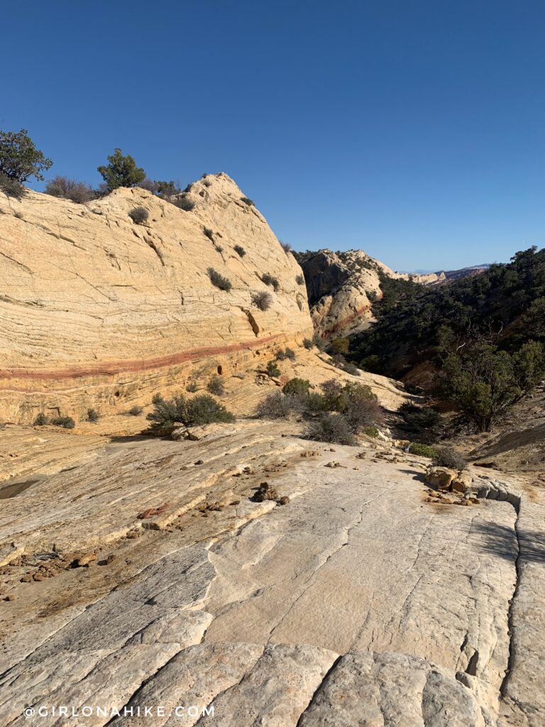
Beautiful rainbow striped rock again.
We were getting so close to the end of the Rim Route! Just an FYI – if you plan to backpack Upper Muley Twist the Rim Route section does NOT have any viable campsites.
Finally, time to start hiking down from the Rim Route. Obviously I was getting pretty tired. This was my biggest hike since last Summer! I wasn’t used to the higher mileage and long days.
Curving North to reach the bottom of the wash.
Back to Saddle Arch, where we originally stayed straight. This time, turn left to get back to where you parked.
The evening light sure was pretty!
Total time for the day was 7 hours 38 minutes, including all of our breaks. So glad long days are here!
We got back to the car around 7:30-7:45pm, and the sun was setting around 8:15pm. Just enough time to find a campsite nearby on BLM land.
Check out my video for the full experience!
Trail Map
My track via Gaia GPS – the best tracking app! Get your app here for a discount.
Nearby Hike
Backpacking Halls Creek Narrows

Save me on Pinterest!