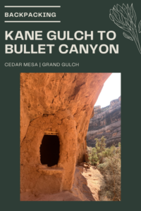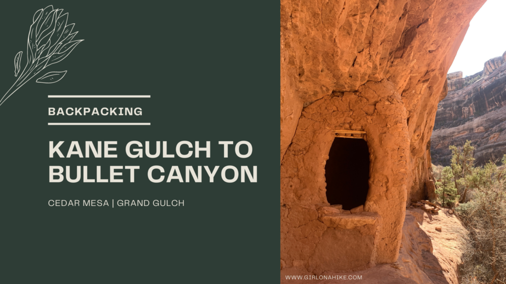
Backpacking Kane Gulch and Bullet Canyons are two popular routes in Bears Ears National Monument within Cedar Mesa, that require at least one night camping. This area is a mecca of ancient ruins and petroglyphs, deep within the canyon walls. Back in the day you wouldn’t see people for days, however, with the increase of outdoor activities due to COVID you now can’t go more than 2 miles without seeing other groups. This is not the area for solitude. Oh yeah, and there’s another big issue…water.
About
I’ll be up front right away – this trip was in my top three worst backpacking trips of my life. Here’s why.
I called the ranger station a few days prior to our trip to ask about water, and I told her my route. She said, “yes it’s flowing”. I asked specifically, “so from junction to junction there’s water?” She replies, “yes, it’s flowing.”
Wow, amazing. Ok, that’s great! I thought, “We don’t have to carry more than 3 liters then!” I relayed the info to my group and we were all excited by the fact that our packs would be lighter since we didn’t have to carry so much water. Whoo-hoo!
We started out our trip with plans to camp near Split Level Ruin the first night, then at the Bullet Canyon junction the second night. However, as we passed group after group the first 2-3 miles they all said, “beware, Kane Gulch is dry.” Umm….what? I asked the man to clarify, and he said, “Well, we didn’t go past Turkey Pen Ruins, so I’m not sure past that point, but up until then there is zero water.” Ok, cool, maybe there was still a chance we would find water past that at Split Level.
Later as we kept getting further into the canyon we asked a few more groups and after also seeing that Kane Gulch was dry up until then we started to worry. The rest of the backpackers confirmed our worst fear – no water until Coyote Spring, another 10 miles away. Well, they said, “there’s water 1/2 mile up Todie Canyon, but it’s pretty stagnant”. My group was not down for trying to find that source, so we kept hiking. While hiking, we decided that since literally the only semi-flowing water source was at Coyote Spring, that we had no choice but to get there that night.
We also were told that there was water at Jailhouse Spring. Ok, we thought, “let’s just fill up as much as we can here at Coyote Spring, then if we need to filter again at Jailhouse Spring.” We knew at that point that this trip had turned into an overnight for us. What point was there to camp only 4 miles away? We all agreed on this, and the next day set out to do another 10-15 miles (we weren’t exactly sure by this point, only an estimation based off my route tracking on Gaia GPS). We were glad we filled up as much as we could because Jailhouse Spring was also quite disgusting and stagnant.
So total mileage over two days was 29 miles! It definitely wasn’t planned, but we literally had no choice due to the water situation. If I had gotten accurate info from the ranger initially, we wouldn’t have been in this predicament, and had either 1) not gone or 2) carried 7-8 liters of water. However, I fully trusted them, so I had no idea what I was really getting into and couldn’t plan accordingly. So lesson learned – don’t trust the rangers 100%, and ask as many people as you can to find out about accurate trail conditions on Instagram, Facebook groups, etc. Even on Alltrails no one had posted an update from about 6 months prior!
More reasons why this trail was in my top three worst backpacking trips of my life.
Campsites were pretty awful – very small, only room for 1 tent, no shade, and of course, no water
My legs got very scraped up from wearing shorts because it was 80F. I had very big welts on my thighs from allergic reactions to the sage and other plants in the area. The trail is extremely dry. Wear pants!
You’ll hike miles without seeing anything – very boring and no change in scenery
A lot of people the entire time – no solitude
Literally the only redeeming quality for me was the ruins, petroglyphs, and pottery. If it wasn’t for that, I would have been even more disappointed. There are SO many other trails in the area that are prettier, free/no permits, dogs can hike to as well, less people, have plenty of ruins, and contain water! Backpacking Kane Gulch & Bullet Canyon wasn’t for me, but again, that’s just my experience. I always try to find the positive in each hike/trip I do, and for this one I struggled. I hope this prepares you for what you will actually see and experience in this area.
Trail Info
Distance: 30 miles (plus more for exploring)
Elevation gain: 1600 ft
Time: 1 night minimum, 2-3 nights preferred
Dog friendly? No dogs are not allowed in this canyon
Kid friendly? Not for backpacking, but maybe a short day hike to Junction Ruins only
Fees/Permits? Yes (both), read below
Directions
FAQs
How do I get a permit?
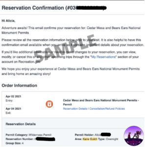
Be sure to read through the Cedar Mesa Permit info page. Everything you need to know is on there. We wanted to go April 2-4, and the earliest permits open up is a literal 90 days prior to what entry date you want. So for our April 2 entry date, I applied for the permit Jan, 2. Once you apply for your entry date, pick “Kane Gulch”, and on the next steps you’ll fill out your info, payment info, and select your exit date. As of 2021, the cost for 4 people plus the reservation fee was $66.00.
You will get an email notification with your reservation number. This IS NOT the actual permit. Depending on if the Kane Gulch Ranger Station re-opens due to COVID, you will either be emailed a copy or your actual permit a week prior to your trip or will be able to pick it up from them directly.
You can day hike each canyon separately however, either way you need a permit. Day permits can be picked up at the THs are are self-serve for $5/person.
When is the best time to visit?
March and November seem to be the best months because the temperatures aren’t too hot. For our trip in April it was already 80F! Summer months are extremely hot and try, along with monsoon season; winter is cold along with high winds. Due to the quick changes in weather, be aware of flash flood danger.
How difficult is it to backpack Kane Gulch? Is this good for kids?
This depends on your experience, fitness level, pack weight and weather – there are no technical areas. You should have a few backpacking trips under your belt, and be comfortable carrying up to 30-40 lbs for hours on end. As always, the lighter your pack, the easier your hike will be. More weight = harder hike.
Can I bring my dog?
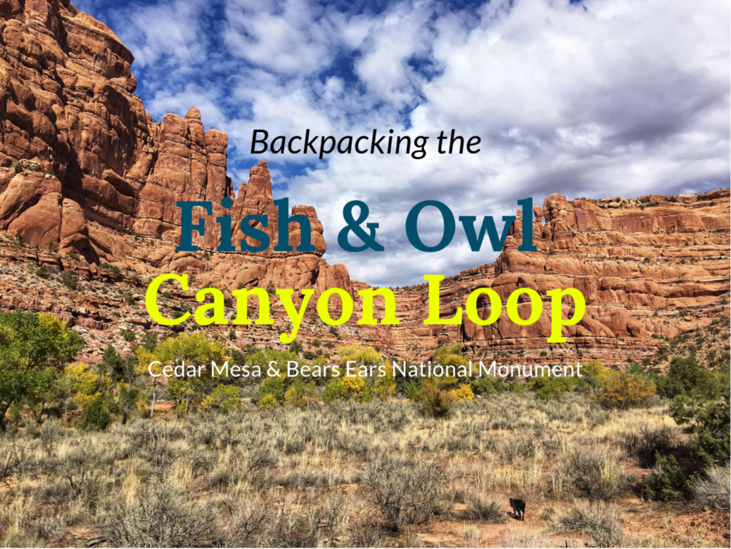
No, dogs are not allowed on the West side of HWY 261. An alternative trip I would recommend with dogs is Fish & Owl Canyon, a 17 mile loop. Permits are also needed for this canyon.
What’s the elevation gain like?
If doing the point to point from entering Kane, and exiting Bullet, you will gain 1,600 ft. It’s not horrible, but there is some rocky scrambling in one section of Bullet Canyon that lasts for about 1/3 mile.
Are there requirements for food storage?
No.
What about water?
As of 2021, the entire Kane Gulch area has been dry for two years, with only TWO reliable water sources to filter. One at Coyote Springs, about 1/2 mile up the canyon, and at Jailhouse Springs. Coyote Spring was slightly flowing when we backpacked this, and was the clearest water we saw the entire 30 miles. Jailhouse Springs had enough water, but was quite stagnant and oily looking. You may be able to find other really small pools of water, but it will depend on if you want to filter from it, as the water is quite nasty. Be prepared to carry at least 5 liters of water for drinking and cooking water depending on where you camp.
Because the canyon was extremely dry, this is why we had to turn our 2 night 3 day trip into just an overnight (yes, 30 miles over two days!). I highly recommend only brining a pump-style filter, such as the Katadyn Microfilter, because the water is not deep enough to use a gravity filter or Sawyer Mini to dip into a small pool. You could also try the Life Straw, but you can’t fill up a reservoir with that style of filter.
We talked to another group of backpackers that filtered from the “pour off” about 2 miles past Turkey Pen Ruins and just south of the Todie Canyon entrance, and they said they filtered water for 1.5 hours and still had green water coming out the filter!
Carry at least twice as much water as you would normally carry.
Are the mosquitoes?
The only time I saw mosquitos was at Coyote Springs, as we were filtering water.
What guidebook or map do you recommend?
The best book is “Hiking from Here to WOW: Utah Canyon Country“. Because I don’t like carrying extra, unnecessary weight I just took pictures of the map and book I wanted on my phone for reference while hiking. Mainly, I relied on my Gaia GPS app for guidance. Get your app here for a discount.

Kane Gulch – Day 1
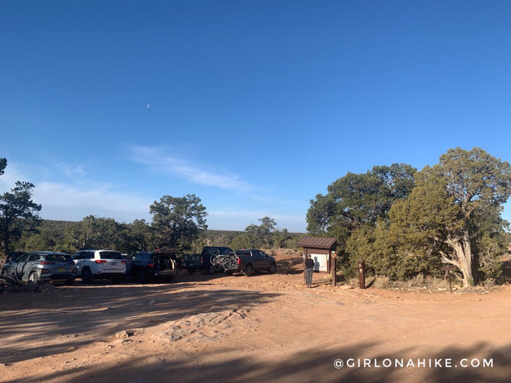
The night before our entry date, we all met at the Bullet Canyon TH to spend the night. It’s fine to sleep in your car or set up a tent in a space that has already been used (campfires are not allowed). If the actual TH is full, keep driving down the dirt road to find other sites. We woke up at 7am, and packed out bags. There is a port-a-potty in the parking area but bring your own TP in case it’s out! From here, we all hoped into one car and drove down to the Kane Gulch TH/Ranger Station.
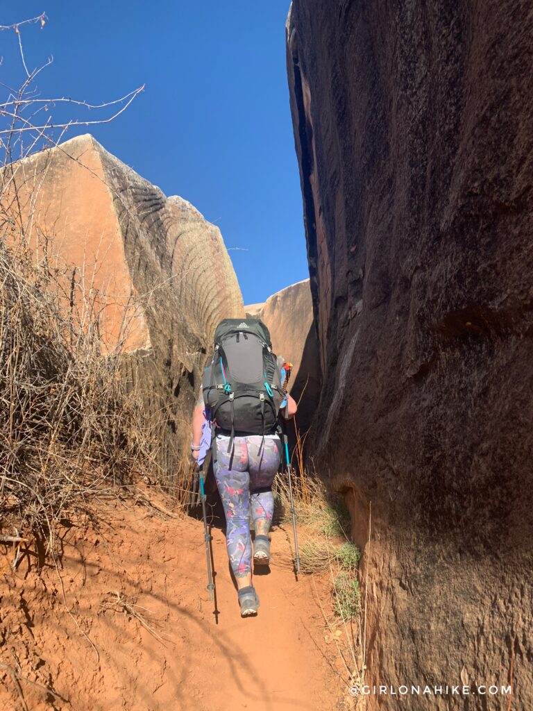
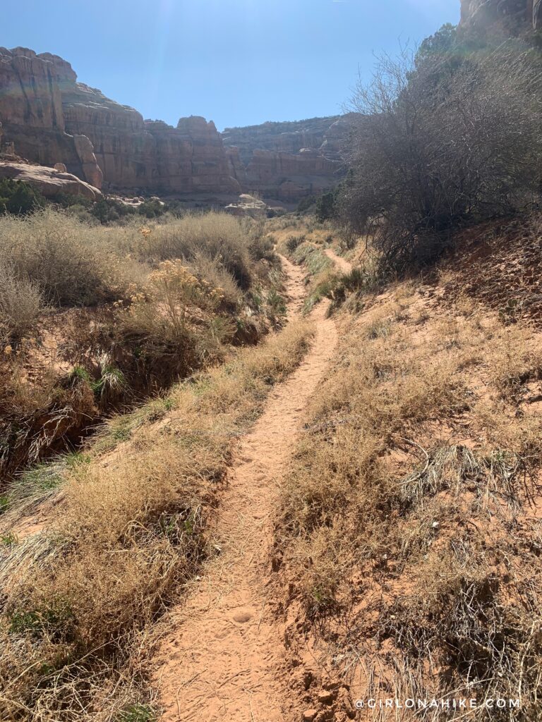
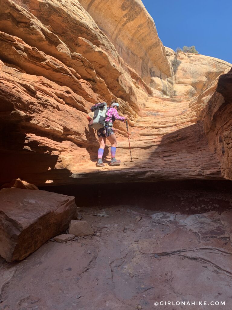
After you cross the road for Kane Gulch, you will hike down-canyon for for close to 2 hours.
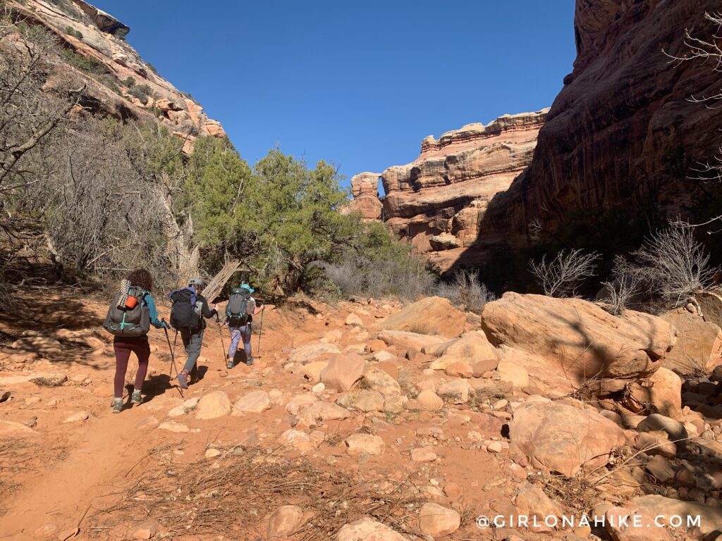
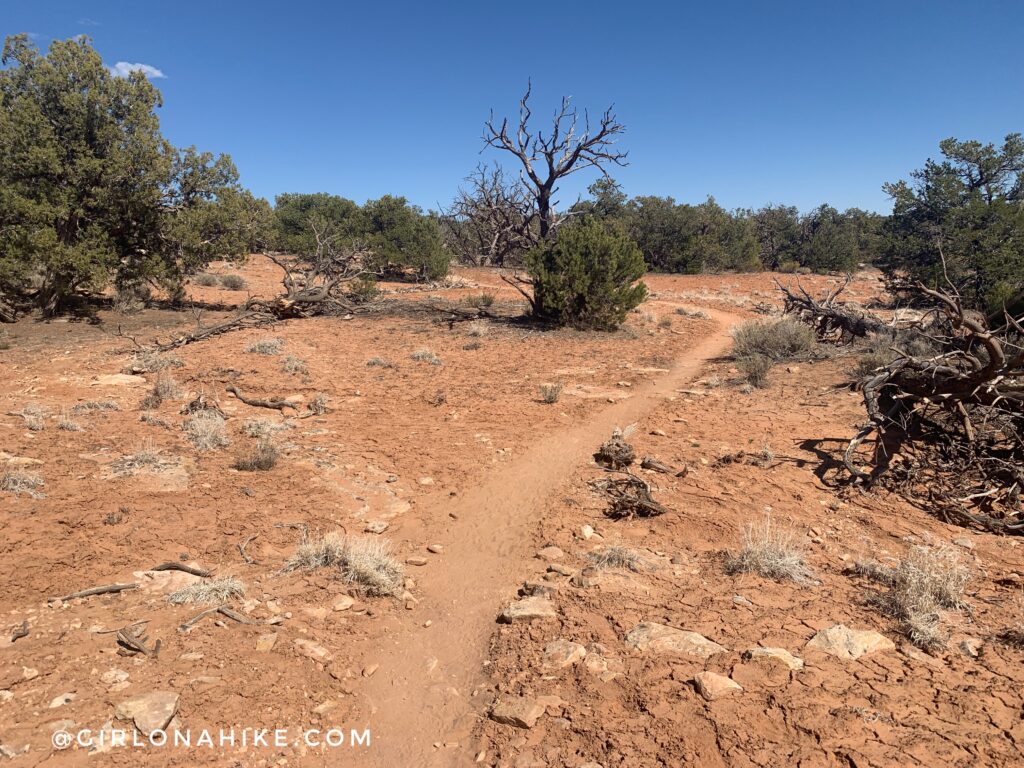
The girls lead the way. It’s really easy to follow the trail, just keep an eye out for cairns.
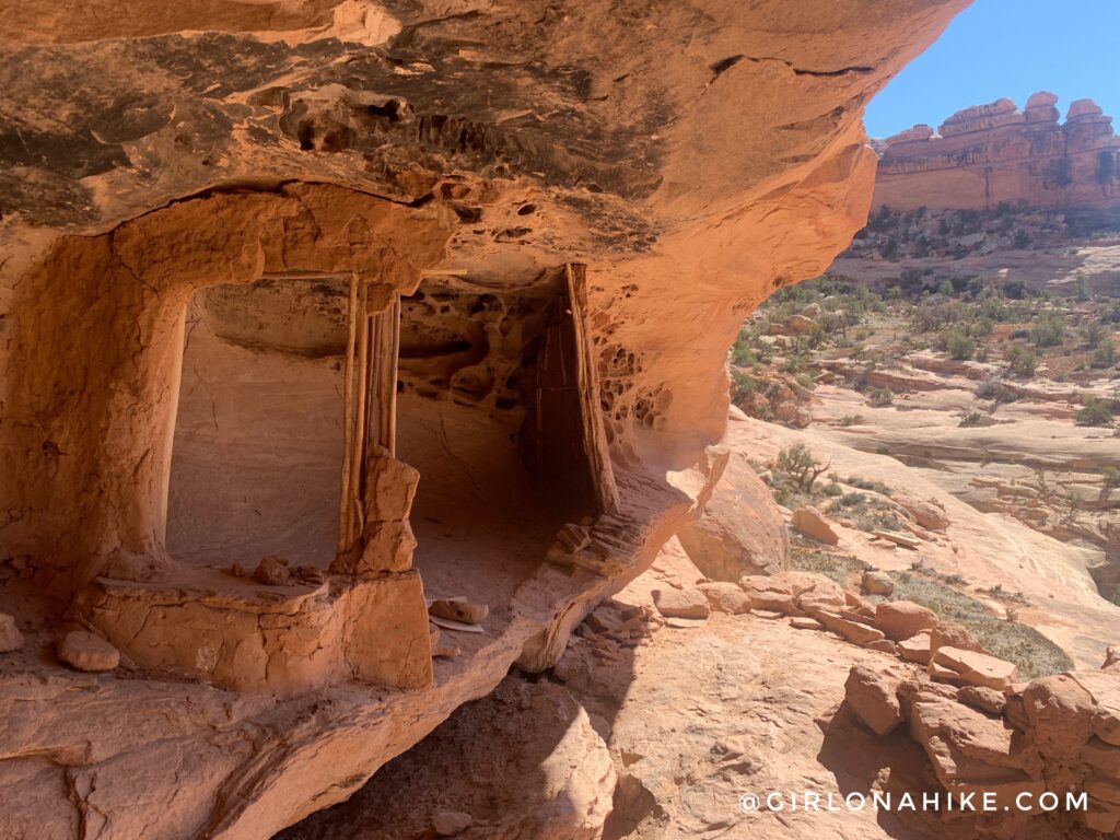
Around 4 miles you will reach Junction Ruins and one nice campsite. It’s easiest to drop your packs at the confluence/campsite then walk up to check out the ruins.
That hole is so tiny! The natives must have been really small people.
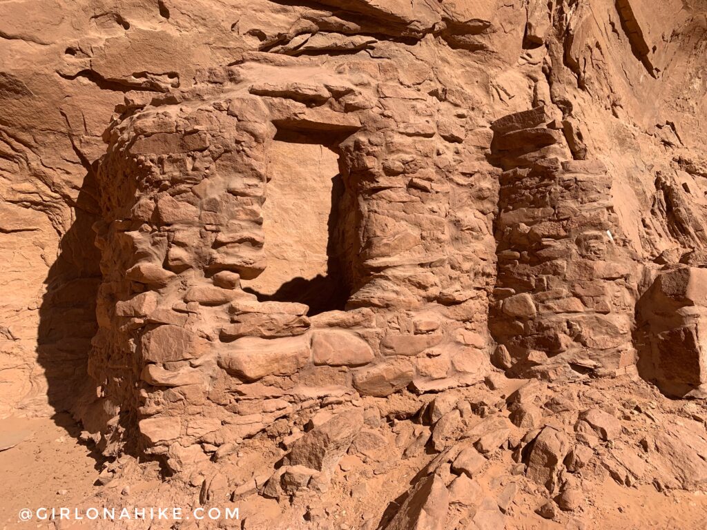
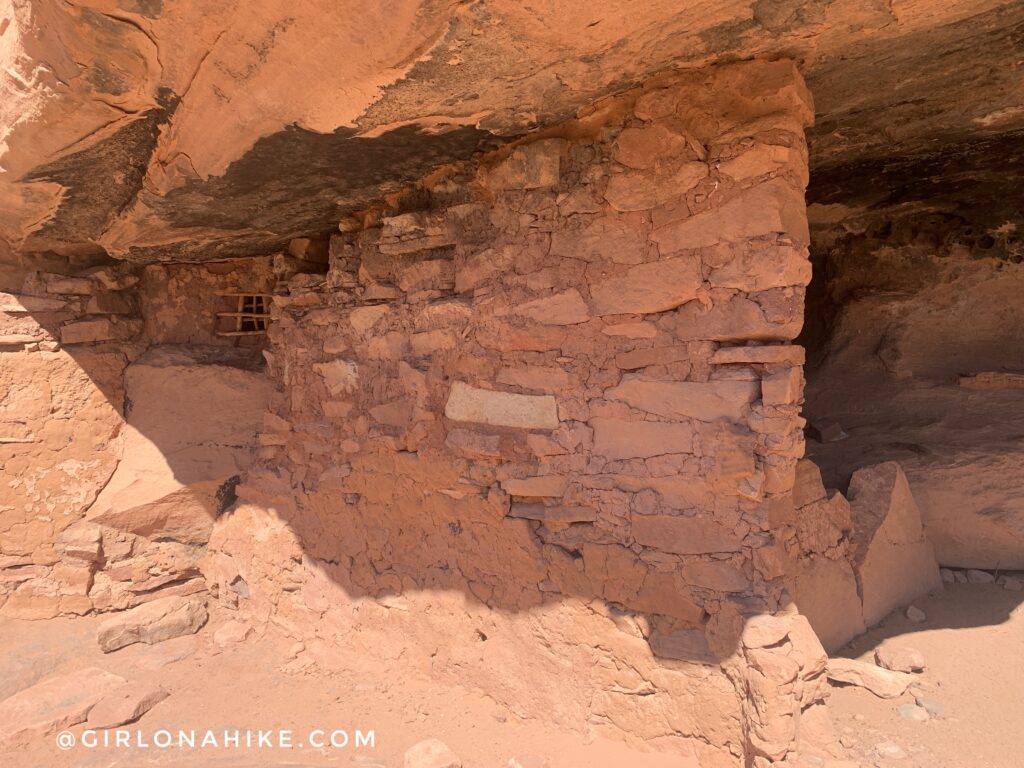
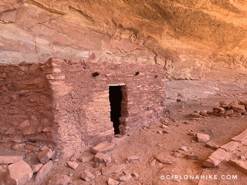
Continuing down further into the canyon you will reach Turkey Pen Ruins.
To see these original structures is just amazing. I can’t believe it’s lasted so long.
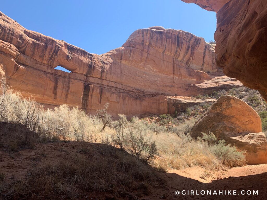
Around the corner from Turkey Pen Ruins, you will pass Stimper Arch high up on the left.
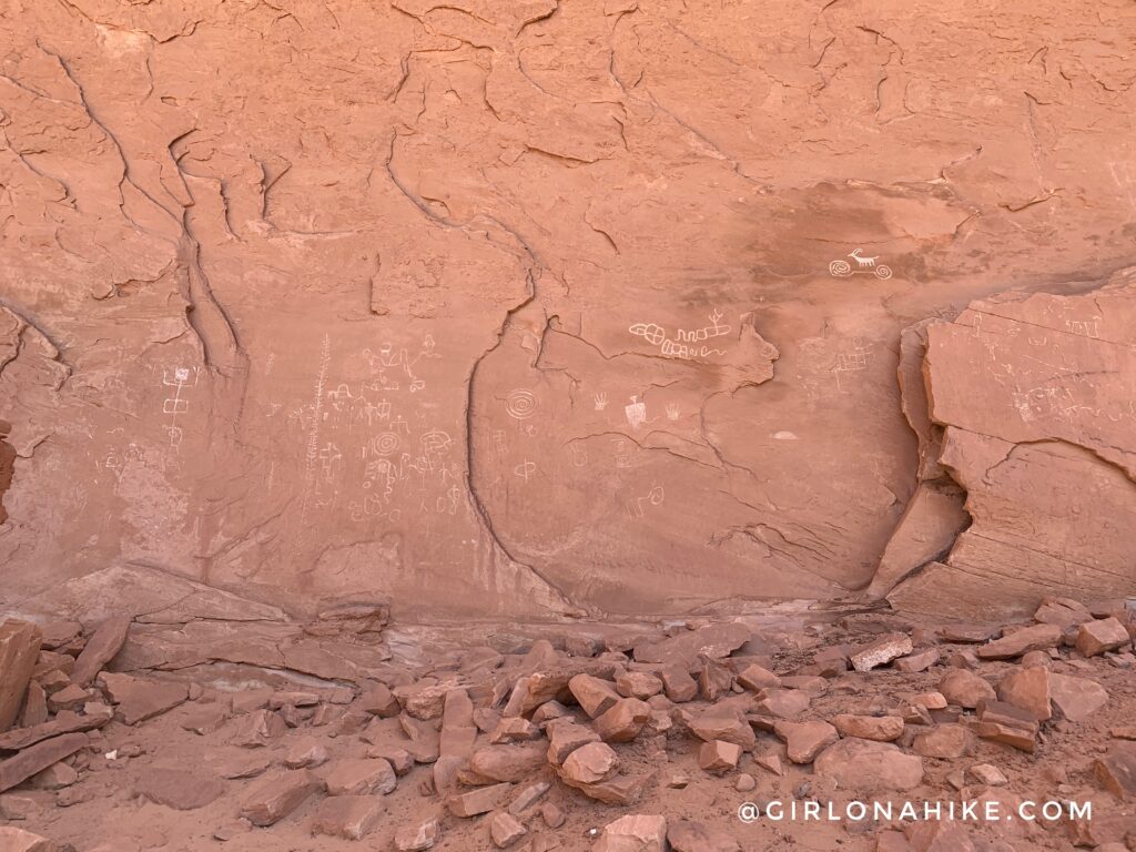
Many ruins and petroglyphs are not marked on most maps, however, if you see small trails leading off to alcove-type areas, there might just be some there!
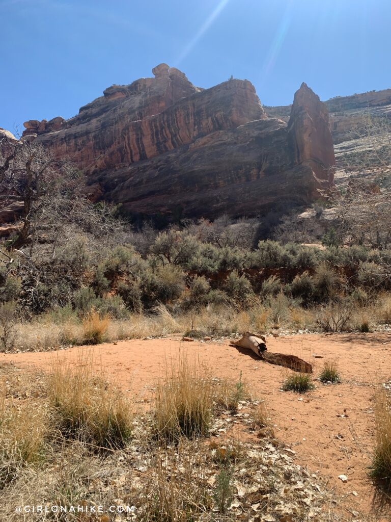
One of the campsites right on the trail. You’ll notice that it’s surrounded by sage and other bushes. This is exactly why I recommend wearing pants. My legs got super cut up by it all in shorts.
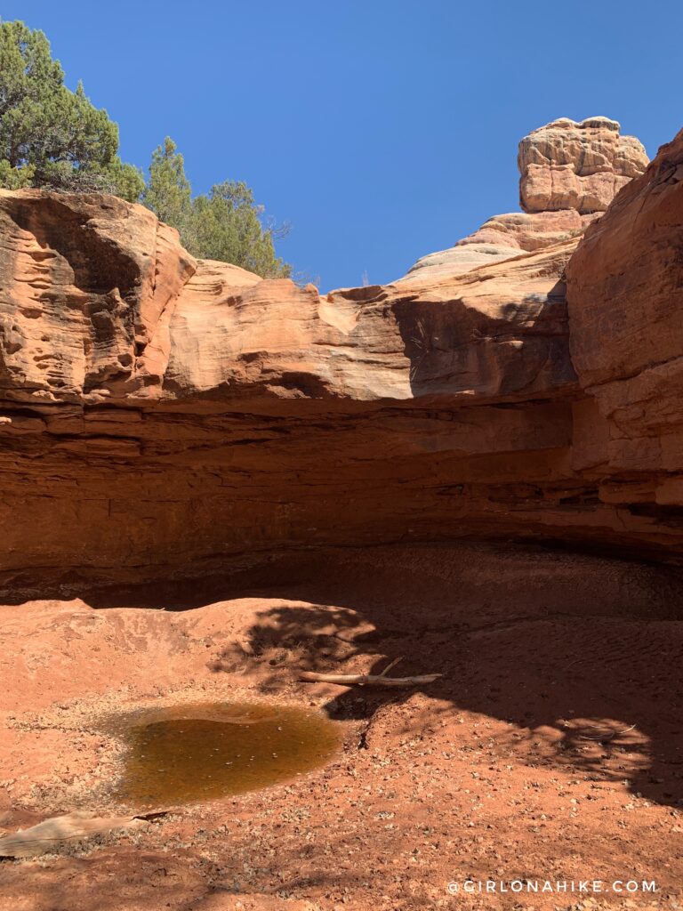
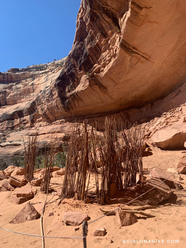
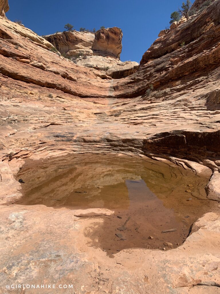
The “pour off” just past Todie Canyon might have water, as shown here. We talked to some backpackers here who were brave and tried filtering this water. They filtered for 1.5 hours and it still came out green! So when others say there are water sources, just be aware that it’s probably stagnant pools. Also notice how shallow this hole is – this is why I recommend using a filter pump rather than a gravity filter so you can easily throw the end into it, without having to scoop water into it. Also be careful when walking close to these pools, as the surrounding area about a foot around was pure mud and the other backpackers fell in after I took this pic! Yuck. Test the mud with your hiking pole to gauge depth.
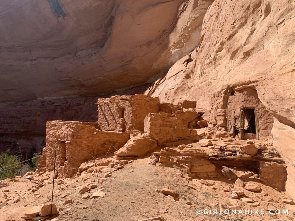
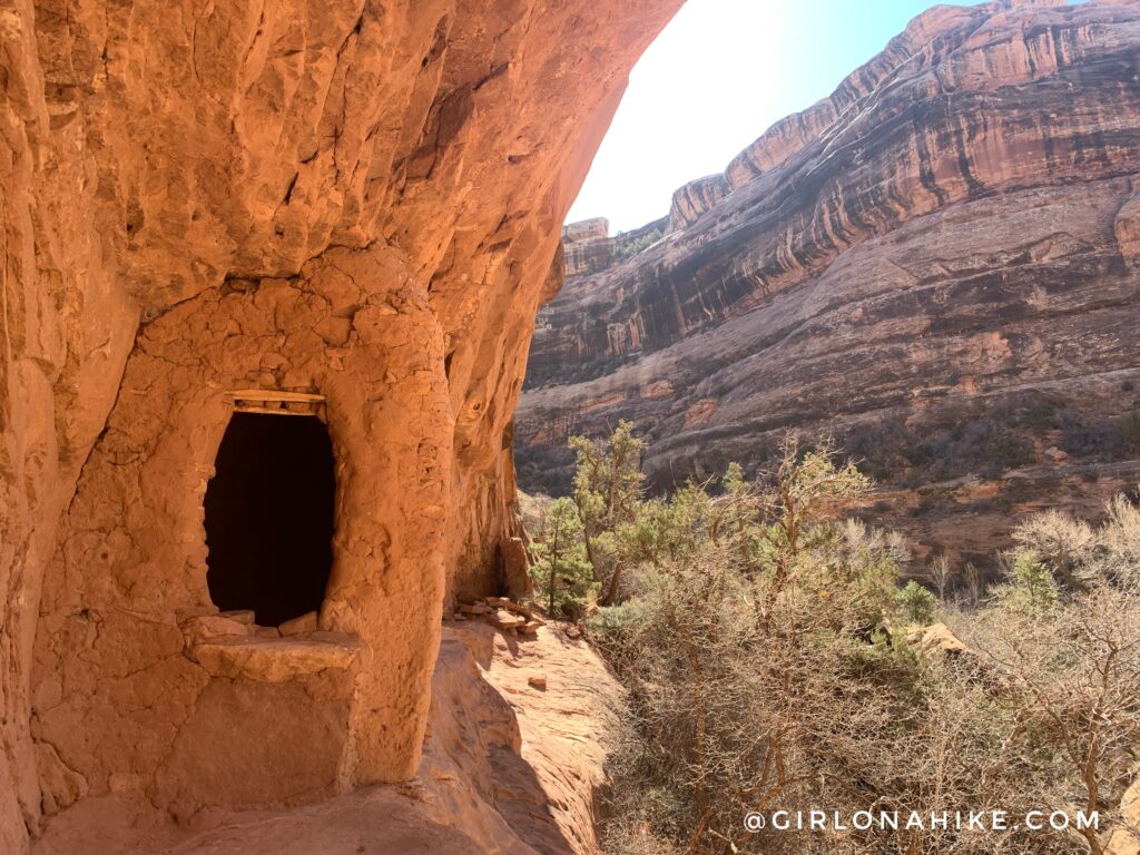
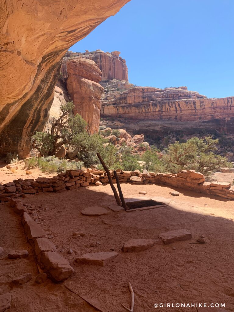
Split Level Ruins – my favorite. This area was filled with pottery shards and of course this really cool structure. At one point there were 18 rooms here and up above!
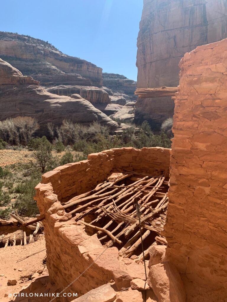
View looking from the top area of Split Level Ruins out to Kane Gulch. This area had about 3-4 campsites as well, but no water nearby.
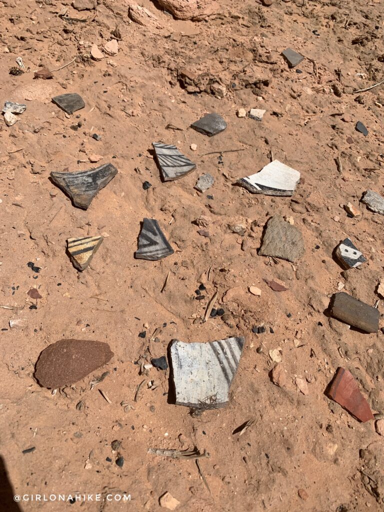
Such cool pottery with the designs still visible.

Finally, after 17 miles we reached the first viable water source at Coyote Springs. The campsite wasn’t great but we made it work. We were running out of daylight anyway, and just didn’t have time to find something better.
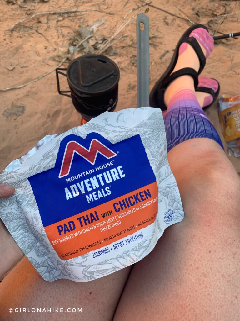
Ohh one of my new favorite meals – Chicken Pad Thai! This was super tasty, but also anything tastes good after 17 miles haha!
I’m also very glad I brought my compression socks to help my legs recover from the big hike. This was the first time I’ve brought them backpacking and they really do help! I ended up hiking out wearing them the next day too.
Bullet Canyon – Day 2
After camping just the one night, we decided there was no point in camping 2 nights due to the water situation, so we packed up camp and made our way out Bullet Canyon. This was taken not too long after the confluence from Kane into Bullet. This trail was much better for the fact that it didn’t tear up my legs. It’s way less bushy, but more sandy.
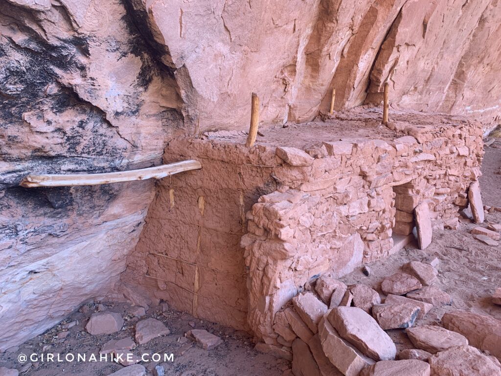
Jailhouse Ruins
Jailhouse Ruins
Perfect Kiva ruins
Perfect Kiva ruins
Finally, about 2 miles from the Bullet Canyon TH we found another water source and this cool section of canyon.
This was my favorite part hiking out because we finally hiked through something different.
Finally, almost back to the car! Whewwww that was a long two days.
Check out my video!
Trail Map
My track via Gaia GPS – the best tracking app! Get your app here for a discount.
Nearby Hike
Save me on Pinterest!