

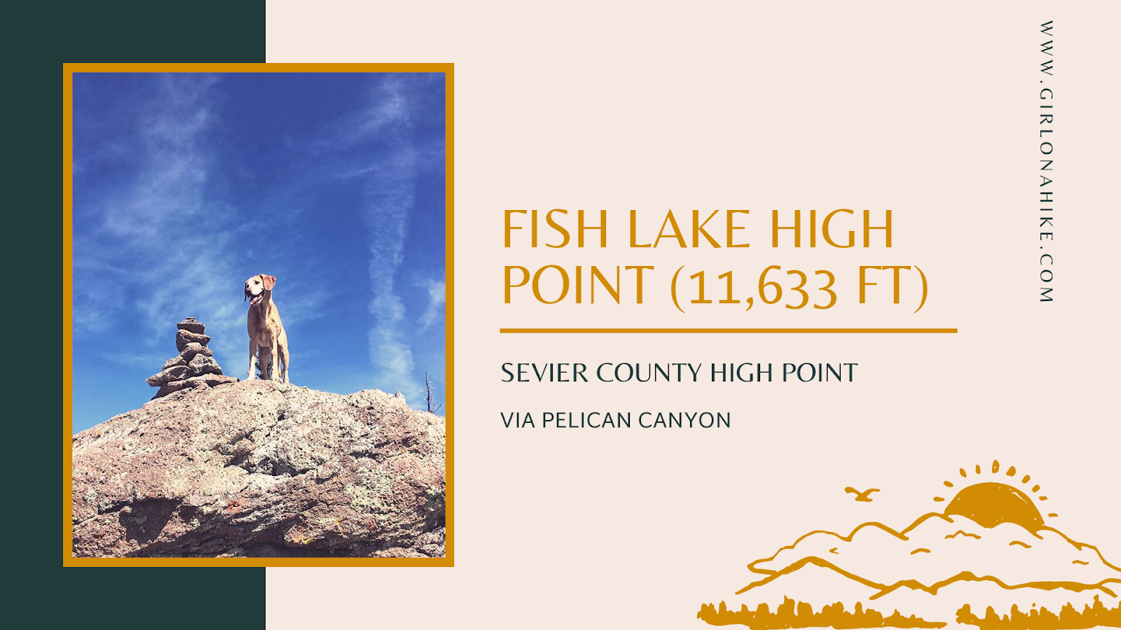
At 11,633 feet, Fish Lake Hightop is the highest peak in Sevier County and a must-do for those completing the Utah County High Points (CoHPs) list. I finally completed this peak as my last CoHP, and I was thrilled to finish the list!
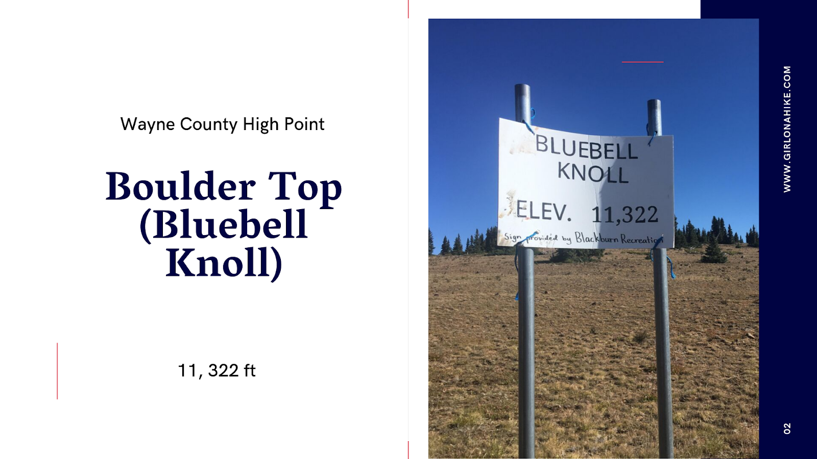
Boulder Top (aka Bluebell Knoll) sits at 11,322 ft high on the Aquarius Plateau, in-between Loa, Utah and Boulder, Utah. Most people come to this "peak" to mark it off their list on the Utah County High Points (CoHPs), for Wayne County. On that list, it is one of the easiest. It's not a hike, but rather a scenic drive with about a 10 minute walk to the summit, which sits in a grove of forested trees, yet also has a view of the nearby Raft Lake just below the summit.
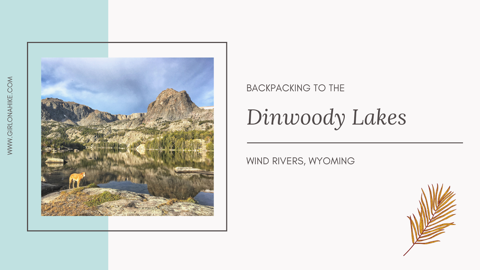

The Dinwoody Lakes area is located in the Wind River Range, and is a popular area for backpackers.
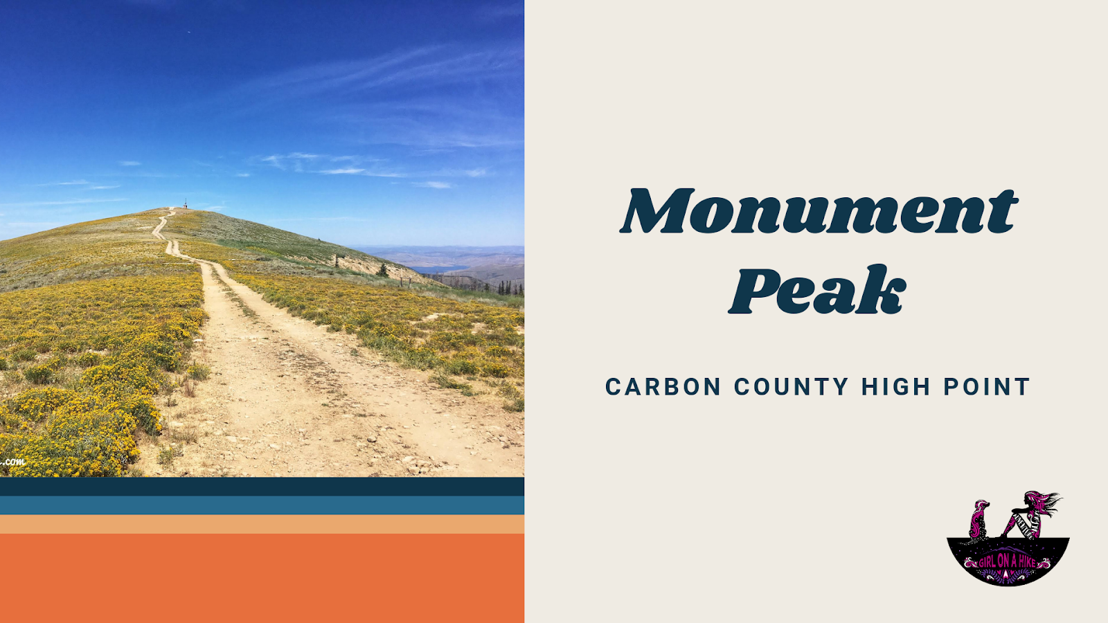
Monument Peak (10, 452 ft) is the the Carbon County High Point, and for those working on the Utah County High Points (CoHPs), this one is the easiest since you can drive to the summit. It's located along the Wasatch Plateau, and because its simply a drive, it should be combined with other CoHPs such as East Mountain and South Tent Mountain. There is nothing special about this peak except for the fact that you can see three CoHPs from the summit. The best time to drive here is in late Summer to Fall when the road is completely dry.
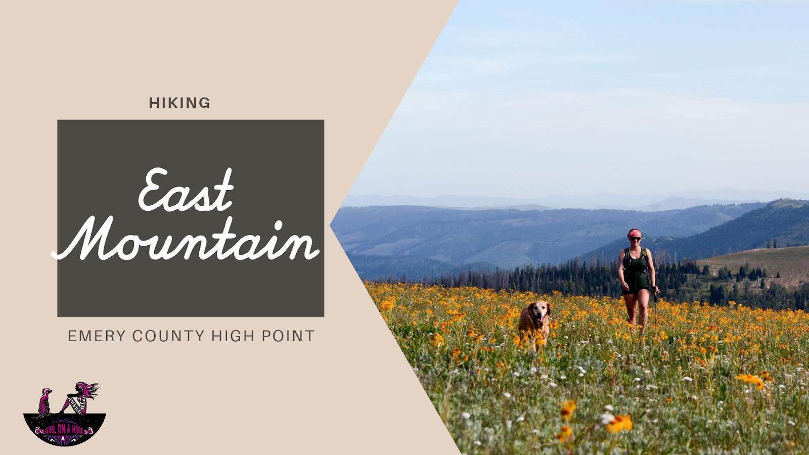
East Mountain (10,743 ft) is the Emery County High Point, and is one of several peaks along the Wasatch Plateau. The hike itself is straight forward, following a well-worn trail used by horses, hunters, and hikers. The main reason why people hike to this peak is for checking off the Utah County High Points (CoHPs) list. It's one of the easier CoHPs, and is often combined with Monument Peak, South Tent Mountain, or all three in one day. For our trip, we only did East & Monument on the same day since I had hiked South Tent Mountain a month earlier. From the summit you can see three CoHPs. Camping is plentiful and the drive is scenic. Both dogs and older kids can hike this route.
[lwptoc]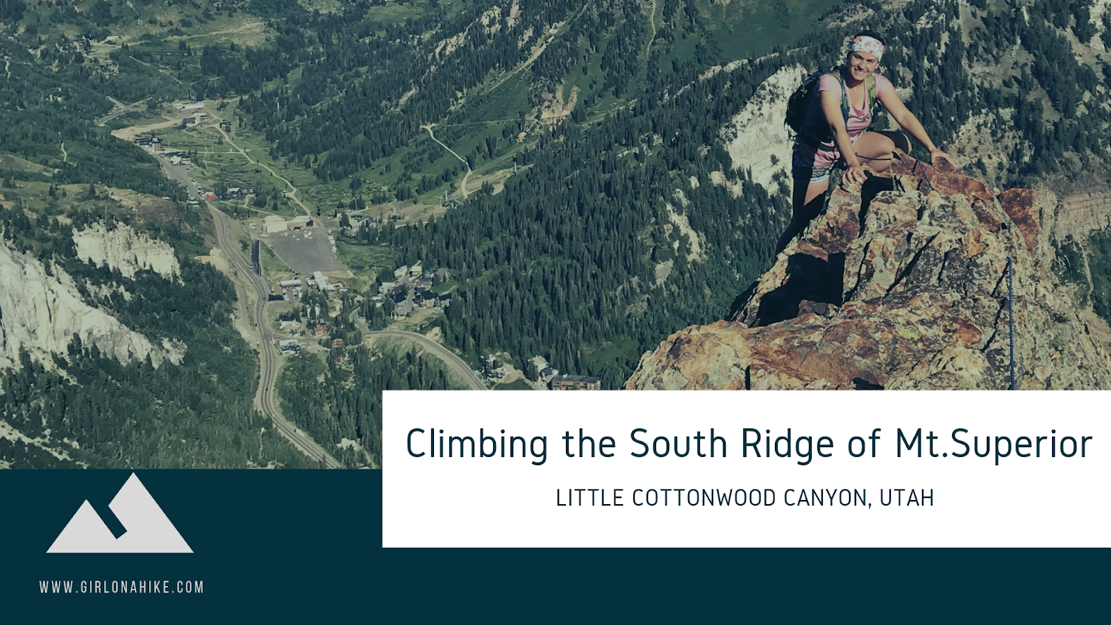
The South Ridge of Mount Superior is a well-known Class 5 scramble and a true gem for adventurous hikers in the Wasatch Mountains. While you can reach the summit via a more traditional hiking trail, this technical ridge route offers a more exhilarating and challenging ascent for experienced climbers.
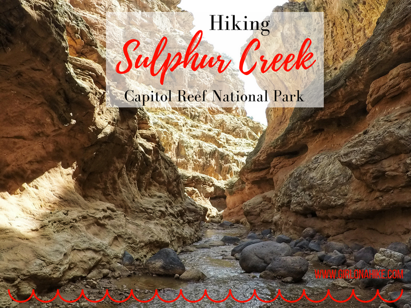
Hiking Sulphur Creek – Capitol Reef’s Hidden Water Canyon Adventure
Sulphur Creek is one of Capitol Reef National Park’s best-kept secrets—a stunning 6-mile water hike that winds through a narrow canyon filled with subway-like channels, layered red and orange sandstone, and three scenic waterfalls. Often compared to Zion's Subway or The Narrows, Sulphur Creek holds its own as a unique and thrilling adventure.
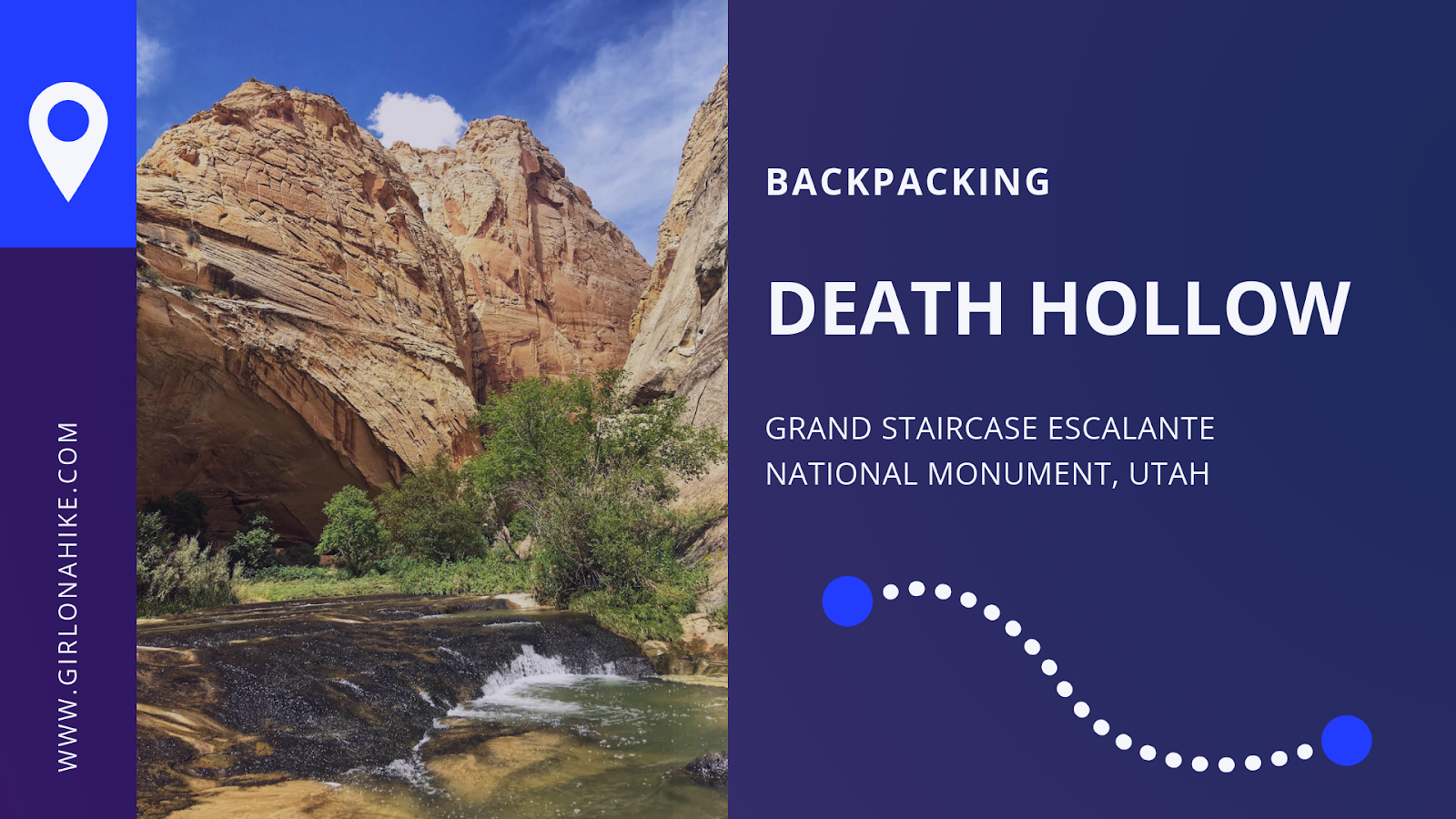
Death Hollow is located in Grand Staircase Escalante National Monument, just outside of Escalante, Utah. The first 6 miles of the trail follows the Boulder Mail Trail - the old route, that even up until 1924, the mules would carry mail on from the residents of Boulder, UT to Escalante, UT. Boulder, UT is right along Highway 12, which wasn't even paved until the 1970's, was the last area in the US to gain automobile access! No matter how much this area has changed due to technology, you'll immediately find yourself in the backcountry and won't see people for days. Over our 3 day adventure, my friend and I only saw two other people the entire time.