

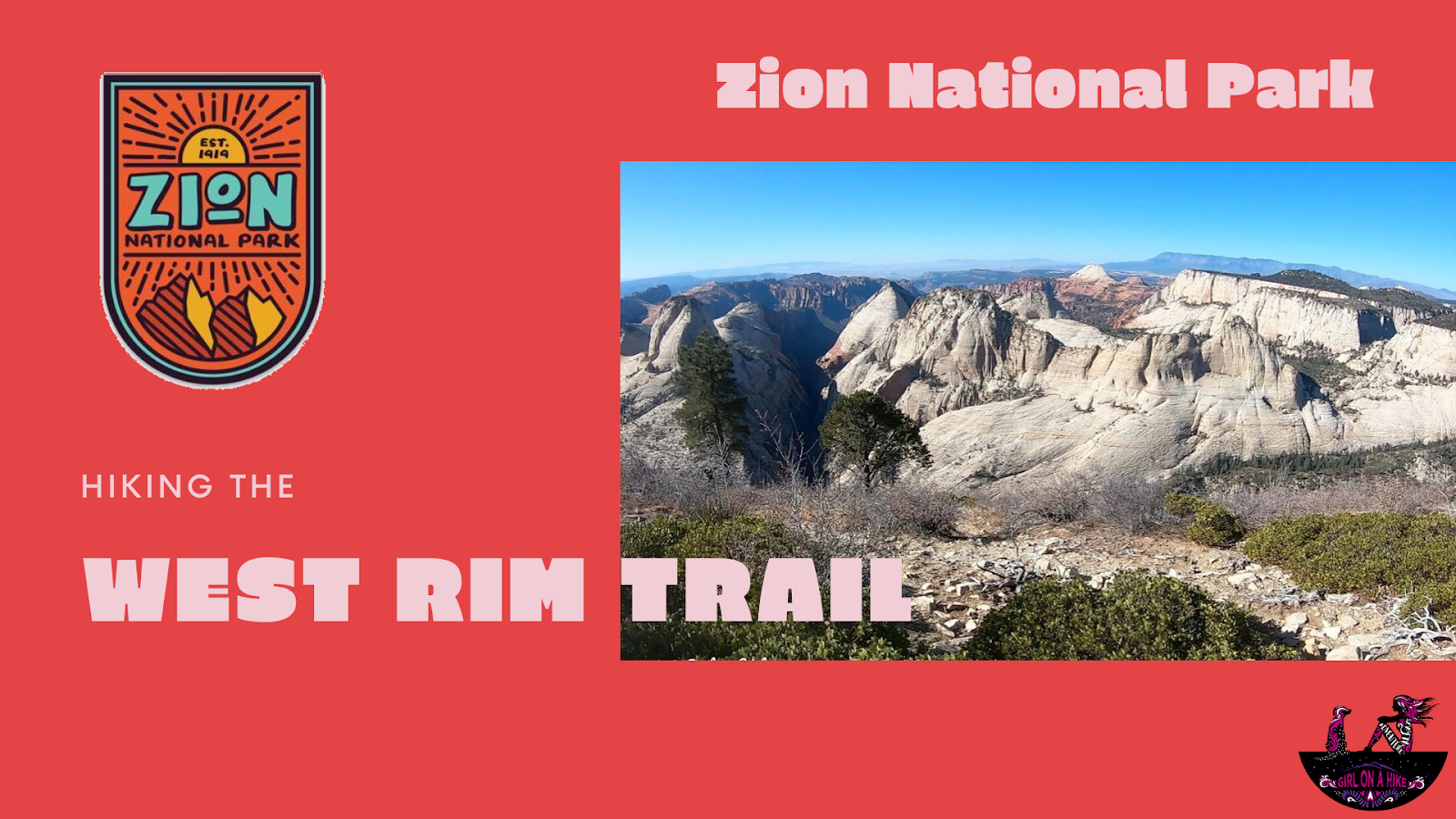
The West Rim Trail is located in Zion National Park (ZNP) and is one of several popular trails for day hikers and backpackers in the area.
12 Mile (Bishop Creek) Hot Springs – A Hidden Gem in Nevada
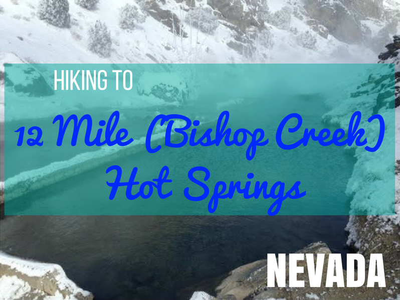
12 Mile Hot Springs, also known as Bishop Creek Hot Springs, is one of Nevada’s best-kept secrets—a natural, 102°F oasis located just 12 miles north of Wells, Nevada. With a flat 2-mile hike and relaxing, year-round access, this hot spring is perfect for families, couples, or solo adventurers looking for a peaceful soak surrounded by nature.
Did you know? Nevada has more natural hot springs than any other U.S. state, with over 300 spread across the region—most concentrated in the northern part of the state.
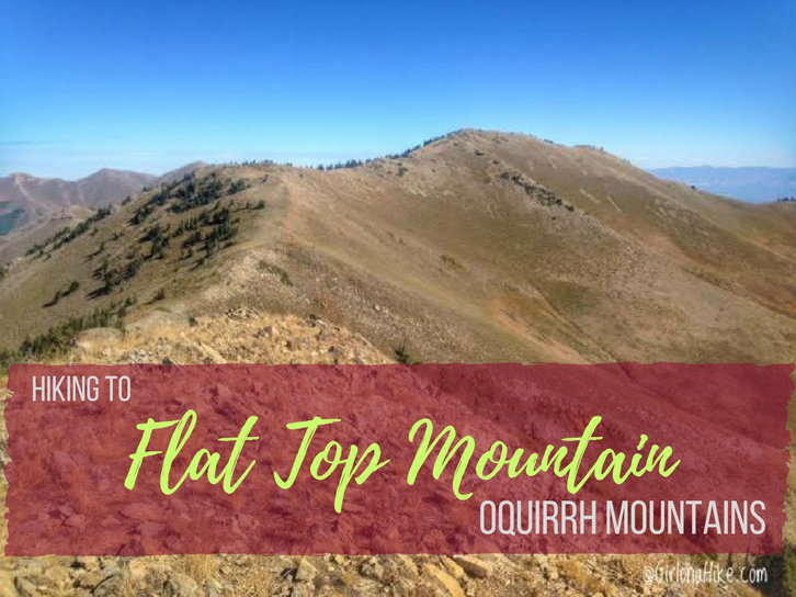
Flat Top Mountain (10,620 ft) is the highest peak in the Oquirrh Mountains (pronounced like "oaker") in Utah, which lies to the southwest of Salt Lake City. Most of the Oquirrhs are private property and mining land for the Rio Tinto Kennecott Mine, however the two areas you are allowed to hike are in Butterfield Canyon, and the Flat Top Mountain trail (update: 2019 land access below). Flat Top Mountain has a prominence of 5,370 ft, making it Utah's 6th highest prominent peak.
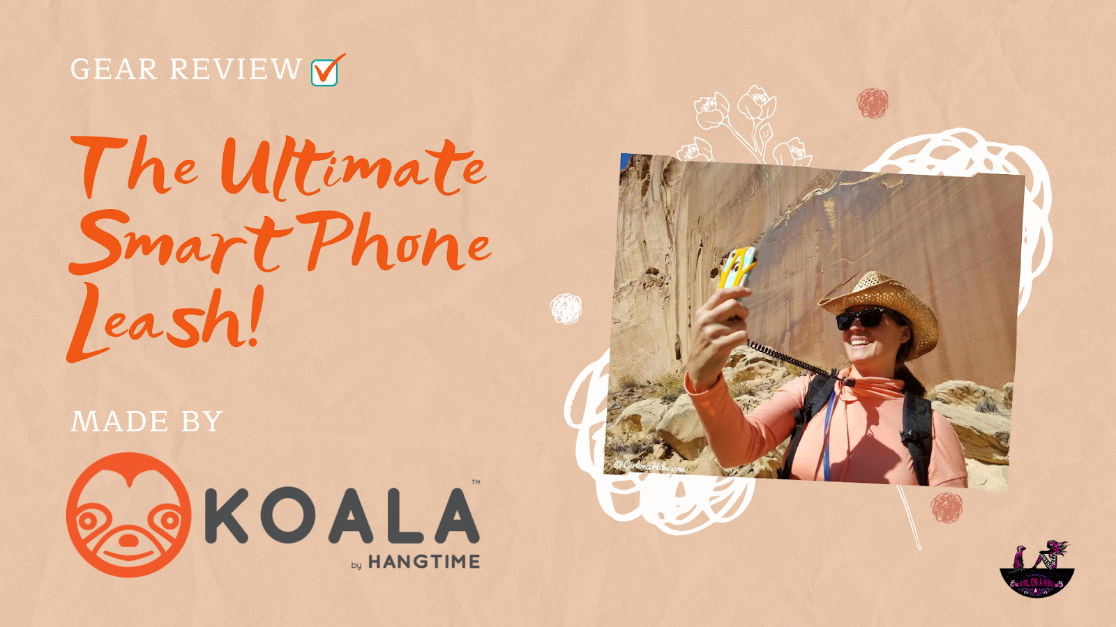
We all take selfies - and usually for me, I'm on a hike, climbing, or in my pack raft wanting to take one. But I'm really scared of dropping my phone! So when I discovered the Ultimate Smart Phone Leash, named "Koala", made by Hangtime Gear - I was "attached"!
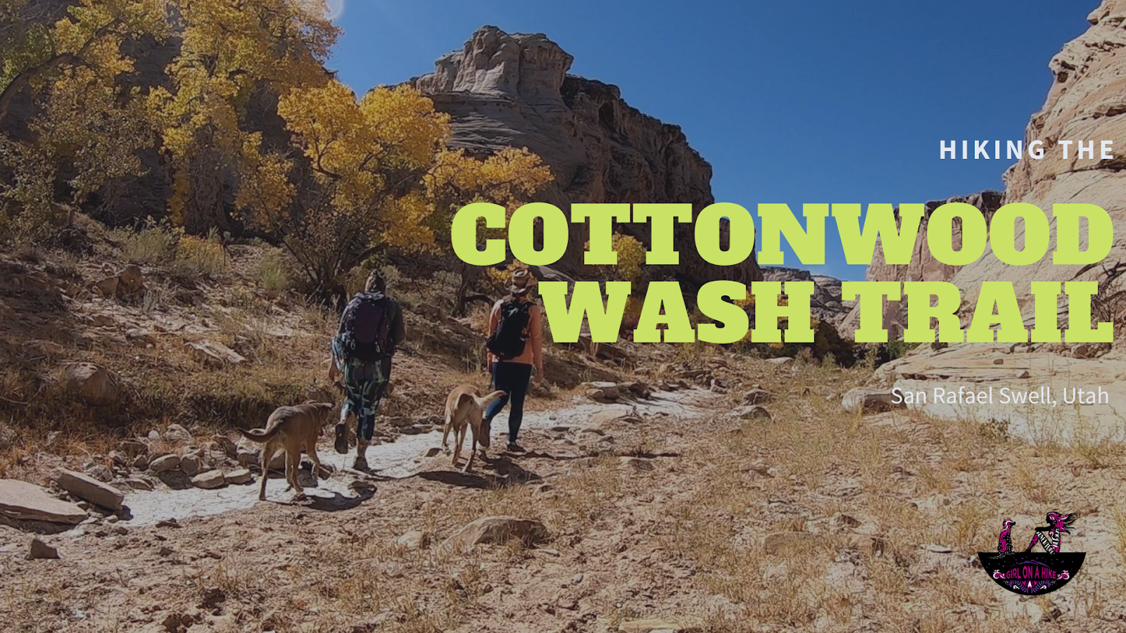
The Cottonwood Wash Trail is a hidden gem located in the heart of the San Rafael Swell, Utah. This easy, family-friendly hike features two impressive natural arches and several fascinating petroglyph panels. The trail is mostly flat, making it suitable for hikers of all skill levels. The only real incline is a short 100-foot section that leads up to the petroglyphs.
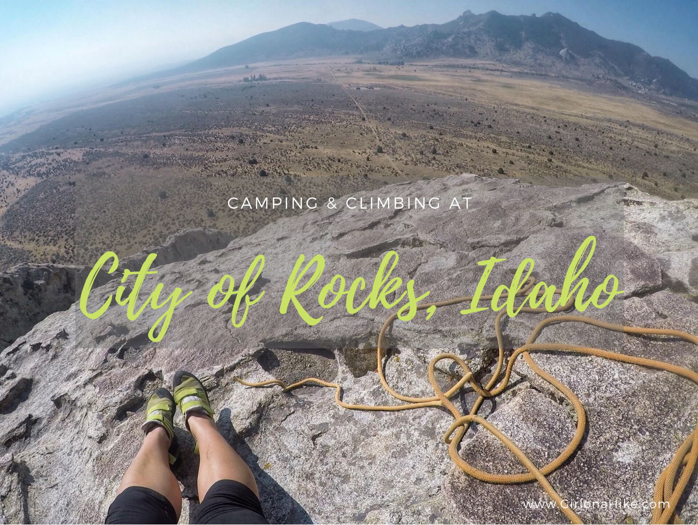
City of Rocks National Reserve is located near Almo, Idaho and is a popular area for climbing, hiking, camping, and learning about geology and local history. This area has several nicknames such as "the silent city", just "the city", and "steeple rocks", but whatever you want to call it, you're sure to find some adventure here. This area is rich with history, as pioneers made their way through this area along the California Trail. Several rocks, cabins, and replica wagons are marked with historical markers.
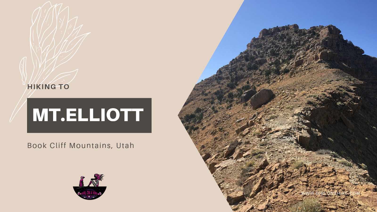
Hiking to Mt. Elliott (7,142 ft) – Book Cliffs, Utah
Mt. Elliott (elevation 7,142 ft) is a remote and rugged peak located in the Book Cliffs between Price, Utah and I-70. If you’ve ever driven from Salt Lake City to Moab, you've likely passed this distinctive peak without even realizing it. Near the small town of Woodside, UT, look southwest from the abandoned gas station (sometimes home to roadside jerky vendors), and you’ll spot Mt. Elliott’s jagged, isolated summit. It’s hard to miss—its sharp profile stands out against the surrounding ridgelines.
This obscure summit ranks #24 out of 29 on the Utah County Prominence Peak list, and due to its isolation and tough conditions, only a handful of hikers reach the summit each year.
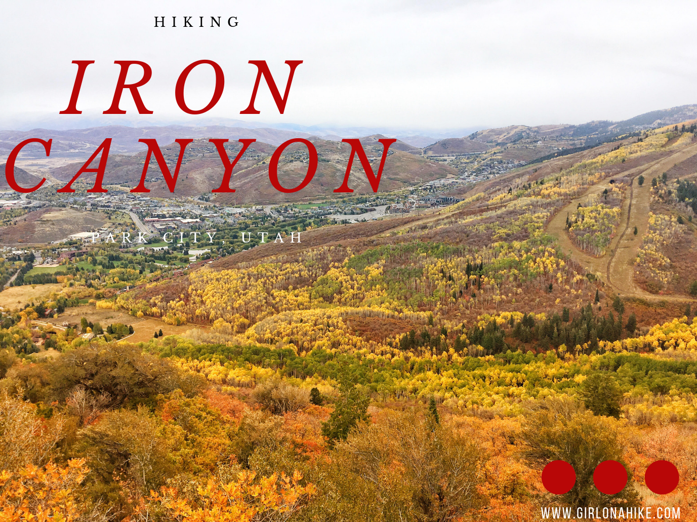
Iron Canyon in Park City, Utah is a beautiful, secluded trail that overlooks the Park City valley and the ski resorts. On a clear day you can see all the way out to the Uinta Mountains. The trail is more popular in winter as a fun sledding spot, but my favorite time to go is in early Summer when everything is turning green again. Most of the mountain is on private land, but the Iron Canyon trail allows for public access.
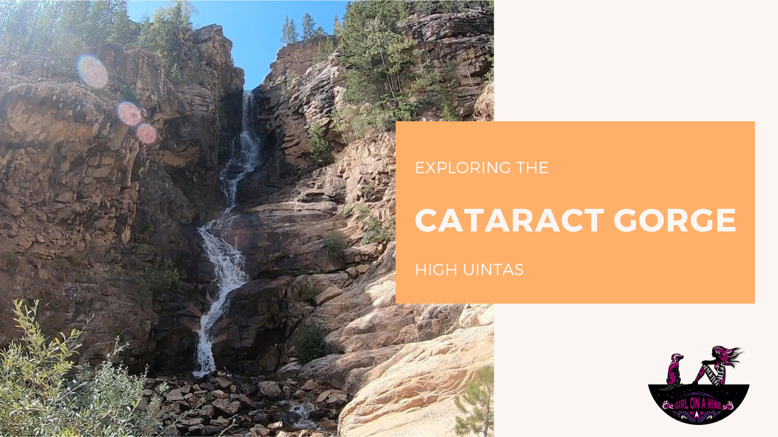
The Cataract Gorge is located near Murdock Basin in the High Uintas. After turning off the Mirror Lake Highway, you'll drive 3 miles along a well-graded dirt road until you reach the forest road intersection for FR027.