

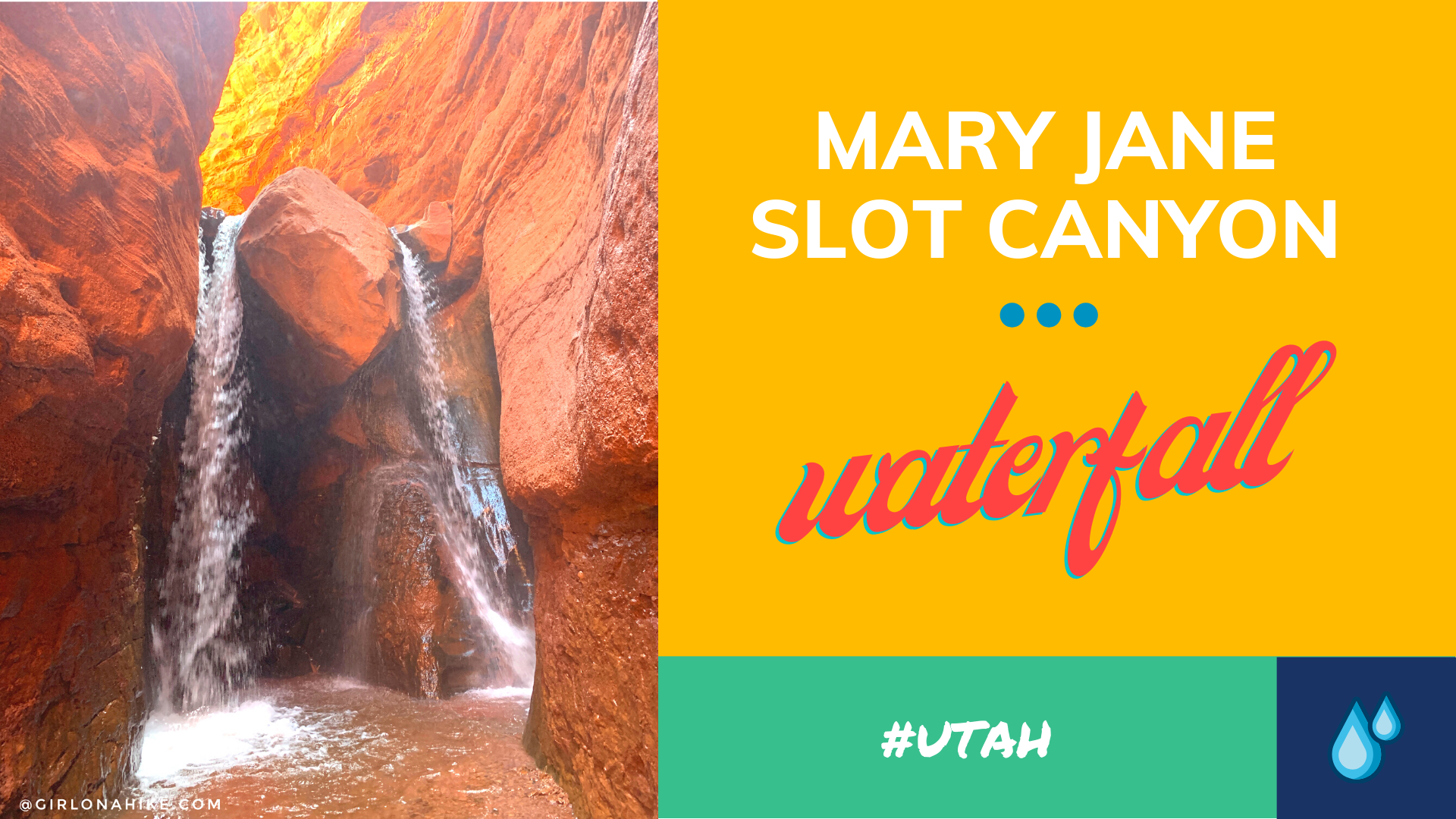
Mary Jane Slot Canyon is one of Moab's hidden gems - the "trail" is a creek the entire way, which leads to a 30 ft waterfall. This is a great trail to do when Moab is too hot, and you, the dogs, or kids need to cool off. The canyon walls get higher as you hike further into the canyon, and eventually will reach upwards of 100 ft! There are several side canyons that allow for exploring tighter slot canyons.
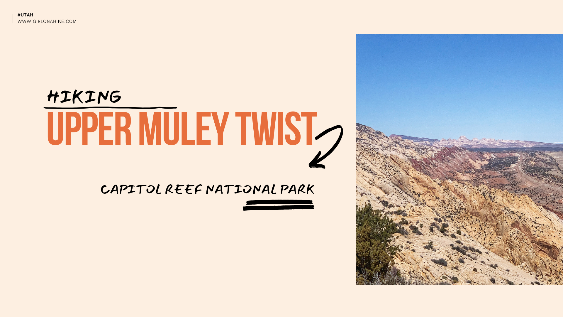

Hiking Upper Muley Twist is located in Capitol Reef National Park (CRNP), and this route covers extremely varied terrain - from deep and narrow, to high and exposed, all within a relatively short distance. It begins in a canyon paralleling the spine of the Waterpocket Fold, a 100 mile long ridge that juts out from the upper crust of the landscape. This long "monocline" is one of the longest in the world! The bizarre landscape is made of brilliantly colored rocks, including at least 7 visible arches, natural bridges, slot canyons, fins, domes, and more. Hiking Upper Muley Twist gives you the grand tour of this area, so it's a must-do!

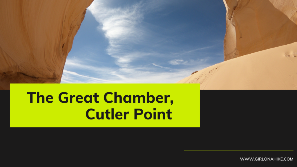
The Great Chamber at Cutler Point is a large open dome with a tall sand hill - perfect for photography. This is less of a hike and more of a scenic viewing area, as long as you can drive all the way! The roads are extremely sandy - high clearance and 4x4 is a MUST.
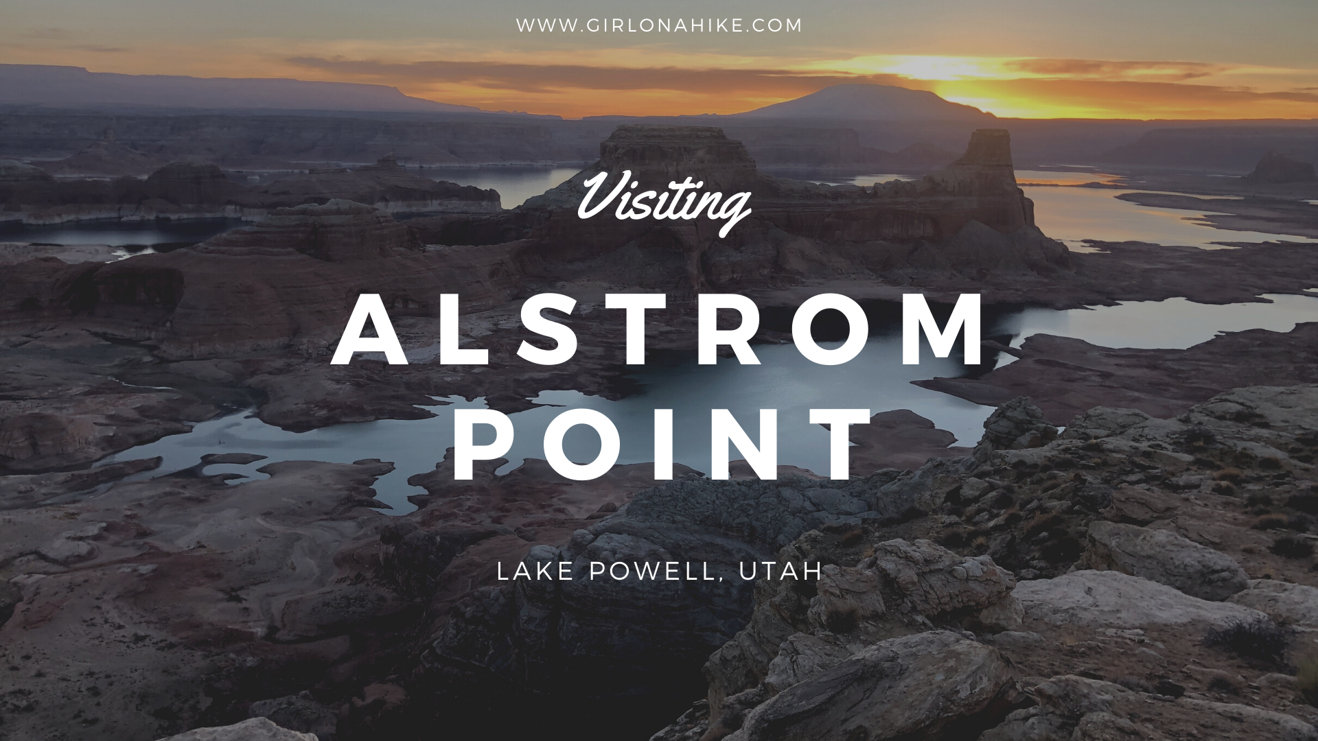

Alstrom Point is a vast, open overlook at the edge of Lake Powell, and offers amazing views of Gunsight Bay, Navajo Mountain, and tall red buttes. It's considered one of the best views in Southern Utah, and requires an SUV or larger to reach the end of the road at the overlook.
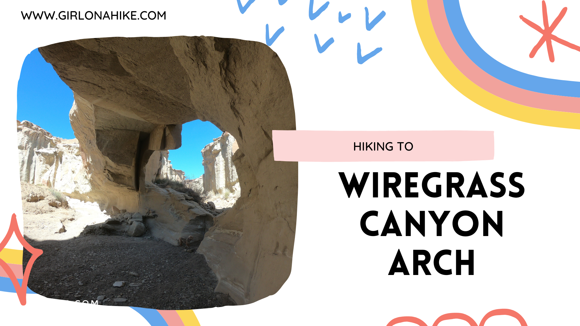
Wiregrass Canyon is one of many drainages that flow into Lake Powell, and offers a fun moderate hike. If you had a full day, you could reach the shore of Lake Powell, but most people only hike to the arch and back in just a few hours. Wiregrass Canyon Arch isn't the only attraction - tall, white canyon walls with two sections of light scrambling make this enjoyable for the whole family. The first 1/2 mile winds through a dry wash, before entering the canyon, where the fun begins.
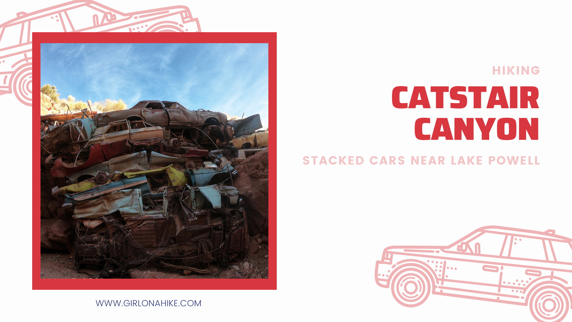

Hiking Catstair Canyon is a fun, quick, and easy hike for the whole family. It's only 0.5 miles RT, and leads to two sections of stacked cars right underneath HWY 89!
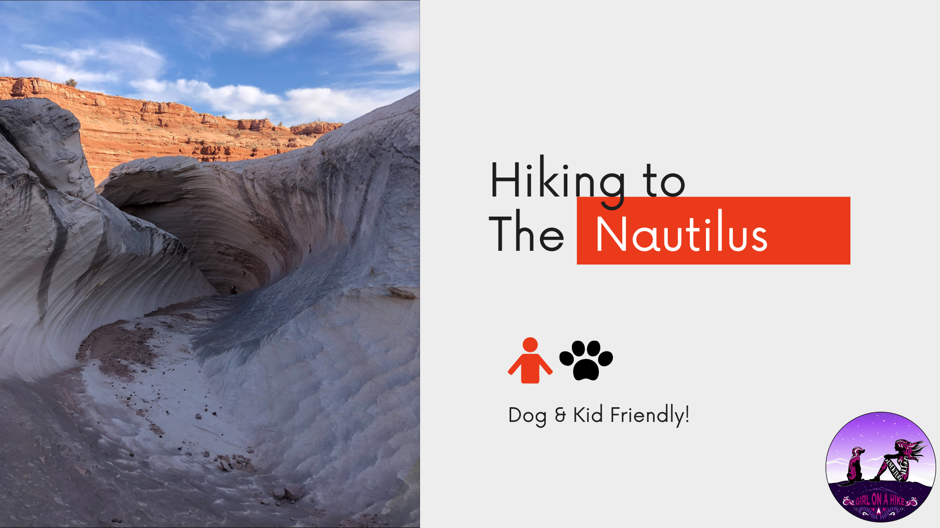

The Nautilus is a delicate and beautiful rock formation made of wind and water eroded sandstone, at the edge of a small ravine near the Paria River, a mere 9 miles Northeast of The Wave. The Nautilus is an outcrop of a soft, thin-layered rock with a rippled surface texture, with the formation of a corkscrew-like gully. It's reminiscent of a conch shell, hence the term nautilus.
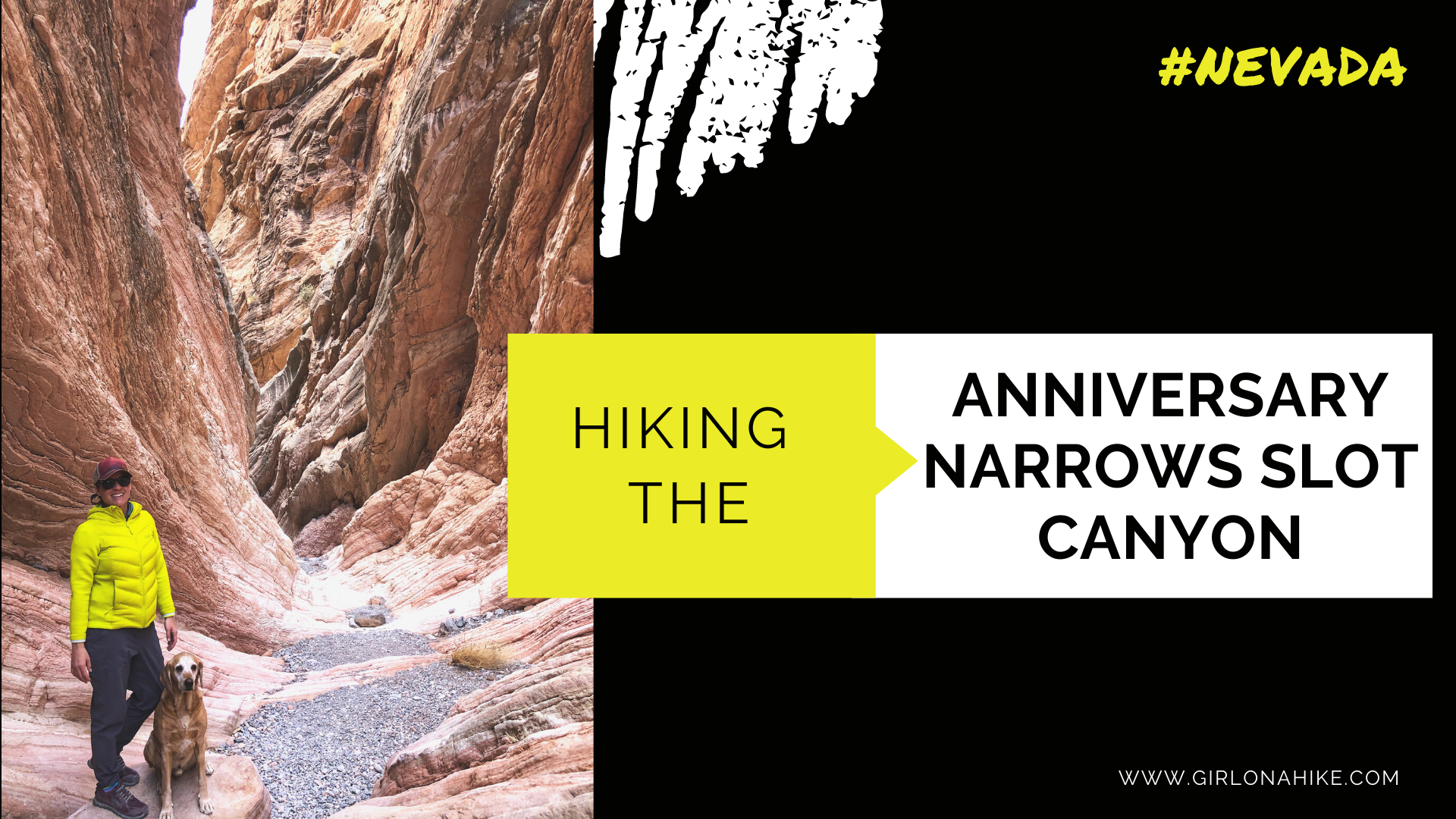
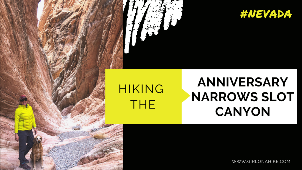
Anniversary Narrows Slot Canyon is located within the Lake Mead Scenic Byway area, just outside of Las Vegas, Nevada. Hiking this trail is best November through March when the temperatures are much cooler.
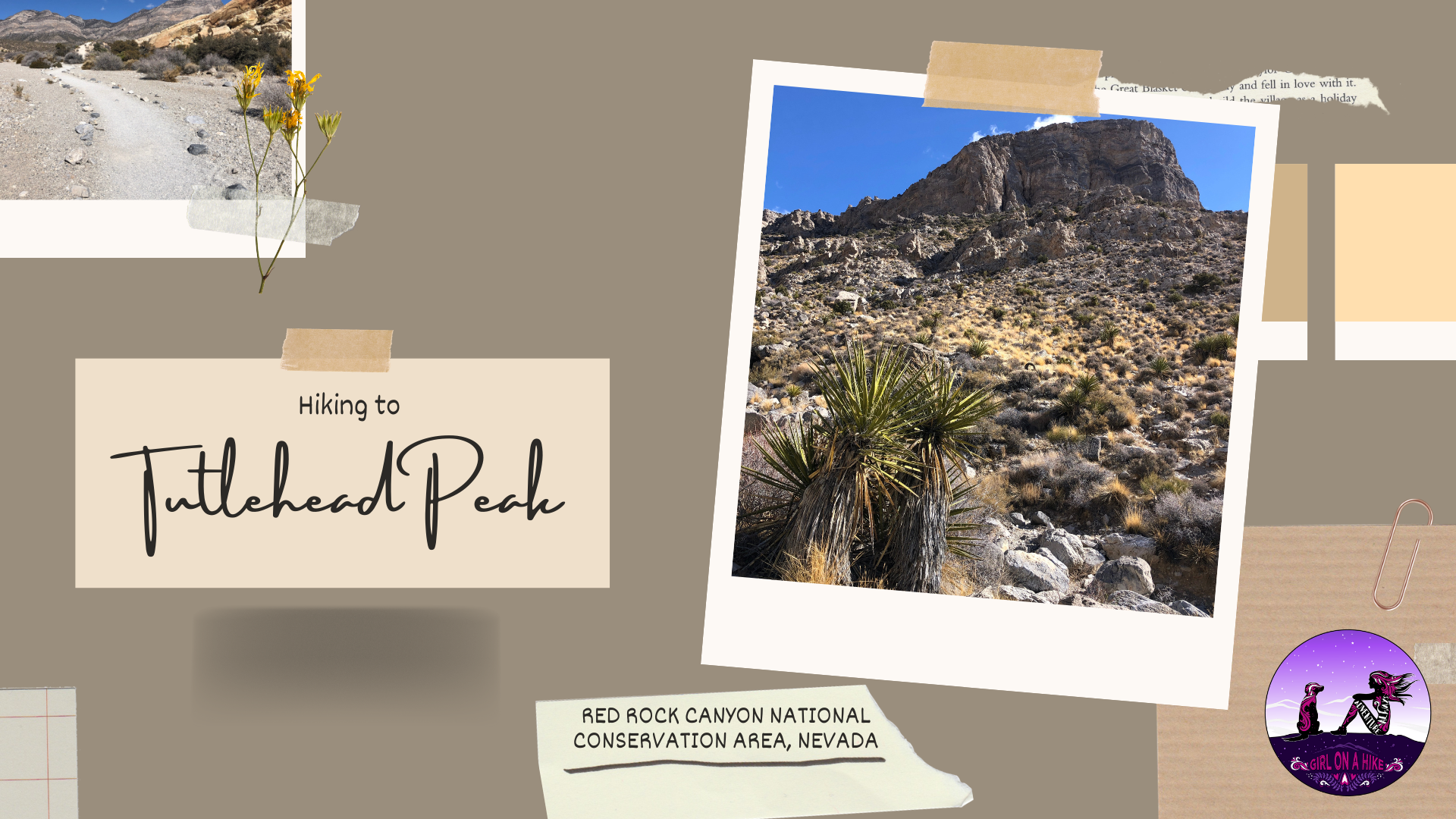

Turtlehead Peak (6, 323 ft) is located in Red Rock Canyon National Conservation Area, and one of the most popular hikes in the park. To reach the trailhead (TH) you must have a timed entry reservation for Red Rocks (get that here), and start hiking early to beat to people all the people and weather. Turtlehead Peak offers amazing views of the entire area, and on a clear day you can even see the Las Vegas Strip!
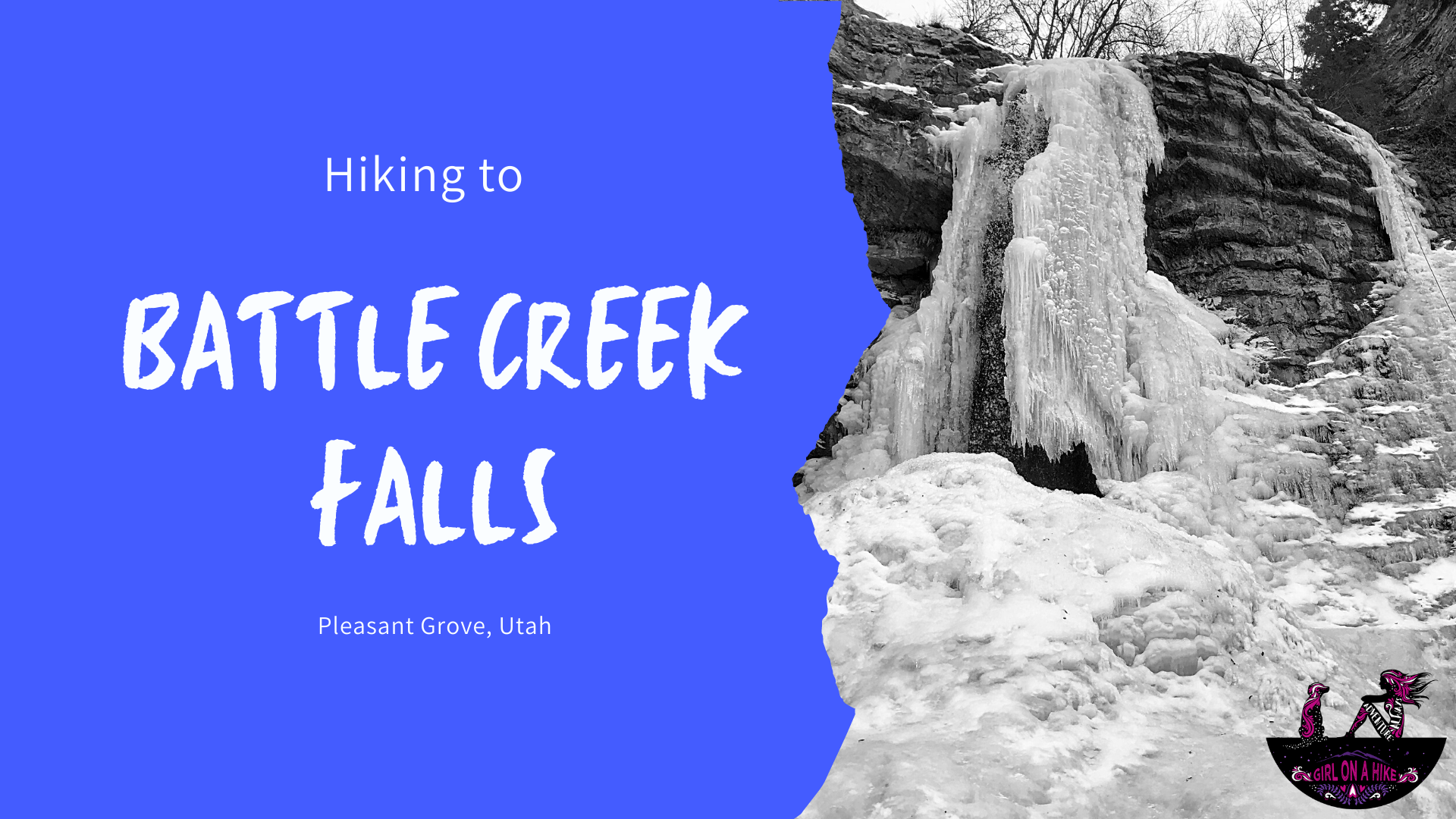
 Battle Creek Falls is another family friendly, dog friendly, and child friendly waterfall hikes that is enjoyable as more of a stroll rather than a "hike". It's short distance and elevation gain make this hike do-able for family visiting from out of town that want to see something pretty, yet not have to work hard to get there.