

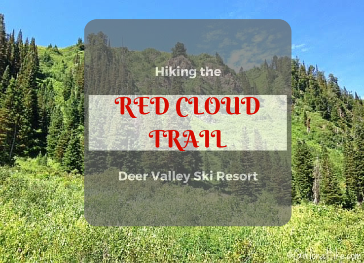
Hiking the Red Cloud Trail at Deer Valley Ski Resort is a very scenic hikers-only trail that begins at the Silver Lake Village, at an elevation of 8,100 ft. Many people do not know that anyone can hike at Deer Valley for free! You don't have to be a member or have to have a "friend of a friend" to be able to visit and hike on the mountain during the Summer months. If fact, you can hike to any peak or on any trail, and ride the chair lift down for free. This hike was apart of the free guided monthly Deer Valley History Hike.
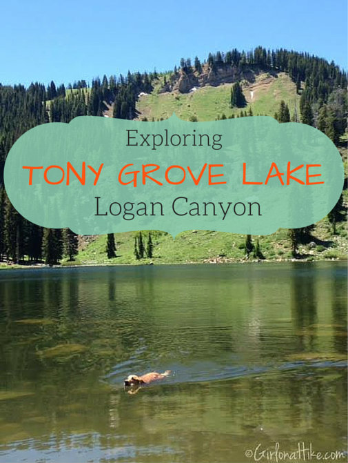
Tony Grove Lake is a popular summer hang out and camping area in Logan Canyon, Utah, about and hour and half drive from SLC. Not only is it dog friendly (off leash) and kid friendly, you can take your kayak or SUP on the lake, there's camping on the southern end of the lake or at the official campground, there's picnicking, hiking, fishing, and will definitely offer something for everyone in the family. Many people head for for just the day to explore Naomi Peak and White Pine Lake as well, or bring a camp chair and enjoy nature along the lake.
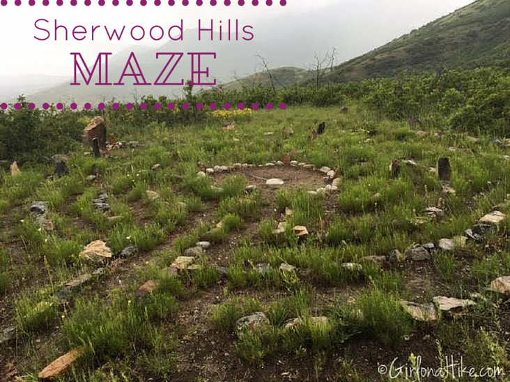
The Sherwood Hills Maze (or Labyrinth) in the foothills of Orem, Utah offers more of a spiritual destination, rather than say, an overlook. This area is not well know, and my friends who live in the area would like to keep it that way. Plus, I really wouldn't recommend this trail to anyone - there is a lot of overgrowth, bushwhacking is required, you have to be very careful about skirting around the private property in the area.
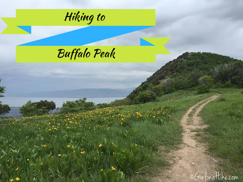
Most peaks require hours of effort and are typically suited for hikers with a lot of back-country experience, yet Buffalo Peak near Orem, Utah is a peak for the whole family to enjoy (even the dogs!). With the low elevation gain, and short distance, even children will be excited to summit this "peak". You can reach the summit in under 15 minutes at a moderate hiking pace, or closer to 30 minutes with children. Buffalo Peak offers a fantastic view of Utah Valley to the West, and the Cascade ridgeline to the East. Late Spring and Early summer is the best time to hike here while the wildflowers are blooming.
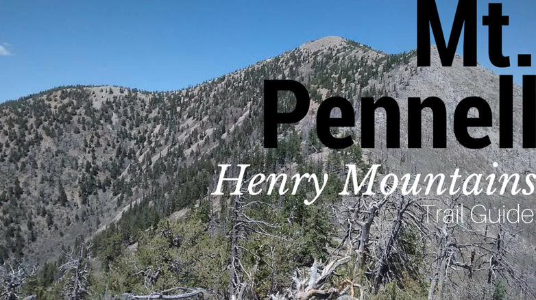
Mt. Pennell (11,371 ft) is the 3rd highest point in the Henry Mountains, coming in after Mount Ellen and Mt. Ellen Peak. The Henry Mountains are off the beaten path for most hikers, but the range itself is a peak baggers dream! 5 of Utah's 81 prominence peaks are found in the Henry's: Mount Ellen (#3), Mt. Pennell (#26), Mt. Hilliers (#32), Mt. Ellsworth (#42), and Mt. Holmes (#64); the last two peaks are also known as the "Little Rockies." Take a few days to spend here, and you could knock out all five peaks.
GUEST POST by Katie Wanders Katie Wanders follows New England native, Katie, around the globe. Katie swapped her oceans for mountains and moved to Utah for two years to see what "Life Elevated" was all about. Katie Wanders follows trips around the American West, adventures along the coasts, trips abroad, and showcases her love of New England. Currently, you can find her in a 2016 Penske truck with her dog and cat, wandering around National Parks and making her way back to the Atlantic. You can follow all of her adventures on Facebook, Instagram, and Pinterest!
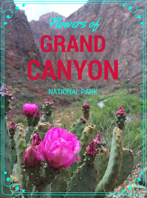
While Backpacking the Bright Angel Trail and Ribbon Falls in Grand Canyon National Park, I was amazed at all the beautiful flowers appearing for Spring along the canyon. Bright pinks, purples, lavender, and yellow flowers appeared everywhere! I couldn't help but stop and take a photo of each type of flower I came across.
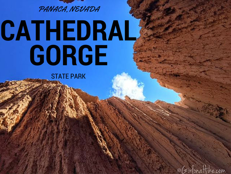
Cathedral Gorge State Park in Panaca, NV is a hidden gem in the heart of the Great Basin Desert. The Great Basin Desert is the largest US desert, which covers an arid expanse of about 190,000 square miles and is bordered by the Sierra Nevada Range to the West, and Rocky Mountains to the East. At the South East corner of Nevada sits Cathedral Gorge State Park, which exposes erosion that has carved unique patterns in the soft bentonite clay.
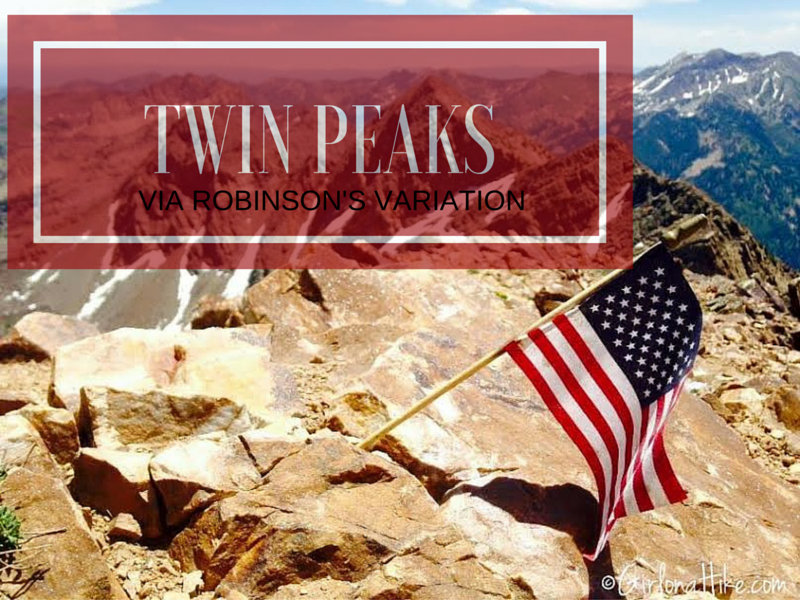
Broads Fork Twin Peaks in Big Cottonwood Canyon via Robinson's Variation is not for the weak nor beginner hiker. It's a tough, long day. If you've done any research on this peak, you've seen several routes that will lead you to the top. My friend who lead us on this hike, had done it other the ways, but wanted to try this route out. I was up for anything! He had heard it was do-able, but steep. Robinson's Variation was also appealing to us because it could be done as a loop hike - up Robinson's, summit, then down the traditional Broad's Fork route.