

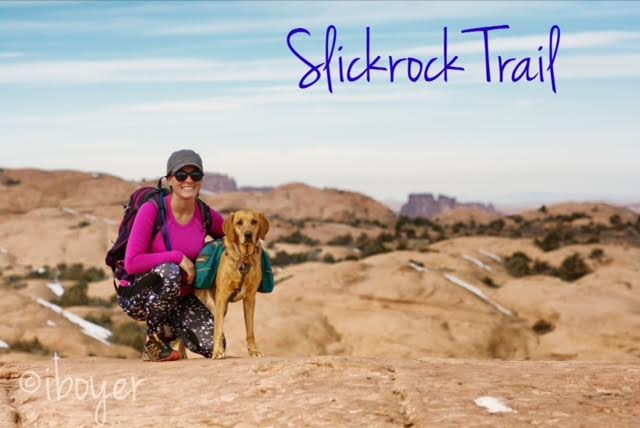
Slickrock Trail, the world famous mountain biking trail, is located in Moab, Utah. Most people bike this 10.5 mile loop, but we hiked it! Slickrock Trail is located at the Sand Flats Recreation Area, about 10 minutes outside of Moab, where we also camped for two nights. This trail is popular for its scenic, rugged expanse of Navajo Sandstone, the remnant of wind blown sand dunes. Slickrock Trail was established in 1969 for motorcycles, but the trail is now popular for both mountain bikes and motorcycles - it is closed to all four-wheeled vehicles.
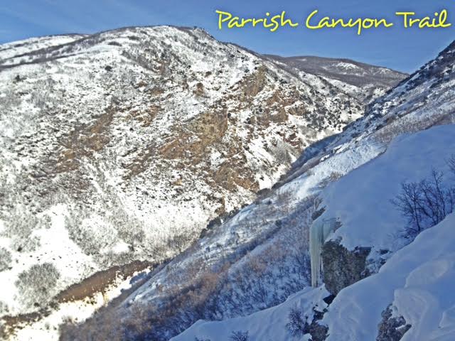
The Parrish Canyon Trail starts along the Wasatch Mountains in Centerville, Utah. Despite its name, the hike actually takes you up the face of the mountain, over a course of several switchbacks, gaining elevation steeply until you have beautiful views of Davis County. This is a nice hike to do in Winter to get out of the inversion and to get the dogs out. If you hike up the actual creek, about 1/2 mile up you will see the Parrish Creek Pictographs. In Winter they are not usually visible due to snow.
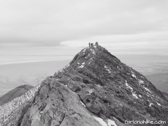
I debated on creating a post for our attempt to Pilot Peak (10,720 ft), mainly because we didn't actually summit. I realized that not every summit will be successful or the most enjoyable, but at least I can share my experience with everyone, and I hope that this can help somewhat guide you and not make the same mistakes we did.
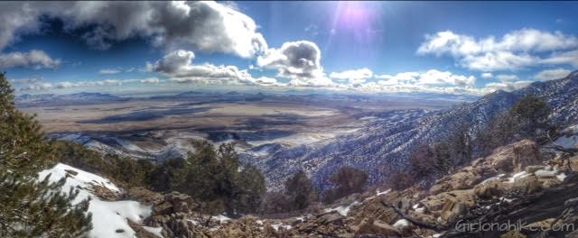
Tetzlaff Peak (6,267 ft) is located in the West Desert in the Silver Mountain Range, northeast of Wendover, UT. It is an obscure peak, meaning that hardly anyone has hiked it because of its location, it can be somewhat hard to get to the TH, and simply because no one has heard of it. It's not the tallest peak in the Silver Mountains (Graham Peak is the tallest) but it's definitely a worthy peak to bag. It's perfect for summiting in the winter months when avalanche danger is high in the Wasatch Mountains, and you are looking to escape hiking in snow. The peaks in the Silver Mountains offer no trail, no shade, and no water, so hiking here in Winter is not as harsh. I highly recommend you don't hike this area in Summer when the temperatures are extremely hot.
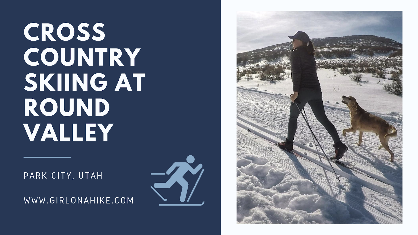
Round Valley is one of my favorite places in Utah to cross country (xc) ski, mainly for two reasons: 1) it's free 2) dogs can be off leash! What's better than that?! Round Valley also has groomed tracks and a wide enough space for skate skiers.
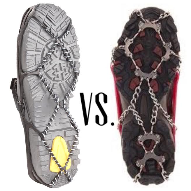
One of the most common questions I get from winter hikers is:
"What’s the difference between Yaktrax and Microspikes?"
In this post, I’ll break down the pros and cons of both traction devices. If you’ve ever wondered who wins in the battle of Yaktrax vs Microspikes, this guide will help you decide which is best for your winter hiking adventures.
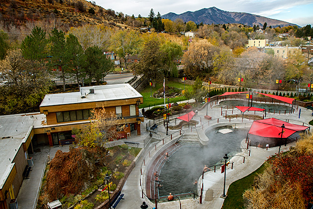
Lava Hot Springs is located in Idaho, about a 2 hour drive north of Salt Lake City. The natural, geothermal hot springs range in temperatures from 102F-112F degrees. The hot water is full of minerals, but has no sulfur, and therefor no bad smells of rotten eggs lurking in the air. Lava Hot Springs is open year round, but the best time to go, of course, is the Winter months. With five outdoor hot pools, the steam from the hot springs wraps around people and creates a very relaxing atmosphere. The red tents above provide shade on sunny days. Be sure to bring plenty of water and a snack to the hot springs - sitting for too long in hot water will dehydrate you and will make some people feel faint.