

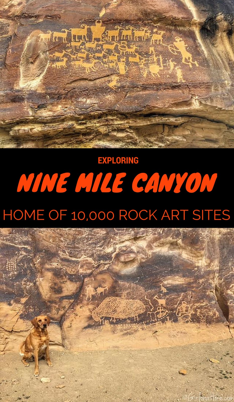
From its name Nine Mile Canyon, you'd imagine that it would literally be nine miles. In reality, Nine Mile Canyon is actually a 70 mile long Backcountry Byway. The BLM believes it derived its name from, when in 1869, John Wesley Powell was exploring the Green River. The expeditions cartographer used a nine mile transect for mapping and the canyon retained that name.
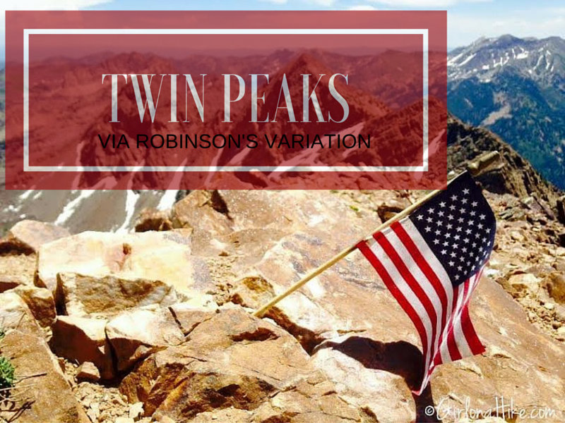
Broads Fork Twin Peaks in Big Cottonwood Canyon via Robinson's Variation is not for the weak nor beginner hiker. It's a tough, long day. If you've done any research on this peak, you've seen several routes that will lead you to the top. My friend who lead us on this hike, had done it other the ways, but wanted to try this route out. I was up for anything! He had heard it was do-able, but steep. Robinson's Variation was also appealing to us because it could be done as a loop hike - up Robinson's, summit, then down the traditional Broad's Fork route.
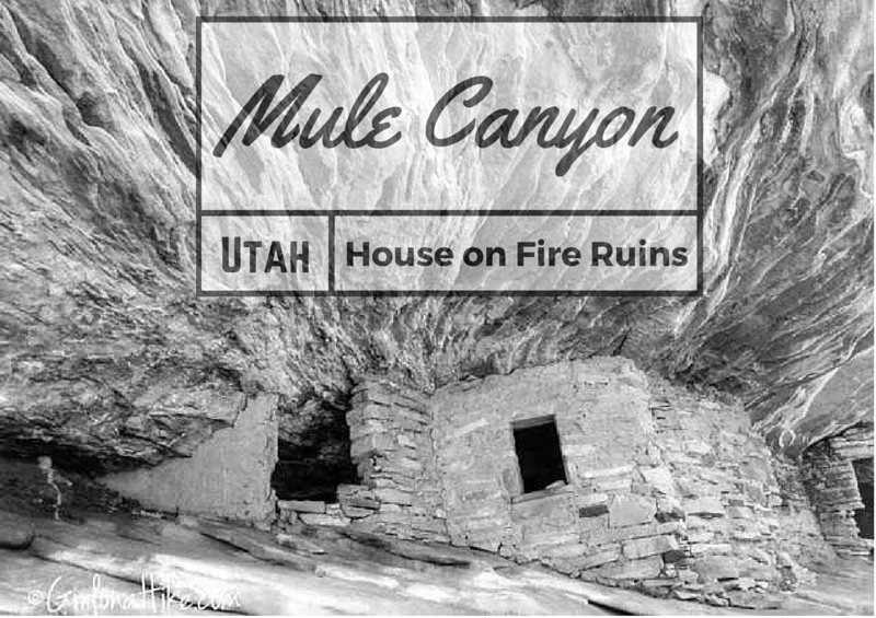
The famous "House on Fire" ruins lie Mule Canyon, in between Natural Bridges National Monument and Blanding, Utah. Southeast Utah is home to the most numerous and varied collection of ruins, spread over a remote area of about 30 by 25 miles. Besides hundreds of ruins, mostly cliff dwellings, the Cedar Mesa area contains many petroglyphs and pictographs, all between 800 - 2000 years old from the Anasazi and Pueblo Indians. Most are found in canyons, where water was easily accessible and conditions were cooler in summer months. All land is public, managed by the BLM, and as of 2016 is protected under the Bears Ears National Monument.
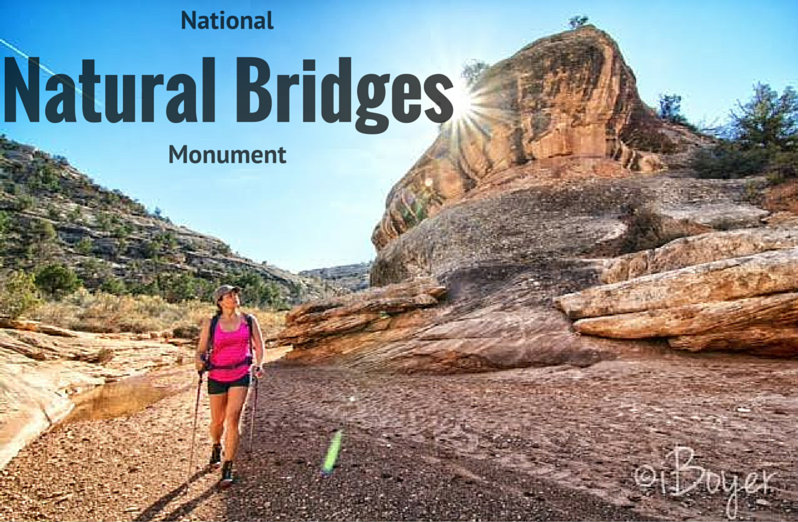
Natural Bridges National Monument covers a small area of SE Utah, and is therefore very remote and not close to any of "Utah's Mighty Five" National parks.
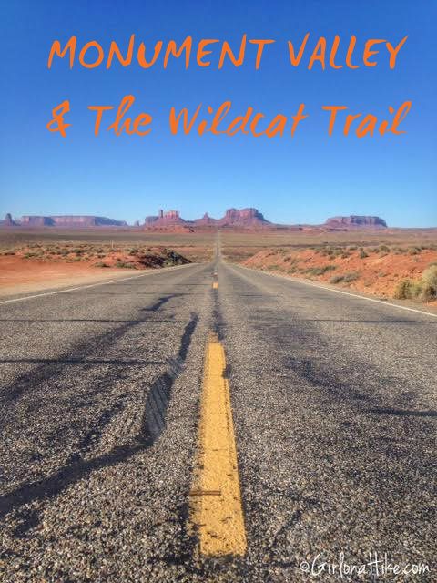
Visiting Monument Valley Navajo Tribal Park – Scenic Drive & Wildcat Trail Hike
Our Day Trip from Goosenecks State Park
On our first full day exploring Southeastern Utah, we crossed the state line into Arizona to visit Monument Valley Navajo Tribal Park. From our base camp at Goosenecks State Park, the drive took just 45 minutes—an easy and scenic route.
When planning our trip, we initially considered taking a guided tour. However, due to budget constraints, we looked into self-guided options instead. It’s important to note that Monument Valley regulations prohibit visitors from leaving their vehicles on the scenic drive to hike around iconic formations like the Mittens—unless accompanied by a Navajo guide or holding a permit..
Thankfully, we discovered that one trail is open to the public without a guide: the Wildcat Trail, a must-do if you're exploring the area on a budget or prefer hiking at your own pace.
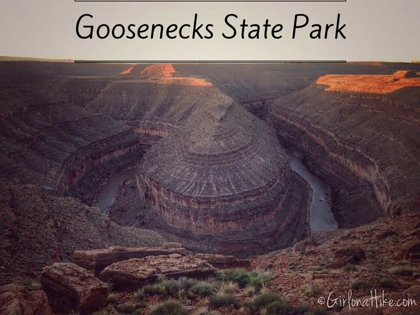
High above the meandering San Juan River, lies Goosenecks State Park. This largely undeveloped park is home to a rare geological featured known as the Entrenched Meander. This refers to a river that is confined to a canyon or gorge, and in most cases is narrow with very little or no flood plain. The headwaters of the San Juan River are in the San Juan Mountains of Southwestern Colorado, which is the origin for 90% of the rivers' flow. The river flows 360 miles from its source, starting at an elevation of 14,000 ft and dropping to just 3,600 ft at Lake Powell.
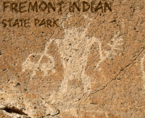
Exploring Fremont Indian State Park After Mystic Hot Springs
After a relaxing soak at Mystic Hot Springs, we continued west on I-70 for about 20 minutes until we arrived at Fremont Indian State Park. This underrated gem is packed with fascinating history, scenic trails, and cultural insights into one of Utah’s oldest Indigenous communities.
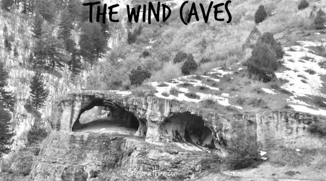
The Wind Caves Trail is located in Logan Canyon about 1.5 hours northeast of SLC. Our plan was to make a day trip of it, and hike this trail and one across the road called The Crimson Trail, which gets you above the China Wall.
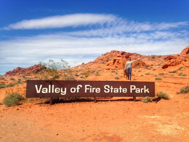
Valley of Fire State Park is the oldest Nevada State Park, which was dedicated in 1935. It covers approximately 35,000 acres, and was named appropriately for the magnificent red sandstone formations that resemble a realm of flames. These formations resulted from the shifting sand dunes more than 150 million years ago in the Mesozoic Era. Surrounding rock includes limestone, shale, and conglomerates.
The Sand Flats Recreation Area is located just outside of Moab, UT, about 5-10 minutes to the East. Sand Flats is a nationally significant public land area at the heart of the Colorado Plateau. With high slickrock domes, bowls, and fins, it meets the colorful mesas with views of the La Sal Mountains to the East. Just to the North lies Arches National Park, and to the West, Canyonlands National Park. Sand Flats is home to one of the most famous mountain biking and hiking trails, Slickrock Trail and the nearby Grandstaff Canyon. Sand Flats is managed through Grand County and the BLM.