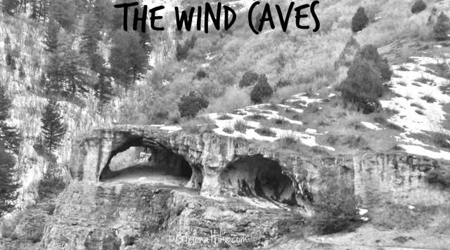
The Wind Caves Trail is located in Logan Canyon about 1.5 hours northeast of SLC. Our plan was to make a day trip of it, and hike this trail and one across the road called The Crimson Trail, which gets you above the China Wall.
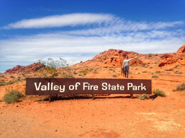
Valley of Fire State Park is the oldest Nevada State Park, which was dedicated in 1935. It covers approximately 35,000 acres, and was named appropriately for the magnificent red sandstone formations that resemble a realm of flames. These formations resulted from the shifting sand dunes more than 150 million years ago in the Mesozoic Era. Surrounding rock includes limestone, shale, and conglomerates.
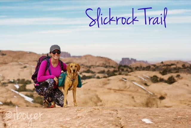
Slickrock Trail, the world famous mountain biking trail, is located in Moab, Utah. Most people bike this 10.5 mile loop, but we hiked it! Slickrock Trail is located at the Sand Flats Recreation Area, about 10 minutes outside of Moab, where we also camped for two nights. This trail is popular for its scenic, rugged expanse of Navajo Sandstone, the remnant of wind blown sand dunes. Slickrock Trail was established in 1969 for motorcycles, but the trail is now popular for both mountain bikes and motorcycles - it is closed to all four-wheeled vehicles.
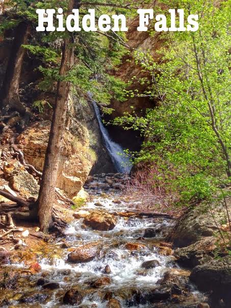
Hidden Falls is a quick walk off the side of the road up Big Cottonwood Canyon - with only a .07 mile walk up the road, there's no good reason to pass it up! This is perfect in Spring when the waterfall is running full. On the 5 minute walk you will also pass by an old, closed off mine. This walk is perfect for those with little kids or family visiting that aren't big hikers but still want to see pretty scenery.
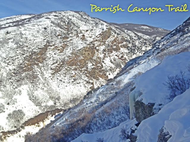
The Parrish Canyon Trail starts along the Wasatch Mountains in Centerville, Utah. Despite its name, the hike actually takes you up the face of the mountain, over a course of several switchbacks, gaining elevation steeply until you have beautiful views of Davis County. This is a nice hike to do in Winter to get out of the inversion and to get the dogs out. If you hike up the actual creek, about 1/2 mile up you will see the Parrish Creek Pictographs. In Winter they are not usually visible due to snow.
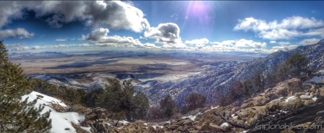
I debated on creating a post for our attempt to Pilot Peak (10,720 ft), mainly because we didn't actually summit. I realized that not every summit will be successful or the most enjoyable, but at least I can share my experience with everyone, and I hope that this can help somewhat guide you and not make the same mistakes we did.
Tetzlaff Peak (6,267 ft) is located in the West Desert in the Silver Mountain Range, northeast of Wendover, UT. It is an obscure peak, meaning that hardly anyone has hiked it because of its location, it can be somewhat hard to get to the TH, and simply because no one has heard of it. It's not the tallest peak in the Silver Mountains (Graham Peak is the tallest) but it's definitely a worthy peak to bag. It's perfect for summiting in the winter months when avalanche danger is high in the Wasatch Mountains, and you are looking to escape hiking in snow. The peaks in the Silver Mountains offer no trail, no shade, and no water, so hiking here in Winter is not as harsh. I highly recommend you don't hike this area in Summer when the temperatures are extremely hot.
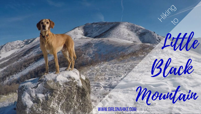
Little Black Mountain sits above the Avenues neighborhood in SLC, and although it seems close, it's looks are deceiving. This trail offers great views of the SLC valley and the BST (Bonneville Shoreline Trails), but get ready to give your hips and calves a work out. Most of the trail is along the BST ridgeline, but gains 900 ft in 1/2 mile!
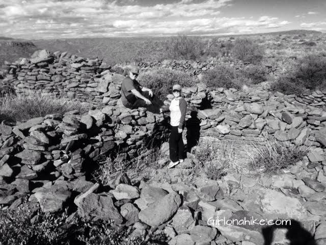
My Thanksgiving weekend was spent with my parents in Phoenix, AZ, and instead of shopping on Black Friday, we wanted #OptOutside and explore an area they had heard about called the Black Mesa Indian Ruins. Hundreds, and maybe thousands, of people drive by the "trail head" every day, but not many know that there are 800 year old ruins sitting on top of the mesa. I put "trail head" in quotes because there's not really a trail - just route finding through thick cactus.