

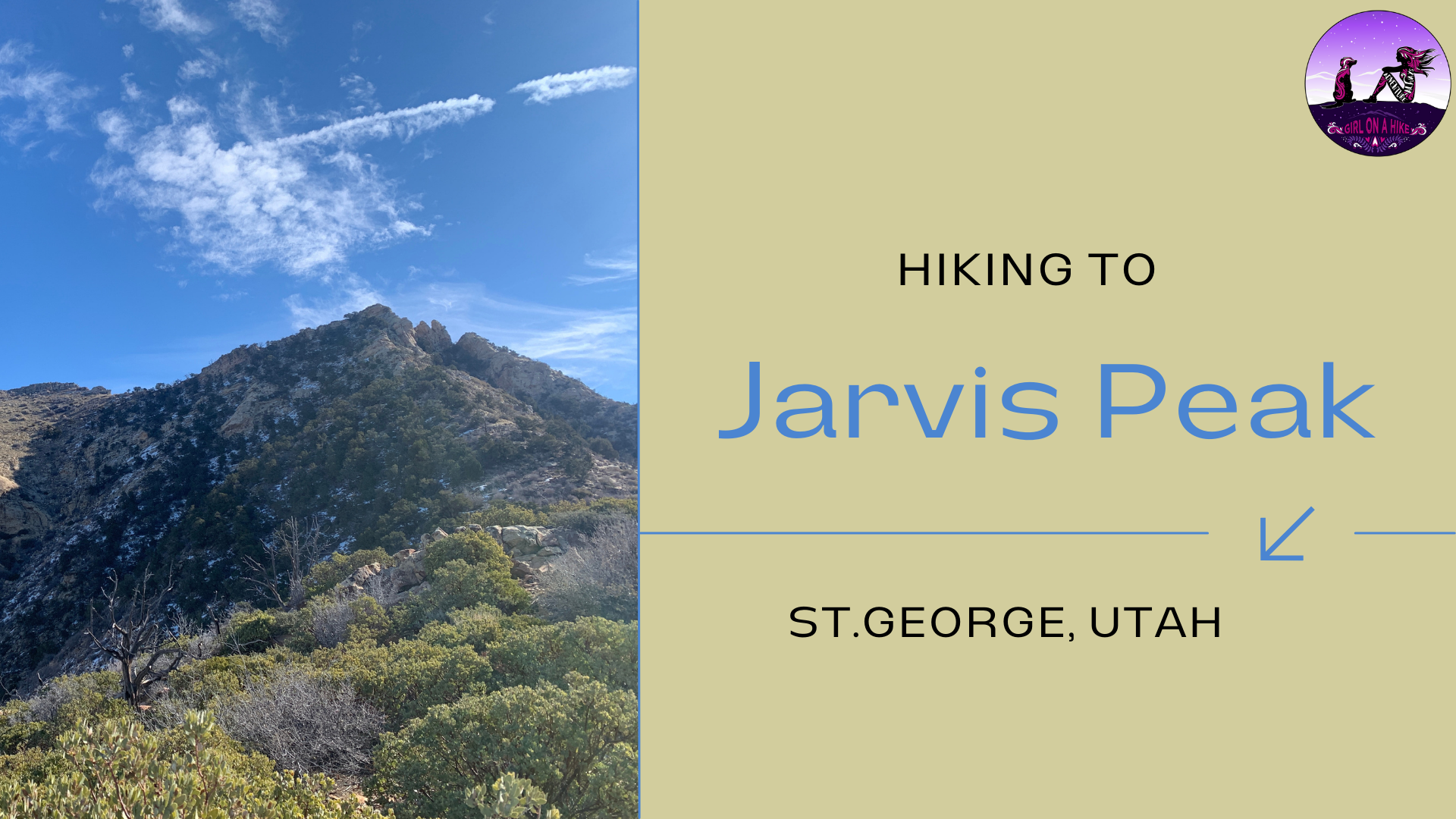
Jarvis Peak (6,529 ft) is located just outside of St.George, Utah in the Beaver Dam Mountains. It's not the highest peak in the area, but what it lacks in elevation, it makes up for in other ways. Jarvis Peak can

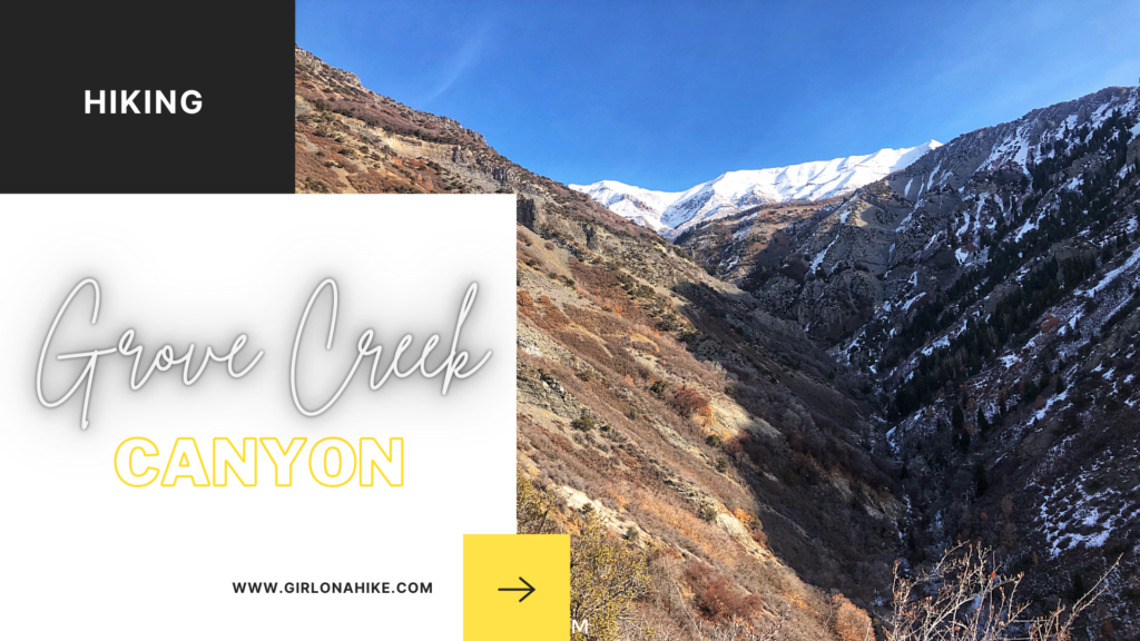
Grove Creek Canyon is located to the east of Pleasant Grove, Utah. It leads you through a somewhat narrow canyon, that eventually connects with the Great Western Trail. Along the way you'll have an amazing view of South Mt. Timpanogos, and pass two waterfalls - the first which is inaccessible, and the 2nd you could probably find a way down to yet wouldn't be easy.

The Tibble Fork Loop Trail (trail #041 & #040) is located in American Fork Canyon, and starts at the Tibble Fork Reservoir, hence the appropriate name. This hike can be done year round, but I find it to be the prettiest during Winter when the trees are laden with snow, the reservoir is frozen over, and the trail offers a certain quietness. The trail steadily gains elevation for the first 2 miles, cuts through an amazing aspen grove and open meadow, then connects back to the Tibble Fork stream and main parking lot.


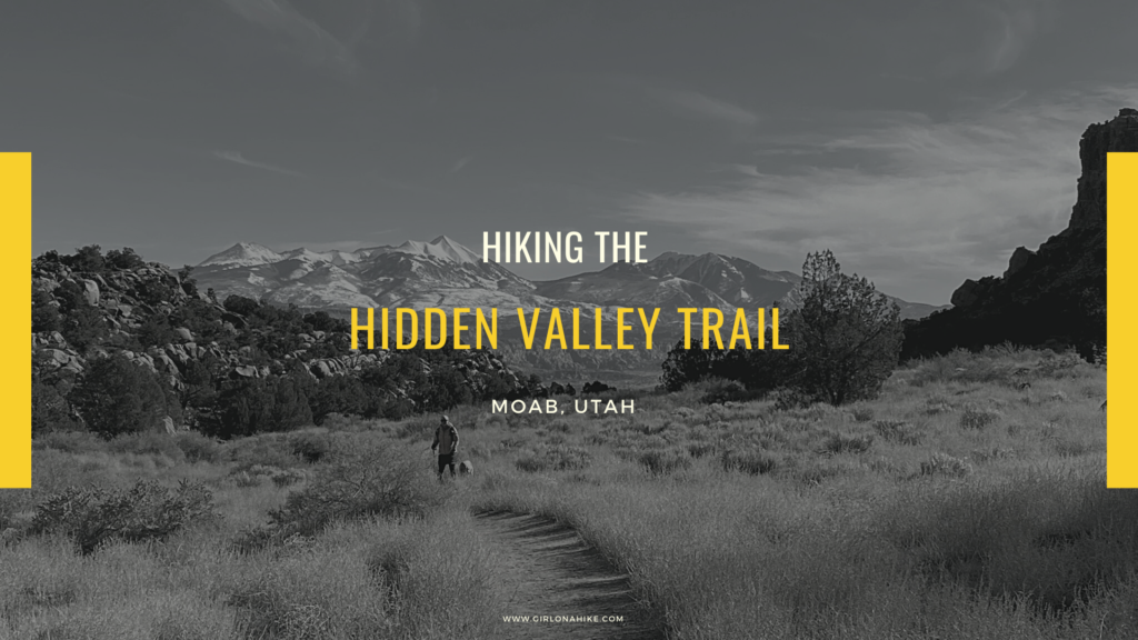
Hiking the Hidden Valley Trail right outside of Moab makes you feel like you are in a totally different place - look anywhere in Moab and the dominant sight is the Moab rim. It's known as "Behind the Rocks" - an interesting mix of sandstone fins, large rock walls, and domes. Is Hidden Valley really a valley? Not quite. It's actually two hanging terraces that descends into Behind the Rocks and eventually widens into a 4-wheel drive road while a boot-beaten path detours along the base of a sandstone wall with petroglyphs.
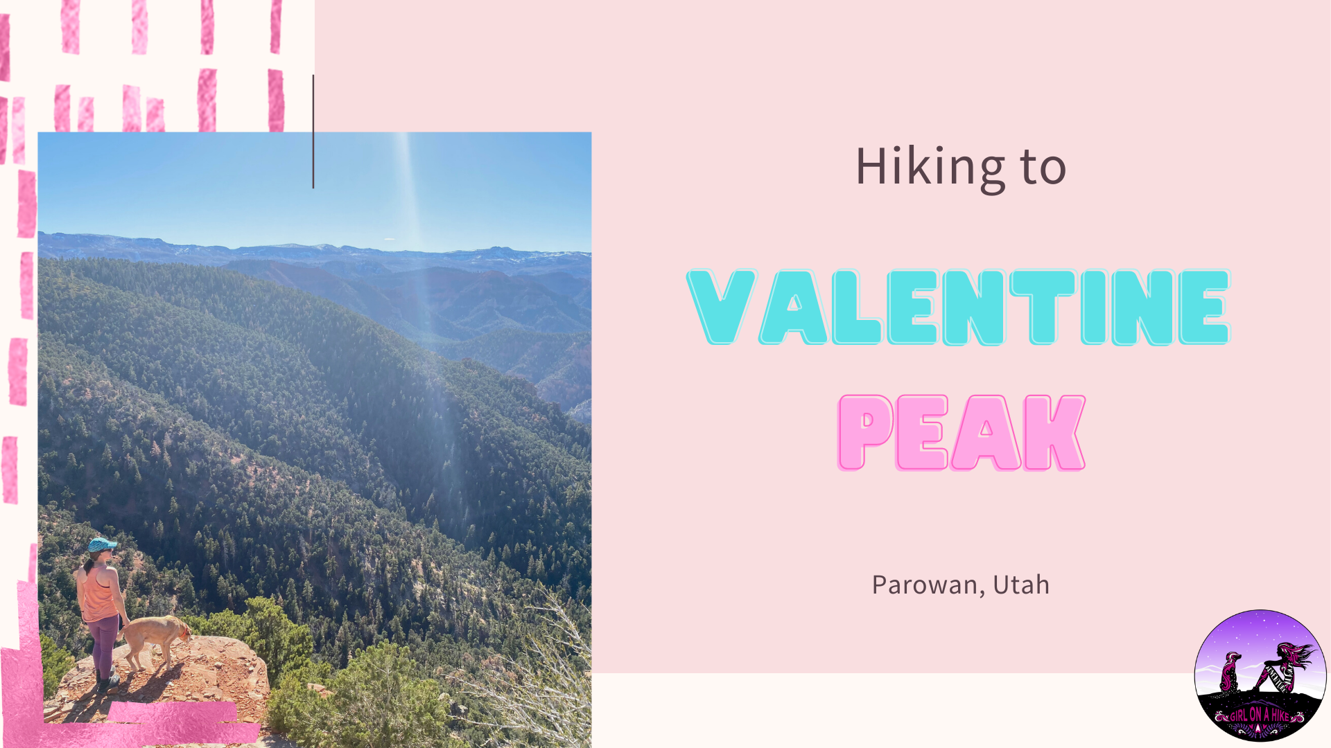

Valentine Peak is located in Parowan, Utah and leads to a 360 degree view of the area, including Brian Head, the Iron County High Point.
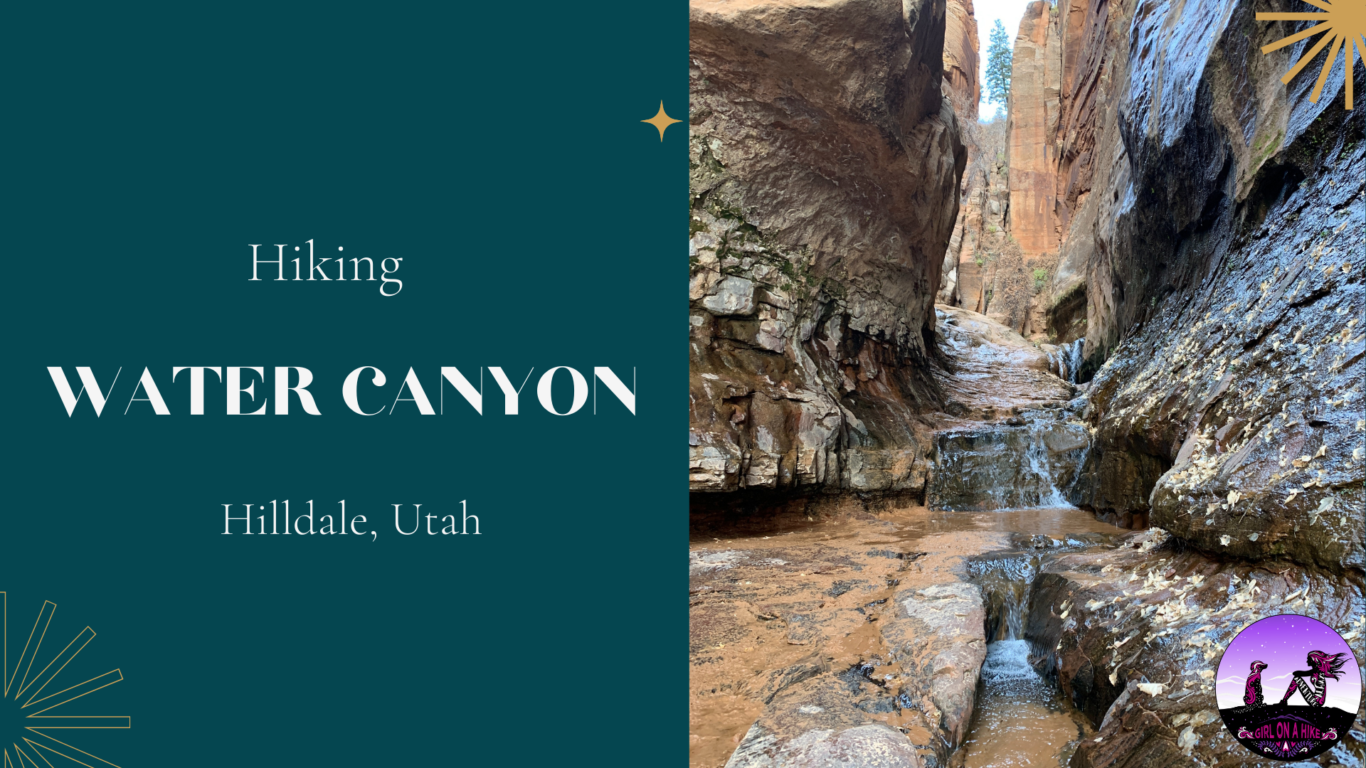

Water Canyon is a perfect desert oasis hike near Hilldale, UT. While this hike looks a lot like Zion National Park, it's dog friendly, perfect for kids, there are zero fees to enter, and you can make the hike as long or short as you want. I highly recommend hiking at least 1.5 miles to the small waterfall and pool area, so the dogs can cool off their paws and kids can explore and splash around.

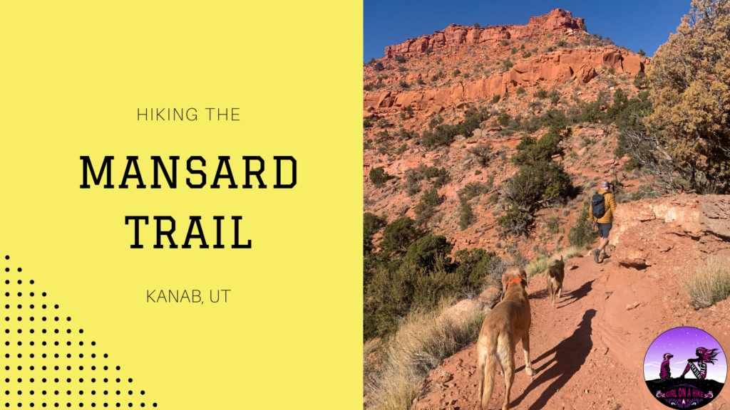
The Mansard Trail is located in Kanab, Utah and leads to a large alcove that is home to several petroglyphs. The trail itself winds its way up several gradual switchbacks before reaching a 6 ft scramble. Dogs and kids will need a boost, but otherwise the trail is quite easy. Halfway through you will reach the mesa, and the trail is mostly flat the rest of the way, but becomes very sandy.

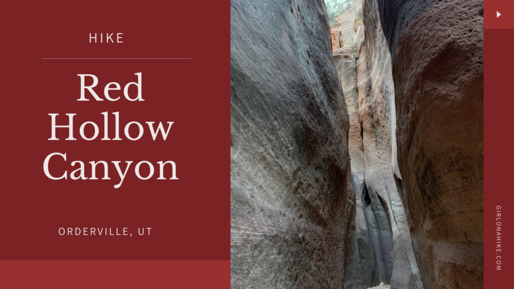
Red Hollow Canyon is a very short slot canyon located in Orderville, UT. Because its only 1 mile round trip, this makes for a great stop for the drive in between SLC and Kanab to get the kids and dogs out for a stretch. The slot canyon section only lasts for about 0.2 miles but it offers some light scrambling (dogs and kids will need a boost), before ending at a tall dry fall.

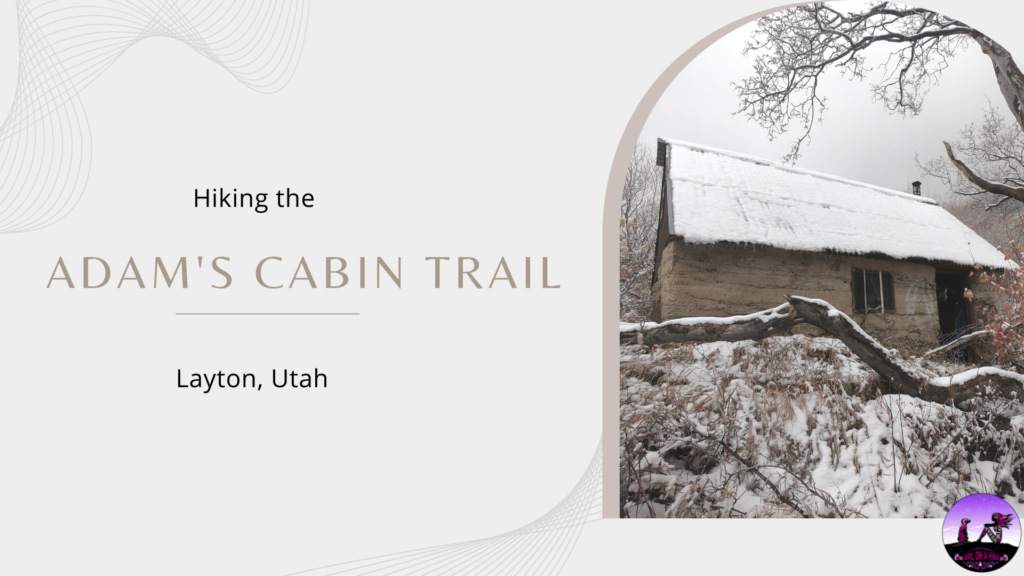
Adam's Cabin Trail leads to an old, historic cabin above Adam's Canyon Waterfall. Adam's Cabin was made of stone in the early 1940s, and today you can still sleep in it, if you dare. Adam's Cabin Trail is steep and not for those with knee or hip issues - it gains 2,700 ft in just 2.7 miles!