

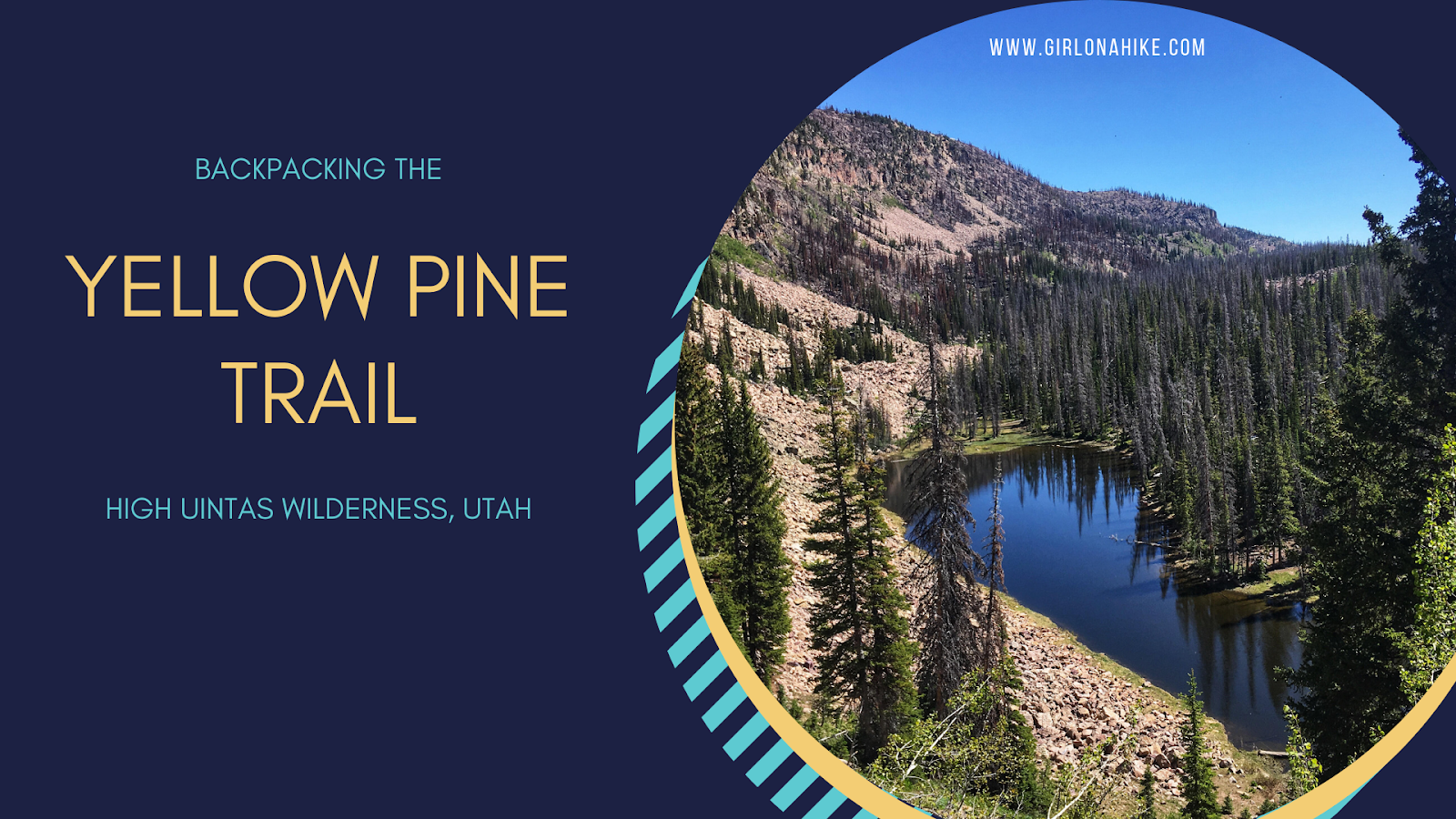
The Yellow Pine Trail is one of the first trailheads you will pass after entering the Mirror Lake Highway, coming from Kamas, UT. The trail leads to three lakes - lower & upper Yellow Pine Lakes, as well as Castle Lake. You can also day hike to Duke & Castle Peak, both over 10,000 ft. This is a great early-season backpacking route when the higher Uintas is covered in snow. The trail is mostly well shaded and offers plenty of water along the way for your pup to drink from or to filter from. It is slightly steep and rocky in sections, so this trail took longer to reach the lakes than anticipated. The best time to hike here is late June though October, or when the first snow flies.
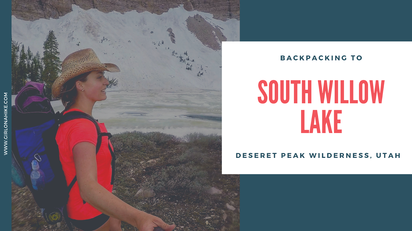
South Willow Lake is a high alpine lake in the Deseret Peak Wilderness, West of Salt Lake City, Utah. It is a fairly steep trail but only 3.5 miles to the lake. The best time to backpack here is mid-June - October, when the winter gate is open and the trail is mostly free of snow. There are two routes to get to South Willow Lake via the Deseret Peak TH or the Medina Flat TH (aka Stansbury Front Trail).
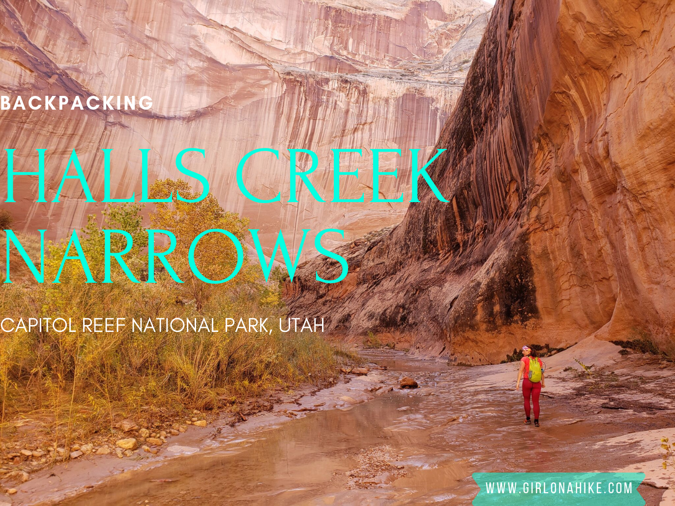
Backpacking Halls Creek Narrows is located within Capitol Reef National Park, only a few miles North from Lake Powell. This area of the park sits between the high cliffs of Hall Mesa on the East, and the Waterpocket Fold on the West. As you backpack towards Halls Creek Drainage (aka Grand Gulch), you'll be surrounded by red, white, and orange slick rock, all while hiking through a mostly sandy trail.
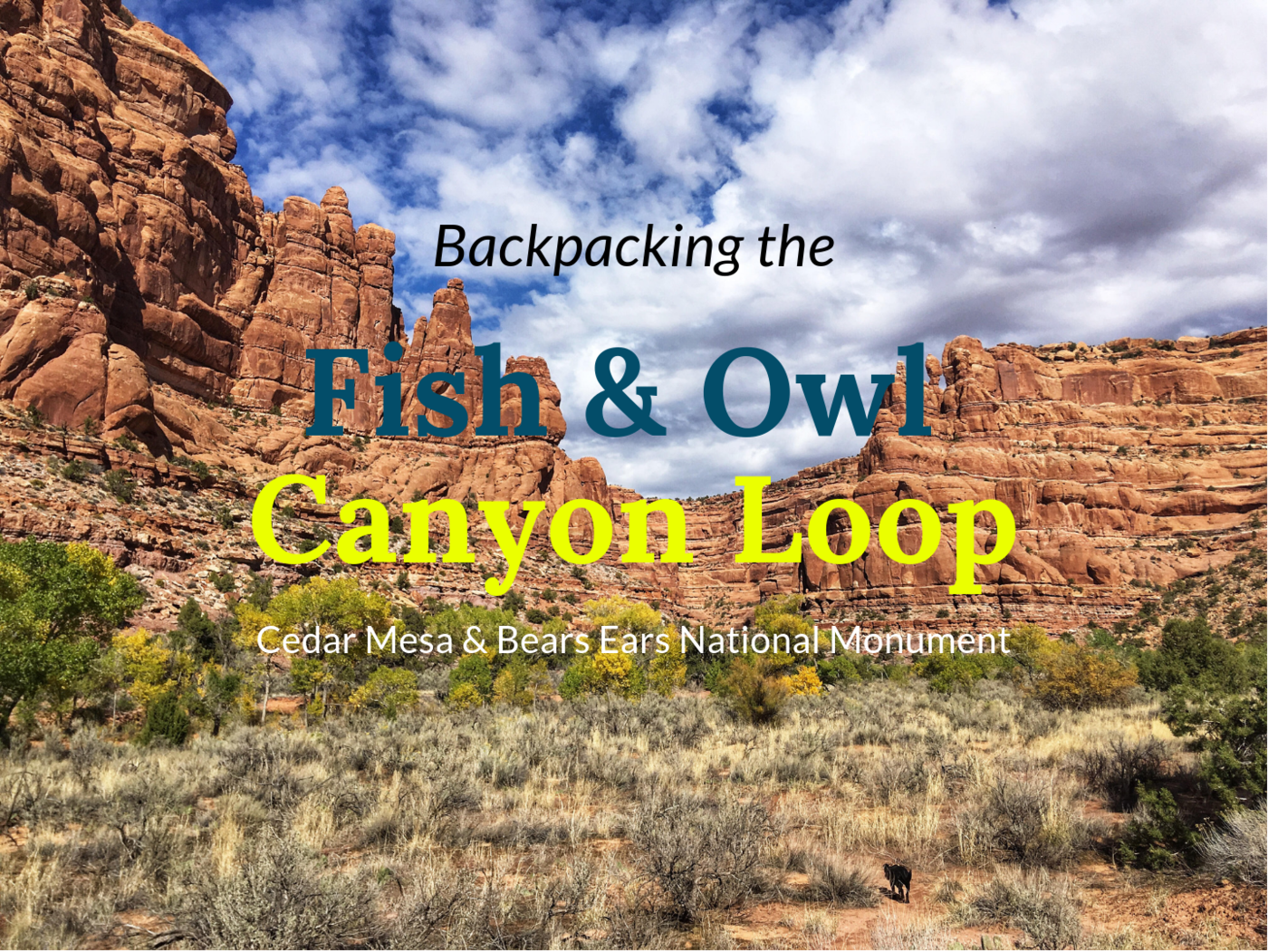
Fish and Owl Canyons, nestled in the Cedar Mesa area of Bears Ears National Monument, offers a stunning loop backpacking route. This trail is ideal for experienced hikers looking to explore ancient ruins and kivas, hike through desert terrain, visit Neville's Arch, and enjoy solitude in two scenic, deep canyons. With challenging terrain, light route-finding, and scrambling, it's best suited for intermediate to advanced backpackers.
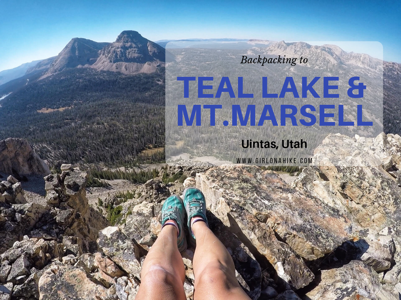
Teal Lake sits at an elevation of 10,400 ft, and is accessed via the popular Ruth Lake Trailhead. You will follow this trail for the first mile, and then after that there is no trail. You should be comfortable with a little route finding, and hiking off trail. The nice thing is that Teal Lake is a mere 2.2 miles, so you really only have to hike off trail for 1.2 miles. You'll pass a few unnamed ponds, Jewel & Naomi Lakes, then reach Teal Lake. There are several nice campsites at Teal Lake, and fishing is plentiful.
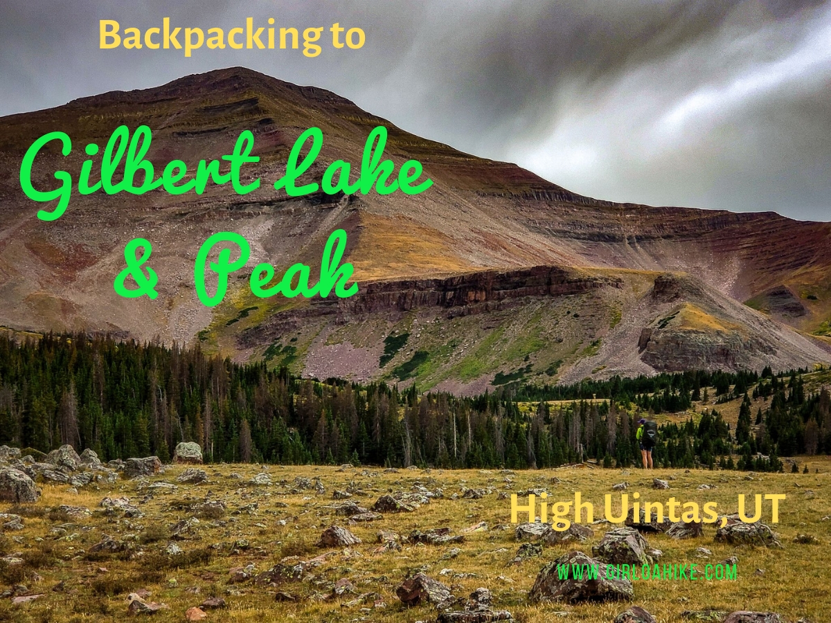
Gilbert Lake is located in the High Uintas Wilderness on the East end of the range, with Gilbert Peak (13,442 ft) being one of Utah's "13ers" (a peak above 13,000 ft). It is the 3rd highest peak in the state, and the second highest county high point, and can be access by several drainages, with Henry's Fork being the most popular, however we accessed it from Gilbert Lake. The trail to Gilbert Lake follows the West Beaver Creek trail for 9.2 miles before reaching the basin which has four lakes total, great campsites, lots of wildlife, and of course, fairly "easy" access to the peak.
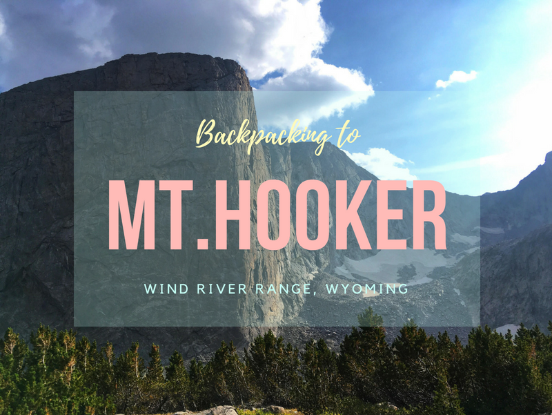

Mt. Hooker (12,509 ft) is a remote and rugged peak located in the southern end of the Wind River Range in Wyoming. Known for its dramatic 1,800-foot sheer granite face, Mt. Hooker is one of the tallest and steepest vertical cliffs in the state. It's also 16 miles from the nearest road, making it a true wilderness adventure for backpackers and climbers.
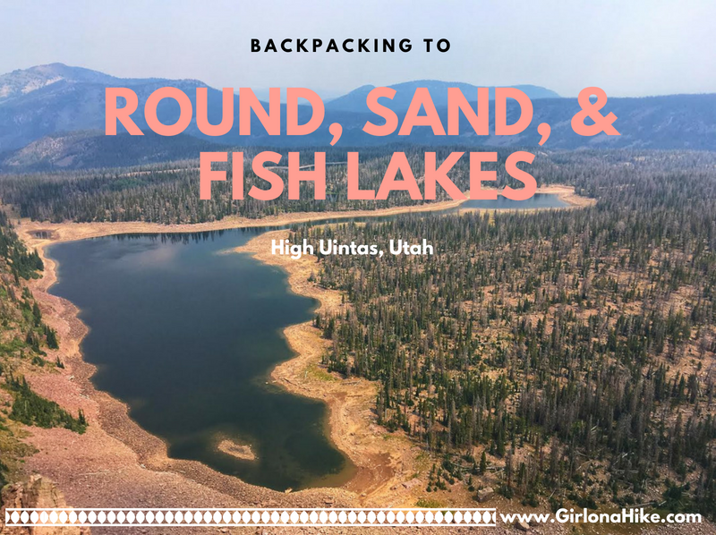
Backpacking to Round, Sand, and Fish Lakes are part of the upper Weber River drainage on the Western end of the Uinta Mountains. The trail steeply follows the Dry Fork stream and canyon, as it makes it way to the three lakes. Camping and fishing are plentiful here. Round Lake is actually home to three species of fish (somewhat unheard of in the Uintas, as there are typically only two species in the lakes). There are Grayling, Brook, and Cutthroat Trout. Further ahead is Fish Lake, which can vary in depth by 19 feet, depending on the snow year and dam levels. Plenty of day hiking options are available too, as most day hikers try to reach the ridge for better views. This route is kid and dog friendly!
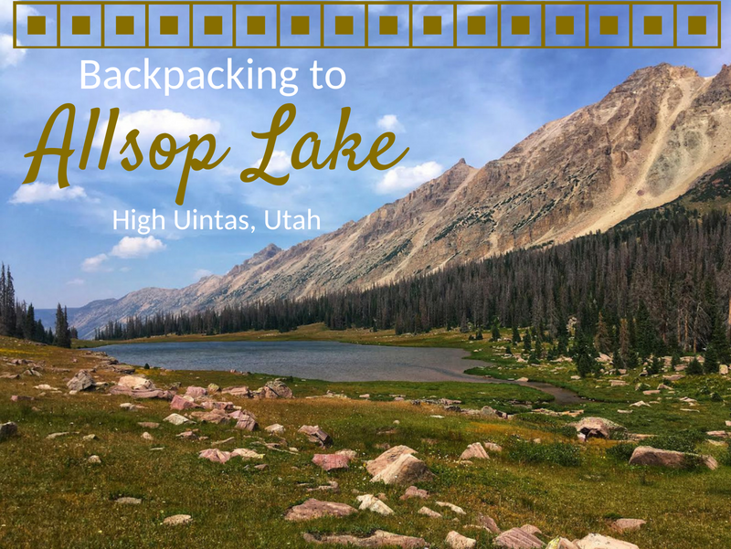
Allsop Lake sits on the Northern slope of the High Uintas Wilderness at an elevation of 10,600 ft. It's 9 miles to the lake, so it makes for a perfect 1 or 2-night backpacking trip. The trail is fairly mellow, only gaining 1,600 ft and has one switchback. Allsop Lake is full of brook and tiger trout, and there are a few day hiking options from the lake as well including Cathedral Peak, Allsop Peak, and Yard Peak. This trail is dog friendly, however be aware that free-range livestock graze along the entire route. Plenty of tent and hammock sites line the lake for a perfect campsite. Keep in mind that the Uintas have regular afternoon thunderstorms, so be prepared for any kind of weather.
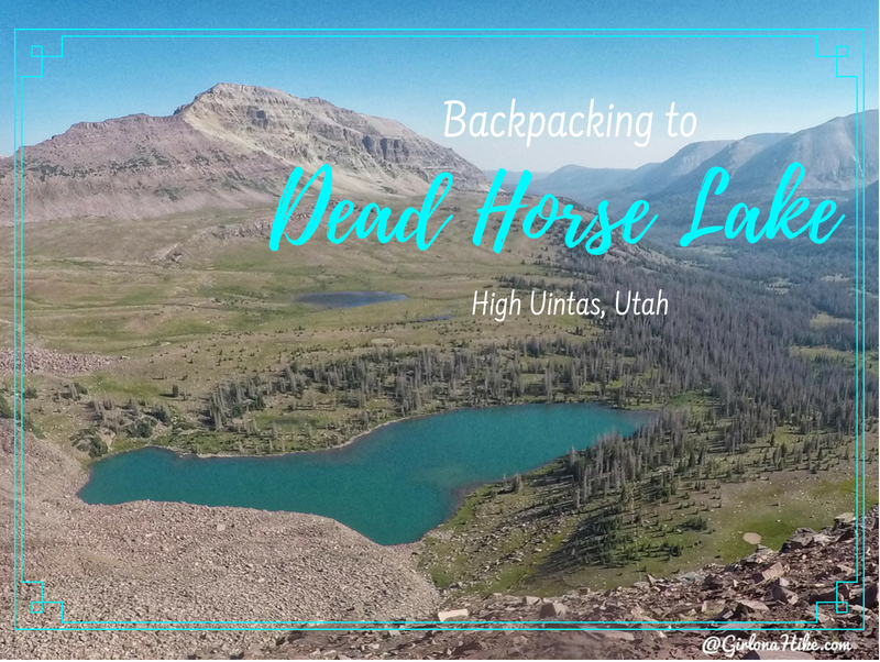
Dead Horse Lake is in the High Uintas Wilderness, and offers an 11 mile hike through large, open meadows, stunning vistas, and of course, leads you to a turquoise lake. This lake offers a great spot for fishing and day hiking. People hiking the Uinta Highline Trail also pass right by Dead Horse Lake. It's a dog friendly trail, though you'll want to give the sheep herds passing by in the meadows plenty of space. Bring your hammock or tent - there are several nice campsites around the lake and plenty of trees for shade. Be sure to check fire restrictions before heading out.