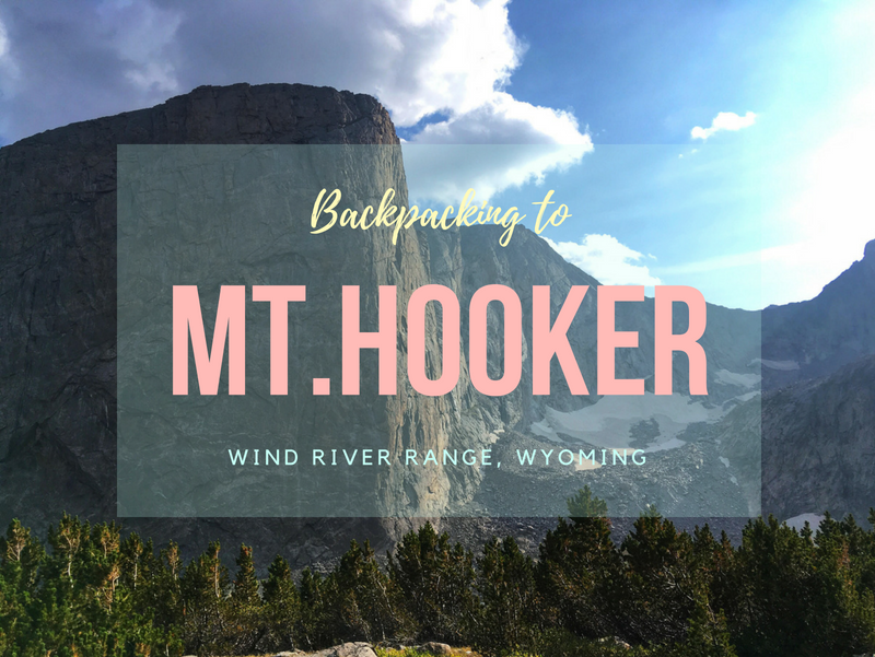

Mt. Hooker (12,509 ft) is a remote and rugged peak located in the southern end of the Wind River Range in Wyoming. Known for its dramatic 1,800-foot sheer granite face, Mt. Hooker is one of the tallest and steepest vertical cliffs in the state. It’s also 16 miles from the nearest road, making it a true wilderness adventure for backpackers and climbers.
Hiking to Mt. Hooker in the Wind River Range, Wyoming
Named after Joseph Dalton Hooker, a renowned British botanist and explorer, Mt. Hooker became a climbing landmark in 1964 when the granite wall was first ascended over the course of three days. Today, the main climbing route, Jaded Lady (5.12a), draws elite climbers from around the country. The wall’s most difficult known route is rated 5.14a.
Mt. Hooker towers above Baptiste Lake, a stunning alpine lake known for its crystal-clear water, excellent backcountry camping, and fishing.
Why Backpack to Mt. Hooker
One reason we chose to backpack to Mt. Hooker was so my partner, Ian, could scout the wall for a potential climb. We also wanted to explore a lesser-known area of the Wind River Range. Our interest in this location began in 2015 when Tommy Caldwell and Adam Stack completed a car-to-car ascent of Jaded Lady. Ever since, Mt. Hooker has been at the top of our bucket list.
This was our third consecutive year backpacking in the Wind Rivers, and for good reason. The scenery is unbeatable: massive granite peaks, wildflower-filled meadows, serene alpine lakes, and cooler summer temperatures. The solitude and untouched beauty keep us coming back.
However, hiking in the Wind Rivers is not for the faint of heart. Trails are rocky, elevation gain is substantial, and weather can shift quickly. Many of the best spots require off-trail navigation, but above treeline, bushwhacking is minimal. We recommend spending at least 3 nights in the area to fully enjoy the experience.
.How to Get There
Driving Directions to Big Sandy Trailhead (TH)
-
From I-80, take Exit 83 and head north on WY-372 for 27 miles.
-
Turn right on WY-28 toward Farson, WY.
-
At the 4-way stop in Farson, go straight past the Mercantile and gas station (last stop for fuel and supplies).
-
Drive 2 miles, then turn left on 4th East Road at the large tan building.
-
The road turns to dirt—continue for 20 miles until you reach a 3-way junction.
-
Turn right onto Elkhorn Cutoff Road and drive 7.6 miles.
-
At the brown sign for Big Sandy Trailhead, turn left and drive another 10 miles. The road is rough but typically passable by small passenger cars. SUVs are preferred, especially in wet or muddy conditions.
👉 View driving map.
Trail Info
Distance: 16 miles to Baptiste Lake & Mt. Hooker
Elevation gain: 3,044 ft
Time: 1.5-2 days
Dog friendly? Yes, off leash (see notes below)
Kid friendly? Maybe (see notes below)
Fees/Permits? None
Frequently Asked Questions
When is the Best Time to Visit?
The ideal months are late July through early September, depending on snowpack. In high snow years, trails may not be accessible until August. In lighter snow years, June access is possible. Contact the Bridger-Teton Forest Service for updated trail and snowpack conditions.
Expect afternoon thunderstorms and the occasional summer snowstorm—always be prepared for rapidly changing weather.
How Hard is the Hike?
Difficulty depends on your experience, pack weight, and route. Although no technical skills are required, you’ll cross alpine passes and carry a pack over rough terrain. A base level of backpacking experience and good fitness are highly recommended. Keep your pack weight below 30–40 lbs to make the hike more manageable.
Can I Bring My Dog?
Yes! Dogs are allowed off leash. However, keep a leash handy in case you encounter wildlife. Your dog should be capable of hiking long distances and rocky trails. Dog food must also be stored properly in grizzly bear territory. Learn how to Get Your Dog Ready for their First Backpacking trip and make sure they have their own Doggie first aid kit.
What’s the Elevation Like?
-
Trailhead (Big Sandy TH): 9,100 ft
-
Highest Point: ~11,600 ft
Be aware of elevation sickness, and know the symptoms in case you or someone in your group starts to feel ill.
What Are the Regulations?
-
Groups of 15 or fewer
-
No camping within 200 ft of any water source or trail
-
No bikes, fireworks, or motorized vehicles
-
Bear-safe food storage is required
-
No permits needed for backpacking
Do I Need a Bear Canister?
Yes. As of 2017, the Bridger-Teton National Forest requires bear-proof food storage. You can either hang your food properly or carry a bear canister. We also strongly recommend packing bear spray.
Is Water Readily Available?
Yes. Water is abundant along the trail from creeks and alpine lakes. You’ll need a water filter, such as the Sawyer Mini or Platypus Gravity Filter.
How Bad Are the Mosquitoes?
Mosquitoes are intense until mid-August, depending on the snowmelt and water levels. Pack 100% DEET and treat your clothing with Permethrin beforehand. Apply Permethrin by Sawyer outdoors while clothes are hanging and allow to dry completely between coats.
What Maps or Guidebooks Should I Use?
We used the Wind Rivers Topographic Map – Southern Half, which provides detailed terrain and trail info.

Day 1

Ready to start hiking! Since the drive took us about 5.5 hours, we didn’t start hiking until around 3:30pm. We knew we’d still be able to make it to either Dad’s or Marm’s Lake for our first night, 7.5 miles in, before it got dark. Our packs were pretty heavy – mine was at 39 lbs, and Ian’s was 46 lbs for 6 nights/7 days. WOW! I haven’t carried that much weight in probably 2 years since backpacking the Bright Angel Trail in the Grand Canyon (back when I had much heavier gear). See a full list of my backpacking gear here.

We were hoping to escape the smoke and haze from the SLC area, but this summer has been pretty bad for the California fires, and the smoke was still present even in the Winds.

Our first major trail split. Heading left for Dad’s Lake. Hiking straight at this trail split will take you towards the Cirque of the Towers.

The first few miles are really green and forested.

Eventually the views open up, and you will hike through several pretty meadows. We were still feeling good as we approached Dad’s Lake, so we kept moving, even as a small rain storm moved through.

Made it to Marm’s Lake our first night!

We found a nice, secluded campsite at the far end of the lake.

Charlie, the water guard. For filtering water we use the 4 liter Platypus Gravity Filter. I’ve had it for about 2 years and love it!

Every backpackers big question – “What did you do for food?”
Ian and I always try to eat “real” food while backpacking. We can usually get real food to last up to 3 days. On the drive to the TH we keep it in a cooler, then we transfer it to an insulated pouch, and always keep the food in one of the packs (where it’s darkest and coldest). A lot of our weight was due to our food. Here’s what we carried in for 2 people over 6 nights, 7 days.
Breakfast
2 lbs applewood smoked bacon
1 dozen eggs
coffee/hot chocolate
Lunch
We never stop to eat lunch, so no real food for that
Dinner
8 Aidell’s Chicken sausages
2 steelhead fish filets
2 trout fish filets
2 filets of dry aged New York strip
2 bunches asparagus
1 medium sized sweet potato
2 sticks salted butter
That food lasted us 3 days (4 days for the bacon & eggs), and the other 3 nights we ate our dehydrated meals, so we had 6 dehydrated meals, plus 1 dehydrated berries & granola, and 1 dehydrated Dark Chocolate Cheesecake for dessert our very last night backpacking.
In addition to this, we also brought along dehydrated bacon (2 packs), Creminelli salami (1 to share), pre-made trail mix (next time we will make our own), several RX Bars & That’s It fruit bars, and 6 tuna packets. We got all of this food from a local grocery store (Harmon’s). We carried two of the medium sized fuel canisters for all this. So you can see a lot of our weight other than gear was food-based. We ate really well!

The next morning was kind of chilly, so we wrapped up our little babushka in his bed, the Double Black Diamond Packable Throw. CostCo usually starts selling these in the Fall for $20/each. They are a bit more expensive online. These blankets are awesome because they double as a dog bed, and a blanket for me if I’m cold, they can be thrown in the machine washer, and they are very lightweight. Charlie has yet to tear this blanket with his paws too!
Day 2

Day 2 we started towards our main destination, Mt. Hooker and Baptiste Lake. Finally, we were starting to see real mountains!

We passed Skull Lake, then found our trail split for Hailey Pass. This is hiking above Mays Lake.

Hiking towards Hailey Pass, which you can’t quite see yet.

Stopping to check out Twin Lakes, just below the pass.

Approaching Hailey Pass.

Yahoo, we made it to Hailey Pass! It was really cool to see the large wood sign for crossing over from the Bridger Teton Wilderness into the Popo Aggie Wilderness. This is looking South.

Hailey Pass, looking North.

Ian and Charlie start making their way down the other side of the pass. It was pretty steep on this side.

Not that surprising that we crossed several snow fields. I was SO happy to be hiking down – Hailey Pass was tough for me with my exercise-induced asthma combined with my heavy pack.

Whew, that is COLD water! But we had to cross the stream to get to our last trail split for the day to Baptiste Lake.

Finally, a first good view of Mt. Hooker! Almost to Baptiste Lake.

We quickly set up camp, and changed out of our sweaty hiking clothes.

Oh yes, we did. We made steak and sweet potatoes for dinner. This trip we brought Ian’s MSR Reactor stove system. We don’t have the pot holder attachment, so we usually build up rocks around it to set the pan on and fuel underneath to cook it, so we don’t have to always hold the handles. Works great!
Days 3 & 4

We originally planned on only staying 2 nights at Baptiste Lake, but it quickly turned into 3 nights. We had an amazing campsite with this view of Mt. Hooker, decent weather considering our elevation (it rained every day in the Wind Rivers, and was often windy), we really enjoyed the views, hardly anyone else was there, and wanted two full days to explore the basin. The temperatures definitely got chilly at night, but we had amazing light!

Great view of Musembeah Peak above Baptiste Lake!

Exploring the basin, great views of Mt. Hooker all around!

Unnamed pond under Musembeah Peak.

Ok Wind Rivers, you win. You’ve outdone yourself for a 3rd year in a row! What a view!!!

Charlie waits for his dad to call him over.

Just want to emphasize there are no trails here – making up your own routes are part of the fun in this area. There’s so much to explore! I was super excited when I came across Elephant Ear flowers, since they are very common in the Uintas where I mostly go to backpack. Also, doesn’t that boulder look like its about to roll off?!

Wow, I was super impressed with Musembeah Peak. If you have the skills/gear/motivation, it can actually be climbed. Check out this link for climbing info.

More exploring!

Ok Charlie, stop showing off. You’re too cute.

Time to get the Alpaca Raft out! We have the Scout raft, and including oars it weighs a mere 3.5 lbs. It’s been really fun having this along for lake/backpacking trips.

My co-captain. Charlie does really well in the pack raft. The material is pretty thick, but even so, I always make sure he is laying down, or his paws when he’s up like this are partially on my lap or legs. We do everything we can to prevent him from popping it. He loves his rides with us in there.

Back on main land, enjoying our views while Ian was now out on the raft.

Can you believe I actually caught this guy!? I was too chicken to actually hold it, so I had Ian take out the hook, and hold him long enough for me to grab a photo. He was close to 18 inches! I was pretty proud of myself, as I’ve started to learn how to fly fish. We didn’t eat any of the fish we caught, we just tossed them back in.

Almost every morning we saw these clouds come in, swoop down towards Grave Lake, and fill in the canyons. It was so pretty! But as each day went on it kept getting windier, and windier. One of the evenings it was so cold and windy, that I ate my breakfast inside the tent just to escape the wind. The Wind Rivers sure live up to their name!
Day 5

After 3 nights at Baptiste Lake, it was time to move on. We made our way down towards Grave Lake, now on the Bears Ears trail, and we passed this cool waterfall.

Passing under Pilot’s Knob and by Grave Lake.

At the far end of Grave Lake you will cross this bridge, if heading towards Washakie Lake.

What a fun surprise, another waterfall!

By now we were only 2 miles away from Washakie Lake. We lost a lot of elevation, but that meant we now had to climb back up to the lake to reach 10, 600 ft.

We found a sweet campsite at Washakie Lake. This was the first night we also made a fire, but it was also the windiest evening yet. It was so windy we couldn’t even really fish, the lake had waves. Here are 6 Tips to Keep Your Dog Warm while Camping!
Day 6

One night at Washakie Lake came and went, and it was time to hike up the last uphill towards Washakie Pass.

Passing by Macon Lake, and a great view of Washakie Lake. We had to hike up all that?? I kept telling myself, “Don’t worry, you got this. This is your last uphill, then it’s all downhill from here.” I was soooo slow.

As we got closer to the pass, a large remaining snow field blocked the trail, so we skirted around it and actually found another trail. This snowfield must be here often if there are two trails to get to the pass.

The winds must have been close to 50 mph, with gusts at least 60-70 mph. It was insane – snot was flying out from my nose to the side of my face LOL!

Whew, finally at Washakie Pass! Braving the winds were tough here. I don’t think I’ve experience anything like it before. I’ve camped in pretty bad wind, but never had to hike over a huge pass in those winds with a heavy pack on. Definitely challenging.

As we started down the south side of the pass, I immediately felt better. Downhill, a little warmer, and great views.

We decided to switch it up and instead of camping at Marm’s Lake again like our first night, we found a great campsite at Dad’s Lake. From here, we’d only have to hike out 6 miles the next day.

Hanging our food & Charlie’s dog pack one last time. We don’t own (nor do I want to get) bear canisters. They fit weird in a pack, and weigh more. It’s easier, cheaper, and lighter to just hang food. Just make sure you know some really good knots!
Day 7
We hiked the last 6 miles to the car! YAY, we made it!
Trail Map
My day hike routes are not shown on here. That’s what part of the fun – make your own route!
Recommended Hike


Save me on Pinterest!