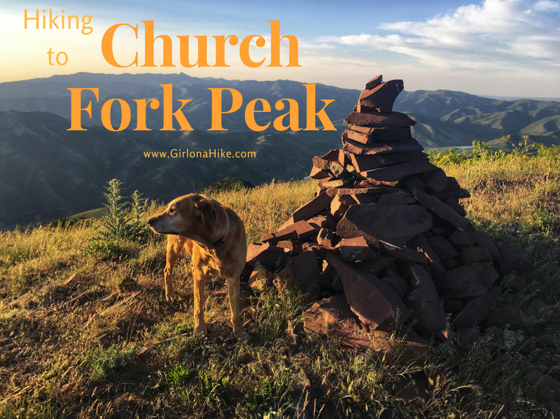
Church Fork Peak (8,306 ft) is located along the Millcreek Canyon ridge, in-between Mt. Aire and Grandeur Peak. To get to the summit, you follow the Pipeline Trail, then turn off on the actual Birch Hollow trail, reach the ridge, then bushwhack your away to the false summit and true peak. This trail is very steep, and requires some route finding along the ridge. If you aren't comfortable hiking off trail, bushwhacking, and route finding, this isn't the trail for you.
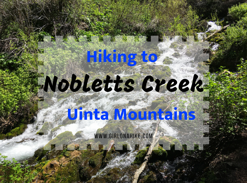
Noblett's Creek, located in the Southwestern end of the Uinta Mountains, is a good early/pre-season hike when the rest of the high elevation hikes in the Uintas are still covered with snow and mud. Because Noblett's Creek is at an elevation of 7,400 ft it is typically ready to hike by end of May/early June (depending on the snow pack from Winter). This trail is really short at only 2 miles round trip, making it perfect for families and kids.
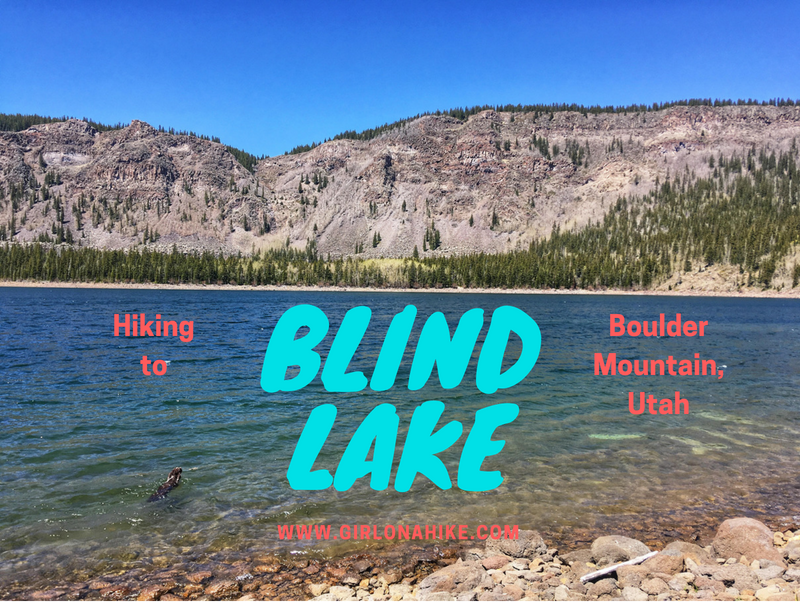
Blind Lake is located on Boulder Mountain in Utah - it is the deepest and biggest lake on the mountain at 52 acres and 52 feet deep. Most people come to the lake to fish for trout, but there the trail itself is great for dogs, kids, and families.
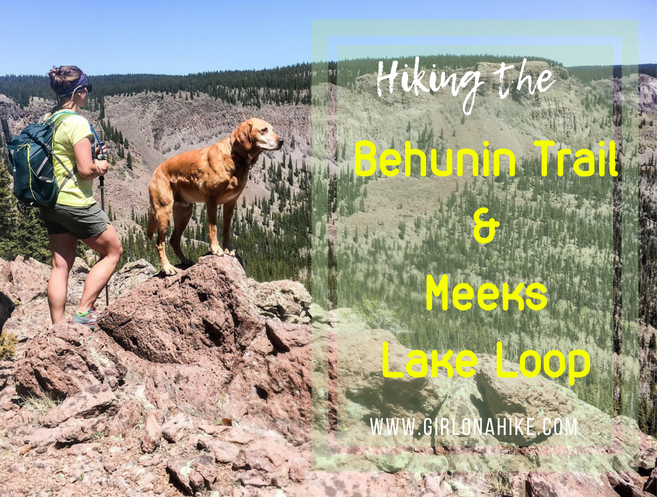
The Behunin Trail and Meeks Lake Trail are both located on Boulder Mountain, Utah, and are often done as separate hikes. However, you can combine them into one big loop to really see the East side of Boulder Mountain, and on clear days, all the way to the Henry Mountains. First, you'll hike up to "Boulder Top", the ridge, where you'll cross several open meadows, a stream, and will pass by an old airplane crash. Then you'll make your way over to Pleasant Lake, which offers great trout fishing and refreshing cooler temperatures, since the lake is at an elevation of 10,300 ft. After that, you'll hike over to Meeks Lake, another popular lake, and though it's pretty, doesn't have many fish. At the end of the day, you'll drop down the Meeks Lake Trail, and make your way through more meadows, and end back at your car.
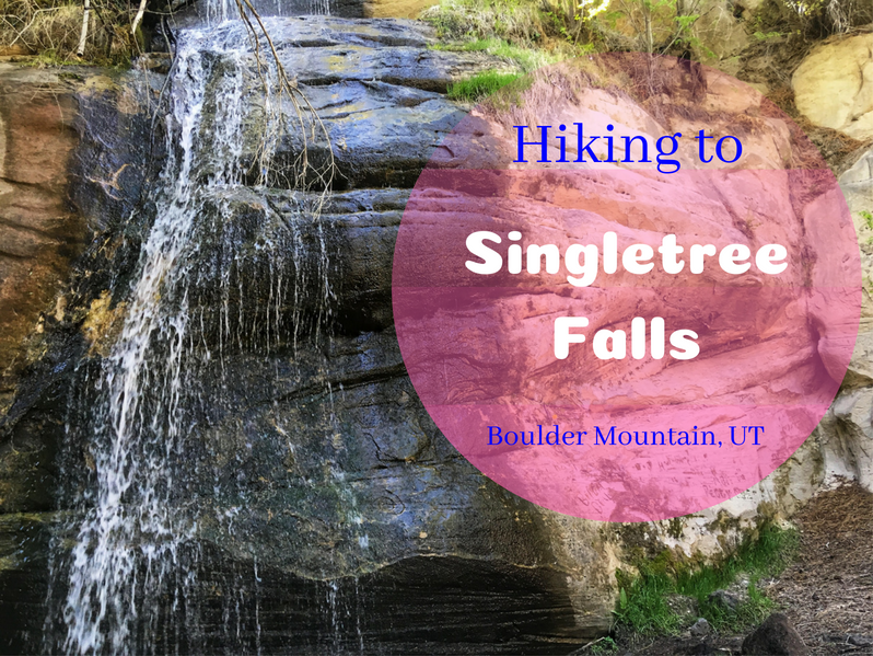
Singletree Falls is a short, scenic, and family-friendly hike located on Boulder Mountain, Utah.
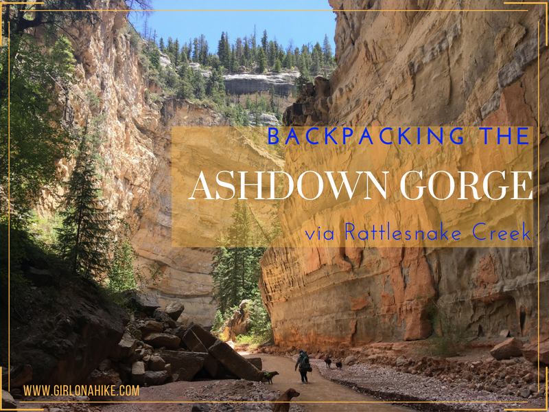
The Ashdown Gorge is located on the boundary line of Cedar Breaks National Monument, and lies within the Ashdown Gorge Wilderness near Cedar City, Utah. The trail starts by following the Rattlesnake Creek Trail at 10,500 ft, and eventually drops into the gorge descending a total of 4,100 ft. This route is best done point-to-point, with 1 over night backpacking. You can definitely do this in one day, but to really experience the canyon and take your time, backpacking this trail is perfect.
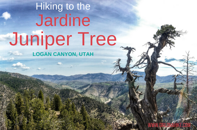
The Jardine Juniper Tree is location in Logan Canyon, Utah, and is 1,500 years old! It is close to 40 feet tall, and 23.6 ft in circumference. The Jardine Juniper was discovered in 1923 by Maurice Linford, who was a student at Utah State (then called Utah State Agricultural College), and the tree was named after the former US Secretary of Agriculture William Marion Jardine.
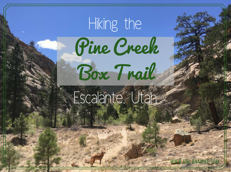
Pine Creek Canyon is a hidden gem in the Escalante area - a pristine creek, tall canyon walls, half mountain-half desert, no cows, all downhill, plenty of shade, and towering Ponderosa trees. Located in the Box-Death Hollow Wilderness, this canyon is also known as "The Box", which is funny since it's not really a box canyon but steep-walled, open-ended drainage carved by Pine Creek millions of years ago.