

at
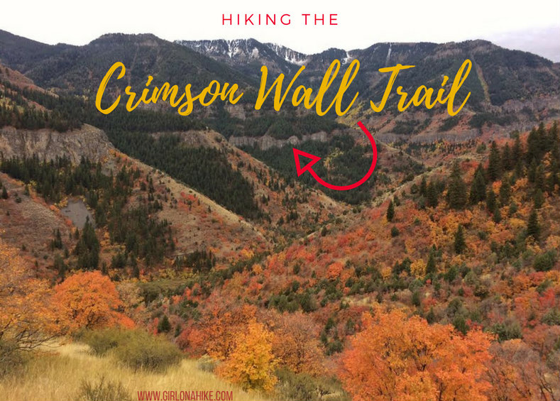
The Crimson Wall Trail (originally called the China Wall Trail) is located in Logan Canyon, and was referred to as such because of the long wall-like formation that lines both sides of Logan Canyon. The wall itself is mainly composed of limestone and quartzite, and offers a few challenging climbs for rock climbers. What attracts hikers to the Crimson Wall is its gorgeous views of Logan Canyon. The best time to hike this trail is in Summer or Fall when the snow is gone and the trail is dry. The trail is mainly north-facing, and therefore the snow and ice remains well into Spring.
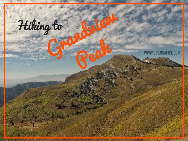
Grandview Peak (9,410 ft) sits at the Salt Lake/Davis County line and is one of the seldom visited peaks along the Wasatch Front. It's a long hike in from all directions, there's no water source, very little shade, and a little bushwhacking required. No matter which route you choose (described below), be prepared for a full 10-12 hour day. However, I've been staring at this peak for 4 years now, and I just HAD to knock it off my peak list. Wednesday night I was looking at the weather for the week, and it was supposed to have perfect blue skies, comfortable temperatures, and the Fall colors were also almost at their peak.
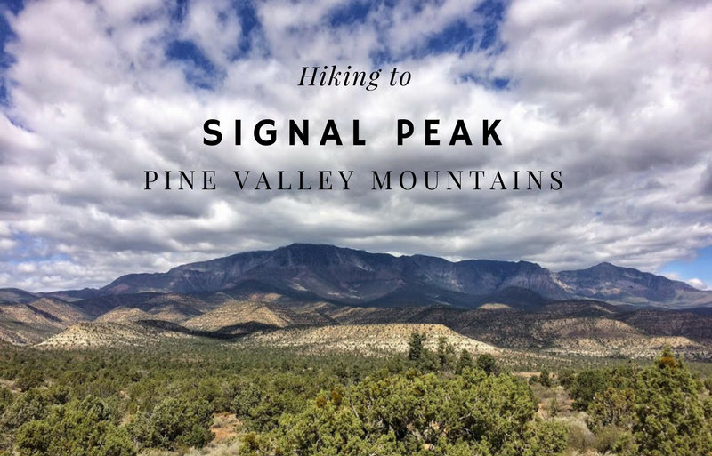
Signal Peak (10,365 ft) is the high point for both the Pine Valley Mountains and Washington County. It you are a peak bagger looking to summit all of Utah's County High Points, you'll be hiking this one. The main route starts from the Oak Grove Campground, and follows the trail up the South ridge very steeply, before dropping into forested areas, and then hiking off trail to reach the summit.
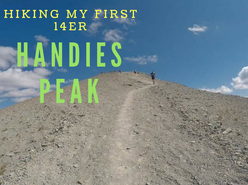
Hiking Handies Peak – Colorado’s Easiest 14er
Handies Peak (14,048 ft) is a stunning summit located near Silverton, Colorado, and it's one of the most accessible 14ers (mountains over 14,000 feet in elevation) in the state. This peak just so happened to be my very first 14er, and what an incredible introduction to Colorado's high country it was! If you're new to the term, a “14er” refers to any peak that rises above 14,000 feet—there are 96 total in the U.S., with Colorado boasting the most at 57.
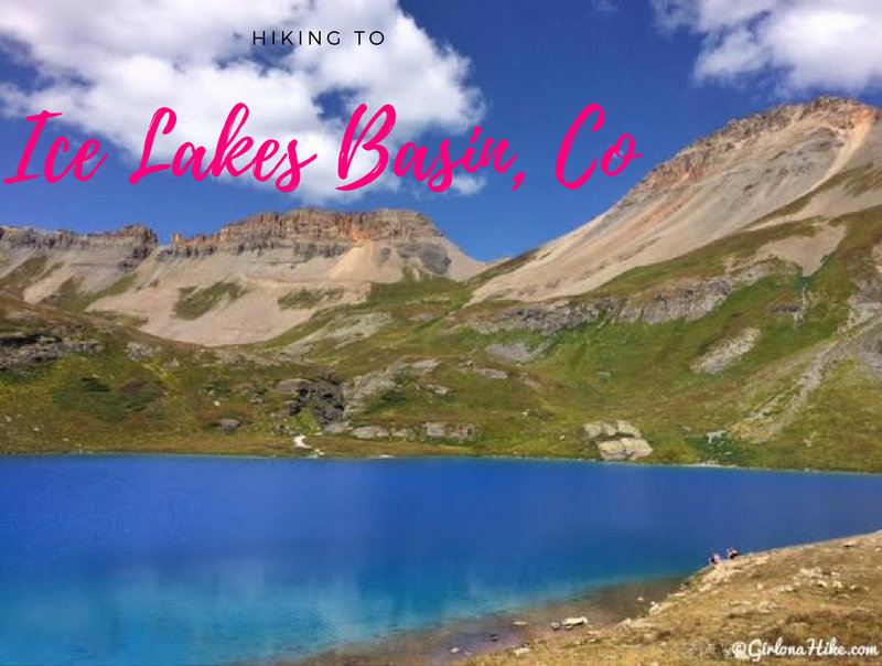
Hiking Ice Lakes Basin – Colorado’s Turquoise Gem Near Silverton
Ice Lakes Basin, located near Silverton, Colorado, is one of the most stunning alpine hikes in the San Juan Mountains—and for good reason. Known for its vivid turquoise lakes, sweeping mountain views, and wildflower-filled meadows, it’s become a bucket-list hike for outdoor lovers visiting southwestern Colorado.
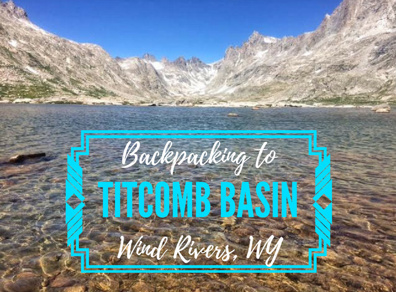
Backpacking to Titcomb Basin in Wind River Range of Wyoming should be on every backpackers "to do" list. The rugged terrain offers massive mountains with spire towers, clear glacial lakes, high alpine grassland & wildflowers, and world class hiking, backpacking, and climbing. Titcomb Basin is truly a pristine and special place.
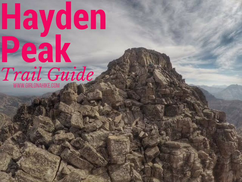
Hayden Peak (12,479 ft) stands out for anyone who's driven along the Mirror Lake Highway in the Uintas. This rugged peak is quite intimidating from the road, but for Peak Baggers that's nothing to prevent us from climbing it. Hiking to the summit of Hayden Peak is NOT for the beginner hiker nor the beginner peak bagger. You should be comfortable hiking across narrow ridges, class 3 scrambles, and route finding. There is either a very faint, or non-existent trail. Though this route is only 2 miles one way, you'll gain a total of just over 2,000 ft.
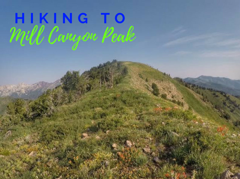
Mill Canyon Peak (10,349 ft) sits on the backside of the Wasatch Mountains and offers amazing 360 degree views. For a 10,000 ft peak this is a relatively easy summit - there's a trail most of the way and no scrambling.