

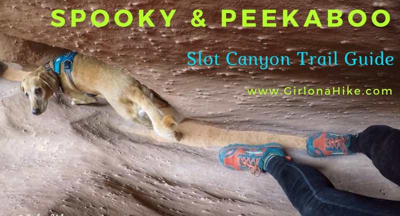
Spooky & Peekaboo are the most popular slot canyons in the Escalante area. The access is easy, you can easily do both as a loop in a few hours, and hikers without technical canyoneering equipment or skills can enjoy both. Spooky slot canyon is one of the narrowest canyons in the world that hikers can safely navigate. It's much longer and slimmer than Peekaboo, forcing hikers to carry daypacks to the side as you shuffle through. Add in a few short obstacles and one 5 ft scramble to make it that much more fun. Claustrophobic people will have a hard time with this Spooky.
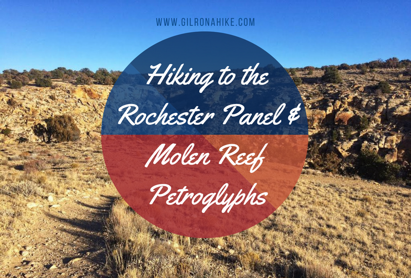
The Rochester Panel and Molen Reef Petroglyphs are near Emery, Utah, and consists of one very large panel of hundreds of images likely carved by the Fremont Native Americans. The vast majority of the petroglyphs have a strong Barrier Canyon influence, including animals, female/male figures, and one large rainbow-like image. Molen Reef Petroglyphs are much smaller, but still expose what the native people were contemplating. You can easily combine both in one afternoon, as the hike to the Rochester Panel is only 1/2 mile, and you can drive right up to the Molen Reef area. Kids, dogs, and casual hikers will enjoy these areas, but please respect the rules and DO NOT touch any of the petroglyphs.
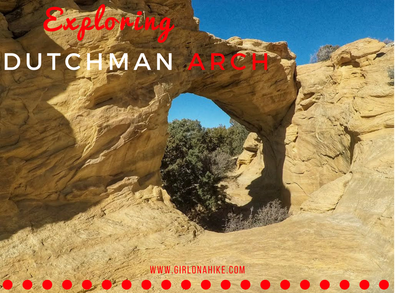
Exploring Dutchman Arch & Head of Sinbad Pictographs – San Rafael Swell, Utah
Located in the heart of the San Rafael Swell, the Dutchman Arch and Head of Sinbad Pictographs are two fascinating sites rich in natural beauty and cultural history. While both are surprisingly close to I-70—just about 1/4 to 1/2 mile north—the drive requires a high-clearance 4x4 vehicle due to sandy and rough road conditions.
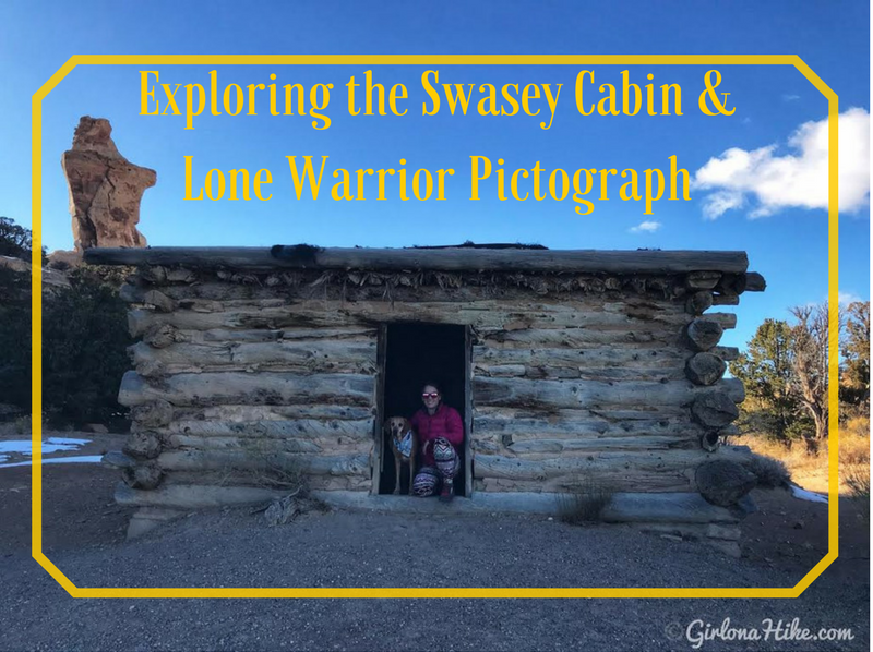
Exploring the Swasey Cabin & Lone Warrior Pictograph – San Rafael Swell, Utah
Located in the San Rafael Swell, just west of Green River, Utah, the Swasey Cabin and Lone Warrior Pictograph are two historical gems worth exploring. This area is rich in both outlaw history and ancient Native American rock art, making it a fascinating stop for hikers, history buffs, and off-road adventurers alike.
The trails I gravitate to most are the ones right out the door - no more than an hour's drive from Salt Lake City. These are the trails I do right before or after work, with friends, solo, or save the bigger hikers for the weekend. Whether you want to see new trails, improve your fitness, or lose weight, use this book as a tool for motivation.
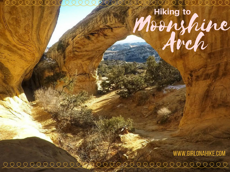
Moonshine Arch is located about 7 miles north of Vernal, UT. Not to be confused with the Moonshine Wash Slot Canyon in the San Rafael Swell, this short trail leads to an amazing arch that is 40 ft high, and 85 ft long. The trail is 90% sand and 10% slickrock, so because of this I highly avoid hiking here in Summer months if you bring your dog (the sand/rock will be too hot for their paws). The best time to hike here is in the afternoon, when the sun lights up the arch and alcove. This trail is super short, so it's great for kids or families visiting from out of state to hike to. Be aware that this trail crosses through an open cattle range, so always have a leash handy and don't disrupt the cattle or other wildlife.
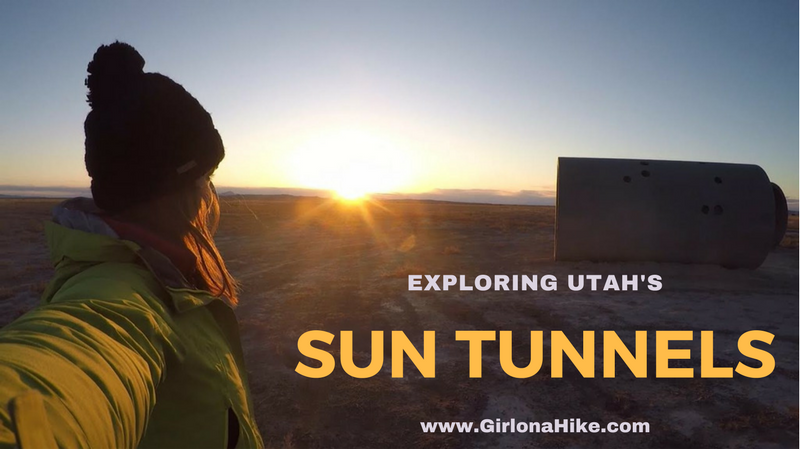
Visiting the Sun Tunnels in Utah – A Solar & Stargazing Sculpture by Nancy Holt
Tucked away in the remote desert of northwest Utah, the Sun Tunnels are a stunning example of land art created by artist Nancy Holt in 1976. Designed to align with the sunrise and sunset during the solstices, this large-scale sculpture also invites visitors to connect with the stars, light, and landscape in a truly unique way.
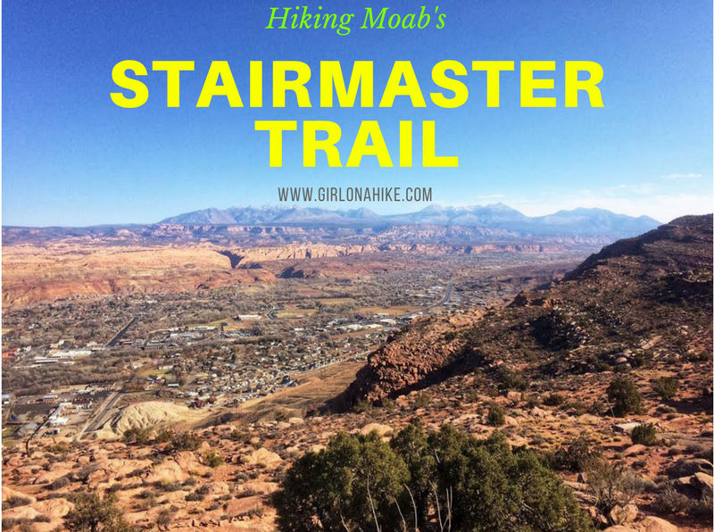
The Stair Master Trail in Moab, Utah is another short yet very rewarding hike that leads to an amazing overlook of the Moab valley and LaSal Mountains. This hike is only 1 mile to the overlook, yet it gains 820 ft. The Stair Master Trail parallels the Moab Rim Safari Jeep Route, so you are likely to see many Jeeps or Razors tackling the rock obstacles. This trail can get really hot in summer, so I recommend avoiding it in Summer months if you are hiking with your dogs (the slickrock gets too hot for their paws) OR start really early in the morning to beat the heat.
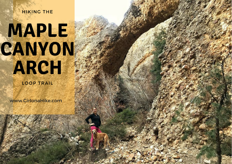
Exploring Maple Canyon – Hiking, Climbing & Fall Colors in Central Utah
Located near Fountain Green, Utah, Maple Canyon is a unique destination known for its dog-friendly hiking trails, world-class rock climbing routes, and stunning fall foliage. The canyon is composed of conglomerate rock, featuring embedded pebbles and boulders, giving it the nickname “cobble climbing”—a favorite among climbers for its unusual texture and challenge.