

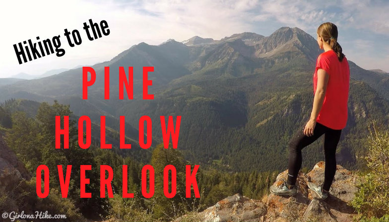
The Pine Hollow Overlook is in American Fork Canyon, and provides an amazing view of the North side of the Timpanogos basin.

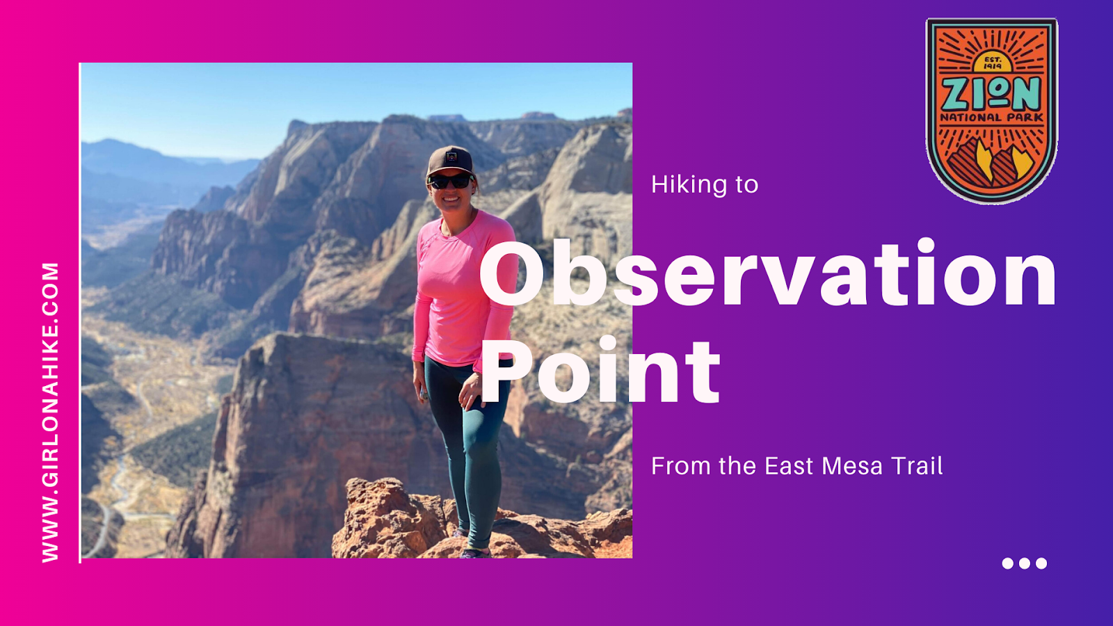
Observation Point – One of Zion National Park’s Best Viewpoints
Observation Point is one of the most breathtaking overlooks in Zion National Park, offering panoramic, 360-degree views of Zion Canyon, the Virgin River, Angels Landing, The West Rim Trail, and even Signal Peak to the west.
At an elevation of 6,507 feet, Observation Point sits about 800 feet higher than Angels Landing, giving hikers a unique perspective that can’t be beat. It’s truly one of the most iconic hikes in Utah and a must-see for visitors to Zion.
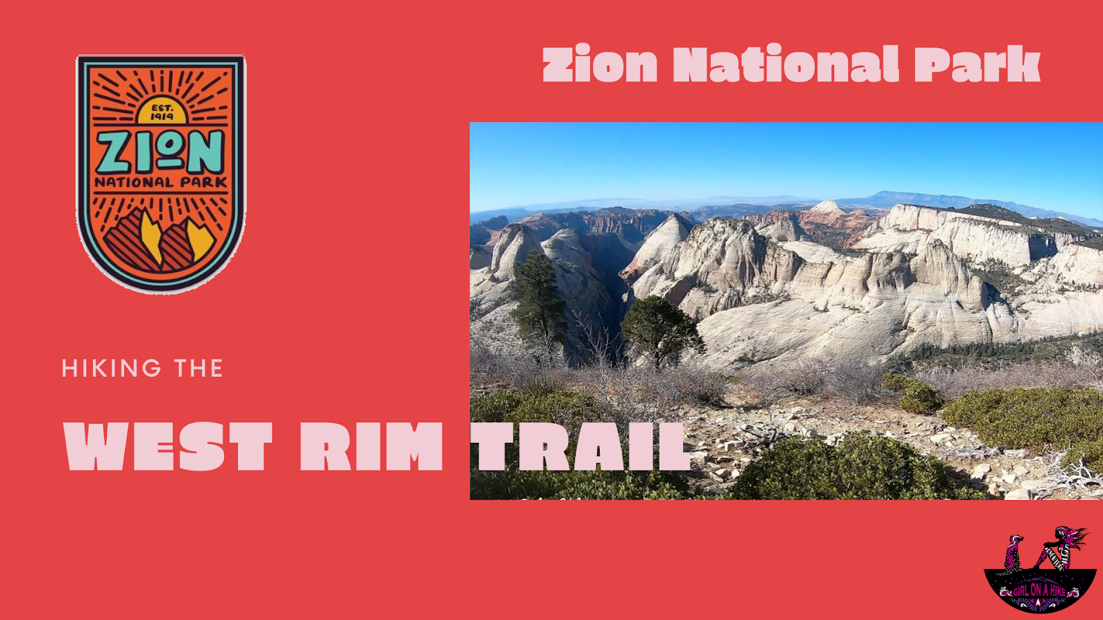
The West Rim Trail is located in Zion National Park (ZNP) and is one of several popular trails for day hikers and backpackers in the area.
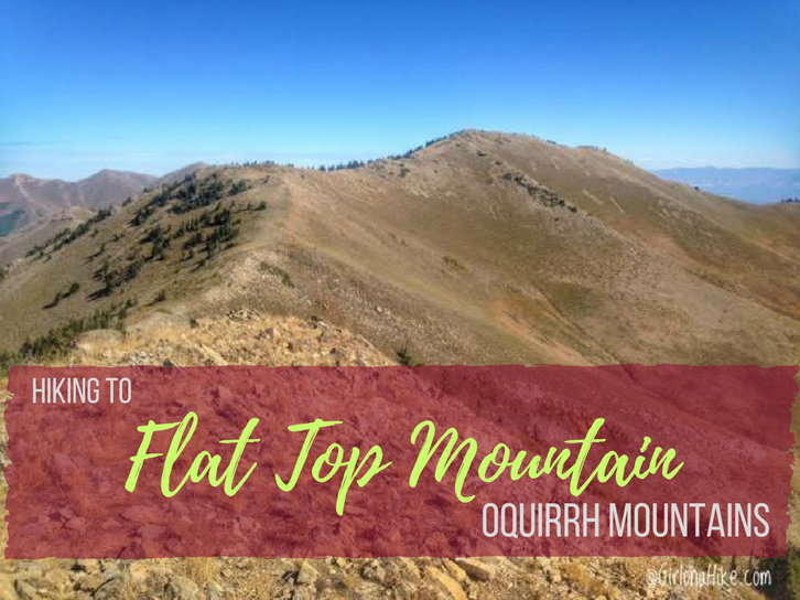
Flat Top Mountain (10,620 ft) is the highest peak in the Oquirrh Mountains (pronounced like "oaker") in Utah, which lies to the southwest of Salt Lake City. Most of the Oquirrhs are private property and mining land for the Rio Tinto Kennecott Mine, however the two areas you are allowed to hike are in Butterfield Canyon, and the Flat Top Mountain trail (update: 2019 land access below). Flat Top Mountain has a prominence of 5,370 ft, making it Utah's 6th highest prominent peak.
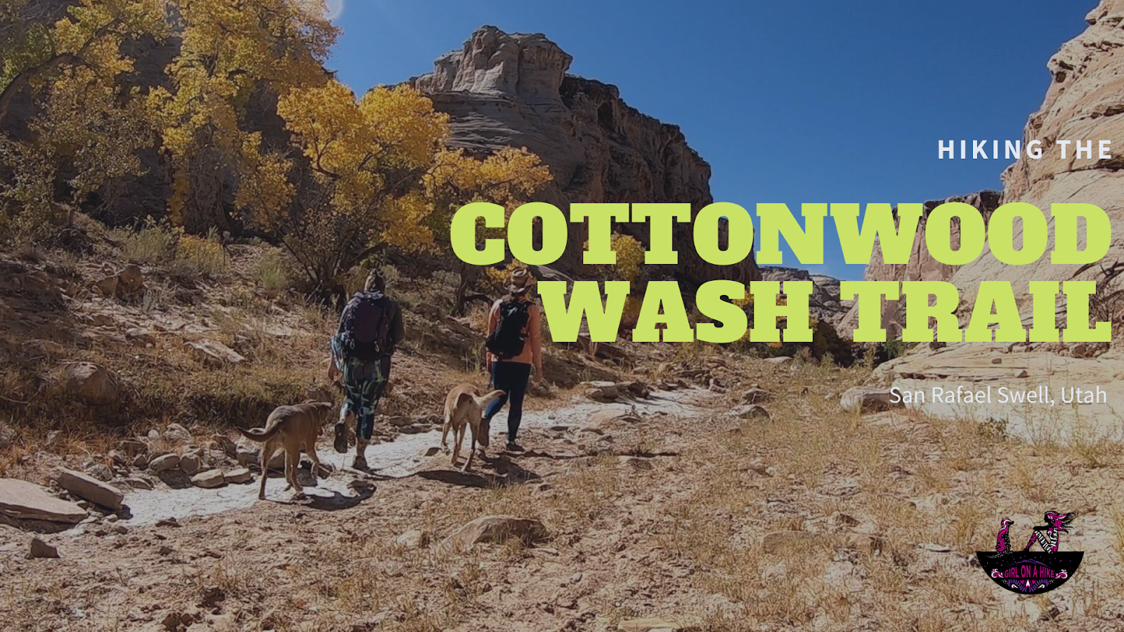
The Cottonwood Wash Trail is a hidden gem located in the heart of the San Rafael Swell, Utah. This easy, family-friendly hike features two impressive natural arches and several fascinating petroglyph panels. The trail is mostly flat, making it suitable for hikers of all skill levels. The only real incline is a short 100-foot section that leads up to the petroglyphs.
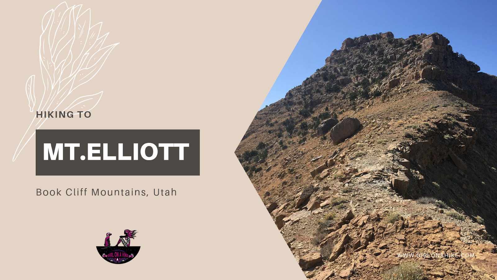
Hiking to Mt. Elliott (7,142 ft) – Book Cliffs, Utah
Mt. Elliott (elevation 7,142 ft) is a remote and rugged peak located in the Book Cliffs between Price, Utah and I-70. If you’ve ever driven from Salt Lake City to Moab, you've likely passed this distinctive peak without even realizing it. Near the small town of Woodside, UT, look southwest from the abandoned gas station (sometimes home to roadside jerky vendors), and you’ll spot Mt. Elliott’s jagged, isolated summit. It’s hard to miss—its sharp profile stands out against the surrounding ridgelines.
This obscure summit ranks #24 out of 29 on the Utah County Prominence Peak list, and due to its isolation and tough conditions, only a handful of hikers reach the summit each year.
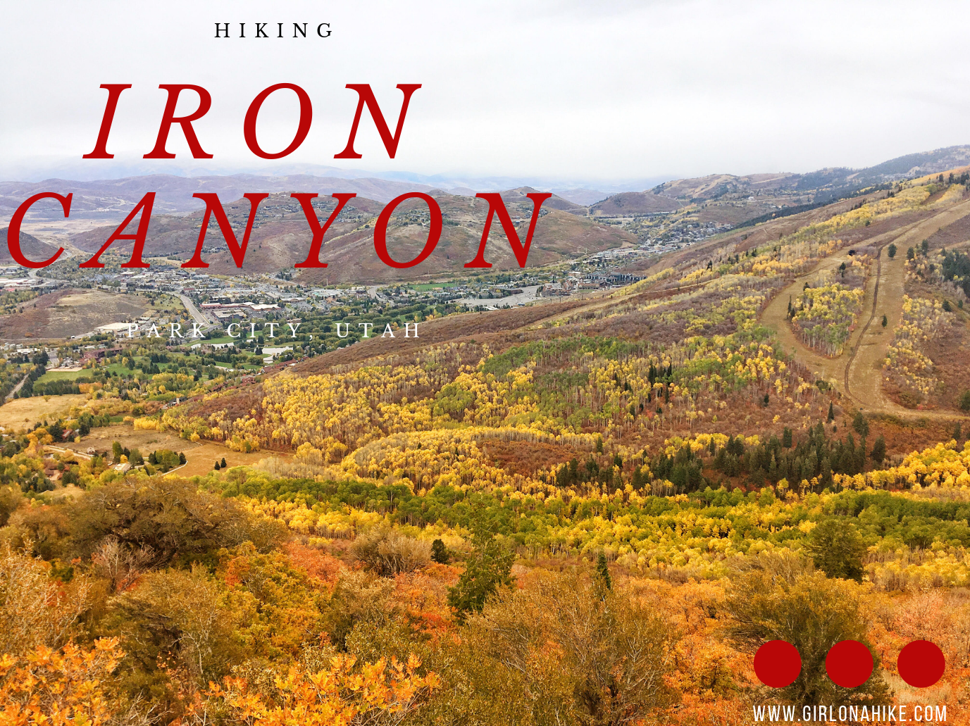
Iron Canyon in Park City, Utah is a beautiful, secluded trail that overlooks the Park City valley and the ski resorts. On a clear day you can see all the way out to the Uinta Mountains. The trail is more popular in winter as a fun sledding spot, but my favorite time to go is in early Summer when everything is turning green again. Most of the mountain is on private land, but the Iron Canyon trail allows for public access.
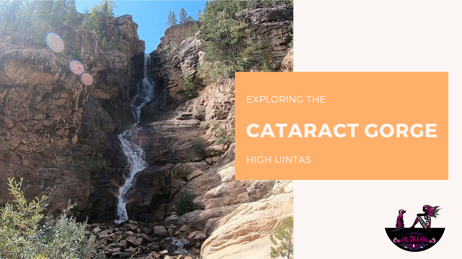
The Cataract Gorge is located near Murdock Basin in the High Uintas. After turning off the Mirror Lake Highway, you'll drive 3 miles along a well-graded dirt road until you reach the forest road intersection for FR027.
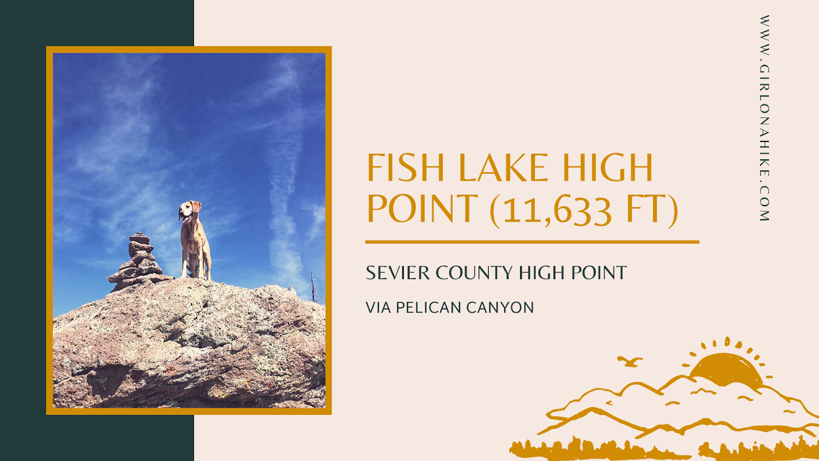
At 11,633 feet, Fish Lake Hightop is the highest peak in Sevier County and a must-do for those completing the Utah County High Points (CoHPs) list. I finally completed this peak as my last CoHP, and I was thrilled to finish the list!