

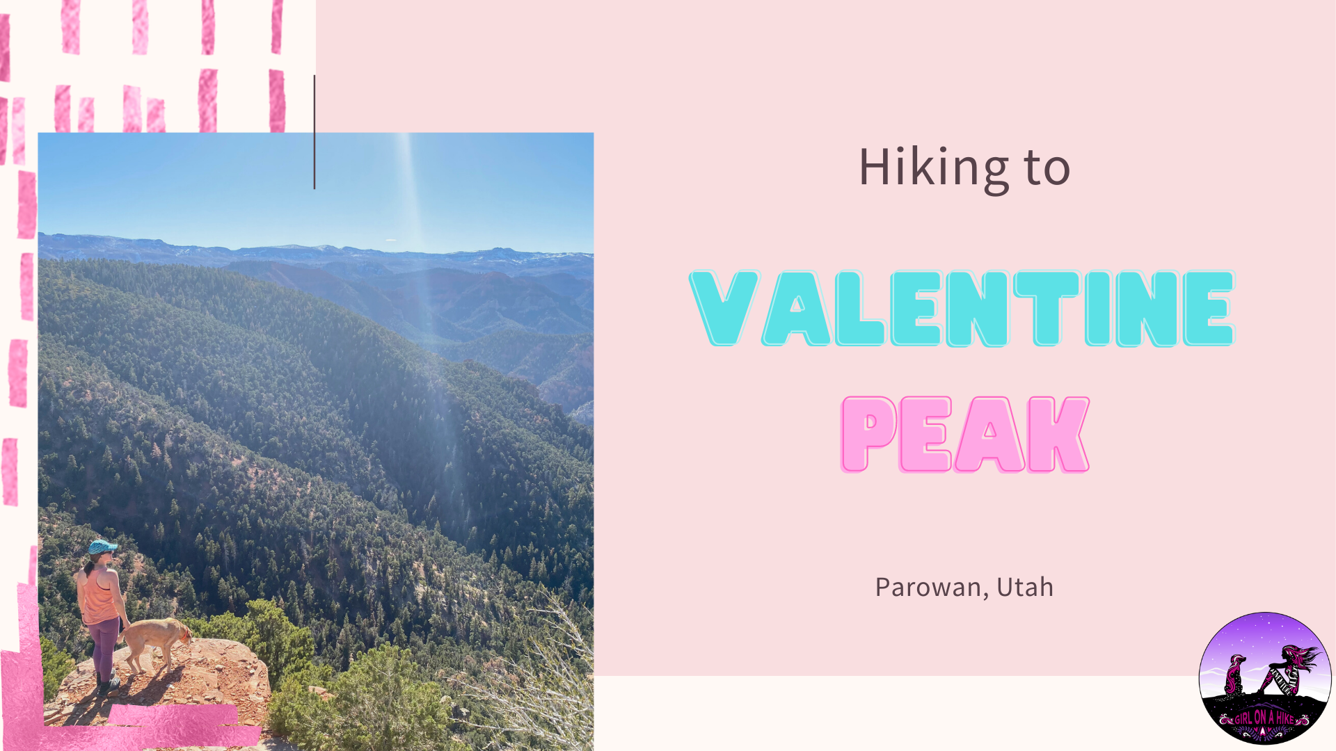

Valentine Peak is located in Parowan, Utah and leads to a 360 degree view of the area, including Brian Head, the Iron County High Point.
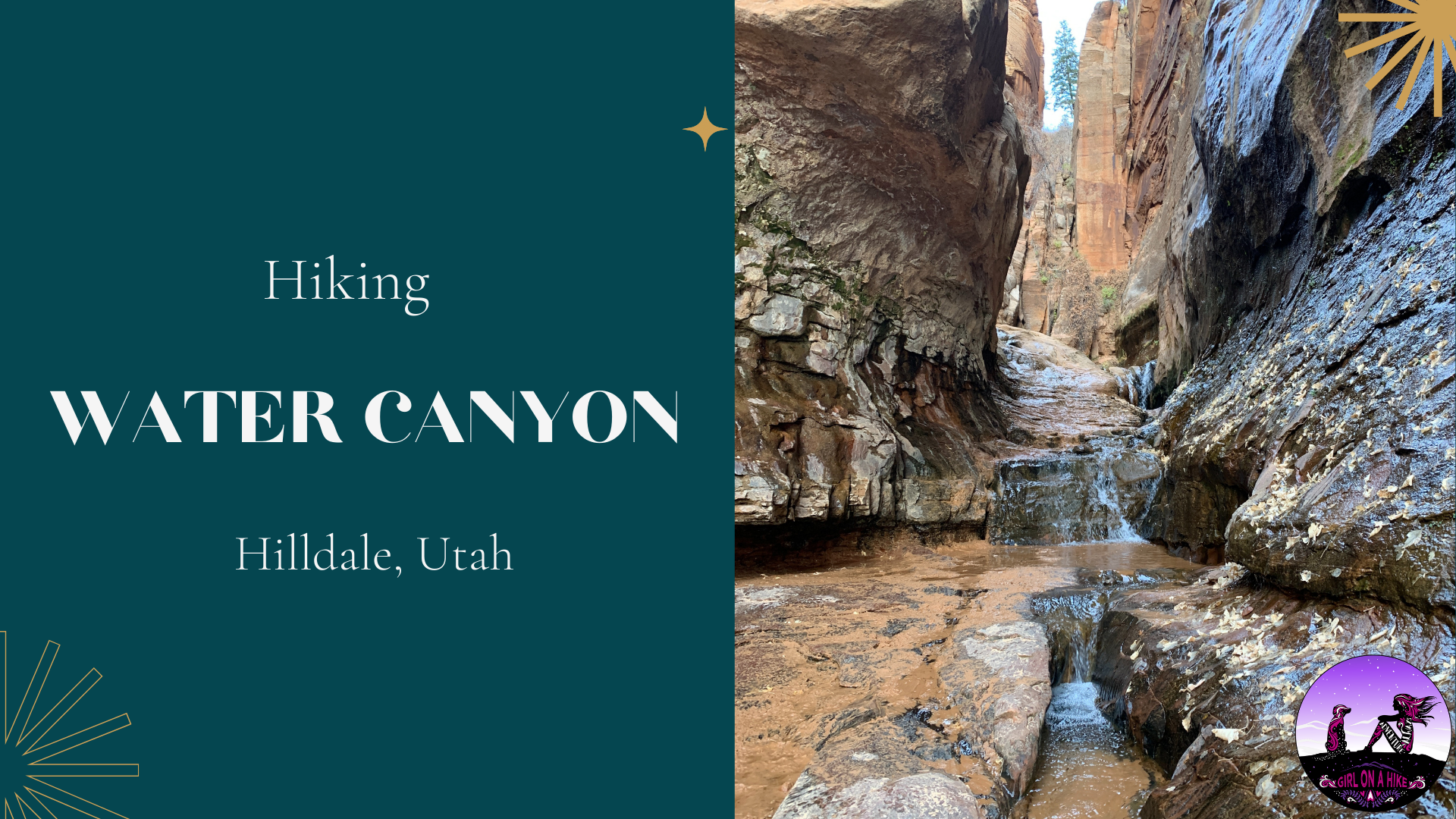

Water Canyon is a perfect desert oasis hike near Hilldale, UT. While this hike looks a lot like Zion National Park, it's dog friendly, perfect for kids, there are zero fees to enter, and you can make the hike as long or short as you want. I highly recommend hiking at least 1.5 miles to the small waterfall and pool area, so the dogs can cool off their paws and kids can explore and splash around.

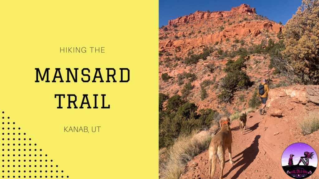
The Mansard Trail is located in Kanab, Utah and leads to a large alcove that is home to several petroglyphs.

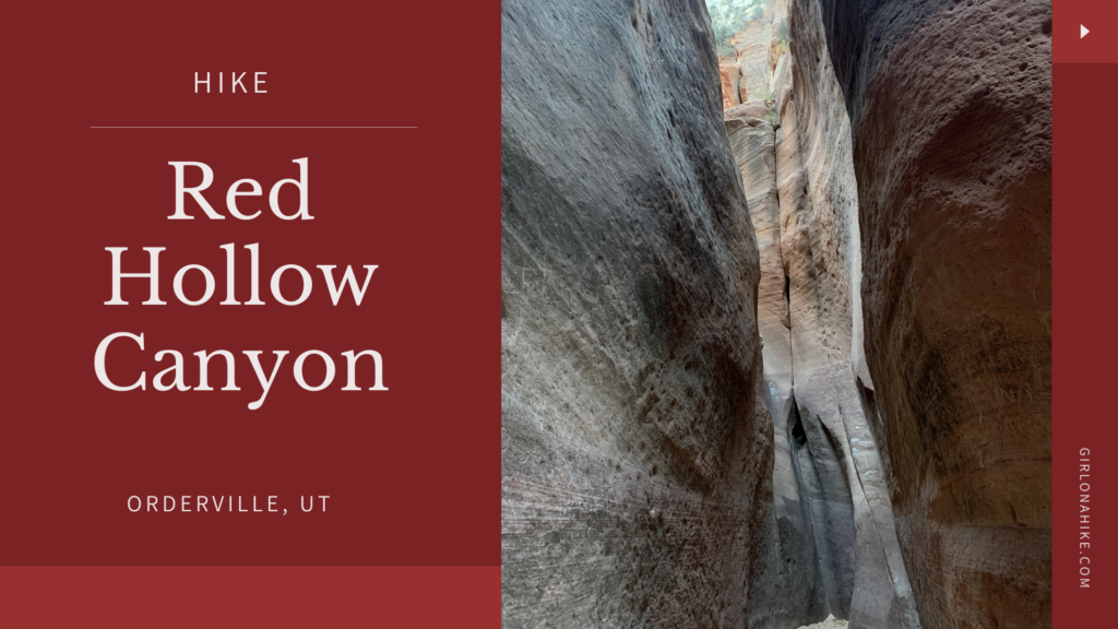
Red Hollow Canyon, a short 1-mile slot canyon in Orderville, UT, is a great stop between SLC and Kanab for a quick stretch with kids and dogs.

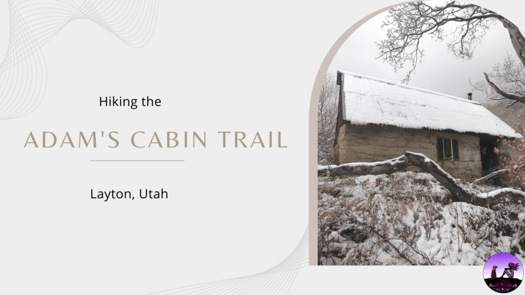
Adam's Cabin Trail leads to an old, historic cabin above Adam's Canyon Waterfall. Adam's Cabin was made of stone in the early 1940s, and today you can still sleep in it, if you dare. Adam's Cabin Trail is steep and not for those with knee or hip issues - it gains 2,700 ft in just 2.7 miles!

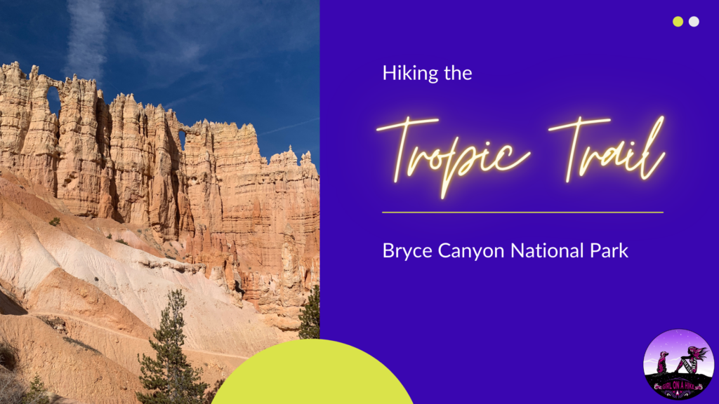
The Tropic Trail is located in Bryce Canyon National Park, but starts on the East side of the park in the amphitheater, as opposed to the rim and the main park entrance.

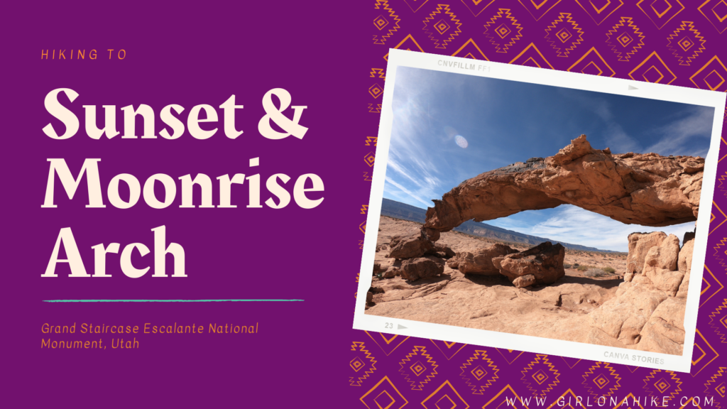
Sunset Arch & Moonrise Arch are two arches located within Grand Staircase Escalante National Monument (GSENM) off Hole in the Rock Road. They are both located in an area that does NOT have an official trail so being able to navigate a GPS is necessary. That being said it is pretty straight forward, and this easy hike is great for small children, dogs off leash, and those wanting to see something cool without the hard effort most hikes in this area require.

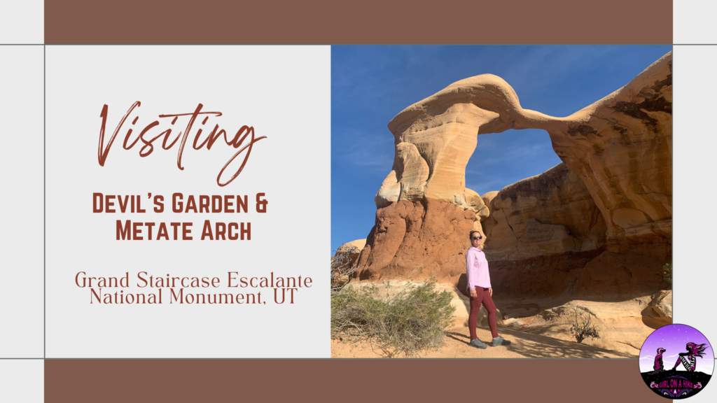
Devil's Garden is apart of Grand Staircase-Escalante National Monument, and is home to Metate Arch as well as hoodoos. Not to be confused with The Devils Garden Loop Trail in Moab, this area is only 640 acres and is part of a Wilderness Study Area, for the purpose of possible wilderness designation; however, wilderness status was not recommended by the BLM back in 1991. One of the reasons state was that the existing roads, parking lot, picnic tables, and port-a-potty are all in close proximity to a natural area. The second reason was the likelihood of several groups of people coming to this area at the same time to the same formations (all of which are within a 2 minute walk from the trailhead). Both of those reasons diminish the wilderness experience of solitude.
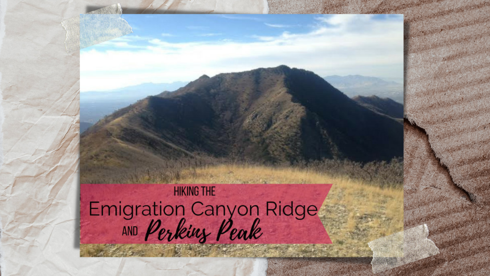

Hiking Emigration Canyon Ridge to Dale and Perkins Peaks – A Hidden Gem Near Salt Lake City
The Emigration Canyon Ridge Trail is a hidden gem nestled between Parley’s Canyon and Emigration Canyon, just east of Salt Lake City, Utah. Starting from the well-known Little Mountain Summit, a popular destination for road cyclists and runners, this scenic ridge hike remains relatively unknown—yet anyone who has driven through Parley’s Canyon has unknowingly passed right below it.
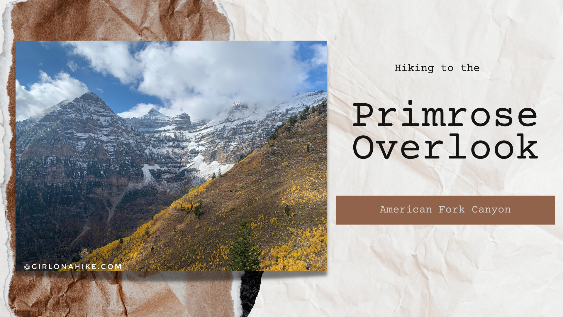

The Horse Flat Trail in American Fork Canyon starts from the Summit Trailhead, and passes through several meadows, large Aspen groves, and shaded areas before finally reaching the Primrose Overlook.