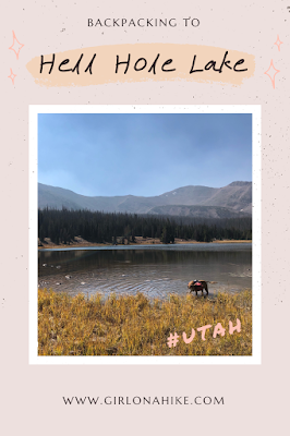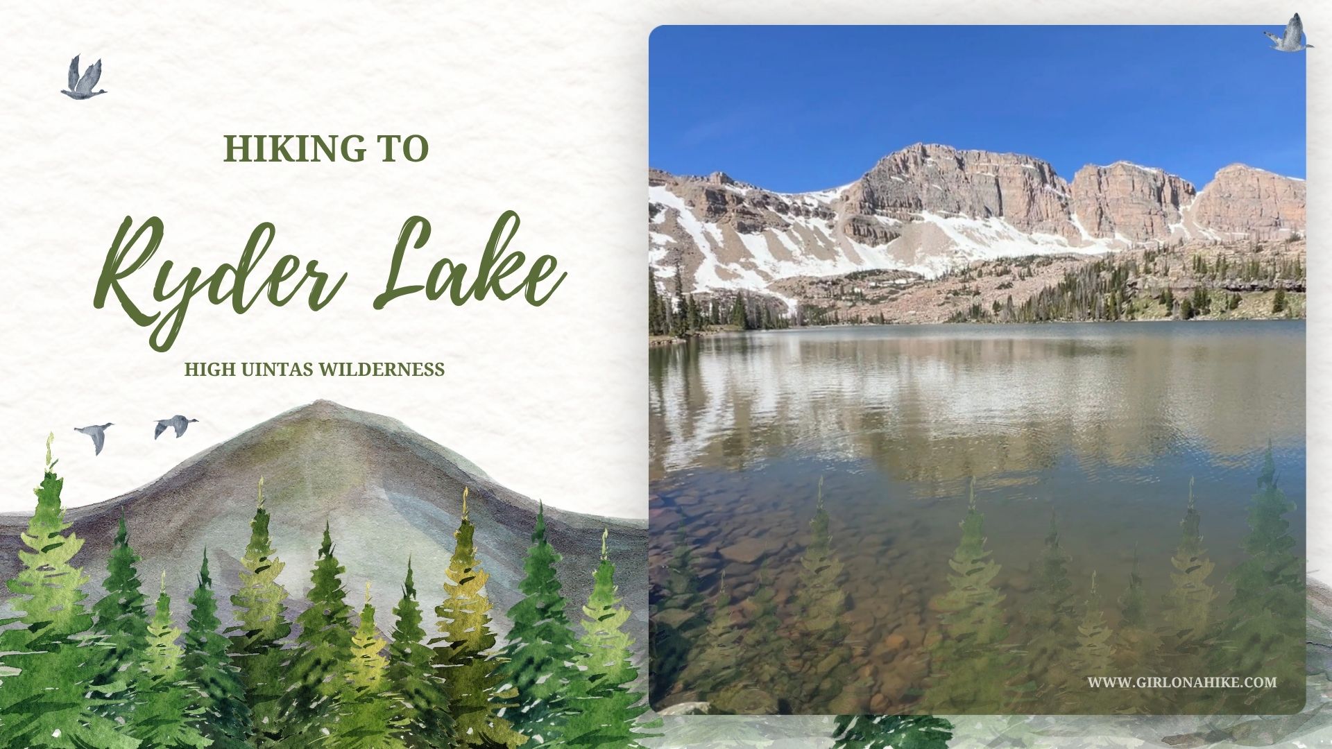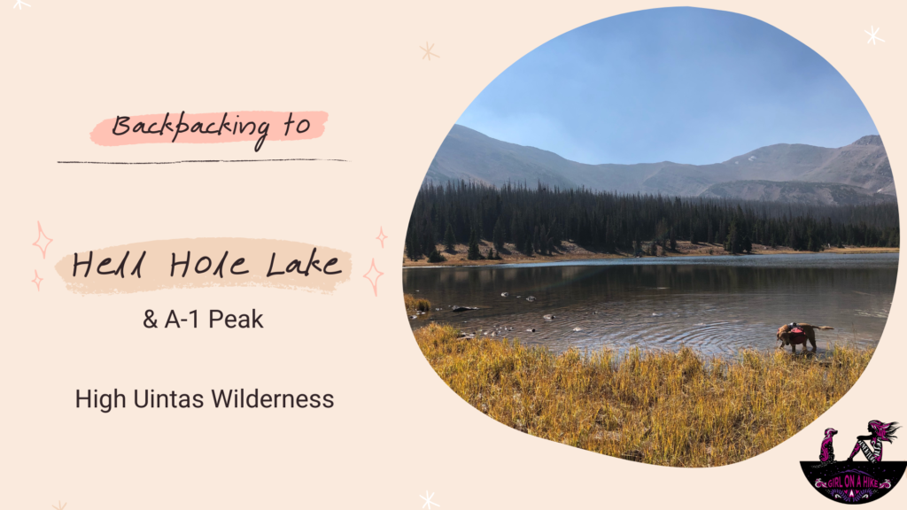
Hiking to Hell Hole Lake in the High Uintas Wilderness
Hell Hole Lake is a scenic alpine lake tucked deep in the High Uintas Wilderness of Utah. Surrounded by rugged peaks like A-1 Peak and Kletting Peak, this secluded lake offers a peaceful backcountry experience away from crowds. Reaching the lake involves a moderately challenging hike that totals 6.7 miles one way, with an elevation gain of around 1,700 feet—a gradual incline that’s manageable for most hikers and backpackers.
Best Time to Visit Hell Hole Lake
The best time to hike or backpack to Hell Hole Lake is late summer through fall, typically from mid-August to early October. While the area is stunning throughout the warmer months, mosquitoes are notorious in this region during early to mid-summer due to the surrounding wetlands.
If you’re looking to avoid bugs and enjoy crisp mountain air, late summer is ideal. Wildlife like moose, elk, coyotes, and deer are commonly seen near the lake, thanks to the abundant water and vegetation.
Trail Overview
The hike to Hell Hole Lake begins with a 3.5-mile walk along a gated road, followed by a section on the Main Fork Bear River Trail. This route offers a consistent and gentle climb, making it ideal for experienced hikers and first-time backpackers alike. Expect stunning alpine scenery, wildflowers in late summer, and the chance to enjoy a serene lake tucked below towering peaks.
Dogs are allowed off-leash, but it’s best to carry a leash in case you encounter wildlife.
Trailhead Options
There are two main trailheads you can use to reach Hell Hole Lake:
-
Gated Road near Christmas Meadows (Recommended)
This is the more reliable route, starting near Christmas Meadows. While it adds a bit more distance, it avoids river crossings and swampy sections, making it the better choice for most hikers.
-
Shortcut Route via Mirror Lake Highway
Located across from Gold Hill, this route cuts off about a mile but involves crossing a river and navigating a muddy marsh. It’s not well marked, and hikers often lose the trail. Unless you’re highly familiar with this shortcut, it’s best to avoid it.
Directions
From SLC head East on I-80 towards Park City. Take exit 146 for Hwy-40 south towards Heber. Take exit 4 towards Kamas. At the first light in Kamas, UT turn left, and at the next light turn Right, onto the Mirror Lake Hwy. Drive until you see the sign for Christmas Meadows, and turn right. Turn right again at the first brown sign that says “Road Gated 1”. Park at the gate. There are no restrooms at the TH. Keep in mind that the Mirror Lake Hwy charges a fee – 1-3 days is $6, 7 day pass is $12, or $45 for an annual pass. If you have an Annual National Parks Pass you get in free. Be sure to place your pass on your dashboard. Drive time from SLC is about 1:15-1:30. Here is a driving map.
Trail Info
Distance: 6.7 miles to HHL
4 miles RT from the lake to A-1 Peak
Elevation gain:
Hell Hole Lake 1,700 ft
A-1 Peak from HHL 2,000 ft
Time: 3-4 hours to HHL, 3-5 hours for A-1
Dog friendly? Yes off leash
Kid friendly? Yes, ages 12+ due to distance and gain
Fees/Permits? None
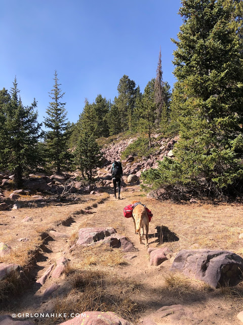
Start of the Hike to Hell Hole Lake
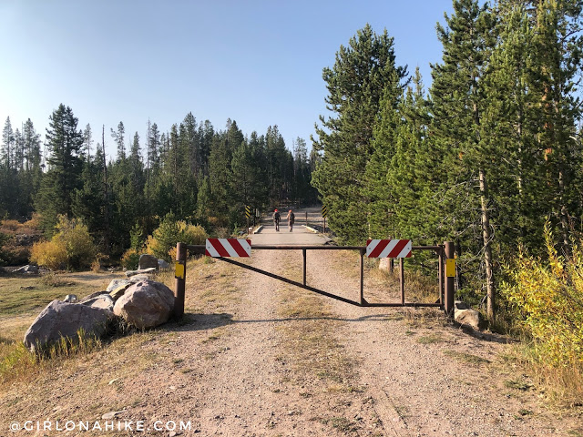
Start by parking at the gate. This is where the road hike begins. Two hunters were ahead of us but branched off very quickly. Over the two days of opening rifle season we didn’t see any other hikers, only a total of 10 hunters.
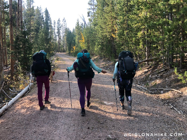
Yay, who doesn’t love a good road hike ha!
Short Cut Trail Split
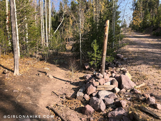
At 2 miles you will see the short-cut trail junction come in from the right (west) side.
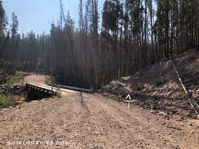
At 3.5 miles you will reach the only bridge and see the trail branching off to the right (south). This is the halfway point, and a good spot for a snack/pee break.
The extra small trail sign. I didn’t even see this until I was wandering around while the others took their pee break.
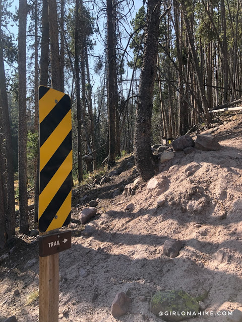
Official Trail to Hell Hole Lake
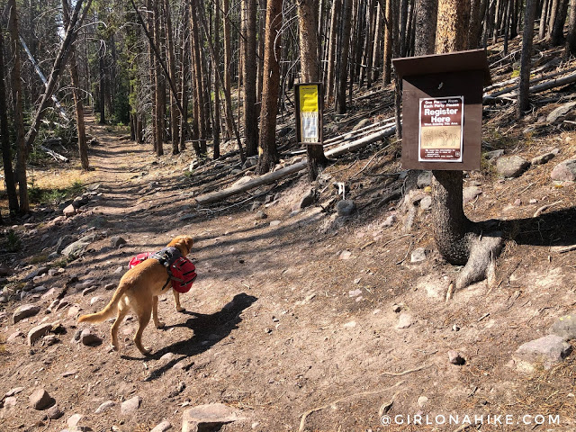
Finally on the actual trail! The first mile of the trail is pretty boring, but eventually the views get better. It’s very rocky but the elevation gain is so gradual it feels flat. You will cross a few small streams.
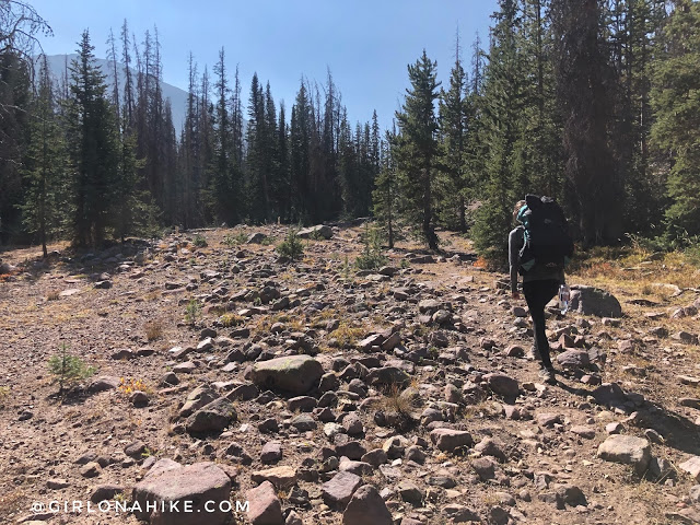
You will hike through nice shaded sections, as well as very open areas.
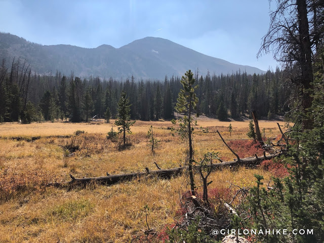
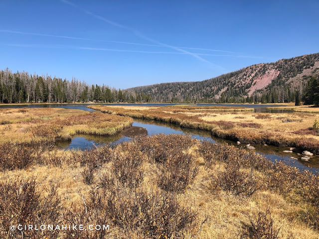
Around the last 15 minutes of the hike, you will come to a giant meadow and have your first good look at A-1 Peak! The fire smoke was really bad though, so the views weren’t the clearest.
Cross the meadow.
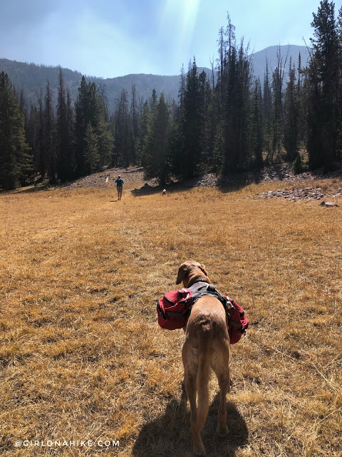
You will then reach the tiniest High Uintas sign I have ever seen. What’s with all the small signs along this trail!?
Only a few minutes to go. There is only one steep section, right before the lake.
Reaching Hell Hole Lake
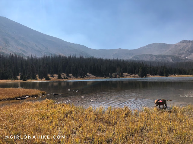
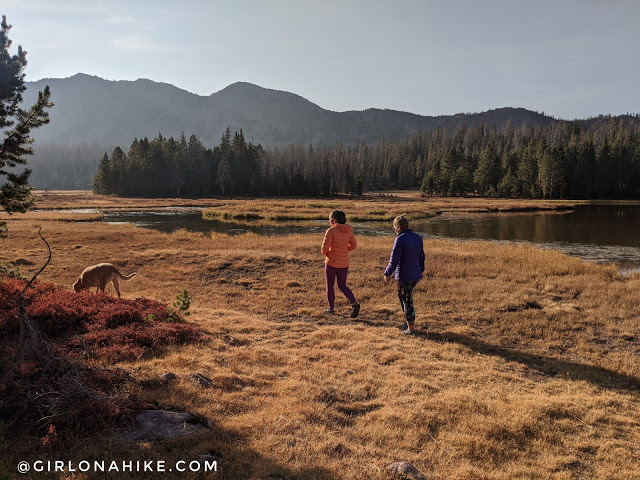
Made it! We saw one fisherman who warned us about hunters, and as we walked around the lake we ran into them. They asked where we were camping, so they knew where to stay clear of us. We said, “Well, that’s what we are looking for right now. A good campsite.” The pointed to some trees and told us about a site, so we picked that one. There are campsites around the whole lake, but the best are on the West and South sides of the lake.
Views from the South end of the lake, looking North.
Exploring Around Camp
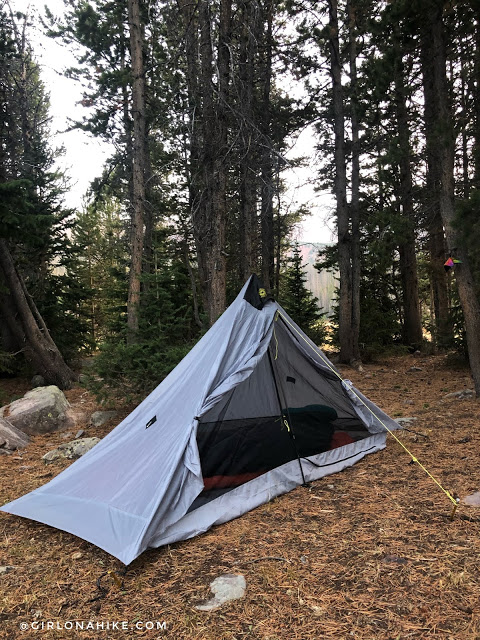
I quickly found a good spot for my Six Moon Designs UL Lunar Solo tent.
Exploring around camp and the lake.
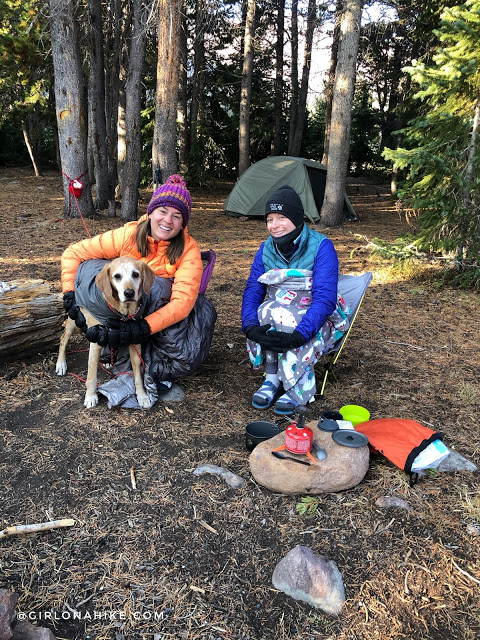
The low temperature was around 32-35F. My water filter had some ice in it, and I froze my butt off at night. I should have slept with more layers on, but I was afraid to get out of my sleeping bag and let all the heat out. So I just dealt with it, but I was ready for my hot tea in the morning! Charlie didn’t shiver once, so I think he’s getting used to the cold before me.
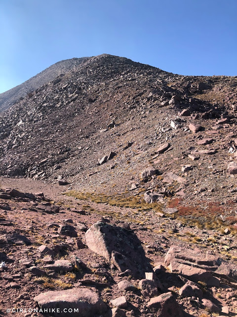
Hiking to A-1 Peak
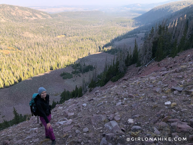
That morning, before we hiked back to the car, Amy and I hiked up to A-1 Peak. This peak has been on my to-do list for awhile. We just aimed for the saddle, but hiking up was so steep with loose rock. I hate scree, but we made it through safely.
Finally we got on the saddle. From camp, it took us 1 hour 15 minutes just to hike 1 mile!
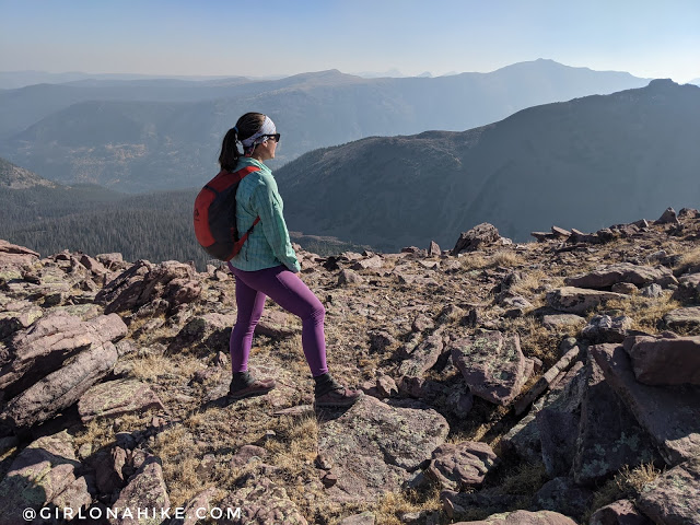
Now, we just followed the ridge up.
On the Ridge to A-1 Peak
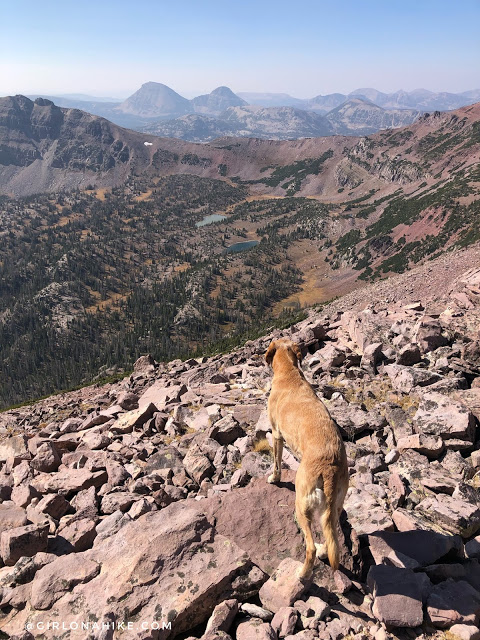
From the ridge, looking back down to an unnamed lake.
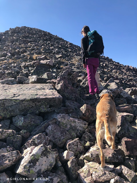
Amy and Charlie lead the way. Slow and steady along these boulders to not get an injury.
Whew, are we almost there? This 1/2 mile was very slow going. At least the summit was in sight now.
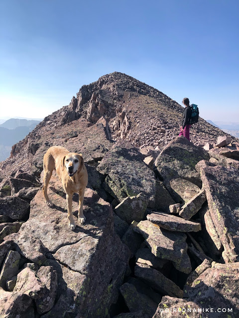
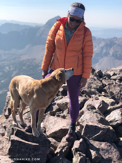
Summit!
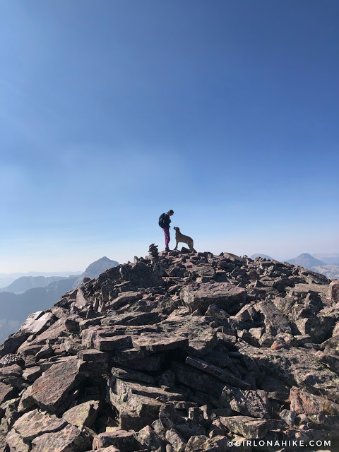
What a cute picture! Charlie was really asking Amy if she had any water for him.
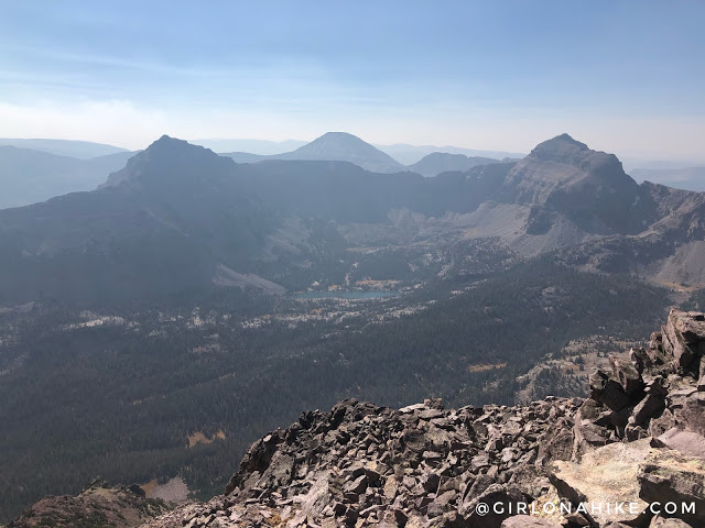
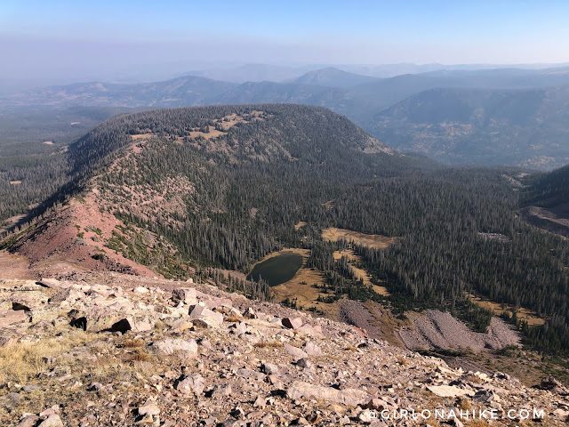
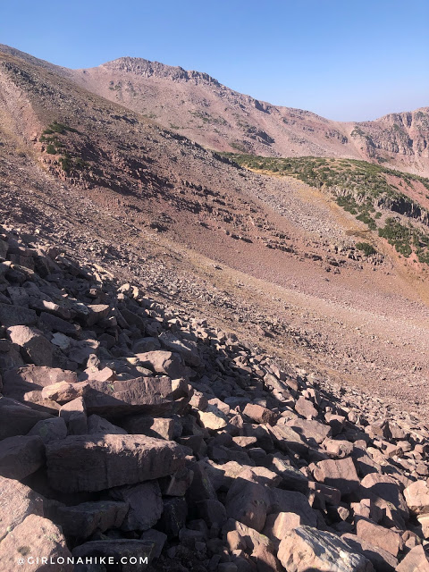
Finally! Marked A-1 off the list. This is looking down to Kermsuh Lake and Hayden Peak to the right.
So proud of my baby! This is definitely not a hike for all dogs. Charlie is used to peak bagging in the Uintas with me, so his paws have toughened up. I carried 1.5 liters of water just for him, and 1 liter for me for this short hike.
From A-1 looking more SW towards Bald Mountain and Reids Peak. I love seeing all the peaks I have done from up here!
Time to Descend
We made our way back down the West ridge, and honestly neither route is easy nor “good”. This side down from the saddle was all medium sized boulders, whereas the North saddle was the loose scree. The North side was steeper reaching the summit, and the West ridge was more mellow once you are on the saddle. Choose your poison!
After we got down, we both said neither route up the saddles was fun or easy – just a scramble to reach the summit. I wanted also bag Kletting Peak, but we gave Ashley a time frame of when we would be back, and had already passed that by 1.5 hours. We were worried that she would be worried! So that’s why we had to skip Kletting, otherwise I would definitely suggest doing both in a day form HHL. Plan on taking around 5-7 hours for both peaks. Hiking to just A-1 took us 3.5 hours RT from camp for 4 miles RT.
Watch my video & Subscribe!
Trail Map
My track via Gaia GPS – the best tracking app! Get your app here for a discount.
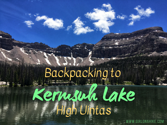
Nearby Hike
Backpacking to Kermsuh Lake, High Uintas

Save me on Pinterest!