

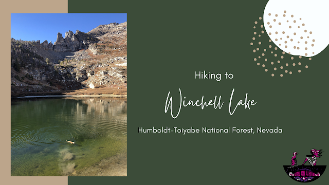
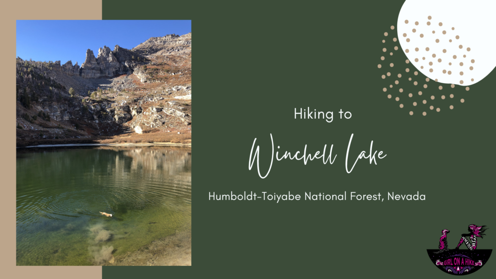
 Winchell Lake is another high alpine lake in the Humboldt-Toiyabe Wilderness near the Angel Lake Rec area, just south of Wells, NV. It's neighboring lakes, Angel Lake & Smith Lake, gets most of the attention, but Winchell is just as pretty! Because this lake is only lightly trafficked, the trail is semi-overgrown and wearing pants will protect your legs. The trail is very easy to follow, it's just filled with overgrown sagebrush.

Exploring Angel Lake Recreation Area in Wells, Nevada
The Angel Lake Recreation Area near Wells, Nevada is a hidden gem for hiking, fishing, and camping. If you've ever seen the brown highway sign for Angel Lake off I-80 and kept driving, it's time to reconsider—this scenic spot is well worth the detour.


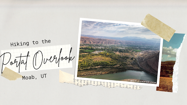
The Portal Overlook is a great overview looking down to Moab, UT as well as the LaSal Mountains and Colorado River. It's a perfect sunrise hike or good trail when you need something short with a great reward! This isn't a trail you want to do middle of summer - zero shade and water, plus lots of bikers, along with the desert heat will make this miserable and can potentially burn dogs paws. The best time to hike this is in Spring or late Fall when the temps have cooled off. Winter would be okay too, just bring microspikes. While this trail is short, I still carried 2 liters of water for just me and Charlie and we both drank it all. You'll definitely get a workout in as this climbs 800 ft to the overlook.
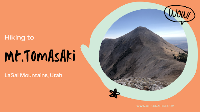
Mt. Tomasaki Hike – La Sal Mountains, Utah
Hiking Mt. Tomasaki in the La Sal Mountains offers an unforgettable alpine experience. As one of Utah’s seven ‘12ers,’ Mt. Tomasaki (12,239 ft) features rugged trails, panoramic views, and high-elevation challenges.”

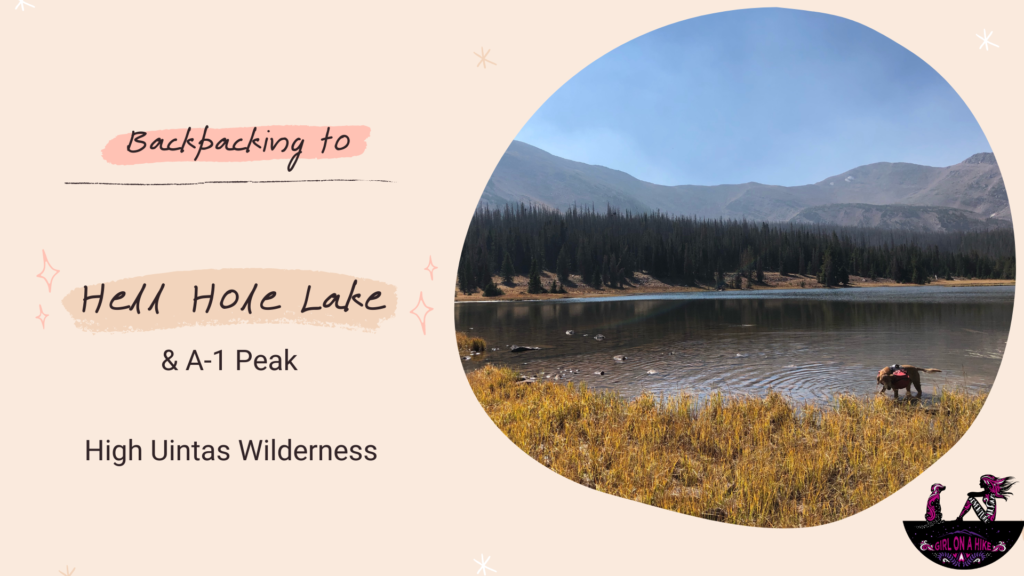
Hiking to Hell Hole Lake in the High Uintas Wilderness
Hell Hole Lake is a scenic alpine lake tucked deep in the High Uintas Wilderness of Utah. Surrounded by rugged peaks like A-1 Peak and Kletting Peak, this secluded lake offers a peaceful backcountry experience away from crowds. Reaching the lake involves a moderately challenging hike that totals 6.7 miles one way, with an elevation gain of around 1,700 feet—a gradual incline that’s manageable for most hikers and backpackers.
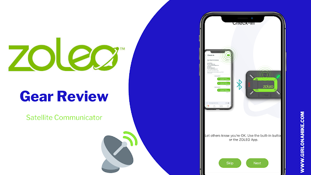
ZOLEO is one of the newest satellite communicators on the market, and on our big 5 night, 6 day trip to the Alice Toxaway Loop, I knew this was something I wanted to take along and test out. ZOLEO sends and receives messages via the Iridium global satellite network when you are in the backcountry. Using the ZOLEO device itself along with the app (required for use), you can text messages via cellular or Wi-Fi when available - you won't even miss a message if the ZOLEO isn't turned on!
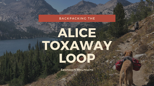

Backpacking the Alice Toxaway Loop – A Stunning Adventure in Idaho’s Sawtooth Mountains
The Alice Toxaway Loop is one of the most scenic and popular backpacking routes in the Sawtooth Mountains of Idaho. This 18-mile loop can be hiked in either direction and offers flexibility depending on how long you want to stay. While some people complete it as a long day hike or over a weekend, we stretched our adventure into 5 nights and 6 days, allowing extra time to explore side trails and soak in the beauty of the backcountry.