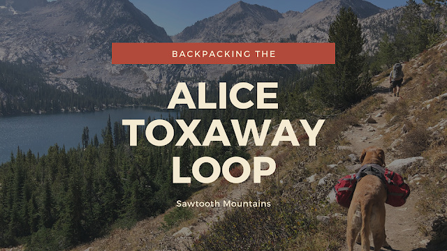

Backpacking the Alice Toxaway Loop – A Stunning Adventure in Idaho’s Sawtooth Mountains
The Alice Toxaway Loop is one of the most scenic and popular backpacking routes in the Sawtooth Mountains of Idaho. This 18-mile loop can be hiked in either direction and offers flexibility depending on how long you want to stay. While some people complete it as a long day hike or over a weekend, we stretched our adventure into 5 nights and 6 days, allowing extra time to explore side trails and soak in the beauty of the backcountry.
About
Along the loop, you’ll pass through dense forests, sharp granite peaks, alpine streams, and several pristine mountain lakes—Alice Lake and Toxaway Lake being the most iconic. With a full week to explore, we ventured beyond the main loop to visit Edna Lake, Imogene Lake, and even summited a small unnamed peak for panoramic views.
Why Fall is the Best Time to Hike the Alice Toxaway Loop
Although we typically plan our annual backpacking trip from late August through Labor Day, our 2020 trip was pushed to late September due to COVID and my partner’s hospital schedule. It turned out to be the perfect time to visit the Sawtooths! Here’s why:
Off-leash dog access (after Labor Day)
No mosquitoes
Vibrant Fall foliage
Cool, comfortable temperatures (highs around 65°F, lows in the 30s)
Fewer crowds compared to the peak summer months
A Must-Do Trip for Alpine Lake Lovers
If you’re dreaming of a mountain paradise filled with alpine lakes, rugged ridgelines, and peaceful campsites, the Alice Toxaway Loop should be at the top of your list. Whether you have two days or an entire week, this route offers endless opportunities for exploration and solitude.
Directions
The Tin Cup Hiker Trailhead is located about 30 minutes south of Stanley, ID and an hour north of Ketchum, ID.
Trail Info
Distance: Our total mileage was 38 miles. The main loop is only 18 miles.
Elevation gain: Varied each day, but the most was 2,000 ft.
Time: You can do the main loop in a day. Most people do 2 nights 3 days, we had 5 nights 6 days. Just depends on how much time you have and how fast you want to do it.
Dog friendly? Yes, read below for details
Kid friendly? Yes, read below for details
Fees/Permits? There is no fee, but a permit is required and is picked up at the self-serve station about 1.2 miles into the hike on either side of the loop.
Frequently Asked Questions About Backpacking the Alice Toxaway Loop
🗓 When is the best time to visit?
The best time to backpack the Alice Toxaway Loop is late July through September, depending on the snowpack. In high snow years, trails may not be accessible until August. In low snow years, you might get in as early as June.
- Check conditions by calling the Sawtooth National Forest Service for updates on trail access, snow levels, and fire restrictions.
- Afternoon thunderstorms are common in summer—always check the weather.
- Snow is possible at high elevations year-round, so pack accordingly.
⛰ How difficult is the hike? Is it family-friendly?
The difficulty varies based on your experience level, fitness, pack weight, and weather conditions. The loop does not require technical climbing, but mountain passes must be crossed.
- Most hikers should be comfortable carrying a 30–40 lb pack for multiple hours.
- We recommend this trail for experienced backpackers with prior trips under their belt.
- You’ll see fewer young kids (we only saw a few under age 12), but older, active children may enjoy it.
🐶 Can I bring my dog?
Yes, dogs are allowed on the Alice Toxaway Loop.
- On-leash required from July 1 through Labor Day
- Off-leash permitted the rest of the year
- Always carry a leash in case of wildlife encounters
- Dogs should be in good shape for long distances and rocky trails
- Poop pick-up is not required, but please be responsible
- This is black bear country—secure all food and dog food properly
📚 Pro Tip: Learn how to Get Your Dog Ready for their First Backpacking trip and make sure they have their own Doggie first aid kit.
🧗♂️ What’s the elevation gain like?
The elevation varies based on your chosen route and daily mileage.
Trailhead (Tin Cup): ~7,000 feet
Highest point on our route: ~9,600 feet
🧠 Be aware of altitude sickness symptoms and take time to acclimate if you’re not used to high elevations.
🔥 Can I have a campfire?
No campfires are allowed in the Alice and Toxaway Lake basins—this is a permanent restriction.
Once over the ridge near Edna or Imogene Lakes, fires are permitted
Always follow current fire regulations
🧺 Are there food storage requirements?
Yes, strict bear safety regulations are in place.
- Use a bear canister or hang your food properly
- Store dog food securely
- Carry Bear Spray at all times—we didn’t see any bears, but they are present
💧 What about water sources?
Water is plentiful throughout the route via alpine lakes and mountain streams.
Bring a water filter like the Sawyer Mini or Platypus Gravity Filter
I carried a 1.5-liter bladder to reduce pack weight and filtered as needed
🦟 How bad are the mosquitoes?
Mosquitoes are worst until mid-August, especially in wet years.
- After that, they tend to die off—but it varies year to year
- Use 100% DEET repellent
- Treat your clothes with Permethrin by Sawyer before the trip (apply outside and allow to dry between coats)
🗺 What map or guidebook do you recommend?
We used the National Geographic Trails Illustrated Map 870 – Sawtooth National Recreation Area.
It’s accurate, but we found the mileage to be slightly off by about a mile
Combine it with Gaia GPS for GPS tracking and route planning

🥾 Day 1 – Hike to Twin Lakes
📍 Distance: 7.6 miles
⛰ Elevation Gain: 1,926 feet
⏱ Time: Approximately 3.5 hours
We kicked off our Sawtooth backpacking trip with a moderate hike to Twin Lakes. The trail steadily climbs through scenic alpine forest and meadows, offering great views as you gain elevation. The hike took us around 3.5 hours, giving us plenty of time to set up camp and relax by the lake.
Twin Lakes makes a perfect first-night stop with several flat, scenic campsites and easy access to water.

The previous night we found a spot along a nearby dirt road to car camp. While there is the Pettit Lake Campground right at the TH ($16/night) we opted for free. Ian makes sure there are no last minute restrictions to this area. Annnnd we’re off!

Within the first 5 minutes of hiking you’ll reach the first trail split. This is where you’ll choose which direction you are doing the loop. We stayed straight for Alice/Twin Lakes to do the loop clockwise. Later, we would come back to this same spot on our last day from the right side.

Passing Pettit Lake (pronounced like pet-it). That basin all the way back there is where we are headed.

At 1.3 miles reach the Sawtooth Wilderness sign. I highly recommend wearing trail gaiters to keep all the dirt and rocks out of your shoes. I buy mine from Dirty Girl Gaiters online (they’re the best out of a few brands I’ve tried).

📝 Trail Permits: What You Need to Know
Before hitting the trail, make sure to stop at the self-serve permit registration box located at the trailhead. Every day hiker and backpacker (in groups of 7 people or fewer) is required to fill one out. These permits are free and help the Forest Service manage usage in the area.
If your group has 8 or more people, you’ll need to contact the Sawtooth National Forest Ranger District in advance to obtain a special group permit.

The first 2 miles are very mellow and shaded. There are a handful of downed trees to climb over. At 2.5 miles cross the stream for the first time.

Soon you’ll cross it once more. Thankfully going in September the water levels are low enough you won’t get wet, and there are plenty of rocks to walk across. I imagine earlier in summer you’ll need to just walk through it.

Ahh I love backpacking when the Aspens are yellow!

At 3.5 miles reach a set of switchbacks. This was the hottest section of the trail this day, as there is no shade.

Working our way up higher. The day before a storm came through and cleared out the smoke for us for the next two days. You can see the White Cloud Peaks in the distance. By mid-week you couldn’t see them at all.

At mile 5.3 cross a high bridge.
🏞 First Look at the Basin & Passing “El Capitan”

At around mile 5.9, you’ll get your first stunning view of the Alice-Toxaway basin and pass by the Sawtooth Mountains’ version of “El Capitan” (elevation 9,901 ft)—an iconic granite peak that towers over the valley.
Earlier in the day, we met a fellow hiker who recommended camping at Twin Lakes instead of Alice Lake, saying it was quieter and more scenic. We took his advice and kept going—Twin Lakes is about 1 mile past Alice Lake and made for a peaceful and beautiful first-night campsite.

The turn-off to Twin Lakes was at 7.5 miles. Many of the signs were low to the ground and could easily be missed.

We reached Twin Lakes and had plenty of campsites to choose from on a Sunday night. We didn’t attempt to fish here because we saw nothing jumping or moving in the water. This year my big gear upgrade was getting a 3-person tent for our longer trips to have more room for me, Ian, and Charlie plus our gear. I got the Big Agnes Copper Spur HV UL3 and its soooo nice. We used to use my 2 person MSR tent, but for 5 nights it was just too cramped and the 3 person weighs the same!

🍽 Backpacking Meals – “Real Food” on the Trail
Ian is all about cooking real food while backpacking, so for the first three nights, we had fajitas with ground beef, and for the last two, we made sausage and peppers wrapped in tortillas. He calculated that our “real food” weighed in at around 10 lbs—definitely heavier than dehydrated meals, but totally worth it for the taste and satisfaction after a long hike!
Here’s what we packed for 5 nights of backcountry dinners:
🥩 Ingredients:
-
3 lbs ground beef
-
8 jalapeño sausages
-
1 large brick of cheddar cheese
-
16 tortillas (Rico’s brand – 2 packs)
-
4 bell peppers
-
1 onion
-
3 avocados
🍫 Desserts & Extras:
-
3 chocolate bars
-
12 York peppermint patties
-
Small containers of salt, cumin, and olive oil
Yes—it was a lot of weight to carry, but after a full day of hiking, fresh, flavorful meals hit the spot.
🥘 Cooking Setup:
-
MSR Reactor for heat
-
Grill grate, balanced on rocks for a flat cooking surface
-
Lightweight Dollar Tree reusable plates (still going strong after years!)
This system worked incredibly well and made our meals feel more like car camping than ultralight backpacking.
🥾 Days 2 & 3 – Hike to Edna Lake
📍 Distance: 8.3 miles
⛰ Elevation Gain: 1,489 feet
Descent: 1,885 feet
Passes Crossed: 2
⏱ Time: Approximately 4 hours
On Days 2 and 3, we made our way to the stunning Edna Lake, one of the highlights of the loop. The hike included two mountain passes and offered panoramic views along the way. Though the elevation loss was greater than the gain, the up-and-down terrain still provided a good challenge.
We spent a full day here to relax, swim, and explore the area—highly recommended if you have the time to spare!

Good Morning from Twin Lakes and this pretty unnamed peak! Time to pack up camp and move on to Edna Lake. We really wanted to get to Edna since it’s on the backside of this basin, where campfires are allowed.

Working our way up past Twin Lakes to the first pass. It seemed smokier on this day.

Getting closer to the pass, with a view of Snowyside Peak ahead. This could also be done as a side hike along your route. Drop your packs at the saddle then hit the summit. Since I knew we’d have to hike about 8-9 miles, we opted to skip this.

Charlie checks in on me, to make sure my slow feet were still coming. To see what Charlie carries check out my post on Backpacking with Dogs for some tips on shopping for a pack and what to put in there.
🗻 The Trail Pass: Elevation Gain and Scenic Views

We reached the first pass.

And wow, what a view! Look at the line of smoky haze in the distance, gross.

Ohh I love lakes this color.

At 4.2 miles reach the trail split for Edna Lake. We took a quick 5 minute snack break here before working up over 2 miles of switchbacks.

Looking back down to Toxaway Lake.
🏞 Crossing Sand Mountain Pass on the Alice Toxaway Loop

Another view of Toxaway Lake. Hiking up to Sand Mountain Pass was tough for me. Not only is it endless switchbacks for 2 miles, but this was also our hottest day so I was just so hot and thirsty. I wore my tank top because it was probably 65-70F, and I got a really bad sunburn. I didn’t think it was hot enough to burn! So FYI bring sunblock year-round.

Finally we got a good view of the area, and we could still see the White Cloud Peaks in the distance.

Made it to the pass! Time to drop down to the left for Edna Lake. From Twin Lakes to here was 6.4 miles.

Hiking down into the next basin.

More switchbacks, but at least this time it would all be downhill for the next 2 miles. Pretty view of an unnamed lake and what I think is Payette Peak.

Once we dropped into the basin we crossed a small stream and it was so warm Charlie took a little belly bath and drink. The water was so clear you can’t even really see it! You can see where we came from here as well – the small pass ahead.
🏞 Edna Lake Trail Split

At 8.1 mile reach the trail split at Edna Lake. There were great campsites at both the north and south end of the lake, so go either way.

First things first – take off the packs, grab a snack, and test the fishing.

We liked this area so much we decided to spend two nights here. We found another sweet campsite.

His and her’s. Can you guess which is mine? The big one of hot chocolate of course haha! While Ian’s titanium 8 oz mug is extremely light, I prefer having 16 oz of liquid at a time. I use the GSI Outdoors Mug, and he has this mug.

Tent snuggle time!

On our day of relaxing, we walked all around Edna Lake while fishing. This was my favorite view, looking north. I got 2 or 3 bites here, but didn’t catch anything.

Next we hiked up to Vernon Lake to fish. It was windy the whole time so no bites here. I found a really nice campsite here too if you wanted to go a little further than Edna. Didn’t see a single person at this lake.

🥾 Days 4 & 5 – Hike to Imogene Lake
📍 Distance: 5.5 miles
⛰ Elevation Gain: 1,170 feet
Descent: 1,236 feet
Passes Crossed: 2
⏱ Time: Approximately 2.5 hours
After a restful stay at Edna Lake, we packed up and made our way to the gorgeous Imogene Lake. Although the hike was shorter in distance, it still included two passes and a bit of elevation fluctuation, keeping things interesting.
We reached Imogene Lake in about 2.5 hours, giving us plenty of time to find a scenic campsite, swim, and enjoy more incredible views. Spending two nights here was a great way to slow down and soak in the beauty of the Sawtooths before the final stretch of the loop.

On our 4th day it was time to head over to Imogene for the next two nights. We hiked back up to Sand Mtn Pass, then dropped over to the Edith basin area. The low point straight ahead was our next pass.

I loved this basin so much! The next day we would hike to this peak.

Charlie spies a small pond ahead to grab a drink from and cool off his paws.

3.2 miles from Edna Lake reach the trail split for Imogene & Edith Lakes. Stay straight/left.

Now it was time to hike up more switchbacks.
🏞 Unnamed Pass on the Alice Toxaway Loop for Imogene Lake

At 4.0 miles from Edna Lake we reached the pass (unnamed). This was probably the smokiest day for us – look at that brown layer, yuck.

Whoaaaa, that’s a lot of switchbacks. From the pass down to Imogene Lake you will hike down roughly 25 switchbacks.

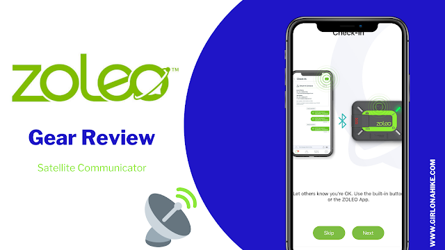
Made it down to the lake! Time for a weather check with my ZOLEO (check out my gear review).
Once again we found a really nice campsite. That is one of the perks of backpacking during the week – your choice of campsites! This sight quickly became a favorite and we decided to stay two nights here as well. The original plan was to stay one night at Imogene, and our last night at Toxaway, but again, the ability to have a campfire and see less people kept us here.

Time for some fishing! However, no bites, here either. Either the wind/weather kept the fish low, or we had the wrong fly – we just didn’t catch hardly any fish the entire trip. I just bought my Orvis Encounter Fly Rod earlier this year (thanks, COVID check!) and am loving it. It’s a 4-piece fly rod so it packs up well for backpacking.

You’re not really reading, are you mom? This is how he asks to get on my lap LOL!
Bonus Hike: Unnamed Peak

The next day, our relax day, we hiked up to the unnamed peak I pointed out earlier. You can do it from the pass (drop your packs first), or what we did was hike back up all those switchbacks from Imogene Lake. From the lake to the peak was only 2 miles one way and about 1300 ft gain.

The boys lead the way. There was actually a trail most of the way.

Looking down one of the shoots at Imogene Lake.

Lots of boulders, but very similar terrain to the Uintas so Charlie’s paws were used to it.

Summit selfie! It was super windy and looked like a storm was coming in, so we literally took this photo, then turned around.

From the peak looking down to Farley and Toxaway Lakes (where we would hike the next day).

Turning around, you can see how dark the skies were! My ZOLEO weather app said there was only a 17% chance of rain that day, yet we did get rained on for about 15 minutes right when we got back to the tent.

Back in the tent, out of the rain, and time for a mid-day nap for all of us. The blanket he is sleeping on the down blanket you can get from CostCo in winter for about $20. They’re super light and synthetic down – great for backpacking.

🥾 Day 6 – Imogene Lake to Tin Cup Trailhead (Back to the Car)
📍 Distance: 10 miles
⛰ Elevation Gain: 1,134 feet
Descent: 2,556 feet
Passes Crossed: 1
⏱ Time: Approximately 4 hours
Our final day was a long but mostly downhill trek from Imogene Lake back to the Tin Cup Trailhead. We crossed one final pass and then began a steady descent through alpine meadows and forested switchbacks.
The trail was well-maintained and moved quickly underfoot, allowing us to reach the car in just about 4 hours. While it was bittersweet to leave the mountains behind, this was a satisfying end to our 6-day backpacking adventure through the Alice Toxaway Loop and beyond.

The storm from the day before helped clear out the smoke again, and you could finally see everything!

Passing by Edith Lake. This lake was super pretty but there’s only two campsites available here. If you can’t snag one of those you’re kind of out of luck – you’ll have to continue to Imogene or elsewhere. I wouldn’t personally recommend attempting to camp here.

From Imogene to the trail split along the Yellow Belly Trail was only 3.3 miles. Again, the sign is on the ground so it could easily be missed. I imagine the reason for this is the harsh winters constantly knocking them down each winter.

Back to the Fall colors! So pretty.

Around 5 miles pass Farley Lake. This lake was gorgeous as well and looked like there could be a few nice campsites here if you wanted a shorter day.

I really liked this section of trail, about 5 miles from the car. A nice meadow, a waterfall to the right (not pictured), and the skies cleared up again to highlight the Fall leaves.

Charlie’s pack rubbed is armpit raw on the 3rd day, so on the very last day since he had eaten all his food, Ian carried Charlie’s pack, inside his pack to let his armpit heal. We do carry a dog first aid kit, and tried wrapping the strap on his pack with some gauze to help prevent more rub, but eventually we decided to just carry it for him. Charlie was extra bouncy that day he didn’t have to carry his pack!

At 6.7 miles cross the stream.

At 7.7 miles reach the Sawtooth Wilderness sign along the Yellow Belly Trail. Almost there! The last 3.5 miles of this side of the route were super boring for me. No views, little shade, and an uphill section for the last mile. I was dying to get back to the car!

And finally, Pettit Lake was back in view and we made it back to the car! Whew, that was a long 10 miles.
🏔 Final Thoughts on Backpacking the Alice Toxaway Loop
What a trip! I absolutely loved this area and the route we ended up taking. The scenery, solitude, and alpine lakes make the Alice Toxaway Loop one of the most rewarding backpacking routes in the Sawtooth Mountains.
If I were to do this again and only had a few nights, I’d hike the main 18-mile loop counterclockwise over 2 nights and 3 days—a perfect way to see the highlights without the extended mileage.
If I had just one day, I’d still consider doing this as a long day hike. With an early start and a light pack, it’s totally doable for experienced hikers.
The beauty of this loop is its flexibility—whether you have one day or an entire week, you can tailor the route to fit your schedule and hiking style.
Trail Map
My track via Gaia GPS – the best tracking app! Get your app here for a discount.
Nearby Hike


Save me on Pinterest!