

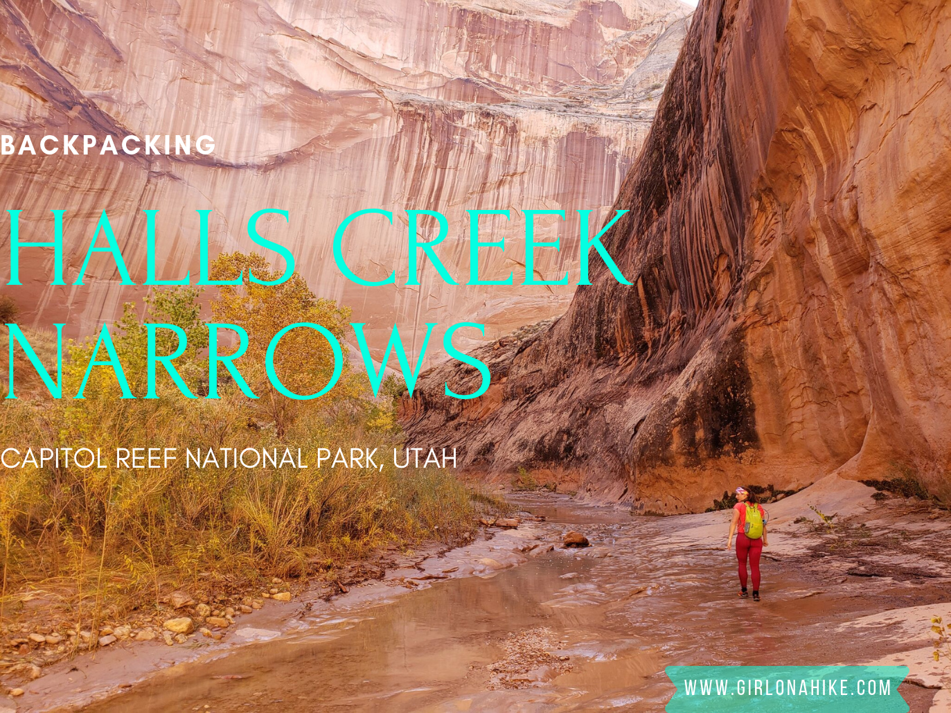
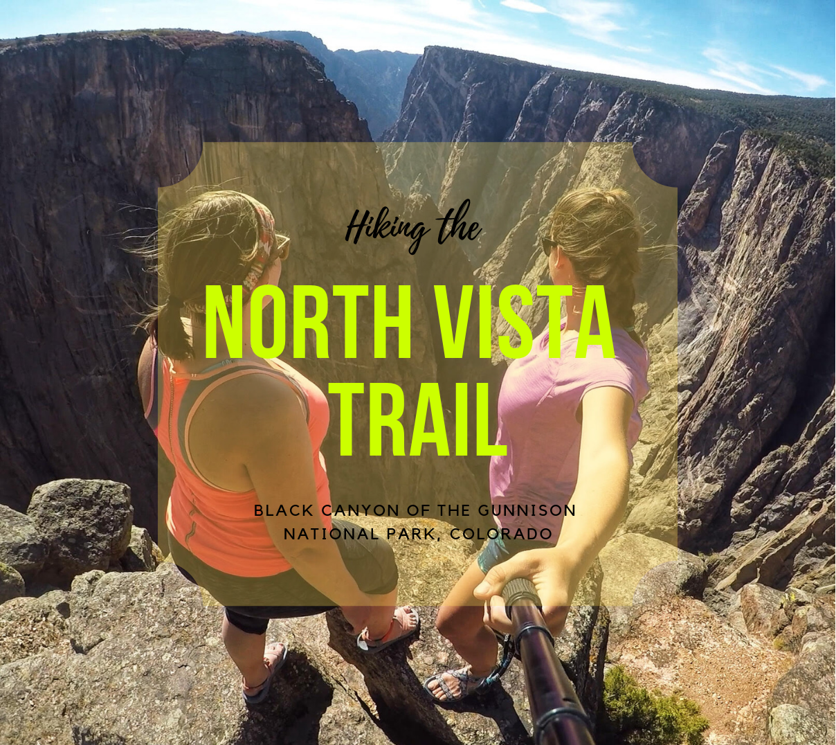
Backpacking Halls Creek Narrows is located within Capitol Reef National Park, only a few miles North from Lake Powell. This area of the park sits between the high cliffs of Hall Mesa on the East, and the Waterpocket Fold on the West. As you backpack towards Halls Creek Drainage (aka Grand Gulch), you'll be surrounded by red, white, and orange slick rock, all while hiking through a mostly sandy trail.
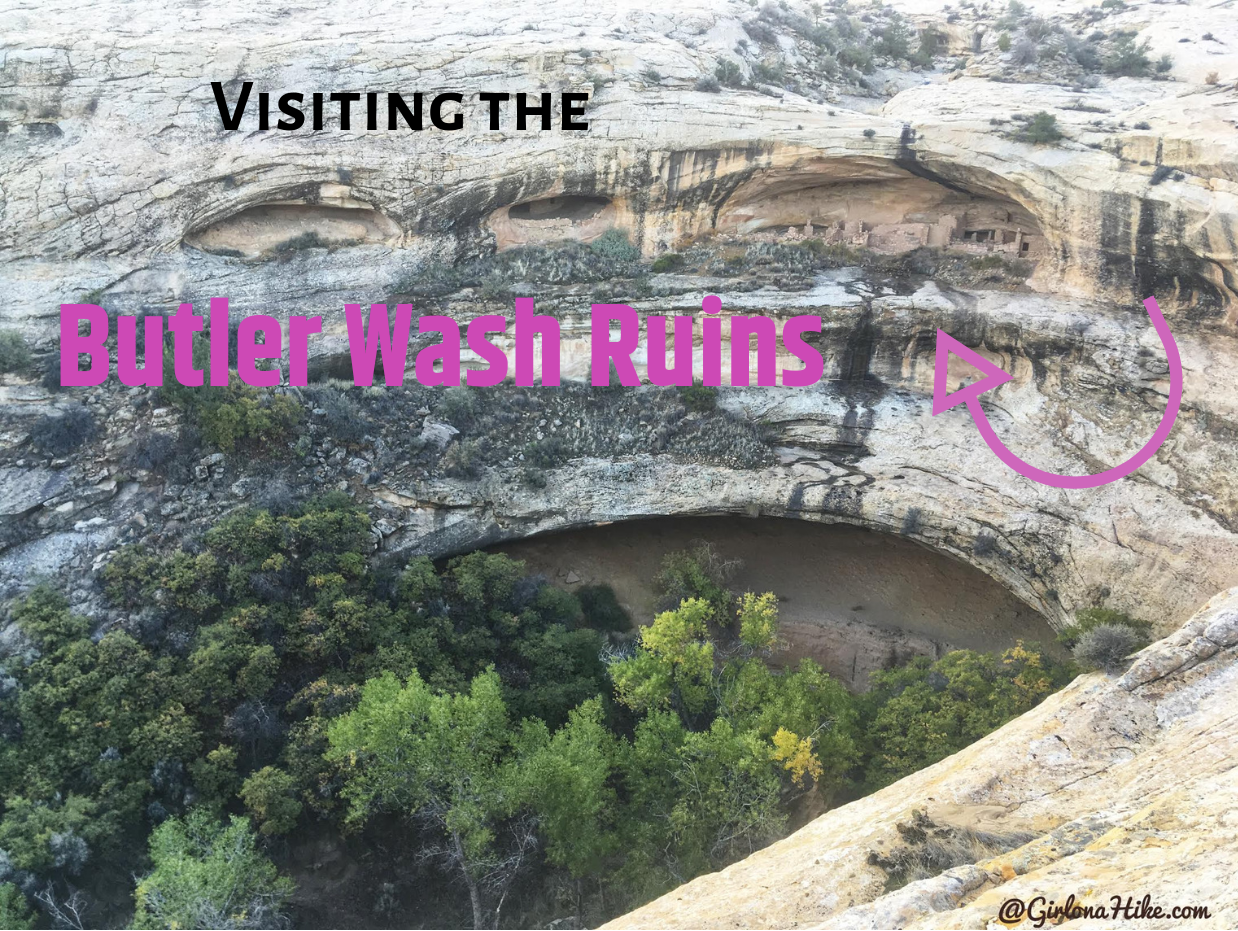
The Butler Wash Ruins are only a 20 minute drive West of Blanding, UT and is only 1 mile RT, so it makes for a great "get-out-and-stretch-your-legs" hike.
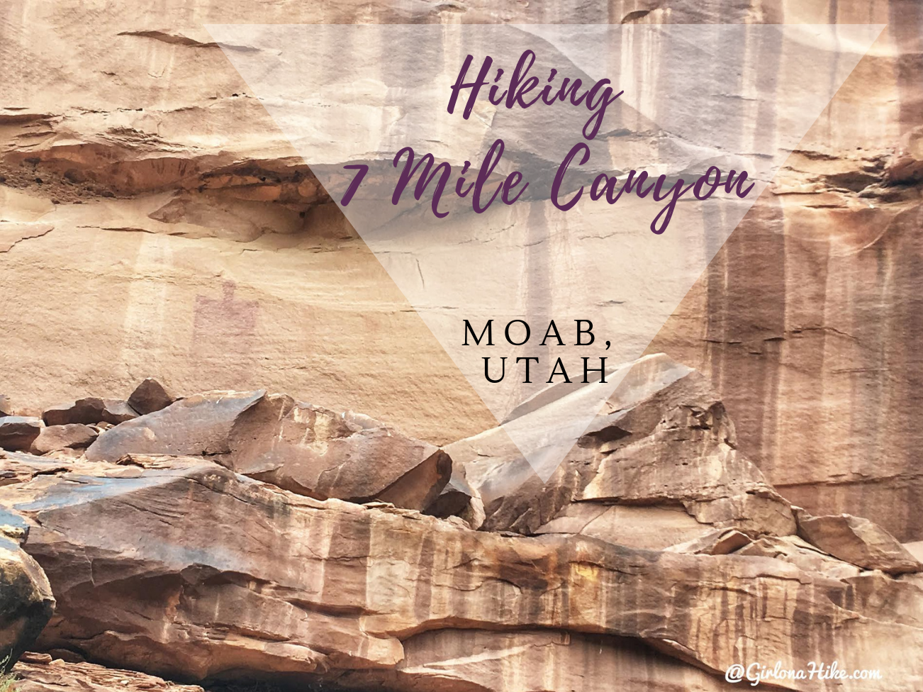
7 Mile Canyon (sometimes spelled out, Seven) is located only 11 miles North of Moab, Utah. It's a great, short hike that dogs and kids will enjoy, as it passes by several petroglphys and pictographs. The trail is very easy and flat, so no hard effort is required to get to these artifacts. 7 Mile Canyon is on the way to Dead Horse State Park, but it definitely has a quiet and remote feel. During our hike we only passed one other person. This hike is very sandy, and you'll hike in and out of the dry steam bed. There's very little shade, so be prepared with the necessary items to keep cool, and carry at least 2 liters of water (and water for your pup!). Please keep in mind that touching the artifacts are not allowed.
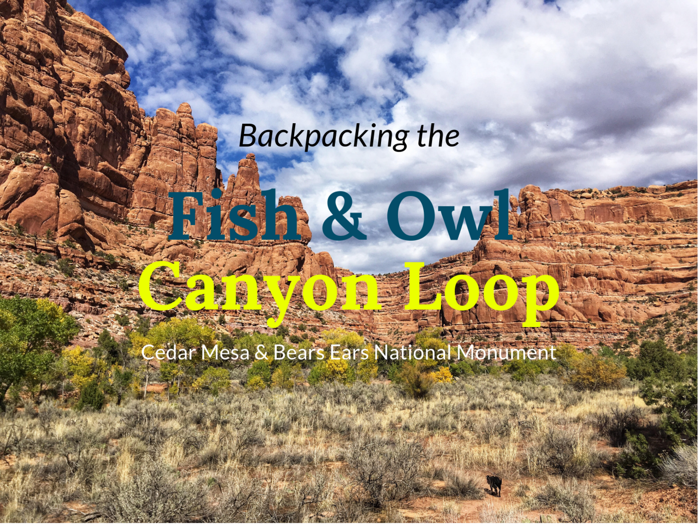
Fish and Owl Canyons, nestled in the Cedar Mesa area of Bears Ears National Monument, offers a stunning loop backpacking route. This trail is ideal for experienced hikers looking to explore ancient ruins and kivas, hike through desert terrain, visit Neville's Arch, and enjoy solitude in two scenic, deep canyons. With challenging terrain, light route-finding, and scrambling, it's best suited for intermediate to advanced backpackers.
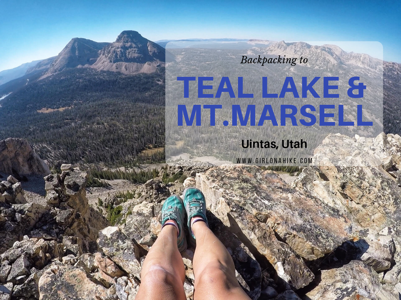
Teal Lake sits at an elevation of 10,400 ft, and is accessed via the popular Ruth Lake Trailhead. You will follow this trail for the first mile, and then after that there is no trail. You should be comfortable with a little route finding, and hiking off trail. The nice thing is that Teal Lake is a mere 2.2 miles, so you really only have to hike off trail for 1.2 miles. You'll pass a few unnamed ponds, Jewel & Naomi Lakes, then reach Teal Lake. There are several nice campsites at Teal Lake, and fishing is plentiful.
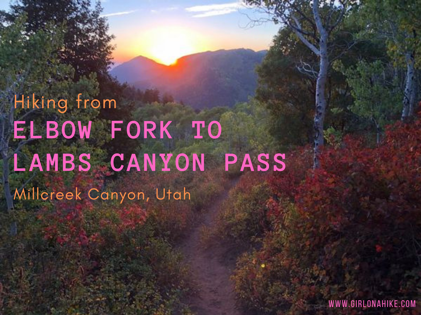
Elbow Fork in Millcreek Canyon is a popular trailhead for Mt. Aire, the Pipeline, and for accessing Lambs Canyon Pass, the dog-friendly way. Many people chose to hike up to Lamb's Canyon Pass via Lamb's Canyon, however that section of trail is part of the SLC Watershed, and dogs are not allowed.
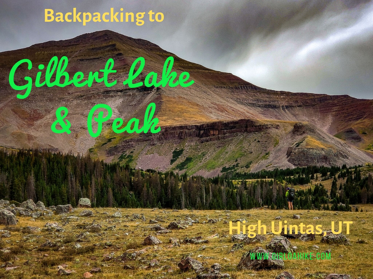
Gilbert Lake is located in the High Uintas Wilderness on the East end of the range, with Gilbert Peak (13,442 ft) being one of Utah's "13ers" (a peak above 13,000 ft). It is the 3rd highest peak in the state, and the second highest county high point, and can be access by several drainages, with Henry's Fork being the most popular, however we accessed it from Gilbert Lake. The trail to Gilbert Lake follows the West Beaver Creek trail for 9.2 miles before reaching the basin which has four lakes total, great campsites, lots of wildlife, and of course, fairly "easy" access to the peak.
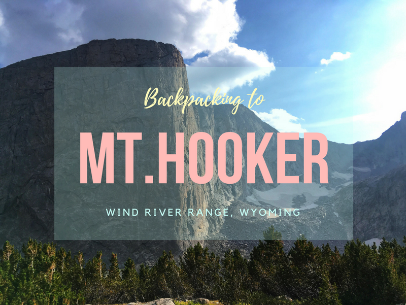

Mt. Hooker (12,509 ft) is a remote and rugged peak located in the southern end of the Wind River Range in Wyoming. Known for its dramatic 1,800-foot sheer granite face, Mt. Hooker is one of the tallest and steepest vertical cliffs in the state. It's also 16 miles from the nearest road, making it a true wilderness adventure for backpackers and climbers.