

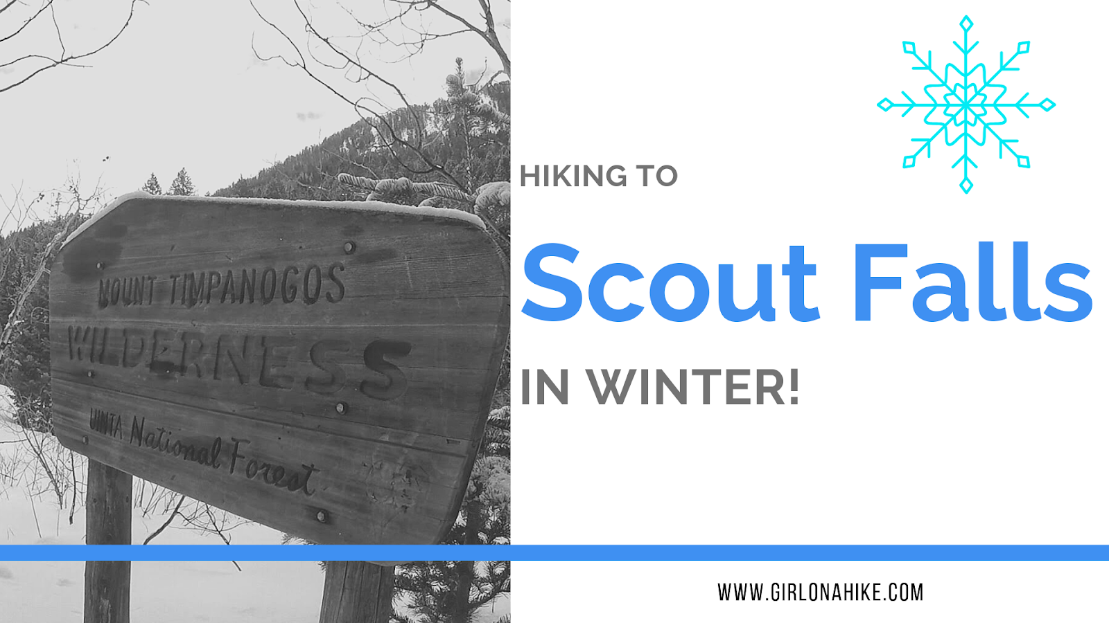
Scout Falls is a popular waterfall located right off the Timpooneke Trail on the way to Mt. Timpanogos. In summer, it's a fun spot to cool off on your hike or filter your water for the long trek to the summit. Normally it is only 1.5 miles to reach the falls but in winter it is 4 miles one way since the road is closed at the winter gate. It's been a goal of mine to see the fall in winter, with long icicles, frozen over.
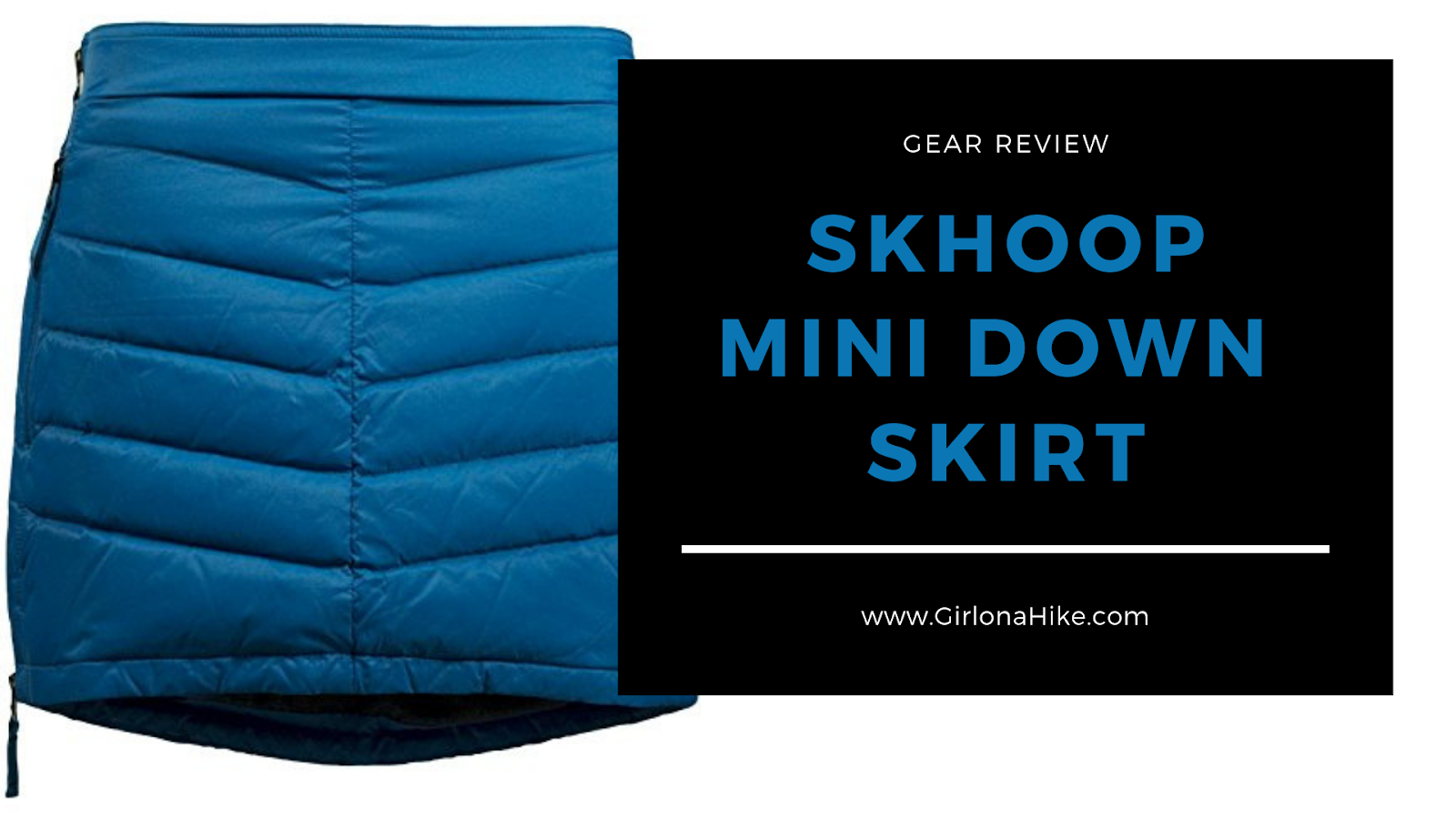
Skhoop (pronounced like scoop), was founded in 1999 by Sissi Kewenter in Sweden - flash forward a few years later and Skhoop expanded into North America in 2007. Skhoop specializes in comfortable, feminine winter clothing for any outdoor activity. The insulated skirt is the most popular product, however over the years they've grown to include various lengths of skirts, jackets, vests, and socks. As the times have changed so has their fabric, adding in PrimaLoft, down, and GORE.
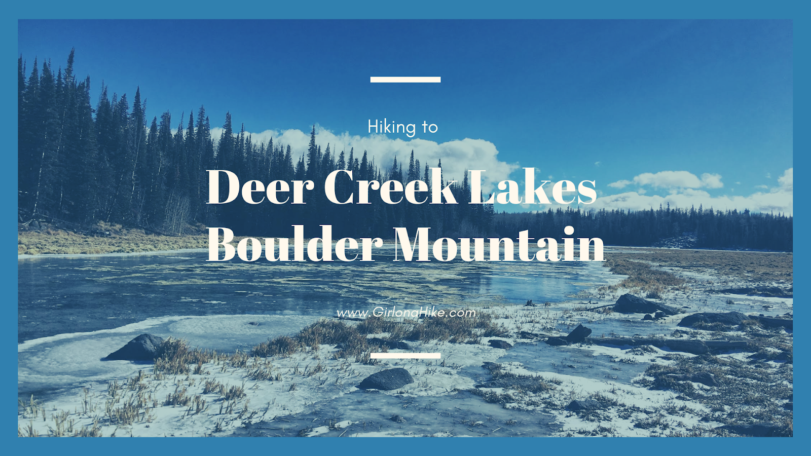
Deer Creek Lakes sits high on Boulder Mountain at 10,000 ft, and several other nearby lakes are accessible as well including Green, Chriss, and Mooseman Lakes. All of these lakes provide for an excellent day hike, quick overnight backpacking trip, and plenty of fishing and sightseeing. The trail to get to Deer Lake is only 2.8 miles one way, and is fairly easy and flat. Over the 3 miles you only gain about 700 ft, making it a gently incline the whole way. Keep in mind that you will be hiking at a high elevation, and that can often slow hikers and dogs down. Take your time - the views from Deer Lakes is amazing and well worth the effort.
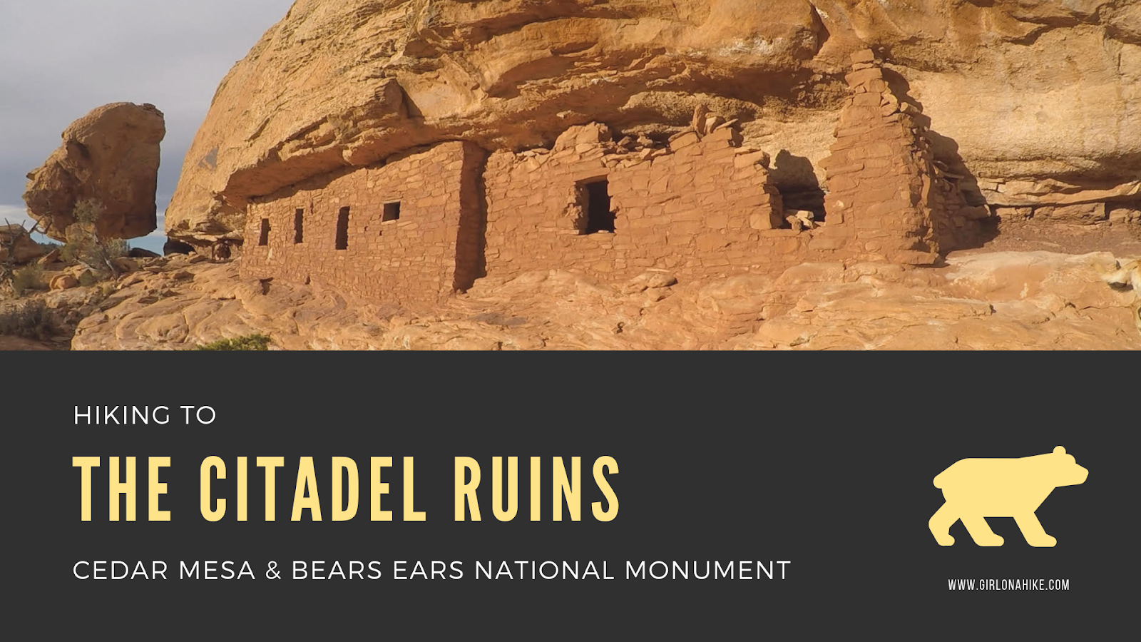
The Citadel Ruins sit high above Road Canyon in Cedar Mesa & Bears Ears National Monument.
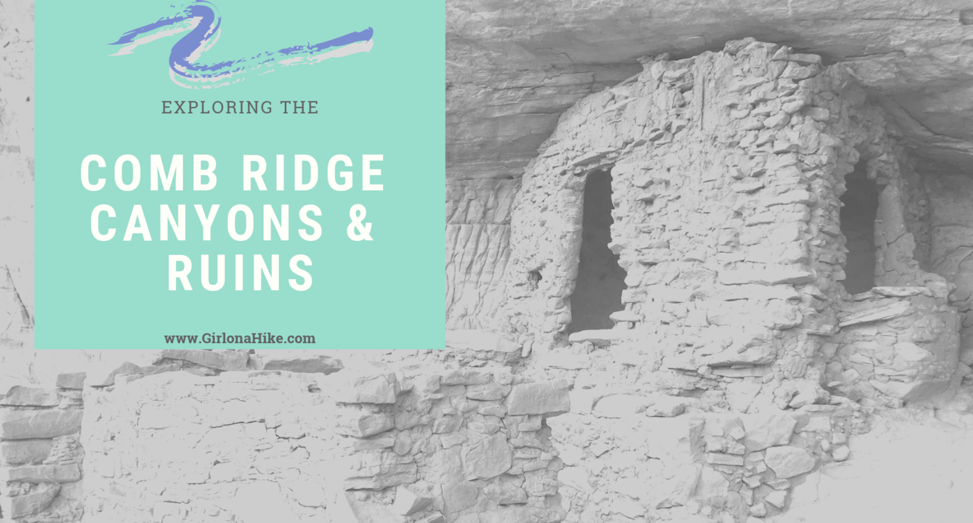
Comb Ridge is a 90-mile long Navajo sandstone ridge (or monocline) running North to South, and is home to many ancestral ruins and petroglyphs that date back around 800 years old. Comb Ridge itself has a gentle eastern facing slopes, while the west side has "teeth" that jut out and above the ridge line. Each of these "teeth" contain drainages that lead to the San Juan River. The Puebloans lived, farmed in this area, and left behind a massive amount of ruins and artifacts. Drought, overpopulation, diminishing resources, erosion, and conflict eventually brought an end to this era.
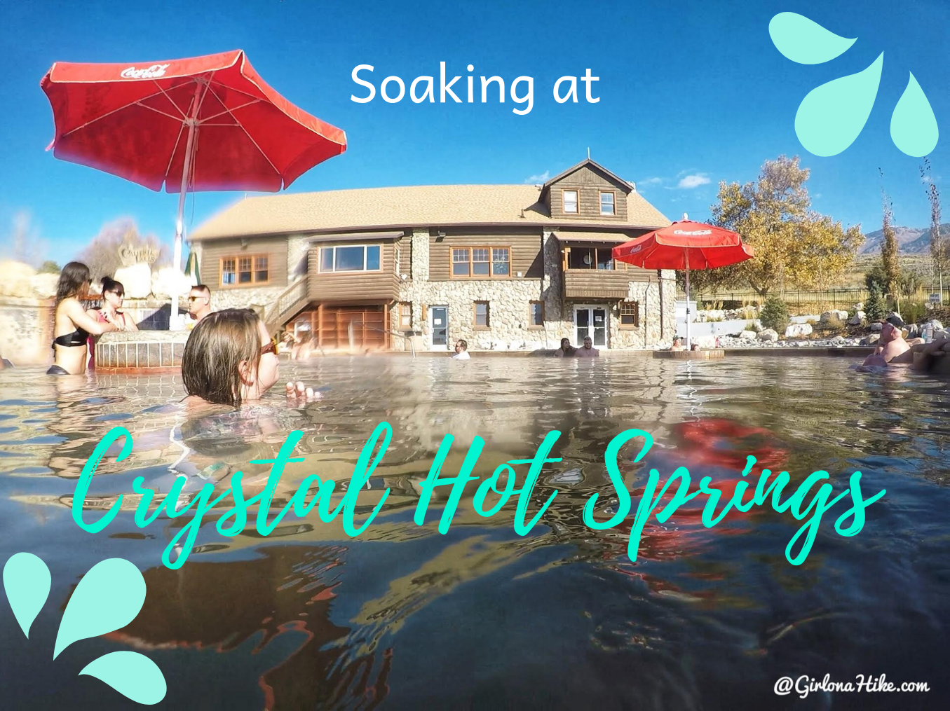
Crystal Hot Springs is a natural hot springs in Northern Utah that ranges from 120-134 degrees F. The swimming pools are regulated so that you can soak in a range of temperatures from 98-105F. Crystal Hot Springs also contains the highest mineral content found in the world! It has roughly 46,000 mg/L - the average hot spring has closer to 1,000 mg/L. You'll notice this mineral content, as you lick your lips or wipe your hands over your face - it's very salty tasting. Get ready to soak in a 22,000 year old hot spring!