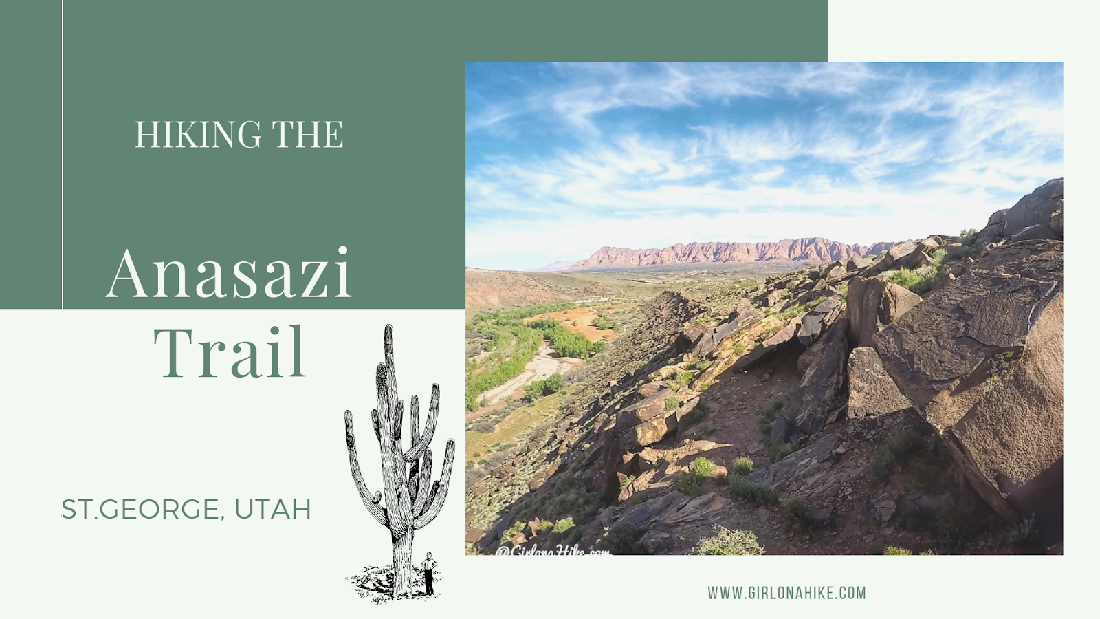
The Anasazi Trail (aka Tempi'po'op, which means "rock writing" in Southern Paiute) in St.George is a casual trail that leads to ancient Pueblo & Paiute remains, as well as petroglyphs. This is more of a walk, rather than a hike, and is great for the whole family to do since it is only 2.2 miles RT. There is zero shade nor water, and the trail gets hot quickly. If you bring your dogs make sure to start early in the day so they don't burn their paws. The path itself consists of long switchbacks, which lead you to a very small hill where the old farmstead was located, and is now fenced off. After checking that out, continue walking uphill (to the South) to see the petroglyphs.
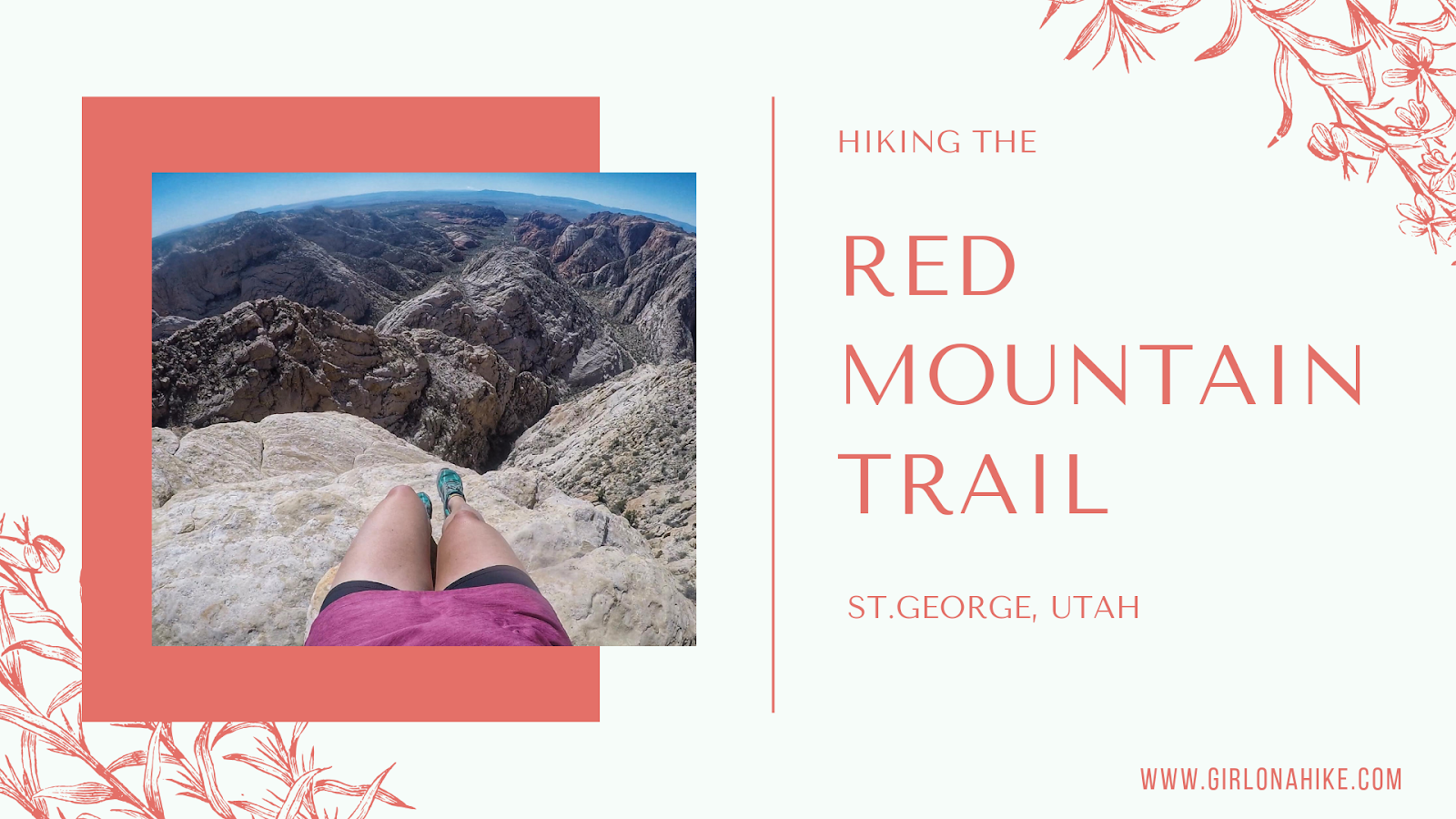
The Red Mountain Trail is located in Dammeron Valley, UT not far from Sand Hollow and Gunlock State Parks. Because it's not actually apart of the state parks and is wilderness area, dogs are allowed off leash. Be sure to start early in the morning so the sand doesn't burn their paws. The first 1.5 miles of the trail is very boring and uneventful, but what the trail does lead to is amazing. The Red Mountain Overlook looks down into Sand Hollow, and the white and red slick rock with Signal Peak in the Pine Valley Mountains to the East is incredibly beautiful. This trail is great for the whole family, as it only gains a mere 360 ft. It's a mix of sand and rock, but plenty of shade if you do need a break.
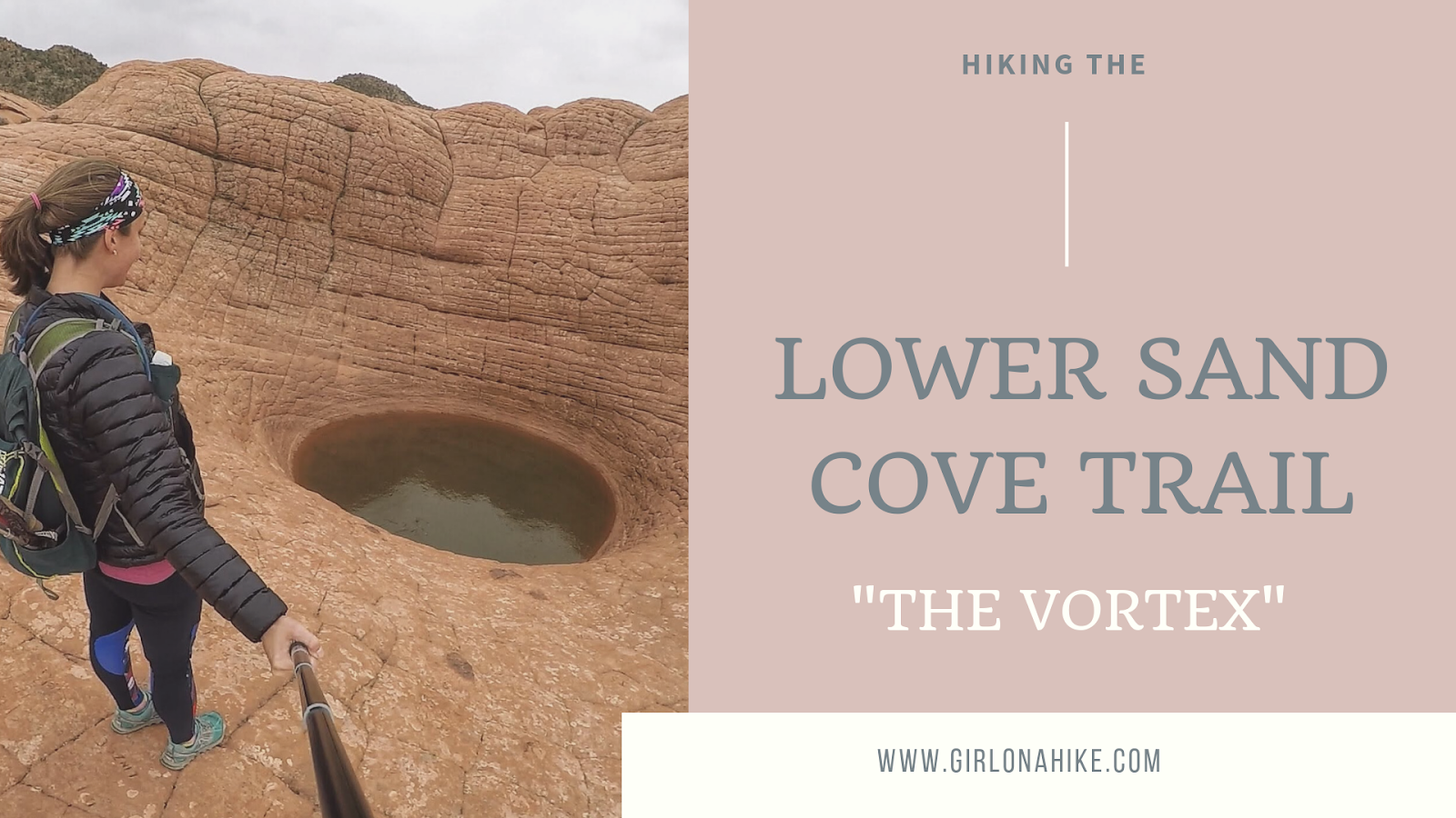
The Lower Sand Cove Trail is located in Dammeron Valley, outside of St.George, Utah. It's located within the Red Mountain Wilderness, making this a dog-friendly hike. Local's know this hike as "The Vortex", due to the interesting geology that created this large pot hole in the slick rock.
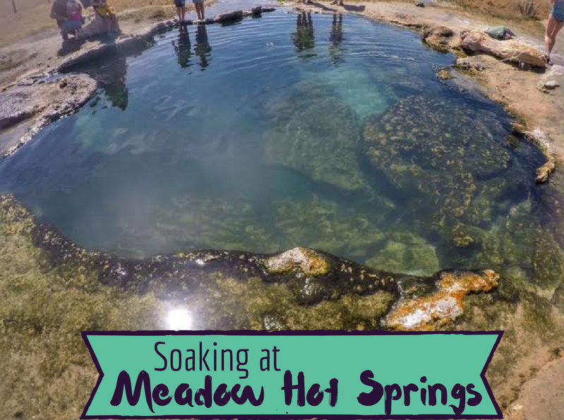
Meadow Hot Springs in Central Utah is a great family-friendly spot to hang out and soak in warm water. It's conveniently located right of I-15 and there's no hiking involved, so it makes for a great, quick soak when you are on a road trip. Meadow Hot Springs is located on private property in the middle of a cow pasture, but they do allow public access. There are a total of three pools to soak in, all around 100F degrees. The most popular pool is one of the smallest and closest to the parking area, and it is also the warmest. Each of the pools have algae in them, so it is wise to wear water shoes to keep from slipping on the rocks under water.
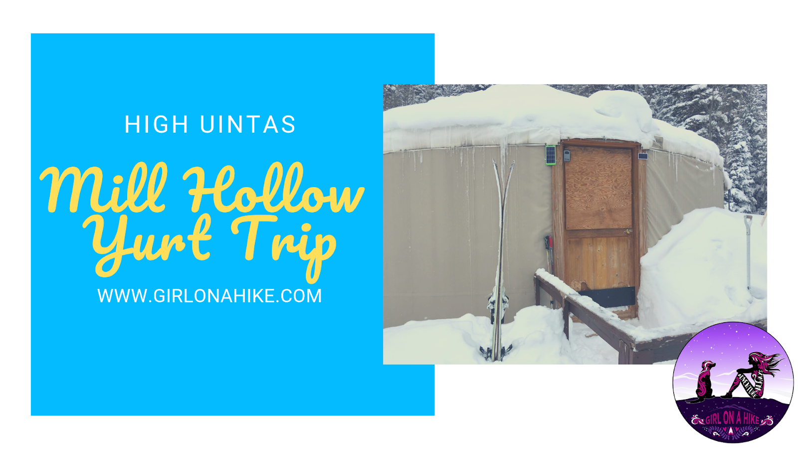
The Mill Hollow Backcountry Yurt is located in the High Uintas Wilderness, with a 6 mile hike/ski/snowshoe to reach the yurt. The "trail" follows HWY 35 for 3 miles, before turning off onto forest roads. This ski in requires you to have comfortable backcountry skills, as well as appropriate gear (beacon, shovel, & probe), as avalanches have occurred here. The hike/ski in is well worth it, as you are surrounded by a winter wonderland, yet have a warm hut to hang out in. Plan to spend at least two nights here - one night is not enough to fully enjoy the area, get out for a tour, or relax.
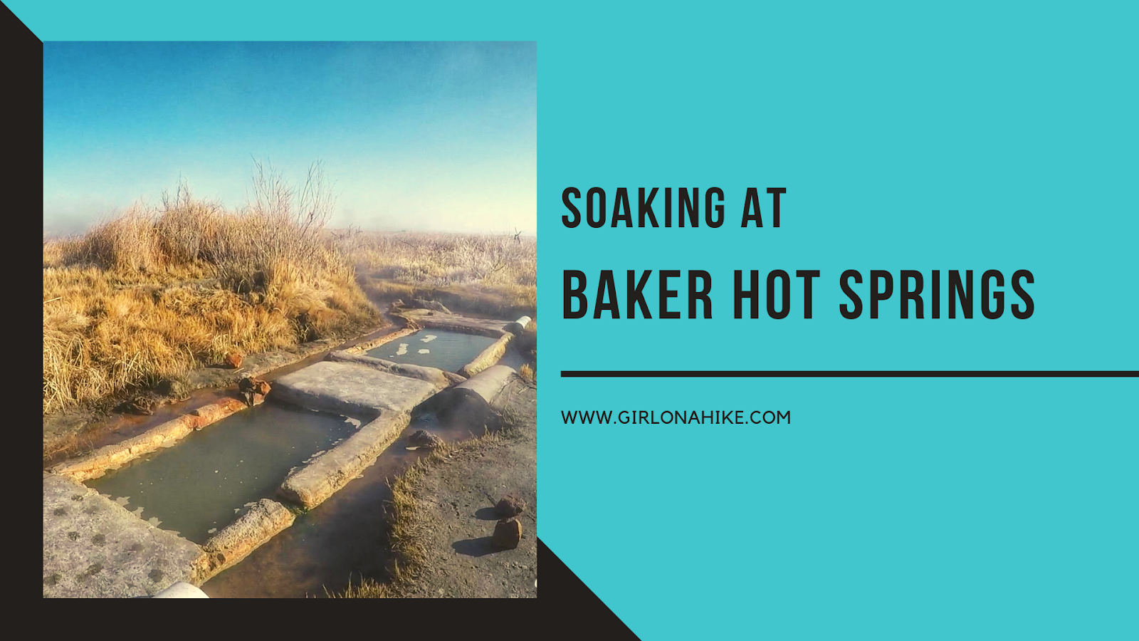
Baker Hot Springs is a small, natural hot springs located in Central Utah, not too far from Delta, Utah. The source of the hot springs is around 180F, but a trench helps the water flow down to three large tubs and cools off the further you are away from the source. The tub closest to the source is the hottest, the middle tub is, well in the middle for temperatures, and the furtherest is the coolest. However, you can "regulate" the temperature by using one of the provided rags to block out the hot water and let cold water from a pipe in.