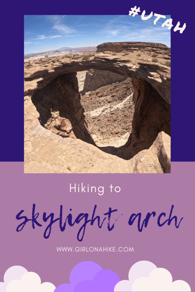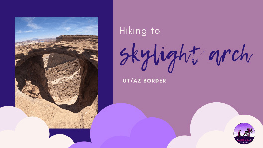

Hiking to Skylight Arch on the Utah/Arizona Border is a perfect trail to stretch your legs on a long drive, and see a really cool arch within a short distance.
About
The great thing about Skylight Arch is that its dog friendly, great for all ages, and provides amazing views of the surrounding area including Lake Powell, Powell Point, Grand Staircase Escalante National Monument and more. Not only do you get great views, but the arch itself is actually quite impressive!
There are a few important things to note on this hike however. Not all cars can make it to the trailhead – as long as you have an SUV or larger you can drive to the official TH. Small, compact cars should not attempt to drive any portion of this road since it is on the sandy side. Another thing is temperatures – DO NOT attempt this in the middle of the day, especially with dogs in summer. The sand and rock will burn their paws.
Even on Memorial Day weekend when my friend and I hiked this, it was 94F! We normally wouldn’t hike at that temperature, but this was the middle of a drive for us, so we wanted to get out and do at least one hike on our long drive and I didn’t have Charlie with me. Even after just 2 miles of hiking we were exhausted from the heat. The best time of year to hike this is typically November through April.
Directions
It’s easiest to just follow Google Maps to guide you there – use this link. You can also just type in “Skylight Arch Trailhead”.
Trail Info
Distance: 2 miles RT
Elevation gain: flat
Time: 1-2 hours
Dog friendly? Yes, off leash
Kid friendly? Yes, all ages
Fees/Permits? None
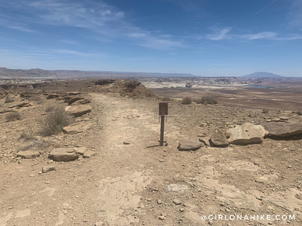
The trailhead begins at this small brown sign.
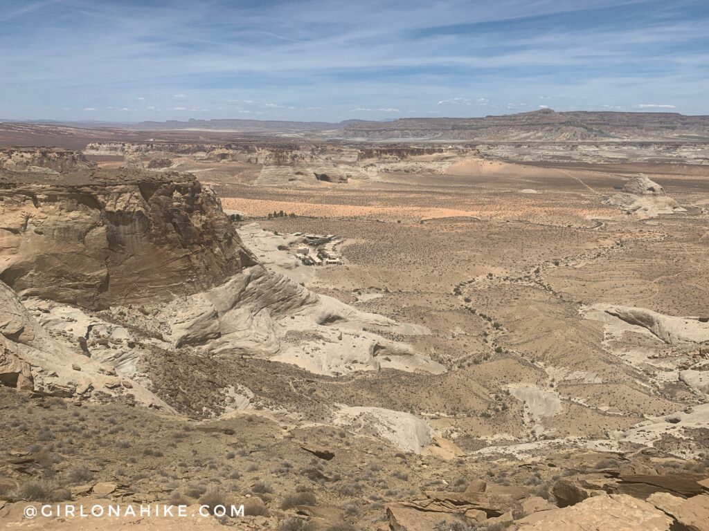
You immediately get great views of the surrounding area, and on the left, can look down to Amangiri Resort.
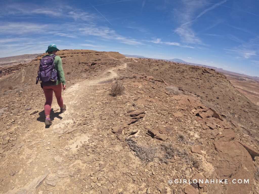
It looks like its a narrow ridge, but it’s actually quite wide. The breeze along here felt amazing, especially since it was 94F! The trail is very easy to follow.
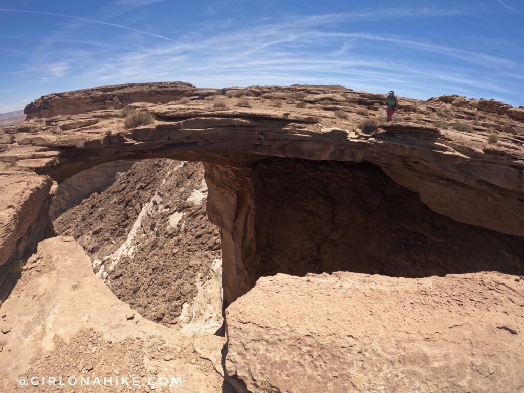
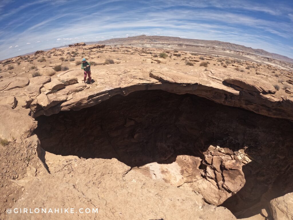
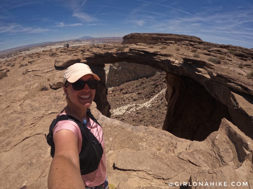
At exactly 1 mile you will reach Skylight Arch! It’s really big!
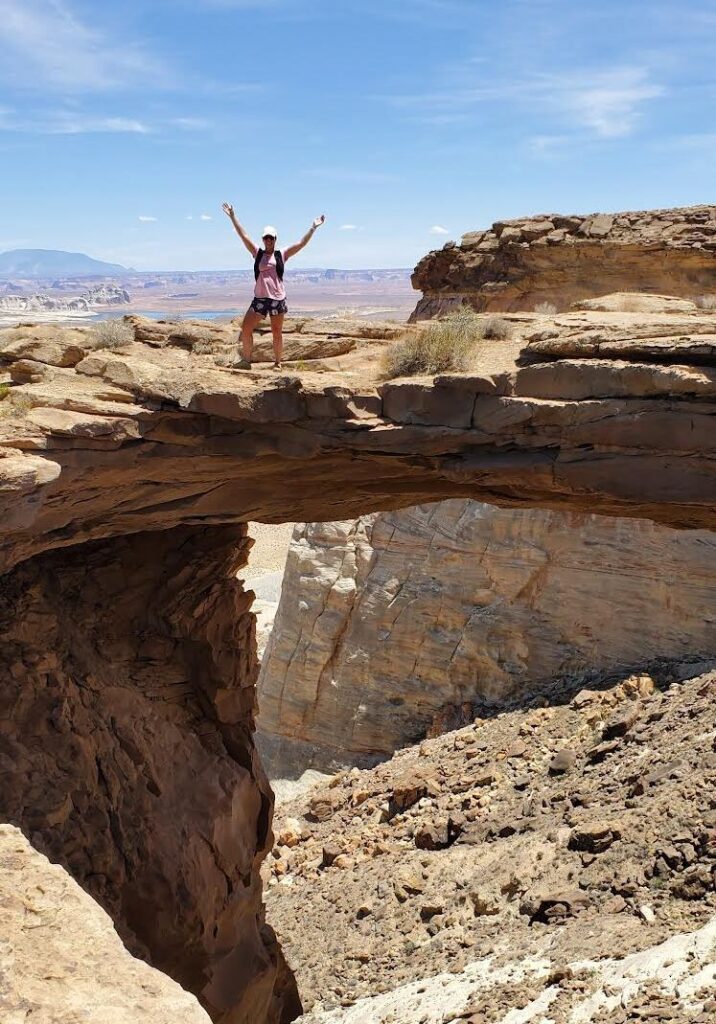
The pictures don’t do it justice with how tall you are on the side of the cliff. You can also barely see Lake Powell in the distance from here too.
Looking back at Ashley, we didn’t realize that when we walked to the edge we were already about 30 feet out on a cliff!
This was a really fun, super short hike to stretch out legs on a long drive! I would definitely come back to Skylight Arch!
Check out my video!
Trail Map
My track via Gaia GPS – the best tracking app! Get your app here for a discount.
Nearby Hike
Hiking Catstair Canyon, Stacked Cars near Lake Powell


Save me on Pinterest!