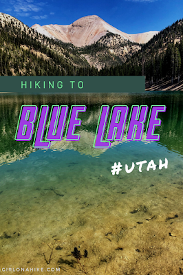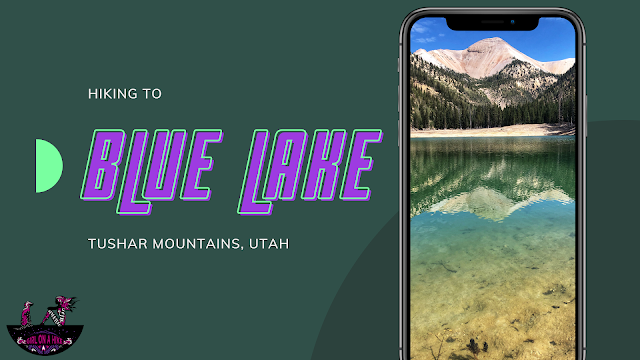
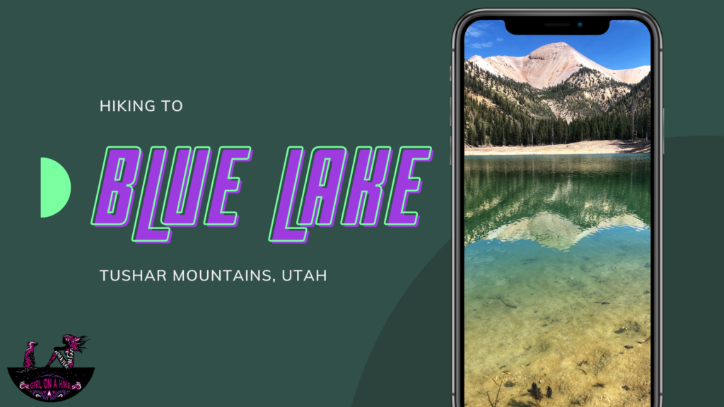
Hiking to Blue Lake in the Tushar Mountains: Scenic Views of Mt. Belknap and Mt. Baldy
Blue Lake is a stunning turquoise alpine lake nestled in the Tushar Mountains at the base of Mt. Belknap and Mt. Baldy in Utah. Known for its vibrant blue color and peaceful setting, the lake features a flood control structure at its outlet and is rimmed by picturesque downed trees.
Though many visitors have yet to see Blue Lake at full capacity, hiking down to the lake offers spectacular views of both Mt. Belknap and Mt. Baldy. The trail takes you through diverse terrain—from dense forest sections to clearly marked avalanche paths—while crossing several pristine mountain streams.
What to Expect on the Blue Lake Hike
The lake water is fed by snowmelt and remains cold year-round. The shoreline is rocky with sharp stones, so wear water sandals or protective footwear if you plan to swim. This trail is suitable for a day hike but is also popular among backpackers who enjoy camping near the lake.
This hike is family-friendly and is best done during the summer months of July through September, when the winter gates are open and the trail is dry and free from snow and avalanche hazards.
How to Get to Blue Lake Trailhead (Mud Lake Trailhead)
Driving Directions from Salt Lake City
Take I-15 south and exit at 112 (Beaver, UT).
Turn left onto Main St. and drive 1.6 miles.
Turn left onto UT-153 and continue for 16.3 miles.
Just past mile marker 16, turn right onto a well-graded dirt road (north side of the highway). Reset your odometer here.
Vehicle recommendation: A 4×4 vehicle is recommended, but a small, compact car can make it if the road is completely dry.
Tip: Call the Beaver Ranger Station at 435-896-9233 before your trip to check road conditions and confirm if the winter gate at Poison Creek is open.
Key Points Along the Road to Mud Lake Trailhead:
0.3 miles: Stay left at the first fork.
0.8 miles: Pass through a metal gate.
2.4 miles: Keep left.
3.3 miles: Pass the Paiute ATV Trail, curve right, pass Big John Flat, the first pit toilet, and cross a cattle guard.
4.3 miles: Pass the second pit toilet.
4.7 miles: Pass Skyline Recreation Trailhead.
5.0 miles: Pass Griffith Creek (may be dry in summer/winter).
5.6 miles: Reach the last winter gate.
6.7 miles: Arrive at the Mud Lake Trailhead.
Important Notes:
Total drive time from Salt Lake City is approximately 4 hours.
If the winter gate is closed, you can still hike to Mud Lake by adding an extra 1.1 miles each way.
Here is a driving map to Mud Lake Trailhead for your convenience.
Trail Info
Distance: 9 miles RT
Elevation gain: 1600 ft (descent)
Time: 4-6 hours
Dog friendly? Yes, off leash
Kid friendly? Ages 12+
Fees/Permits? None
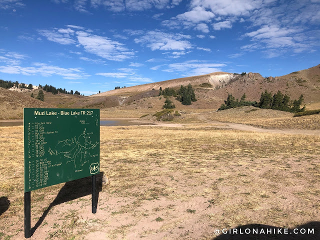
Start your adventure by parking at the Mud Lake trailhead.
The trail begins on the opposite side of the lake, inviting you to explore its scenic surroundings.
Trail Overview and Early Terrain
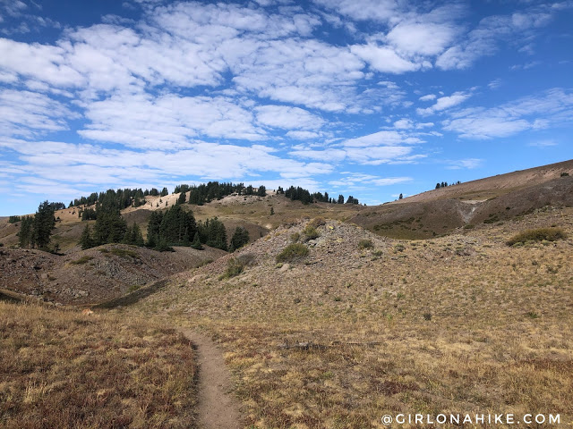
Soon, you’ll descend into a small gulley before climbing back up. From here, you can spot the small saddle that you will eventually hike toward.
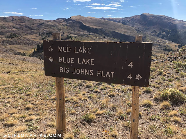
At 0.6 miles, reach a trail split and take a sharp right turn to continue your journey.
Reaching the Saddle and Views of Mt. Baldy
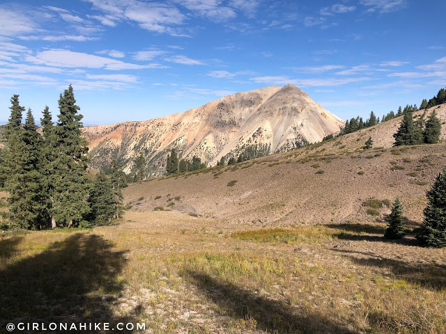
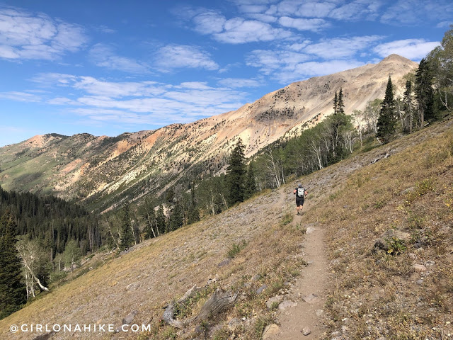
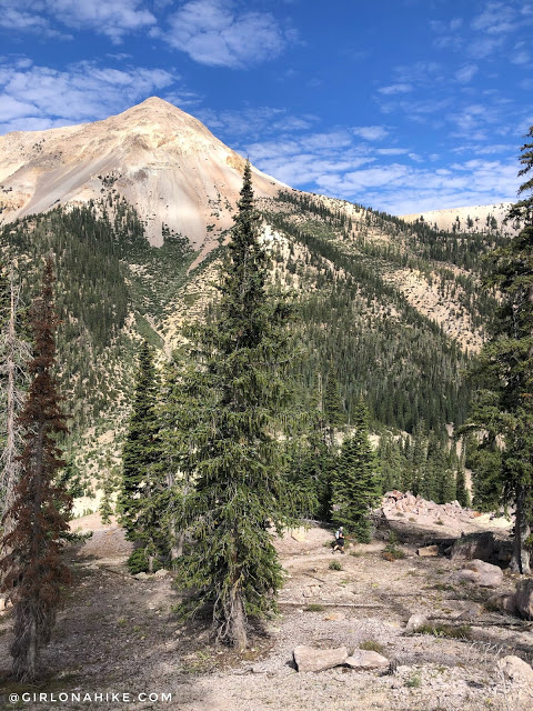
After reaching the saddle, you’ll begin a steady descent all the way down to Blue Lake. Here, enjoy your first breathtaking view of Mt. Baldy!
The trail then winds through several long switchbacks, gradually making its way downward.
Optional Overlook at 1.8 Miles
At 1.8 miles, you’ll arrive at an incredible overlook. If you’re short on time, this makes for a perfect turnaround spot before heading back.
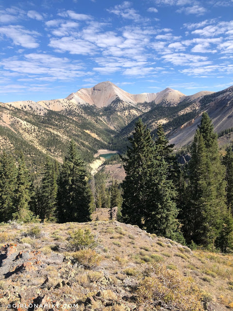
From this vantage point, you’ll also get your first stunning glimpse of your final destination—Blue Lake.
Final Stretch to Blue Lake
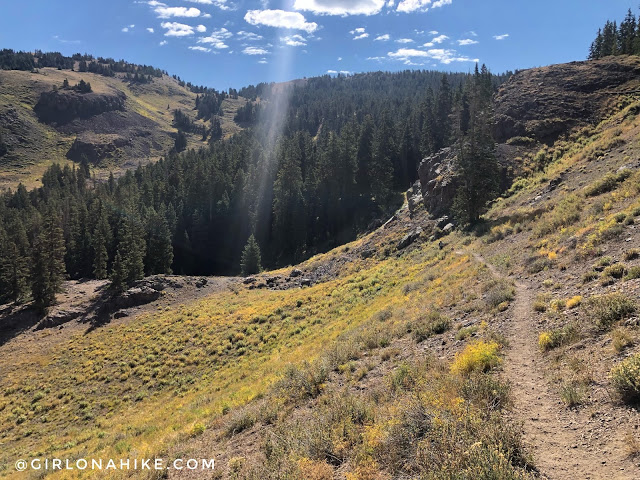
Continue winding down more switchbacks as you approach the lake.
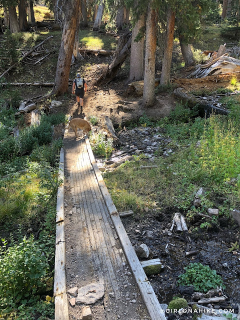
At 2.2 miles, you’ll cross the trail’s only bridge over a small creek.
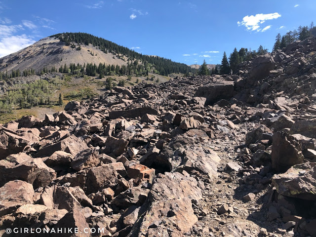
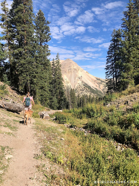
Next, you’ll hike through a boulder field. Don’t worry—the trail is well-defined here. Since there is no shade, it can get quite hot, so be prepared!
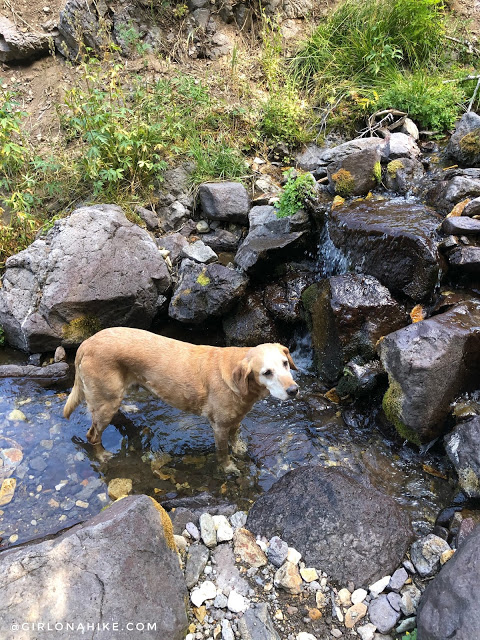
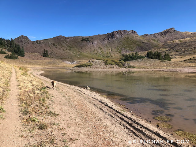
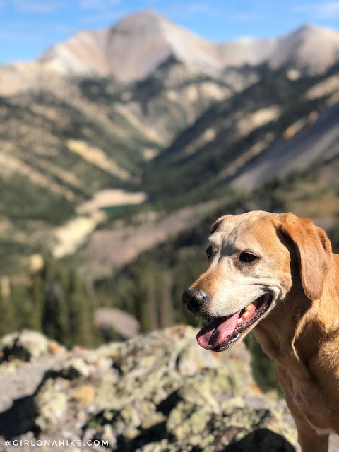
Charlie enjoys dipping his toes and drinking from the many small streams along the way.
The trail continues to wind around several large bends, offering more scenic views.
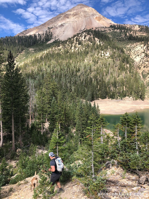
What a view of Mt. Baldy! For comparison, notice how small Ian looks in the vast landscape.
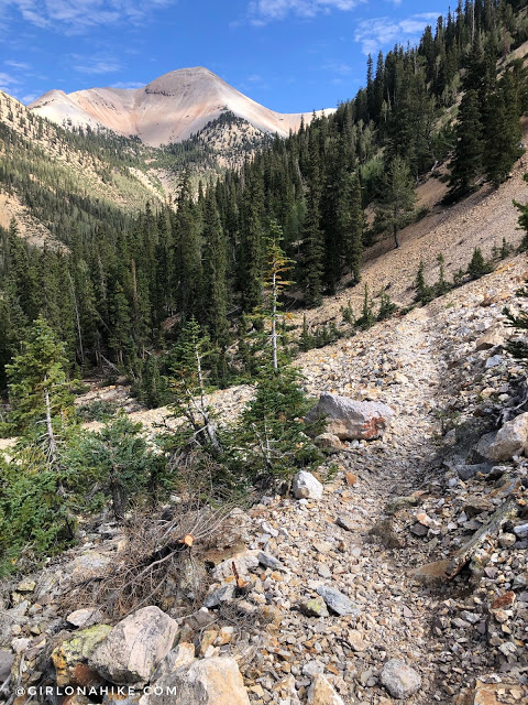
Almost there! The trail changes from dirt to loose rock as you get closer to Blue Lake.
At 4.2 miles, there is a shortcut to reach the lake faster. We took it, but be aware that it is a steep, loose scree section.
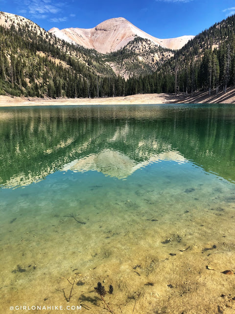
Finally, here it is — the beautiful Blue Lake!
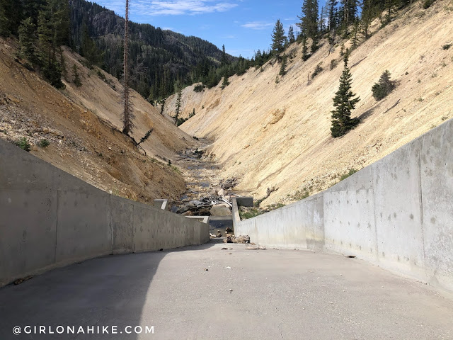
I explored around and climbed up to the dam. It’s hard to believe the lake was once high enough to flow over this spot. As of September 2020, the water was about 30 feet below the dam’s overflow level.

Such a pretty lake, but also a little sad to see how low the water level is.
Time to hike back up…
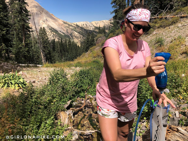
On our way back up, we got low on water so we decided to take a few minutes to filter fresh stream water. For this hike I used my collapsible water bottle filter – its great for quick and easy water filtration for day hikes. The water was so cold and refreshing!
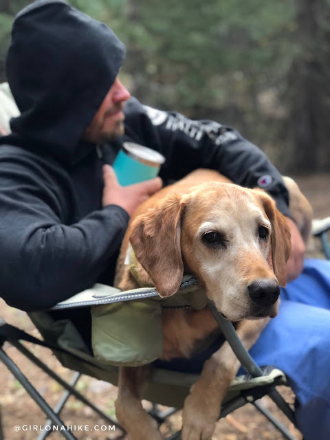
Back at camp, Charlie gets snuggly in his dads lap! What a great day to be outside.
Check out my video!
Trail Map
My track via Gaia GPS – the best tracking app! Get your app here for a discount.
Nearby Hike


Save me on Pinterest!