

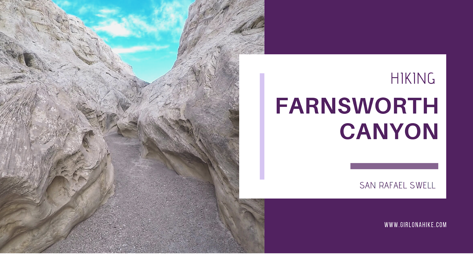
Farnsworth Canyon is located in the San Rafael Swell, and offers a little something for everyone. A short slot canyon, pictographs, exploring off trail, and desert flowers in the Spring all abound. Hiking to the pictographs is only 1.5 miles one way, so even kids can enjoy this hike and "hunt" for the pictograph. Farnsworth Canyon does extend much further, to the other side of the reef, but most people turn around at 1.5 miles. There is zero shade or water, so start early to beat the heat. The slot canyon is very easy to walk through, and nothing technical is required so it's great for beginners.
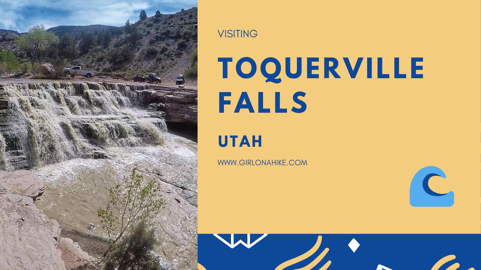
Toquerville Falls is located near St.George in Toquerville, UT. The falls flow from La Verkin Creek over two pour offs - the first a cascade of falls, and the second a complete drop off to about 20 feet to the bottom of the creek.
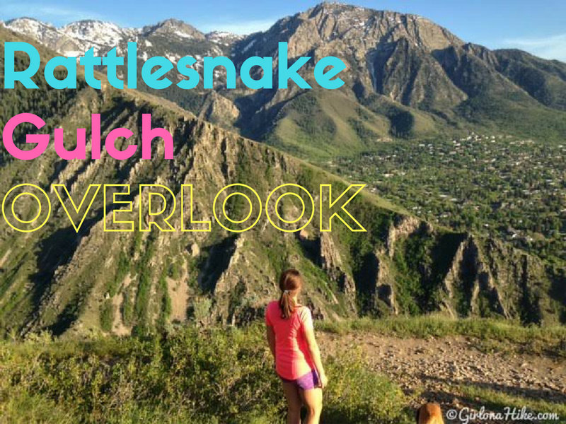
Rattlesnake Gulch in Millcreek Canyon is one of my go-to after work hikes. You don't have to drive very far up the canyon to have great access to this moderate trail, which leads to a beautiful overlook of the Salt Lake valley. I highly recommend this as sunset hike - bring a thermos of hot chocolate or tea and sit at the overlook to enjoy the view. This trail works steadily up the mountain for the first mile, then is level for the second mile, making this a great trail run. There is plenty of shade, but no water.
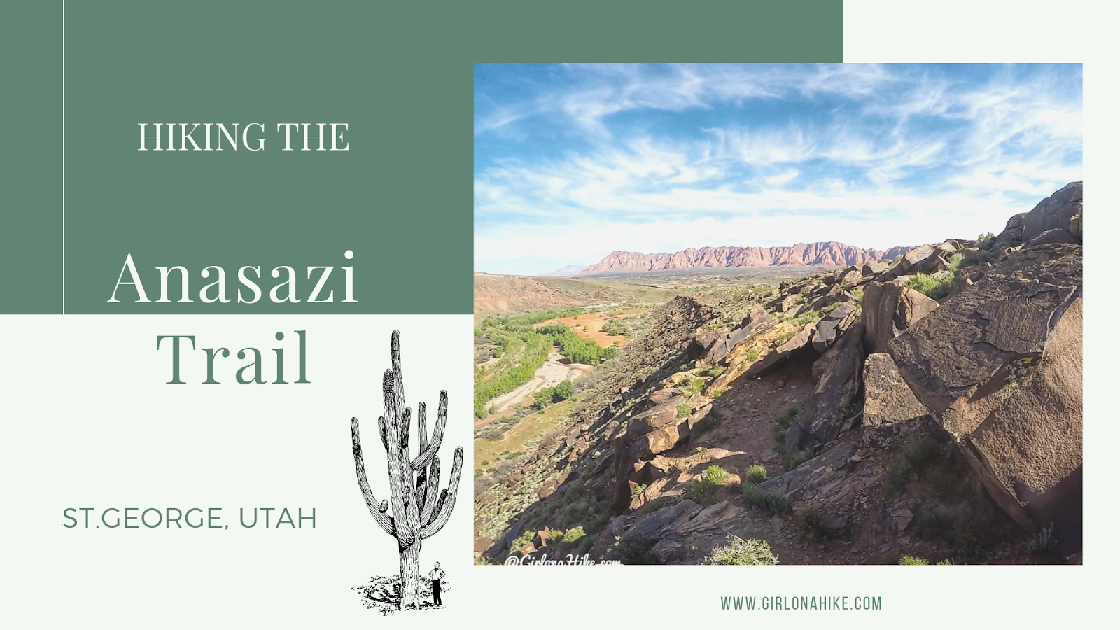
The Anasazi Trail (aka Tempi'po'op, which means "rock writing" in Southern Paiute) in St.George is a casual trail that leads to ancient Pueblo & Paiute remains, as well as petroglyphs. This is more of a walk, rather than a hike, and is great for the whole family to do since it is only 2.2 miles RT. There is zero shade nor water, and the trail gets hot quickly. If you bring your dogs make sure to start early in the day so they don't burn their paws. The path itself consists of long switchbacks, which lead you to a very small hill where the old farmstead was located, and is now fenced off. After checking that out, continue walking uphill (to the South) to see the petroglyphs.
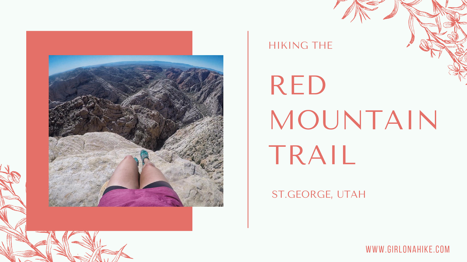
The Red Mountain Trail is located in Dammeron Valley, UT not far from Sand Hollow and Gunlock State Parks. Because it's not actually apart of the state parks and is wilderness area, dogs are allowed off leash. Be sure to start early in the morning so the sand doesn't burn their paws. The first 1.5 miles of the trail is very boring and uneventful, but what the trail does lead to is amazing. The Red Mountain Overlook looks down into Sand Hollow, and the white and red slick rock with Signal Peak in the Pine Valley Mountains to the East is incredibly beautiful. This trail is great for the whole family, as it only gains a mere 360 ft. It's a mix of sand and rock, but plenty of shade if you do need a break.
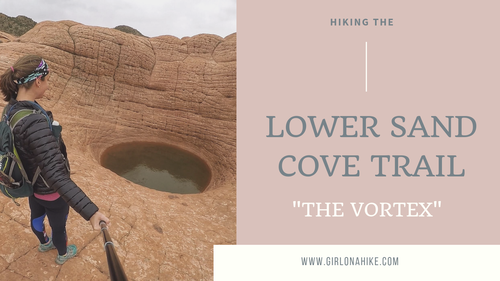
The Lower Sand Cove Trail is located in Dammeron Valley, outside of St.George, Utah. It's located within the Red Mountain Wilderness, making this a dog-friendly hike. Local's know this hike as "The Vortex", due to the interesting geology that created this large pot hole in the slick rock.
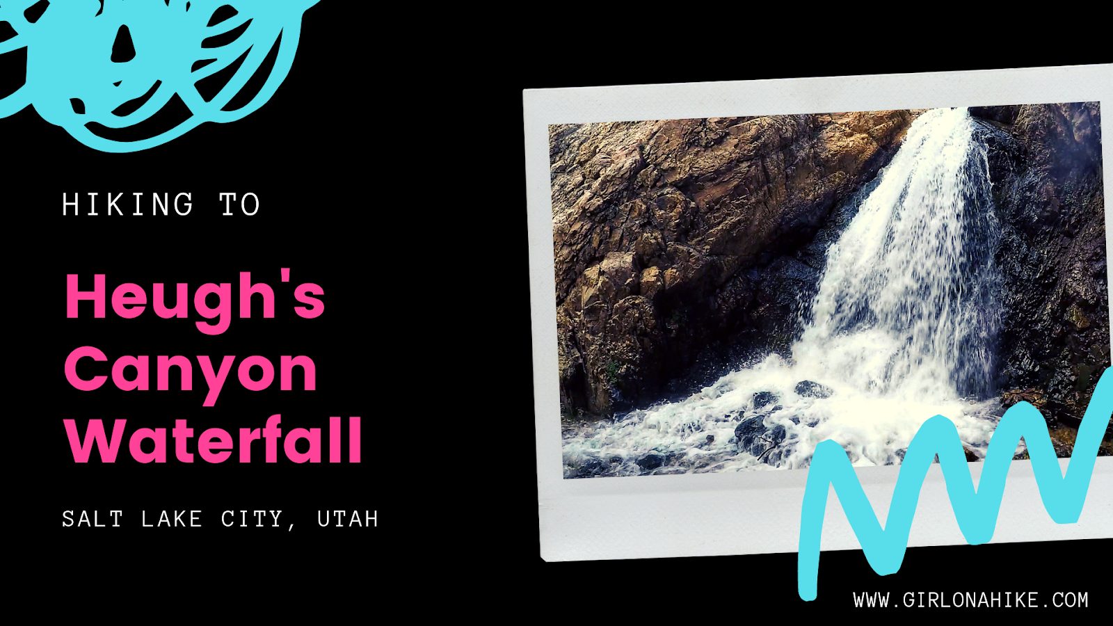
Heugh's Canyon Waterfall is a canyon is situated between Big Cottonwood Canyon and Mt. Olympus, making this a dog friendly hike. The trail starts from the elite Cove Canyon neighborhood on the East side on Wasatch Blvd.