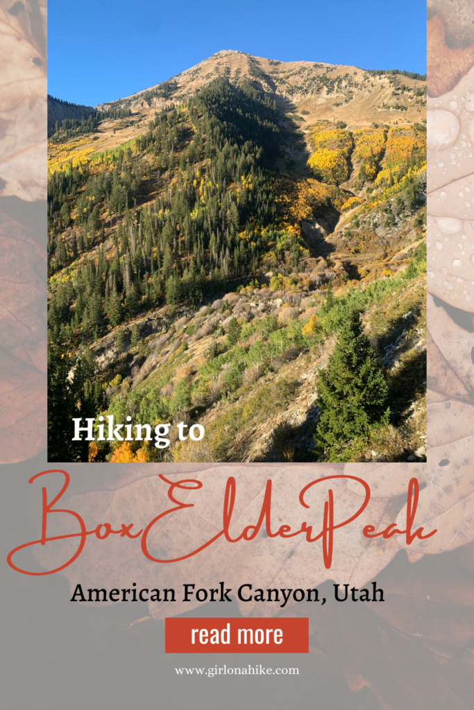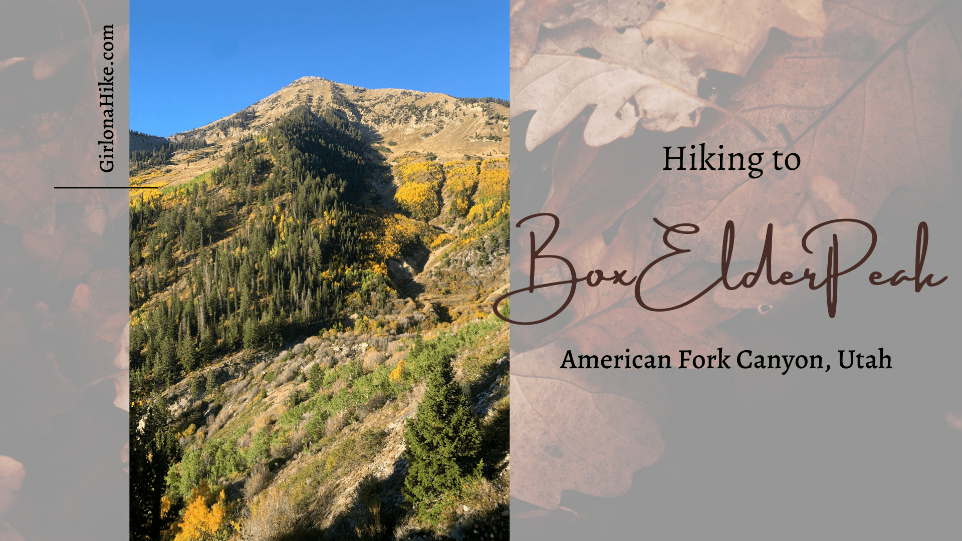
 Box Elder Peak (11,101 ft) is the large, well known peak in between Mt. Timpanogos and Lone Peak – it dominates the ridgeline above, and to the North, of American Fork Canyon. Because the summit is over 11K, it is a popular hike among Peak Baggers. There are several routes to choose from, the most popular being the Dry Creek-Deer Creek Trail #043, which starts from the Granite Flats Campground just past Tibble Fork Reservoir.
About
The best way to hike Box Elder Peak is to turn it into a loop hike so you get to see more of the mountain and experience a new trail. The route isn’t for the beginner hiker though – the long, steep trail is sure to give your calves a workout and leave you out of breath. On the way to the summit, the trail gains 4,900 ft in just 7 miles – whew!
There is no water along the trail, so be prepared to carry at least 3 liters of water, plus more if you bring your dog. Another plus about hiking Box Elder Peak- dogs are allowed off-leash.
Only dogs with a lot of hiking experience in rocky, rough terrain and who have done several high mileage hikes should attempt this hike. Charlie and I hike, on average, 15-20 miles a week, so he’s used to doing hikes this long.
If your dog has never done more than 10 miles in one day without issues (paws tearing, dehydration, soreness, etc), this is not the hike for them. Dogs will need at least 1 liter of water on this hike.
Box Elder Peak is best to summit in Summer or Fall. Winter and Spring will be sketchy due to snow and avalanche terrain, and may require crampons and an ice axe – only very experienced mountaineers should attempt Box Elder Peak in Winter.
Directions
From SLC, head south on I-15, and take exit 284 towards American Fork Canyon. You will now be on HWY 92 – drive into the canyon past the fee station. Turn left at the brown sign for Granite Flats Campground & Tibble Fork Reservoir. Drive this road for another 2 miles until you reach the reservoir. Just past the reservoir is a sharp left turn, which heads up the hill. Continue for about 1 mile until you reach the campground. If the campground gate is open, you can park at the TH, which is about 100 yards past the entrance on the right. If the gate is locked, you can park just before the campground, on the right. There is enough space for about 4-5 cars in each area. Here is a map link.
Trail Info
Distance: 10.5 miles (loop)
Elevation gain: 4,600 ft
Time: 6-8 hours
Dog friendly? Yes, off leash
Kid friendly? No
Fees/Permits?
There is a $10 fee for a 3 day pass to enter AF Canyon. If you have an annual National Park Pass or annual AF Canyon Pass it is free. No permit is required.

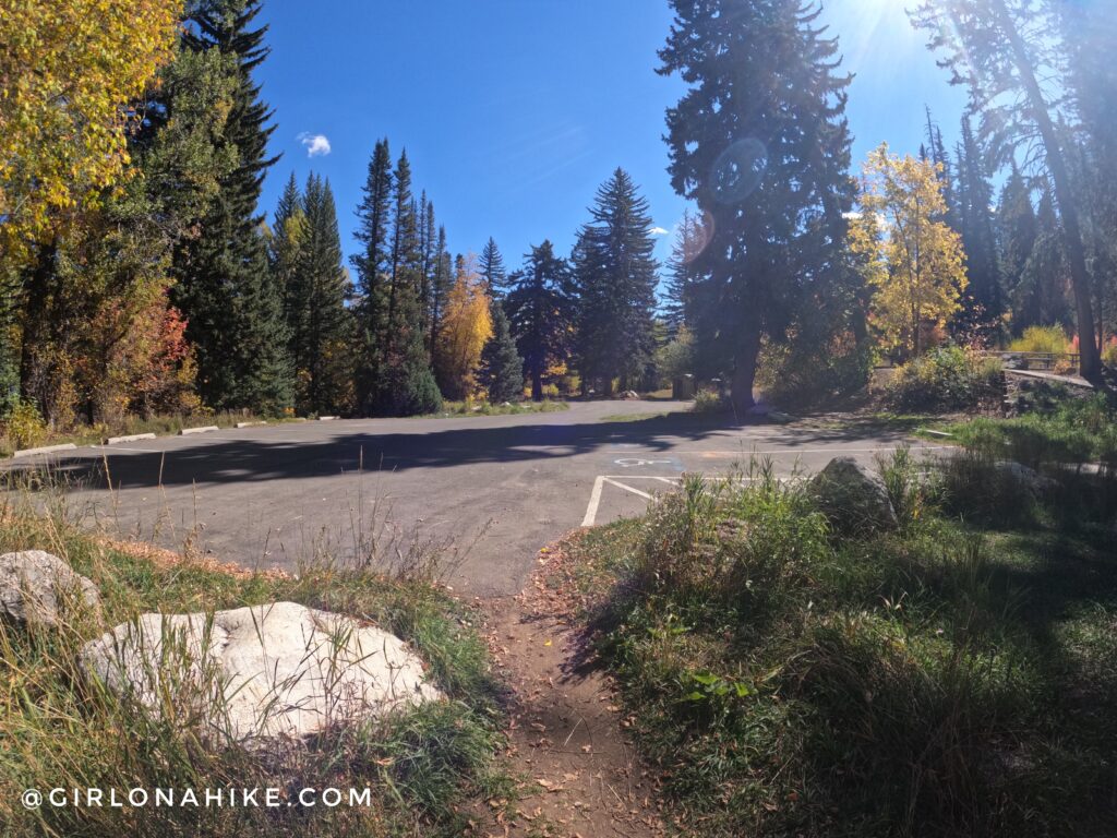
Parking is just before the campground entrance on the right. If the gate is open, you can drive through and park at the actual TH, also on the right, about 100 yards up the road.
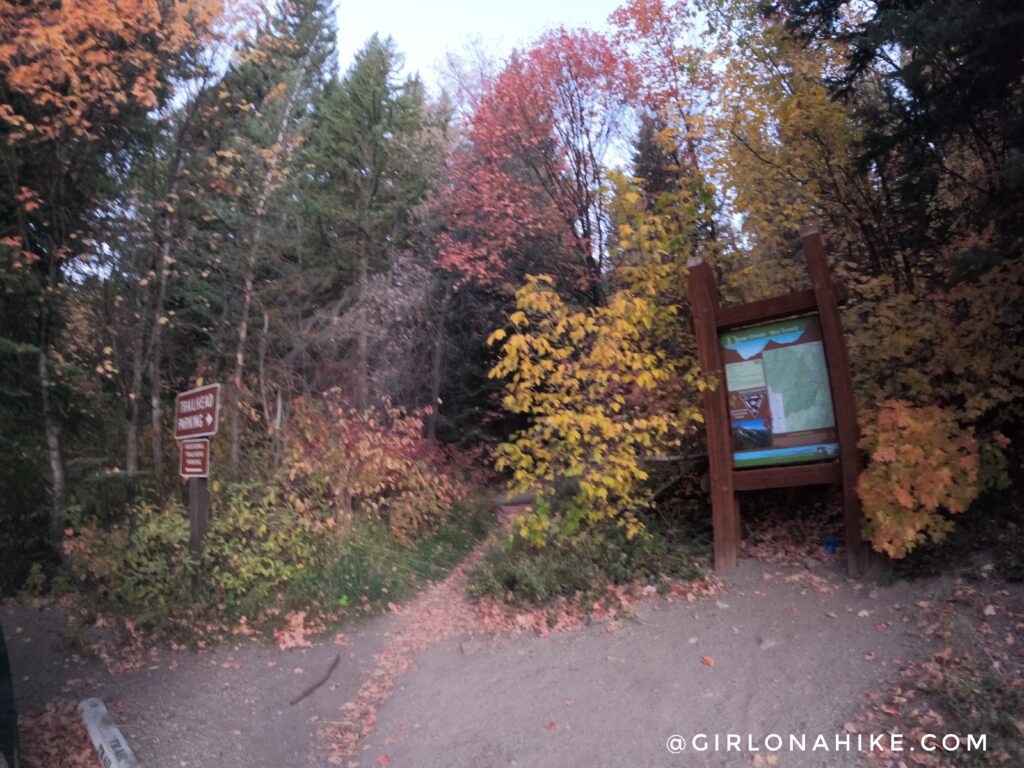
Official TH for the Dry Creek-Deer Creek #043.
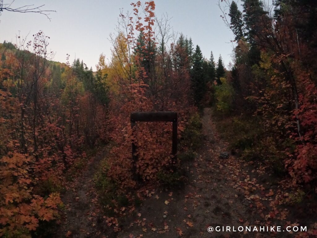
You will quickly reach a trail split. Both end up at the same spot, however going left will not make you cross the dirt roads. I chose to stay left.
You will reach the trail split from where the other trail intersects, if you chose to stay right. This is looking back at where I just came from, but stay left again.
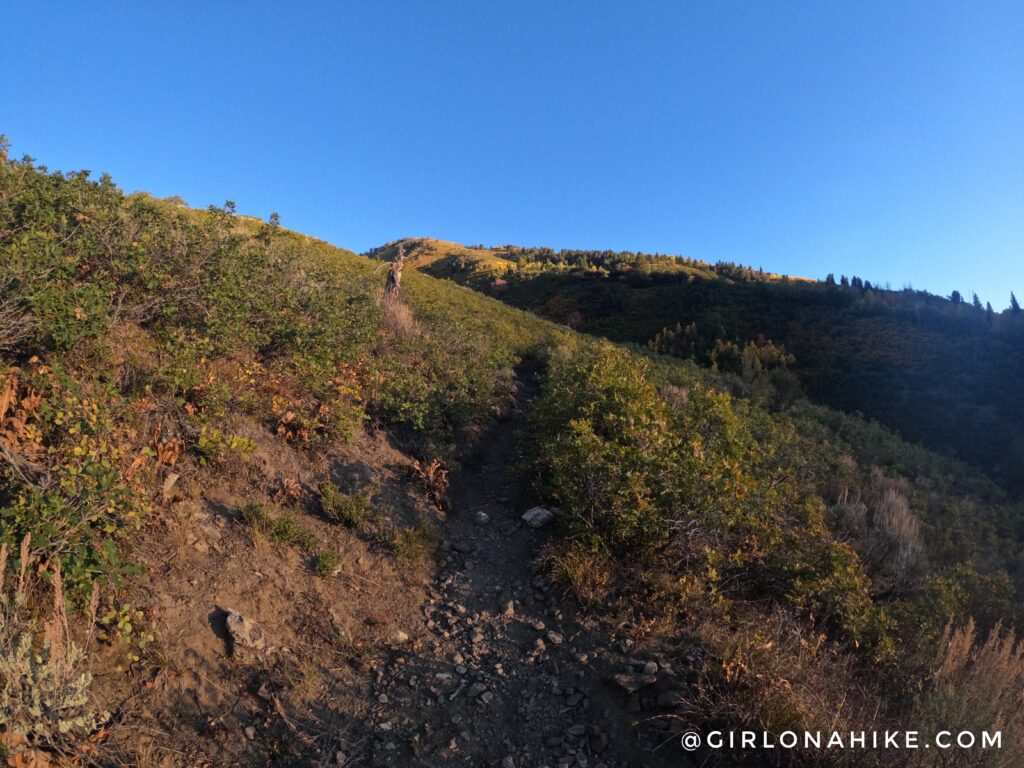
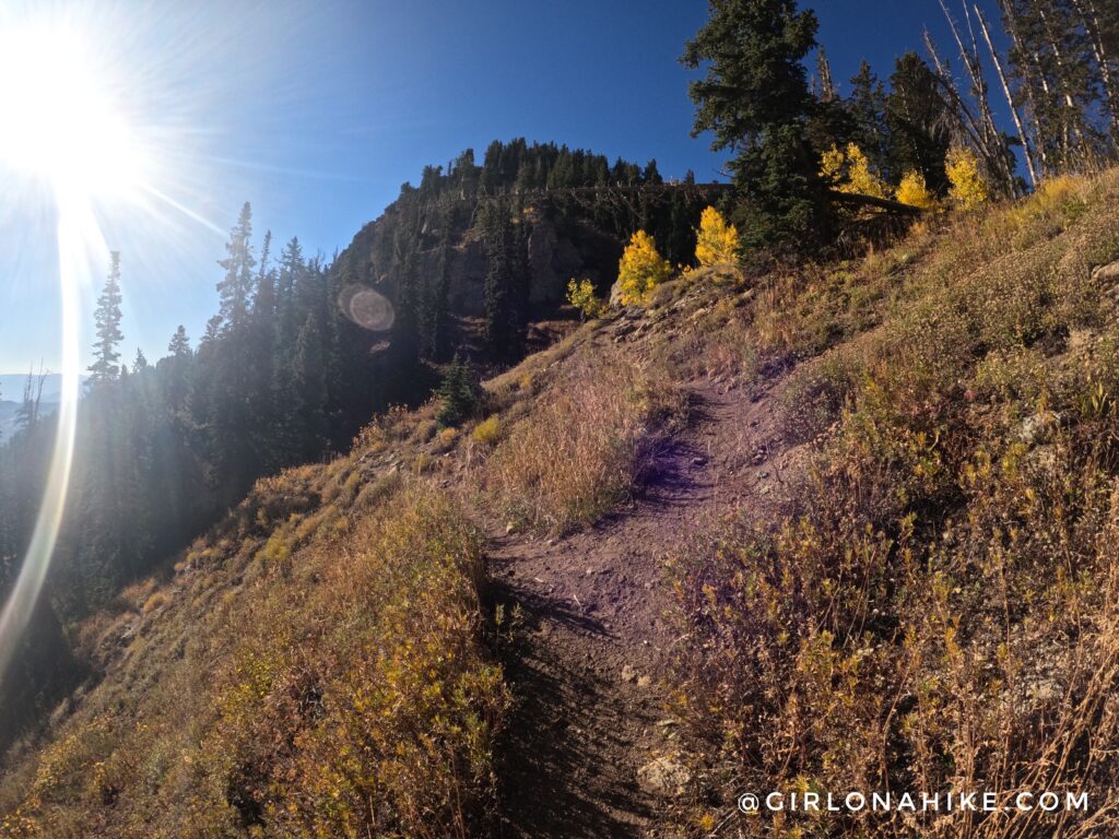
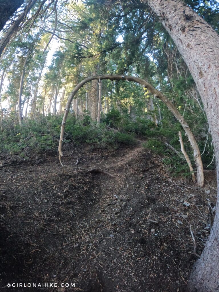
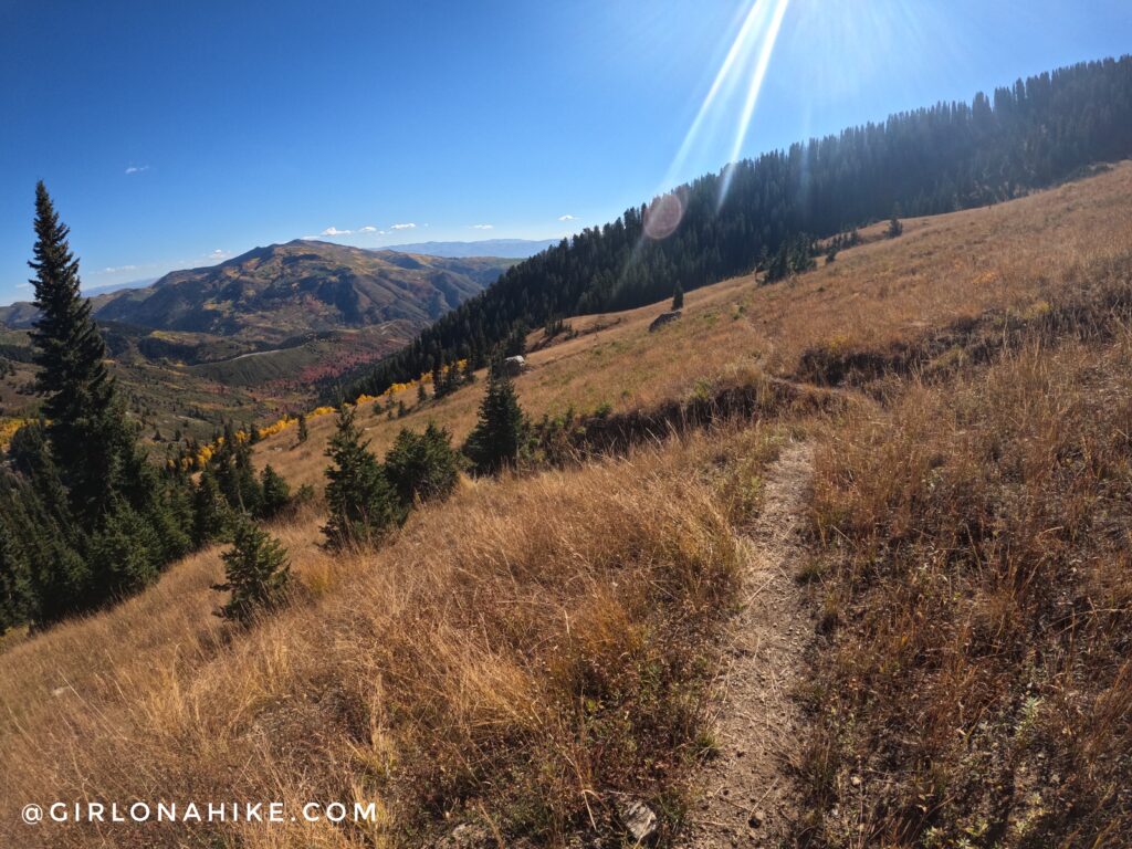
At 1.8 miles, you hit the first of many switchbacks. This is also when the trail begins to really gain elevation.
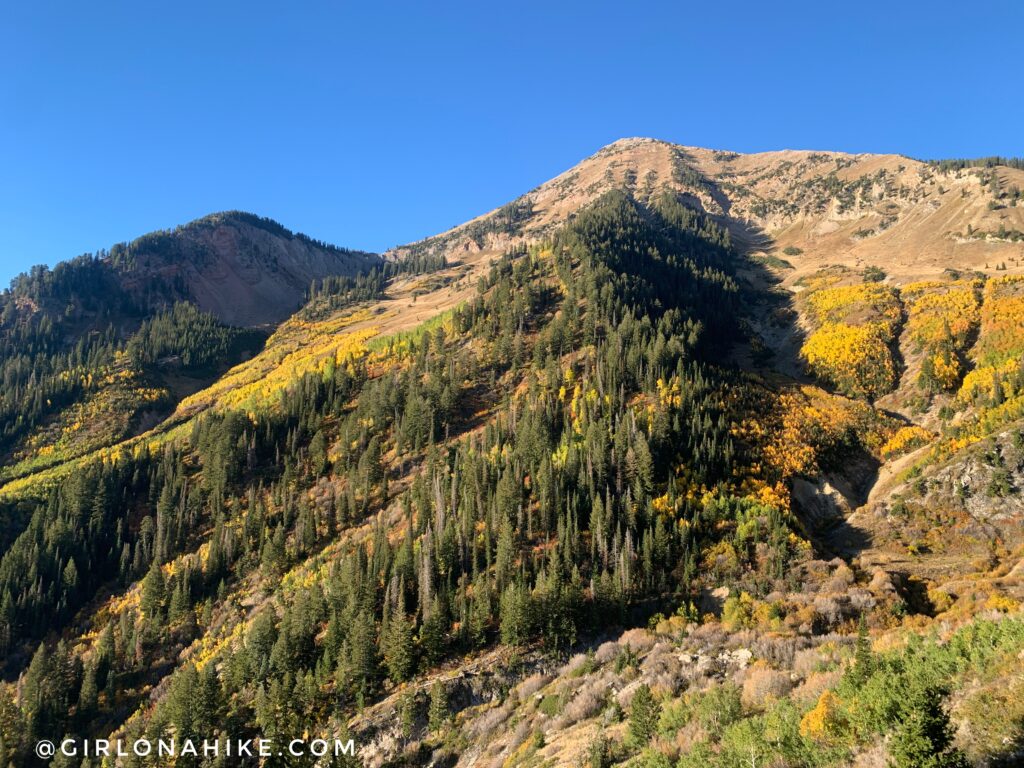
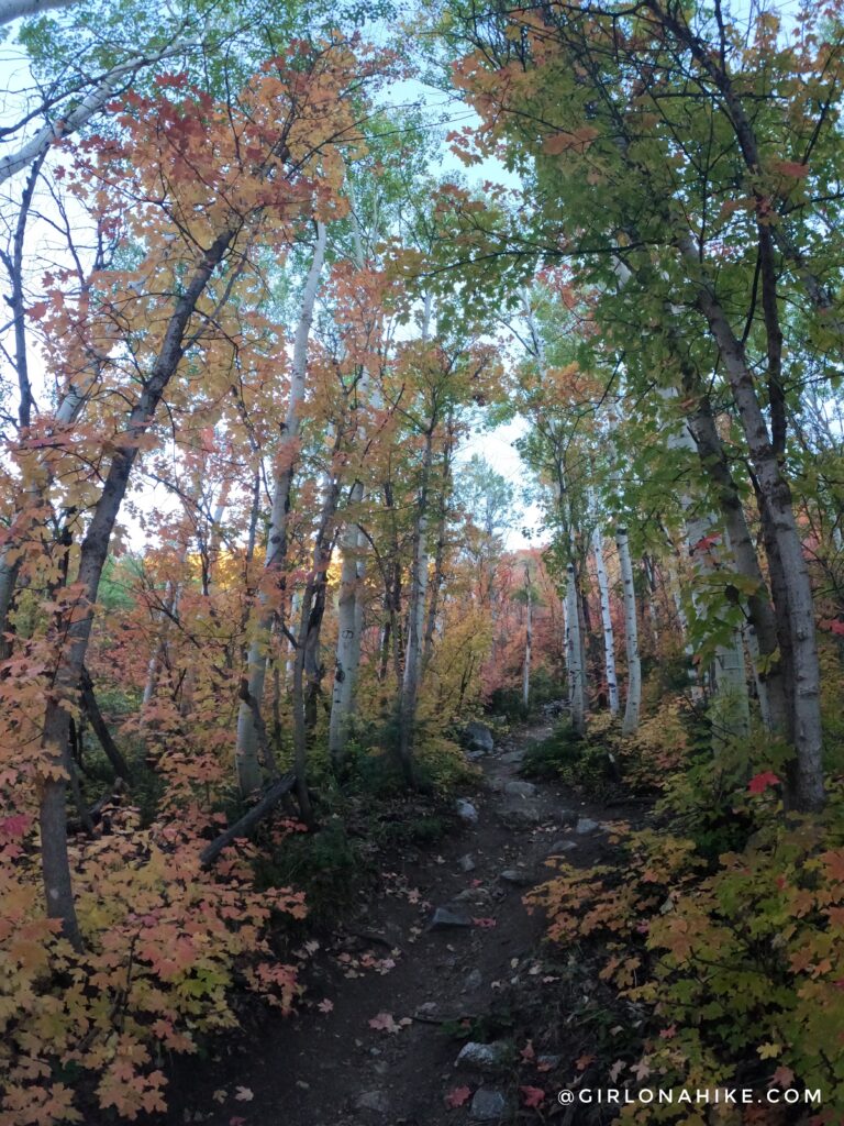
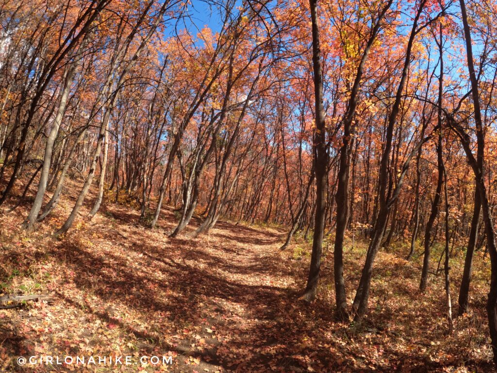
Although Box Elder Peak stares at you the entire hike, it seems really close, and like you are almost there. Not quite. It’s actually much further than you think. The Fall colors in October are amazing!
Many times I thought I may have been on the wrong trail because it keep heading north, and away from Box Elder. But I kept checking Gaia GPS, and I was on track.
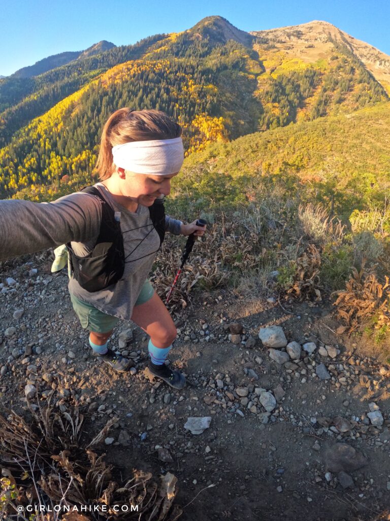
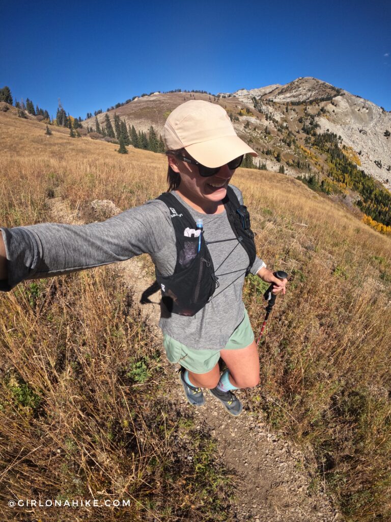
So many switchbacks! I highly recommend wearing compression socks – they will save your calves and help you recover so much faster! I like ProCompression the best – they are tight and have the best styles!
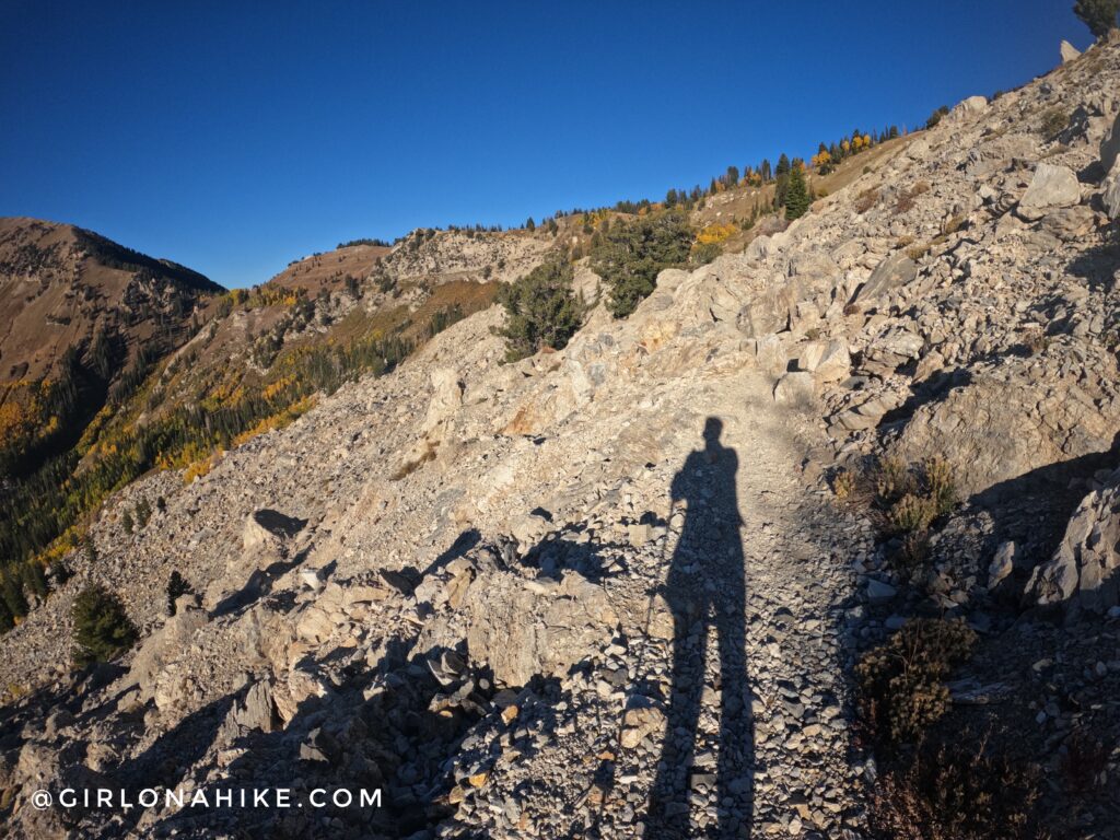
Cross this white rock boulder field.
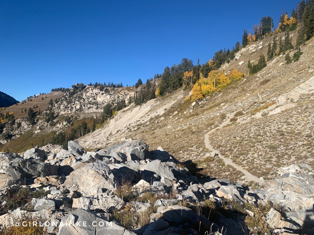
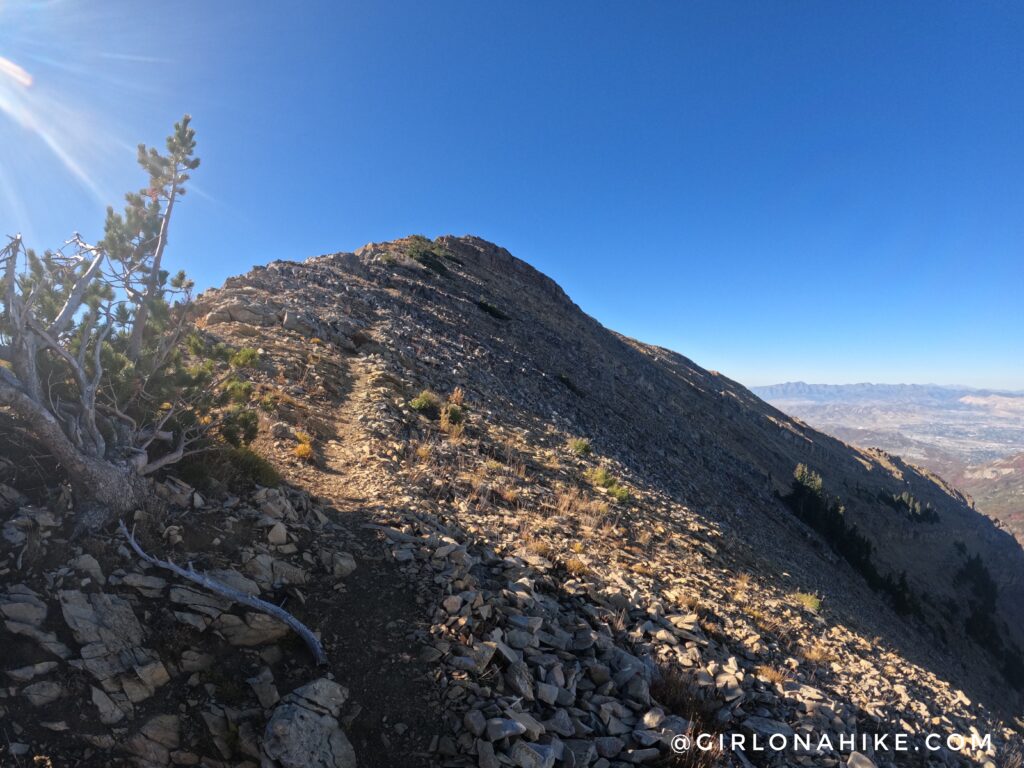
Note that the trail doesn’t lead directly to the main saddle. It actually takes you up higher on the ridge to a flat meadow to a 4-way intersection.
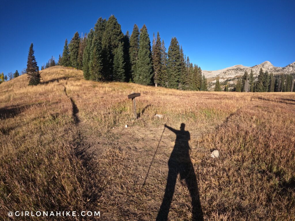
Finally at the 4-way intersection at 3.6 miles and 2,800 ft elevation gain. To get to Box Elder Peak, you’ll want to continue left, along the ridge. From this point to the summit, it took me another hour.
Love this view!
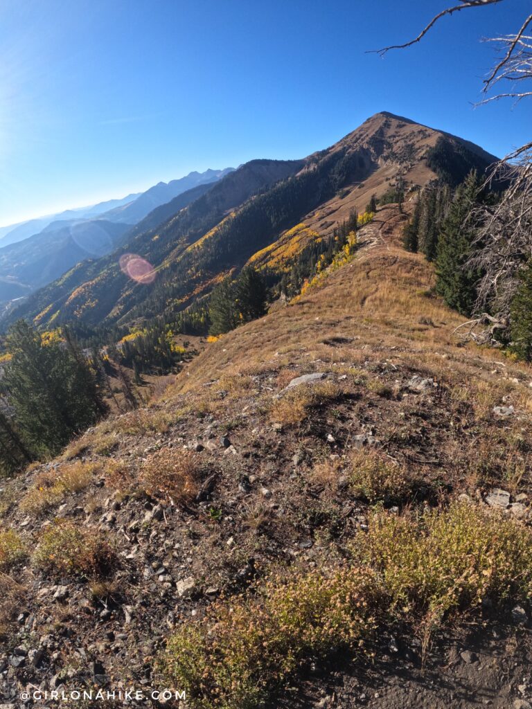
Continuing down the ridge, you’ll reach this trail split. To reach the summit, go straight, and the trail becomes extremely steep.
This trail split is where you’ll want to return to and turn at, if completing the loop as I am describing here. It is not marked.
The trail was VERY steep, and this stretch from the saddle to the peak is the hardest section of the trail.
Eventually you will leave tree-line and are now so close!
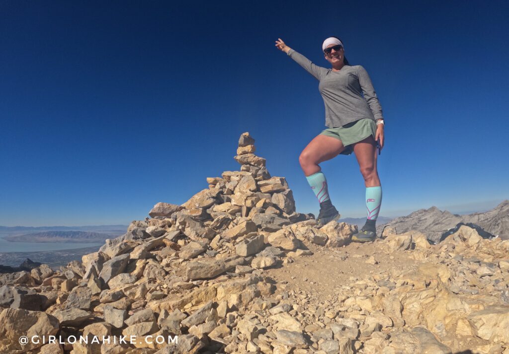
Whoohoo on Box Elder Peak for the 2nd time! 3.5 hours to reach the summit.
Trail Gaiters are also very helpful to keep rocks and dirt out of your shoes. I get mine from Dirty Girl Gaiters (they have mens too)!

My first time on this peak was in 2016, back when Charlie was a young pup and could handle big, steep hikes! Those days are long gone…
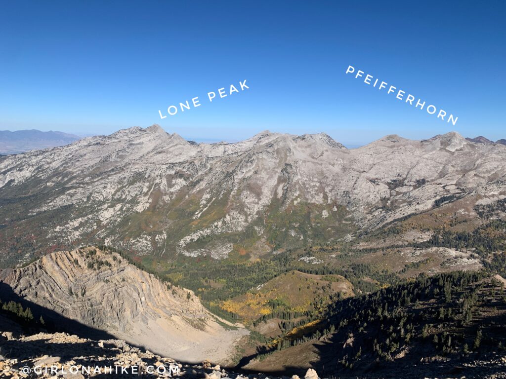
Great views across the basin to the Little Cottonwood ridgeline – Lone Peak on the far left, the Pfeifferhorn on the right.
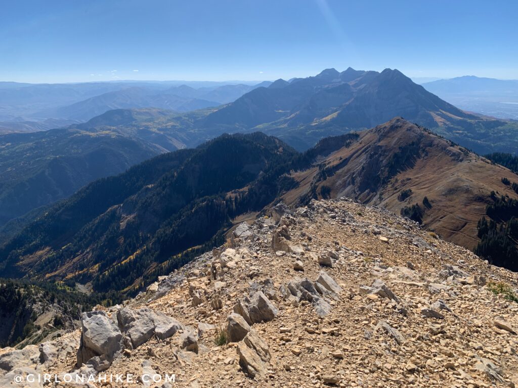
Great view of Mt. Timpanogos to the south.
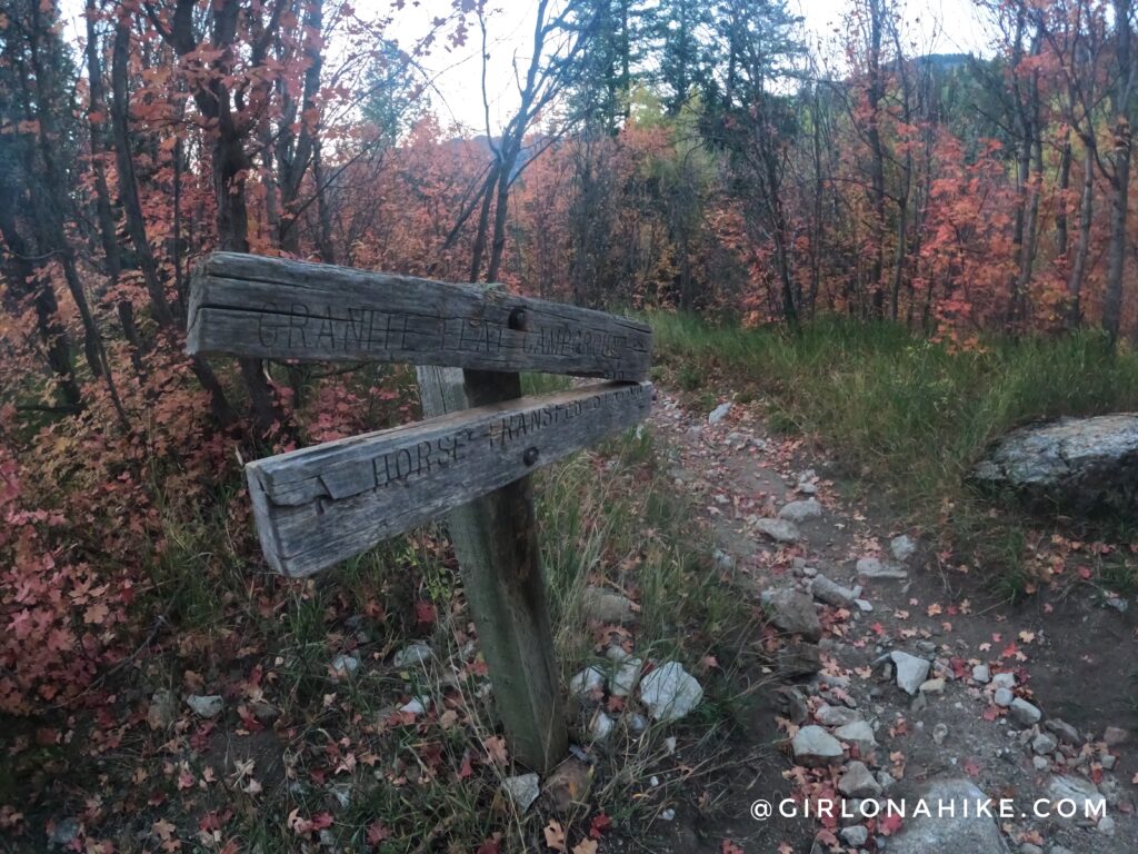
After summiting Box Elder, head back down to that last un-signed trail split, and follow it downhill from the saddle.
This trail turns into White Canyon Trail (however, you won’t see any signs for it for the next 2 miles or so). You can’t tell by the photo, but when you are hiking down this, you can actually see the Dry Creek-Deer Creek trail you hiked up on across the canyon. I was able to only jog down about 1/2 of the rest of the route down.
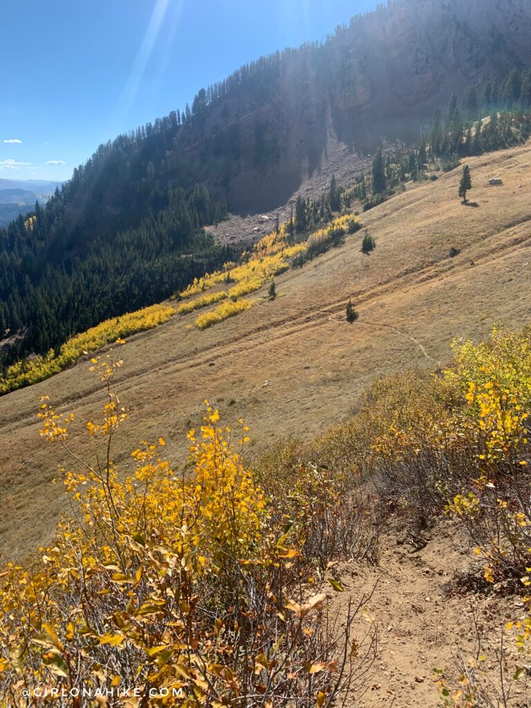
The trail seems to head too far south, and just when you thought you couldn’t take it anymore, the trail gains a little more elevation. I felt a little discouraged at times, checking my route to make sure I was going the right way. The trail does get a bit overgrown at times, but it’s never hard to stay on the correct trail. Cross another open meadow.
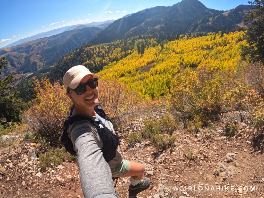
Around mile 7.5 is when you finally start a complete descent. But first! More selfies with the yellow Aspens haha!
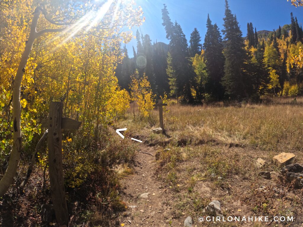
Eventually, you’ll reach a signed trail split. Turn left here, and you are now on the Box Elder Trail #044. This route is another option for summiting Box Elder if you turn right.
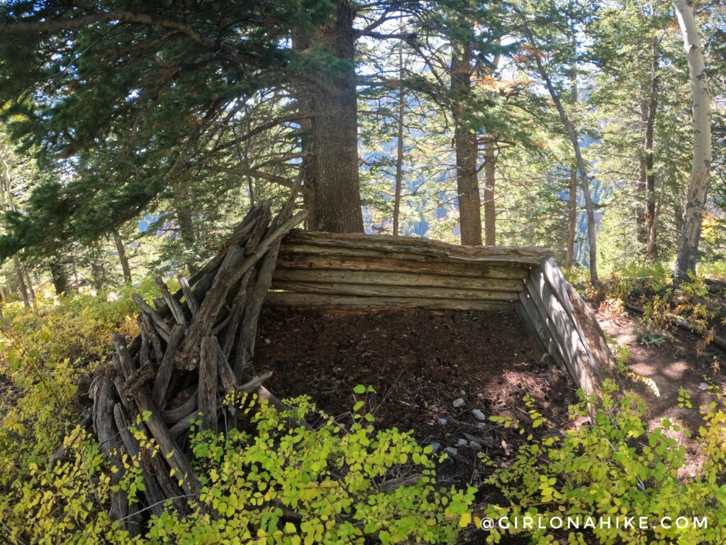
Passing by an old miners cabin on the right.
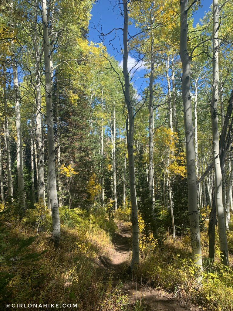
The last mile turns more into these types of trees, so you now you’re getting close!
After what seems like forever, you’ll be back at the campground. Turn left at the stop sign.
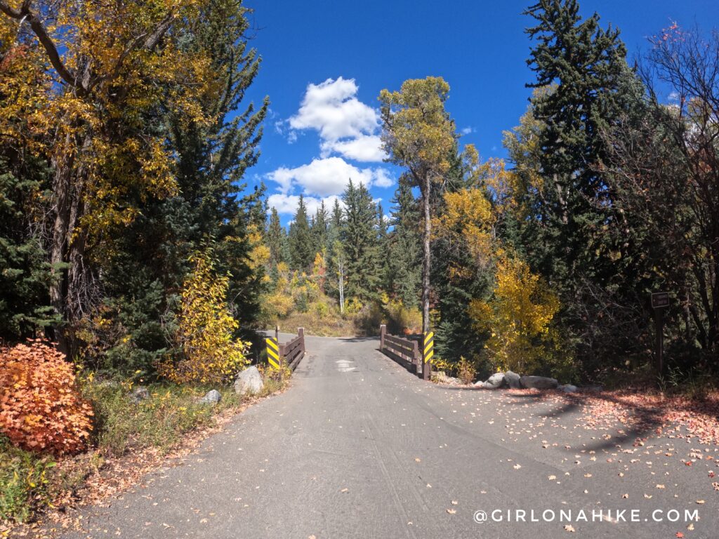
Cross the bridge, and you’ll back to your car! What a great day!
Check out my video!
Trail Map
My tracks via Gaia GPS – the best tracking app! Get your app here for a discount.

Save me on Pinterest!