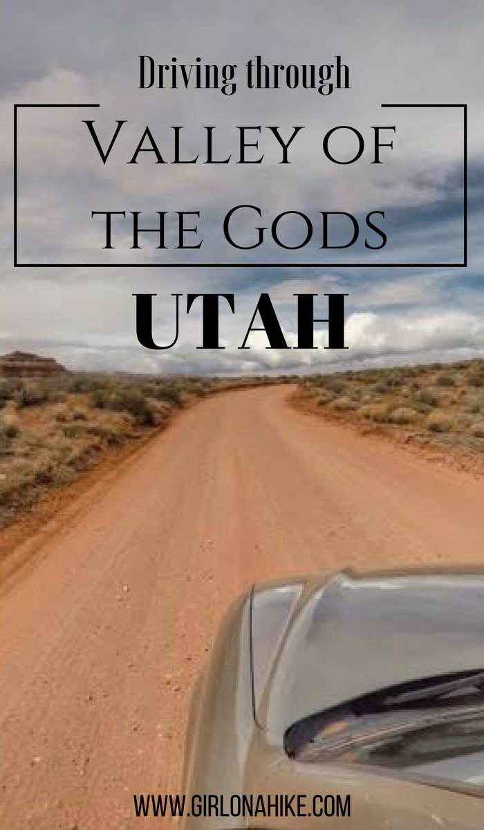
Exploring Valley of the Gods, Utah: A Scenic Drive Through Monument-Like Beauty
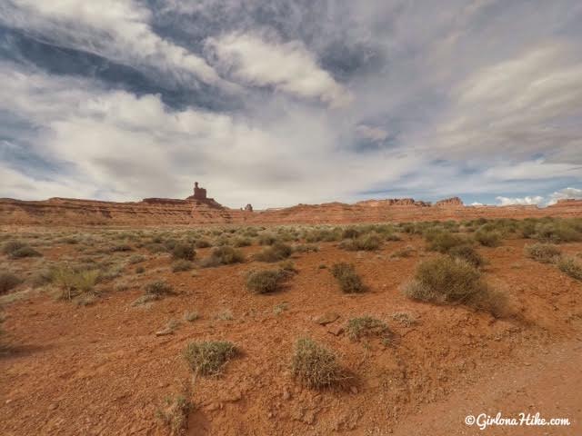
Valley of the Gods is a breathtaking backcountry destination in southeastern Utah, located near Mexican Hat and just north of Monument Valley. This hidden gem offers stunning views of towering buttes, sandstone spires, and expansive desert landscapes—without the crowds or entry fees that Monument Valley draws.
What to Expect in Valley of the Gods
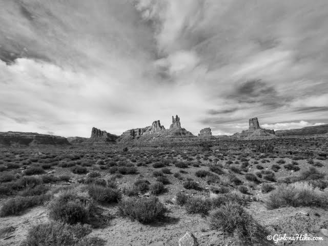
The scenery rivals that of nearby Monument Valley, featuring:
Towering rock pinnacles
Isolated buttes and mesas
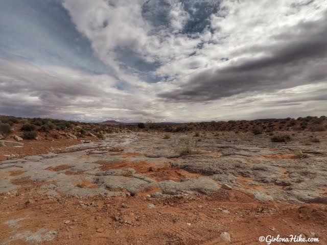
Vast, open desert views
Zero entrance fees and very few visitors
Because this area is remote and rugged, be sure to:
Bring plenty of water
Fill up on gas beforehand
Pack emergency supplies
Travel with GPS or offline maps, as there’s no cell service
Permits, Camping, and Road Conditions
Valley of the Gods lies on Navajo Nation land and is administered by the BLM. While you can drive the road without a permit, hiking, biking, or camping off the road typically requires a Navajo backcountry permit. Always check with local authorities or visitor centers before exploring beyond the main route.
Though the road is usually in good condition, washboard surfaces, dips, and rocky patches may be encountered. Avoid traveling during or just after a rainstorm, as the terrain becomes extremely slick and muddy.
Run, Bike, or Drive: Choose Your Adventure
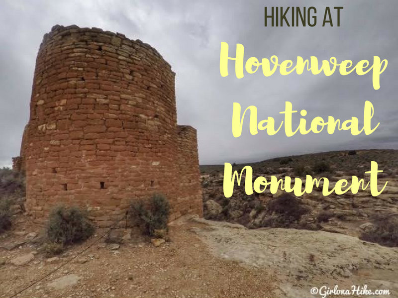
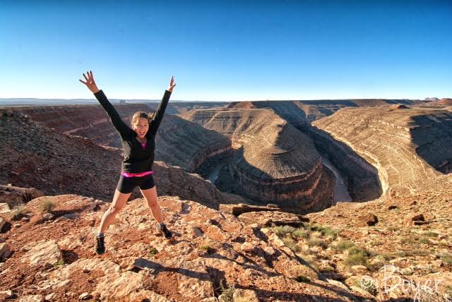
For a unique experience, consider running or biking the entire 17-mile road. On our visit, my partner, who is training for a 50K race, ran the route west to east while I hiked at nearby Hovenweep National Monument. After his run, we met up and drove the road together, taking in the stunning views along the way. He completed the run in just a few hours—and loved every minute of it.
Directions
If you are coming from the South such as Mexican Hat, UT use this map.
If you are coming from the North such as Blanding, UT use this map.
FAQs
Are dogs allowed?
Yes, dogs are allowed but as stated before, to hike in the backcountry you do need to get a permit from the Navajo tribe.
Is this a good place for kids?
Yes, definitely!
Where is the best place nearby to camp or get a hotel?
The best and closest place to camp is Goosenecks State Park, only 9 miles away from the West entrance.
The closest town for decent hotels is in Mexican Hat, UT where they have either the San Juan Inn or the Hat Rock Inn.
Best place to eat nearby?
I love the Comb Ridge Bistro! Excellent coffee, lattes, sandwiches, and diners. Really clean and artsy inside & a great staff. Plus it’s local!
How do I get a permit?
Please check the Navajo Nations’ website for permit info
Fill up on gas, and let’s get driving!
Road Info
My little Sonata was able to drive the entire route with no issues. Sections of the road were like a washboard, but as long as you drive slow (25 mph & under) it was fine.
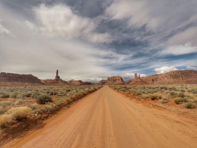
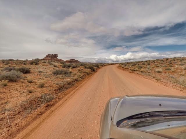
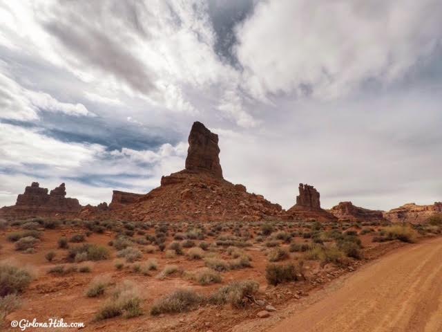
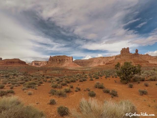
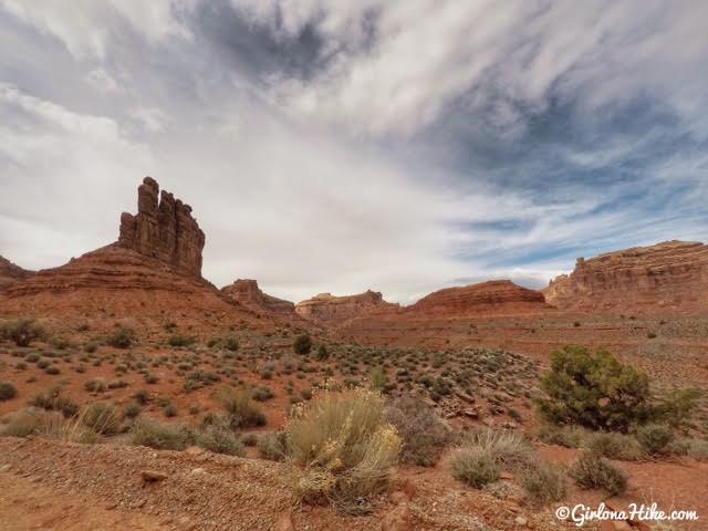
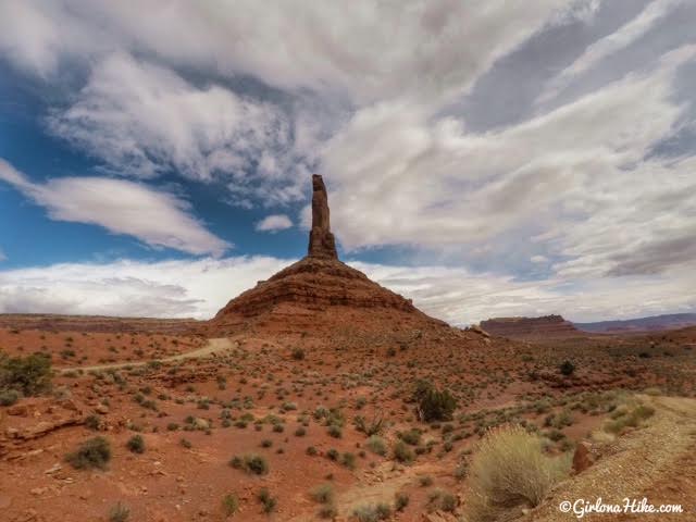
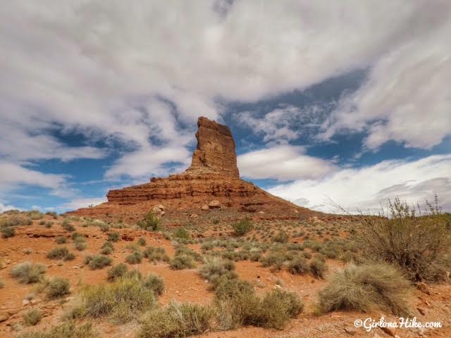
What a view! The best section of the drive is halfway, where you drive closest to all the amazing buttes.
Geology Info
The statuesque buttes in Valley of the Gods are all sculpted from Cedar Mesa sandstone dating to the Permian age, 250 million years old! The 1200 ft thick sandstone was cemented by calcium carbonate interspersed with red siltstone and was deposited in huge sand dunes near the shores of an ancient sea. Erosion by water, wind, and ice over millions of years chiseled these amazing rock formations and shapes we see today. (source)
The Navajo interpretation of the Valley of the Gods rock formations means that they “are places of power in which spirits reside.” They believe that these buttes are Navajo warriors frozen in stone, who can be appealed to for protection – they are guardians whose power and strength aid young servicemen and women going to war.
Filming Info
The Valley of the Gods and Moki Dugway are popular filming locations because of its classic “western” look. Filming projects include still shots and moving film for major films, commercials, promotions, and recreational events such as hot air balloon rides and even background shots for a PlayStation game. The CBS show, Airwolf, which aired from 1984-1987, used a mesa here as the secret hiding place of Airwolf. Two episodes of the BBC science fiction TV show, Doctor Who, were also filmed here.
The formations at Valley of the Gods have all been given names from the locals – Rooster Butter, Sitting Hen Butter, and Balanced Rock/Lady in a Tub!
Old lava rock??
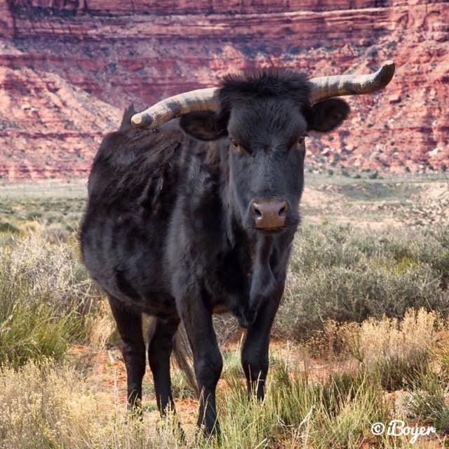
Keep an eye out for cattle!
Map of Valley of the Gods
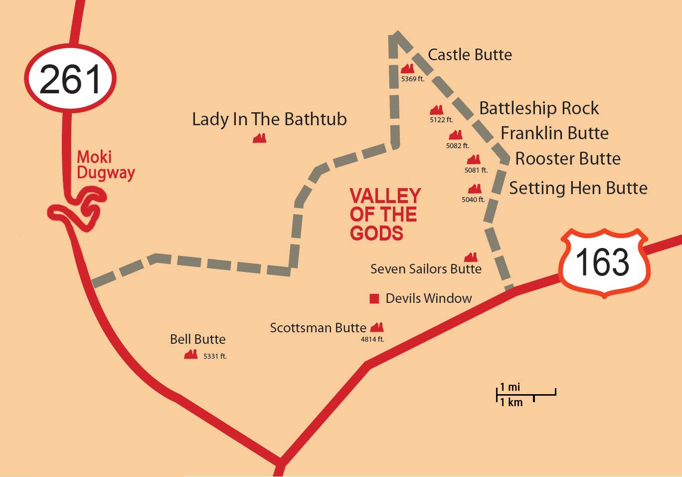
Map of the buttes.
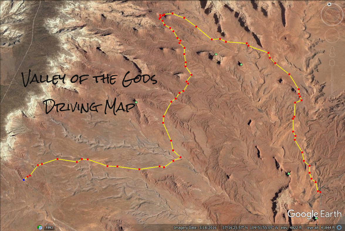
Valley of the Gods driving map.
Make sure you stop by Goosenecks State Park! It’s one of my favorite places to camp and even just sit to enjoy the view.

Save me on Pinterest!