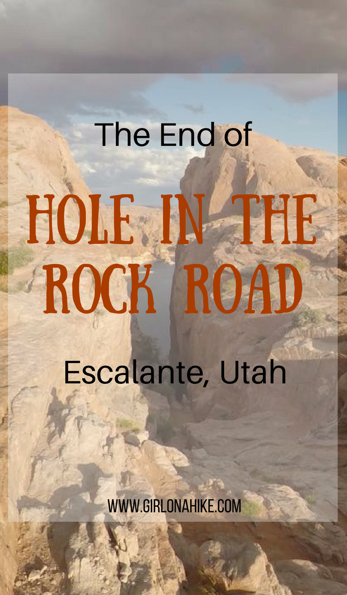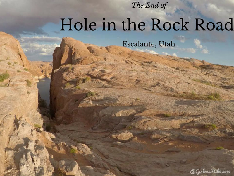
Driving Hole-in-the-Rock Road: What to Expect on This Historic Route
Hole-in-the-Rock Road is a rugged, 62-mile dirt road that runs from Escalante, Utah, to the actual Hole-in-the-Rock on the western edge of Lake Powell. This remote road traces the route of the historic Hole-in-the-Rock Expedition of 1879, when Mormon pioneers carved a trail through the sandstone to eventually settle in Bluff, Utah. Today, this route traverses sections of Grand Staircase-Escalante National Monument, Glen Canyon National Recreation Area, and BLM-managed land.
A Rough Drive Through Remote Desert Terrain
Driving Hole-in-the-Rock Road is not for the faint of heart. This long, remote stretch of road is often washboarded, rutted, and deeply eroded, especially after storms. Most high-clearance vehicles can handle the first 50 miles in dry conditions, but the last 10 miles near the lake require 4×4 capability—expect to see only trucks, Jeeps, or ATVs past this point.
Be prepared with:
A full tank of gas
Plenty of water
Emergency supplies, including a spare tire and recovery gear
A paper map or GPS (there’s no cell service)
In summer, temperatures soar above 100°F. In winter, it can be freezing. And during monsoon season, sudden downpours can wash out the road entirely and make it impassable.
Stop at the Escalante Interagency Visitor Center
Before driving down Hole-in-the-Rock Road, stop by the Escalante Interagency Visitor Center to:
-
Check current road conditions
-
Pick up free backcountry camping permits
-
Grab area maps
-
Use clean restrooms and fill water bottles
-
Learn about BLM regulations and Leave No Trace practices
The staff are incredibly helpful, and it’s your best source for up-to-date safety information.
What Is Hole-in-the-Rock?
The Hole-in-the-Rock itself is a narrow, steep crevice along Lake Powell’s cliffs. In 1879, it served as a crucial passage for the Mormon pioneers, allowing them to descend the sheer cliffs and cross the Colorado River before the construction of Lake Powell.
“Construction of this passageway was very difficult… Although a 3 ft shelf had already existed, an extension to the shelf was formed by driving two-foot stakes into the rock and piling vegetation and rocks on top. This portion of the trail was nicknamed ‘Uncle Ben’s Dugway’ in honor of its engineer, Benjamin Perkins…” — Glen Canyon Information
Keep in mind, when the pioneers completed the trail, Lake Powell didn’t yet exist—the river crossing was dry and far more treacherous. The lake was formed in the 1960s with the construction of Glen Canyon Dam, which flooded the Colorado River corridor.
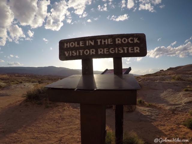
Arriving at the end of Hole in the Rock road, you can check in the Visitor Registration.
Exploring the area, trying to find a good campsite.
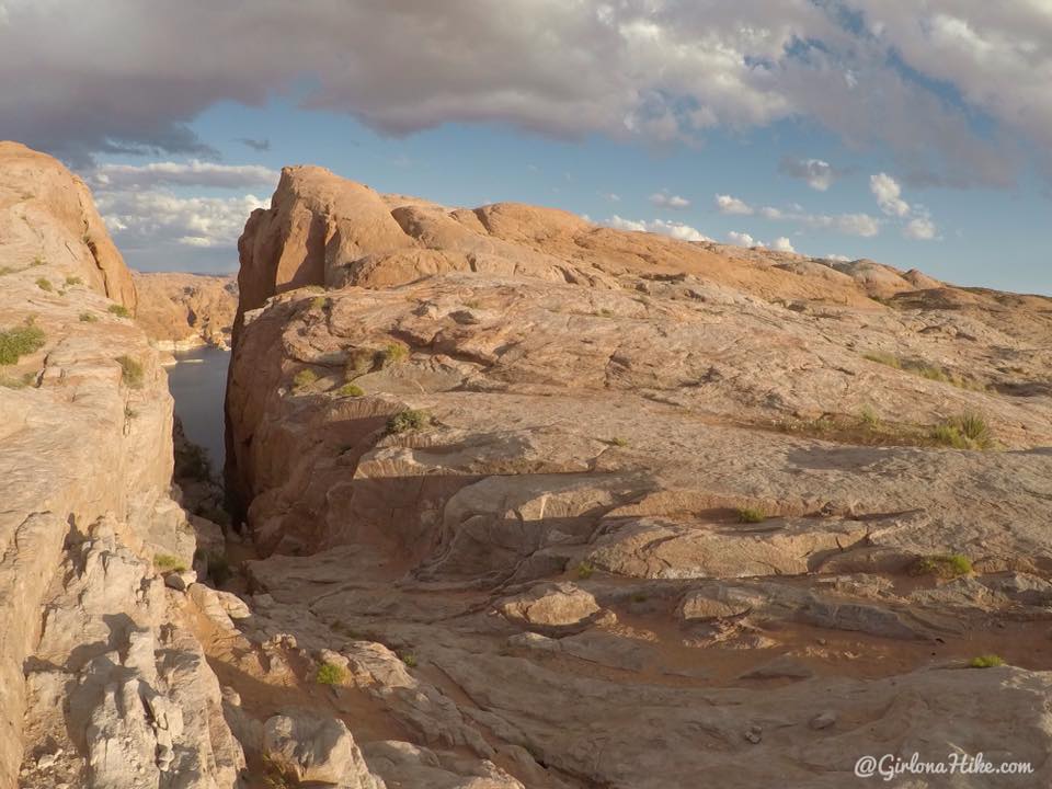
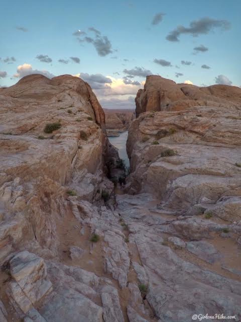
The actual Hole-in-the-Rock.
Can you believe the expedition brought over 1,000 people and hundreds of wagons up this?!
It’s much bigger and wider than I was expecting – it had to be at least 100 feet or more across.
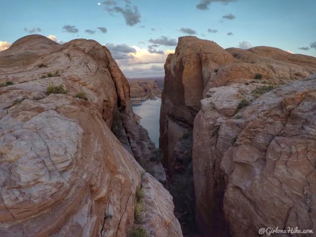
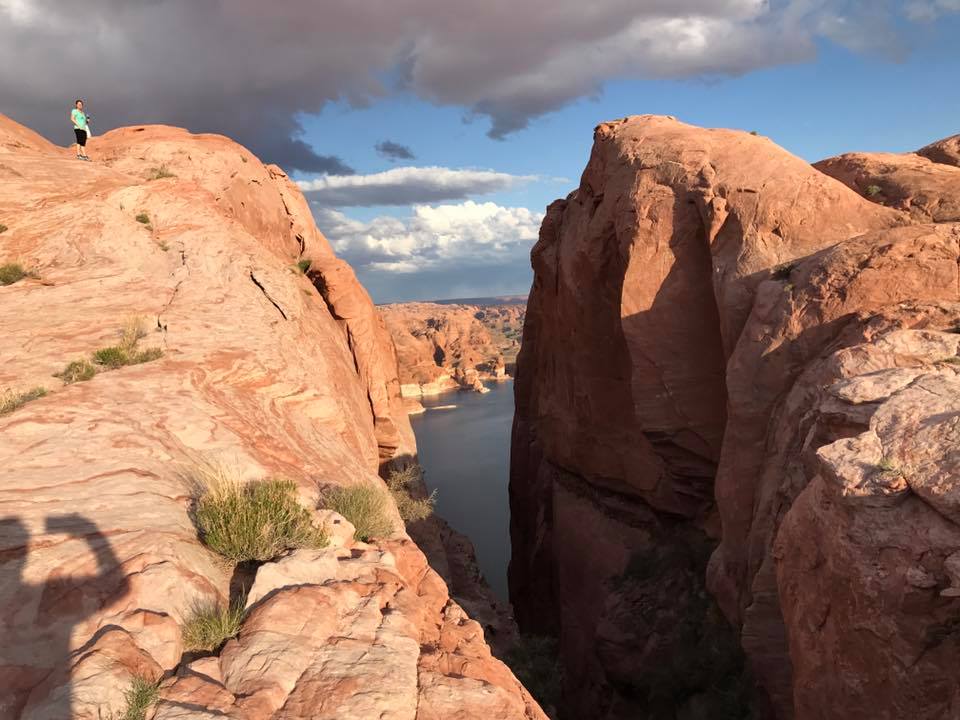
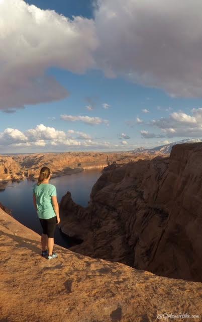
The light on the rock and lake is really pretty at sunset.
You can hike down to the bottom of Lake Powell – it’s about 1,000 ft of descent, so just remember that you need to hike back up. My partner hiked down and up and it took him close around an hour at a fast pace. I did see one child hiking up it, but he was in tears LOL.
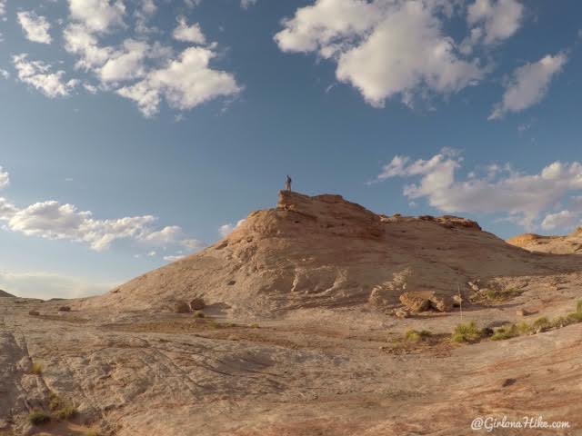
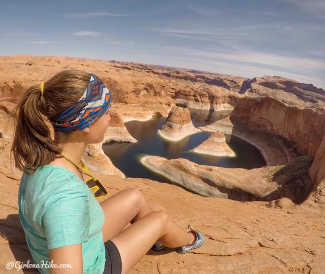
Checking out the view from the ridge.
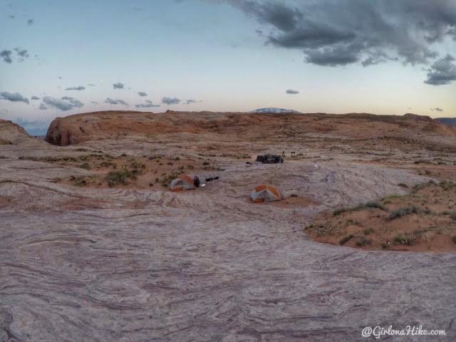
You can camp anywhere you like, but just remember that you do need a free backcountry camping permit that you can get from the visitor center. Not only is it a way for the Interagency to calculate how many people are camping in the area per night, but it is a good paper trail in case you get lost, stuck, etc.
My friends decided to set up their tents right by the car. You can see there is plenty of space to camp.
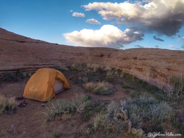
We decided to set our tent up in a little alcove about 100-150 ft up from the car in a secluded spot. We figured it would protect us from the wind. Well, that night we camped in the most extreme wind I’ve ever been in. In the morning, I just stuffed everything in my backpack, walked down to the car, and then would pack it up nicely for our adventure the next day to Reflection Canyon. My partner stayed behind to pack his bag, and take down the tent. Well, he came down about 20 minutes later….with no tent.
He said, “well, the tent is gone.” I replied, “What do you mean it’s gone??” He said as soon as he turned around to put the rain fly away in his pack, and turned around, the entire tent had blown away – with the poles! We even had it staked down and tied to a heavy rock. I couldn’t believe the wind was so bad that it just blew away. He said he never even heard it take off. We searched all around camp, hiked down to the lake and nothing. I’m sure its hundreds of miles away floating in Lake Powell at this point. If any of you find an orange Black Diamond tent, well, you know who it belongs it!
Nearby Hike
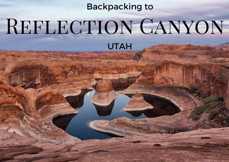
Check out my post on Backpacking to Reflection Canyon!

Save me on Pinterest!