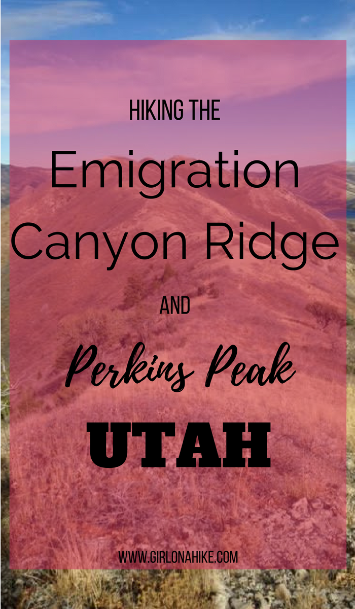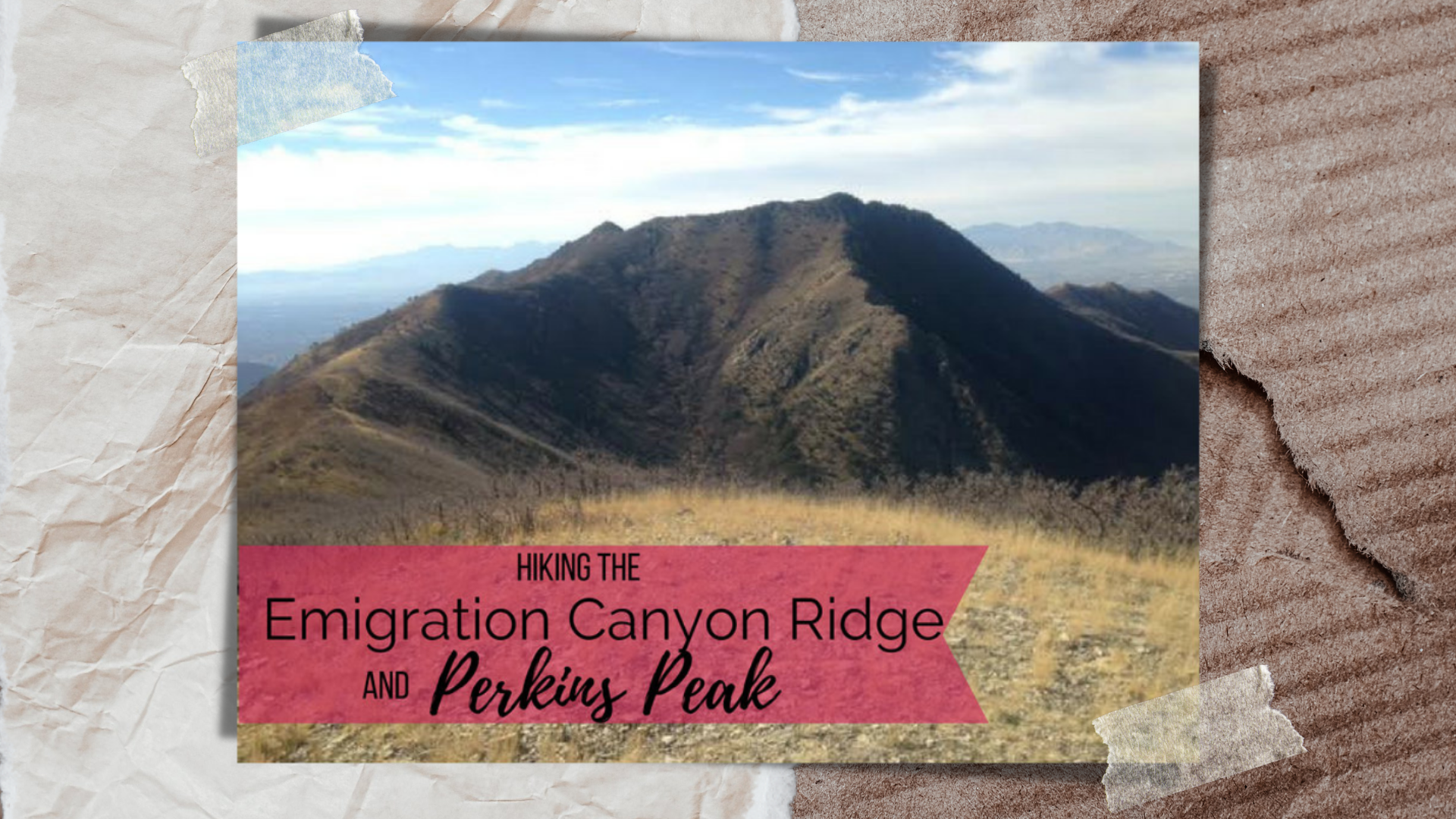

Hiking Emigration Canyon Ridge to Dale and Perkins Peaks – A Hidden Gem Near Salt Lake City
The Emigration Canyon Ridge Trail is a hidden gem nestled between Parley’s Canyon and Emigration Canyon, just east of Salt Lake City, Utah. Starting from the well-known Little Mountain Summit, a popular destination for road cyclists and runners, this scenic ridge hike remains relatively unknown—yet anyone who has driven through Parley’s Canyon has unknowingly passed right below it.
This peaceful ridge offers access to two lesser-known peaks:
Dale Peak (7,367 ft) and Perkins Peak (7,491 ft)
The trail follows a wide-open ridgeline with incredible panoramic views of the surrounding Wasatch Mountains, canyons, and ridgelines. Best of all? The hike is non-technical, with no scrambling required, making it perfect for beginner hikers or those looking for a mellow summit day.
Know Before You Go – Dog Restrictions
Although many nearby ridges allow dogs, Emigration Canyon Ridge lies directly on the Salt Lake City watershed line, meaning dogs are strictly prohibited. Unlike nearby trails like Clayton Peak, this area enforces the restriction, and several “No Dogs” signs are clearly posted. Local authorities, including SLC watershed police, are often stationed at Little Mountain Summit—especially during bow hunting season—and will issue citations to those violating trail rules. Be sure to leave your pup at home for this one.
When to Hike Emigration Canyon Ridge
This route is accessible year-round, but:
-
Spring and Fall offer the best conditions with cooler temps and fewer crowds.
-
Summer hiking is possible, but be warned—there is zero shade along the ridge, and it can get extremely hot midday.
-
Winter hiking is also enjoyable when the trail is packed down, and the views of snow-covered peaks are stunning.
A Great Intro to Peak Bagging
If you’re new to peak bagging in Utah, Dale and Perkins Peaks make excellent introductory summits. The terrain is mostly smooth and the elevation gain is manageable, with just a few short, steep sections as you approach each peak.
Trail runners in the Wasatch Mountain Wranglers community will also love this route—its gentle ridgeline, consistent elevation, and quiet terrain make for an excellent training run.
Directions
From SLC head East on 800 S, all the way past Foothill Blvd, which turns into Sunnyside Blvd. You’ll pass the Hogle Zoo and Ruth’s Diner on your right. Drive all the way up Emigration Canyon until you reach the Little Mountain Summit on the saddle. The large parking lot is on your right (South), and can fit about 40 cars. The TH begins right behind the restroom. Here is a driving map.
Trail Info
Distance: 8.5 miles RT
Elevation gain: 1,700 ft
Time: 3-5 hours
Dog friendly? No, dogs are not allowed due to watershed rules/laws
Kid friendly? Yes if you go slow
Fees/Permits? None
Hiking the Emigration Canyon Ridge – What to Expect
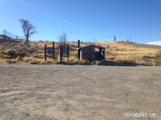
The trail starts behind the restroom, in between the Watershed sign.
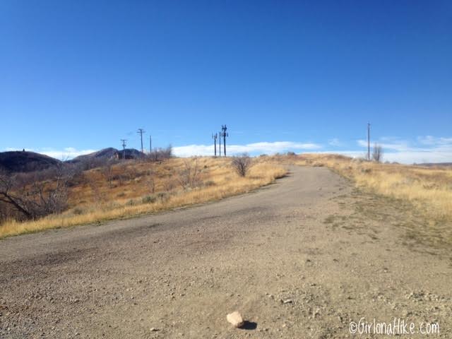
The first 3/4 mile follows the wide paved road past all the utility buildings, and passes by several electricity and cell phone towers. Not the prettiest view starting out.
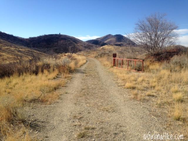
Pass by an old red gate.
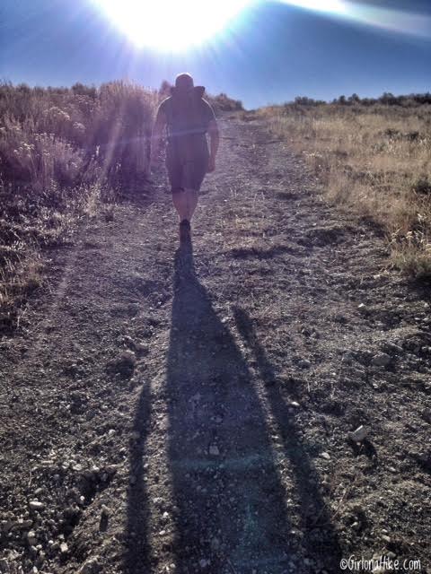
You’ll see trails splitting off to the right side, which will take you around the hills. We chose to hike up and over all the hills to get in more of a workout. Beginners may not like all the up and down, so if you are new to hiking or need an easier day, take the side trails.
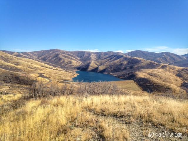
Looking back (East) to Little Dell Reservoir.
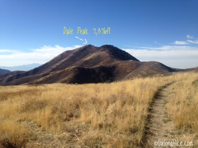
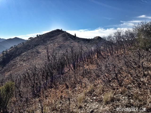
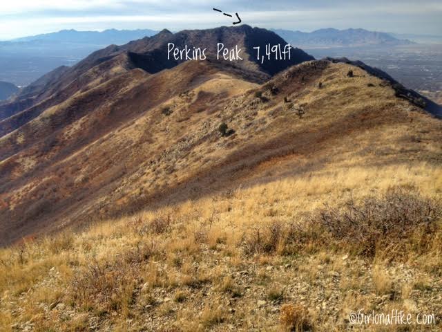
Continue following the old jeep road. You should now clearly be able to see your first destination – Dale Peak. Some maps and guides will refer to it as the Dale Benchmark. It’s a high point, so I’m sticking with “peak.”
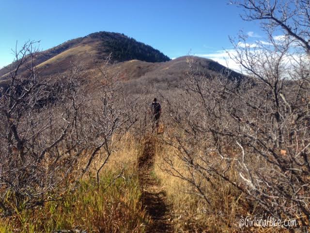
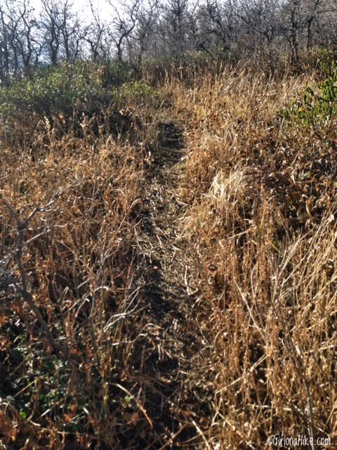
The trail can be very brushy at times with scrub oak.
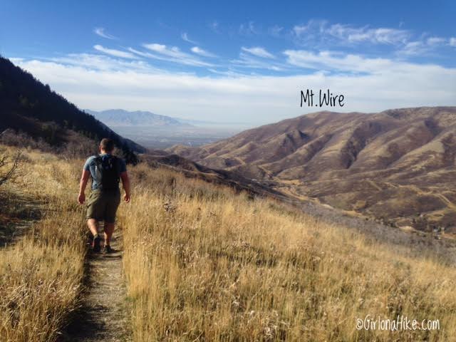
As we got closer to the base of Dale Peak, we could easily see down into SLC and over to Mt. Wire (another great year-round hike!)
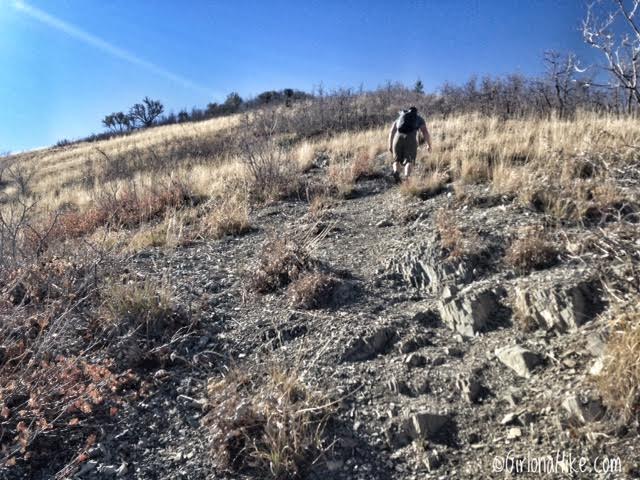
The trail gets really steep for the next 20 minutes or so. It’s a mix of hard and loose rock. As long as you have shoes with good, grippy tread you should be fine. Don’t wear shoes with all the tread gone. We both wore our Inov-8 Mud Claw 300s on this hike, which is a trail running shoe with amazing tread.
As soon as I got to a flat part, I thought I was on the peak! It was the false summit! Keep going until you reach the high point.
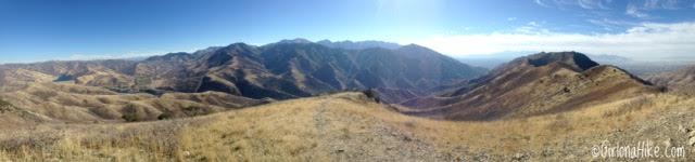
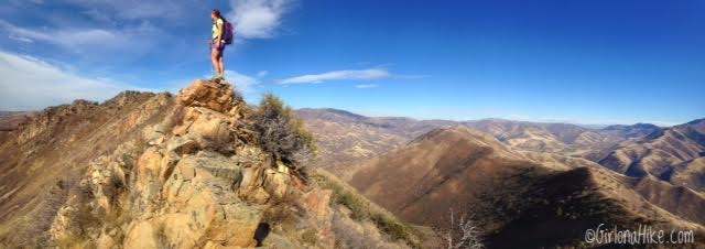
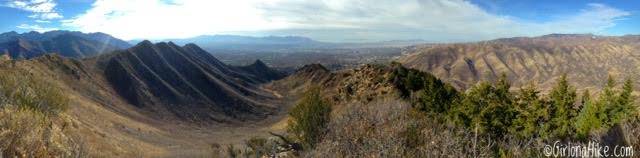
Finally on Dale Peak with a panorama looking south. I-80 is below in the canyon, and Grandeur Peak & Mt. Aire are clearly visible from this spot.
Dale Peak
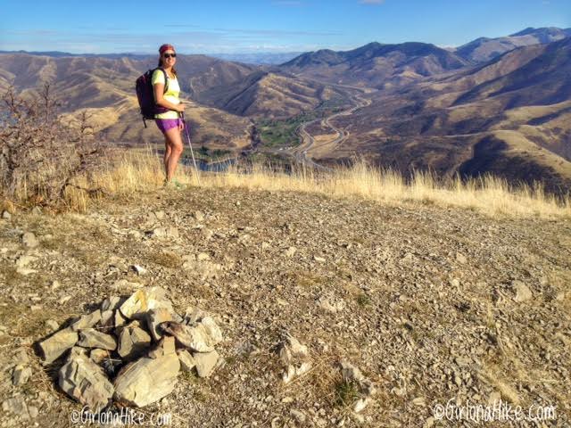
We reached Dale Peak in just over 1 hour. This would be a good turnaround spot if you only had 2-3 hours to fit in a hike or a quick 1 hour run. Did anyone notice that I’m wearing shorts and a t-shirt….in mid-November?! This warm weather has been crazy this year. Last year this time of year I was hiking in a foot of snow!
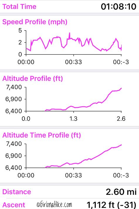
Trail stats for Dale Peak.
To continue along the Emigration Canyon Ridge and over to Perkins Peak, simply continue West along the ridge. The trail is well defined. Hiking to Perkins Peak will take you about another one hour from Dale Peak.
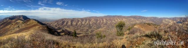
Panorama from Dale Peak looking North.
Getting closer…
Soon after we dropped down from Dale Peak, we saw a cow moose right off the trail.
As you get to the base of Perkins Peak, you’ll see the trail split and also fade very quickly. Keep left and follow the now faint, game-looking trail to the saddle. Once you get to the saddle, look for another very faint trail off in the bushes and turn right. Follow this small trail up to the ridge, which leads you to Perkins Peak.
Perkins Peak
On the ridge heading towards Perkins Peak. Once you reach this section there is a tiny bit of scrambling.
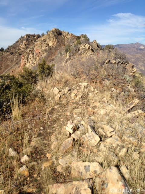
Keep following the ridge.
On Perkins Peak, my 40th peak this year! Woot woot!
I have hiked up Jack’s Mailbox Peak (the peak in front of me) so many times and looked up to this ridge, wondering how to get up there. Finally, I can say I’ve been up there! The canyon below me is private property, so hiking isn’t allowed up that way to this ridge.
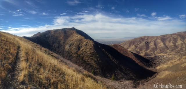
Panorama on Perkins Peak looking down canyon to Jack’s Mailbox Peak. South Perkins Peak is the high point to the left, which you can also access from this same trail. Just go back to the saddle and continue West. We decided to skip it since we were short on time.
Sun Dog
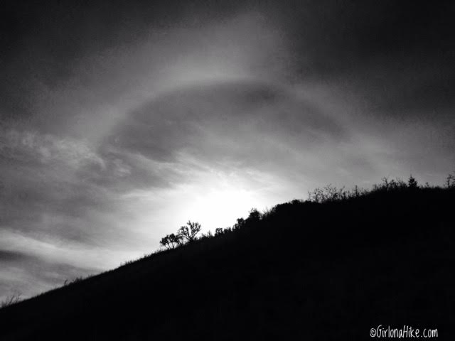
Sundog showing as we were coming off the peak. A Sundog is a bright, colored patch of light that forms on either side of the sun when it’s low in the horizon. Sundogs are named so because it “sits” beside the sun (like a loyal dog attends its owner). The scientific name is “parhelia.” Ironic that we saw a “sundog” where dogs aren’t allowed haha.
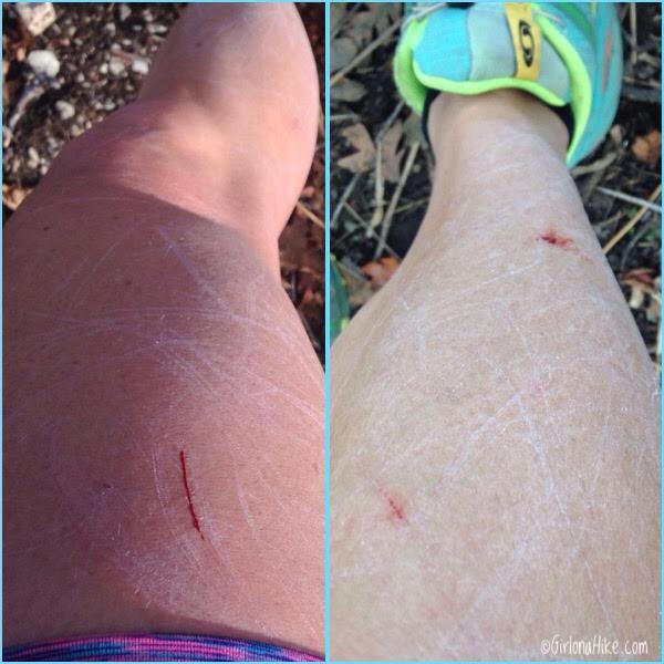
OUCH!!!!
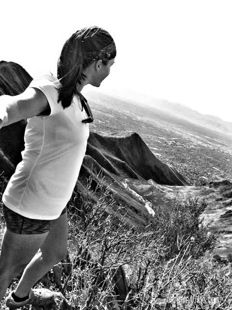
I highly recommend wearing pants on this trail. My legs got cut up from all the scrub oak along the trail. I didn’t think it was that bad until I saw I was bleeding in three different spots from it. After awhile, my legs started to feel sore from all the oak brushing against me.
Trail Map
My track via Gaia GPS – the best tracking app! Get your app here for a discount.
Also check out…
The BEST 8 Trails in Salt Lake City for Visitors!

Save me on Pinterest!