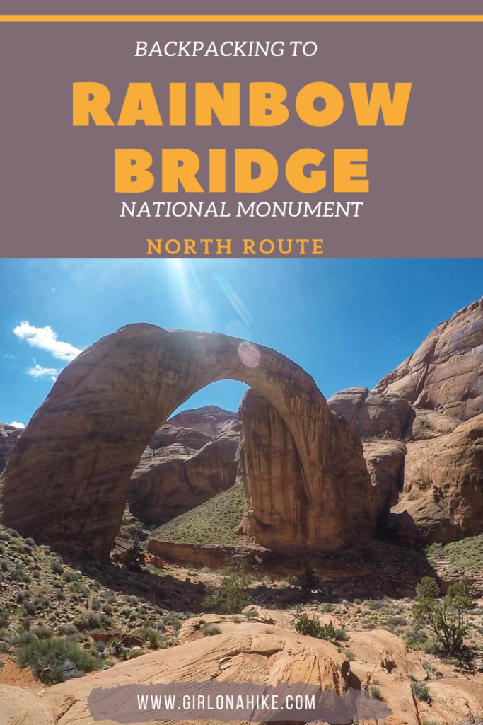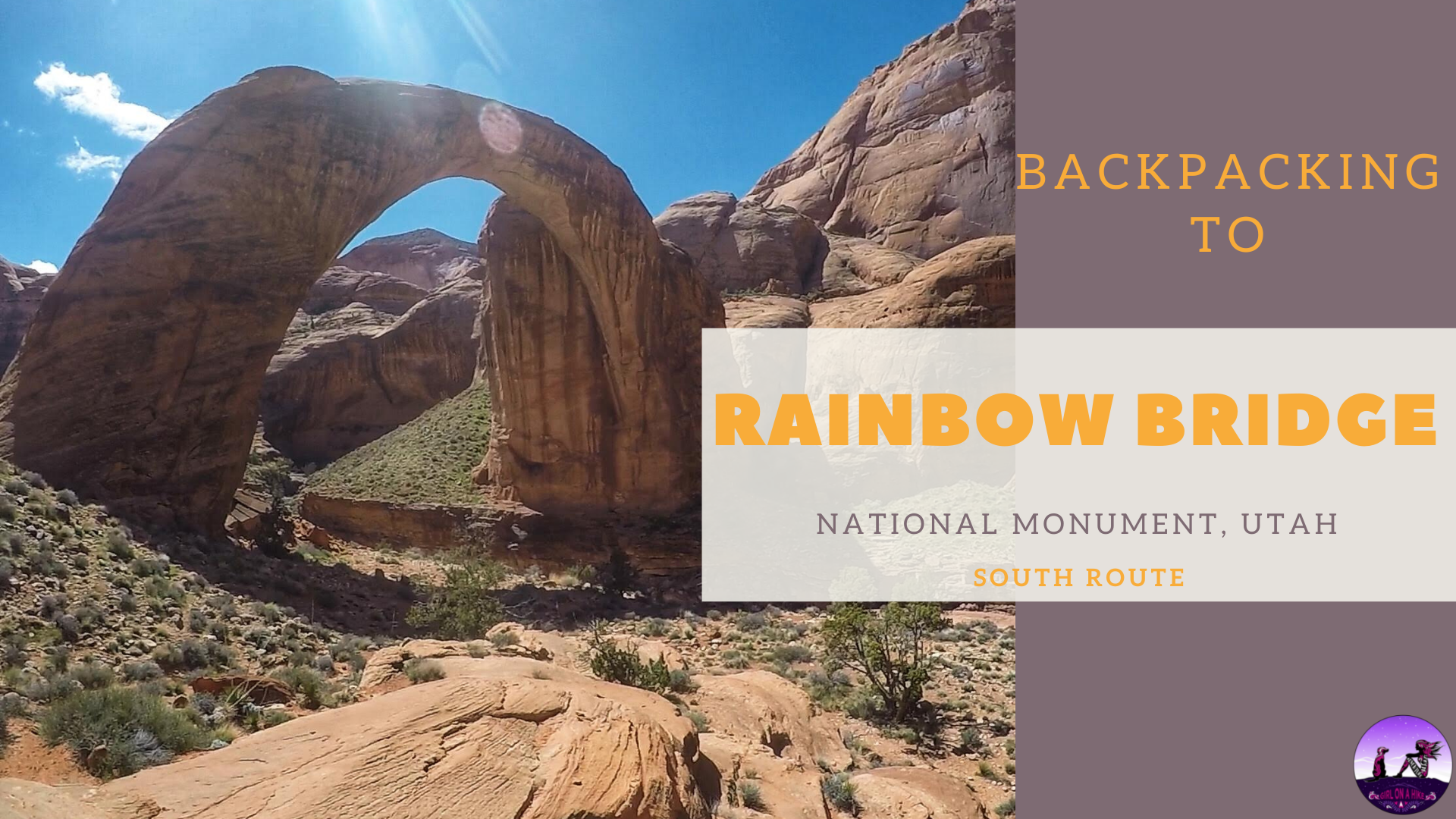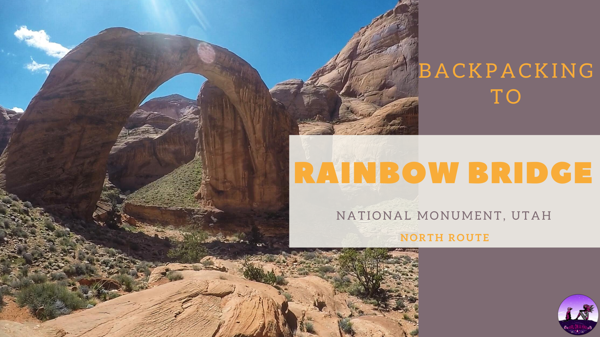
Rainbow Bridge National Monument sits within Lake Powell on the Utah side, and although is one of the largest natural bridges in the world, this national monument is one of the smallest managed by the National Park Service. Rainbow Bridge itself stands 290 ft tall from the base to the top of the arch, and is 275 ft across, making it nearly as tall as the Statue of Liberty.
About
The most popular way to access Rainbow Bridge is via boat on Lake Powell. You can take a boat tour to this area, then walk 1 mile to the bridge. This is a very expensive option, but again, the most popular. If you are looking for more of an adventure, plan to backpack the 15 mile trail instead.
There are two trails that lead to Rainbow Bridge, the North and South Route. We took the North Route because I heard it was more scenic than the south, and we weren’t disappointed! The North route is roughly 15 miles one way, making this a perfect 1 or 2-night backpacking trip. Some people will even opt to backpack one way, then take the boat back to Wahweep Marina. If you take this option, you would need a shuttle to the North TH (again, expensive, but maybe worth it for some people especially if you don’t have a 4X4 car). The last time that water was under Rainbow Bridge was in 1999 when Lake Powell rose to 3,696 ft, pushing 42 ft of standing water under the rock channel.
To hike either the North or South route you need to get a permit months in advance from the Navajo Nation, since you will be parking on and accessing their land. Keep reading below for permit instructions. This trail is also great for dogs, and the best time of year to visit is Spring and Fall when the temperatures are cool and water is running. Backpacking to Rainbow Bridge is well worth the effect, and you’re likely to see few people hiking here. Over 2.5 days we saw a total of 6 other backpackers! Once at Rainbow Bridge the tourists were there, and we saw about 20-30 people. Each year, almost 200-300k people visit Rainbow Bridge, with 95% of visitors arriving by boat. Take the less traveled path instead, and backpack there!
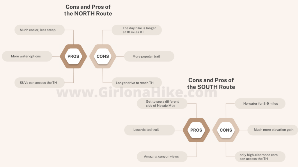
Here are the pros and cons to each route:
Please use these map links below based on what city you are driving from.
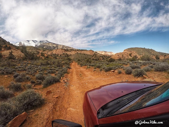
The last 4.5 miles are dirt road, and you’ll want a higher clearance car. My Subaru Forester worked perfect, so as long as you have something like that or higher you’ll be fine. I would not recommend a small, compact car at all since you have to drive over a lot of rocky sections and two dry washes.
Trail Info
Distance: 30 miles RT
Elevation gain: The most we gained in one day was 1,330 ft, as we hiked back to the car from Owl Bridge.
Time: 1-3 nights depending on quick of a trip you want
Dog friendly? Yes, off leash
Kid friendly? No
Fees/Permits? Yes, both.
You need to get a permit from the Navajo Nation – use this site to send in your request at least 4-6 weeks prior to your trip. I applied about 4 months in advance and received my permit about 3 weeks later. When paying for your permit, you can only send in a money order or cashiers check payable to Navajo Nation. Currently the tribe does not have a way to apply for a permit online, fax, or by calling. You have to mail in your request. Make sure you fully read the Navajo Nation Hiking & Camping Rules page.
This is what your permit will look like, and what you need to carry with you on your trip.
FAQs
The National Park Service has a great review of FAQ’s. Here are some additional FAQs.
Can I bring my dog?
Yes, dogs are allowed. It is a good idea to always have a leash handy, in case you come near wildlife. Dogs should be able to hike for long distances and over rocky terrain. Dog poop is not required to be packed out. Note that there is plenty of little critters and deer here, and food storage regulations apply for backcountry users, including dog food. Bear cans aren’t required, but probably a good idea.
Is this a good trail for kids?
Not for younger kids, but those who have backpacking experience and can carry their own weight & water should be fine.
Is there a water source along the trail?
The North Trail (our route) has four water sources: Cha Canyon, Bald Rock Canyon campsite, Owl Bridge campsite, and the Echo campsite. These sources may be dry depending on snow pack and how late in the year you go. In March 2019, all creeks were flowing very well from Navajo Mountain.
Where can I camp?
Conveniently, the campsites are also where the water sources are: Bald Rock, Owl Bridge, Oak Canyon
(water may not be available here, depending on the season), and Echo campground. Camping is not allowed at any other dispersed locations.
When is the best time to backpack to Rainbow Bridge?
March and October seem to be the best months – the temperatures aren’t too hot, and water is still running in the creeks. Summer months are extremely hot and try, along with monsoon season; winter is cold along with high winds. Due to the quick changes in weather, be aware of flash flood danger.
How hard is the trail?
This depends on your experience, fitness level, pack weight and weather. There are no technical areas of the route, but climbing over passes and slickrock are required. You should have a few backpacking trips under your belt, and be comfortable carrying up to 20-40 lbs for hours on end. As always, the lighter your pack, the easier your hike will be. More weight = harder hike.
How many days/nights should I plan on backpacking here?
Backpacking to Rainbow Bridge could be done in as quick as one night, but I recommend staying at least two nights to really enjoy your stay. We set up camp at Owl Bridge for both nights, and day-hiked to Rainbow Bridge that way we didn’t have to carry our backpacks in the entire way; we used our small day packs most of the time.
What guidebook or map do you recommend?
The Navajo Nation recommends using a certain map that can be purchased at the local outdoor/map shop in Page, AZ under the name “Navajo Mountain, Arizona-Utah” and “Rainbow Bridge Trail Map.” We opted not to use these – I used my Gaia GPS app (see photos below). I was able to create a route using way points. Make sure you create the route, download the map, and save before heading out for your trip.
This is the map that the Navajo Nation provides – you can see it’s not the best nor precise map but it does provide a general sense of direction and a good visual. Use my maps that I’ve created below for a better source.
Day 1
Distance: 6.5 miles one way to Owl Bridge Campsite
Time: 3 hours
As you are driving to the TH, you will veer left at this brown post marked RBT (Rainbow Bridge Trail).
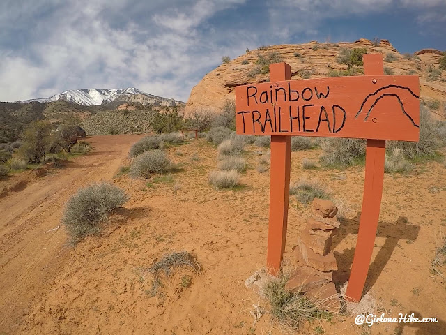
The actual TH is marked by this sign, and roughly 5-6 cars can fit at the very end.
For the first mile, the trail has several ups and downs, but gradually descends into Cha Canyon.
The trail is very easy to follow, but keep an eye out for cairns.
Cha Canyon has a nice stream running for the dogs to drink and cool off in. Each of the major canyons are marked by these brown signs.
Wild horses! It was sad to see them so skinny.
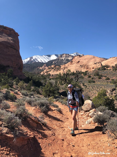
Working hard uphill with Navajo Mountain in the distance.
At roughly 3.5 miles you’ll reach a ledge with another sign for Bald Rock Canyon, then work down some steep rocky switchbacks to the base of the canyon.
Making our way down Bald Rock Canyon – you can see the trail at the bottom.
Not a “real” petroglyph, but probably left over from when the Navajo Guides would take tours to Rainbow Bridge.
Look how small my friend looks! The canyon walls were so tall.
We reached Bald Canyon Camp at 4.0 miles, roughly 1:45 hours of hiking. I found this large tree to take a quick break and stretch out my shoulders and back. Plus the sun felt amazing!
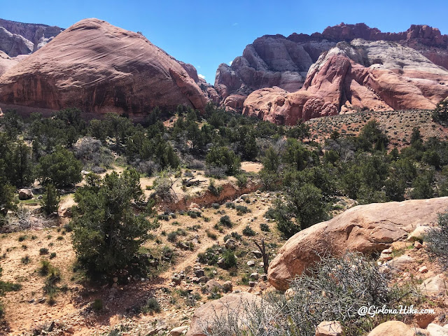
Continuing past Bald Canyon, the trail winds its way around, up and down, through more canyons.
Eventually we reach the Surprise Valley sign, as we hike down slick rock with sections of rock chipped out to make small stairs. On the map you’ll see that for this section, you hike NW, then take a sharp turn South. Don’t miss the cairn!
Hiking through Surprise Valley. So green!
After 6.5 miles we reach Owl Bridge camp, which would be home for the next two nights. We set up our tents, ate dinner, had a fire, and filtered water from the stream. There’s plenty of trees for shade, a picnic table, established fire rings, and space to hang a hammock. Roughly 12 tents could fit in this area.
This was my first time testing out my new Six Moon Designs “Lunar Solo” tent. I got this tent because I really wanted a one person tent for when just me or me and Charlie backpack together. Even though I didn’t have him with me this trip, he and I would fit perfect in there. By myself I had enough room to put all my gear inside too. I love how UL this tent is too, at only 26 oz for everything!
Day 2
Distance: 18 miles RT
Time: 10 hours
Day 2 was our big day – we knew that Rainbow Bridge would be about 9-10 miles one way, making that an 18 mile day hike. We put on our UL day packs with water, food, my mini water filter, and sunblock, and we headed out for the day.
We didn’t get a super early start because the sun wasn’t setting until roughly 8pm so we didn’t feel very rushed. We are both fit hikers and knew our pace would be comfortable to take our time yet still make it back to camp before dark. The first mile past Owl Bridge will be all uphill, and a few tiny switchbacks towards the ridge.
The next two miles will be up and down, hiking through sage brush and dry canyons. This view is looking down to Oak Canyon, you’re next reliable water source.
Oak Canyon
This is the next campsite after Owl Bridge, but we referred to it as the “ugly campsite” because…well it was. There’s literally only room for one tent, and it’s right along the trail. The creek is just to the right, and there’s this one tree. Not ideal, but you could make it work.
From the base of Oak Canyon, you’ll work up two longer switchbacks to climb out of the canyon.
Finally, the canyon we’ve been waiting for – Bridge Canyon. This is looking down into the canyon, and from here you’ll hike down several short, but steep, switchbacks.
Bridge Canyon has very nice tent and hammock sites, established fire rings, plenty of shade and water. This would be my 2nd choice for a camp site. This is roughly 12 miles in from the main TH (or 5.5 miles past Owl Bridge camp). Once you follow Bridge Creek, you’ll be crossing the creek several times.
Along the North route to Rainbow Bridge you’ll actually pass three Hogan’s (a Navajo home). Do not touch or go inside as they are very fragile structures.
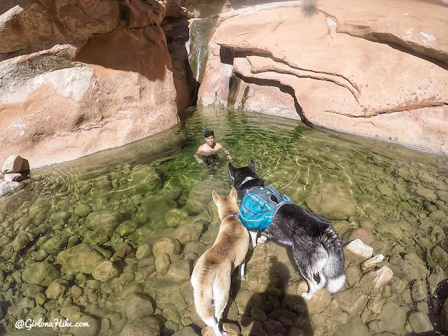
We found a perfect swimming hole to cool off and filter water. I was too much of a baby to get all the way in, but it sure felt nice on my legs!
Just past the intersection where the South Route reaches the North trail, you’ll find another large campsite. It’s very flat with plenty of shade and could fit roughly 15 tents. There is no name for this camp.
Once you pass the large green hill on the south side of the Bridge Canyon, you are only 1.5 miles from Rainbow Bridge!
I loved the last section of Bridge Canyon leading to Rainbow Bridge – the canyon walls were huge, and the trail followed a rim above the water so you had a great view of everything.
Echo Camp – this is the last viable campsite, and was used heavily back in the day for travelers making their way to Rainbow Bridge. We counted 8 of these leftover metal box spring frames. It seems like people still use them today, but be careful with all the metal sticking out (it could pop your sleeping pad or tear other gear). There is a really small creek here to filter water from as well, and a small pond at the end of this canyon.
Finally, after 9 miles we reached Rainbow Bridge!!!!
I was amazed at how massive this natural bridge was. We dropped our packs under a tree and explored the area, after all the tourists from the boat tour left.
Wow, that rock is thick. Many people wonder if the bridge is in good structural condition, and although it is, it will eventually succumb to natural erosion and weathering. Scientific assessments have concluded that the bridge is strong and stable, and expands approximately 1 inch in diameter during hot summer months.
I highly recommend the Sea to Summit Ultra Sil day pack! I just picked it up right before the trip to lighten my load from my old day pack, and it worked great. It weighs a mere 2.5 ounces, and I was able to carry water and food comfortably. There is no support of any kind – it’s literally a sack to carry things. No exterior pocket or bladder port, however, it’s one of the lightest packs on the market so if you want to go lighter and faster, get this pack.
Exploring the area after all the tourist left.
Just amazing.
We went back to the tree where we left our packs and had crackers and tuna, before heading back to Owl Bridge. The dogs were starting to close their eyes, so we knew we had to start hiking or we’d all get tired from hanging out too much.
Amazing view of Navajo Mountain on the hike back to camp.
Dog-gone tired! We finally figured out that to wear these pups out we have to hike them for 18 miles haha!
Relaxing at camp with a small fire before climbing into bed early from a long day.
Day 3
Distance: 6.5 miles
Time to hike out and head home!
What an amazing first backpack trip of 2019! The weather was absolutely perfect, the company was great, scenery amazing, and we couldn’t have asked for a better trip.
Check out my YouTube video!
Trail Map
My track via Gaia GPS – the best tracking app! Get your app here for a discount.
Nearby Hike
The next best option in the Page, AZ area would be

Save me on Pinterest!
