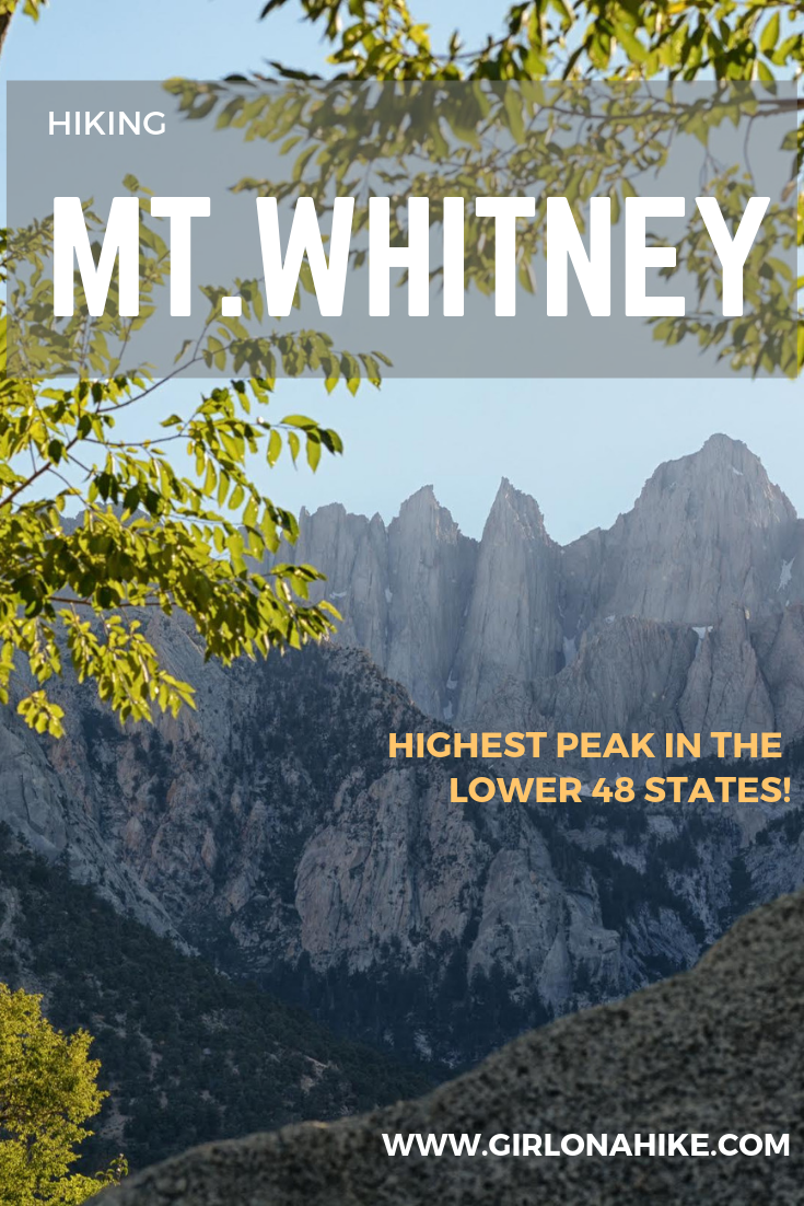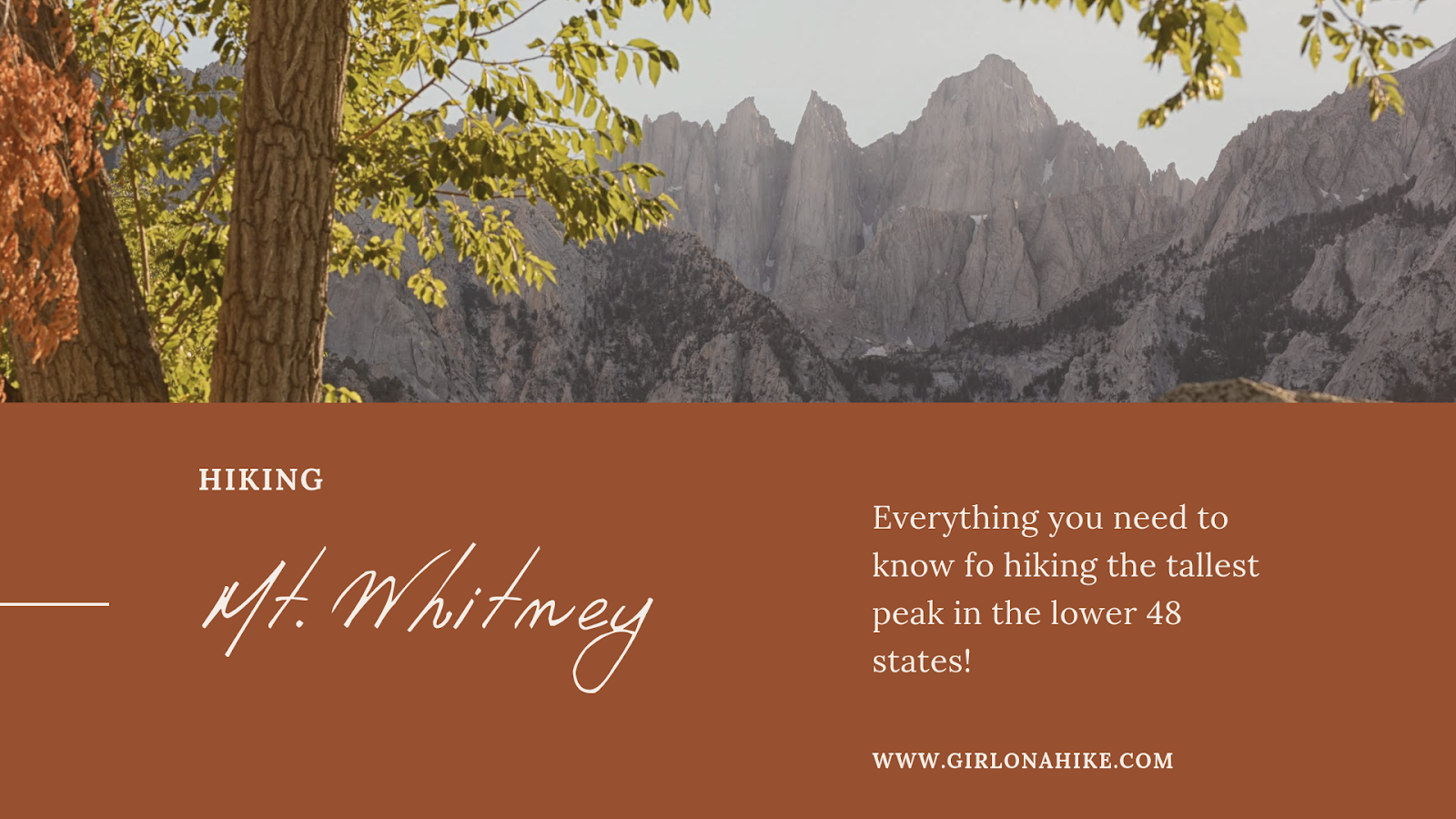
Hiking Mt. Whitney is a bucket-list goal for many hikers and backpackers, but tackling it as a day hike is a serious challenge. This 20-mile round-trip adventure gains over 6,100 feet of elevation in just 10 miles one way. It’s a strenuous endeavor not meant for the faint of heart. However, the real challenge isn’t just the physical hike—it’s securing a permit. With only one-third of the 17,000 annual applicants receiving a day-hike permit, the competition is fierce. When combined with backpackers on the John Muir Trail (JMT), nearly 20,000 people reach the summit of Mt. Whitney each year.
About Hiking Mt. Whitney
Once you score a permit, training becomes your top priority. The two main reasons hikers fail to summit are altitude sickness and poor weather. While you can’t control the weather, you can prepare your body. Training hikes over 15 miles at high elevation are crucial. Because most people take between 10–15 hours to complete the trail, hikers often begin at 3 a.m. to avoid high temperatures and afternoon thunderstorms.
A Brief History of Mt. Whitney
-
July 1864 – Mt. Whitney was named after Josiah Whitney, California’s state geologist, by the California Geological Survey.
-
August 1873 – Charles Begole, A.H. Johnson, and John Lucas became the first known people to summit Mt. Whitney. At the time, there was no formal trail—just raw wilderness, basic tools, and incredible determination.
-
July 22, 1904 – The original Whitney Trail was completed. To mark the occasion, a team of pack mules carried firewood to the summit, where a bonfire signaled to the town of Lone Pine that the trail was complete.
-
1936 – The Civilian Conservation Corps built the Whitney Portal Road, an “auto road” designed to meet the growing interest in visiting Mt. Whitney.
Want more history? Check out the Mt. Whitney Trail history page.
Quick Trail Stats
-
Distance: 20 miles round trip
-
Elevation Gain: 6,182 feet
-
Estimated Time: 10–15 hours
-
Dog-Friendly? No, dogs are not allowed
-
Kid-Friendly? No
-
Permits Required? Yes (see below for details)
Frequently Asked Questions About Hiking Mt. Whitney
🐶 Can I Bring My Dog on Mt. Whitney?
No, dogs are not allowed on Mt. Whitney.
👧 Is Mt. Whitney Kid-Friendly?
Not for younger kids. However, older children with prior peak-bagging experience who can carry their own pack and water may be able to complete it. During our hike, we saw two 10-year-olds (from different families) reach the summit—proof that it’s possible for well-prepared, experienced young hikers.
💧 Is There Water Along the Mt. Whitney Trail?
Yes! The trail follows Lone Pine Creek up to Trail Camp, where a small lake is also available for filtering water. Most hikers refill here before tackling the “99 Switchbacks,” located about 4 miles from the summit.
I personally drank 5.5 liters on the hike—half of that was an electrolyte drink using Nuun tablets, which helped significantly with energy and recovery. You don’t need to carry all your water from the start—filtering along the way keeps your pack lighter and more manageable.
⛺ Where Can I Camp Before Hiking Mt. Whitney?
The best option is the Whitney Portal Campground, located right at the trailhead. If it’s full, the next closest is Lone Pine Campground, just 10 minutes away.
As soon as you get your permit confirmation, book your campsite—these fill up fast!
Our strategy:
-
Night 1 at Lone Pine Campground
-
Nights 2 & 3 at Whitney Portal Campground
This allowed us to sleep at the trailhead before our 2 a.m. start and recover right at camp post-hike, avoiding the need to move gear after a 20-mile trek.
🚿 Do the Campgrounds Have Showers?
No. The closest and most affordable option is at the Whitney Portal Hostel in Lone Pine. Showers cost $7, are hot and clean, and are available during store hours (typically open until 9 p.m.). You’ll need to bring your own towel and soap.
🏨 Are There Hotels in Lone Pine?
Yes! Lone Pine offers a few hotel options and you can also check Airbnb. Booking early is key, especially during peak season (July–August).
📅 When Is the Best Time to Hike Mt. Whitney?
July and August are the most popular months due to clear trails and minimal snow. That also means more competition for permits. In low snow years, hiking in June or September may be possible. For a better shot at securing a permit, apply for mid-week dates.
📲 Where Can I Find Current Trail Conditions?
Check out these resources:
🏞️ How Difficult Is the Mt. Whitney Trail?
Difficulty depends on your fitness level, experience, pack weight, and altitude acclimation. While the trail isn’t technical, it requires gaining over 6,100 ft on a long, rocky ascent. You should be comfortable carrying 15–20 lbs for several hours. A lighter pack = an easier hike.
⏱️ How Long Does It Take to Hike Mt. Whitney?
Most hikers complete the trail in 12–15 hours, but this varies depending on pace, breaks, and overall fitness. An early start (around 2–3 a.m.) is typical to avoid afternoon storms and heat.
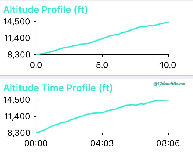
🗺️ What’s the Elevation Profile Like?
Expect a steady and continuous climb. The trail is well-maintained, but the elevation gain is unrelenting.
Camping Overview: What to Expect
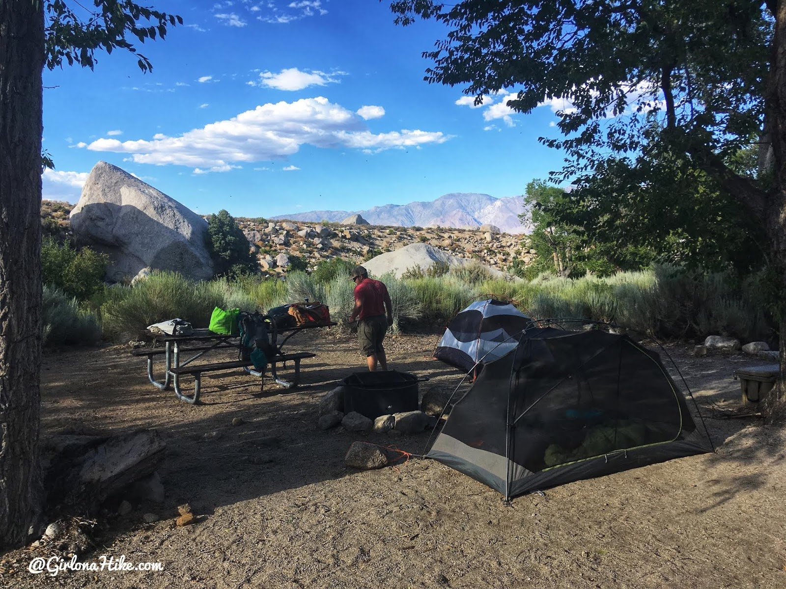
A nice campsite at Lone Pine CG. You can’t tell, but a creek runs right next to camp by those boulders. Great for cooling off while the valley is 100F. Drinking water is available by pump inside the CG.
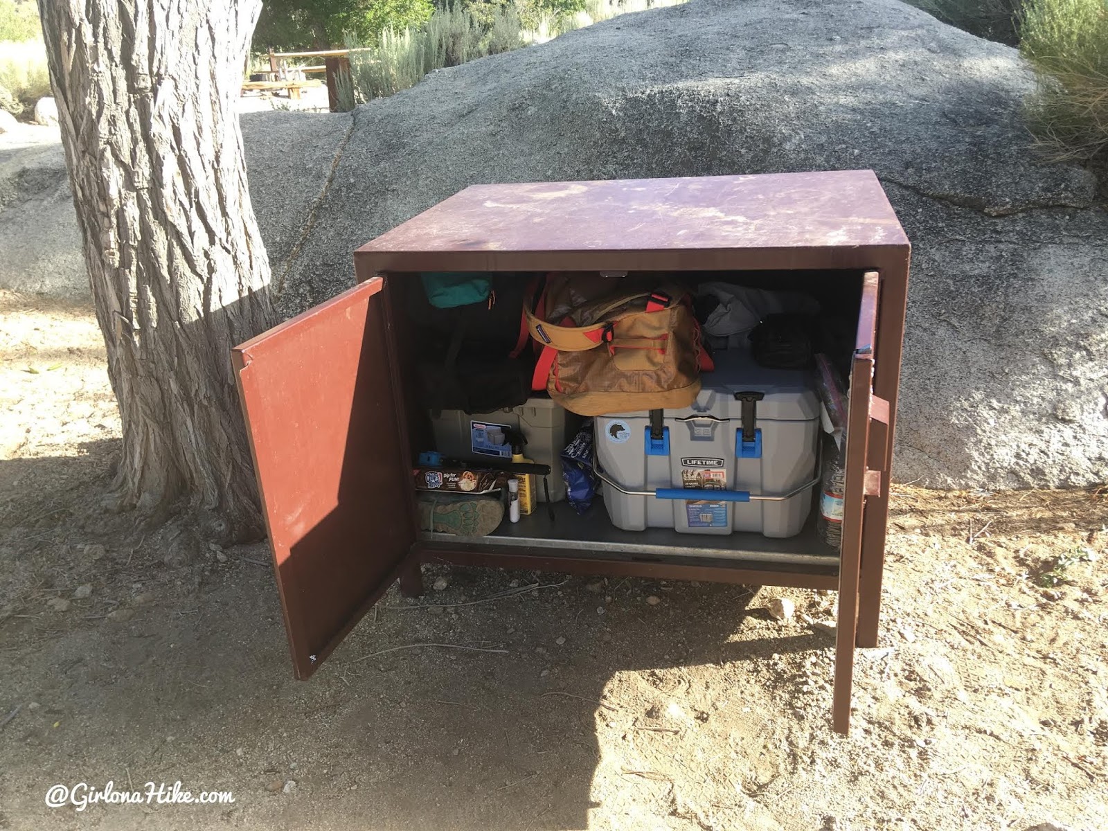
All CGs in the area have large bear safes to keep ALL of you gear in. Everything that is in your car needs to go in here.
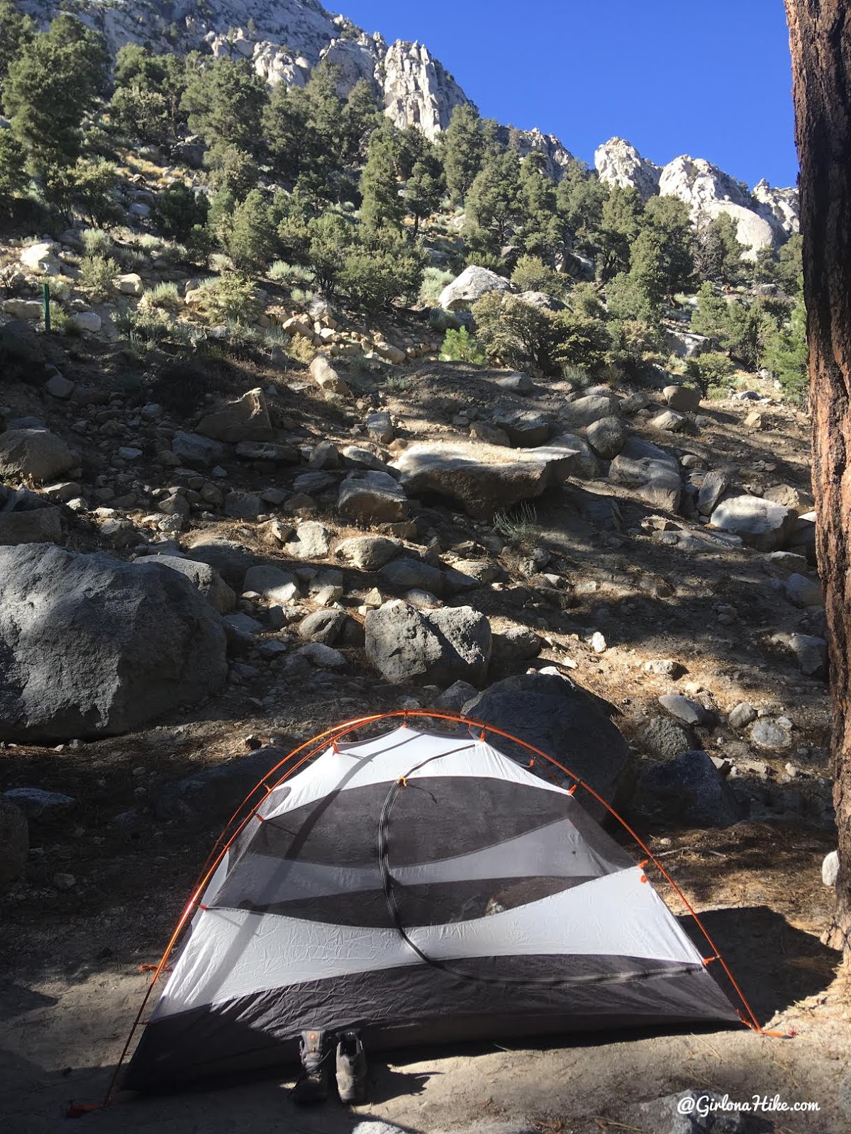
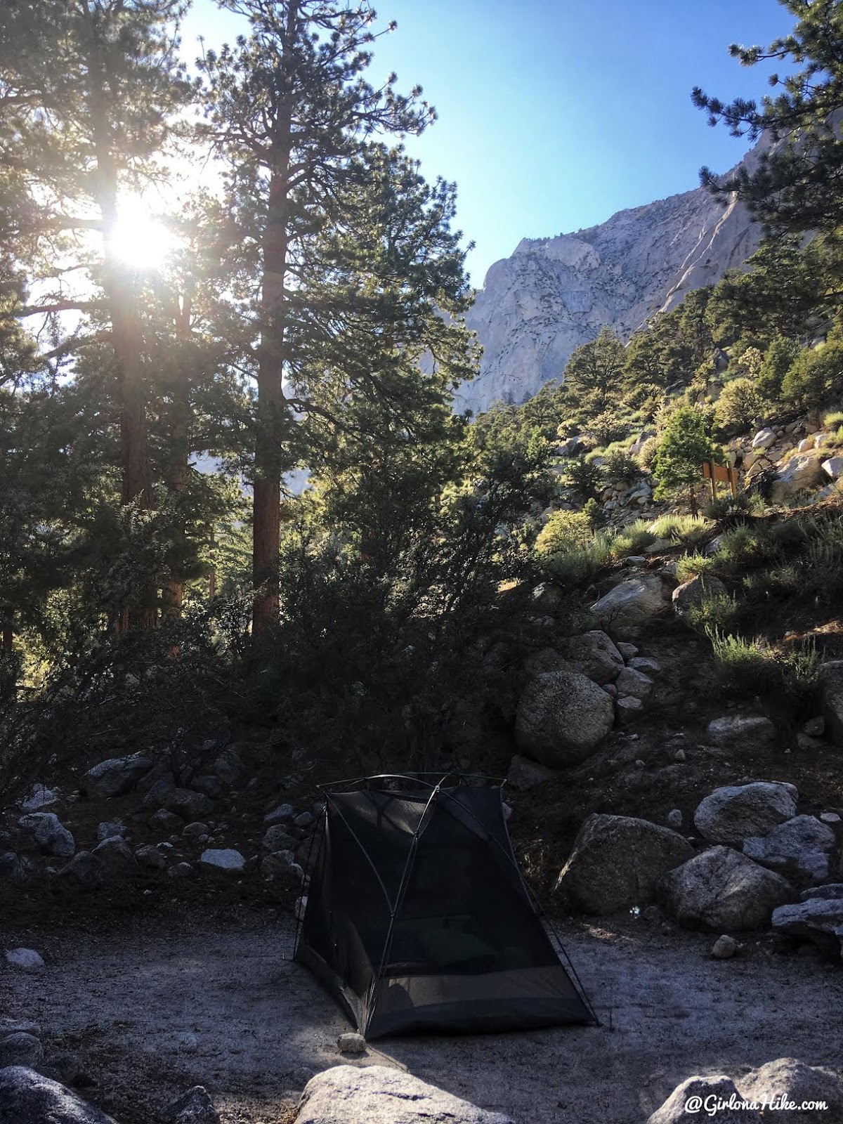
One of our tents at the Whitney Portal CG. Much more shaded, and the same creek runs through the middle of camp that flows down to Lone Pine CG.
🏕️ Whitney Portal Campground Details
Our second tent was set up at Whitney Portal Campground, which sits at an elevation of 7,900 feet. Because of the higher elevation, temperatures here are significantly cooler compared to Lone Pine Campground. The campground also offers pump-access drinking water for hikers and campers
🚿 Do the Campgrounds Have Showers?
No, the campgrounds do not have showers. However, the closest and most affordable option is the Whitney Portal Hostelin Lone Pine, CA, where showers cost $7. After summiting Mt. Whitney, we used these showers and found them clean with hot water—just what we needed after a 20-mile hike!
Bring your own towel and soap. There’s no time limit on showers, but be sure to check the hostel hours ahead of time—they typically close at 9 PM.
🛏️ Where Can I Stay Before or After the Hike?
Lone Pine, California offers a few hotel options, which are a great choice for recovery after the hike. You can also explore Airbnb for additional lodging flexibility. Booking early is essential, especially during peak hiking season.
📅 Best Time to Hike Mt. Whitney
The ideal months to hike Mt. Whitney are July and August, when the trail is typically free of snow and mud. These are also the most popular months, with nearly 19,000 hikers applying for permits.
In low snow years, hiking may be possible as early as June or as late as September. For better odds of securing a permit, try applying for mid-week dates (Tuesday through Thursday).
How can I find out current trail conditions?
There is a Mt.Whitney Facebook group, as well as on Whitney Zone.
🧗♀️ How Difficult Is the Mt. Whitney Trail?
The difficulty of the Mt. Whitney Trail varies depending on your:
-
Experience and fitness level
-
Pack weight
-
Acclimatization to elevation
-
Weather conditions
The trail involves a 6,100 ft elevation gain and rocky, uneven terrain. While not technically challenging, it is physically demanding. You should be comfortable carrying 15–20 lbs for long periods and have prior experience with long-distance or high-altitude hikes.
💡 Pro tip: The lighter your pack, the easier the hike.
⏱️ How Long Does the Mt. Whitney Hike Take?
Most hikers complete the trail in 12–15 hours, but time can vary based on pace, elevation effects, weather, and rest stops. Start early to avoid afternoon storms and give yourself plenty of daylight.
📈 What’s the Altitude Profile Like?
Expect a steady and consistent elevation gain throughout the hike. There are no major downhill sections, so pacing and acclimation are key to reaching the summit safely.
I only used the Gaia GPS app to track my entire route. With Gaia, you can:
-
Download offline maps
-
Create custom hiking routes
-
Mark waypoints
Get your app here for a discount.
📝 How Do I Apply for a Mt. Whitney Permit?
You can apply for permits through the Inyo National Forest Mt. Whitney Lottery Permit Page. Applications open every year on February 1st. Visit the official Recreation.gov page for full instructions. Applications open February 1st annually.
🎟️ What Are the Chances of Getting a Permit?
Honestly, they’re low. In 2019 alone:
-
16,842 applications were submitted for 84,000 people
-
Only 34% of group leaders were awarded their preferred dates
Compared to 2018, the success rate dropped from 37% to 34%, so plan accordingly.
🔑 Tips for Increasing Your Permit Odds
-
Apply for weekdays (Tuesday, Wednesday, or Thursday)
-
Split into smaller groups, then have each leader apply separately
-
Try for September, when demand drops as school resumes
-
Keep your group size small to increase flexibility and selection
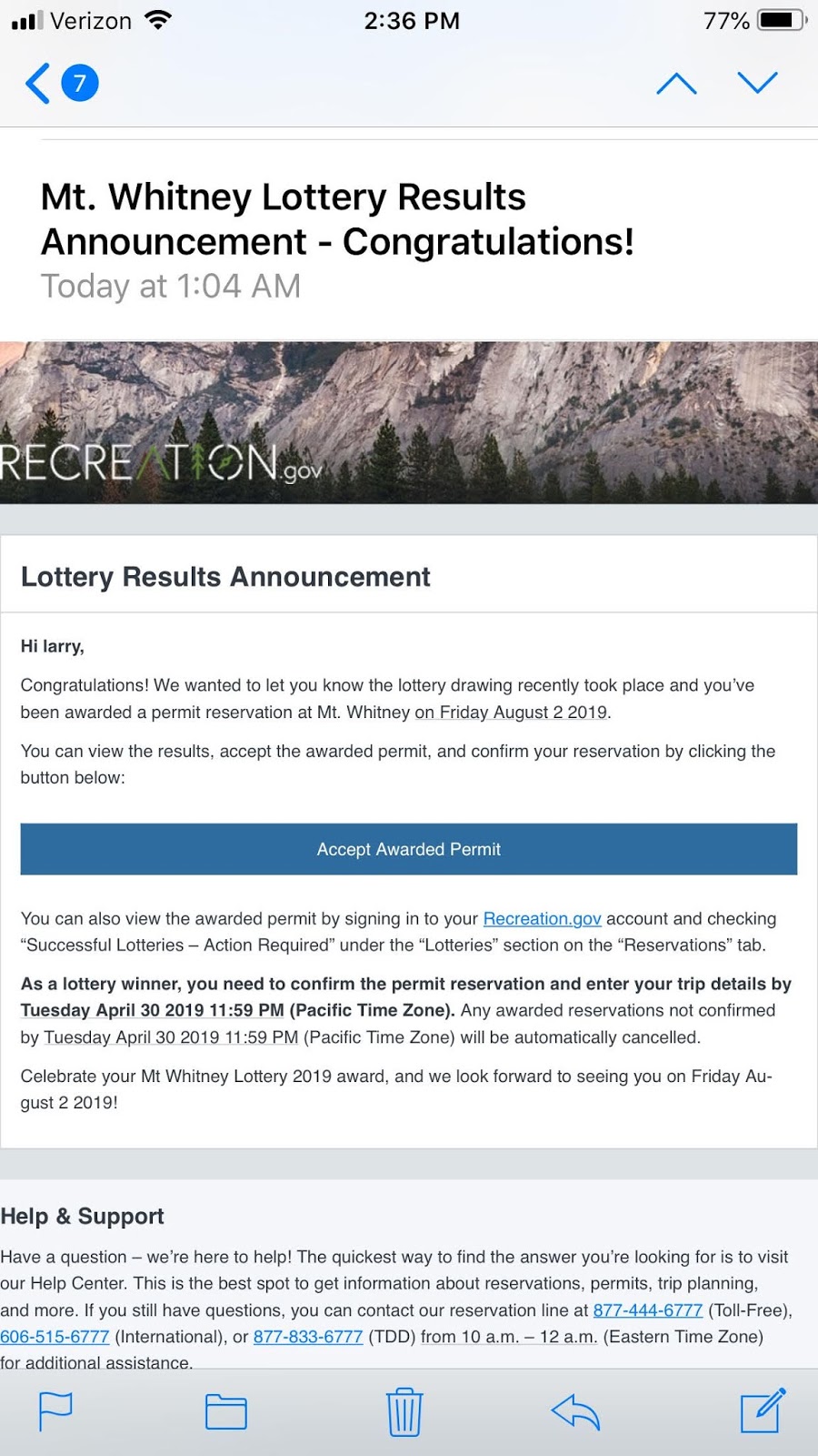
📬 How Will I Know If I Got a Permit?
You’ll receive an email notification. Be sure to:
-
Accept your permit within 30 days—if you don’t, it will be forfeited.
-
Remember that this email is not the actual permit.
-
Pick up your physical permit at the Lone Pine Ranger Station 1–2 days before your hike date.
For our group, I didn’t win a permit—but thankfully our friend Larry did!

Mt.Whitney Hike Overview: What to Expect
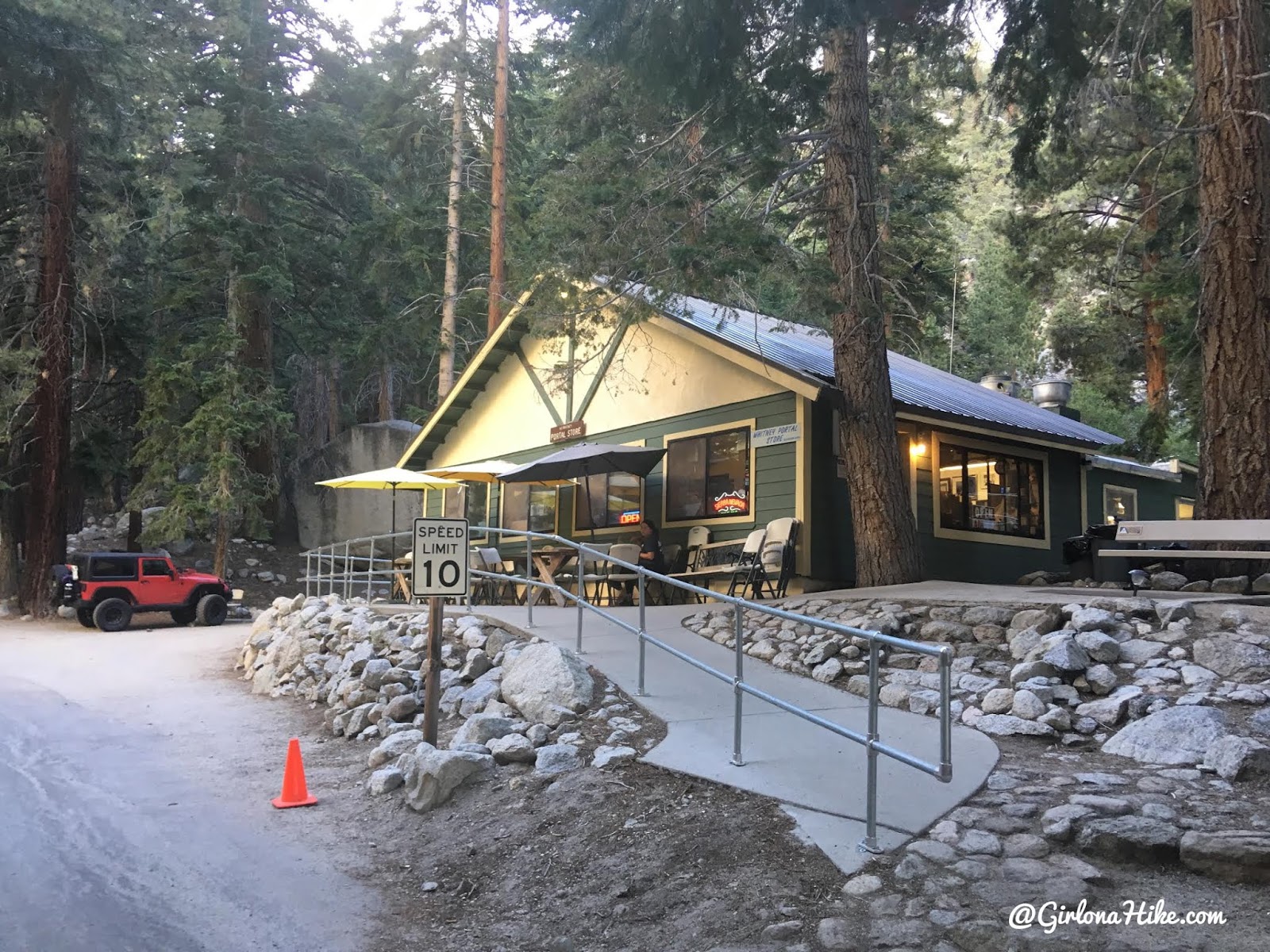
The night before our day hike, we found our Campsite and checked out the area so we would know where to go in the morning at 3am. We stopped in the Whitney Portal Store – they had lots of clothing items, packs, bladders, trinkets, books, maps, some small backpacking items, and a small over-the-counter restaurant. Basically you can only get burgers and fries and that’s it. They also had a few vending machines and a cooler filled with drinks and candy.
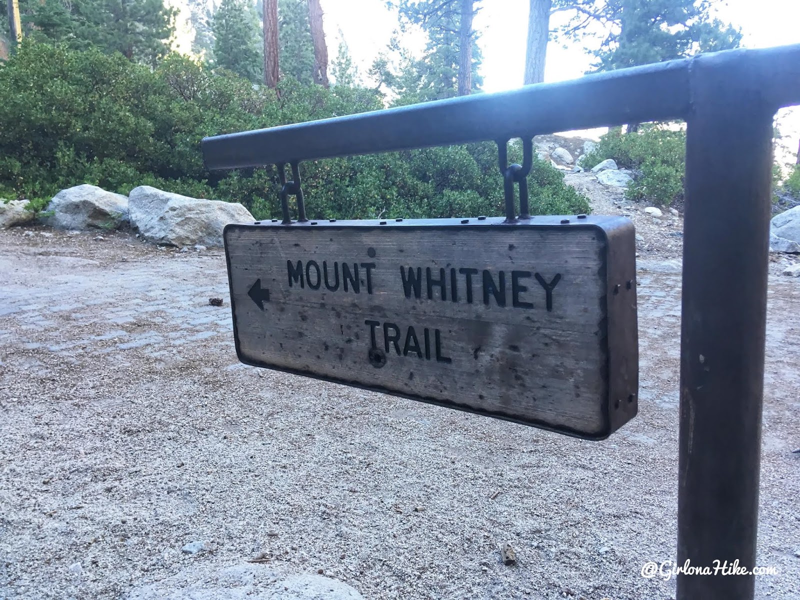
Yay, we found the official TH! Woot woot! It’s right next to the Store on the East side.
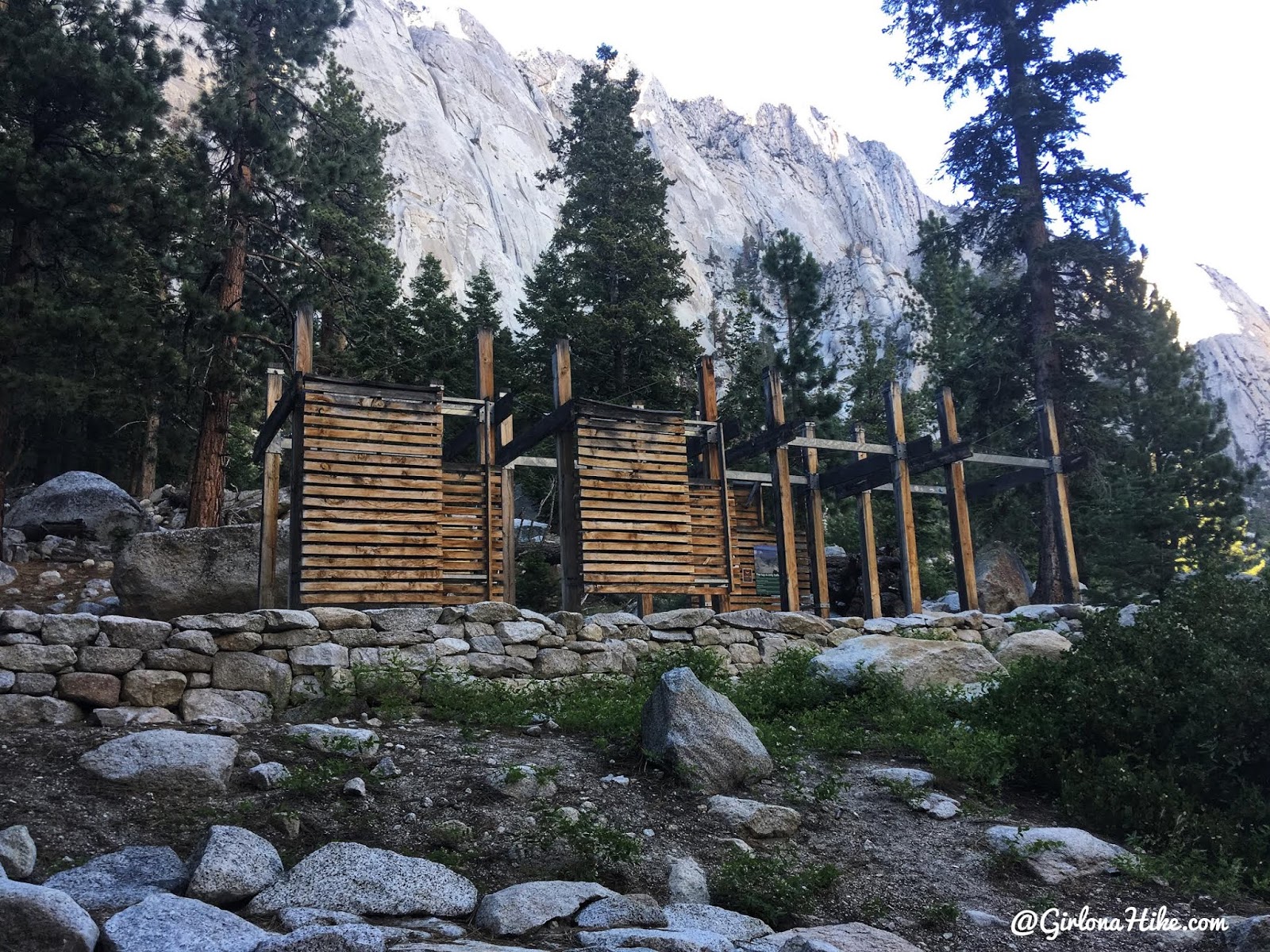
The official entrance and beginning of the Mt.Whitney trail! Feeling better about where to go, we went back to camp to make dinner and were all in bed by 8pm.
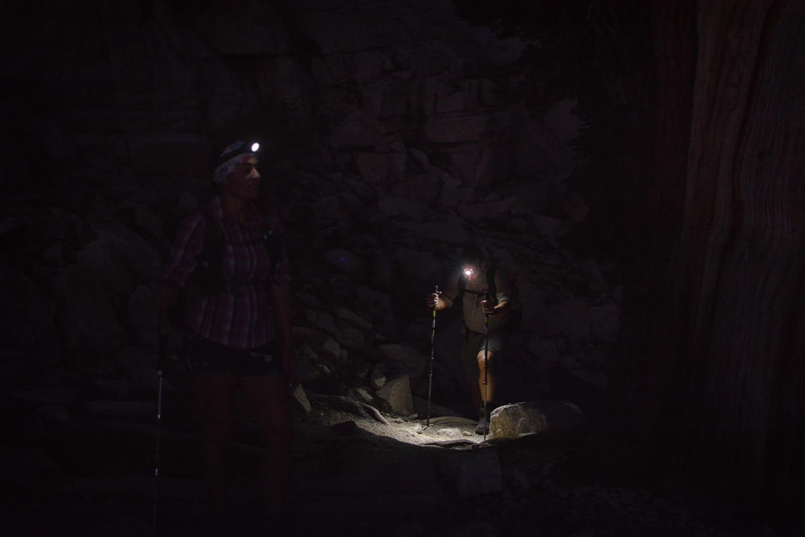
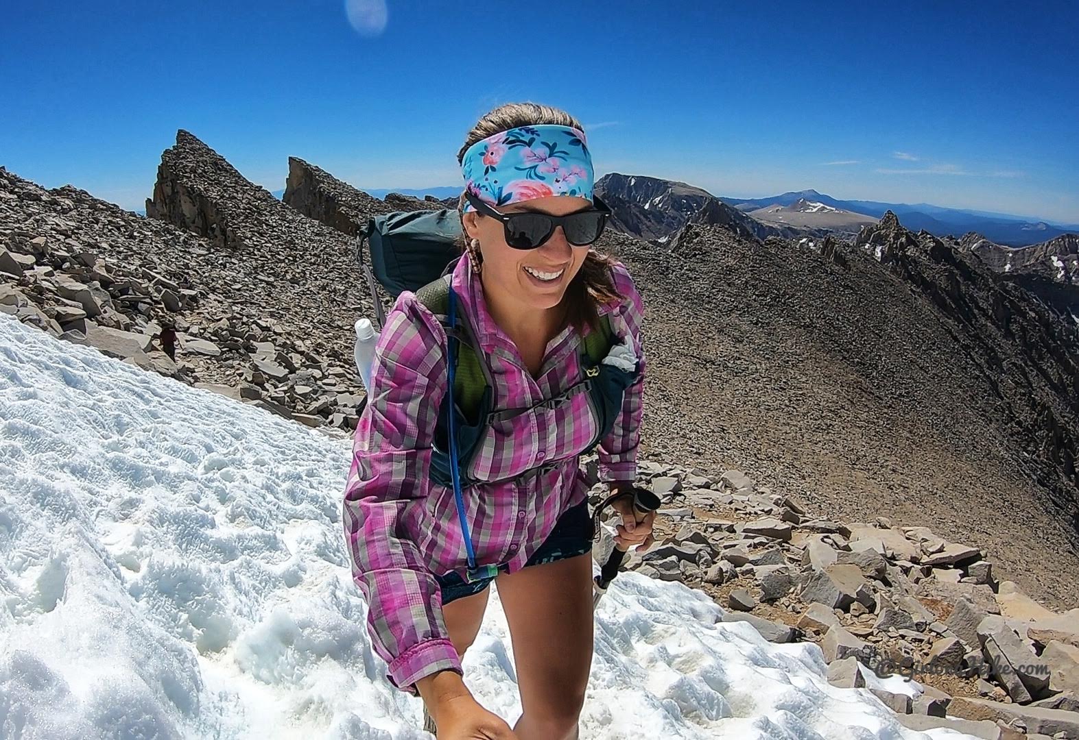
We woke up the next morning at 2am, and were hiking by 3am! Knocked out 5 miles all in the dark, had a few stream crossings, but were able to stay dry even at night. We passed several other day hikers, and knew we were hiking at a steady pace.
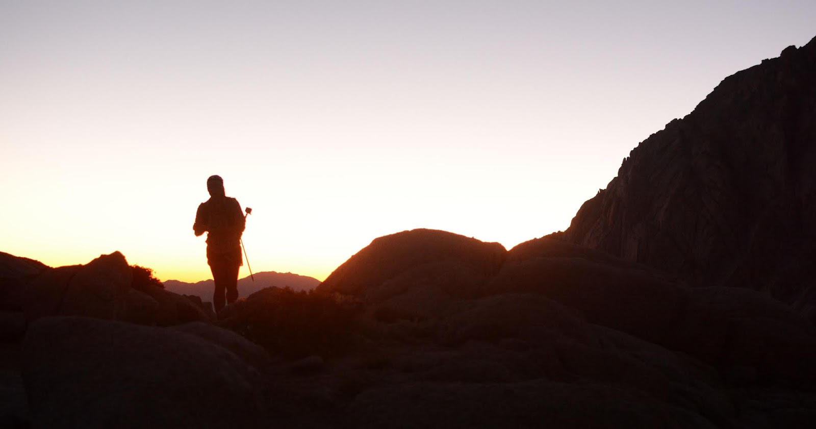
Around 6-6:30am, the sun started to appear. This photo doesn’t do it justice, but it was one of the most amazing sunrises I’ve seen. The sky was so orange and deep blue at the same time.
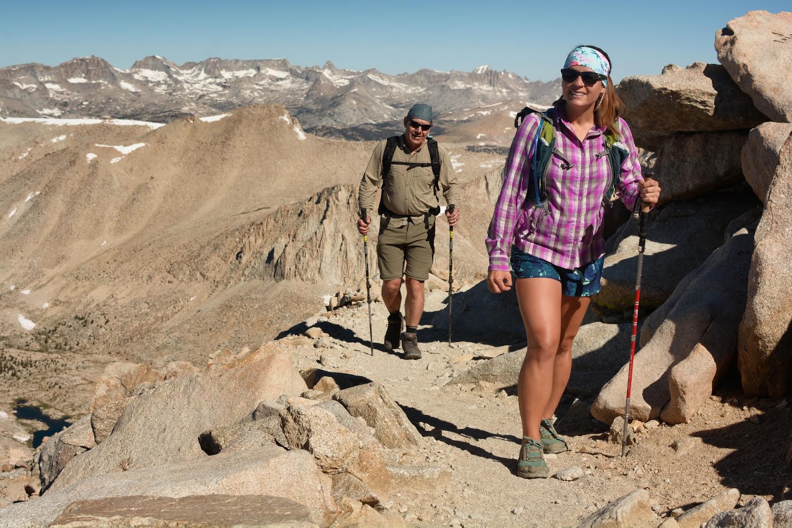
We were finally able to remove our headlights and day with daylight. By this point, we had already passed at least 15-20 people.

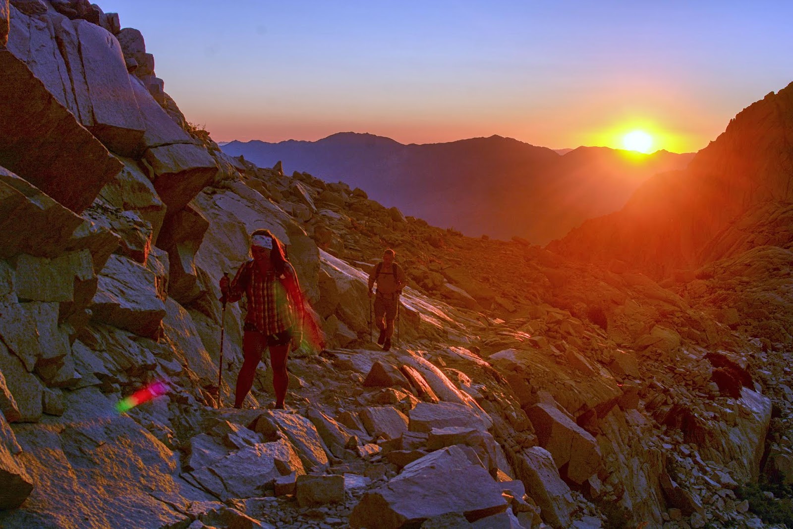
First light along the ridge.
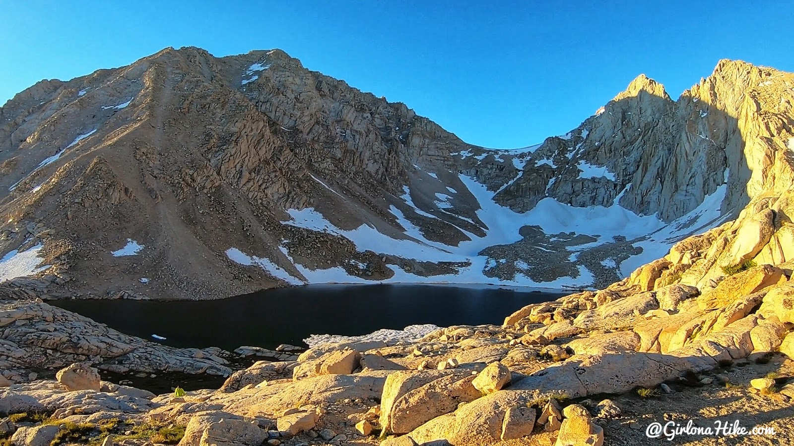
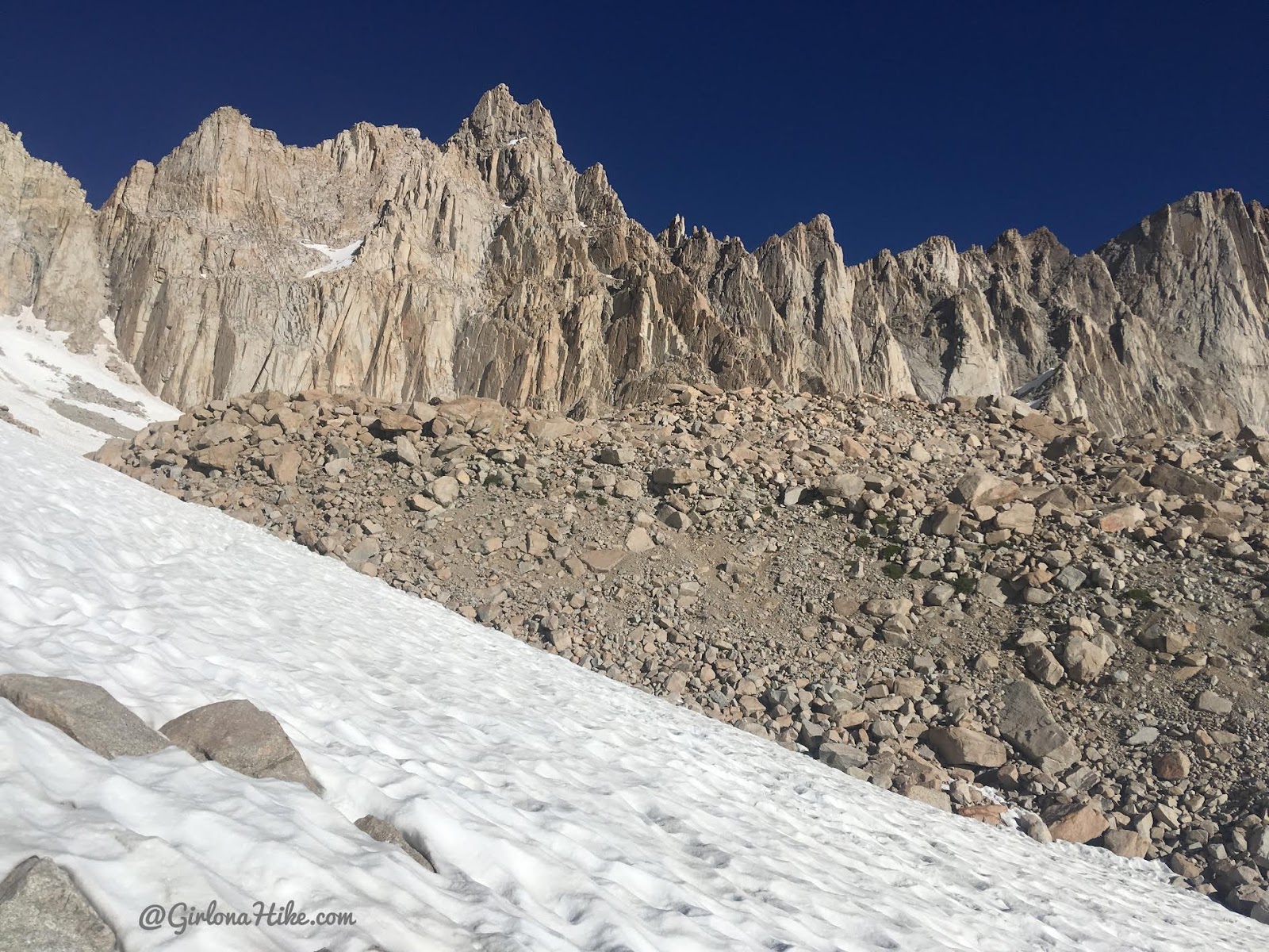
Passing Consultation Lake to the left (South).
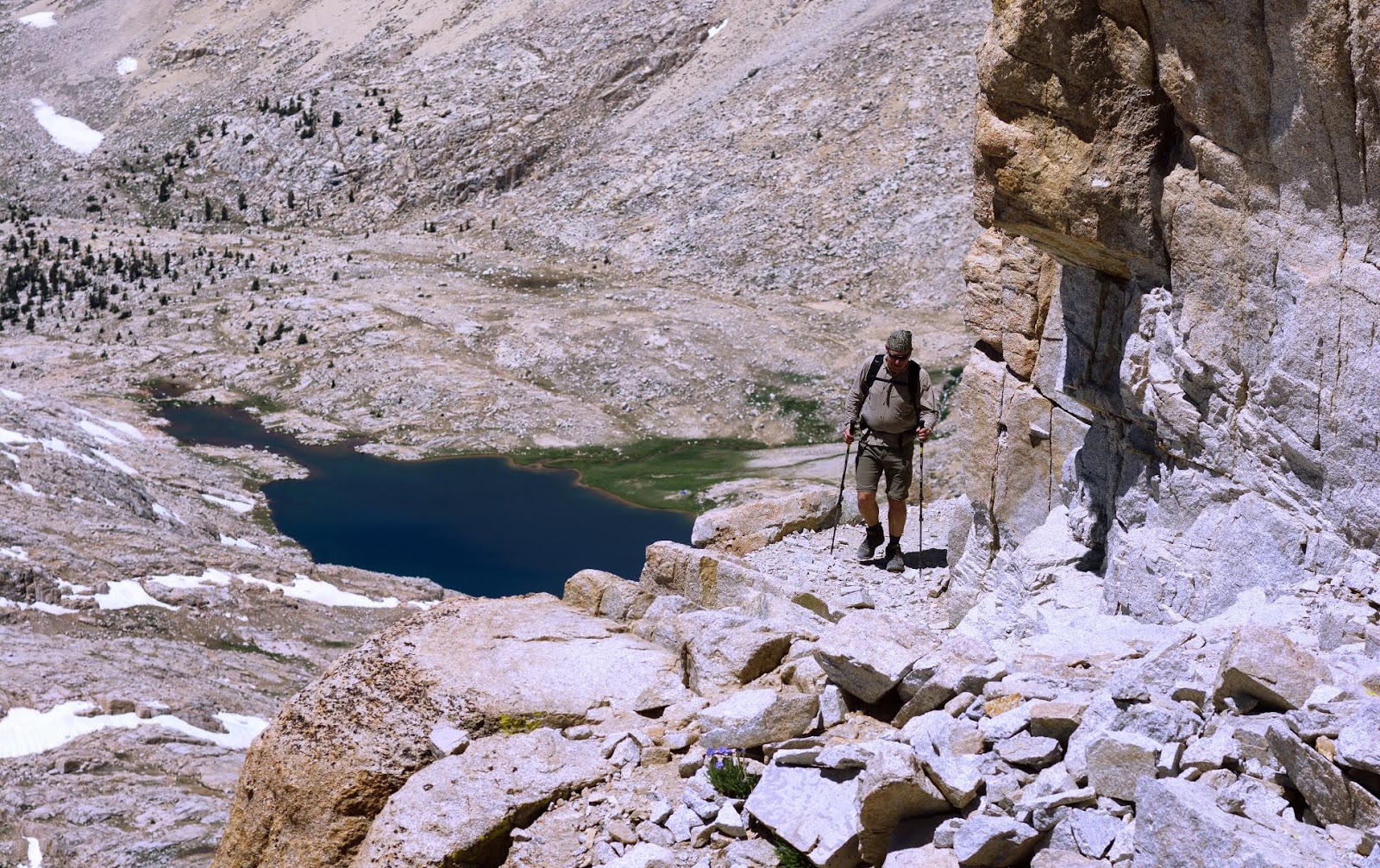
Arriving to Trail Camp.
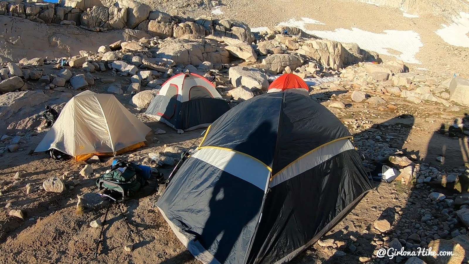
If you are backpacking the Whitney Trail, then you’re likely staying at Trail Camp. This gives you an idea of what the campsites look like – tucked right in next to each other. No privacy. No shade. Right off the trail. LOTS of people. When we got up here around 7am, we saw close to 50 people just at camp getting ready for the day and filtering water.
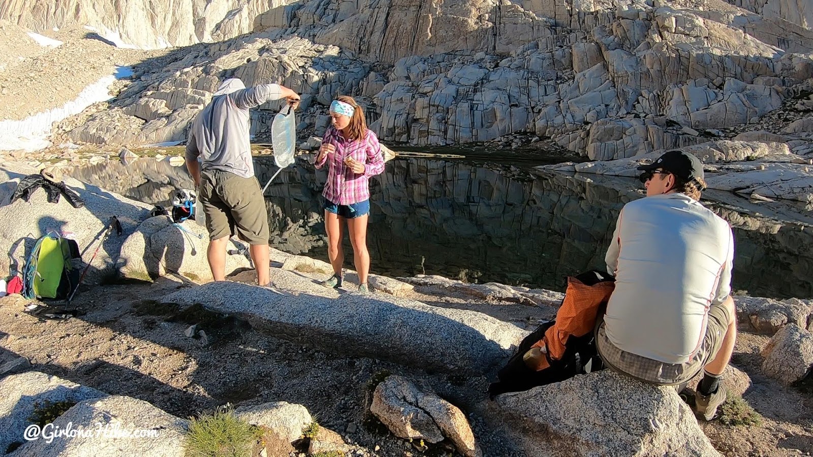
Trail Camp at mile 6 is the most popular spot for filtering water and taking a break before hiking the “99 Switchbacks”. It’s the last water source for 8 miles – 4 up to the summit, and 4 back down to Trail Camp. This is where we stopped to get water and eat both on the way up and back down.
Most people will drink between 5-7 liters of water while hiking Mt.Whitney. DO NOT carry all of that at one time! Only hike with about 2-3 liters of water, then filter. This will make your pack so much lighter, plus who doesn’t love fresh, ice cold water to drink?! Half of my water was fresh water, the only half I drink electrolyte water using Nuun Tablets. The tablets went in my smart water bottle to not ruin my bladder that was holding my regular water. You can buy these are REI, Smith’s, other local grocery stores, or if not available in your area, Amazon.
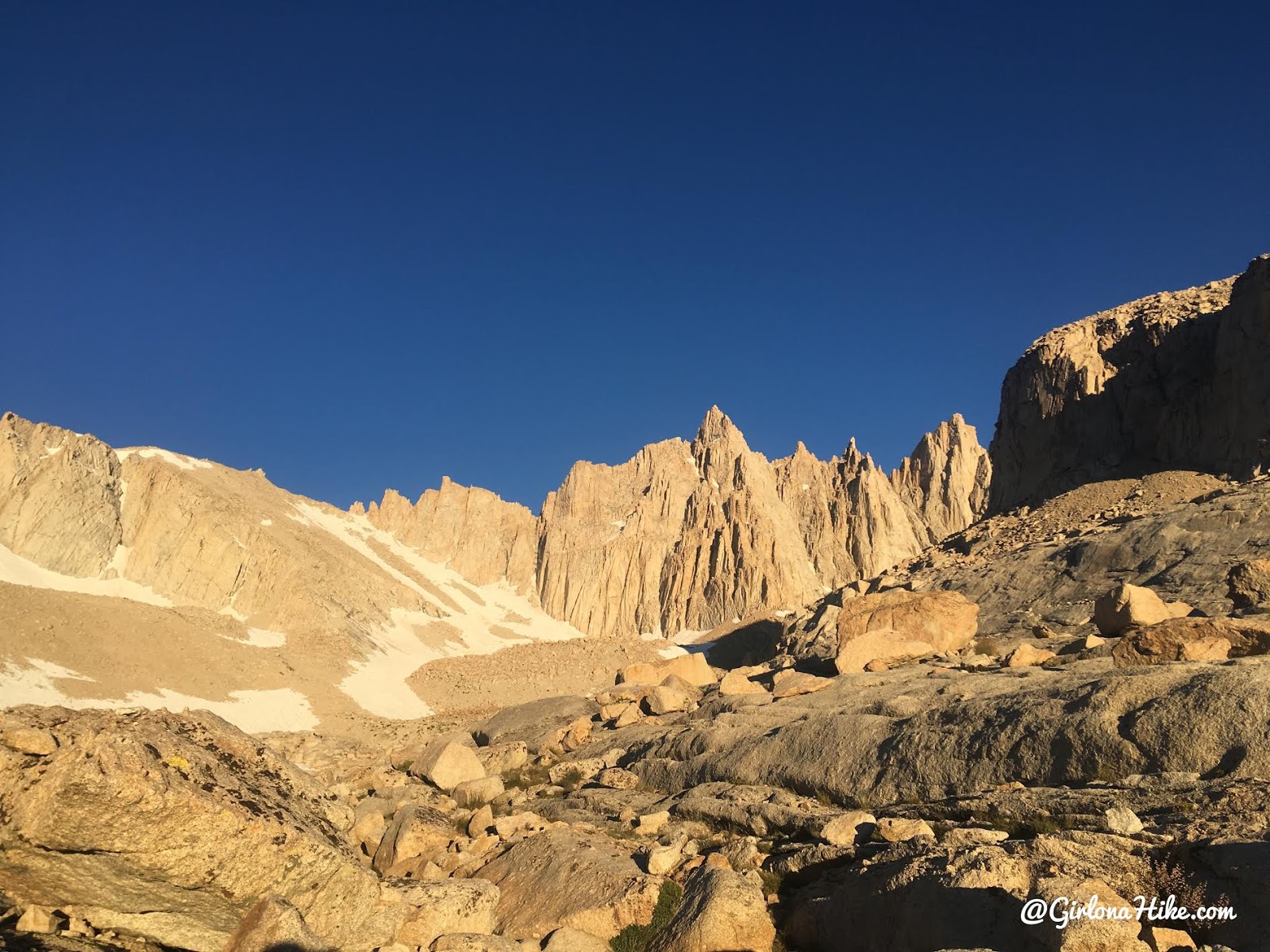
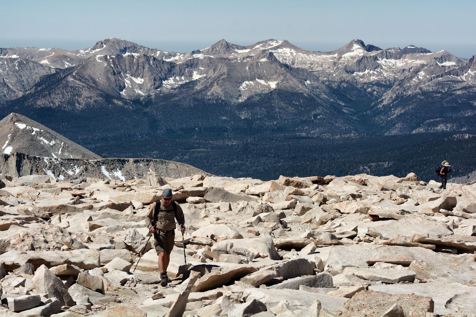
Time to start up the “99 Switchbacks”! What a view!
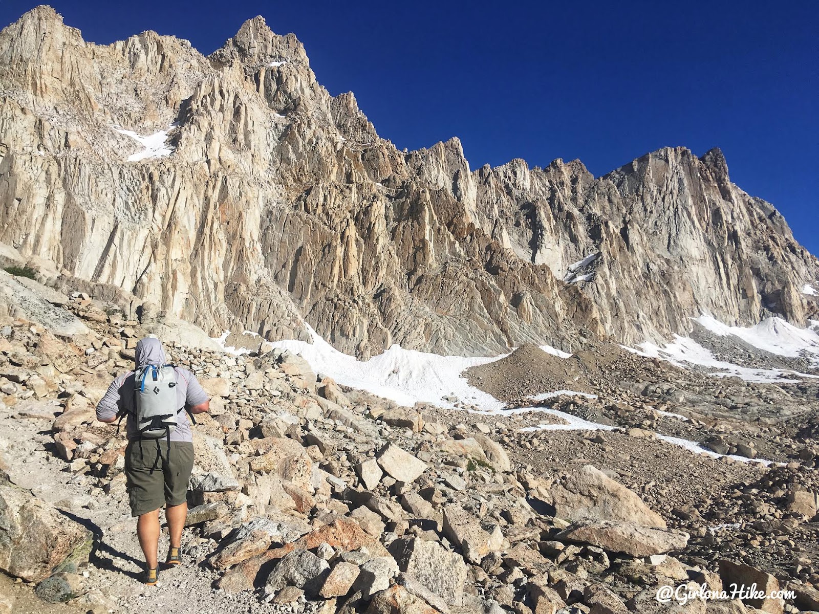
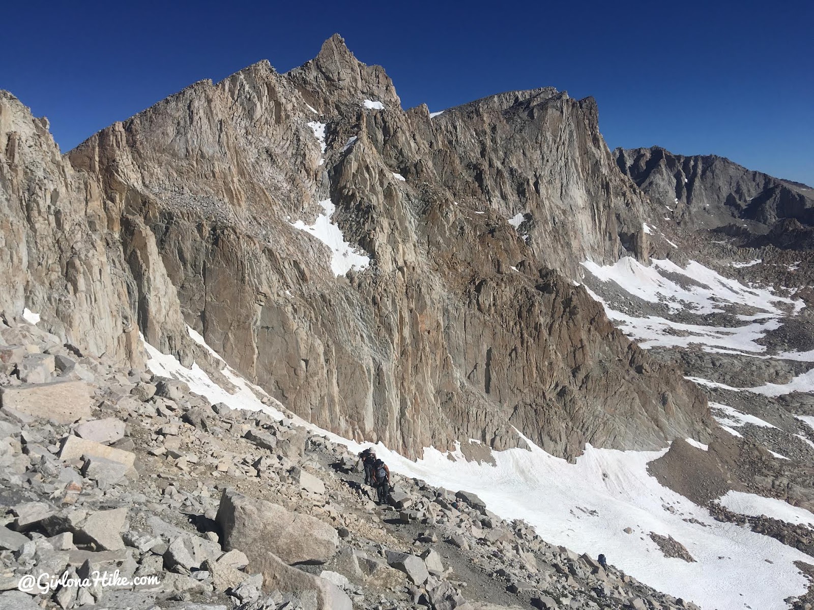
Yes, there are really 99 switchbacks. Some say 100 or 101, but wither way, this section is sure to kick your butt but also has some of the best views. Take your time through this section – you will be gaining a lot of elevation over a short distance and this is where people tend to start feeling altitude sickness (13K ft).
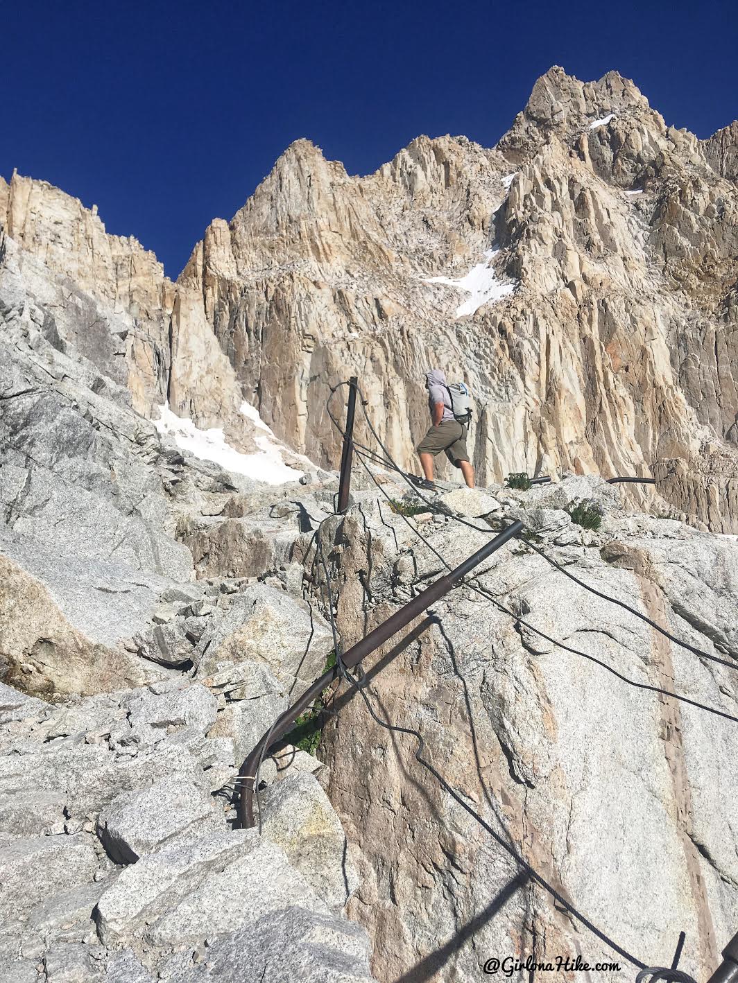
Passing the famous cables section at mile 7.
While hiking the 99 Switchbacks, it is better to hike a much slower but steady pace, rather than hiking and stopping the entire way. Your body will be more efficient doing this. Ian and I kept our slow pace the entire way up, and passed close to another 10-12 people because they would hike. Stop. Hike. Stop. Even though you may feel really slow doing this, it’s much more efficient and your body will thank you.
The hard work uphill was paying off with rewarding views. Mt.Whitney was now in sight, on the top of the rounded peak in the distance. Sooo close!
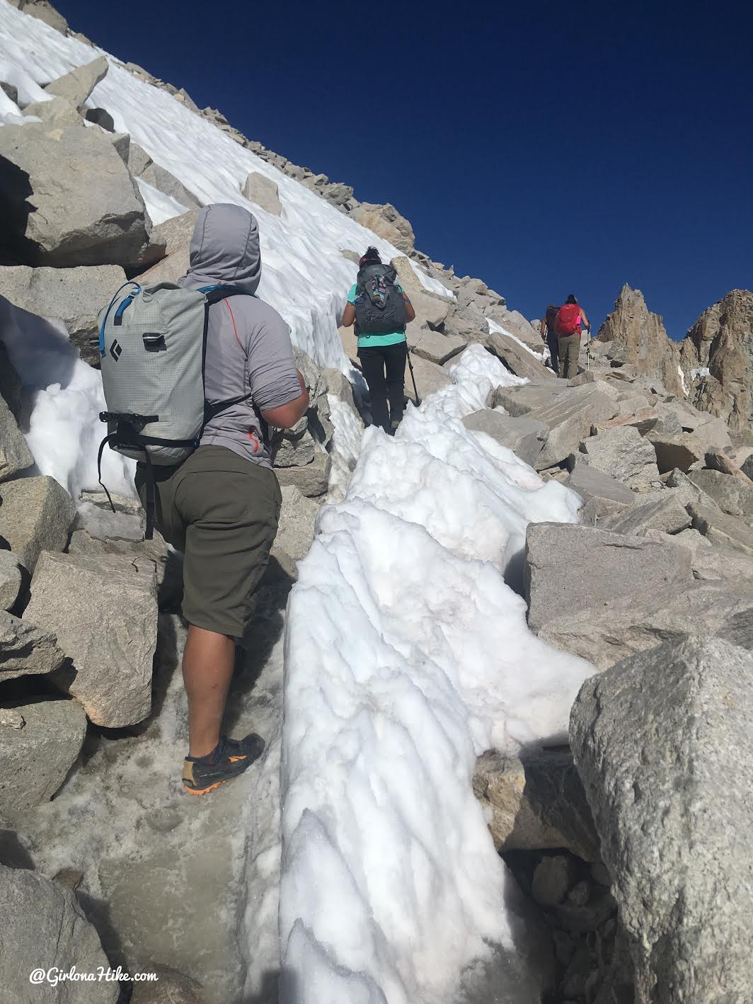
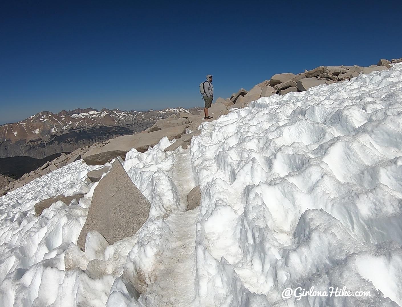
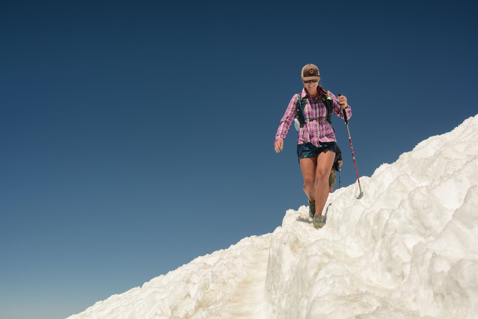
Ian and I caught up to a few more hikers, and also a short section of snow. No extra gear (spikes, gaitors) was needed through here.
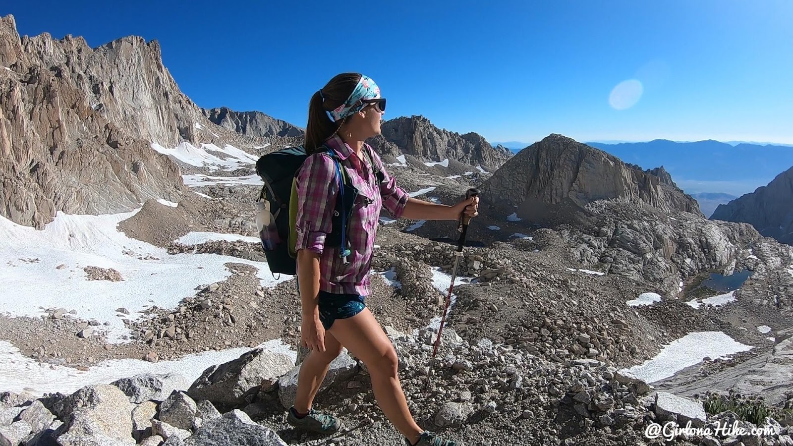
Taking in the views.
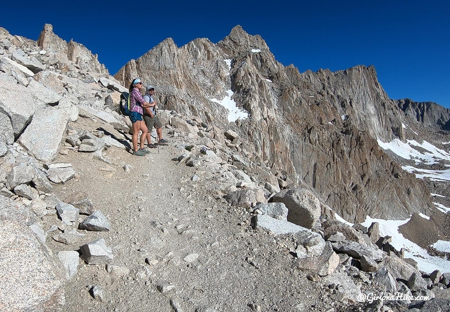
At mile 8, we reached Trail Crest. Larry was quite far behind us at this point, so we took a 15 minute break to let him catch up.
Fact
Trail Crest is the highest trail pass in the US at 13,650 ft!
Just amazing! I ate some crackers here and hydrated for the next two miles.
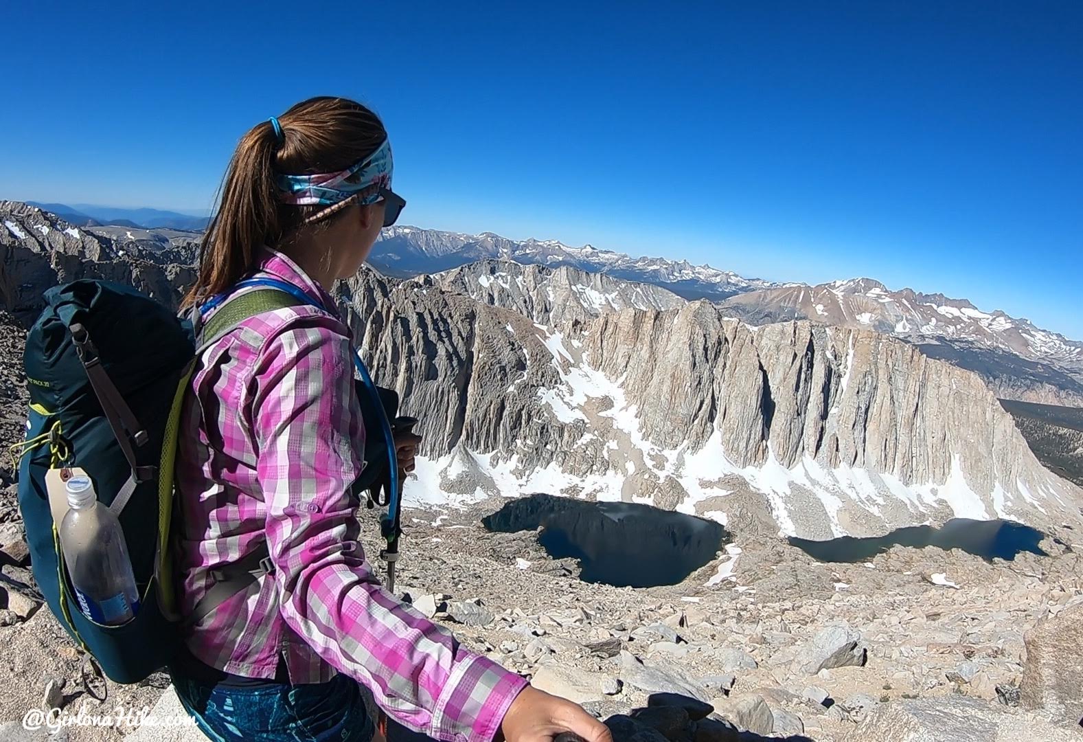
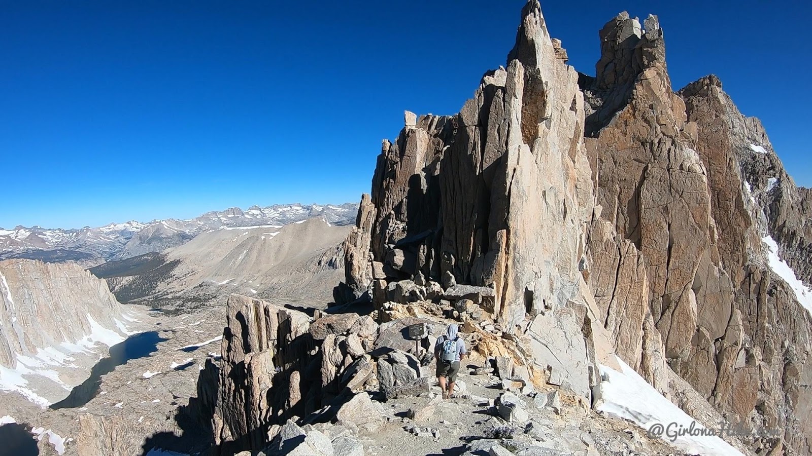
Just past Trail Crest the trail drops a little in elevation. A nice relief for the legs! But don’t be fooled, you still have another 1,000 ft to gain! This is looking down to Hitchcock Lakes.
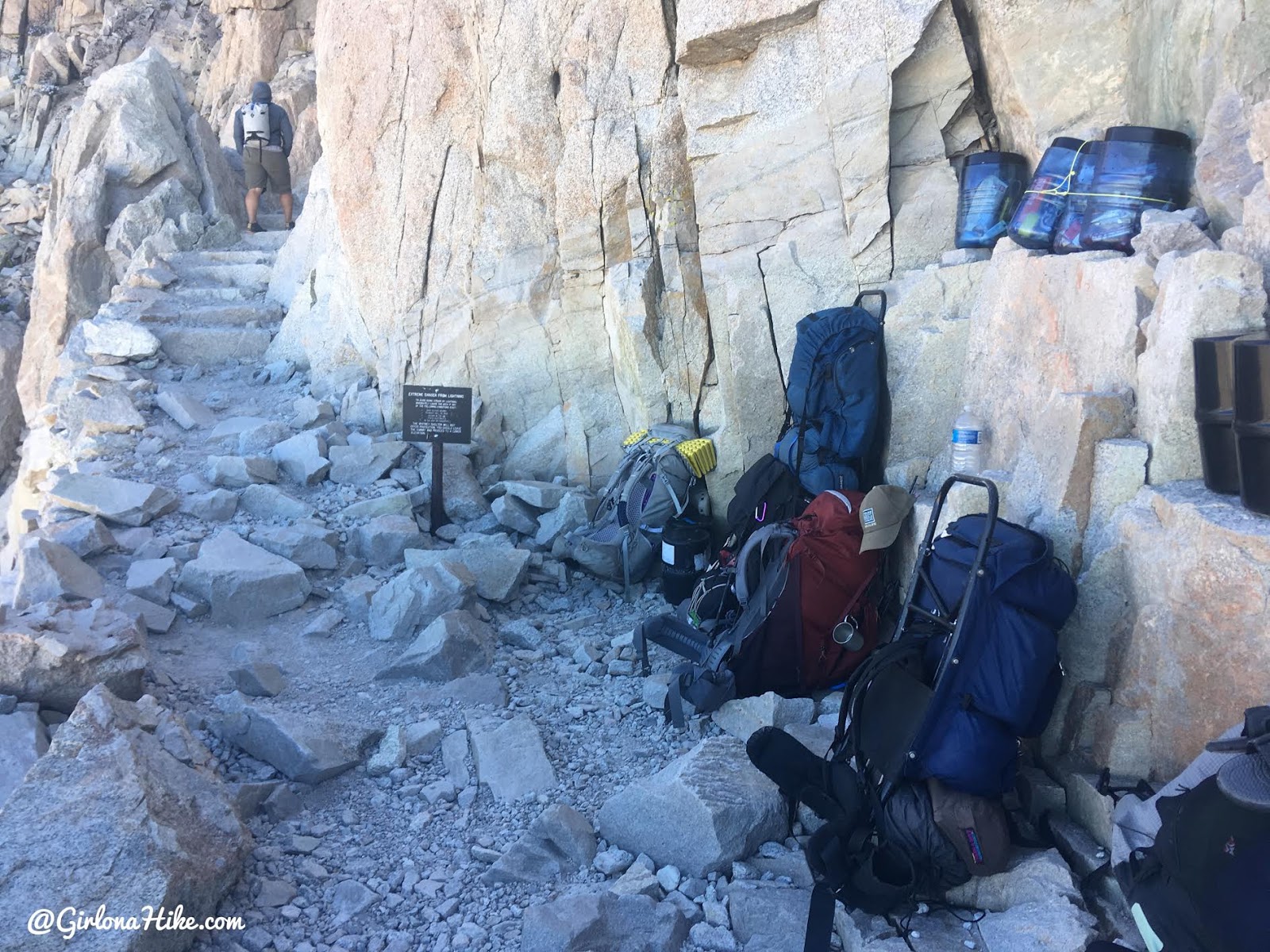
The trail will intersect with the John Muir Trail (JMT). The packs left here are from the backpackers wanting to summit Whitney, but don’t want to carry all their gear so they can hike lighter and faster. I would highly advise not leaving your day packs here – the marmots in this area were huge and will get into everything. Only leave your packs if you plan to have a friend stay with them the entire time and if that friend doesn’t plan on summiting.
The trail gradually makes its way up a few more switchbacks, and this time, its much more level than the 99 Switchbacks. You’re still hiking uphill, but it’s not as hard as before.
We had one more snow patch to hike through, but again, no extra gear was needed. It was easy hiking since it was so packed down from other hikers.
Larry makes his way up the last stretch.
Finally we could see our destination!
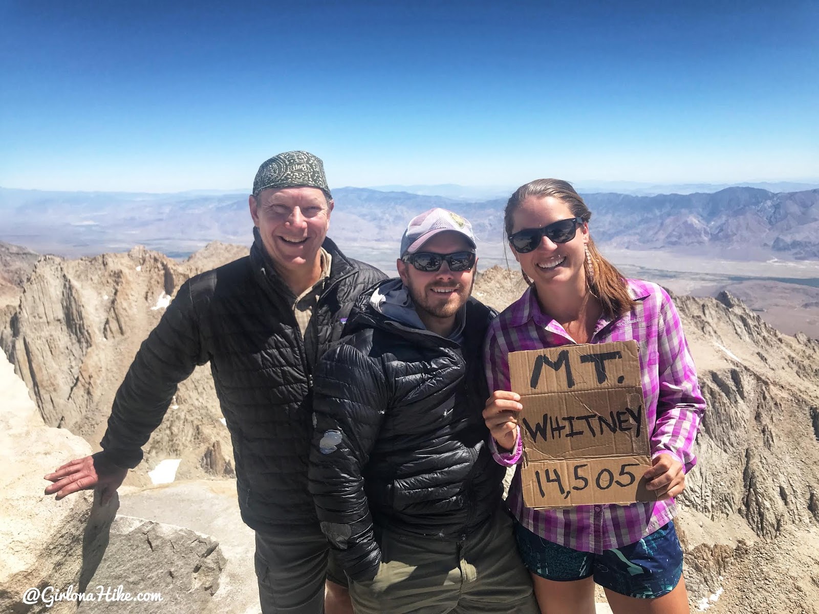
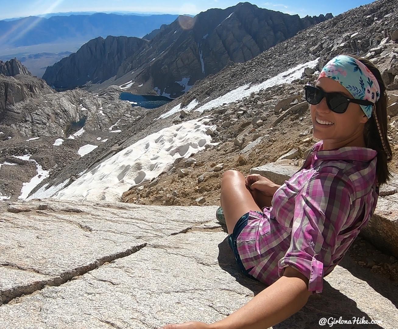
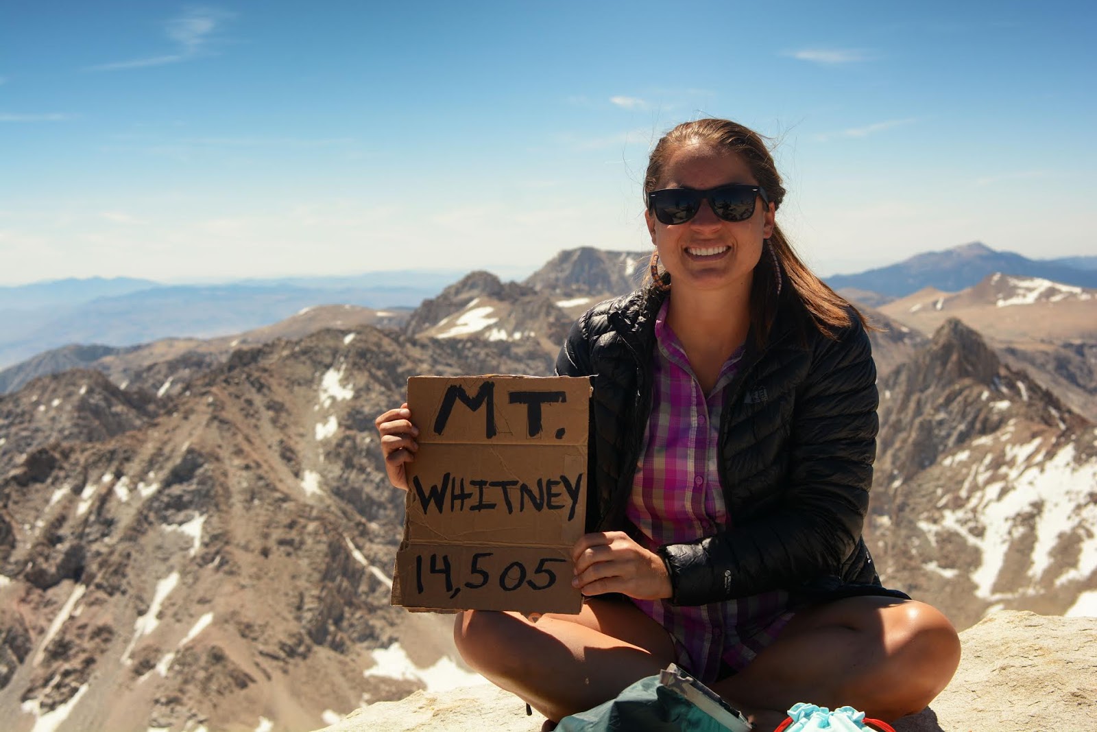
After 8 hours and 10 miles, we reach the summit of Mt.Whitney! Woot woot! What a day!
🏔️ Reaching the Summit of Mt. Whitney
As soon as we reached the summit of Mt. Whitney, I couldn’t hold back the tears. I turned to Ian and, through my classic ugly cry-talking, said, “I’m just so happy I made it without feeling like crap!” 😅
It was an incredibly proud moment—all my training, preparation, and hard work had finally paid off. Standing at the highest point in the lower 48 states felt surreal.
🧐 Why Does the Elevation Say 14,505 ft Instead of 14,494 ft?
If you’ve seen conflicting elevation numbers for Mt. Whitney, you’re not alone! Many signs and older resources list the elevation as 14,494 feet, but current data shows it at 14,505 feet.
Here’s why:
-
Over the past 160 years, Mt. Whitney’s elevation has been measured multiple times using evolving technology—from early mercury barometers to modern high-precision GPS.
-
Small differences in measurement matter a lot when you’re claiming the highest peak in the contiguous United States.
-
Tectonic activity is slowly pushing the Sierra Nevada upward, which can cause elevation increases over time.
-
Additionally, changes in mean sea level—potentially due to climate change—can affect elevation readings.
The official elevation of 14,505 ft comes from the most recent surveys, and the mountain will continue to be monitored and measured in the future.
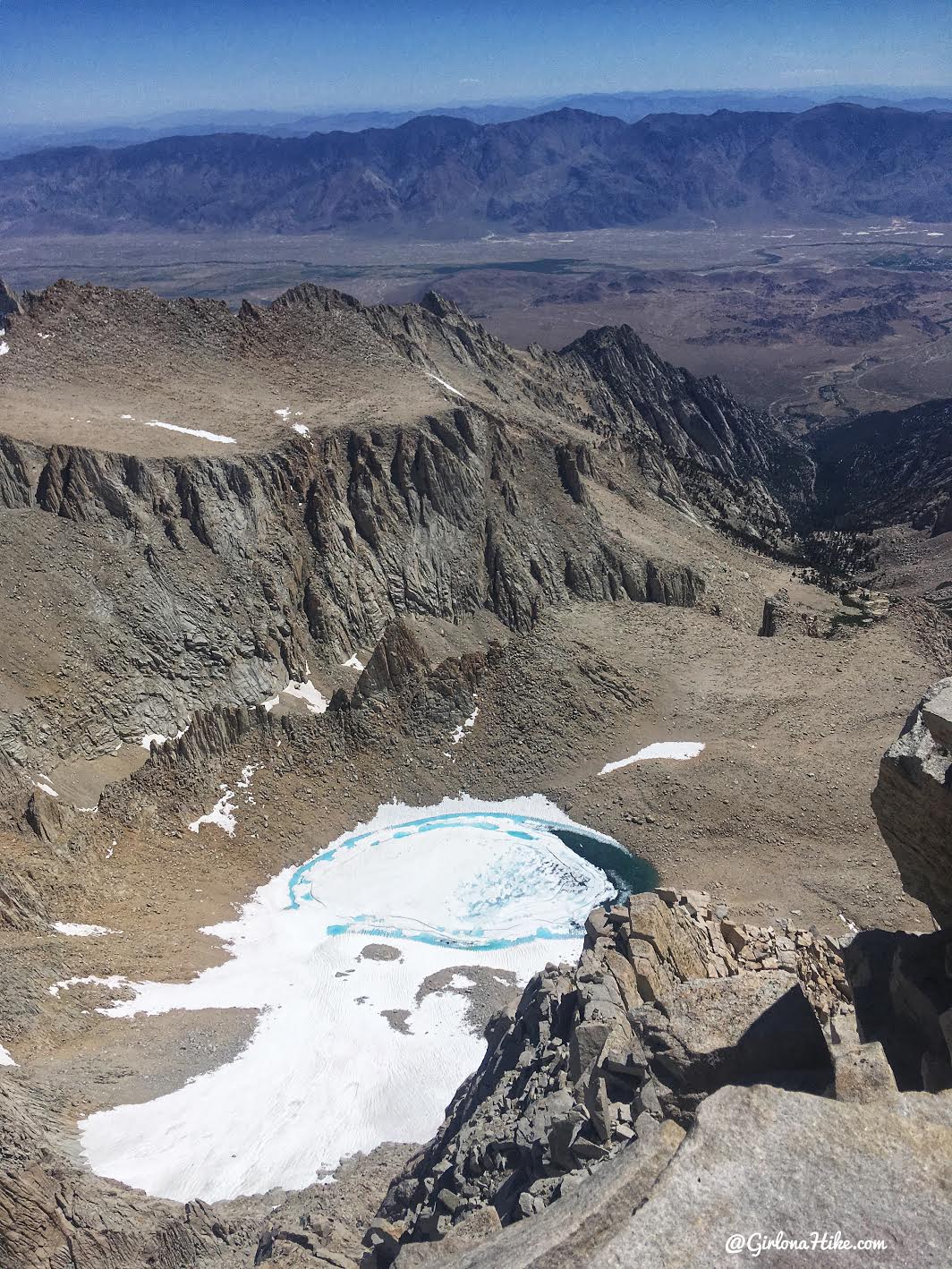
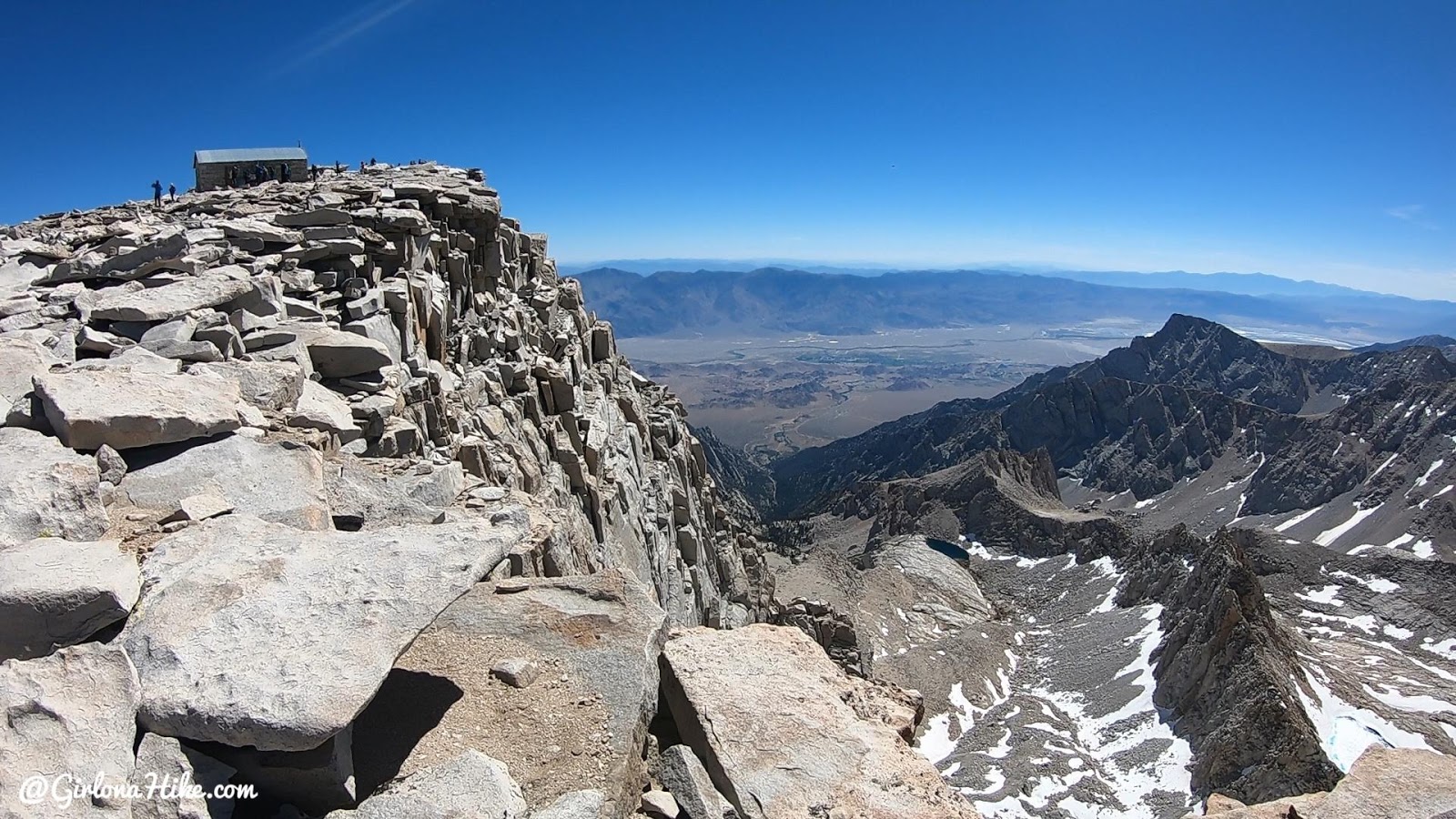
On the summit of Mt.Whitney looking down to Iceberg Lake.
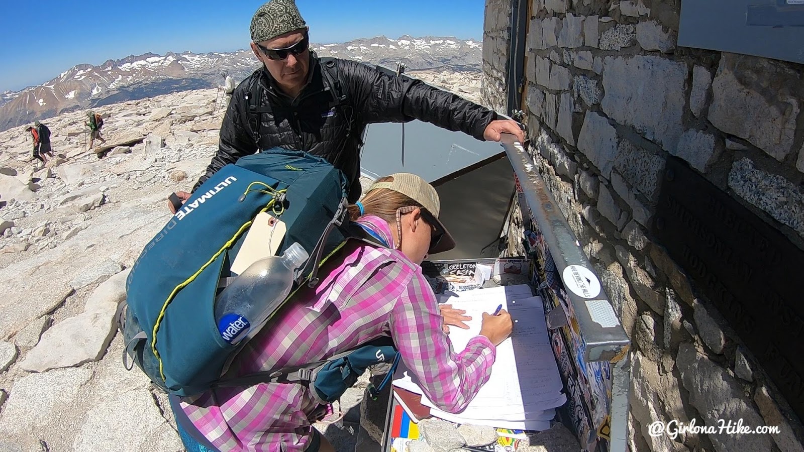
It’s official – I signed the summit register! August 2, 2019!
After spending about 45 minutest to an hour on the summit, it was time to head down. We were only half way done – we still had to hike 10 miles back to the car.
One of my favorite things in summer – still seeing leftover snow from Winter!
Larry kept us moving, even though I just wanted to sit and soak in the breathtaking views! Larry and I have shared many unforgettable adventures, including backpacking in the Grand Canyon, exploring multiple locations in the Uintas, and hiking iconic spots like Yosemite and Half Dome.
Rounding the corner with Guitar Lake below.
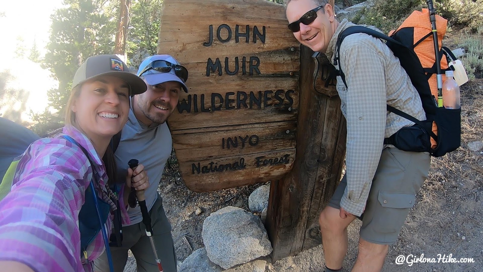
Since we started hiking in the dark, we didn’t get to see the first 5 miles of the hike, and we really wanted a photo with the John Muir Wilderness sign!
After 20 miles RT, 14 hours, 6,100 ft elevation gain, 5.5 liters of water, lots of food, one crying session of happiness, lots of laughs, and about 10 pee breaks, we made it back!
This is definitely one of the most amazing hikes I’ve done. If you get the chance to go – GO!
Yes, you’ll need to do some training.
Yes, it will be a long hard day.
But no, you won’t regret it!
“As long as I live, I’ll hear waterfalls and birds and winds sing. I’ll interpret the rocks, learn the language of flood, storm, and the avalanche. I’ll acquaint myself with the glaciers and wild gardens, and get as near the heart of the world as I can”.”
―
Check out my hike in a full video!
Trail Map
My track via Gaia GPS – the best tracking app! Get your app here for a discount.
Nearby Hike
Mobius Arch, Alabama Hills
From Lone Pine, CA head West on Whitney Portal Road for 2.7 miles, then turn right on Movie Road. Drive 1.6 miles until you reach the Mobius Arch TH, marking by a large parking area. Here’s a driving map. The hike is only 0.6 miles RT, and should only take about 15-20 minutes. The best time to hike here is in the morning hours, when the arch is lit by sunrise.
Save me on Pinterest!