

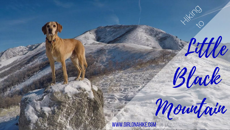
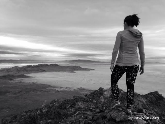
Little Black Mountain sits above the Avenues neighborhood in SLC, and although it seems close, it's looks are deceiving. This trail offers great views of the SLC valley and the BST (Bonneville Shoreline Trails), but get ready to give your hips and calves a work out. Most of the trail is along the BST ridgeline, but gains 900 ft in 1/2 mile!
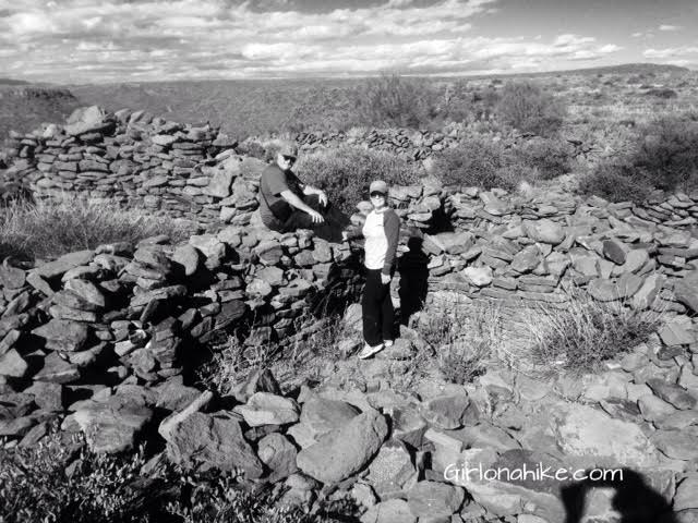
My Thanksgiving weekend was spent with my parents in Phoenix, AZ, and instead of shopping on Black Friday, we wanted #OptOutside and explore an area they had heard about called the Black Mesa Indian Ruins. Hundreds, and maybe thousands, of people drive by the "trail head" every day, but not many know that there are 800 year old ruins sitting on top of the mesa. I put "trail head" in quotes because there's not really a trail - just route finding through thick cactus.
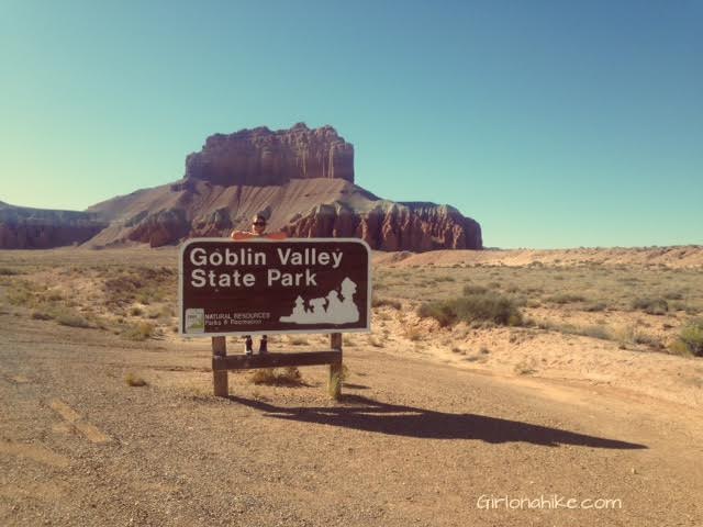
Goblin Valley State Park feels like another world - most say it resembles what would be Mars, however the park sits at the northern end of the San Rafael Swell. The hoodoos ("goblins") are mushroom-shaped pinnacles that are only a few feet high. The formations have large orange/red boulders of hard rock on top, with weaker sand layers below that have eroded more quickly over millions of years from the combined effects of rain and wind.
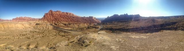
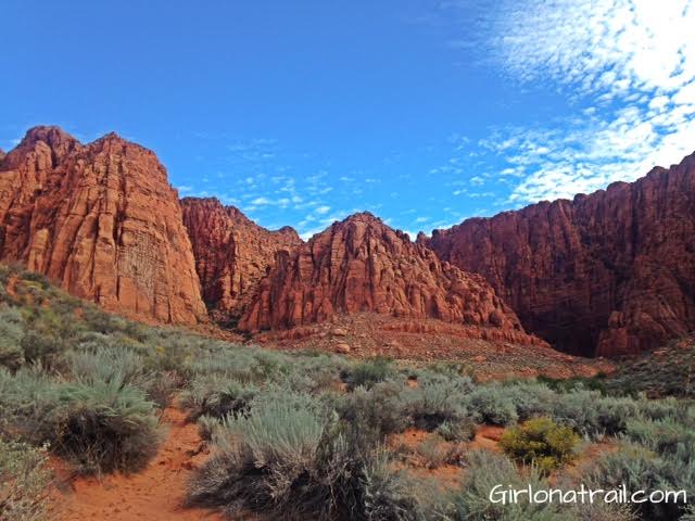
Spotted Wolf Canyon is located off I-70 at the Northern end of the San Rafael Swell, which makes up about 1/4 of Utah. "The Swell" as us Utahns call it, is what most people think of when they think of Utah. The arid area, with little vegetation is often very scenic, with mesas, cliffs, buttes, springs, and many canyons; these are sometimes wide or can be very narrow such as Little Wild Horse Canyon. Most of the swell is owned by the BLM and encompasses 2,000 square miles! This is great for 3 main reasons in my opinion: 1) the land is protected and will not be built on 2) dogs are allowed off leash 3) you can camp almost anywhere, for free!
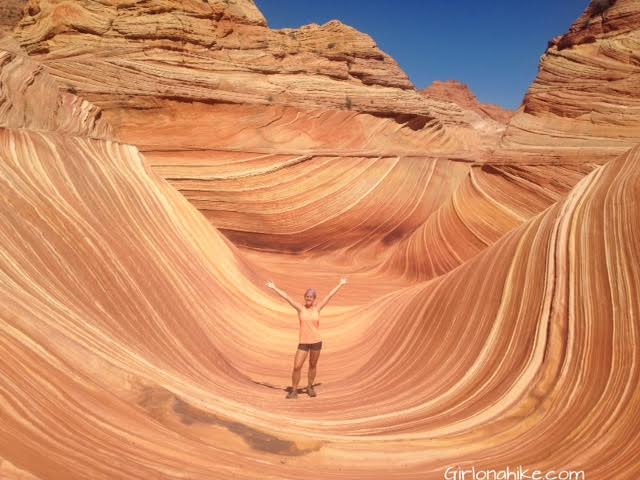
The Wave is a hiker & photographers dream destination! The smooth, unique rock formations make for an unforgettable experience. The Wave has become so popular in the last few years due to social media, photographers, and many articles naming it one of the "coolest", "most unique", "most isolated", most blah blah places on earth! And it really is. However, people don't do their research before hiking here and many have needed to be rescued or have even died while gone missing. Why? The reason is because they go unprepared. There is no trail, the temperatures can be up to 115 degrees in summer, and people don't bring enough water and food.
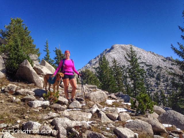

Ibapah Peak is the tallest point in the Deep Creek Mountains and Juab County, at 12,087 ft. Getting to to the trail head is a long drive, since it's about a 4 hour drive from SLC.
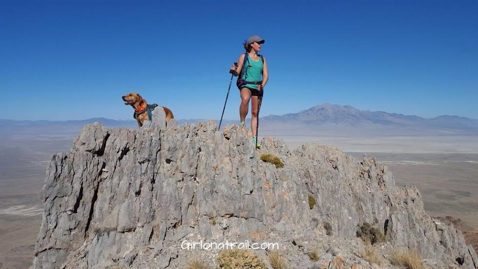
Rishel Peak (6,196 ft) is a fin-like peak created by volcanic activity, and is located in Utah's West Desert in the Silver Island Mountains. There is no trail, no shade, no water, and no true parking area or signs. Be aware that you MUST have a high clearance or 4X4 car to drive out here, and be prepared for flat tires from old mining nails still scattered about.The best time of year to hike this peak is in Spring or Fall when the temperatures are not as hot. Because this area is BLM Land, you can camp for free anywhere. However, there are no established camping areas, and Leave No Trace principles apply.
Hiking Cobb Peak in the Silver Island Mountains: What to Know Before You Go
Cobb Peak (7,021 ft), located in the Silver Island Mountains of Utah, is one of the toughest and most rugged peaks I've attempted—and honestly, not one I’d rush to do again. If you're planning on hiking Cobb Peak, here’s what you need to know to prepare for a steep, exposed, and route-finding-heavy adventure.
Kayenta Canyon Trail is known by two names: Kayenta Canyon, and to the locals, Hellhole Canyon. This trail starts in the town of Ivins, UT, about 15 minutes west of St. George, UT. If you don't like walking in sand washes, this is not the trail for you. 90% of this trail is walking in the wash, and on a sunny day (most days in Southern Utah), it can get very hot. There is no water, no shade, and no restrooms.