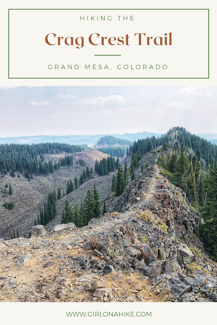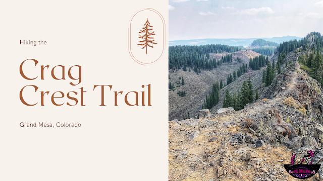
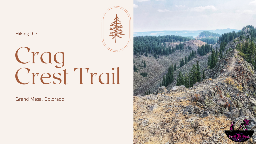
Hiking the Crag Crest Trail on Colorado’s Grand Mesa
The Crag Crest Trail, located in Grand Mesa National Forest just one hour from Grand Junction, Colorado, is a must-visit destination for hiking enthusiasts. Known for its high-elevation ridgeline and panoramic views, this trail is especially popular in the summer for hiking, fishing, and camping, and in the winter for snowmobiling and cross-country skiing.
Why Hike the Crag Crest Trail?
The highlight of the Crag Crest Trail is its stunning 2-mile-long ridgeline, or “crest,” which offers incredible views across the Grand Mesa, the largest flat-topped mountain in the world. On clear days, you can even see the distant San Juan Mountains, La Sal Mountains in Utah, and more.
The trail is non-technical, making it a great option for families, beginners, and dogs alike. Though we visited during a period of wildfire smoke, it’s typically known for crystal-clear vistas and peaceful alpine scenery.
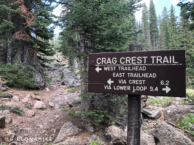
Trail Options: Loop vs Out-and-Back
🔁 Full Loop (11.3 miles round-trip)
Most hikers choose to complete the full loop, which includes both the upper and lower Crag Crest trails. However, be aware that the lower section has:
-
Many downed/dead trees
-
Limited shade
-
Only one easily accessible lake for dogs or filtering water
↩️ Out-and-Back (Recommended)
For a more scenic and enjoyable experience, consider hiking the upper trail as an out-and-back:
-
Hike ~5 miles one way to the end of the crest
-
Then retrace your steps back to the trailhead
🚶♀️ Pro tip: The out-and-back option lets you skip the less exciting lower section and focus on the dramatic views along the ridge. It’s cooler, shadier, and far more rewarding.
When to Hike Crag Crest
The best time to hike Crag Crest is typically late June through September, when the snow has melted and trails are dry. Be sure to check local trail and weather conditions before heading out, as snow can linger well into summer at this elevation.
Final Tips for Hiking Crag Crest Trail
Start early to avoid afternoon thunderstorms common in Colorado mountains.
Bring plenty of water and sun protection—there’s limited water access and minimal shade on the ridge.
Keep dogs leashed and bring a bowl for water.
Pack layers: weather can change quickly at high elevation.
Directions
Here From Grand Junction, CO head East on I-70 and take exit 49 for HWY65. You will see signs for Grand Mesa. Follow this road for 33 miles. Turn left into the signed “Crag Crest Trailhead”. It is a giant parking lot with a port-a-potty. Here is a driving map from Grand Junction, CO. Total drive time from Grand Junction is about 1 hour.
Trail Info
Distance: 11.3 mile loop
Elevation gain: 1,388 ft ascent, 1,333 descent
Time: 5-7 hours
Dog friendly? Yes, off leash
Kid friendly? Ages 12+
Fees/Permits? None
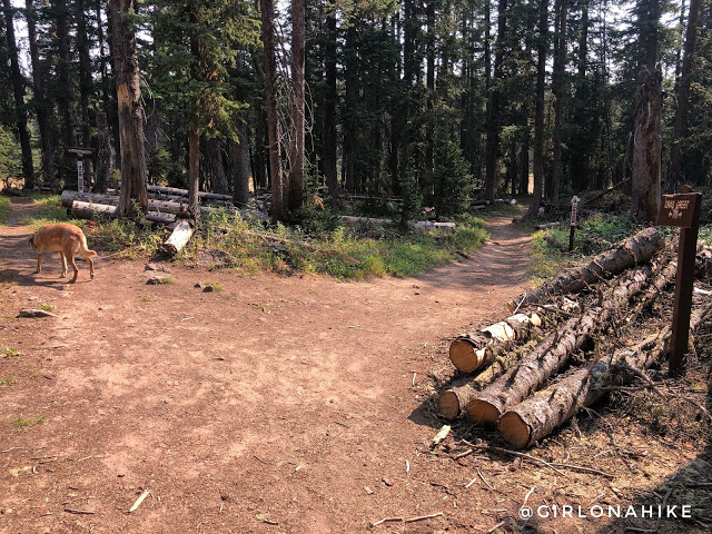
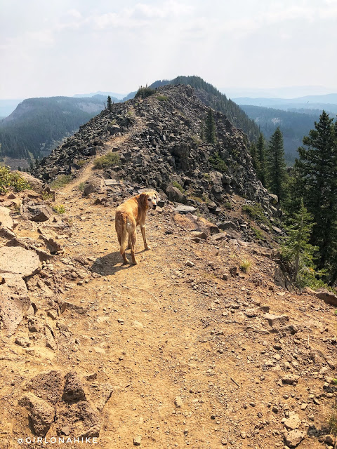
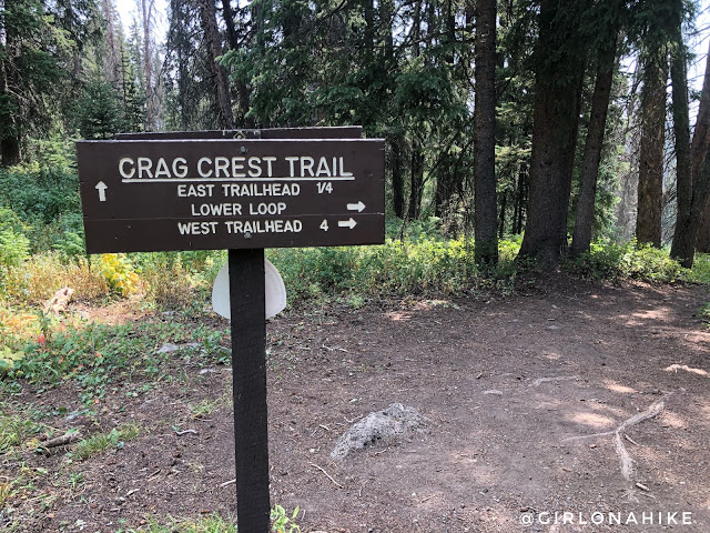
Start of the Crag Crest Trail
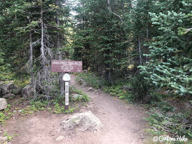
There are two trailheads you can begin to hike – we chose the East TH, which is right off the road, and provides easiest access to the crest.
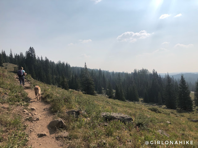
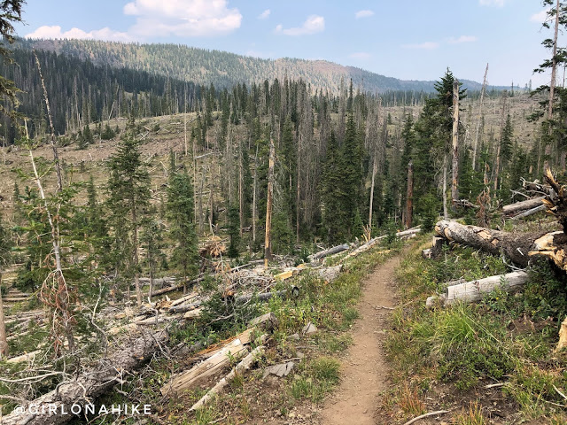
This trail gradually gains elevation very slowly. Over 5 miles you will only gain about 900 ft!
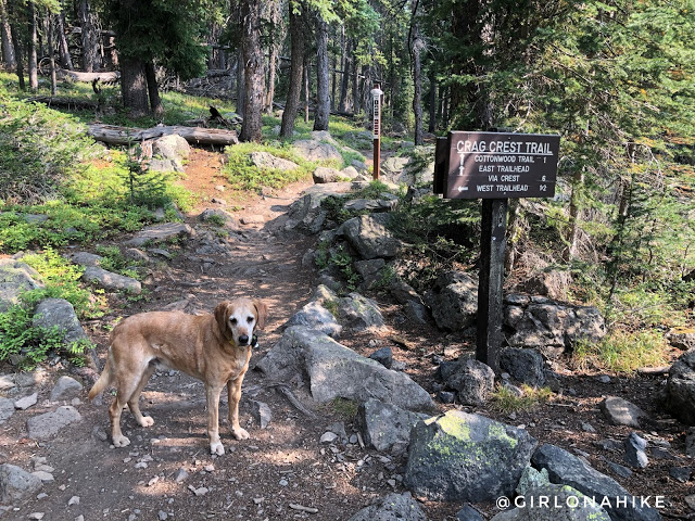
At the first trail split, stay left. This is about 10 minutes into the hike. If you decide to do the loop, you will return here from the right.
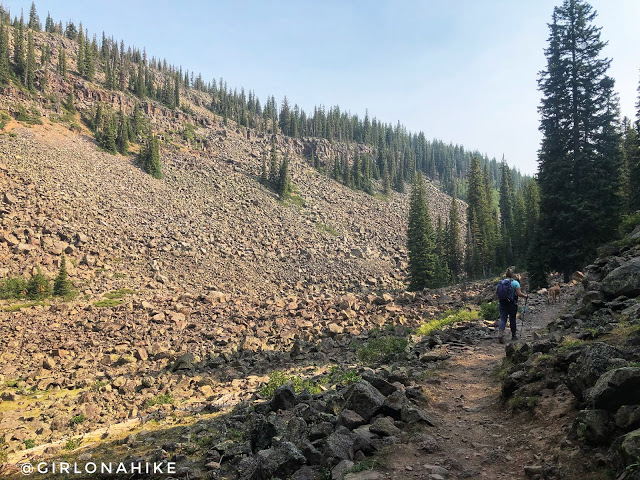
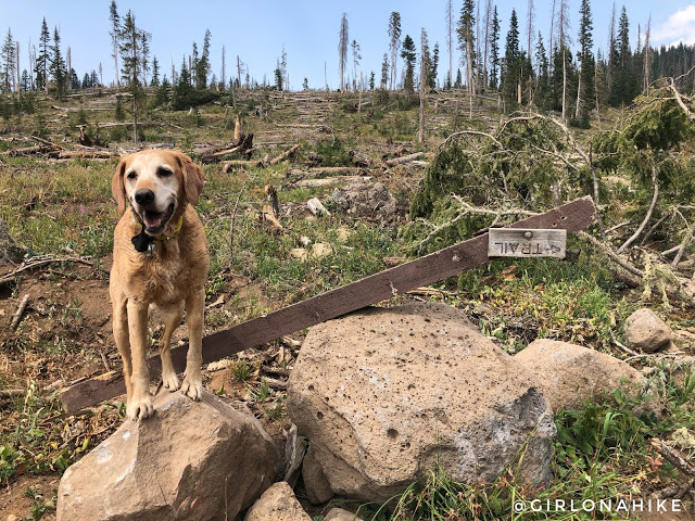
Pass by a boulder field. Honestly this area reminded me of the Uintas!
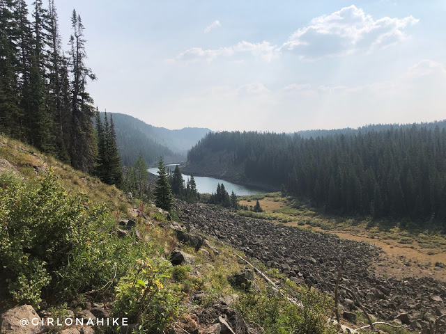
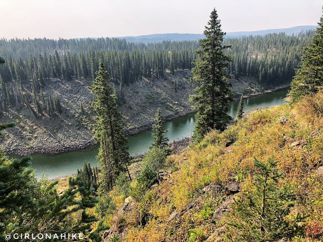
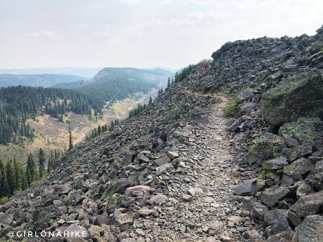
At 1.0 mile, hike up the first and only switchback to reach the crest. You should also be able to see Wolverine Lake.
At 1.6 miles stay right for the crest.
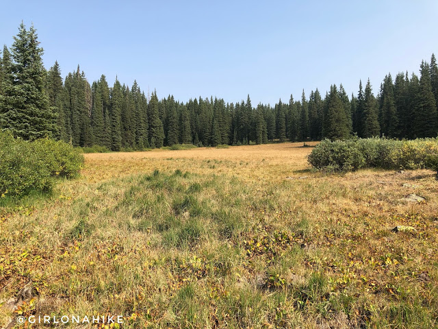
Pass by a nice meadow on the left.
You’ll see many “trails” leading to the cliff edge, but only a few actually had good views.
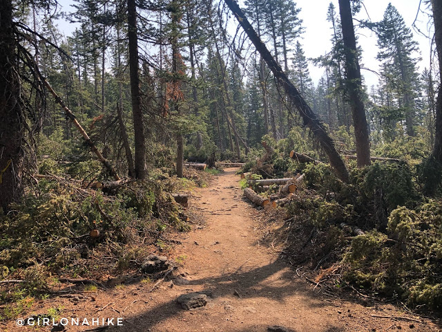
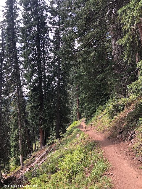
Hike through a section with a lot of downed trees.
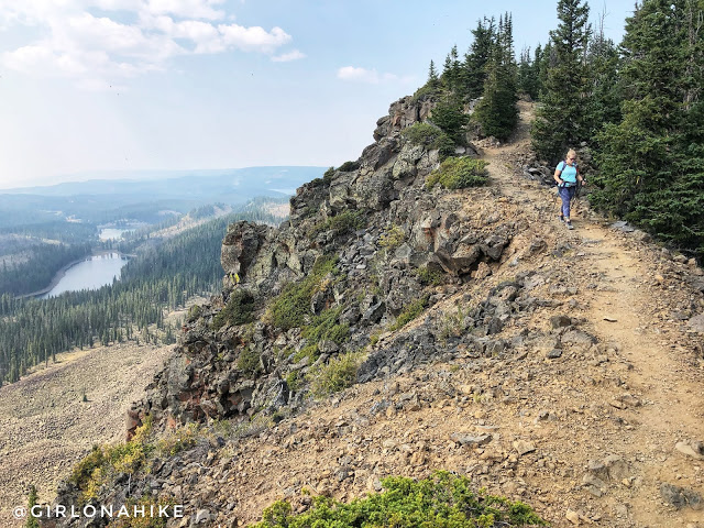
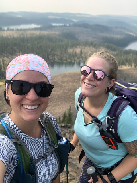
The Fun Begins – Narrow Ridge
At 3 miles, the fun begins along the crest! Now this is what we came here for!
This was so cool!
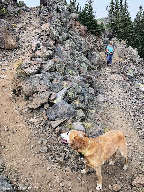
One small switchback.
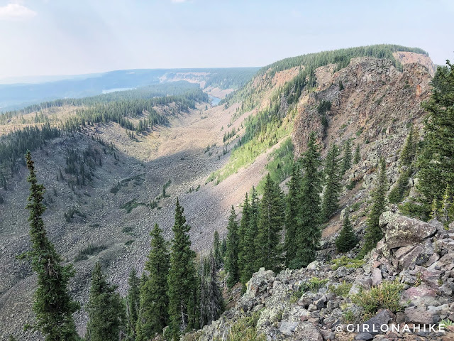
Wow, I can’t imagine what these views must be like when there aren’t fires in the whole Western US!
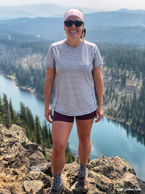
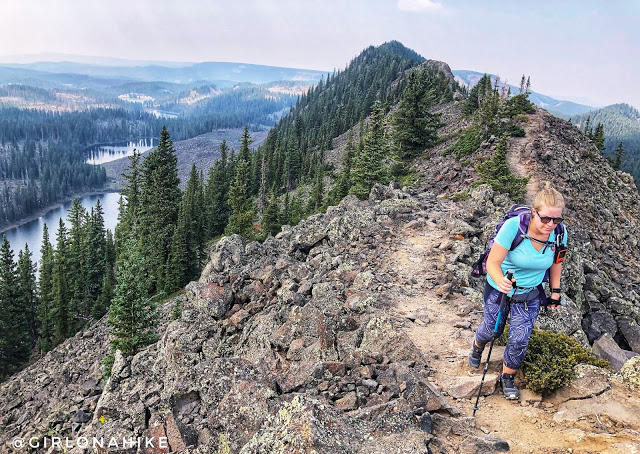
At the top of the crest, it was time for a photo op! The lake below me is Butts Lake haha!
This shirt is made by Duluth Trading Co! I love their Pier Genius t-shirt because it has SPF built in, smell-proof material, and is quick drying. The shorts are from Amazon and are the best spandex-style yoga shorts for hiking, plus very affordable.
Gotta keep moving! We weren’t even quite halfway done yet.
Amazing Photo Opportunites on the Crag Crest Trail
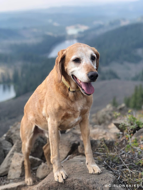
Ok Charlie, time to snap a good photo of you too! Overall he was doing really well – he was drinking a lot of my water yet it was only 70F.
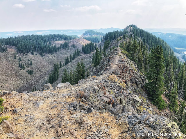
Ahhh so pretty, I love ridge hikes!
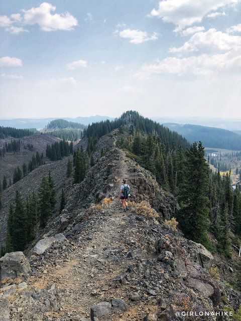
My favorite section of the crest, probably because it was the most narrow section.
Ashley is a strong hiker, and loved this trail too.
The Descent
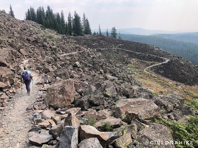
If you plan on doing this hike as an out and back, and you reach this spot, I recommend turning around. Below this is where the trail turns back to dirt and downed trees, and honestly becomes boring the next 4 miles.
A few switchbacks to drop in elevation.
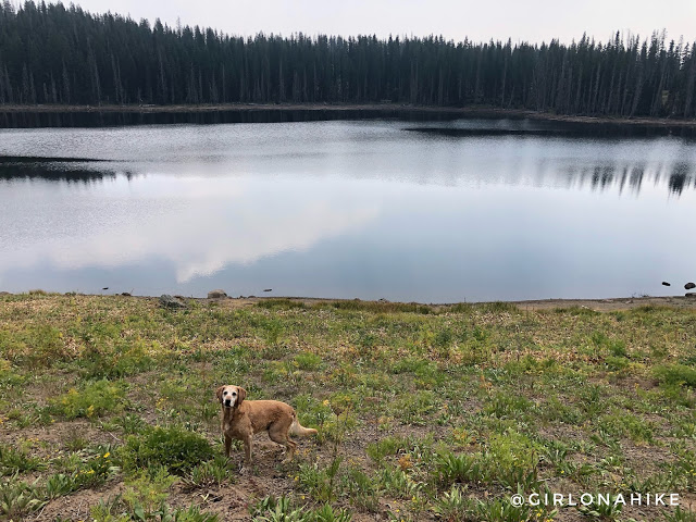
Stopping by Upper Eggleston Lake to let Charlie swim, and for me to filter water. After 6 miles I was down to 1/2 liter, so I knew I would need to more to make it out the last 4 miles since Charlie drank most of it.
Looping Back
At 7 miles, turn right, to start making the loop back.
And this is what most of the lower trail looks like….boring, hot, dry, sandy. This was the one good view we had looking back to the Crest.
Which way should we go, Charlie!?
At 10.8 miles reach another trail split. This one is a little confusing, but its a 3-way intersection and you’ll want to turn right to get back to the East TH. It’s confusing because the arrow points right for both West/East TH, but this will take you back to that first trail split.
We made it back to the car and total hiking time including all of our photo stops, lunch break, etc., was 5.5 hours.
Back to Camp
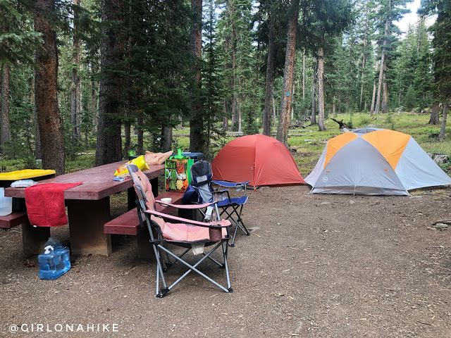
There are tons of campgrounds to choose from in the area, and I randomly chose the Cobbett Lake Campground. Typically we like free, dirt road camping, but because neither of us were familiar with this area and we wouldn’t arrive until midnight, we felt better just paying to reserve a campsite. Recreation.gov says that the water service was suspended here, and that wasn’t true, the water pump was working perfectly. Always call the forest ranger and ask before your trip so you know how much water to bring. This campground was really clean, however it is close to the road so the sound of cars was annoying.
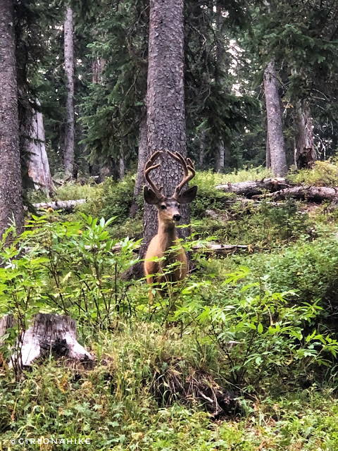
This giant buck was within 30 feet of our campsite – how cool!
Watch my video & subscribe!
Trail Map
My track via Gaia GPS – the best tracking app! Get your app here for a discount.
Nearby Hike
Hiking the North Vista Trail, Black Canyon of the Gunnison

Save me on Pinterest!